Belize, our route map shows, has been another case of zigging and zagging about. We didn’t need to come here at all, as it doesn’t span Central America’s skinny land mass. One can pass from Mexico directly into Guatemala. But it’s an interesting place, so of course, we were curious. We dropped in from Mexico, right at the top of the country.
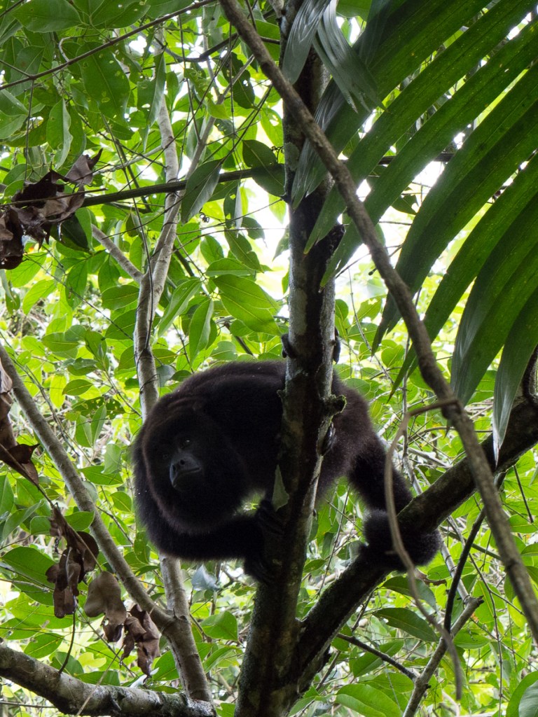
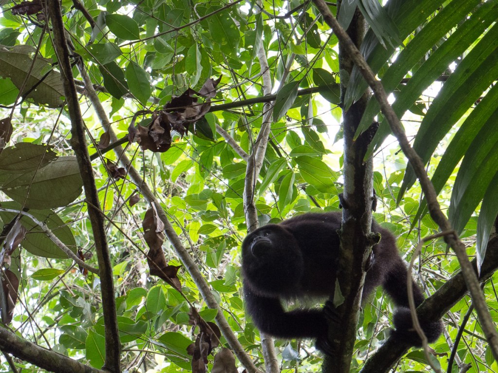
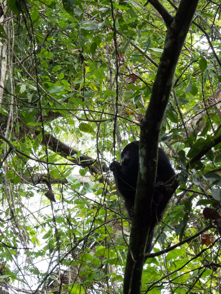
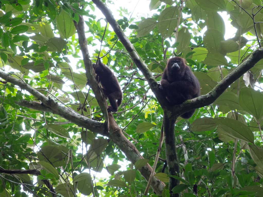
It’s a small country, so it’s possible to go from North to South Belize in a (long) day. We’d rushed past the fishing village just across the border on the east coast and before we knew it we were a third of the way down the country at the baboon sanctuary. The baboons – actually yucatan black howler monkeys – were fabulous. We were barely in the forest before we heard and saw them. Our guide was our first Garifuna encounter, all laid back and charm, in r e a l l y s l o w English, and creole with his mates. For indeed, Belize used to be British Honduras, and the official language is English.

From there we were at the north-west regional hub of San Ignacio – and the “ATM”. ATM is at the top on all of the must see lists. It’s not the Automatic Teller Machine or Another Tourist Missing but the Actun Tunichil Muknal cave. Having been there I can see why it’s number one. It’s stunning! Our tour guide was ex-military but once we’d got over the ‘I’m here to look after you. If I give you an instruction please will you follow it’ – shouted to the petit oriental young lady at the front of our group. On the first of our river crossings to get to the cave she had failed to release the safety rope and float away down the river to a different landing site when Patrick had shouted the command. The water was chest high on us and had a fair flow so she was probably rather insecure with the idea of letting go of the safety line prematurely. We soon learnt when Patrick shouted ‘jump’ we echoed ‘how high’.
After the initial blip Patrick proved to be a very nice guy. He was very knowledgeable about the jungle happily answering some tricky questions from our young undergraduate enthusiast. Equally, we were soon to find out, he was very knowledgeable about the cave itself. We crossed the river three times to reach the cave where I have to say, I was pleased to be wearing a buoyancy aid. I’d quickly given up any hope of keeping my t-shirt dry to try to keep warm. Once in the cave, having scaled the rocks and dropped down into deep water, we started our one hour wade, swim, clamber; at times making a human chain to get round a deep corner or to cross a deep section as the water gushed past. We stopped a number of times to admire and investigate the rock formations created over centuries of water cascading down with layer upon layer of calcium carbonate leaving its track. We finally reached the main attraction. 10 feet above our heads was the start of the massive cavern that had been used as a sacrificial site up until about 900AD. We clambered up a very convenient rock with a supporting rope attached to it. At this point we had to take off our shoes to try to minimise the damage made by aggressive footwear.
We were in the ‘living’ museum. This was not some mock up but the real thing. Every thing we saw was as it had been used / left by the Mayans, the Belizeans having made a conscious decision not to excavate it. Many areas were calcified showing that the water had coursed through this way leaving calcium deposits in its wake. In the 900 and more years since the Mayans were in here, some deposits had built up to a few inches thick, blurring and obscuring the thousands of broken sacrificial pots. The thickness of the deposits helps with dating the offerings, which generally, went deeper and deeper into the cave as time went on. In a sub equatorial rain forest with 82 inches of rainfall a year there is never any shortage of rain water. Well, except in about 900AD – climate change and drought are the leading theory for the demise of the southern Maya cities.
Seven skeletons were present, deep in the cave system. Some of the remains were in a heap where it is supposed that they had been washed down in the flow of water before being glued in place by calcification. Each had been sacrificed. Archaeologists tell us that towards the end of the greater Mayan society the rain fall was less reliable and there was a change in the sacrificial offerings, brought on, perhaps, by desperation. Initially the skeletons were of older people but what is believed to be the last two are young males. This greater sacrifice was of young males was thought to be in an effort to please their gods who would they hoped provide more rain. One boy, believed to be twelve is considered to have been bound up and left to die whilst not far away was the skeleton of a seventeen year old boy although he was laid out flat.
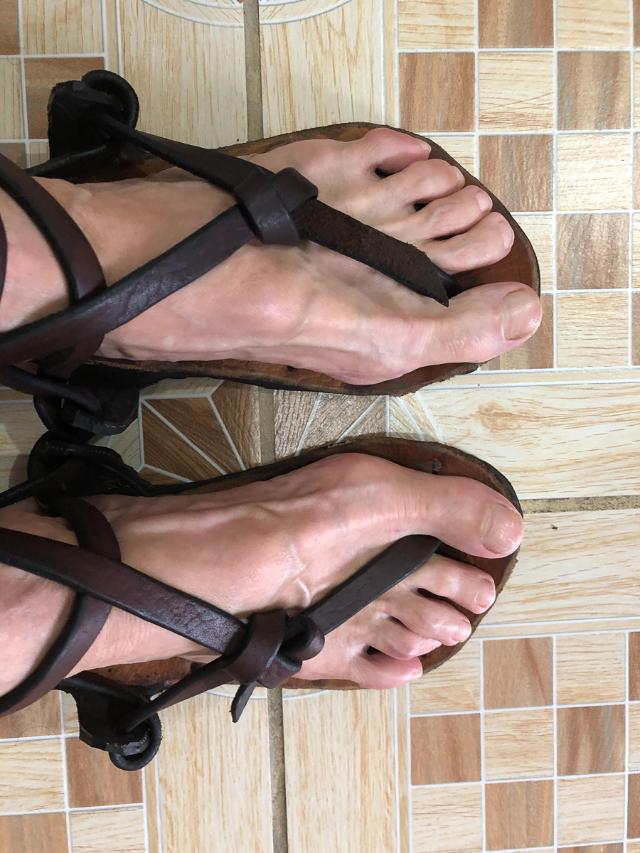
Unfortunately for us, cameras, phones and other lumps are forbidden following an accident where a camera was dropped on the 12 year old’s skeleton’s skull. It now has a letterbox shape hole in it where the camera landed. Therefore we took no photos, except of Patrick selling Clare his patented old tyre sandals.

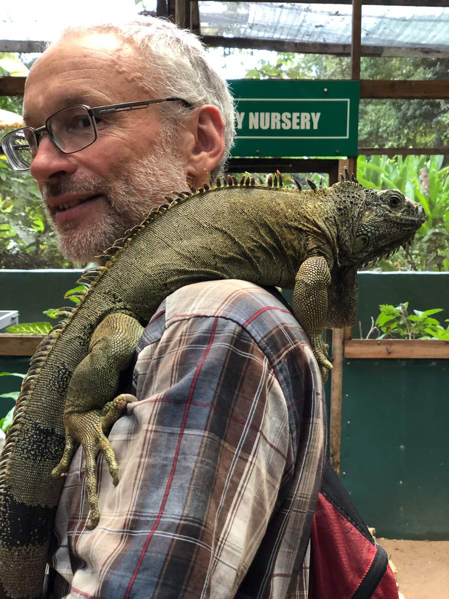
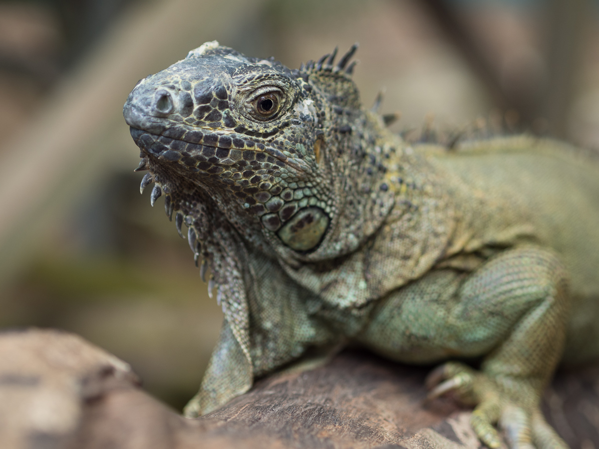
A brief diversion from the same base of San Ignacio, was the local Green Iguana Sanctuary. These have some endangerment so they’re captive bred there, then released. The Black Iguana, in contrast, is very common, and we saw them all over the place: The two on the log, actually in Belize Zoo, are sneaky visitors, not captives.


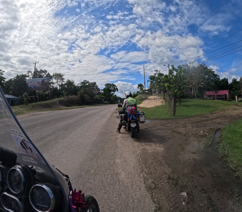
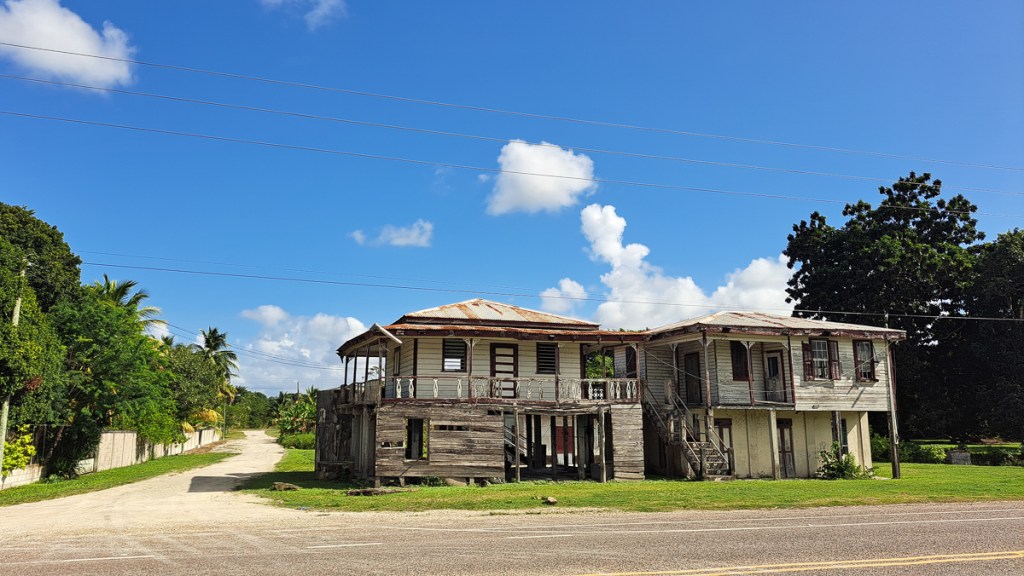
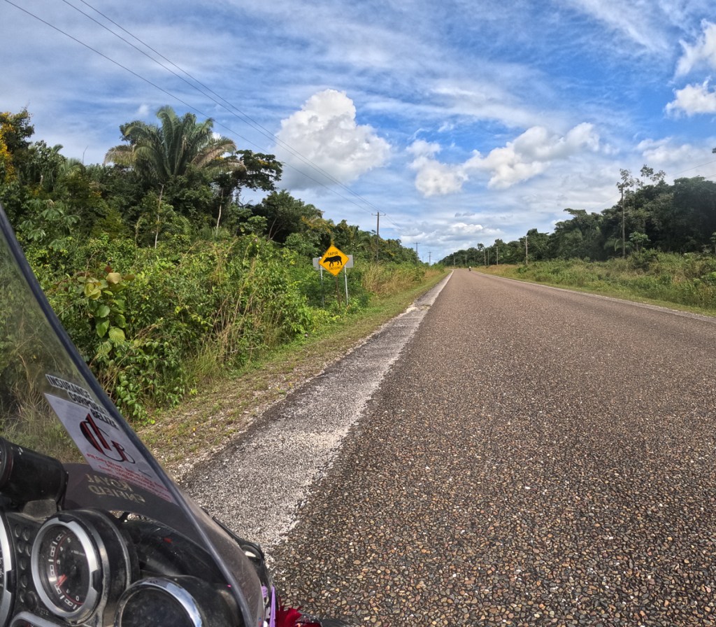
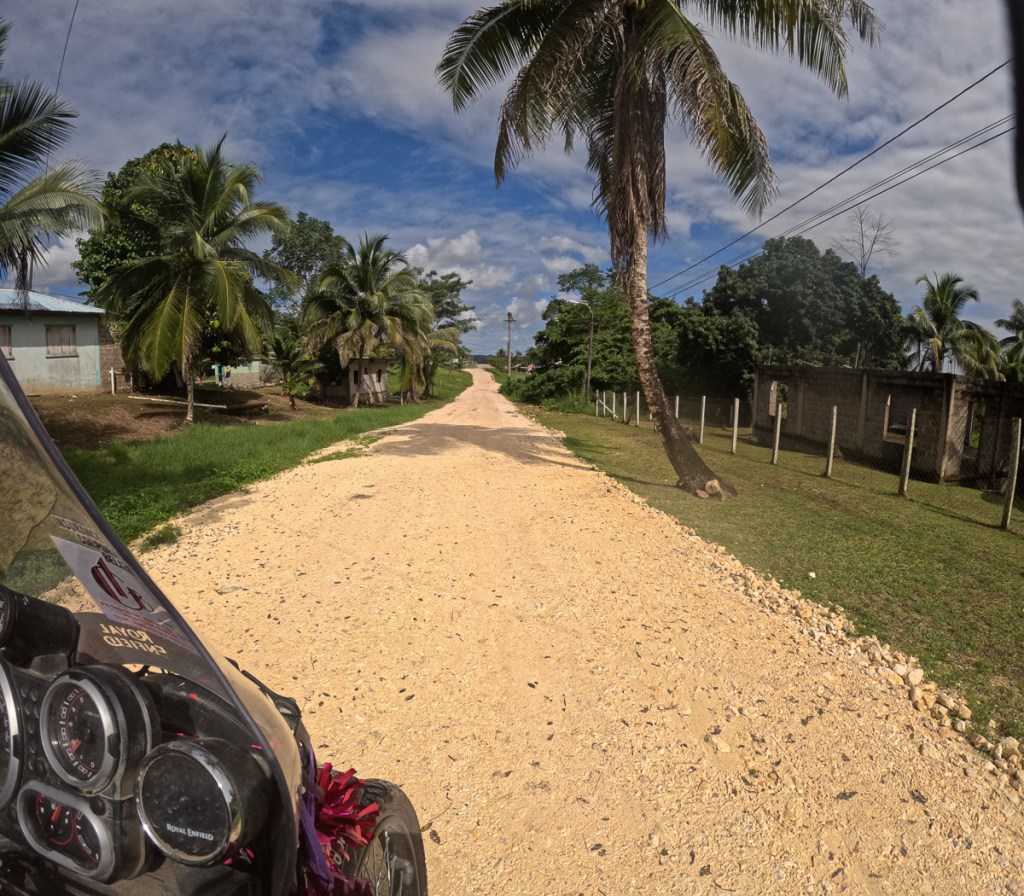
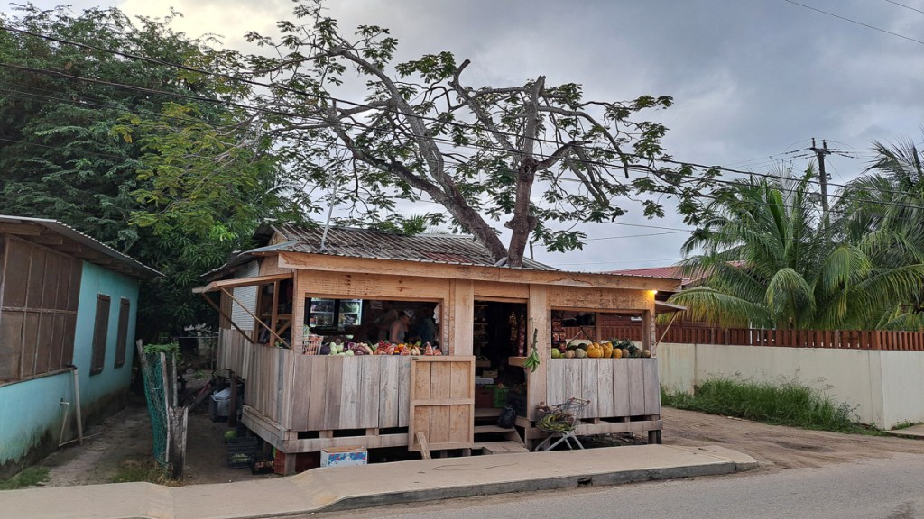
The Belizian roads are in a better condition than the Mexican roads. Their speed bumps are better labelled and they seem to have three sorts. One sort – a set of three narrow rumble strips you barely have to slow for and another a well marked smooth mound, then there’s single or double rows of metal domes that usually make the bike wriggle alarmingly. They do have some potholes but nothing like the near total disintegration of the road that we frequently experienced in Mexico. There are probably less roads as well as the population of Belize is quite small so perhaps less traffic. Decent main roads and short distances made Belize pretty uneventful on the motorcycling front. Off the main routes it’s back to dirt roads but because of the recent flood in Mexico and the current heavy rainfall we’ve stayed off those. The combination of rain and soft sandy mud, or slimy mud will make them pretty dodgy places to be on two wheels.


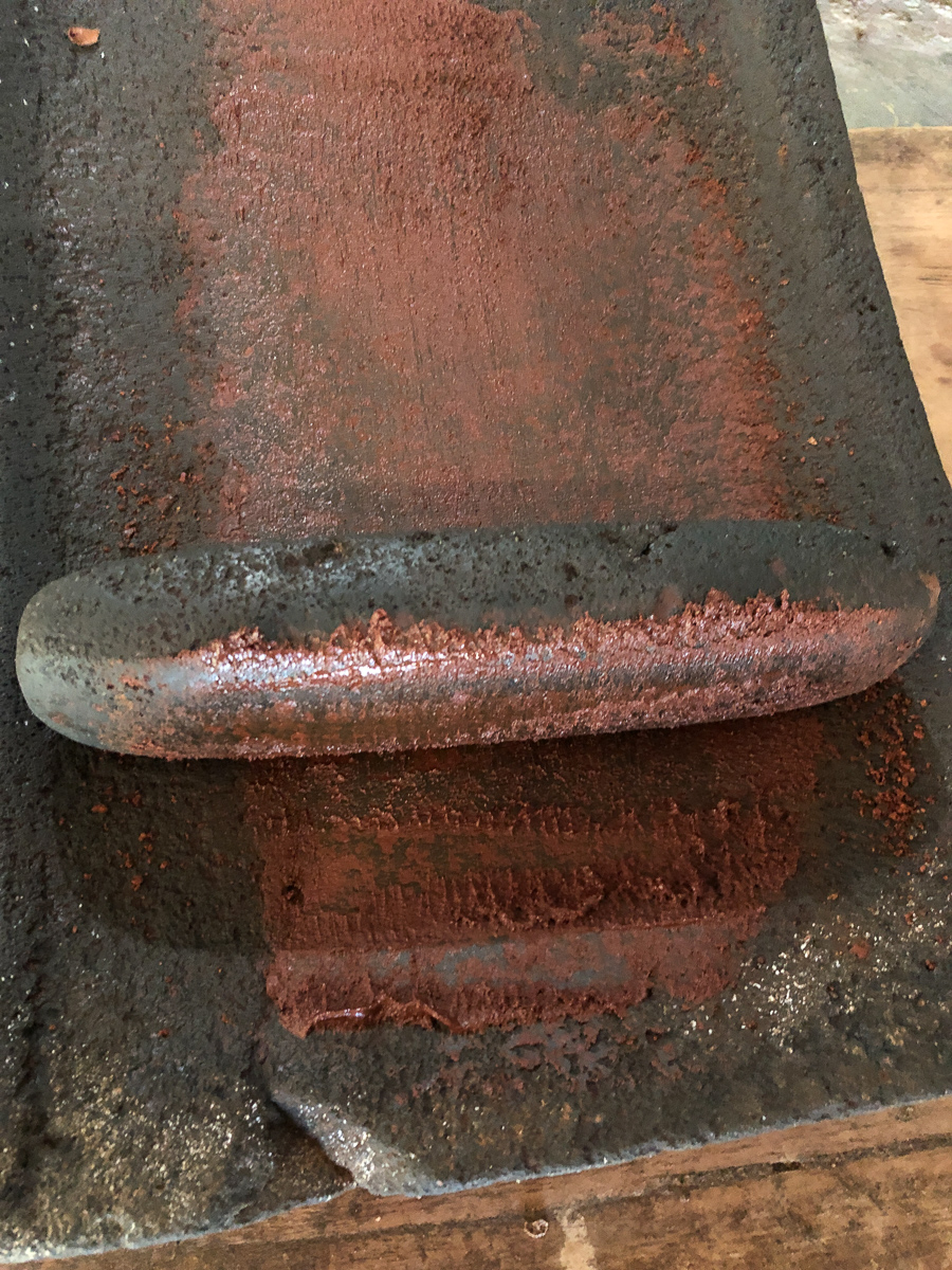
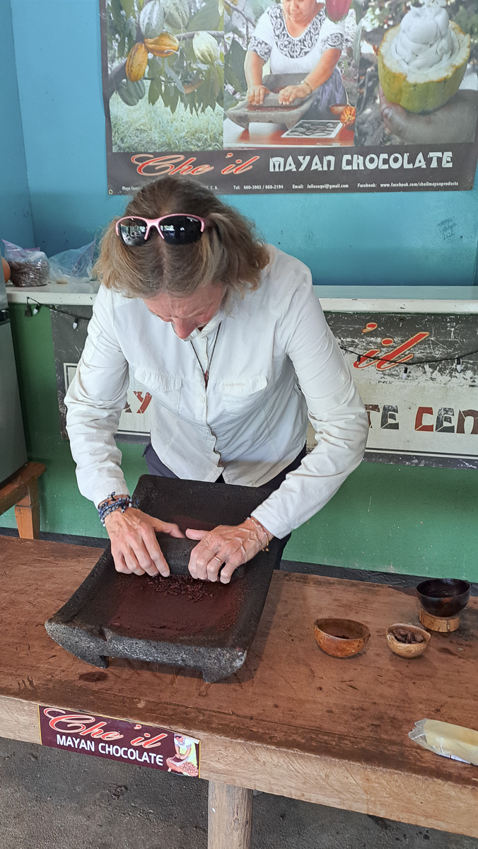
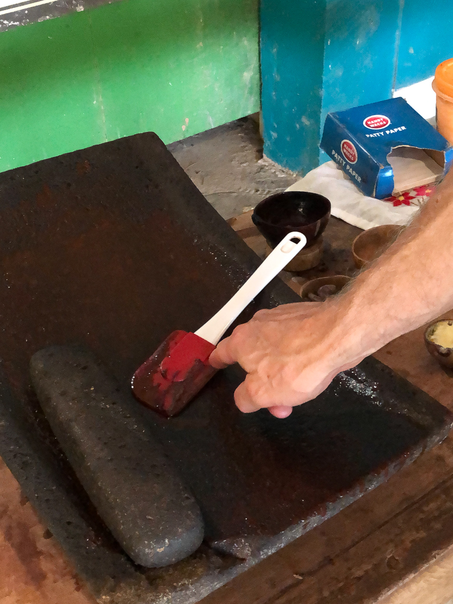
We’re back to the Caribbean coast for Christmas. We broke the journey to the beaches at Maya Centre where we took one guided night stroll and another guided day stroll in the Cockscomb jungle – nope, no jaguars. One frog, one turtle and two catfish is hardly an exciting haul but the red brocket deer in daylight was a pleasant surprise. Belize has made a point of having a lot of nature reserves, although they do mostly seem to be on land unsuitable for agribusiness type farming. But – revelation – here’s a chocolate making tour. Guess who dived straight in? We’re taken off to Narciso’s chocolate farm, where we learn about the fruit, and the beans, and the 6 day fermentation and 7 day drying. Then to the factory where they’ve been roasted. Robert directed the procedure: taste “nibs”, grind them, mix in the cane sugar (grows everywhere in Belize), and extra cocoa butter. Scraped into the mould, place in fridge for 5 mins. Eat. Very yummy! The chocolate drinks here are something else, too.


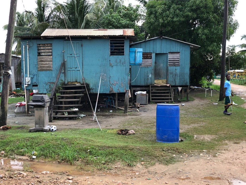
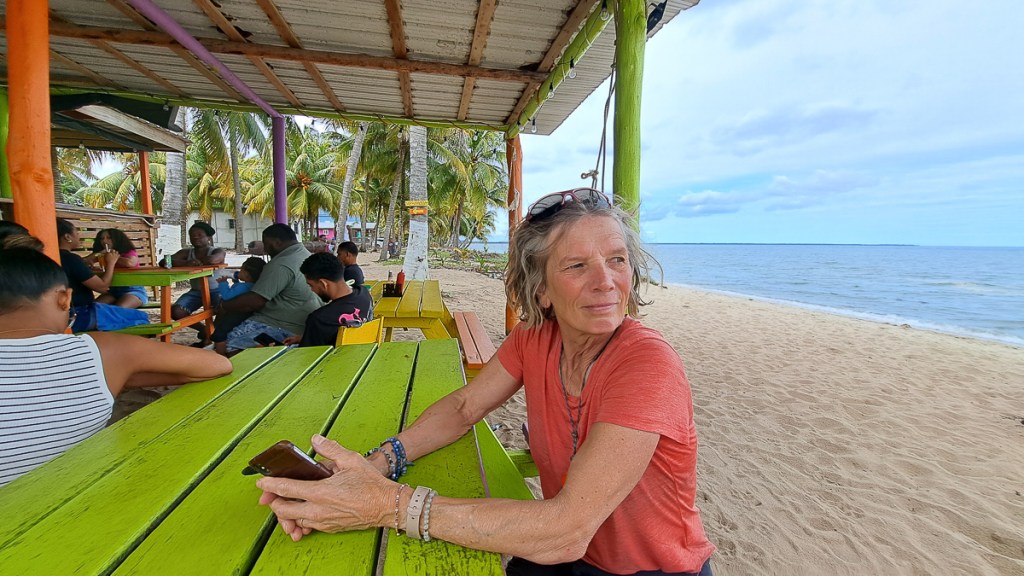
Beach village Hopkins, recommended by a number of people, is a vibrant colourful small town full of very friendly Caribbeans and wooden shacks. People were happy to stop and chat, many with a cause or two that we should contribute towards. One chap offering us magic mushrooms and a number of cannabis bars along the street might explain the very relaxed vibe to the place. Hopkins is presumably run by the ladies as the chaps all seem to be relaxing around their omnipresent beer bottles. 30 miles south on the coast is Placencia. Wow is it different! The road in is lined with concrete barricaded mansions interleaved with “plots” – prominent Private Keep Out warnings with For Sale banners and ‘gated’ developments available. It’s a bit of paranoid “me-me-me” Florida dropped into the “hey man” Caribbean coast. At the end of the peninsula is the main village of Placencia. The village itself is back to colourful Caribbean settings but millionaire’s row has left its mark, it feels a bit phoney and fleecing compared to Hopkins, albeit in much better repair. Our main beggar in Placencia wanted money for an eye operation, whereas his colleague in Hopkins claimed to be a shaman…


Belize is about the size of Wales, but only ~400,000 citizens inhabit it. Having been part, not of the Spanish Empire, but the British (a legitimisation of piracy and unrestrained logging), it speaks English, has yards, and miles. Interestingly, the Belizeans couldn’t say if the petrol was sold in US gallons, or Imperial, although Gregorio from Maya Centre reckoned the measures were short! I went into a hardware/motor parts store to buy an M8 bolt for my pannier rack, but almost everything was in inches (I know not if Imperial or American SAE): Bizarre, indeed as they do have quite a few pre-90s American pickups and lorries which will be SAE, but 90% of their vehicles will be metric. They have Charles III as monarch, which led to some very odd conversations, so I’m not sure what they’re told about his role. Elizabeth II, pictured at around 1965 I think, still graces the banknotes and still seemed close to their hearts. And Philip, we were proudly told, visited them in 1985 and planted that tree.
The country is an ethnic melting pot. Whereas Mexico seemed mostly like a creamy soup of well, Mexicans, Belize is sort of ethnically lumpy stew, different peoples in different places or roles. Is this a result of Mexico being freed of external rule in 1821, but Belize’s being in the British Empire well into my lifetime? It seems the Mayans dominate the southern countryside, putting them in charge of the jungle and the important chocolate supply. The (germanic, white) Menonites often stay quietly on their large farms, and do most of the food and deforestation. The garifuna dominate the coast, catching fish, tourists, and the odd beer or splif. The numerous north American expats like secure gates, big houses, “private” signs, and, naturally, F150 pickups; they run a lot of the tourism businesses, stating their prices in US dollars, not always clearly so, and much the same prices as US prices too (perhaps to pay for their USA medical insurance?). Whereas greengrocers and restaurants are often Spanish, every large village has are two or three medium-sized supermarkets, selling the same broad selection of goods, and always, it seems, run by merchants of Cantonese descent. I’ve probably missed someone out – Wikipedia has more detail and yet more. They all seem to get along just fine. Belize is officially English speaking, but as a tourist, it would be helpful to know the Spanish, Creole and Cantonese for “shall I charge the tourist double?”, although the north Americans charge most of all, and then you realise it’s in US not Belizean dollars, a fixed 1:2 rate doubling it again.
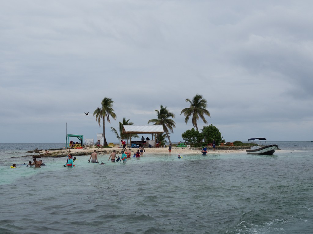
Southern seaside village Placencia was our Christmas break choice. Snorkelling was on the plan but we didn’t know much more about it. We planned a four night stop in the backpackers hostel, hoping it would be a lively community over the Christmas break. When we arrived it was only us; a few more travellers did turn up, but it stayed pretty quiet. Mark and Sheila, the owners, were very helpful and pleasant but we couldn’t help notice the For Sale sign as we came in. The nearly new hostel is three miles out of town so we’re wondering if it’s too far out for backpackers who frequently occupy hostels but have no transport (although the hostel has bikes and the buses are cheap). The village itself seemed to have plenty of tourists on Christmas breaks. The dive centre had space tomorrow, 24th Dec., but that’s it until 2nd Jan. We booked up for tomorrow.
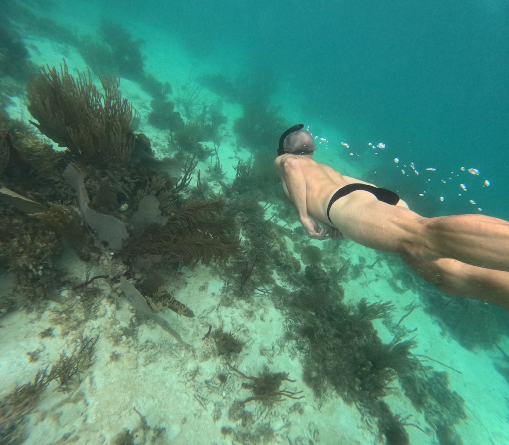
Kitted out we set off and were told it would take an hour to reach the coral destination. The sea was flat so we zoomed along with little discomfort. Our snorkel guide explained the ropes. We were going to circumnavigate the little island. He would narrate and had a pointy stick to draw our attention to certain features. Once in the water I was off keen to make the most of our forty minutes. The kit worked well and I could dive down to take photos although a lot of the corral was barely three feet beneath us. On a couple of occasions I got left behind and was redirected back to my group. It was fabulous. The seaweeds were moving with the flow. Fish darted to and fro or just nonchalantly drifted past. The coral and fish were colourful and gorgeous.
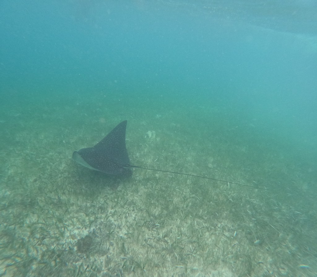
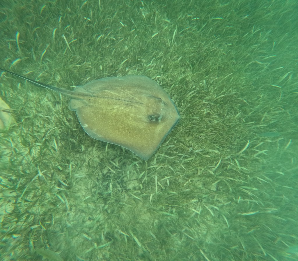
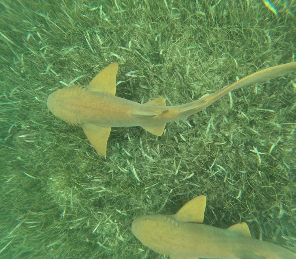
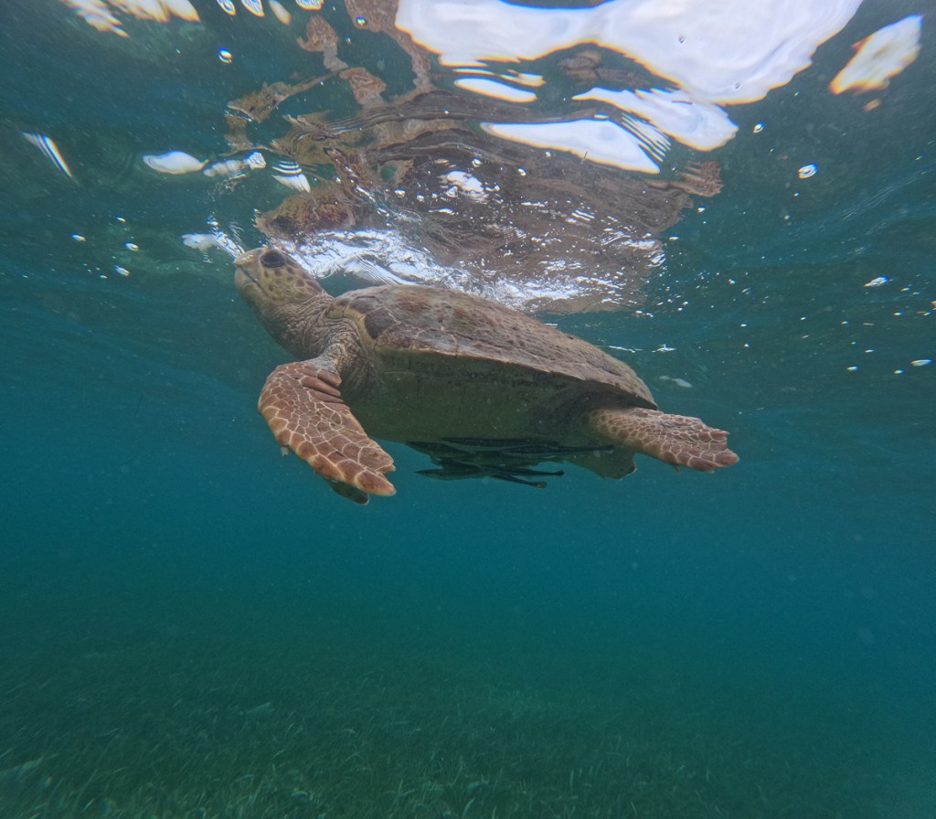
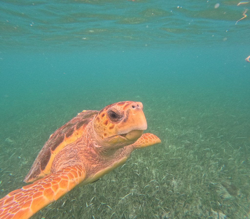
Once lunched on the island we were off to the second site. Here we were told we would see turtles, nurse sharks and sting rays. Yep, they were right. It was stunning. Barely in the water I watched a white spotted eagle ray swim past. It seemed huge! The graceful flapping of its ‘wings’ seemed poetic. So slow was the motion as the ray glided along. Mindful of its tail that must have been at least six feet long I didn’t get too close. Minutes later I’d seen a few other smaller rays but was anxious that turtles and nurse sharks were also on the list. I heard an ‘over there’ call directing me past one of the other boats. As I approached it the sea bed was disturbed. Cursing inept snorkellers who must be putting their fins down I circled round the outside of the sand storm. Wrong! It was nothing to do with snorkellers. I watched a nurse shark wiggle down on the ocean floor and with a thrust spurt up leaving a sand cloud behind it. It was in this area that I also found the turtle with cleaner fish nibbling under its tummy. Wow, how beautiful!
To cap it all on our way back we happened upon – or our captain found – a school of dolphins. Eight fins were visible at one point. Some came very near to our boat swimming alongside occasionally jumping. One even did a completely airborne breach.
Christmas day away is weird when you are used to spending it with family. What were we going to do? Family phone calls made we were at a loose end. Supper would be late so we could use the day light but we still didn’t have a plan. There was another village, Sein Bight, to the north, much closer than Placencia, but devoid of tourism. We wandered off to it having been warned that a number of places would be shut. Having topped up our supplies in the only open supermarket we reached the other end of town before cutting through to the beach for the walk home. In this local’s village it’s no problem reaching the beach but back nearer to our accommodation it was ‘Private’ access again. We weren’t sure where we would cut back to the road. We stopped at a bar on the beach. A rickety Caribbean owned place to sup and admire the palm tree framed view of the sea. The owner chatted to us asking if we were going to come back later in the afternoon to see the Christmas Day tradition. He told us people dress up and go around the houses. We’d be able to take photos, video, whatever. We ambled back along the beach, and cut back to the road through a smart resort, wondering if we only got away with that because we’re white like most of the guests and none of the staff.

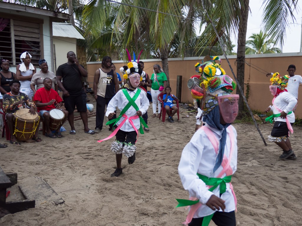
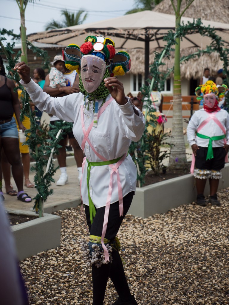
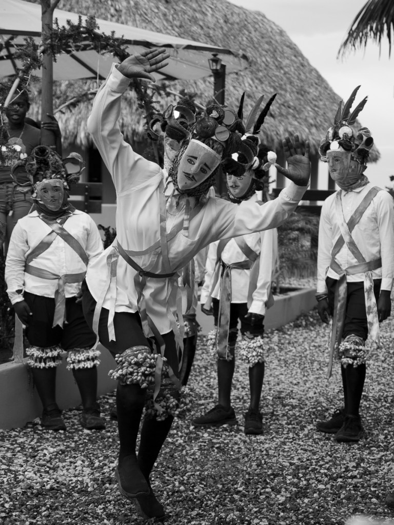
At two o’clock it was pissing down. Three o’clock it had cleared up. Off we went back to the beach shack to find out more. We found the procession. It was awesome. Drummers thumped out a rhythm while youngsters performed a traditional dance, shells on their knees to add to the beat. Wanaragua (mask) is a dance performed in pink mesh masks and white shirts creating a satirical representation of the white slave masters. The dance is a part of the South Belize heritage which is passed down the generations and we were lucky enough to experience this tradition.

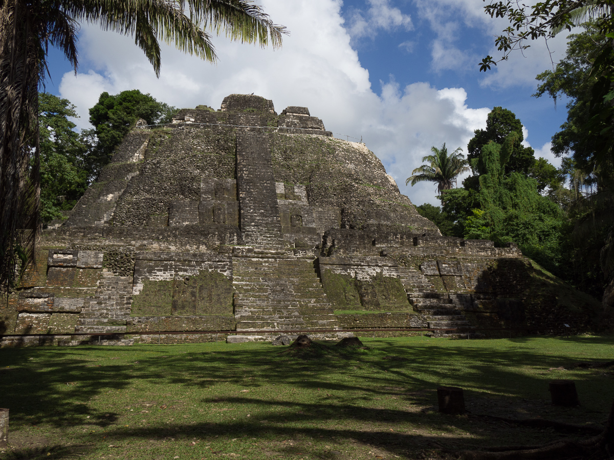
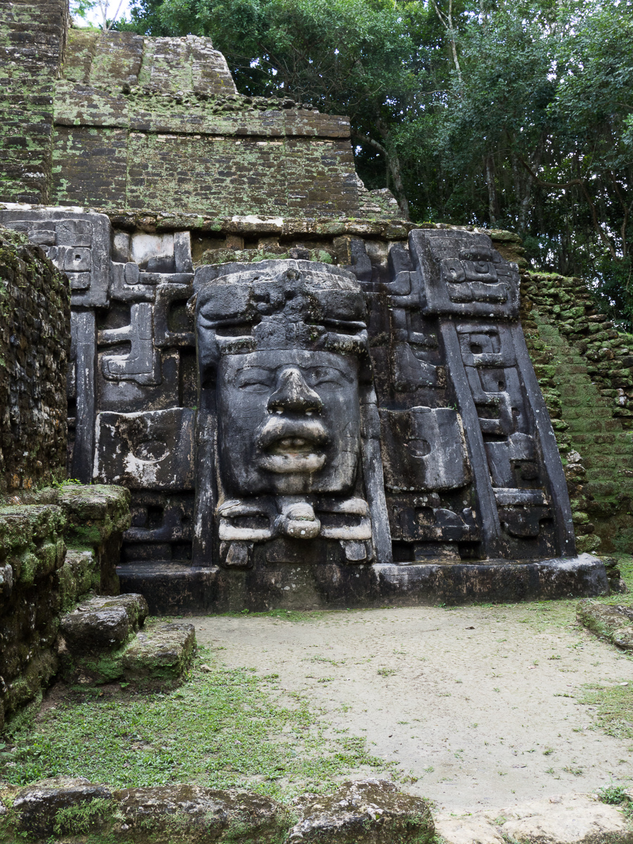
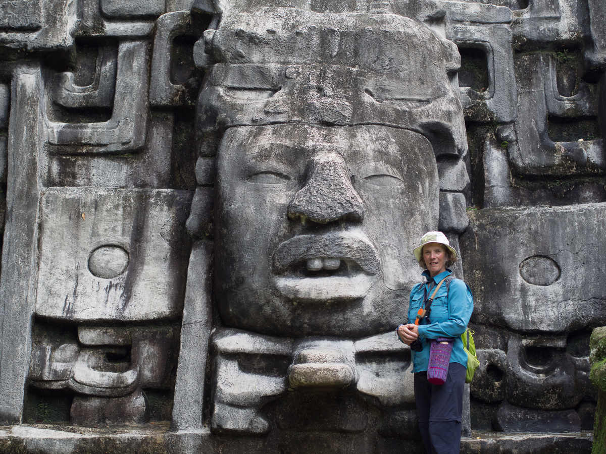
We’d come into Belize a bit haphazardly, and now decided to retrace our steps northwards, to the second city of Orange Walk, to see the Mayan ruins at Lamanai. We wimped out of the 30km wet dirt road access, and took the tourist launch which meant we had, unusually, a tourist guide, Amit, with his no 1 badge. He was genuinely informative, more so than what we usually gleaned from signage. Old friends might be intrigued to know that Holpitan, the name of the people who built Lamanai, means canoe people, but they were called Yucatec by the Spanish.
Our brief interlude of English over, we next head to Guatemala, and it’s Spanish* all the way to Ushaia…
*Ok, Brazil is Portuguese, if we divert west.
