Sumatran Struggles – Beaten?

A double posting tonight – you might have missed Sumatra continued – Photos?
Sumatra is the toughest place we’ve been on this trip. We’ve given it our best shot, but after a month, we’re still a week from the ferry to Java. Legs are aching from the endless very steep hills, and skin is blotchy and spotty from the endless sweating and humidity. It’s time to take an easier path. I wrote that on a Jakarta-bound air conditioned bus.
Its tough because of the hills. After Toba, we made our way south, along the volcanic spine, for a way, before going West, so as to benefit from the coastal lowlands. Well, they are low, but they ain’t flat. For much of it, spurs or ridges extend to the sea. They’re only 100m or so high, and the coast road takes them in endless savage little hills. In the heat and humidity, we can’t climb fast, or without cooling breaks; progress is sometimes demoralisingly slow. Two of our last three cycling days gained only 60 and 52km, little over half our average. And there was a rest day in between two of them! On our last day of cycling in Sumatra, we were a week later than our planned crossing to Java, with 500 hilly kilometres to go. By 4pm we were still 40km short of the day’s target. Then, on a narrow bridge, this big bus had to wait behind us to overtake (nb: a technique unknown to Java’s bus drivers). We turned and signed “bikes in bus” to the driver. It worked! We covered the 40km to Krui in comfort. Well, sort of comfort, as the road remained the same bumpy corkscrew we’d struggled on. There we rested a day, and sorted ourselves onto the next day’s bus to Jakarta. That recovered one lost week, by skipping roughly 500km. I guess I should add as a postscript that we didn’t cycle east Sumatra, which the maps suggest is flat and swampy, and might have been easier, but less scenic.
Pictures of hills – oddly, we have lots…
It’s tough because of the heat and humidity. Shortly after starting, every day, we were soaked in sweat. Towards the end of Sumatra’s big hills, Clare started to suffer from heat rash. All day pedalling hard, then often sleeping in hot, stuffy rooms, was too much for her skin. Gid later showed some signs of this too, but generally coped a bit better, perhaps cooled by his stylish Bukittingi haircut or just baring a silver cyclists chest with shirt flapping in the wind. No wonder the girlies are all in fits of giggles. Clare bought some cotton clothing hoping it would be cooler even if not designed for cycling. It seemed to be working… The rash not getting worse.
Err, no pictures of the sweat and rashes, sorry.
Accommodation was difficult at times. Once out of the highlands, it’s way too hot to camp, especially in our rainproof, but poorly ventilated Scandinavian tent, as there’s rarely much breeze. Hotels and guest houses are usually good value, often offering AC, but thinly spread, though not so thin as  OSM and Google suggest. Although we’d agreed not to try for big distances, often mapped accommodation is over 100km apart, and not always do we find somewhere unmapped. We have new words – Penginapan, for lodging house; Losmen for inn. Rarely in electronic maps, these can be found in smaller towns. Even towns not on the map but deduced from a road junction – some surprisingly big towns show up that way. We’ve been taken in by locals, which was a great experience, but a hot, sticky night, fully clad, in a communal room. Once we crashed out in the utility block of the local police station, which isn’t uncommon for Sumatra cycle tourists. I reckon if you can stand the heat, you could sleep free most nights. If you can’t, fan cooled rooms start at little over $10, air-con from maybe $15, so long as you can find a decent sized town. We always aimed for aircon, for a night’s sleep and dry skin, although we didn’t always get it. It’s the best option to dry out laundry overnight – we’re only using two sets of clothes. Finally, aircon’d places have most vents closed, whereas the traditional method of staying cool is maximum ventilation; this means there’s many fewer mozzies in an aircon room.
One afternoon, we were pulled over by a roving Warm Showers scooter patrol. Mati offered us free accommodation pretty much exactly where we were heading. How cool is that? Well pretty cool, as it was a kind of substantial beach hut, with the best overnight breeze, and a very well aimed fan. A shame we were keen to press on, it would have made a nice beach break. There’s a fair number of Warm Showers hosts in Indonesia, it’s got to be a great option if you sleep OK in the heat.
No pictures of hotels, either…
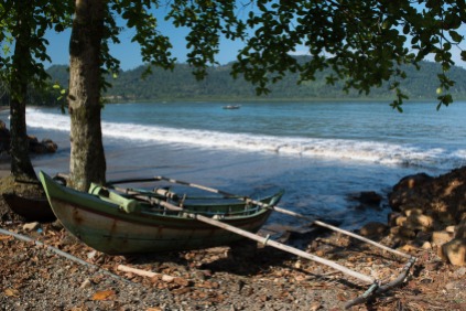
Talking of beaches, we did see some surf, and some surf dudes, on the west coast. The best action is supposed to be out on the western islands. The coast we saw looked attractive for some surfers and maybe sea kayak too, but perhaps tricky, for sea kayak landings.
Though tough, Sumatra is a very rewarding place to tour. 2,300km long by the shortest road route, the mountain views are stunning, the rainforest, even roadside, is full of lush greenery and noisy beasties. The agricultural areas range from fascinating and colourful gardens and paddy fields to duller palm plantations. Some tourists find the palm oil plantations depressing, mostly as they often represent torn up rainforest. But they’re not so bad to cycle in. Sumatra is big, but it’s always had a modest population and limited development, so there’s not much history to see, it’s more the landscapes and the people there now that are the “sights”.
They are not all the same people – we see different cultures as we roll struggle through, but always the people are friendly. Each day is spent grinning and greeting. Clare realised she’d been wearing a fixed grin for 30 minutes passing through some town, so many folk wanted to wave and call. As usual after a couple of months in a country, we got up to a shamefully poor vocabulary of maybe 20 words of Indonesian. It was enough, with gestures, and a few Indonesians speaking English (“Hello” is the same, and all Indonesians know “yes”, “no” and “selfie”). I guess there are about the same number of selfie stops as India, but here it’s mostly girls. And very giggly ones too, at least two per scooter.
People…
With fairly heavily loaded road orientated bikes, and limited time, we stayed mostly on minor main roads. Like in most hilly regions, the minor roads rarely joined up to provide alternative routes. But away from Medan and its horrible road to Berestagi, traffic was light. We were there mostly in June: Monsoon downpours happened at times, but most days were dry.
A self-inflicted accidental challenge was that we left the Christian region around Lake Toba at about the start of Ramadan. Thereafter, roadside eateries were shut all day, we had to make very boring picnics from the small supermarkets. And there was a bit of a feeling of it being somewhat impolite to drink or eat in public. But we had to, as finding roadside  privacy proved as impossible as in India. The degree of fasting rigor varied as we travelled, some regions appearing more devout than others. It was a relief when it ended, by that time we were in Java.
Our final thoughts on Sumatra differ. Clare was thoroughly fed up with it by the end. The endless hills, and their brutal steepness, the enforced distances to hunt aircon, the problems with food, the heat, and the frequently off-road experience when we avoided the highway, was all too much. Gideon is more positive, but thinks to get a great tour there, we’d need a bit more youth and/or heat tolerance, a lot less baggage, fatter tyres and maybe suspension, and stronger legs. Oh and maybe three months, just for Sumatra, not Indonesia.
Clare claims North Java is flat, find out if it really is in the next blog!

Sumatra continued – Photos

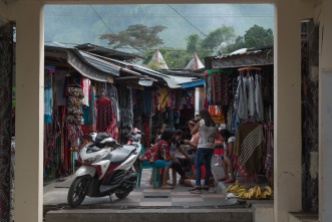
Clare in the Town

Gideon

Clare in a Paddy

Gideon


Clare on the Beach

Clare in the Quarry

End


Cheap As Chips?

A tiny blog posting – a Micropost!

I thought it would be interesting to see how the countries we pass through compare economically. Thanks to Wikipedia, it’s pretty easy.

Here’s a chart showing the Per Capita Income in each country we’ve passed through, or hope to pass through.

GDPUSD2015.png

And here’s the same chart, adjusted for the cost of living in each country (called Purchasing Power Parity, or  PPP).

PPPUSD2015

PPP seems to have the effect of making the people in middle-income states better off. And Singapore.

We can even divide one by the other, to give us a rough Cost of Living Cycling. However, this is a bit rubbish, as in most of Europe, costs were kept down by camping. From about Bulgaria/Romania onwards, it felt a bit insecure rough camping, and hot – we really appreciated the comfort of a shower, so mostly stayed in guesthouses and cheap hotels. In tourist cities, that was often pretty cheap, but out on the road, I would guess that it very often was close to $20/night for a room for the two of us, irrespective of country. So far the most expensive nights have been Uzbekistan ($70 for a yurt), India (~$70 for a tent, ~$40 for a palace (really it was, gorgeous)), and Myanmar ($50 at two of the hotels, trading on scarcity). Not normally regarded as high-cost locations. The Caspian Sea ferry was also an expensive night, but did cover a fair bit of ground as we slept. The Tajikistan Toyota Tour was by far our most expensive week, but wasn’t exactly integral to the trip. And it didn’t include the (cheap) guesthouses!

CostOfCycling

Turkey, Uzbekistan and India have been most costly for souvenirs, not because of prices, but because of the wonderful handicrafts, and their availability, and perhaps more stop days, and maybe the timing of Christmas.

End of micropost!

(Note to self – master spreadsheet stored on cloud, in case plans change!)

Uzbekistan – On the Road

Uzbekistan had so much to see, do and snap, that we made a number of themed blog posts, instead of trying to tell one story.  We hope this posting will give an overview of our tour in Uzbekistan, and show of the pictures we took between the “sights”.

Our posts on Uzbekistan:

Uzbekistan’s roads were generally good to us. We were often on main roads, which were often dual carriageways. But this was rather like Turkey – there was plenty of room and not too much traffic, albeit the roads were not as smart and new as Turkey’s. It was flat. And it was sunny but not too hot. Not too much wind. Out of the desert, there were plenty of little shops and teahouses. Really nice touring conditions. The only bugbear was trying to comply with the hotel registration rules. We mostly managed this, with a few deviations into teahouses.

Uzbekistan’s people were invariably friendly and helpful. We were often flagged down, or addressed from a car crawling alongside: “atcuda, atcuda?” – Russian for “where are you from”. Strangers rushed to take pictures of themselves, or their friends and family, with us. In towns especially, young people would come up and ask to practice their English with us. We were, of course, given melons. And one lovely family invited us in, with delicious food in the local style, and the extended family all joined in too. That was an especially lovely experience, and we thank them again for their kindness.

Just before we got to Uzbekistan, on the ferry, Clare had a severe, if short, bout of food poisoning, and Gid’s tummy was a bit uneasy as well. The timing of it made us suspect a pre-ferry pasty rather than the actual ferry food. But Clare’s tummy then kept suffering from recurring problems which had us calling on pharmacies as we went along. It wasn’t desperate, but the overall effect was weakening and depressing. We took a few extra rest days in an attempt to ease the impact. With various tummy pills and a very plain diet it was sort of kept under control. We needed rest and a long break stop, but the Uzbekistan visa was only 30 days. Whereas we’d always planned a long stop in Bishkek (visa free for 60 days). Thus we altered our plans a bit:

  • Original Plan: From Samarkand, south into Tajikistan’s capital Dushanbe, then loop south taking the Pamir Highway along the Afghan and China borders, then north into Kyrgyzstan, Osh, then Bishkek. A classic, but tough ride, and in the back country.
  • Plan B: From Samarkand, north to Tashkent, then east over mountains into the Ferghana valley (this road might’ve needed our Tajikistan visas. Across this valley; flat, fertile & historic (have you heard of the Bactrian empire?), to Osh in Kyrgyzstan, then north to Bishkek. Less back country, and three significant passes to cross, but easier  and shorter than A.
  • Plan C: From Samarkand, north to Tashkent, then north to Shymkent in Kazakhstan, then east to Bishkek. This route is pretty flat, and on major roads. This we took, and indeed were able to make pretty long distances most days.

Gallery

Cotton Picking

On The Road

 Generous Hospitality

OLYMPUS DIGITAL CAMERA


All Aboard

Deciding early on we didn’t like the hassle of Turkmenistan’s visas and conditions, left us the route options of a northern route via Russia, or taking the “ferry” from Baku, Azerbaijan to Aktau (Aqtau), Kazakhstan. The “ferry” is not arranged like a scheduled public ferry, it’s more that tourists can have spare space on a rail/truck shuttle. That was what we chose.
Cycle touring blogs abound with tales of the hassle, faff, and hardship involved. A lot of it is probably due to language issues and Soviet approach to service: Although most individuals are helpful, the system isn’t. The operators publish no user information, so the web is full of garbled advice, from everyone’s individual experience, but perhaps too often folk assume their example shows what the system is, when really it’s quite variable and ad-hoc. So here’s our experience:
Following online advice, we went to find the Baku ticket office. The directions on welovemountains were helpful, although Baku changes fast and the last bit differed: the rough road and grey tatty building are gone. The new port entrance is smart. To the left of it, the port’s electricity substation is stone or marble clad and lettered in gold. Right and just inside the port entrance barrier (and its helpful guard) is an old shipping container, painted white and turned into the ticket kiosk. The recommended lady, Vika, inside from 11am on our days, does indeed speak English. So far so good.
It took me a while to fully grasp what Vika was saying: “Call tomorrow to find out if there’s a ship tomorrow. Yes, on the same day. We open at 11am. The ship will go from Alat, 80km away.” So depending on sailing time, it may be impossible or a terrible scramble to actually catch the boat.
I asked, “Can we only buy tickets here”: Answer, “Yes, here”. It sounds clear, but three English lads in a car bought theirs in Alat, so clearly incorrect. Probably Vika didn’t get the “only”. Or meant that she didn’t sell anything but tickets (my bad English!). But I believed it, so with a day or two in hand, we checked out travel options to Alat:
Cycle: Allow 6 hours, dual carriageway, not too hilly. Ok if getting to port at 6pm is acceptible. Actually, on the day, it pissed down, so just as well we didn’t.
Coach: Station is about an hour’s crap ride from the ticket office. Bus ticket sales staff not able to help, I couldn’t find timetable. Not even sure if a full size coach goes that way. Small coaches can’t take bikes.
Bus: Service 195 apparently, from 20-ci. But getting bikes on buses is not easy.
Minibus: (from coach station, services for Sabirabad). No fixed schedule or tickets, drivers helpful about the bikes “no problem”. Probably best cheap option, but cycling cross town, then waiting for it to go could make it little faster than riding.
Train: English no use at train station, couldn’t even get times. Staff told us bikes not allowed on Azeri trains, although other Azeris say that’s not true.
Taxi: Almost all are saloons & can’t carry bikes. We wandered about the day before until we saw a big estate taxi, flagged it down and got a number. Got the hotel to call driver, agree a price and times. This worked well, and was quick, although at the end there was a disagreement about the fare. No idea if genuine or if driver was trying it on. We took responsibility for the last stage of navigating, driver wasn’t familiar with Alat Port.
Anyway, next day at 11, I call, and wooooo, there’s a ship: Be at Alat at 17:00. Rushed over to ticket office with both passports (needed), and cash. Prices were quoted in USD, but Vika said we could be paid in Manat or USD. $110 each, bike free, including cabin, bedding, food. I took Manat, using the typical exchange rate, and had a pleasant surprise that the exchange rate used worked out significantly cheaper. There was some delay finding the cashier person, but really it was smooth enough.  I did, however, get entangled in Baku’s one-way system on the way home. Anyway, we got tickets for Merkuri 1.
Again advice was confusing, we saw stuff online that cars and trucks can be loaded at Baku, whereas rail and foot passengers board at Alat, or occasionally vice versa. We boarded at Alat, where we cycled on, via vehicle ramp, noting the presence of rail tracks from inside the port onto the boat, so they could have loaded rail cars. But in fact we were followed by trucks, and finally a Ford Fiesta containing three English lads, Ivor, Martin, Andy on a post college jolly. I suspect that, as the entire fleet has the same dimensions, any of them can load anything at either port, but perhaps they don’t mix road and rail cargoes – another ship alongside was filling up with railcars. I don’t think trucks were part of these ship’s or docks original design, as the artics and dolly towers alike all had to reverse off.
The whole paperwork and loading process, both our personal bit and the whole ship, was way slower than a European car ferry. We’d been told to arrive 17:00 and were early, waited to be called up about 17:15, and were on-board about 18:15, bikes tucked in a corner before loading trucks. The three lads in a car, waiting before us, boarded last, car filling last gap, after 21:00 when the canteen had closed. Actual departure was about 22:30.
On boarding, and lashing down, we carried all our bags up (groan) to our room, including the heavy provisions we’d bought for the journey, after terrible online warnings about the food.
There’s no announcements on ship, but it’s easy enough to stroll along to the bridge and ask the current plan. I was originally told we’d dock about 22:30 (having departed almost exactly 24 hours before). But at 22:00 we heard the anchor going down, and I strolled f’ward to be told it’d be the morning (the dock was occupied). That was good for us – a comfy bed for the night, instead of dumped ashore at midnight. In fact it was about midday when we docked. And the crew were correct in predicting about an hour for Kazakhstan customs. All passengers had to leave the ship (and bulky luggage), do the paperwork (ok), reembark, and roll off. Customs then did a moderately thorough search, and in my case, had a go on the bike. I guess we were rolling by about 13:30. In our case just into Aqtau, to stock up for the long empty roads of Western Kazakhstan.
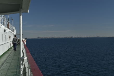
As for the ferry and voyage, it was fine, nothing matching the dreadful online reports. The sea was calm. Merkuri 1 was showing her 31 years, but everything important worked. The 2 bed cabin was rather tatty, but spacious, with an opening porthole, shower (sometimes hot, sometimes not), desk, loads of storage, and really comfy new mattresses. The 3 meals a day were basic but ok. It took me a while to find it, but there was always cay available. There didn’t seem any way to spend money on the ship, except for using phone data while near land.
Clare was violently ill in the first night. It must’ve been food poisoning.  But the timing makes it difficult to pin it on the ship’s cook. Just as likely to be the dodgy supermarket sausage sandwich she had while we waited to board. However we did thereafter both avoid the salad at mealtimes, as raw, unpeeled, fruit is generally a known risk.
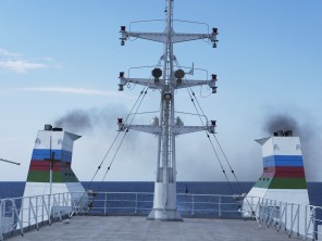
Crew were friendly and helpful, but mostly without English. But in a fix, make for the bridge – I guess English is mandatory for marine VHF on international waters. Special mention for the stewardess who bangs on the doors at mealtimes, actually she more or less dragged us out of the cabin to the dining room. Below, she is putting out the laundry.
Other passengers mostly Turkish truckers, all friendly, the 3 English, and 3 folk from Aqtau, 2 ladies and a little pickle, who was spoilt rotten by everyone. I’m sure P&O wouldn’t have been keen on the round-the-ship-chase, climbing the mast at night, and steering-the-ship-even-though-you-can’t-see-over-the-console (tho’ I suspect the autopilot was on).
So yes, we had to be a bit flexible on timing, but apart from needlessly rushing from ticket sale in Baku, and Clare’s tummy, it was a walk in the park.
We celebrated passing this milestone with a dip in the Caspian (much cleaner looking in Aqtau than in downwind Baku). As it started to patter with rain.
img_0408

Baku

Baku was a curious place. Rural Azerbaijan was a very natural feeling synthesis of what we’d seen in Romania, Bulgaria, Turkey and Georgia, plus more apparently rich people, and a tendency to build ornate walls around scruffy areas. Baku was thus, writ large.
We came into Baku on a big busy highway, amongst increasingly smart, and large, cars & SUVs, generally driven quite soberly. They and the trucks must have been newish, too, as the air quality wasn’t so bad for a city. Buildings got smarter and newer, until in the centre, it felt very developed. There were gleaning new public buildings, malls, loads of swanky shops, and innumerable little phone shops. There were gleaming limousines, a Bentley showroom, and in the car park also serving the hotel, I spotted two cars fitted with the pricey option of the Valeo Surround View system I used to work on: Never seen so many in Europe!
We spent an unnecessarily long time in Baku, because we took a while to be ready to buy our ferry tickets. There were things to see and do, but to a lesser extent than Tbilisi. Here we are seeing and doing old Baku:
New Baku:
Yes, those are London taxicabs: Baku ordered 1,000 of them a few years ago.
Human Baku:
Baku is not liked by every visitor. Perhaps it’s a bit raw. The new bits have no history yet, and the old bits are few, or it seems that way because they were often restored so as to look new. And perhaps there’s a suspicion it is trying very hard to look grand, but not doing so much for the locals. Yet it seemed a perfectly good place to just be. And reasonably safe to cycle around in, albeit in great loops because of the one way systems.
The hotel was the Guest House Inn, with a guest kitchen which helped keep costs down, comfy beds, and helpful staff. Hope the sick kitten made it! We used both 2Teker and Velosport (?) bike shops, conveniently they’re in almost the same road. Both a bit limited for cycle tourists, but we didn’t need much (although dry weather lube would’ve been good). Couldn’t find anyone selling “outdoor gear” although this shop situation was reversed in Aqtau.

Istanbul – Getting In

This is posted out of order as we’d overlooked this nearly-finished draft!
Research into getting into Istanbul, whilst all agreed on using the D020 and approaching from the north, was mixed – catch the ferry, use the river-side route/ cycle path – the latter lasted for a whole 200m, catch a bus.  All at least agreed that cycling was to be avoided due to the heavy traffic and manic drivers.  Gid spent some time looking into the ferry option.  Despite finding a 2016 timetable, pinning  down a departure point, time and destination that met our very flexible needs was impossible. Actually, there probably isn’t a ferry that runs along the coast in the way we wanted – the buses meet the needs of that route. Cycling it was then! Initially we took the aerial route into Sariyer.
Having been reduced to pushing the bikes up the hill (we no longer have bike friendly gradients) I pushed my bike down. The back wheel was skidding as I tried to keep the bike under control whilst walking down, this didn’t inspire confidence in my ability to ride.  At the bottom we abandoned any hope of back tracking to find the elusive ferry ‘terminal’ and headed on down south.   Istanbul old town, where our apartment was, was 30km away.
Initially there was a wide promenade and all seem good.  This came and went as we progressed from one town to the next along the route.  When ever it existed we sort it out as it provided a respite from the traffic.
Into Istanbul, the Garmin couldn’t locate the apartment.  Frequently places have been spelt differently on road signs and the map which makes the navigation more difficult. The Garmin may recognize one spelling but not the other.  So it was down to Gid who used his phone to track us in to his pin-point, but we had to keep stopping to check our route.
It’s a city, so the traffic was heavy but two local youngsters showed us how to do it by giving a demonstration on how to dart backwards and forwards across the traffic using all three lanes going in our direction.  Gid again fared better than me as he boldly stuck his arm out, to fork left, and crossed all three lanes of traffic, at a major junction.
 Finally, AirBnb’s habit of sending all communications to email, itself, and texts, meant we easily met up with our host and were tucked up into the comfy apartment a few km into the suburbs.

Travelling South Across Bulgaria – Part 2

We’ve still seen the occasional horse and cart as we’ve travelled down through Bulgaria but they are much smaller and seem to be used for personal transportation rather than the industry that was evident in Romania.
Again we are noticing that villages and areas have their own characteristics.
In one small village, old prams, with plastic boxes to load up, were the order of the day. It didn’t seem to matter if all 4 wheels we firmly attached & rotated. Four or five of these turned up and were parked outside the store while the owners toddled in to do their shopping.
A couple of villages, in close proximity to each other, were drying sliced mushrooms on racks along the road side.
On occasions mud bricks are being used. At first we saw a pile of them next to the road.  Nearby there were some new homes where they had been used to make the walls; perhaps the rendering has not yet been applied.  They have been quite frequently used to fill old door ways or window frames that are clearly no longer needed. Equally, where rendering has fallen off extensions or out-buildings it has exposed mud bricks.
Whilst contemplating where we might stop for the night we where on the look out for a campsite, or a cafe in which we could stop, get refreshments and peruse the map.  The sun shades make the cafes quite easy to locate unlike grocery stores that frequently have no advertising or signage at all.   On entering Straldza however, both of us quaked as it was evident that the cafe was on the edge of a shanty town.  Fearing the attention we would attract, we sped past but found a very nice cafe, shop and cheap hotel at the other end of the village.  Thankfully, we were once again under a solid roof when the storm came through.
Heat and hills is becoming the norm but thankfully there are quite frequent water springs along the way providing refreshing cool water. Both the Bulgarians and Turks fit the roadside springs out with pipes and a trough, perhaps a habit left over from horse drawn days. Very welcome and nice water too. We’ve both taken to sticking our heads under the water flow before filling our bottles.
The views from the hill tops are beautiful and on occasions it even feels worth the climb.
Our Bulgarian map was a 400k Reiss Know-How map, and proved one of the most informative at this scale, with some contours, and waterproof too. The key didn’t explain what the symbols for places meant, so here’s ours:
  • Urban area 1cm or more on map: Will have most facilities. Choice of hotels but obvious ones may be pricey. Probably a nice centre bit. Big enough to get lost in.
  • Urban area 5mm to 9mm. There will be at least one hotel/motel/guesthouse. You may have to ask around in shop or street corner to find it. It may be on the edge of town. It will probably be 40-60 Bulgarian (20-30 euro) for room for two, excluding any food. There will be an in-hotel or nearby restaurant. There will be more than one food shop, and they will have fresh fruit and reasonable bread.
  • Big dot. No place to stay. Some kind of bar or cafe (may not do hot drinks). One shop, at extreme edge of viability: No fresh products, bread may be mouldy or end dated; vaguely disquieting smell. Difficult to get even UHT  milk, or cheese. Although a fresh cheese is sometimes available from a concealed bucket. This is an interesting contrast with Romania, where little village shops were normally selling fresh bread, and tomatoes, cucumbers at least, and generally seemed viable.
  • Small dot: Just houses, a good proportion falling down.
Later, in Turkey, we encountered three French lads cycling in the opposite direction, and we swapped the excellent Bulgaria map for their equally useful, same publisher, Central Asia map – a perfect trade for both of us.
The other interesting contrast between Romanian and Bulgarian villages is that the former are always a wide main street with houses spaced along both sides. Bulgarian villages are more houses around an area, with side streets, and usually a consciously designed, open, central square, with some communist-era fair sized buildings around (often semi deserted). And in maybe a fifth, it seems like all the houses were demolished and replaced with small apartment blocks, 1 to 5 in a village. They’re often in poor repair.

Ready Bikes!

Here they are, loaded & ready to go…. For another weekend shakedown tour. Turns out we forgot the fuel pump and had a stripped gas bottle thread. That’s why we have shakedowns.

DSC_0060-02_ReadyBikes

Clare’s at the front. Thanks for the retirement pressie solar panel draped over the back there. They’re probably 40-45 kilos each. Glad we squeezed slightly lower gearing on a little while ago.

(First post from a phone, too, rather hard work!)