Goodbye Turkey

So, we bussed out of Dogubayazit,  in a Dolmus to Igdir (50km, 16TL for us and 20TL for the bikes as they used all the Transit’s luggage space. Didn’t stop driver heaping more on top). On the bus we met Harun, a final year student. We chatted for a bit, struggling with Google Translate. He was also going to Kars, and offered to help us with the transfer. Most appreciated.

Unfortunately the Igdir to Kars bus was the worst possible type: a sort of mini real coach. Although it had a high passenger deck, the luggage compartments below were too small for a bike without extensive dismantling.  So, this 150km cost an eye-watering 140TL, with the bikes taking 5 seats. And turning the bars put a kink in Gideon’s rear brake cable. But in we all went, anyway.
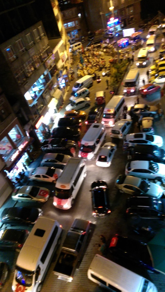
We then had a luxurious 2 days in Kars, in a 3 star hotel Harun’s friend had worked in. Being rather expensive, we don’t normally stay in that grade of place. Why 2 nights when we’d just stopped for a day in Dogubayazit? Well, after all the warnings, and several changes in response, our route and schedule were in a mess. It was 26th July: we couldn’t enter Azerbaijan until 19th Aug, Georgia is not big, and we were about 2 days from the border. Tbilisi is supposed to be pleasant,  but probably not interesting enough to stay there 2 weeks. Equally, deciphering the Foreign Office website advice is very slow, it’s all place names which are off maps or spelt differently, one mandarin paragraph took an hour to relate to the map. By checkout time we hadn’t even decided where to go. We were also keen to check with the local police that the intended road was OK. By midday we’d got it sorted. The revised plan takes us 3 days up to Turkey’s Black Sea coast, then over the border and a few days in Batumi.
We had a potter around Kars castle, and Kars streets.
While wandering rather aimlessly, we espied a touring bike, well, a pile of luggage with handlebars poking out, wall-hanging outside an Internet Cafe (still common in eastern Turkey). Inside we met Engin,  only our second meeting with a touring Turk (the first was on ex-Istanbul ferry, young fellow going to Iran, but untalkative). Engin was another student (and author), on a sort of circular trip, but like us, replanning, in his case cancelling a swing south. We chatted (in English) ending up in a cay shop. Engin was much tougher than us, normally wild camping. I think he was genuinely appalled at the cost of our hotel, well so were we – I write this in a Pansiyon costing 90TL less! Engin pointed out to us how much of Kars’ buildings and streetplan was Russian, not Turkish. We’d not noticed, although I had read that Kars was ceded to Russia as the Ottoman empire crumbled in the 19th century,  only returning to Turkey after World War I. (Although Turkey was on the losing side, Russia was even worse off after its revolution, so Turkey gained some territory in the early 20s).
After the edgy feel of Dogubayazit,  Kars felt normal. Life was civilian, the police weren’t armoured. There was little hassle from boys. It felt more prosperous. Curiously, around Muradiye and Dogubayazit, the usual Turkish throng of banger Renault 12s and 9s and FIAT 131 derivatives vanished, replaced by fleets of Fords – not so in Kars (however Gid did see his first GAZ Volgas there, a brace of Az registered 31105s !). The other vehicular curio is that since about Muradiye,  we see occasional archaic looking trucks hauling tanker trailers. They have yellow plates with squiggles. Think these are part of Iran’s oil exports.
The attempted coup happened while we’re in Afsin. That evening and the following evening were both noisy.  When we got to Malatya there were hectic processions during the evenings, big political gatherings we could hear nearby, with a distinctive thumps and a rousing, but rather oppressive tune (no, not Turkey’s national anthem), together with a very shouty, repetitive,  one can only say rabble-rousing speech. We heard it some other places too,  and so repetitive one suspects a recording. This was interspersed with other speakers,  although one of these (female, at top of voice) also heard in other places, so it must have been video linked or recorded. One can only hope that the same very civil and courteous Turks we meet, listening to this, do not fall into any spell of intemperance from its awful tone. But the tune, and the recognisable bawling voices, were not heard in the Kurdish areas, after Malatya. From Ardahan the rallies resumed, but without the awful music and shouting. So one suspects we’re hearing the demarcation lines of Turkey’s political parties.

IMAG0307_BURST001

Kars is within the area with a substantial Kurdish population,  although I’m not sure it’s a majority. In our southern Turkey travels we met quite a few Kurds, including some of the folk we mention in the blog. It is often an early part of their introduction,  so it’s clearly very significant. I rather get the impression they really do feel somewhat trampled, and want to have a recognised homeland – but none of them suggested any support for violence, more usually the opposite. As we travelled in the Kurdish areas, we may have inadvertently caused some irritation by greeting people in Turkish, perhaps “Hello”, which is widely used, is more neutral. As so often when a people has a problem, some react at extremes, and a guerrilla / terrorist war has ground on in parts of Turkey’s southeast for decades.
The buses passed through areas of rolling upland hills and between Igdir-kars, one or two substantial passes. There was a lot of grazing land, but the view was rubbish compared to that on a bike.
After Kars, we headed – on Bikes again – north to Ardahan. Now we could see the upland grazing clearly, as our legs could feel the gradients. Adding bus and bike, there was probably 200km of it at least. Sumptuous grass full of wildflowers (and bee hives!). Rather shacky buildings probably only lived in in summer. Villages of white tents (and blue polythene). Herds of brown cows, with herdsmen. Flocks of sheep and goats, also herded. Quite few horses, sometimes pulling carts or hay making machines. Flocks of geese near villages. Small boys who never really managed to pester, but sometimes clearly intended to. There was visibly a lot of manual hay making, even scything, but also lots of tractors and balers. It seemed like all possible resources were on the hay making, as from our second night in Kars, there were occasional heavy thunderstorms.
We don’t have as many photos of this traditional life as we’d like: The small boys and the big dogs made us reluctant to stop for any time when near a flock/herd/village/camp, especially if the next km wasn’t downhill.
The Ardahan outskirts were busy with a big new bypass and splendid new university campus. Probably explains why first two cheap hotels were full. While in town looking for our next hotel (there are at least 7), it pissed down, and a very kind Turk from France invited us to sit it out in his new Chevrolet – how hospitable, how Turkish.
We knew Ardahan to Arthingworth would be tough,  100km+, and mountainous terrain. The first 20km was pleasant and speedy. We met Ando, from France, going the other way. He was right: Georgia (and China, his destination) were East; it was us going West that was odd. But it’s sensible for Batumi.
The next 25km were a well graded drag on a good road. This gained us the plateau, intermittently shrouded in low cloud. There were numerous herds and flocks. Then a rather disorganised looking village: old buffers drinking cay, younger men looking more industrious. Around and inside the village was boundary-less rough grazing, giving the village a sort of unclear edge. The climb continued another km maybe, rising gently, to a sign saying 2581m. (Approx. 3 hrs to reach the top.)
The next 25km or so were downhill, losing loads of height into a deep river valley (a tributary of the famous Coruh, for any paddlers reading). Although no higher than the side we’d come up (!), this terrain was totally different. The early part of road was seriously steep, with lots of hairpins, many of which were gravel strewn, so we went pretty slowly, with boiling wheels from all the braking. Whereas the road up was wide and well finished, the downwards one was narrow and sometimes only gravel or dirt.
The views on this downhill were stunning. Every slope seemed to be 45 degrees, and all shades of verdant green, steep forest as well as grass. Far below the sun glittered on the tin roofs of a village. So the descent was much slowed by photography. This took us into the town of Ardanuc. After that we cruised along a river gorge for a bit. A headwind started to blow up the gorge, at times we were in a low gear, going downhill. Then it started to go uphill again, still with a headwind…
After an hour or so of grinding away at this, around 16:30/90km in the day, a tea shack appeared on the left. We pulled over and flopped down for a reviving drink. There were a few chaps there, centred around an old fellow on a bench. We knew we were about 20km from Artvin, but our electronic and Turkey paper maps are all crap at showing height. So Clare started doing charades with the guys to glean how much more “up” lay ahead. 2km. Her face fell. Then, a huge grin, as one of the guys thumbed towards his pickup. Would we stoop so low?
YUP!
DSC_0186
After finishing off the climb, we could almost immediately see Artvin. It looked about 4km away, if that. Trouble is, one of the km was vertical. The descent wiggled all over the valley, giving amazing views over Artvin and one of the new Coruh dams (beneficial for locals but cursed by kayakers, rafters, and I guess archaeologists). Artvin seemed one of those mountain towns where everything is steep. I didn’t much fancy exploring it! Eventually, the truck got to the river level, our benefactor pulled over and announced “Artvin!”. Then asked “Borcka?”… He was going to the next town. Would we stoop so low?
YUP!
Well, that saved 20km off each of 2 days, and an awful lot of steep climbs. It was easy enough finding a cheapish hotel (Oojooz Otel is the phrase), the bikes again in the laundry room.
After Borcka, most of the morning was spent trundling slowly up a river valley,  until, inevitably, the road reared up and to the right, to get over the hills to the coast. At about this point, an unfinished twin bore tunnel stuck out from the hill. It must’ve taken an hour to climb the 600-700m pass, not including our last cay stop, and a cow-in-road photoshoot. The road was moderately busy (quiet by English standards), and lacked Turkey’s usual hard shoulders. But well graded, pretty smooth,and wide enough to avoid heart-in-mouth moments. Spectacular views at the top, and a whizz down to Hopa. Just before the town, we saw the other end of the nascent tunnels. Hopa initially presented industry and scrapyards,  bearing out Wikipedia’s unenthusiastic writeup, but ended with a pleasant seafront for our picnic lunch.
In the afternoon, a fast flat cruise along the coastal main road was notable only for the nearside lane being full of waiting trucks, the numerous tunnels, and the lack of any view of the sea. Border processes were a little slow and convoluted, but trouble free. So, bye bye Turkey, next is Georgia.

Ignorance is bliss – Van Golu to Dogubayazit

The big bus dropped us off in Tatvan, at the western tip of Van Golu, at about 5am.

_CTF0332

From there we cycled to an early stop at Adilcevaz. A small town trying to make the best of its scenic lakeside situation.

The next day’s ride took us off the north-east end of the lake to Muradiye. We stopped on the edge of town to ask a man in a van where the centre or an “oojooz otel” might be. He turned out to be a policeman (yes, that is a holster!), and promptly led us to the town’s teachers hotel, for another comfortable yet economical night.

For a while now a few people have been saying cycling in Turkey is dangerous.  But then so is cycling in Romania, India, the Stans and numerous other places.  It’s been difficult to ascertain why!  Firstly, it was Zoe and Adrian, who were selling their bikes in Istanbul and flying across Asia & going to continue their trip by hitch-hiking round India. Secondly, there was the man from Istanbul who thought we were mad cycling in his city but didn’t mention else where in Turkey.  His concern was linked to the drivers. However, Secil, from the bike touring store in Istanbul, advised us to take the southern route through Turkey so that we could enjoy the sights with no mention of any problems. And indeed, away from Istanbul and especially it’s developing third airport, traffic has been light and the roads feel safe enough.

We’d also done our research on the British Government site too, checking where it was ‘safe’ to go but this info., although explicit in saying where we needed to avoid, did not expand on the information and give reasons. We had assumed it was linked to the Syrian troubles as the restricted areas are down south near the border and we’ve seen more and more refugee camps – all small – as we have travelled further south. So we had fast tracked, by intercity bus, out of the strip of Turkey that was between the marked problem areas on the UK site. Safe, we thought.

Ramo, our guide in Malatya, advised us not to go near Agri, north east of Malatya,  because of trouble there but again, he didn’t say what kind of trouble. That swayed our decision to go further east & up the main road avoiding this town altogether.
 We arrived at Muradiye, happy that we’d done the first part by completing the eastward section, and now we would be turning north. However, standing at reception of the teacher’s hotel, a man in hospital theatre clothes said, ‘Why are you here? Don’t you know what’s going on here in Turkey?’  I replied rather lamely, yes I did know what was going on in Turkey, overlooking the word ‘here’ , assuming that he meant in Turkey generally, and the attempted coup, as opposed to this specific area.

We set off the following morning, with a couple of sight seeing spots to visit on the way, in mind.

Having done the visits and got the photos it was nearly lunch time.  We stopped at the next town, Caldiran, to get some provisions.

While Gid was getting our lunch time feast, an off-duty policemen came and asked where we were going.  I showed him on the map.  His response was, ‘It’s over the mountains, did I realise it was over the mountains’.  His English was very good so I joked saying, of course it was over the mountains, you can’t get anywhere in Turkey without going over mountains. He then explained that there was active guerrilla warfare in the mountains we would cross.  He carried on to explain that we would be fine.  They weren’t fighting tourists but don’t stop!  If someone tries to stop you or talk to you, we must keep going and not stop. This he stressed several times. It’s not clear if our 5kph uphill speed counts as going or stopped. The trouble spot was 25 km away, he’d  said. We would see soldiers on this route but that was normal, so not to worry about that.  If we had a problem phone 155.

We didn’t manage to swallow much of the lunch.  The pass reached an all time high for us at 2644m, but we took very few breaks, anxious to keep going.  It’s amazing what adrenalin can do. At first we saw a watch tower high on the eastern hill top.  This we now think may have been the Iranian border.  Shortly after, we passed armed soldiers  perched high up on an out-crop on the western side,  who, like everyone else, called ‘hello’ and waved. Thankfully, although in two places the road was constricted, presumably to facilitate road blocks, there was some traffic on the road which felt reassuring. So, not many photos from this spectacular ride…

As we passed through the higher part, the more immediate threat seemed to be dog attacks.  We’ve had a few weeks of peace from dogs but today they were back with a vengence.   The dogs, singularly, in 3s or bigger groups, didn’t get any closer than a metre or so away but that was far too close as they ran at us, often wolf sized and baring their teeth. Finally, Clare had enough and jumped off bike , grabbed her dog stick and went on the rampage.  This seemed to do the trick until the next lot arrived on the scene, game for a chase. These were not random dogs, each mini-pack was associated with a small flock of sheep and, usually, the small boy or boys in charge. When there was an adult shepherd, we didn’t have a problem.
The children, at times now, rather than just being keen to wave and say hello, are begging: “money money, money”. Well the boys do, not girls, but in this part of the world it seems to be the 10 year old boys who are out and about.  This was worst in the high pass, and got better as we descended, but it was capped, as we arrived at Dogubayazit, when two lads started off begging then progressed to persistently hauling on the backs of our bikes.

After a nights sleep we were determined to keep a balanced outlook so decided to visit the tourist sites just out of Dogubayazit.  The Ottoman – Ishak Pasha Palace,  built in 1700, was spectacular.  No need for bikes, a dolmus was only 2TL each, each way. The over looking castle was curious as it seemed to be a wall, with occasional towers , around the mountain top, with nothing inside, but climbing up it gave spectacular views of the palace.

There were quite a few visitors, but all appeared relatively local. We got there in a moderately crowded dolmus. The top carpark was largely used for picnicking and Bbqs. We really did seem to be the only exotics, although we saw a French registered car there too, but likely the owner was a Turk who lived in France.

While there, we very definitely heard automatic-gun fire coming from the mountains. On returning to our hotel we rechecked government warnings. The UK website was still the same – we were safe! The New Zealand site, on the other hand, was more cautious and gave specific towns, a number of which we have passed through, as well as saying all of Turkey was high risk and to be avoided. Hmmmm.  We decided to visit the local police station which is currently behind barricades, with armoured vehicles with guns on top, parked at the front, 50 odd metres from our hotel, for further advice.  They were quite explicit that we should not be cycling in this area and were prepared to accompany us to the local bus station to help arrange bus transport out.

This we did the next morning – dolmus to Igdir, then a mini-coach to Kars in north east Turkey.

Out and About in Malatya

Malatya and its surrounding area was probably second to Cappadocia in the “Must do and see in Turkey” lists on web sites.
Although we had set off from Goreme with every intention of ‘doing’ the Mount Nemrut area it started to look doubtful.  Firstly there was our get out of Turkey quick response to the attempted military coup.  Equally, we’d now struggled up one of the what appears to be many minor road 2000+metre passes and knew it would take us a long time to reach the area. Especially as Mount Nemrut itself was surrounded by  3000+ metre high mountains.
Plan B kicked in resulting in Ramo, recommended on the internet, picking us up from our hotel in Malatya to take us on a one day tour of the area.
First stop was the Roman bridge – Cendere Bridge. Having passed many dry river beds it was good to see water flowing.  This gave the locals the opportunity to demonstrate Turkish car cleaning.  Drive into the river and throw buckets of water over the car and the job’s done.
Our second stop was the ancient Kahta Roman castle.  Looking anything but Roman; it was nearing the completion of a renovation program which was going to leave it gleaming.  It had, in fact, been started during the Roman times and like many ancient buildings it had been expanded, redesigned and revamped over the centuries.  We later looked down on the castle which gave a much better impression of how extensive it was and how it was built along a ridge.
From here, just down the road, we visited Arsameia, summer residence of the Commagene rulers in the 3rd century BC. A number of rock carvings depicted scenes of the period and a couple of caves were well worth exploring.  Being the highest point in the area, the views were stunning.
Finally we made it to the big one – Mount Nemrut.  Listed in the UNESCO World Heritage site it demonstrates some of the earliest examples of rock carving.  The climb up again afforded us stunning views. The east side is more organised with the statue’s fallen off heads, remarkably well preserved, in front of the remains of each statue.  The west side, where we would be able to watch the sunset, was higgledy-piggledy but had better preserved heads.
The drive back, covering 80 odd km in 2 1/2 hours due to the steep mountainous terrain, led to a variety of conversational topics one of which resulted in us arranging a local tour of Malatya, with Ramo, during the next day as we were booked onto an over night intercity bus leaving us free during the day.
The local tour was great.  We visited the local ancient mosque, an ancient market place, the beheading criminals ‘blood cupola’, the old town with Ottoman houses.
But the most interesting place was Arslentepe, where ancient civilizations going back to early Mesomopotamia had occupied the same spot for thousands of years.  This was another site with global significance due to its mud structure, ‘cave’ paintings, examples of first swords suggesting the start of armed combat, and what acedemics have perceived to be the development of a structured society.
Archaeologists had been able to peel back the layers to find a throne with kneeling spot, a series of rooms – some with clay pots suggesting communal use, first swords made of copper, large clay pots for storage and seals suggesting a distribution system.

East Central Anatolia – Interesting Times

Cycling across these rural, untouristy areas it was common for the menfolk to invite us to join them for cay. Increasingly small groups of younger kids would come up as well, try their English, and poke and prod the strange bicycles. Turkey’s harvest, and thus school holidays, are earlier than in the UK,  and in many places we could see parents delighted something was diverting the kids. The kids are often pretty adept with Google Translate! They showed me how to enter Turkish characters that my EN keyboard doesn’t show.

Saris is a small town and probably only has one otel. The old chaps on the street corner called the otel owner and then insisted on cay, which absolutely wasn’t a problem. The otel owner ambled across the road and soon we were in the small, simple but very good value Otel Hilal, especially nice breakfast. We set off reckoning on another garage camp. However, the road proved especially arduous, very steep, especially the first few km from Sariz seemed to go straight up. The locals had warned us about this, and contrasted the twice-as-far southern route. We weren’t the only ones to struggle with this road – see the picture of a tuck that had been coming down before we got there. The picture does not show the 60 degree slope the other side of the crash barrier – they were lucky to be alive. The route was also mostly barren of supplies, even water, until near the end. Just before Hurman Calesi, we stopped at a riverside picnic area, and met a big family of friendly Turks, all travelling in Dad’s small lorry. The younger ones were really intrigued by the bikes, and filled our bottles from the clear stream that ran through. A few miles further, and we finally found a village shop. Although goods for sale were limited, they pampered us with extras… Tasty chickpea treats, salad leaves, ayran, watermelon, and of course cay.

Getting towards Afsin, we decided we were too tired and dirty to rough or garage camp, and to seek an Otel. Going directly to the busy town centre, we quickly found…. Oh, that’s going to be pricey. We pull over opposite, and get out phones, but as usual in Turkey, a guy pops up willing to help. There’s a bit of miming and phrasebooking. Another guy appears, speaks some English. We’re in luck, he’s a teacher! We follow his car a short distance to the teacher Hotel, he checks us in and we chat for a bit. Although only separate single rooms are available, it’s comfortable and very good value. As evening turns to night,  the town seemed to be having a bit of a party that night, lots of noise, hooting (pretty normal in Turkey) and maybe…. Guns fired into the air?

Next morning, early, Clare shows me a message from her big brother: “you’re in a coup!”. A look online, and yes, Turkey has had a coup attempt. It seems to have failed. At breakfast, and around the lounge television, older folk are tense. We check the UK foreign office advice, it says “stay in”. There’s no problem staying another night, so we do so. An enforced rest day results, so the blog gets more content! We also spent some more time replanning, of which more below. Gid nipped out for a few errands, including a beard trim, but otherwise we stayed in until it was time to find dinner. At which event, things seem normal, except for the young men parading on scooters and cars, blowing horns, playing load music, and, especially, waving Turkish flags.

Sorry – no photos – we though it rather unwise to wield cameras in the circumstances.

Next morning, online advice is things are pretty much normal, so off we go…. Due West. Because everyone in the town said “you must go and see the Seven Sleepers”. This is a legend common to Islam and Christianity,  and others too. Unfortunately, although Afsin seems to be recognised (eg by UNESCO) as the likely location, other claimants are much more dominant online. Local directions were vague… Eventually we found out enough to set off.

Eshab-i Kehf was 5km West, all uphill, and the last bit steep. A mosque is built around the cave, and complex of other old buildings around that. Before the mosque there was a Byzantine church. It was interesting and peacefully lovely, a few other Turkish tourist and staff there, friendly and helpful and keen on sharing photos.

Eventually we had to come down and we set off eastward about 11.

This was a minor main road. After 20km or so to Elbistan, it was single carriageway and very quiet. There was quite a bit of flat, but toward the end of the day, a big climb. This took us up onto a relatively flat plateau, largely rough grass and rocky bits. It was a bit reminiscent of an upland Scottish moor, but drier and hotter. Then, the road dived down a grassy, scrubby, rocky valley which resembled a Yorkshire dale, except for the large, flat roofed houses. And the heat.

Yorkshire Dales Lookalike

Just west of Darika, scenery resembled England’s in some ways.

The problem with this road, we’d suspected from the start, was it didn’t really go through anywhere, and was too long, with its hills, to do in one day. We didn’t fancy rough camping with the country so nervous. We decided to go on as far as the first garage the navi indicated, and try our luck there. We expected – without reason – a typical Turkish main road garage, which in UK terms, is a small service station, standing alone, or several together. The generous spacing means there’s usually room for our tent, and the restaurant means they can sell us dinner. It turned out to be a small petrol station and various small shops and a small restaurant,  spread out along the dual carriageway, hemmed in by a steep slope. Anyway, we asked about, had a meal, bought supplies, asked a bit more… We could camp on a rough patch of gravel at the end of the village very near the road, this looked uncomfortable and unsecure. Or, we could kip on the floor of an office at the end of the row.

We chose the latter, it was fine, especially as it had its own toilet. We felt a bit awkward, because we’d definitely been scrounging, but we really we getting a bit desperate. We did offer to pay, but this was declined. We were settled in by the owner’s sons Oguzhan and Mevlut, and Google Translate. The shops closed at 11:30, and the shop owner, Durmus, then called by to ask if we’d prefer to move to his sitting room floor? But we were already comfortably camped, and Clare sound asleep.

In the morning, Durmus declined Clare’s attempt to buy provisions, and invited us in for breakfast. The flat above the shop was large and cool,  compared to England, less furniture and much nicer carpets. Breakfast arrived on an huge tray, and we all sat around in a circle on the carpet and ate. We were impressed how much of the many cheeses were home made. It really was a lovely start to the day.

Just as well, as again, there was a fair bit of climbing, as so often, on a broad, lightly used, dual carriageway. But after maybe 30km, we reached the plains of rich agricultural land around Malatya, and had a smooth run in to our biggest city since Istanbul, passing mile after mile of the famous apricot orchards. 

Apricots drying in the sun

Apricots drying in the sun on the way into Malatya.

Malatya wasn’t on the original plan. We’d envisaged going further south to historic Nemrut area. But at detail planning stage, we realised Nemrut by bike would consume many days to get in and out. The roads hairpin their way about 100km of steep mountains. So we cut out the Nemrut loop, and Clare fixed us up a motor excursion, from a 2 night stop in Malatya. The excursion has its own post.

We stopped in the hotels area in the city centre, intending to search around for a cheaper sort of place. But it’s a tough year for tourism in Turkey, and the staff ran out of the nearby Kent hotel, almost dragged us off the bikes, and agreed to our budget. Err, ok. And very comfy we were too. We would have been even comfier if someone hadn’t mistaken the AC remote for the TV, and tucked it out of sight. Malatya isn’t an intensive tourism centre, but it is a good centre for historical visits, and at least the hotel sector is feeling the effects of the abuse Turkey is presently suffering.

Malatya’s hotel area is very central, and the post-coup political rallies in Turkey are noisy, festive, but slightly intimidating affairs. Both nights we were in Malatya, people rallied in a central square just the other side of our block, lots of noise, speeches, chanting but didn’t stop us sleeping one jot. Again, no photos of this, sorry!

Now, confession time! At the same time we realised Nemrut by bike wasn’t practical, we confirmed we were running late, in terms of the timing of our Azerbaijan visa. Then the attempted coup underlined how Turkey is presently a bit tricky security-wise, especially in the south. So as we’d long thought might happen, we used public transport to speed things up, taking an overnight otobus to Tatvan, three or four days ride East. Even with some 90 minutes delay, this dropped us off about 4am. We then had an easy 65km alongside Van Golu to Adilcevaz and a Pansiyon.

Istanbul to Cappadocia

We knew that cycling across Turkey was going to be challenging.  Two months or more in hot and mountainous conditions was never going to be easy but we started off well.

Leaving Istanbul on an overcast day, with plenty of rain, meant that the heat would not be a problem but these conditions brought there own challenges.  How well could we be seen, were our lights bright enough? Could we cycle in rain kit up the hills or would we be too hot?  Where flooding had occurred meant that in places we couldn’t tuck in close to the ‘curb’ because we’ve frequently seen, where the road has been resurfaced, the drains, occasionally with covers, are a good 18″ deep in a steep sided hole.  Hitting one of these would wreck the bike and maybe us with it.

The weather did improve and we ended up with our first wild camping in Turkey.  It was again a picnic area but this time, it had no designated camping spot, was by a lake and was frequented by friendly people.  Altogether the experience, and swim in the lake, was a much more enjoyable experience.

From here we continued to develop our intimate experience with Turkey’s mountainous terrain.  After three passes clocking in at 870m, 1180m and 1240m high, we felt we were getting to know what might be ahead.   We are also aware that there are plateaus across Turkey.  Having finished these passes, we collapsed into the first café in the town of Nallihan and were delighted to hear that the road ahead was indeed one such plateau and was ‘flat’.  Flat, not quite.  We’ve just finished the Danube and know what flat is.  There were some serious undulations to say the least.

Our second day of ‘on a plateau’ was much more successful.  We whizzed along at an average height of 700m admiring the beautiful views, all that is, until the last 10km when there was a sting in the tail as we climbed another 300m.

After the picnic area, we stopped at another little hotel, a sort of track stub off a mountain lay-by, where we built a screen of brushwood to hide the tent, this was a nice stop as only 300m from a spring. The next day’s cycling was rather long and arduous, and we’d found the alternating wild camp/hotel regime quite good, so we headed into Polatli hoping to find an hotel. Well we did, but Polatli is quite a big town (Pop 120,000, I think the sign said), so we actually had quite a few conversations with locals, one actually accompanying us around the hotels, sort of translating. We stuck our noses in two others, before settling on Gordium Otel. It all took ages, we really should learn the lesson of either sorting it out online beforehand, or cycling into the town centre before asking. Where we discovered via Wikipedia, that the small brown sign we’d passed 10km before, heralded a major site of antiquity – Gordium. Well, we’d pedalled for 5 days, so we declared a rest day, and went back to Gordium the next day – in a taxi (no buses we were told, and definitely no pedalling). That was a fascinating day – see another posting.

After Gordium we continued through more “plateau”, which may have involved a hill range to cross. We stopped in a garage forecourt, pitching between two used diggers for sale – foolishly choosing a garage with no restaurant. Gideon screwed up the cooking and the local dogs were not sure about the result either. We had a relatively easy, if baking, day along the side of Tuz Golu, a great salt lake. We reached Sereflikochisar and while wondering where the cheap hotels were, asked a chap out strolling with his young son. Inam proved a wonderful chap, and, as a teacher, signed us into the town’s teachers hotel – a bargain. Then he suggested meeting later for dinner. That was lovely, and he insisted on paying for the food – what hospitality!

Next day, we had a crap wild camp at what looked nice from a distance, but proved to be sloping, bumpy, sticky-grass infested, unexpectedly overlooked and possibly the local dogging spot. Then more undulations until we pitched up at – wow – a proper campsite (Panorama Camping) at Goreme.

At Goreme we stayed for four nights, exploring the wonderfully weird scenery, and blowing the budget on a balloon flight. The subject of a separate posting…

Cappadocia – Balloon Flight

Cappadocia was added to the route plan as it seemed to be a “must see” part of central Turkey, and the map showed “real” campsites. We didn’t actually study it until we were in Polatli: As soon as Clare read about the hot air balloon flights available in Cappadocia she was set on going. “I’ll have it as my birthday present!”. Emails, texts follow, and we’re booked. We have one rest day in Goreme, Cappadocia, then the flight. The reason the flight is not, by definition, on a rest day is, it requires a 4am pickup. Groan….
Anyway, both us and taxi are at the campsite entrance at 04:20. As the activity is fairly expensive, both taxi and then breakfast are included. Soon we’re at the launch site, in a throng of balloons,  minibuses, tourists, and great jets of flame.
 
We’re one of the last to set off, perhaps allowing our pilot to observe the wind directions better. One of the most impressive aspects of the flight is how he manages to take us around almost in a circle.
 
The baskets is quite big, with two or three of us tourists in each corner compartment, and the pilot in the middle. 11 souls in total.
 
The photos say more than words can. We expected great views. We didn’t expect the balloon to get so close to the clifftops, fairy chimneys and other things. A passenger from Saudi managed to pluck a leaf from a tree.
The objective when landing is to drop the basket onto the trailer. The pilot controls the height, rotation, and fine X position; the truck driver controls coarse X by snaking and Y. In our case it worked, with an error of perhaps 30cm in Y and 5 degrees of rotation, these corrected by heaves from the ground crew. Once clipped to the trailer, we climbed out, although Clare then fell off the trailer…
#VoyagerBalloons for more info (we got the “deluxe” package as a free upgrade when they consolidated flights; we booked via TurkeyTravelPlanner for an claimed discount).

Cappadocia – Caves and Ancient Civilisations

We wrote about the cave monastery we visited in Bulgaria earlier.

We almost missed Gordium, in fact we cycled past the little brown sign for it and ended up backtracking the next day in a taxi. The Gordium citadel is roughly contemporary with Stonehenge, but rather more clear in purpose; being the hub of the Phrygian civilisation. The “Midas Mound” tomb is impressive, although now reckoned to be Midas’s father. And there’s an informative museum, too.

After Gordium, we were cycling along a minor country road, with a mix of rough grass and fields around,  when we saw a knobbly outcrop, greatly undercut with caves. But we pressed on, until a few hundred metres later, saw another knobble, this time with an obviously carved-out and decorated entrance. Clearly we had to investigate. These were abandoned cave dwellings (or possibly graves), with interconnecting tunnels, and chambers. After an hour we resumed travel. In ancient Turkey, this didn’t even merit a roadside sign.


Later that day, passing through an ancient looking village, we saw above it extensive cave holes, mostly now used for storage or abandoned. It seems this whole region is riddled with them. It’s the volcanic tufa rock, that’s so soft it’s easy to carve out. Unfortunately, there’s clear evidence the caves often have a fairly short life – collapses and eroded remains abound.


The same day, already late, we saw another little brown sign “Tatlarin Underground City”. Wiser now, we knew we had to follow it up … dump all our hard-won height, down to the city and up again. But stunning though. Free admission, there was a caretaker who let us in (and a school group just afterwards, aaargh!). The site had a well-preserved cave church with frescoes, and extensive tunnelled chambers, of which enough were open to give us  backache.  Time being the main constraint, the tunnels were  both long (100m) and low (ouch).


Then we got to Cappadocia. Well, it’s a region, and the above (and us) maybe were already in it. In tourist terms, it’s often reduced to just around the tourist hub, the large village Goreme. At this place, the weird rock formations make the tufa into “fairy chimneys” which are extensively dug out for churches, houses (?) and graves. Of course there’s an underground city too, and nearby the citadel, also dug out, of Uchisar. Some of this we were fortunate to view from a balloon.

Istanbul – Getting In

This is posted out of order as we’d overlooked this nearly-finished draft!
Research into getting into Istanbul, whilst all agreed on using the D020 and approaching from the north, was mixed – catch the ferry, use the river-side route/ cycle path – the latter lasted for a whole 200m, catch a bus.  All at least agreed that cycling was to be avoided due to the heavy traffic and manic drivers.  Gid spent some time looking into the ferry option.  Despite finding a 2016 timetable, pinning  down a departure point, time and destination that met our very flexible needs was impossible. Actually, there probably isn’t a ferry that runs along the coast in the way we wanted – the buses meet the needs of that route. Cycling it was then! Initially we took the aerial route into Sariyer.
Having been reduced to pushing the bikes up the hill (we no longer have bike friendly gradients) I pushed my bike down. The back wheel was skidding as I tried to keep the bike under control whilst walking down, this didn’t inspire confidence in my ability to ride.  At the bottom we abandoned any hope of back tracking to find the elusive ferry ‘terminal’ and headed on down south.   Istanbul old town, where our apartment was, was 30km away.
Initially there was a wide promenade and all seem good.  This came and went as we progressed from one town to the next along the route.  When ever it existed we sort it out as it provided a respite from the traffic.
Into Istanbul, the Garmin couldn’t locate the apartment.  Frequently places have been spelt differently on road signs and the map which makes the navigation more difficult. The Garmin may recognize one spelling but not the other.  So it was down to Gid who used his phone to track us in to his pin-point, but we had to keep stopping to check our route.
It’s a city, so the traffic was heavy but two local youngsters showed us how to do it by giving a demonstration on how to dart backwards and forwards across the traffic using all three lanes going in our direction.  Gid again fared better than me as he boldly stuck his arm out, to fork left, and crossed all three lanes of traffic, at a major junction.
 Finally, AirBnb’s habit of sending all communications to email, itself, and texts, meant we easily met up with our host and were tucked up into the comfy apartment a few km into the suburbs.