Yeeh-Ha ! More Western Adventures

Cycling through Arizona and New Mexico has been a bundle of surprises.
The Wild West seeps out of every corner with frequent sightings of Stetson hats shading a rough hewn face, cowboy boots, and decorated belts holding up the faded denims. Straight out of the Western movies holsters and leather chapps are readily available too. Out on the street, the soundtrack is in Español and V8 rumbles..
We had to make a short visit back to the UK, for which we booked flights from Phoenix. This gave us a little spare time before Phoenix. So just before Thanksgiving, we pitched up in Wickenburg, treating ourselves to a motel. On wandering into town, after spending  hours in the fine museum, we discovered we were in the world capital of Team Roping. And, oh dear, rather a lot of souvenir or western gear shops. All closed of course, so we extended our stay. After a curious camping stove cooked Thanksgiving dinner, and a comfy night’s rest, we hit both the town’s attractions. As we’d read online, “heeling” proved a lot harder than “heading”. Well, a steers horns are a fine hook to lasso, whereas it’s hind feet definitely point the wrong way. Maybe half the teams managed both.  Saguaro cactuses adding to the Wild West feel.

This slideshow requires JavaScript.

Dotted between Fort this and Fort that are Indian reservations. The Navajo reservation was followed by Hopi reservation and then came the Apache reservation. The latter is probably the biggest reservation we’ve been through. They are quite notable for their lack of development. But unlike the Australian aborigines the Native North American Indians have held on to some of their sacred sites and banned mining on their land. They do run a few casinos though. If you want to see the historical life of these original Americans, you have to visit a museum.
Cycling down through the Tonto Basin we came across the Tonto National Monument Cave Dwellings. Abandoned in about 1450 AD the Apache Indians were the original suspects for driving the occupants out but current opinion is that the Apaches didn’t arrive in the area until 1500 AD.  A little later we cycled over a double peak to reach the Gila Cliff Dwellings set in the Upper Gila River valley.  Claimed to be 80% original it gave a fascinating insight into Indian life back in period around1270 where again, for a relatively short time – approximately 30 years – the cliff dwellings were home to a community. In both cases it’s nothing like “cavemen”: The inhabitants built their usual adobe (mud brick) buildings inside the caves – shady and defensible places –  it seems a sensible thing to do.
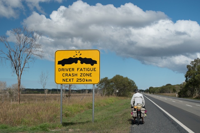
Our distances are, as always, influenced by where the next shower is. Here, we are finding that progress is slow with small distances between accommodation or camp grounds followed by unmanageable distances to the next one. Neither of us are that keen on wild camping. We’ve done it a number of times and are always fretful about the prospect of being disturbed; on one occasion receiving advice that we shouldn’t contemplate wild camping in this area as the local reservation residents are prone to excessive drinking and unruly behaviour.  But sometimes we have to stick the tent where we’ve got to. It is, at least, often common and legal, until we reach Texas.
Warmshowers has been a fabulous organization providing a means by which to contact local people who will offer a free bed to touring cyclists. Often, they’re touring cyclists themselves, or were. Making arrangements is naturally a bit hit and miss, but it’s great to have a shower, share a meal or two, natter or go out, and retire to a comfy bed.
Our Safford Warm Showers hosts Hal and Jay filled us in on a lot of local history, and took us on a jeep tour of mountain back roads south of Pima. In an area steeped with history we saw where the Apaches ambushed a wagon train, and where the local Mormon settlers robbed the pay wagon crossing the pass from the south.
The landscapes have been delightful. Sweeping views held in with mountain peaks, at times volcanoes. Blue skies dappled or streaked with white cloud formations provide contrast to the expansive desert and savanna. The desert and mountain plants can be lovely red, whites and purples, beside the expected yellow and green. It looks especially dramatic in low afternoon sun. The short days of winter do make it easier to grab dramatic photos, but they also limit available cycling time, clamping down with dark and cold.

This slideshow requires JavaScript.

The temperature has fluctuated radically. Whizzing down the California coast we were frequently nudging into the 30s. We were repeatedly told the temperature was high for this time of year. Further tales suggesting this winter was to be a mild one were warmly accepted. Then, wallop; up a few mountains and the temperature dropped radically. By the time we reached New Mexico’s Gila Cave Dwellings, we’d been over 2267m or 7440 feet. So it was chilly as well as dramatic. One morning, crawling out of the tent greeted us with -5C degrees. On another it was -3C but each time it rose to 20C/70F odd by lunchtime. Then came the big freeze -13 degrees Celsius (9F). My water bottle, filled with fresh water indoors, rattled a couple of hours later when I rather rashly tried to have a drink. I’d already had problems with condensation freezing on the inside of my glasses forcing me to scrape it off in order to see the road ahead. The forecast threatened 2 inches of snow in the first few hours leading to decisions to be made – sit tight, despite our dwindling food supplies, or try to bum a ride out.
Well, the snow came and we sat tight for a couple of days helped out on the food front by our cabin hostess Bonnie who kindly cleared out the depths of her freezer for us, coming up with unwanted meat items as she’s vegetarian. The weather warmed up as forecast, and our escape was to divert down south, off the official route, to avoid the highest mountainous passes and the prospect of more snow.  We end with a rare huge-progress day. From Faywood to Las Cruces was a 143km blast, dropping 365m, pretty evenly, with a tailwind. For a day we believed we were fast! The next day, we crossed the New Mexico/Texas border, marking the one-third point of our USA journey, and a big culture change.

The Land of John Wayne

The United States has never been on my ‘must visit’ list. The awe and wonder has long since gone with the US continually in the limelight; splashed across the media for this reason or that. The States felt some how over familiar, un-exotic, and ‘the easy way’. Gid had occasionally posed the idea of going east across South America, denying that it would be his first choice for our way home; just waiting for me to bite, I felt.

But an hour or so after we arrived in LA, I was hooked. It didn’t have one or two beach volleyball courts, there were twelve of them lined up waiting for players. Roller blades, bikes, skateboards all zoomed past; the place was alive. As we cycled toward our host’s place in Korea Town, Gid pointed out the Hollywood sign on the hill in the distance. What a perfect start! Hollywood boulevard, Sunset boulevard, Route 66 here we come.

This slideshow requires JavaScript.


We were lucky to be staying with an enthusiastic local, Oscar, who was generous enough to take us on a guided tour for a day. Whizzing about on our bikes we visited the Griffiths Observatory, downtown, rode the metro with our bikes (yah boo LT) … and had the best tacos in town.

This slideshow requires JavaScript.

Under our own steam we wandered along Hollywood Boulevard, spotting the stars names in the pavement sidewalk. Besides a spattering of tourists like us, there were scores of movie wannabes, in costume, hustling for paid photo shoots. Instead, more economically, Clare opted to lie down with Rod Stewart and Burt Lancaster, and fire off selfies. She passed on Donald Trump though: he used to host a talk show, apparently. What have we missed?


  • Wide, long, hot, dusty streets – check
  • Grids, intersections, traffic lights – check
  • Glitzy mall – check
  • Elaborate Christmas decorations – check
  • Spanish spoken maybe more than English – check
  • Stretch limos, Ferraris; and Porsche runabouts – check
  • Movie cameras in use on the street – check
  • Black & white squad cars – check
  • Big red fire engines blasting through intersections – check
  • Palms and bougainvillea – check
  • Huge pickups with nothing in and rumbly engines – check
  • Empty lots and abandoned shops – check
  • Body beautiful workouts on the beach – check
  • Joggers left, right, and centre – check

Gid was struck by the poverty evident amongst the splendour. Street walkers riffled through the bins, make-shift shelters filled hidey holes, and tents appeared along the concrete floodways. Shanty towns, where structures were covered with random sheets of plastic, that could have been straight out of India, filled areas of wasteland. Such ad-hoc homes were especially evident when we followed the cycleway along the enormous culverted drain – and each tent seemed to have a bicycle or several.

OLYMPUS DIGITAL CAMERA

We’d chosen Cycle Route 90 – the USA Southern Tier coast to coast crossing, because during the fall it’s run as a commercial trip. Local ‘guided trips’ we’ve done before are picked for their scenery, points of interest and traffic free roads so we hoped this would be too. We would be cycling November to February, so we hoped staying well south would avoid frozen toes (and many mountains too).

This slideshow requires JavaScript.

To reach Route 90 we rode down the California coast, with eye watering camping costs but beautiful coastal views, to the starting point in San Diego, then turned eastwards and set out through California towards the desert. To our relief, camping costs plummeted, often being free and the occasional motel became affordable.

This slideshow requires JavaScript.

This was a different USA entirely. Small towns, widely spaced in the hills and sands. The days are short, so we often cycled through sunset, and occasionally met the dawn when we crawled out of the tent in the morning. Most days we meet at least one other cycle tourist, although most of them seem to be heading for South America rather than California. It’s a playground for the local big cities too. Motor bikes, quad bikes, buggies: big, medium and small career around sending out plumes of sand up behind them. Endlessly, we’re passed by towed buggies and all-terrain vehicles behind monster pickups and huge RVs. Unfortunately, while American freight drivers (“semis” mostly) seem responsible enough in passing or waiting, the RV boys seem unconscious of their width, bow-wave and tail suck; it’s a good job the roads are mostly wide and lightly trafficked.

This slideshow requires JavaScript.

With lots of space to leave things where they are, and a climate that’s kind to buildings, metalwork and even mummified roadkill, there’s lots of photogenic old stuff to take pictures of.

This slideshow requires JavaScript.

One disappointment so far, is that wildlife seems very timid.  We’ve not seen much although, the humming birds were rather special and much too fast for our cameras . On the highway, there’s not even roadkill, until just recently a couple of flat & desiccated coyotes. Maybe morelive beasties will turn up further east.

Writing this, here we are in Wickenburg, AZ, a town of cowboys and rodeos – team roping capital of the world, it claims. But frustratingly, it’s Thanksgiving Day, so no rodeo today. Worse still, the local shops have run out of turkey, except for whole frozen ones. Chicken will have to do, cooked on the camping stove on the veranda of this comfy motel.

The Green and the Grey – New Zealand

‘South Island, Mum. You’ve got to visit the South Island. The North Island is all very beautiful, but it’s just like Wales. You’ve seen it all before . It’s the South Island that’s spectacular.’ These sentiments were reiterated several times but so were the warnings of steep windy roads and heavy traffic. The main highway from Christchurch is closed due to the November 2016 earthquake. This diverted all the commercial traffic up the smaller twisty central highway. ‘No place for a bicycle’ we were warned. Mind you, we’ve had a lot of warnings like that.

We went for a compromise. An outdoor pursuits instructor in Christchurch had recommended the South Island’s northern coastline going from Picton via Nelson west out towards the Golden Bay. He reckoned it was one of his favorite rides; it also passed the test of my daughter who had liked it out there. So having flown into Wellington, we took the ferry and buses out to Takaka, and cycled a little further west to get a better view of Golden Bay before turning around to start our New Zealand leg for real.

Our route back took us over the Takaka pass. At 791m it’s a mere babe of a mountain alongside the many big sisters reaching 3000 m or more. Two such snow capped beauties we admired whilst looking out across Havelock’s inlet.


The Tasman’s Great Taste Trail, where we admired the views from the top of the ridge before sweeping back down to the coast and crossing the river, was our first experience of New Zealand’s many bike trails. The ferry from Mapua delivered us to the deserted estuary beach where sand and shingle replaced gravel tracks and bitumen, as we wound our way across the deserted island.

Thus we’d started our NZ trip but the honeymoon period was over. Half a dozen rain spots was all we’d felt so far but that was about to change. The Scottish game we call it having spent two weeks of 2014 cycling up to John O’Groats with the on/ off rain kit syndrome. Cycle for ten mins; it’s raining, on goes the rain kit. Thirty mins later it’s dry; off comes the rain kit. Thirty mins later – it’s raining- on goes the rain kit. Ten mins later it’s stopped, off comes the rain kit. This interspersed with whole days of continuous rain was what we were in for.

Official advice on the New Zealand bike trails site is, ‘take rain proofs and a sense of humor – you never know you might enjoy cycling in the rain’. Coffee culture in NZ where even tiny villages have a café that we could cower in certainly helped.

We’re no lightweights when it comes to outdoor pursuits in rain having spent five whole days in continuous rain on a sea kayaking trip in Alaska and four days hiking in a rain forest in Vancouver Island but cycling is possibly the trickiest because of the changing levels of exertion required to climb hills and mountains, pedal along the flat, or freeze on long downhills. In heavy rain it’s easy to keep cool but in drizzle and light rain it’s not long before you are wondering if it’s leaky rain clothes or sweat that’s soaking you to the bone. When you can see them the views in the rain are very atmospheric with trees and hill tops poking up above the clouds.

The must do Tongariro Alpine Crossing, with its stunning snow capped volcano, craters, sulphur lakes and alpine views was fantastic. It’s a 19.4km one day hike across a mountains pass. Boots not bikes, is definitely counted as a rest day but I’m not sure our legs were convinced! The day started in perfect sunshine but this didn’t last. A couple of hours into the walk the cloud closed in. Fortunately we’d already snapped away at Mount Ngauruhoe and we’re lucky that the cloud cover lifted enough for us to enjoy views of the Red Crater and Emerald lakes. The alpine views on the downward path swept before us like flicker cards presenting the scene as the cloud, and by now drizzle, wafted past.

Calamity! 19.4km afoot makes for a pretty tiring day, and Clare dozed off in the shuttle bus on the way home. As she snored, her bag fell over, and her battered, cracked, scraped, but still working camera ended up in a puddle inside the bag. End of camera.

A couple of days later we tackled the Timber Trail. It’s an easy grade 2/3 mountain bike ride, which was an obvious choice to get a taste of a full length bike trail, especially with the added attraction of crossing eight suspension bridges.


A solid day of rain before we started ensured the mud levels were at their best. Sections of it were slow and exasperating as we slipped and slid along the track, frequently shoving the bikes through squelching mud. Information boards presented the history of the logging industry in the area while the two days of sunshine, and respite from the rain, kept our spirits up.

Our last few days of riding in  New Zealand continued in the same vein – pretty hilly and rather damp. There’s an old saying about no bad weather, just bad gear, but it does slow you down. Fortunately we still made it to the camera shop in time to pick up the ordered replacement. And on our very last riding day the hills receded into the distance as we dropped down a scenic gorge, then traversed agricultural plains – with no headwind and no rain! We never quite made it to Auckland, meeting up with emigrated old friends Sally & Stuart near Hamilton. We decided to duck the logistical and timescale challenges of getting in and out of Auckland with boxed bikes, and gratefully accepted a lift to the airport, ready (really?) for America.

OLYMPUS DIGITAL CAMERA

End.


Down and Out

(The day before this post we showed most of our Australia photos separately, here)

On a whistle stop tour of Brisbane we saw, nestled between the gleaming glass, chrome and concrete monoliths, red brick relics of bygone times. Churches and municipal buildings that document the Victorian birth of many of these towns. Staying in Sydney a little bit longer we delved beneath the high rise towers to find rows of terrace houses, churches, and curious institutes. That, together with the numerous parks, gave the place a spacious feel despite the flyover, and tunnel being built, to cope with the volume of traffic. Melbourne, with intimate lanes where eateries spread out across the road and waiters dance between pedestrians, also feels spacious with wide roads that accommodate tram lines, cycle lanes and cars. A pleasant mix of the old and new that have plenty of space to blend. And some very British (but better) public provision of toilets, benches, parks etc.

_CTF6232-1.jpg


But it hasn’t been the history or lack of it that has been an inspiration in Australia but the abundance of wildlife; multitudes of marsupials that we’ve never seen before. The dazzling variety of birds swooping about, deafening at times. Flying foxes, echidna, wallabies and kangaroos, hump back whales and the occasional sighting of our immigrant friends rabbit, stoat and weasel. We finally, days before leaving, after many hours cycling with our necks craned up, genuinely saw a koala in the wild. We’d already visited Raymond Island’s koala tourist trek to tick that box, but it was awesome to see one snoozing in a mainland tree.

_CTF6495-1

Having travelled for many months through Asia and South East Asia where, in rural areas especially, traditional methods of fishing and farming were still very evident, I was keen to see aspects of indigenous people, but we’ve had to seek out aboriginie heritage centres to get a view of their past, present and future. Sydney Museum spelt out the conflict and massacres that took place between the invading whites and the aboriginal people, while Rockhampton cultural centre and Melbourne Museum focused on the traditional way of life. The pride of the indigenous people was evident with videos showing younger generations learning traditional skills.


_CTF6437-1.jpg

Mosaics were on display at the Eden Killer Whale Museum


We’ve also had conversations with many Australians, and learnt more that way. I was going to write that having in-depth discussions in English is also a novelty, after so long. But we met adept English speakers in India, Thailand and Singapore. Perhaps the difference is our willingness, maybe also the locals’ too, to discuss difficult issues.

While combine harvesters, trains and trucks have replaced Asia’s scythes, oxen and carts in Queensland’s sugar cane production, if any aboriginal people have managed to cling onto traditional ways of life it will be way out in the dry centre and west, well hidden from tourists like us. That’s one thing I suppose about the sort of life presented in books like “Walkabout” – it creates an association between aboriginal life and harsh land, whereas one thing that’s now clear to us is that the best of that life was in the good lands, such as we’ve been through, that our invaders nicked for farming.

_CTF6439-1.jpg

It isn’t difficult to see how conflict has arisen as European values of exploiting the land with intensive and commercial farming, logging or miners culling the land before moving on are in direct conflict with aboriginal beliefs and practises that sustained flora and fauna. The land being ‘sacred’ – look after the land and the land will look after you.

Koalas, one iconic Australian animal, are doomed if the current rate of deforestation continues. 15 years, we were told, until loss of habit will result in no more koalas in the wild. Aborigines, however, made tree bark canoes from trees where, in time, the bark grows back, just one example of where they use the environment without destroying it.

_CTF6441-1

The history of the aboriginal peoples connection with the land is displayed on information boards at key locations that explain the importance of each site often stating that it had been significant sight for 40000, 50000 or 60000 years. Never do they tell of the 200 hundred years it took to destroy it.

Of course, said “European” values didn’t just affect the Australian Aboriginals, this was the era of the Scottish Highlands clearances, Irish potato famine, Napoleon and Bismark invading everywhere, and colonies. Brutish dog-eat-dog behaviour at all levels. But in the British Empire, it does seem the Australian Aboriginals were uniquely ignored, politically, as in the other new lands, the indigenous population was formally recognised – although still shot, infected, or driven out. In Australia, the indigenous population were explicitly not people but listed as fauna until 1967. Yes, Nineteen. The image of aboriginal people in a line depicting Australian fauna at Sydney Museum has, in very recent years, been removed.

Whilst the east coast has certainly got it’s fair share of hills to pedal up and down which by the end of a day is knackering, the coastal views are breathing taking. Endless expanses of golden or white beaches as far as the eye can see. Red cliffs, Clifton Sea Bridge and numerous bays with blue sea contrasted by ripples of waves were highlights along the way. As we moved south into Victoria, the land became greener and more convoluted.


‘Git ou’ the waaay”. It took a moment or two for me to decipher this advice growled at us from a vehicle as it passed, but it was one of the least offensive we’ve received. Australia has been the first country were there has been occasional direct hostility towards us as cyclists, as well as a lot of truly dreadful passing. We’d read about this, and especially the road trains, online. It does seem that a lot of Aussie drivers, especially truckers, would rather trust to luck on blind bends, than ease off the loud pedal. Aussie truckers are probably the near-worst drivers we’ve encountered, after Indian bus drivers and their Indonesian colleagues. The notorious road trains didn’t seem especially bad, probably because they’re only on relatively empty roads with few bends.

One of the problems, we think, is over ambitious claims or misconceptions about the cycle tracks which may lead car drivers to consider that we are well provided for. Well, provided for we are by: disjointed, frequently poorly maintained, unsignposted and, at roundabouts in Cairns, the outright dangerous positioning of a cyclist should we use it. Sometimes we can use the hard shoulder, but it doesn’t always exist, and oftimes seems to have been deliberately ruined with road features placed down the centre of it. The concept of cycle tracks is a good one but they have to prove useful to cyclists. In the city of Newcastle they were, but elsewhere a lot of the facilities, as in England, had an air of local authority quota filling, and especially, almost no direction signs. Locals only, perhaps. But further south in Victoria, a series of rail trails have made very pleasant and productive traffic free cycling. Overall, in terms of road safety and comfort, most things improved steadily as we worked our way south.

Much more pleasantly memorable are the many helpful, friendly and very supportive folk who have stopped on their way, to give us gratefully received advice on better routes or attractions in the area. One such lady had us back track half a kilometer, head this way then that until we found an old mining road. It was right where the map displayed it but had failed to list it as a cycle track and too many such dirt roads aren’t suitable for our narrow tyres. Gebber Road, as it was called, was a good quality dirt road that took us through beautiful woodland (with numerous sightings of goanna, and a fine snake), past fields and mangrove swamps before emerging, several hours later along another small coastal road on our way to Tea Gardens (yes, that’s its name).

Yet more memorable are the folks we’ve stayed with, from Warm Showers, friends of friends, and folk we met on the road. Always interesting to talk to, too. Nick, Andrew, Mitch & Tanya, Grant, Bernie, Tony & Laurelle, Kirsten & Warwick – thank you all.

We’ve had plenty of moments where we’ve felt we weren’t going to cover the distance from Cairns to Melbourne within our three month visa. But, we’ve made it with time to spare managing to see many chosen sights along the way, and as so often, learning at least a little about the land, its wildlife, and its people.


Australia – Photos

Wow – what a lot of photos we took in Australia – getting on for a thousand each. Well, here’s a selection. There’s even more wildlife photos a few of which we’ll upload to the Birds and Beasties pages someday.

The Scenic Views, Part 1

The Scenic Views, Part 2

On the Road

Urban

Whale Watching

Hervey Bay, since you ask. Several times we saw whales from the coastal cliffs, down much of the SE coast. The humpbacks migrate that way.

The Best of the Rest of the Wildlife

The Holiday Snaps

End

Down Under

Tears welled up in my eyes as I sat on the promenade bench gazing out towards the sea, seagulls waiting expectantly. It could have been home.

_CTF5115-1


We were like kids in a candy store picking out lunch as old favorites competed for our attention – coleslaw, hummus, fresh rolls, all there ready and waiting.
Our fabulous warm showers host, Nick, eased us back into civilization with his bachelor pad where his no clutter policy didn’t extend to the workshop.


IMAG2141-1

Sunrise yoga on the beach

Following on from bike servicing, back servicing and a fantastic Barrier Reef dive trip we finally made a move where the sunshine state once again propelled us back home with three days of grey skies and drizzle.  Our must see list dwindled: tree kangaroos that come out in the sunshine, cassowaries in the car park “just” 4 km away down a now mud track and platypus where we arrived at the camping book-in point four minutes too late. Rules is rules, I just apply them was the retort from the proprietor who showed no compassionate interpretation of them on this dismal day. Even the omnipresent kangaroos were nowhere to be seen. But the trail of unfortunate road kill victims enticed a splendid assortment of birds of prey down to the bitumen as we pedalled our way along. Low density woodland and grass scrub providing grazing for beef cattle and a few horses too.


Grassy verges need a ‘keep off’ warning sign as we learnt the hard way. A 12 metre shortcut across a grassy verge resulted in 20 min removing thorns from my tyres together with the rather predictable two slow punctures I fixed later. Down the road  we became aware of another local hazard. Thankfully it is our helmets that testify to the magpies’ dive bombing habits. It also explains a local fashion of alien looking bike helmets with tie-wraps poking out of the top.


Having spent several days cycling through the Atherton Tablelands we headed back down to the coastal road. Not so remote as we cycle down south, we hope, but towns and roadhouses are still few and far between. As you’d expect the major highway is generally flatter but the traffic has increased considerably. You get used to the traffic, one blog article states.


At one campsite Gid came back from the shower with a spring in his step to declare that John, a grey nomad from a couple of vans down the park, had offered to show us on the map where we could get onto smaller roads by the coast. We tried in vain to find the place starting with Bene… something on our Queensland map. John joined us a little later spreading his ancient torn maps on the table where his accumulated notes told of adventures past. There he said, pointing to a town on the map just above Sydney. That’s the town; there’s the road. That’s good too, he enthused moving his finger down a bit. A little hilly though, helpfully writing hilly on the map. He added a few more notes as he continued down the coast explains the features as he went. Very kindly, he left his maps with us but we couldn’t help giggling that our hoped for escape from the main highways was six or seven weeks away and in a different state.

Wind lifted the shirts off our backs as we sailed past the Whitsunday Islands, pedal pushing all the way. A stab of regret shot through me as I visualized the tall ship, Solway Lass, that had been highly recommended as the perfect way to cruise between the National Park islands. Reality struck home. Firstly, it was stunningly expensive for budget conscious cyclists. Secondly, we’d only just got going and were very aware of time constraints. Thirdly, should we need another reason, I’d been extremely nauseous on our one day reef trip despite having taken sea sick pills.

Hotels with the occasional 3* luxury are a thing of the past. Now we’re scouting the electronic devices for camp sites, free if possible, with the latest ‘3* luxury’ being paid for sites with a shower. Aged backs grumble at our crawl-in tent. Ground level cooking, eating and packing all take their toll at the end of a day in the saddle. Campsite camaraderie, where spare food and water are readily offered and simple exchanges of a few words, are now deeper conversations.  Another factor eating away at our time constraints as the grey nomads are only too happy to wile away a bit of time and keen to share adventures.


We’ve taken a while to get our heads round distances and the endless kilometers of nothing. Towns sprawl out with scrub land between single storey homes, dead-end roads lead out back, well worn wooden buildings and old Queenslander homes adding a touch of history along the way.

It’s around 3,700km from Cairns to Melbourne, by the coastal route. Let’s hope we don’t find it too tiring…_CTF5272-1

Bali and the Dragons

We cycled only a couple of days in Bali, to Jimbaran, just south of the airport, for a comfy, cheap, tourist hotel, and especially, just round the corner from a really useful bike shop. That Surly Ogre with that bike packing kit was probably perfect for Sumatra.
From Bali we took a bikeless side trip to Flores and Rinca, where be dragons.

Clare in Bali

Gideon in Bali

Clare in Flores

Clare on the Boat to Rinka

Gideon in Flores

Clare’s Dragons

Gideon’s Dragons

Then we packed up, and probably marking the end of our most adventurous travels, left Asia and its bustle, noise, and low prices, for Australia.

Java – The Pictures

Strange – Our overriding memory of Java is the unpleasant major road conditions. But the photos tell a different story. There’s plenty good in Java, but probably a bicycle isn’t the most reassuring mode of transport to pick for it.

On The Road in Java

Horse and Smoke Dance

This was pure luck! Somewhere in mid-Java, we’d managed to escape the manic main road for an hour or two. In a small village, we chanced upon this event in a little roadside space. It was just villagers and a few passers-by, as far as we know, so we weren’t invisible ourselves!


Borobudur – Ancient Buddhist Temples

Before Java became Islamic, there was a major Buddhist complex here. Abandoned for centuries, and somewhat vandalised, it was “rediscovered” and restored relatively recently. Apparently the carvings showing saucy Buddhists have been covered over during the restoration.

Prambanan – Ancient Hindu Temples

Before Java became Islamic, there was a big Hindu civilisation on the island. Whereas Bali has remained mostly Hindu, this temple complex on Java was long abandoned.

Prambanan – The Umbrellas

More Java Photos by Clare

More Java Photos by Gid


Short Ferry Crossing to Bali

End

Java – The Story

And So To Java. We pedalled away from Jakarta’s bus station in the early morning. The Garmin did a good job of finding a quiet way out. Jakarta was quiet – too quiet. Our relief at being away from Sumatra’s hills, and then the end of Ramadan, was short lived. Ramadan is immediately followed by Eid al-Fitr, which is by definition a religious event, but substantially experienced as a transport event; everybody in Java is on the roads. Java’s land mass is structured around a few massive volcanoes, the main roads weaving through on the flat bits in between. Alas, the smaller roads often don’t join up, so to get anywhere, everyone, including us, had to use the main, but only 2 lane, highways. Really, it was madness to cycle at that time. Cyclists would be best off spending Eid holed up, especially if they can join in the festivities.
It calmed down after about three days. Java’s crowded, narrow, bumpy major roads are at least relatively flat, and still alive after a week of good progress, we took a couple of days off in the historic, and more or less geographical, centre of Java, Yogyakarta, before continuing on to catch the short ferry to Bali.
Java has a big population in a not-so-big space.. Drivers are not so deliberately homicidal as Indian drivers, and they’re more inclined to look where they’re going, but the traffic is a lot denser, as Indian main roads are hugely bigger. As usual, it’s the bus drivers who are most aggressive and unwilling to share space or time. Well, they’ll happily ‘share’ your lane if they’re going the other way and want to overtake something. But the drivers are mostly ok, it’s the motorbike riders who are nuts. Well, more likely they’re happy, carefree folks who have no worries about any possibility of collision. Overtake a truck on the inside on a narrow blind bend – no problem. Overtaking is probably the Indonesian national sport, and often would earn many points for artistic flair and imagination. On the whole it felt less safe even than India, which is saying something. However, it was a lot less noisy than India, with only brief blasts of horns used beneficially. It got a bit less hectic as we worked our way east, taking loops via minor roads when we could.
Dear reader, you might get the impression that crossing Java by bike is a dumb plan: That’s about right. Whereas Sumatra, whilst being very tough, felt a worthwhile adventure. Bali’s roads we only experienced from the ferry to Denpasar, the capital, travelling mostly on the main road. It was somewhat less hectic than Java, and, crucially, the road was both a bit wider and in better repair. The last 40km or so on Bali’s minor roads were lovely, full of things to see.
So where are the photos?


Sumatran Struggles – Beaten?

A double posting tonight – you might have missed Sumatra continued – Photos?
Sumatra is the toughest place we’ve been on this trip. We’ve given it our best shot, but after a month, we’re still a week from the ferry to Java. Legs are aching from the endless very steep hills, and skin is blotchy and spotty from the endless sweating and humidity. It’s time to take an easier path. I wrote that on a Jakarta-bound air conditioned bus.
Its tough because of the hills. After Toba, we made our way south, along the volcanic spine, for a way, before going West, so as to benefit from the coastal lowlands. Well, they are low, but they ain’t flat. For much of it, spurs or ridges extend to the sea. They’re only 100m or so high, and the coast road takes them in endless savage little hills. In the heat and humidity, we can’t climb fast, or without cooling breaks; progress is sometimes demoralisingly slow. Two of our last three cycling days gained only 60 and 52km, little over half our average. And there was a rest day in between two of them! On our last day of cycling in Sumatra, we were a week later than our planned crossing to Java, with 500 hilly kilometres to go. By 4pm we were still 40km short of the day’s target. Then, on a narrow bridge, this big bus had to wait behind us to overtake (nb: a technique unknown to Java’s bus drivers). We turned and signed “bikes in bus” to the driver. It worked! We covered the 40km to Krui in comfort. Well, sort of comfort, as the road remained the same bumpy corkscrew we’d struggled on. There we rested a day, and sorted ourselves onto the next day’s bus to Jakarta. That recovered one lost week, by skipping roughly 500km. I guess I should add as a postscript that we didn’t cycle east Sumatra, which the maps suggest is flat and swampy, and might have been easier, but less scenic.
Pictures of hills – oddly, we have lots…
It’s tough because of the heat and humidity. Shortly after starting, every day, we were soaked in sweat. Towards the end of Sumatra’s big hills, Clare started to suffer from heat rash. All day pedalling hard, then often sleeping in hot, stuffy rooms, was too much for her skin. Gid later showed some signs of this too, but generally coped a bit better, perhaps cooled by his stylish Bukittingi haircut or just baring a silver cyclists chest with shirt flapping in the wind. No wonder the girlies are all in fits of giggles. Clare bought some cotton clothing hoping it would be cooler even if not designed for cycling. It seemed to be working… The rash not getting worse.
Err, no pictures of the sweat and rashes, sorry.
Accommodation was difficult at times. Once out of the highlands, it’s way too hot to camp, especially in our rainproof, but poorly ventilated Scandinavian tent, as there’s rarely much breeze. Hotels and guest houses are usually good value, often offering AC, but thinly spread, though not so thin as  OSM and Google suggest. Although we’d agreed not to try for big distances, often mapped accommodation is over 100km apart, and not always do we find somewhere unmapped. We have new words – Penginapan, for lodging house; Losmen for inn. Rarely in electronic maps, these can be found in smaller towns. Even towns not on the map but deduced from a road junction – some surprisingly big towns show up that way. We’ve been taken in by locals, which was a great experience, but a hot, sticky night, fully clad, in a communal room. Once we crashed out in the utility block of the local police station, which isn’t uncommon for Sumatra cycle tourists. I reckon if you can stand the heat, you could sleep free most nights. If you can’t, fan cooled rooms start at little over $10, air-con from maybe $15, so long as you can find a decent sized town. We always aimed for aircon, for a night’s sleep and dry skin, although we didn’t always get it. It’s the best option to dry out laundry overnight – we’re only using two sets of clothes. Finally, aircon’d places have most vents closed, whereas the traditional method of staying cool is maximum ventilation; this means there’s many fewer mozzies in an aircon room.
One afternoon, we were pulled over by a roving Warm Showers scooter patrol. Mati offered us free accommodation pretty much exactly where we were heading. How cool is that? Well pretty cool, as it was a kind of substantial beach hut, with the best overnight breeze, and a very well aimed fan. A shame we were keen to press on, it would have made a nice beach break. There’s a fair number of Warm Showers hosts in Indonesia, it’s got to be a great option if you sleep OK in the heat.
No pictures of hotels, either…
Talking of beaches, we did see some surf, and some surf dudes, on the west coast. The best action is supposed to be out on the western islands. The coast we saw looked attractive for some surfers and maybe sea kayak too, but perhaps tricky, for sea kayak landings.
Though tough, Sumatra is a very rewarding place to tour. 2,300km long by the shortest road route, the mountain views are stunning, the rainforest, even roadside, is full of lush greenery and noisy beasties. The agricultural areas range from fascinating and colourful gardens and paddy fields to duller palm plantations. Some tourists find the palm oil plantations depressing, mostly as they often represent torn up rainforest. But they’re not so bad to cycle in. Sumatra is big, but it’s always had a modest population and limited development, so there’s not much history to see, it’s more the landscapes and the people there now that are the “sights”.
They are not all the same people – we see different cultures as we roll struggle through, but always the people are friendly. Each day is spent grinning and greeting. Clare realised she’d been wearing a fixed grin for 30 minutes passing through some town, so many folk wanted to wave and call. As usual after a couple of months in a country, we got up to a shamefully poor vocabulary of maybe 20 words of Indonesian. It was enough, with gestures, and a few Indonesians speaking English (“Hello” is the same, and all Indonesians know “yes”, “no” and “selfie”). I guess there are about the same number of selfie stops as India, but here it’s mostly girls. And very giggly ones too, at least two per scooter.
People…
With fairly heavily loaded road orientated bikes, and limited time, we stayed mostly on minor main roads. Like in most hilly regions, the minor roads rarely joined up to provide alternative routes. But away from Medan and its horrible road to Berestagi, traffic was light. We were there mostly in June: Monsoon downpours happened at times, but most days were dry.
A self-inflicted accidental challenge was that we left the Christian region around Lake Toba at about the start of Ramadan. Thereafter, roadside eateries were shut all day, we had to make very boring picnics from the small supermarkets. And there was a bit of a feeling of it being somewhat impolite to drink or eat in public. But we had to, as finding roadside  privacy proved as impossible as in India. The degree of fasting rigor varied as we travelled, some regions appearing more devout than others. It was a relief when it ended, by that time we were in Java.
Our final thoughts on Sumatra differ. Clare was thoroughly fed up with it by the end. The endless hills, and their brutal steepness, the enforced distances to hunt aircon, the problems with food, the heat, and the frequently off-road experience when we avoided the highway, was all too much. Gideon is more positive, but thinks to get a great tour there, we’d need a bit more youth and/or heat tolerance, a lot less baggage, fatter tyres and maybe suspension, and stronger legs. Oh and maybe three months, just for Sumatra, not Indonesia.
Clare claims North Java is flat, find out if it really is in the next blog!