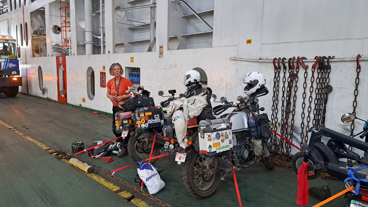
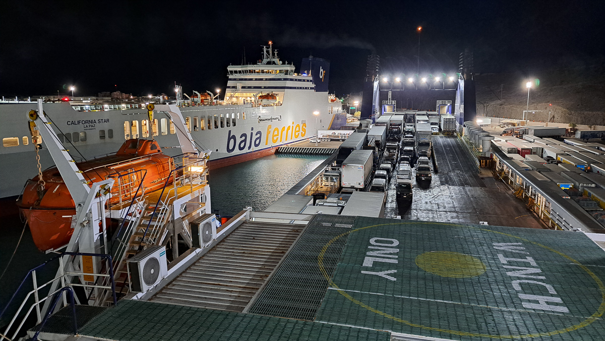
From La Paz, on the end of the Baja California peninsula, we were heading for Mexico City (CDMX), because Clare unfortunately had to return to the UK for a week, on family business. We’d normally avoid such a big city, but it offers direct flights to London, and a couple of young Aussies we’d met in California said it was great fun. ‘Not to be missed!’ So, there we go. The ride started with an overnight ferry from La Paz to Mazatlán on the mainland. It was ok, but “bring your own tiedown straps” was a PITA. However – Be Prepared – we now have them for our next ferry crossing.
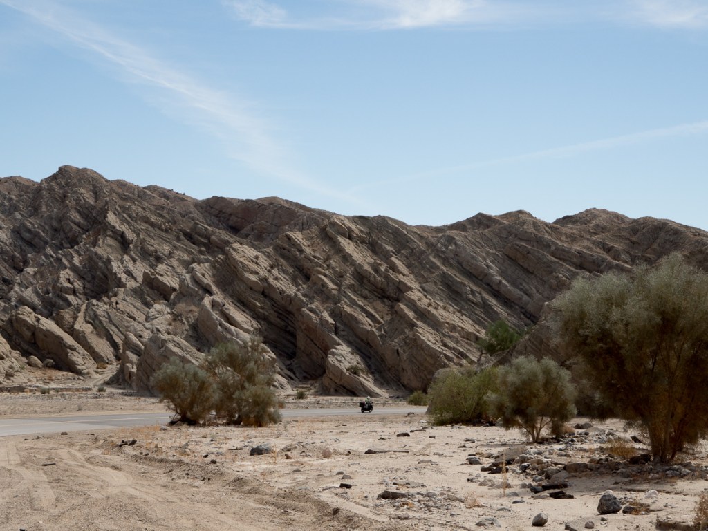
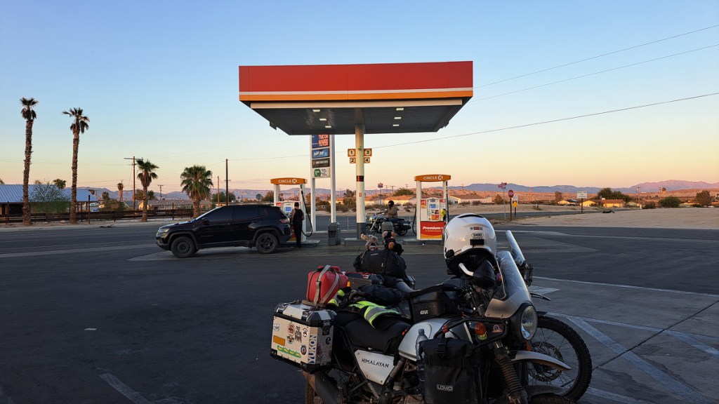
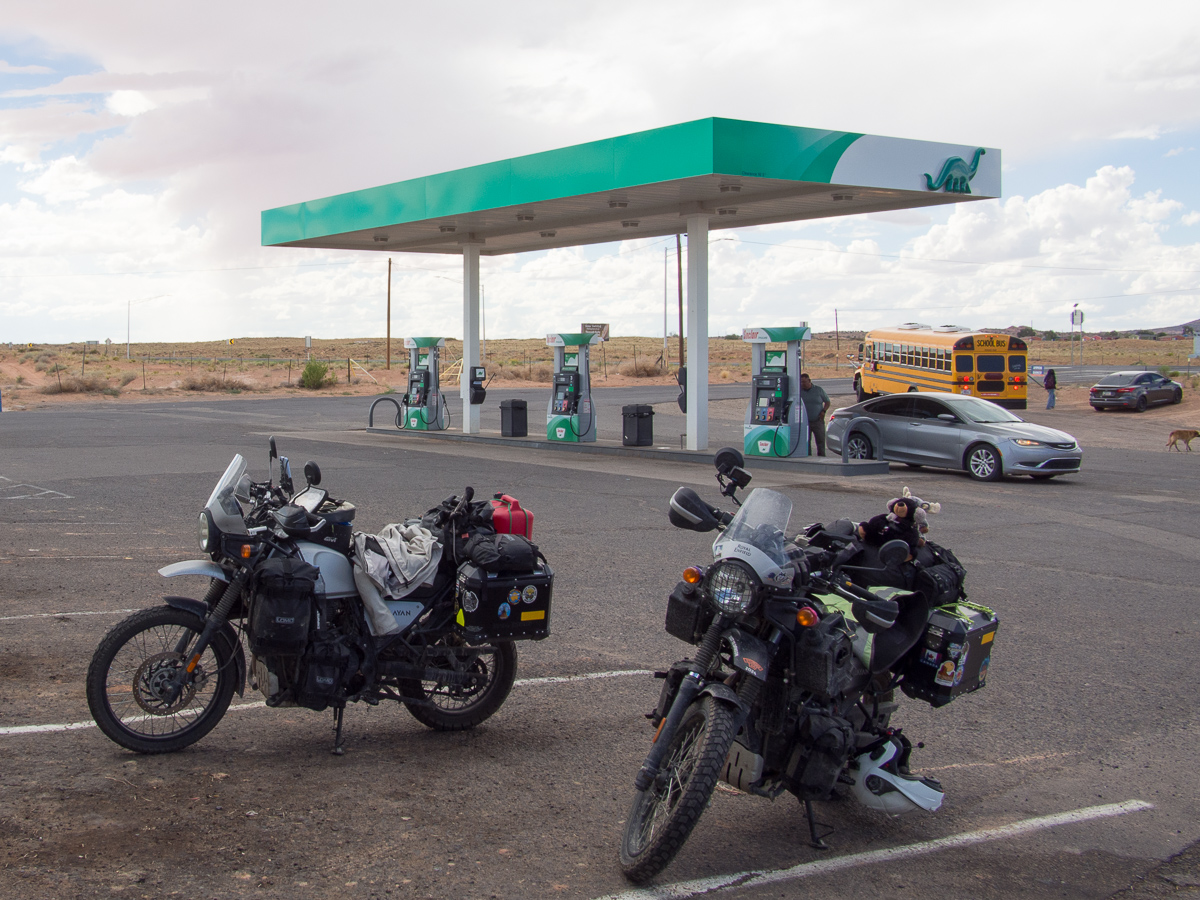
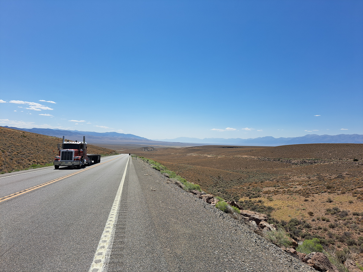
We took a pretty direct route from the Mazatlán ferry dock towards CDMX. UK FCDO recommended against going into some areas on the way, because of the threat of violent crime, which in turn meant our travel insurance would probably be null-in-void, even if a problem wasn’t crime related. Thankfully the toll roads are considered safe. We took them. They did indeed feel safe but stunningly boring. They’re big modern roads. The traffic is light, largely trucks – time is money – but Mexican trucks are rarely fast. Our Himalayans gleefully overtook them. Moto tolls seem modest until at the end of the day we realised we’d spent twice as much on tolls as fuel (fuel being roughly £1/litre). Ouch! Once in a FCDO “safe” area we took the normal roads as Mexican towns and villages are often vibrant and lively but the famous topes (speed bumps) and potholes need constant attention.
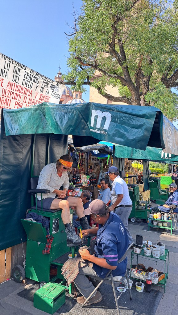
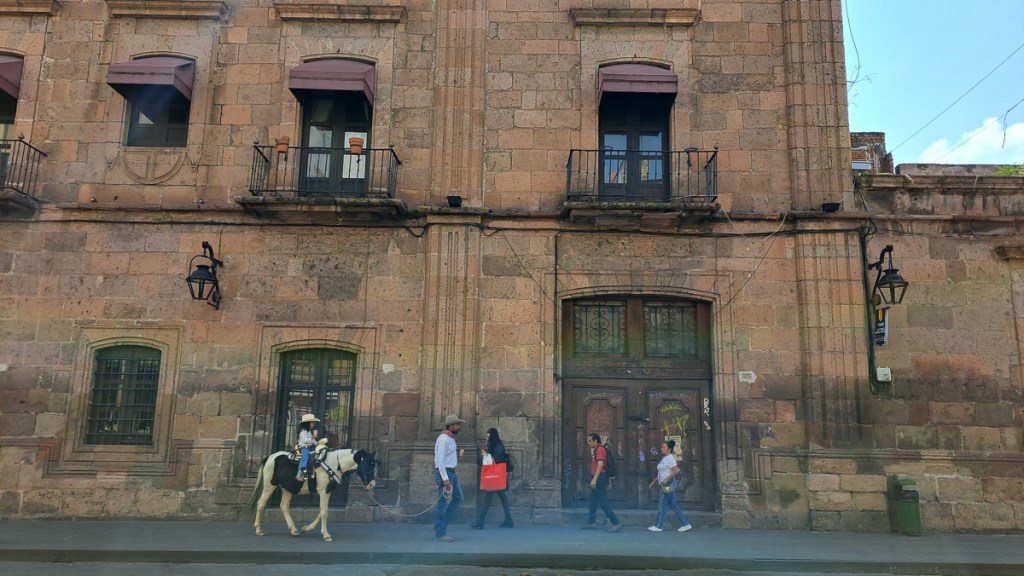
We did it in four days: Day 1 ended in Tequila (yes, it is! No, we didn’t), the local hills blue with the agave farms. Day 2 ended in Morelia. Not internationally prominent, but a lovely old centre to this provincial capital, so we spent day 3 there too.
Finally, on day 4, getting into CDMX was tedious, especially as we forgot to allow the satnav to use motorways. We wound our way round back streets in a very tedious fashion. CDMX is one of the worlds big cities – over 9 million people in the city itself, 23 million in the conurbation. But we got to our very nice CDMX apartment around sunset.
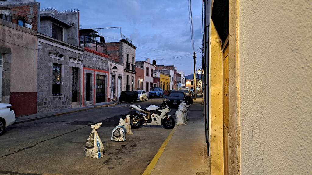
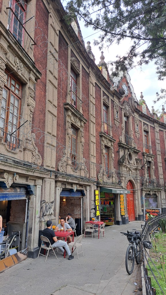
Our rather smart (think yuppie) accommodation in a block with 24 hour concierge and gated car park was in a modest neighbourhood. Busy, often tatty or improvised little shops and street food, lined these streets together with moto wrecks. But it really buzzed, enterprise was everywhere, broom laden folks kept it clean, the streets throbbed with traders.
It was a short walk to the supermarket, motorcycle workshops, and other useful things. I even availed myself of the local scrap metal merchant to replace a missing pull-up bar in the apartment (supplied & cut to length for $1). A longer stroll would get us to the Royal Enfield dealer, in the lower floors of a smart retail development – they even had one of those destination cafes, although perhaps wisely, it was associated with Ducati and Piaggio, not RE (but Chai would be nice!)). Naturally the city centre tended towards the posher end of things, but most places didn’t feel exclusive.
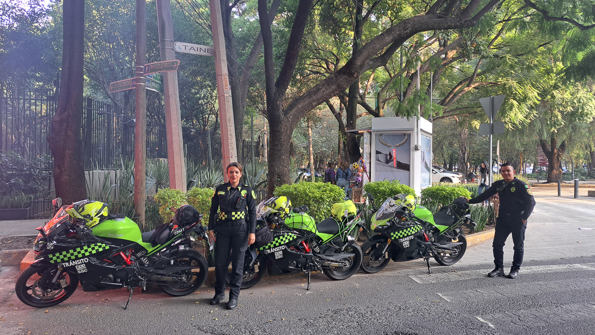
The city quickly grew on us. As our walks grew in length we started using the very diverse public transport. CDMX must have some rough areas, and times, but everywhere we went was busy and felt safe. CDMX is also crawling with diverse police forces, and when I went into a big car/moto parts place to buy some lamps, I couldn’t help noticing the security guard toted a shotgun – it was nearly as long as she was tall. Establishments of any size have security, although usually not so heavily armed.
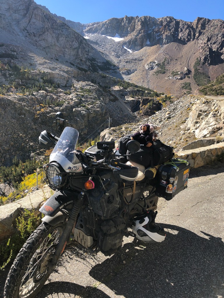
At the end of our street, a single railway line ran diagonally across the grid of streets. I only ever saw one train on these tracks – a big loco very slowly pushed a few big hopper waggons. On the front of the first waggon, three workers perched, whistling and hollering to anyone who might be in the way. They not only at the diagonal junctions, but also along the track, as the railway’s spare space to the sides had recently been made a “parque linea”, with a pavement one side, and a cycle track the other. I found it a great route to go for a morning run, flat, easy to follow and not too busy. Turn at the Soumaya art museum for 5Km run, or Temple Wok for 8km. It took some acclimatisation though: CDMX is at 2,200 metres. If I connect the diagnostics to the bike, air pressure is reported as 11psi (sea level is nominally 15psi, although the air filter reduces it to 14.5). So it felt like hard work. I didn’t much trouble the numerous outdoor gym installations. And the hopper waggons? They were heading for the giant Corona Cervecaria’s gates. Must be barley, or collecting the spent grain.
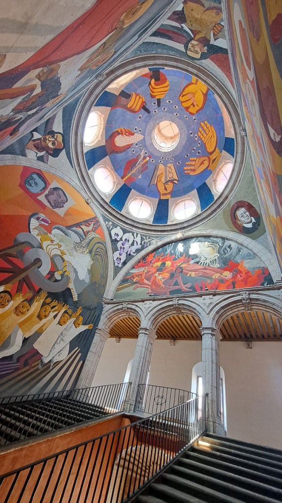
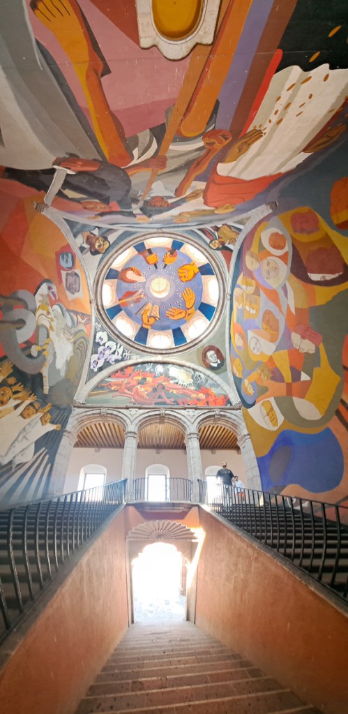
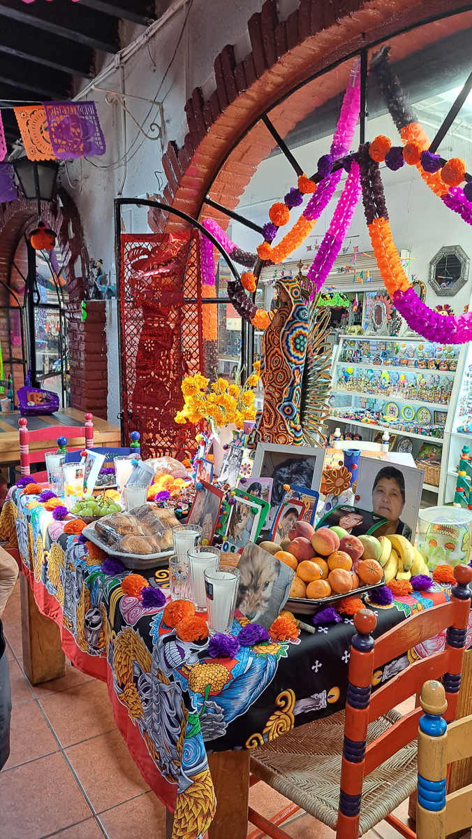
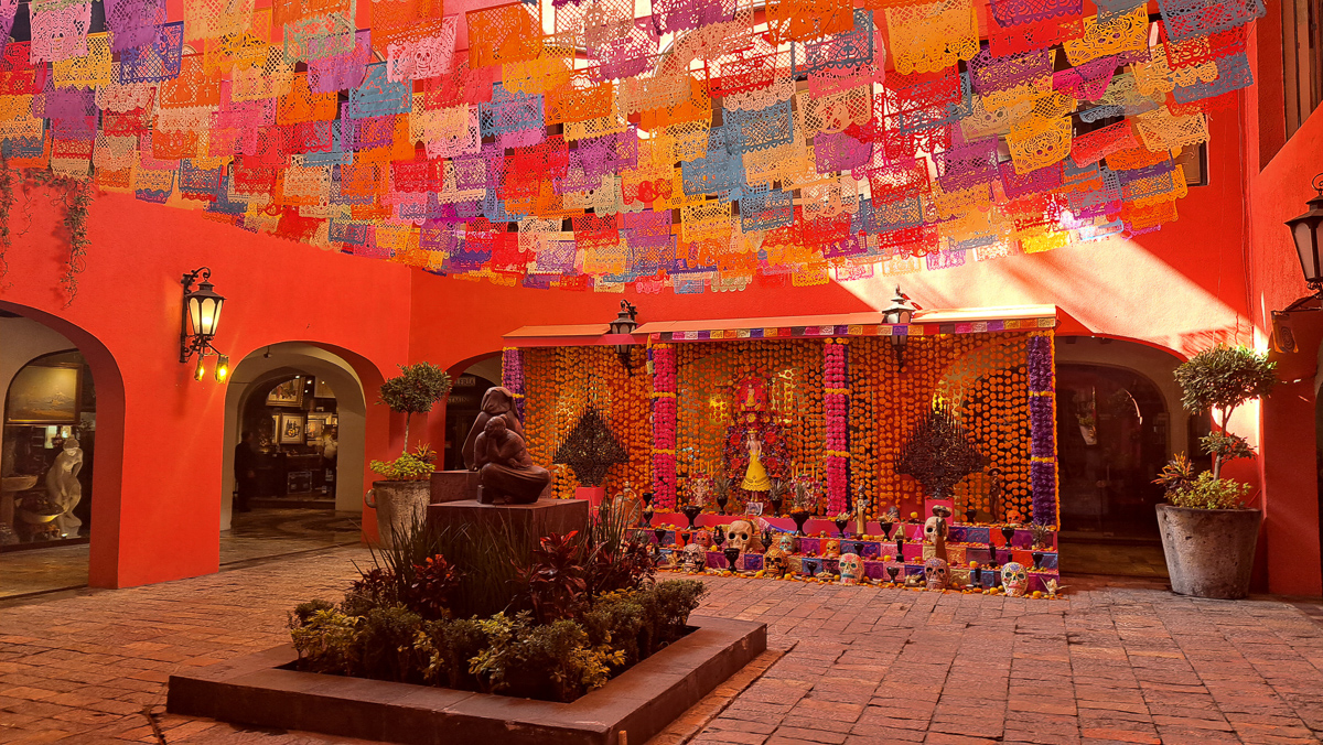
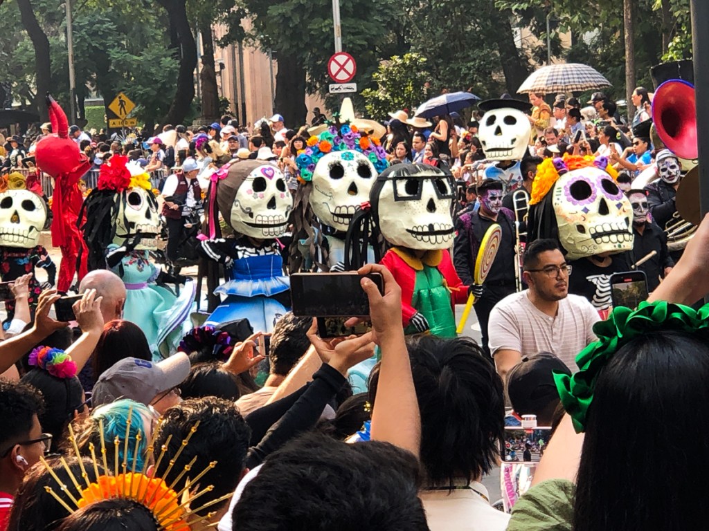
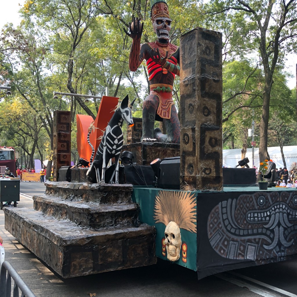
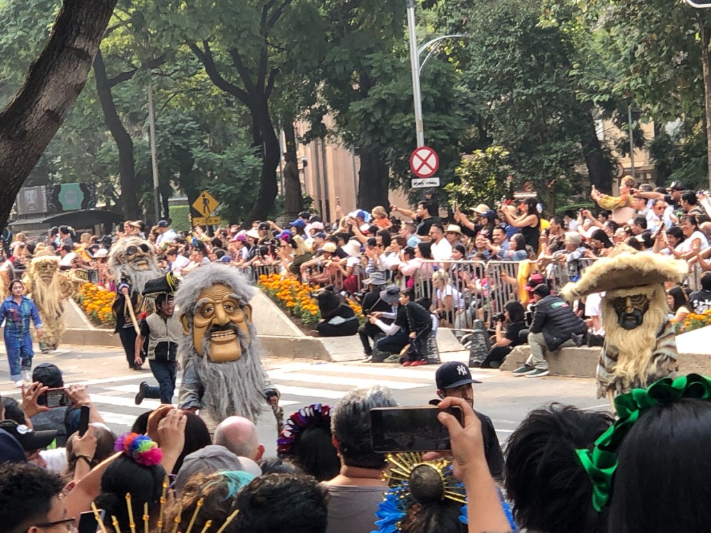
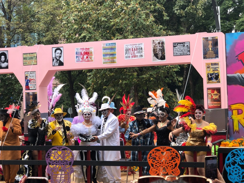
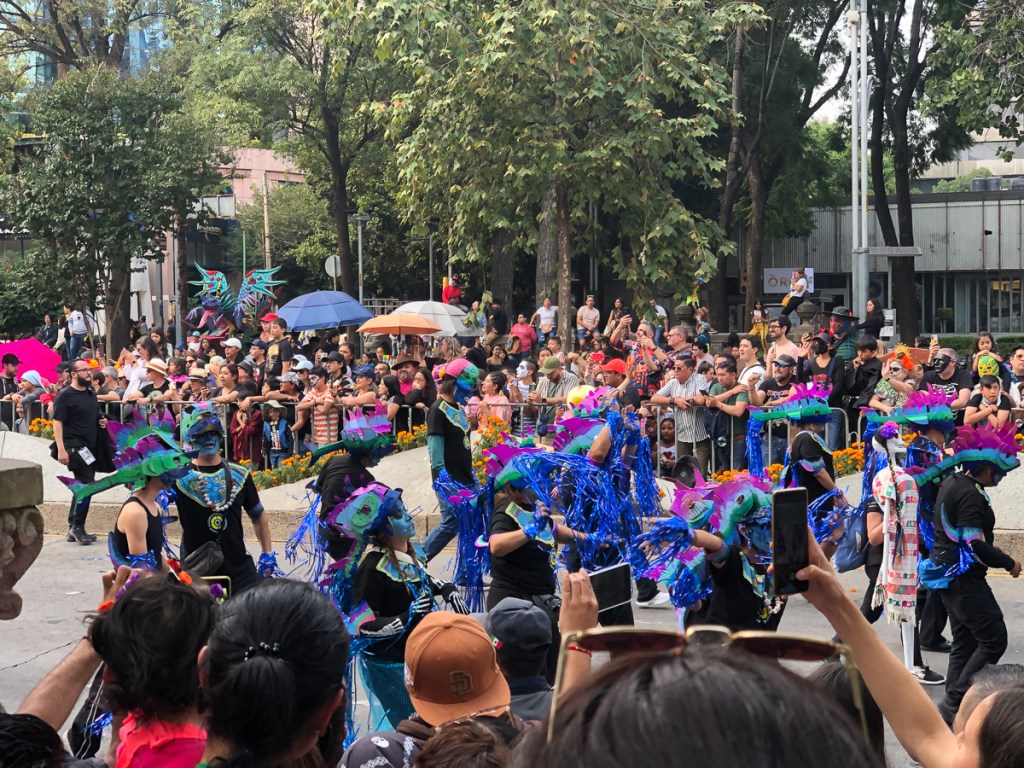
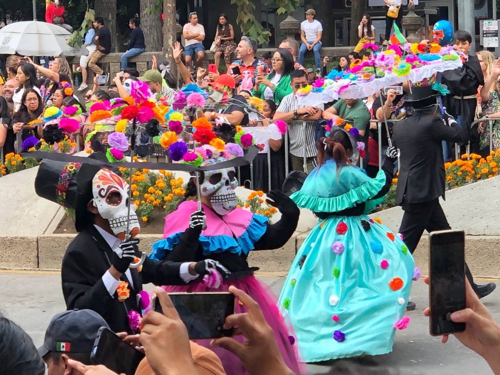
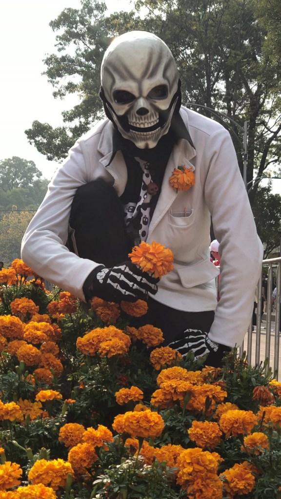
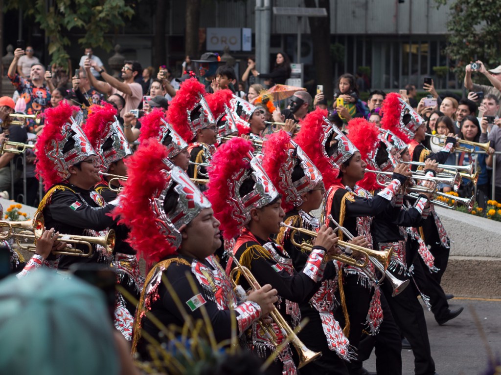
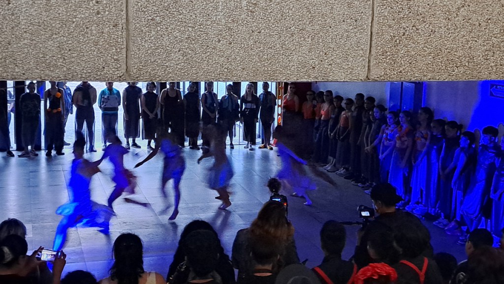
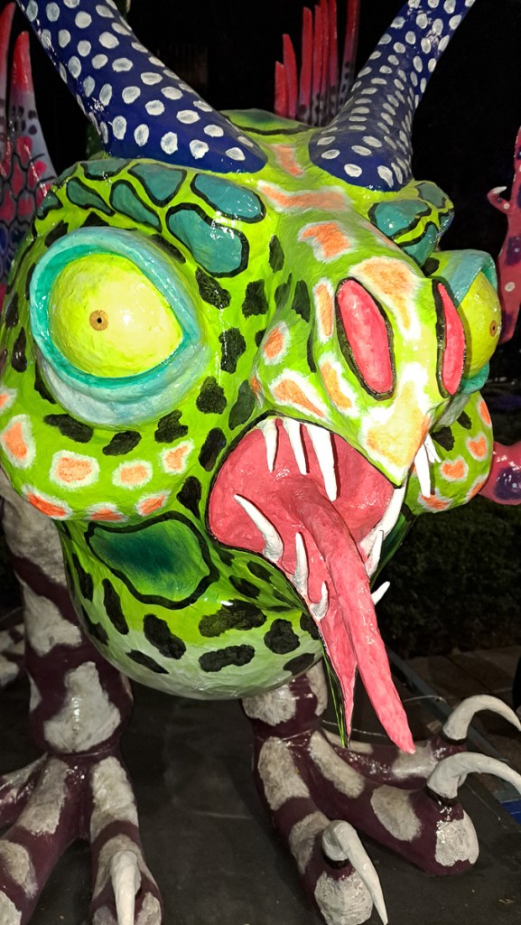
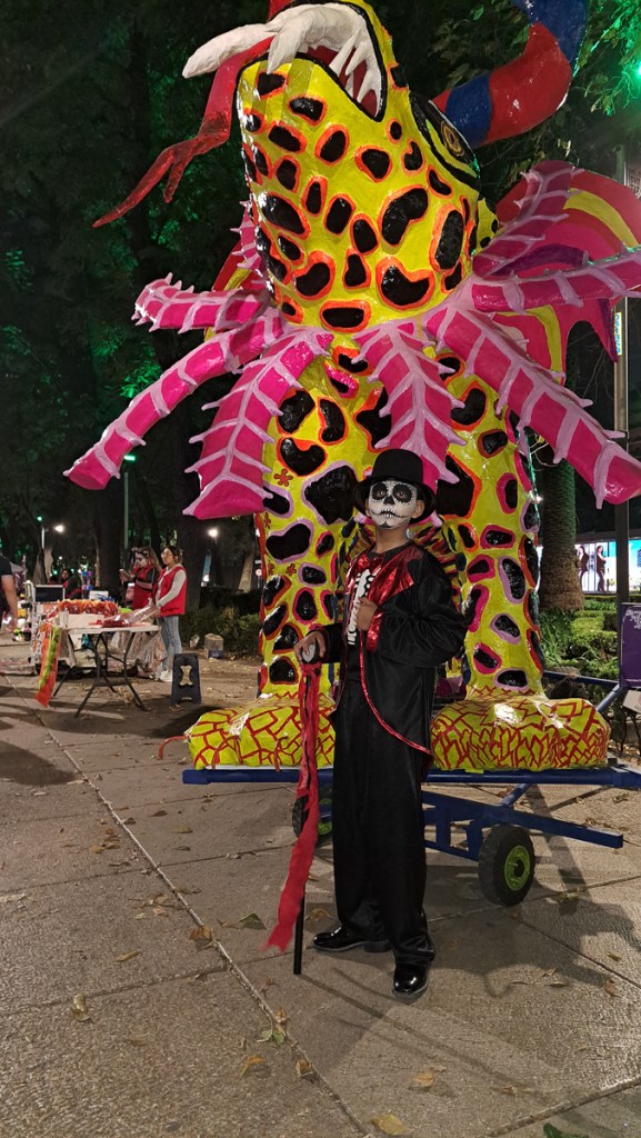
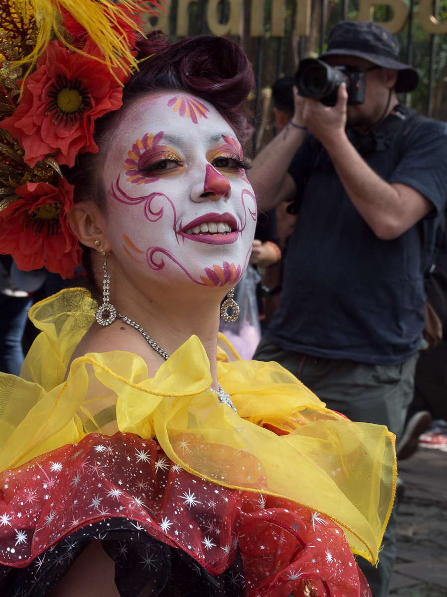
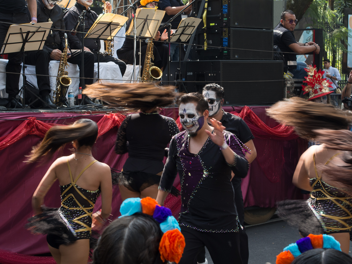
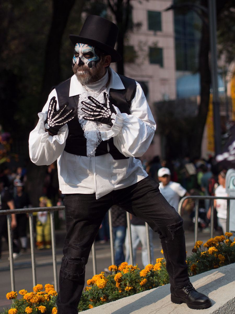
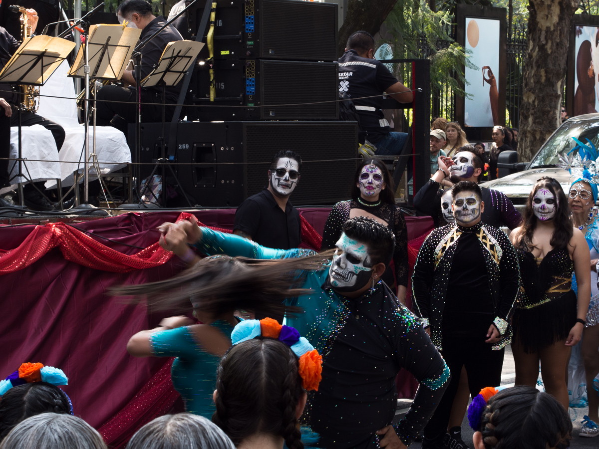
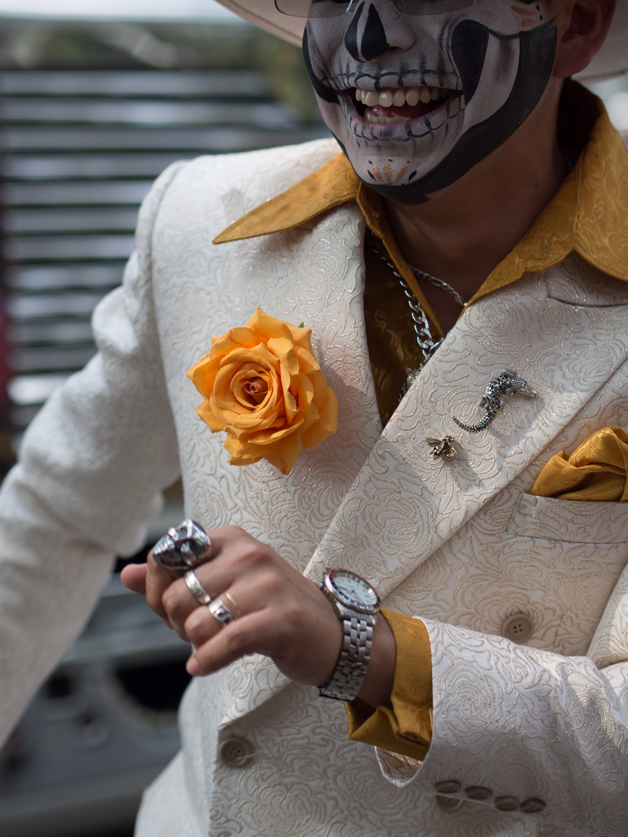
La Dia de los Muertos
Unusually for us, we actually planned for The Day of the Dead, and arrived in time to enjoy the festival, before Clare flew home. It’s a visual and aural spectacle, so we’ll leave it to the photos…
Parade
Parade.
In the City
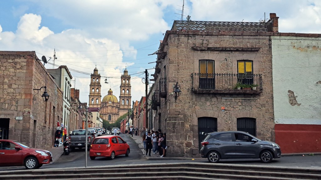
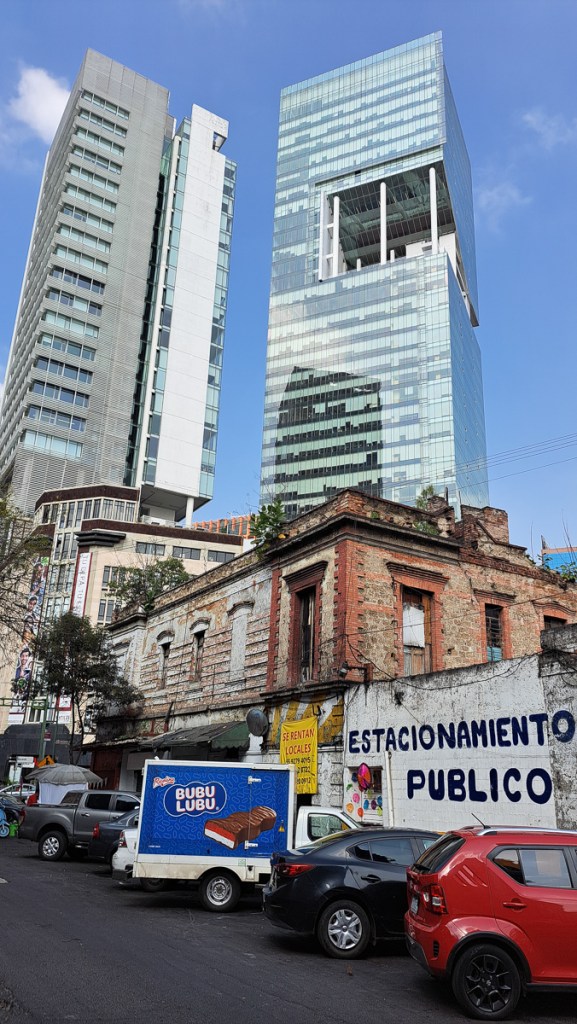
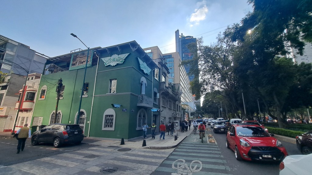
Apart from ruins, the oldest buildings are imperial Spanish, together with later ones from different republics or briefly the Mexican empire. They’re generally pretty ornate, going on florid. Many now crumbling, many in use and often cherished, especially churches. Above them gleam typical late 20th/early 21st century skyscrapers of glass. Much as any big city nowadays, although CDMX has many more vacant lots or little used old shells than London.
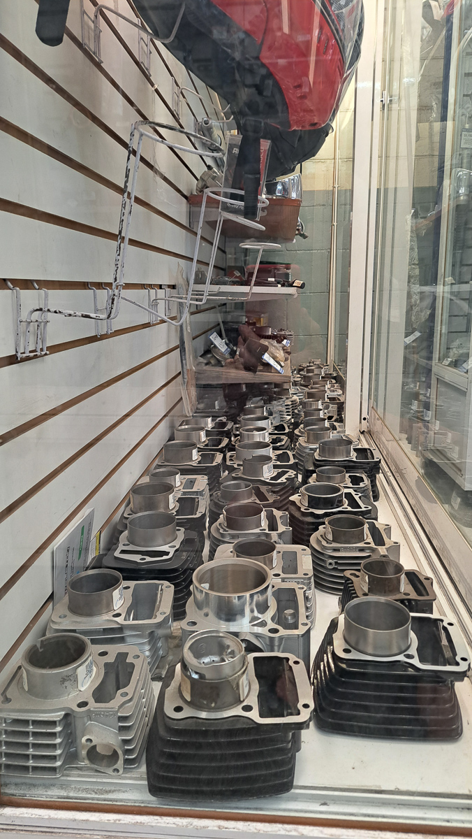
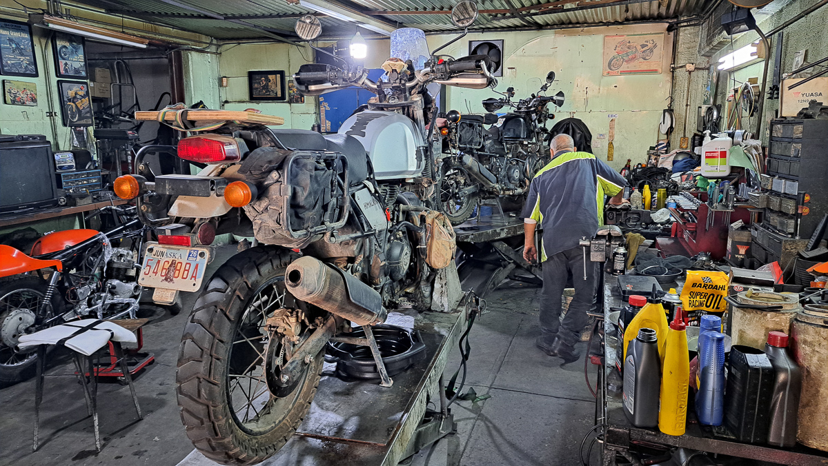
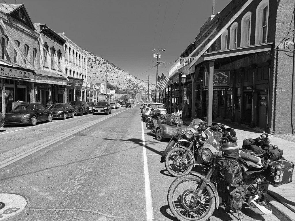
CDMX is also full of motorcycles. Mostly quite small, locally manufactured, all that’s needed for urban use. But there were quite a few bigger imports too, which made it easy to find somewhere to get the messy parts of the bikes – 18,000 mile service now done.
The aussies were right – it’s a great city. And that’s with us oldies eschewing the bars and nightlife.
We’d spent the previous afternoon filling in the forms at the campsite. Gid’s android translated the info into English. Mine didn’t. I felt as though I was signing my life away with a blindfold over my eyes. He was feeling challenged with his own form and didn’t need me constantly quizzing him. We finally got there. Paid up, two forms. Copies of this, copies of that. But one of them said we needed a paper copy and please arrive at the border with it. We were crossing the border on a Sunday and suddenly we needed a paper copy.
On the way out of our Palomar campsite we’d called into the local convenience store. The part time lady cheerfully said she’d ask the manager for a print as they did have a printer. It all seemed quite hopeful. The manageress arrived flushed and in a considerable flap. ‘I do wish you hadn’t offered to do this,’ she admonished her assistant. Despite three heads trying to solve the problems it was not going to happen – passwords, signals, connections – the list goes on.
Gid was keen to try the few random shops we passed. I was more, ‘Of ‘cos they’ll let us in. Are they really going to send umpteen tourists away?’ One more failed effort just before the Mexican border left us with no option. We progressed forwards. It all seemed very relaxed. There were a few officers there in uniform but they just waved us through. Gid exploded. ‘We can’t just go through. We need our paperwork stamped and the bikes need to be registered.’ He conveyed this to one guy who casually pointed to the office at the side and told us to go through the barrier and come back to do the paper work!
The Mexican immigration office was to the right on a one-way street. With no access to it we had to park further down the road and walk back. The señor in the office was very patient as we tried to locate, from among the umpteen forms we’d saved, the ones that he wanted. We emailed them to him so that he could print them out. Stamped and dated off we went. The vehicle importation was equally trouble free once we’d sorted out which paperwork equated to which bike and whose it was. Our recently hard-won, but very elementary Spanish hadn’t really been challenged, but it had had a little outing.
In. Now we needed some Pesos. Going down the main drag I spotted an ATM sign. We pulled in behind a car. Gid jumped off his bike and in he went. Moments later un hombre policia appeared pen in hand opening the pages in his ticket book. He pointed to the writing on the side of the kerb and said what must have been, ‘No Parking’.
‘Un momento, Un momento,’ I cried, calling to Gid through the intercom that he was about to get a parking ticket.
‘I’ve just put my card in, I can’t come now,’ he anxiously replied.
The policia was gesticulating that Gid’s bike needed be to moved. I indicated that I would move it. But of course as I swapped bikes mine was now illegally parked. I was trying to wiggle Gid’s bike round mine when Gid reappeared. Thankfully the policia seemed to despair of this comedy act and walked away. Two bikes two riders, money, we were off.
As we set off down the road Gid informed me that a high proportion of the population have never taken a test. Pay a little extra and the licence was yours is what most Mexicans did. Somehow I was sensing that and the signage wasn’t as clear as we’d got used to either. There were stop signs used in the same way as in the US but the accompanying stop line had been erased – some of the signs had suffered over the decades of time. I ploughed straight through one. Thankfully no one was coming. Later we learnt that irrespective of red lights, Alto signs and what ever, ‘Get eye contact!’ before progressing, that’s the important thing. Things seem a little “loose” compared to the UK, Spain or USA, but it works on civility yet is not remotely in an Indian or Indonesian league.
Further down the road I was overtaken on the hard shoulder. A car just came careering past me on the inside. Wow! What was that? The next half hour was a sharp learning curve. The hard shoulder albeit much narrower than the road lane was regularly used to over take. One vehicle straddled the solid white line that demarked the hard shoulder while the overtaking vehicle straddled the central solid yellow line. All sorted then. One good thing was that as the hard shoulder served as a lane, of sorts, it wasn’t full of debris. The crap was piled high in the pull outs and off the side of the road. No $1000 fine here for littering.
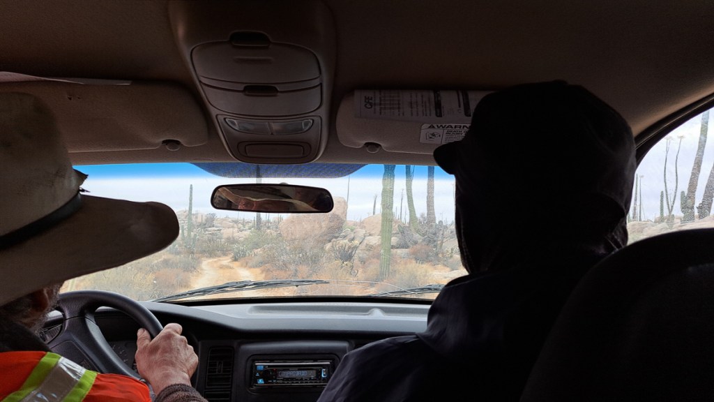
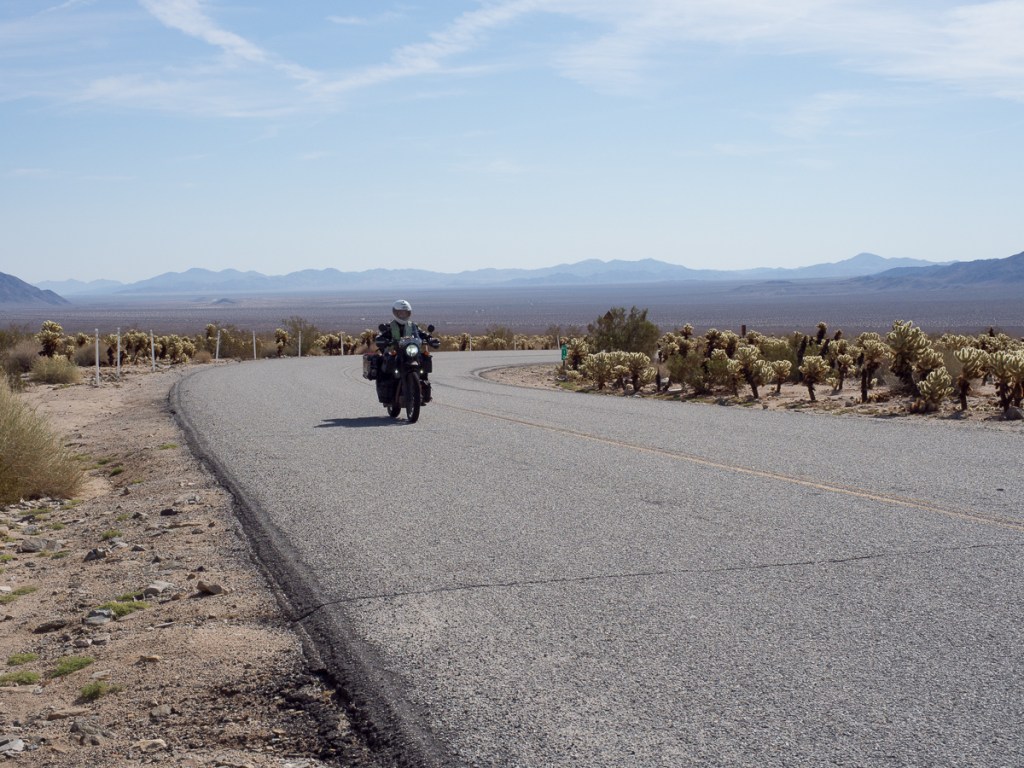
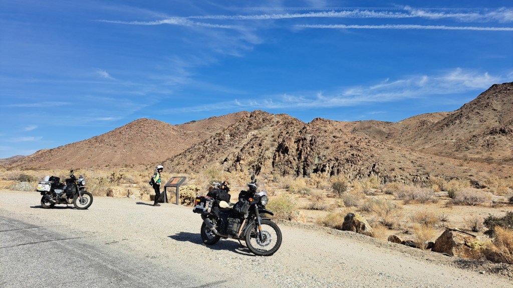
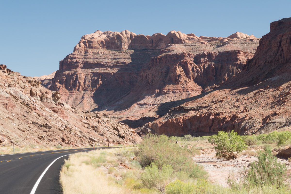
Another surprise was the trucks passing along through the towns and along the highways with armed soldiers masked and in full uniform standing in the back. Regular check points along the roads also told of the extent of the drugs problem in Mexico, a lot of it driven by the trade over the border in the USA. The nearest we got to being searched was one bored pair of young military guys asking where we had come from and where we were going. Other vehicles, mostly northbound, had numerous inspectors with torches pawing all over their trucks. The bigger the vehicle the more extensive the search. We settled into the new regime. The road to Ensenada passed through a scenic wine making area, and wasn’t heavily trafficked – a great introduction once we’d worked out the hard shoulder plan.
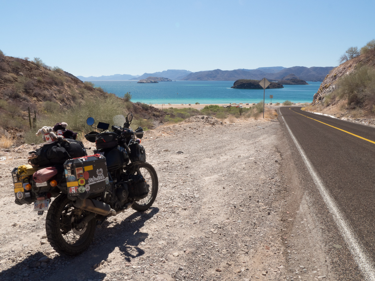
Ensanada was our first destination, for very prosaic reasons. But it was a joy to visit. The internet-booked motel was just fine, and after months in the western USA and Canada we could again wander around a town. While none of the pavements were consistently flat it had a centre we could amble through enjoying the atmosphere. Gid could have stayed a few more days, but after all the delays I was keen to get on. The plan was to travel the length of the Baja peninsular, then ferry across to the mainland. Interestingly, it was two weeks before the famous Baja 1000 desert race. We decided not to enter.
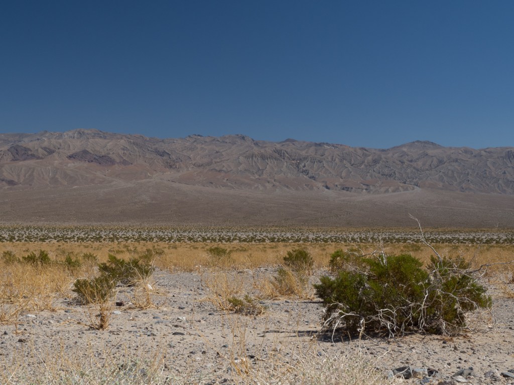
We’ve visited Spain a number of times and the similarities here were stark. In some towns with buildings set back from the road, many things were broken down or in need of repair with the occasional thing half built while others had large murals and were brightly painted with bougainvillea adorning the walls. Whereas the western USA has almost everything in town concreted over, in the pueblos the road had a wide apron of dust – of course, everything was coated in it unless it moved.
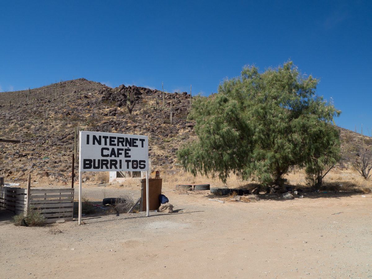
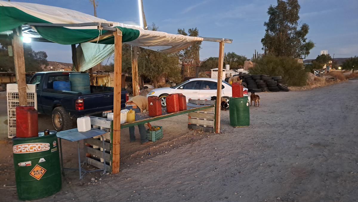
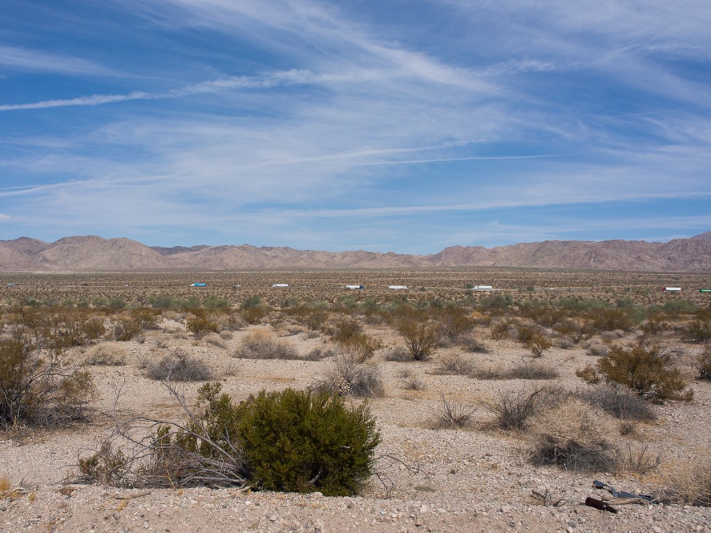
We’ve travelled fairly extensively across the globe, and it was a pleasure to see again local, improvised, low key services along the road. Home made as well as printed signs are common, and as Baja California is both very sparsely populated, and not highly developed, sometimes we needed to see that “man with a can” gas stop, or the little stall selling burritos (we hadn’t even been entirely sure what a burrito was). And every café had a “wifi” sign – the wifi may well have been the most reliable service. There were many “proper” gas stations, but interspersed with can men whom we really needed at least once pricey though he seemed. Very sugary pop is also always available, more difficult is avoiding it!
Another change – to us – is an expected one. In the USA we tended to avoid the trafficked and expensive megopolises, and skip from scenic park to scenic park, camping. In the less developed parts of the world, there are fewer campsites, debatably less safe, and our pounds go a lot further. So we tend to reverse the pattern and skip between cheap hotels in towns. Cheap hotels here can be jolly nice, usually best not booked through a big website – local rates are cheaper. El Hotel Frances was a memorable 19th century historic building, in rather mid-western style (but of probably tropical hardwood), but most are pretty new, Hispanically concrete. None has yet approached in cost the San Diego campsite!
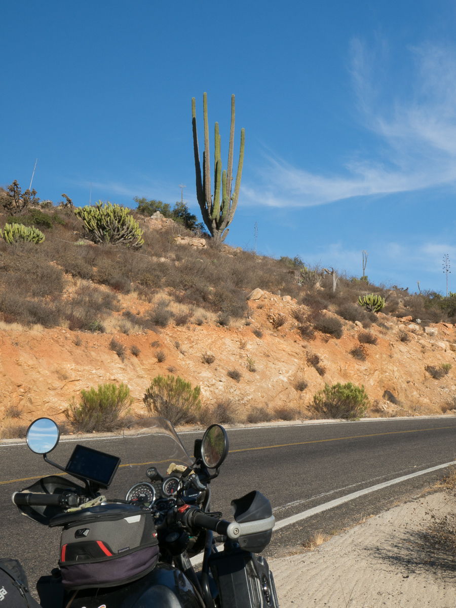
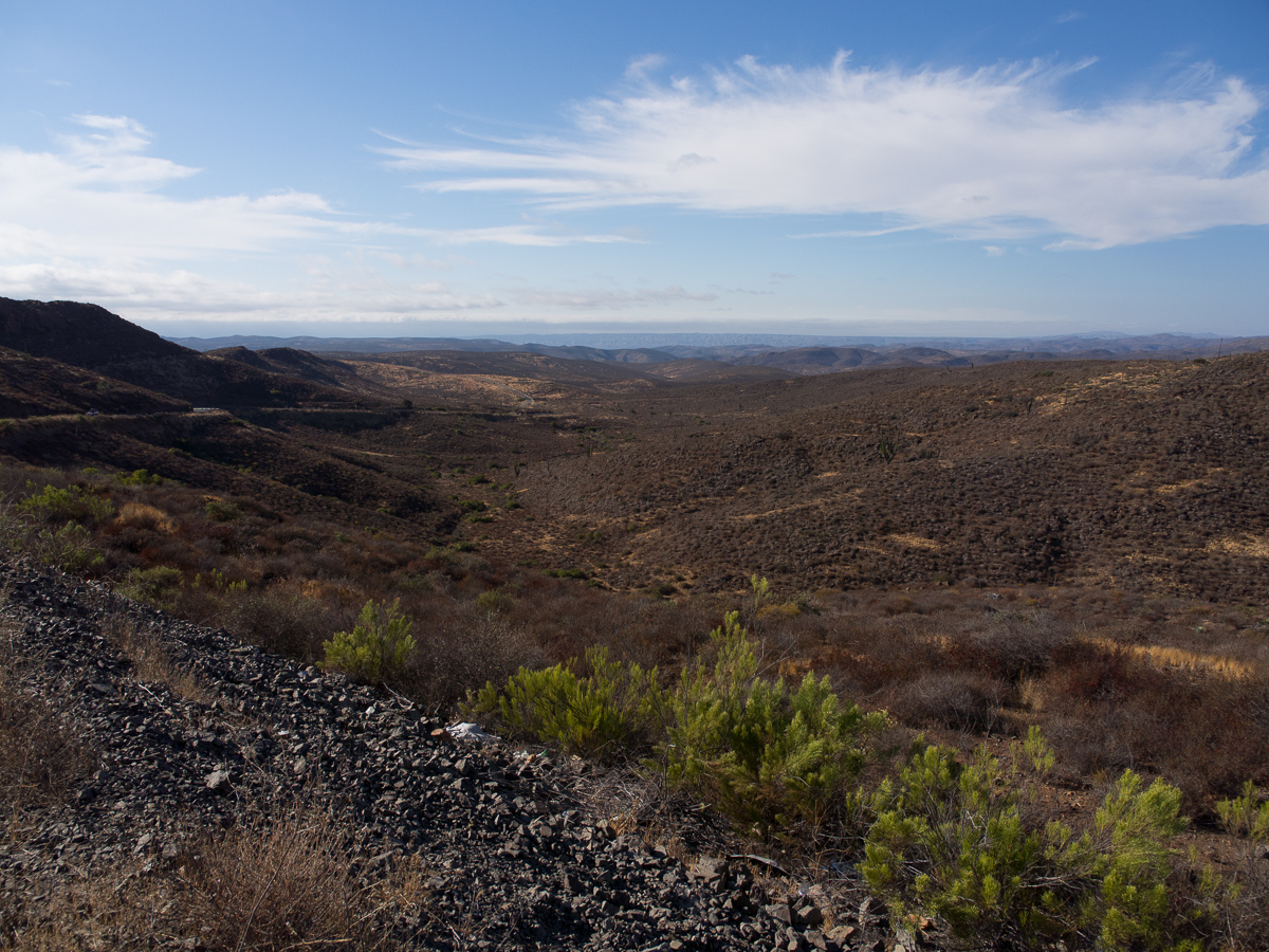
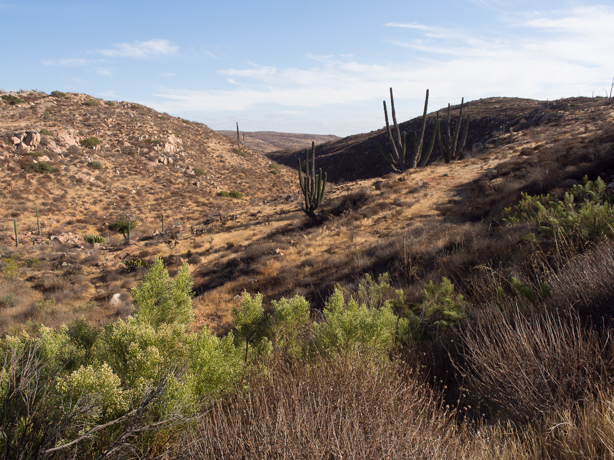
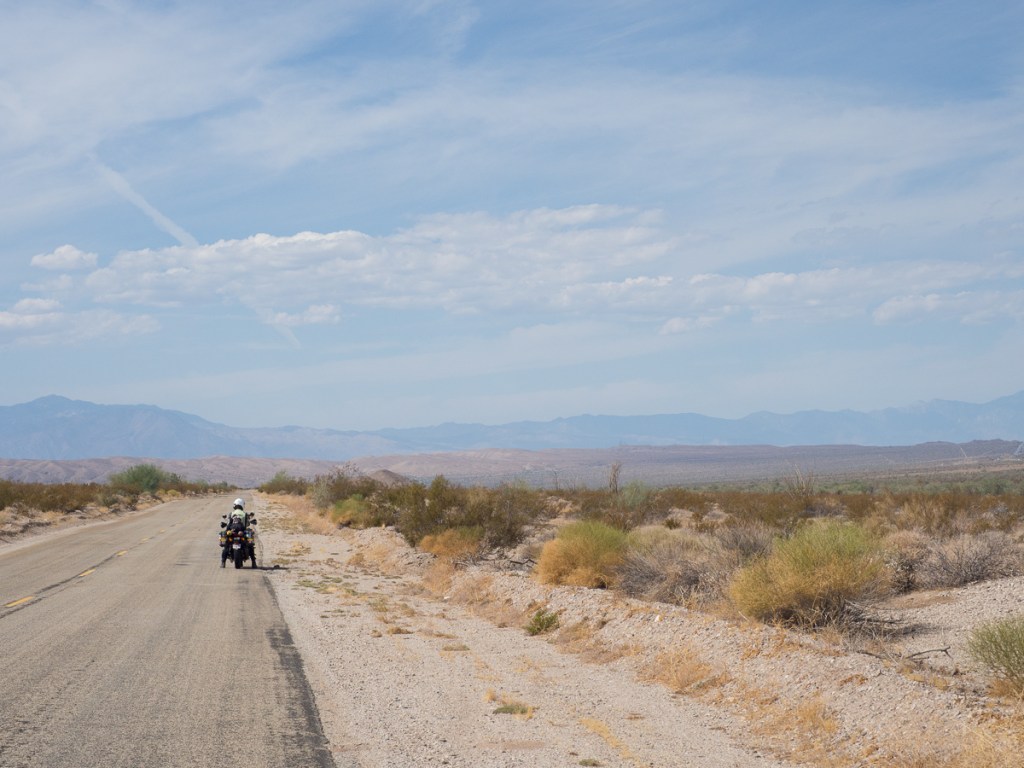
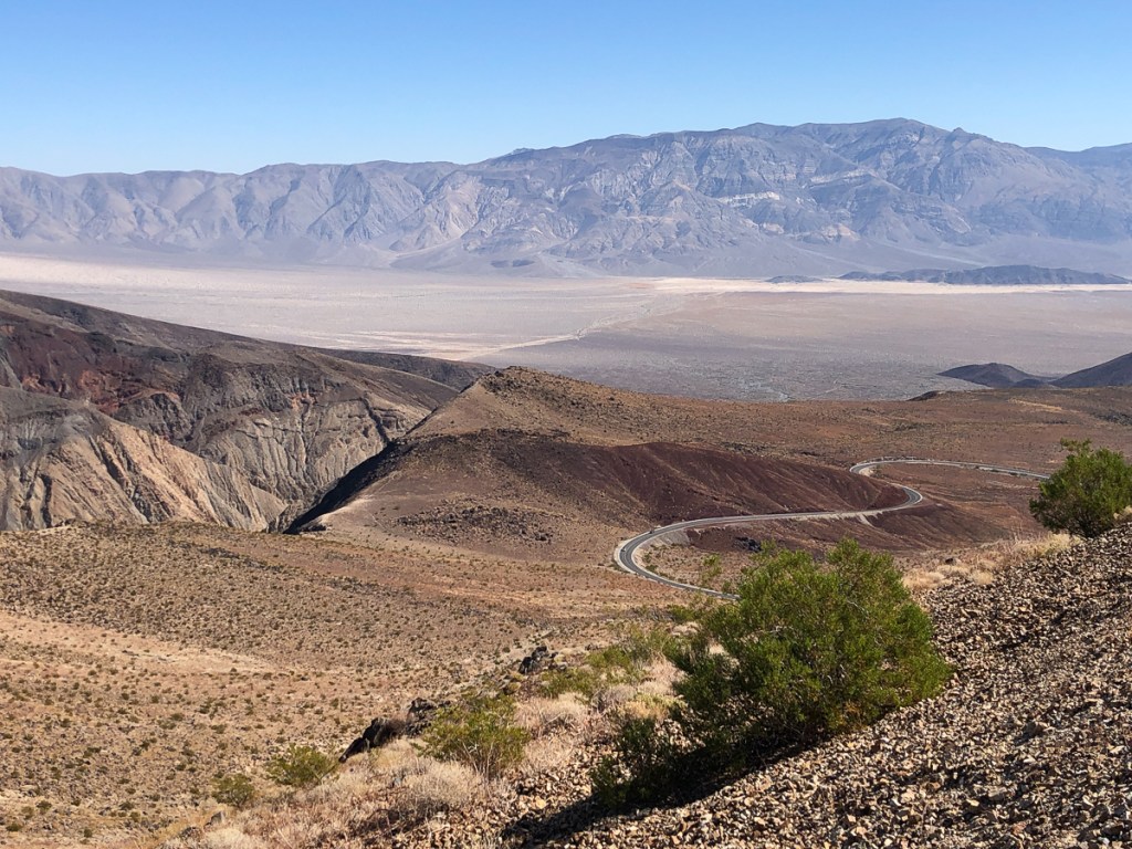
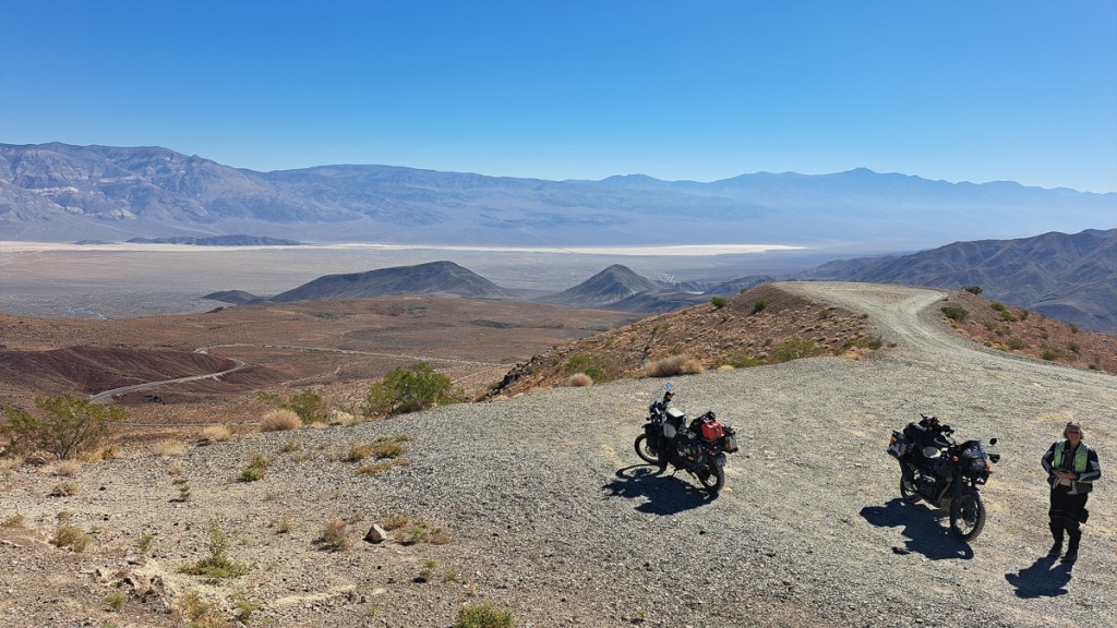
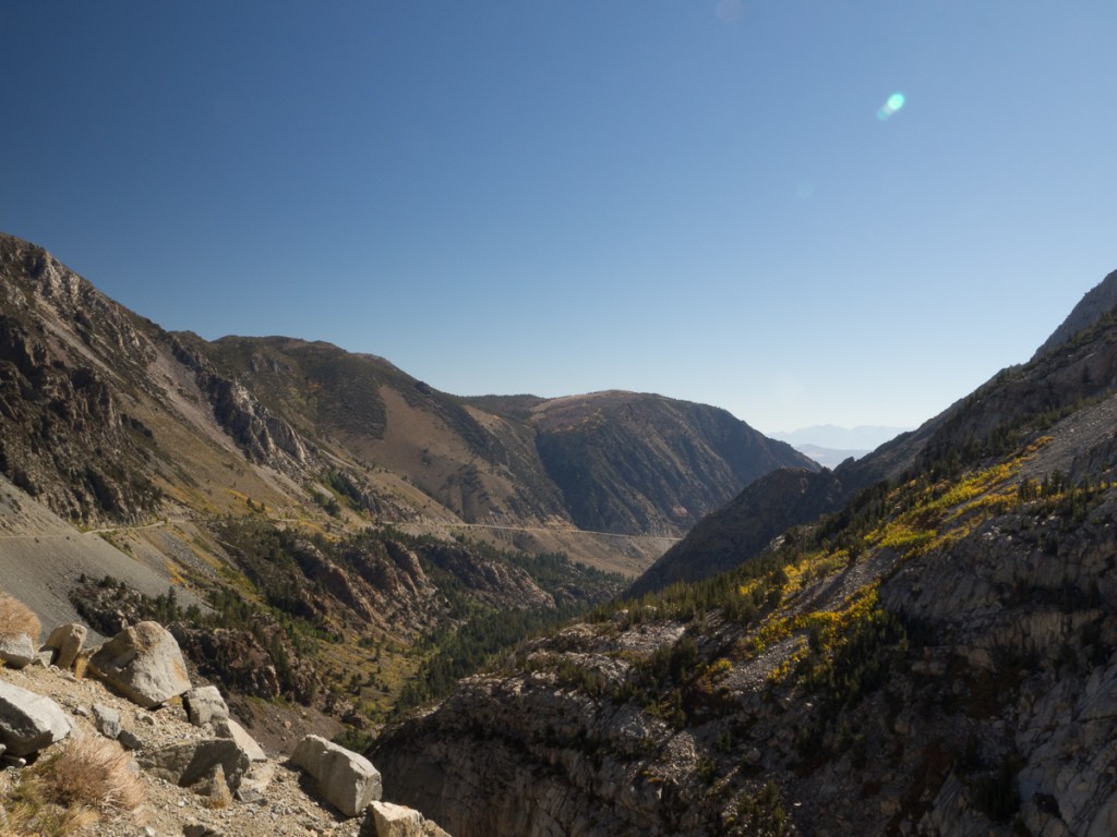
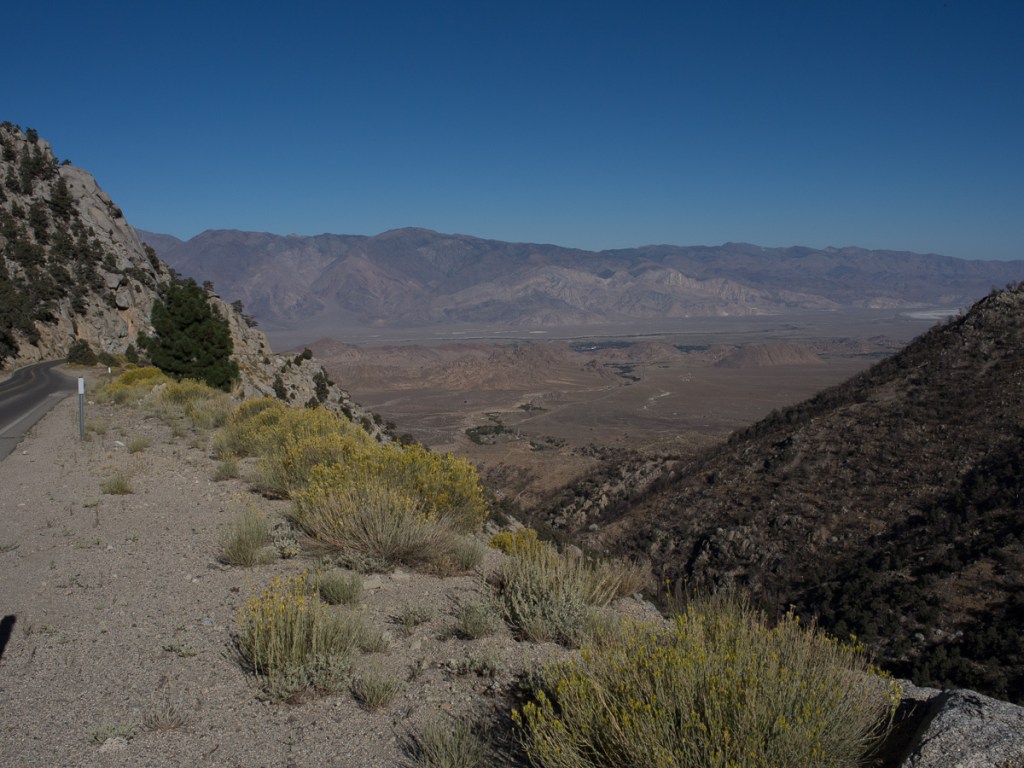
We still felt very wary of much adventure in Mexico and there’s only one main road down through the Baja peninsula which was generally ok, two lanes, little traffic, and relatively few slow bits through pueblos.Occasionally it was a pristine new surface but at times a pitted pot-holed mess – no worse than our home town in the UK, but that’s not a 60mph road. On our Himalayans we didn’t need to lose much speed to plough through whatever the road surface threw at us. Along the grotty sections we even overtook some cars and trucks. We passed a road repair team on a couple of occasions. It was a truck loaded with tarmac and some spades. The truck stopped. Out jumped the team. One filled the hole, another raked it flat while a third flagged the approaching traffic. All sorted. Move on. They had their work cut out! More dangerous than the overtaking, and the potholes, was probably the occasional livestock, rare in the first place, that had gotten out of the fenced ranches and now munched at the roadside.
But plenty of the roadside was also lovely to look at, and especially in the north, quite curvy with fabulous views.
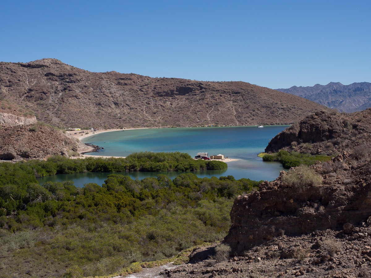
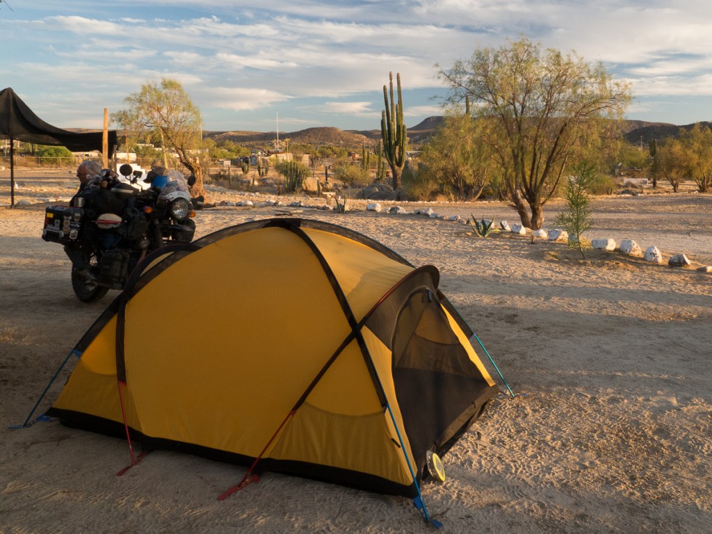
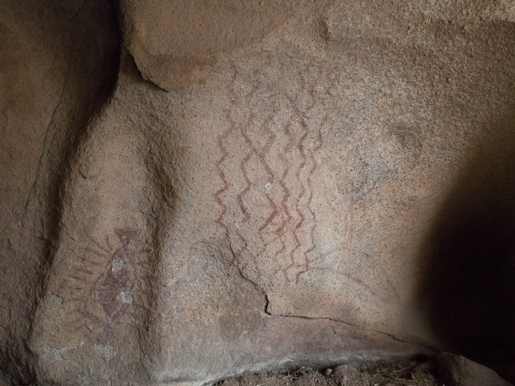
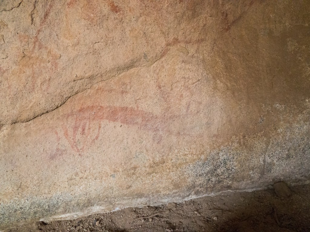
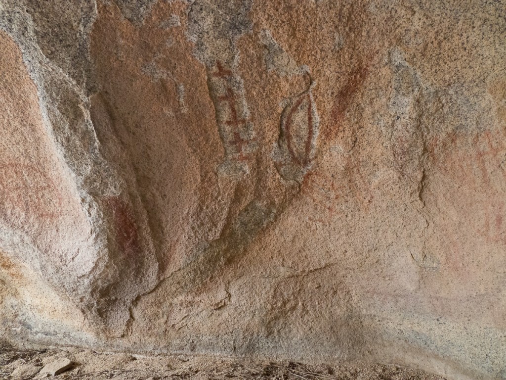
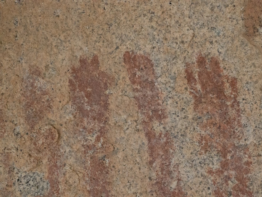
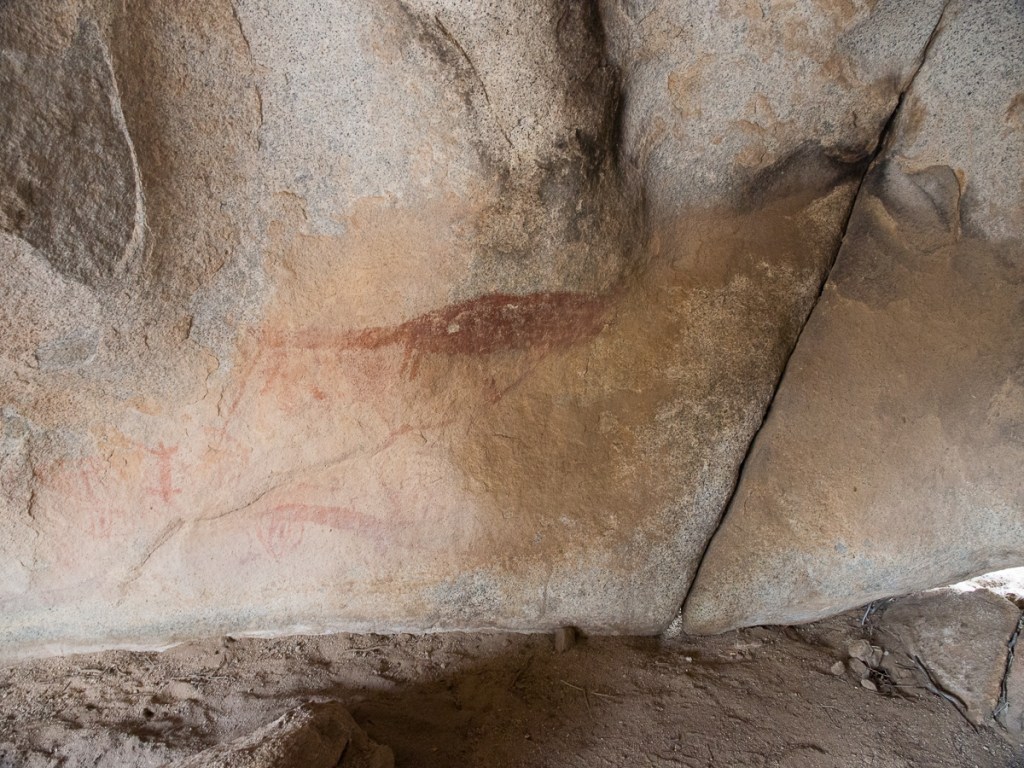
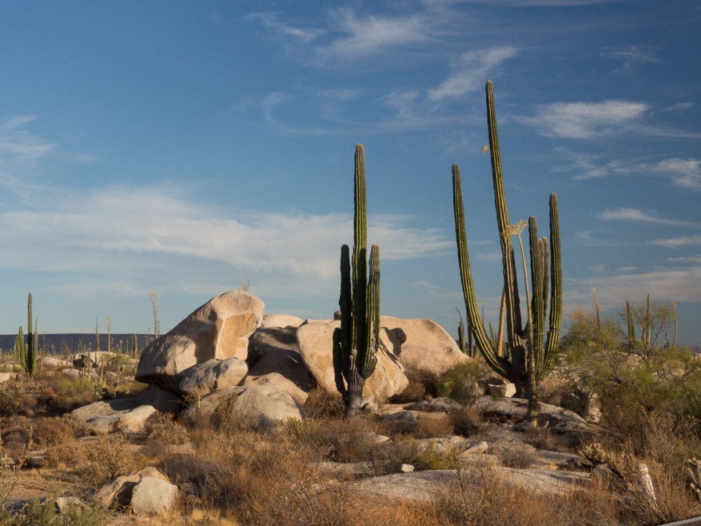
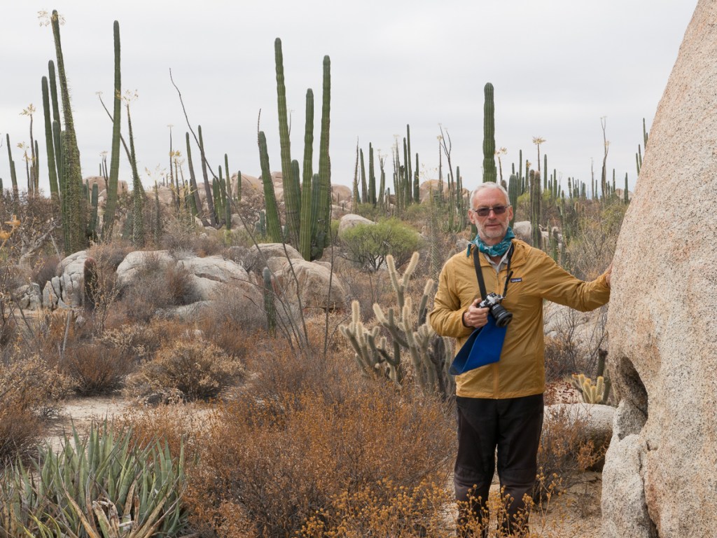
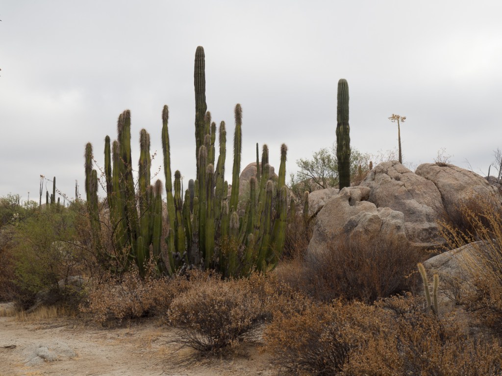
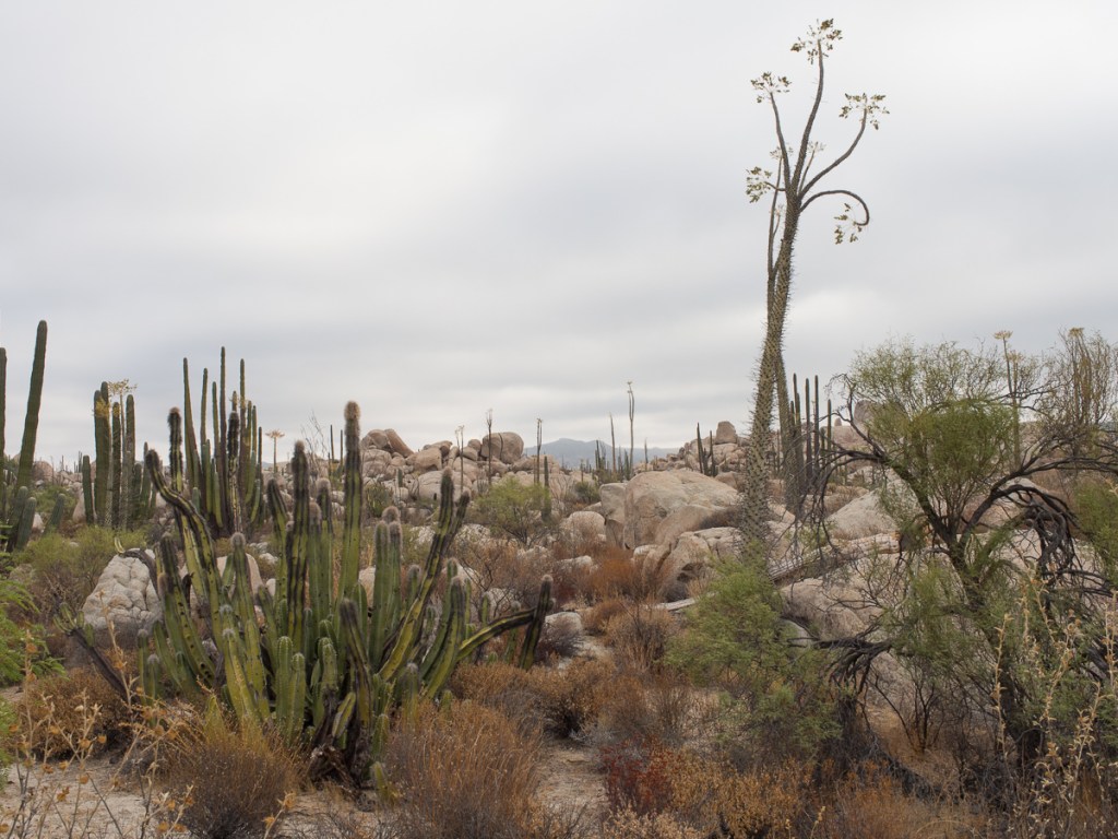
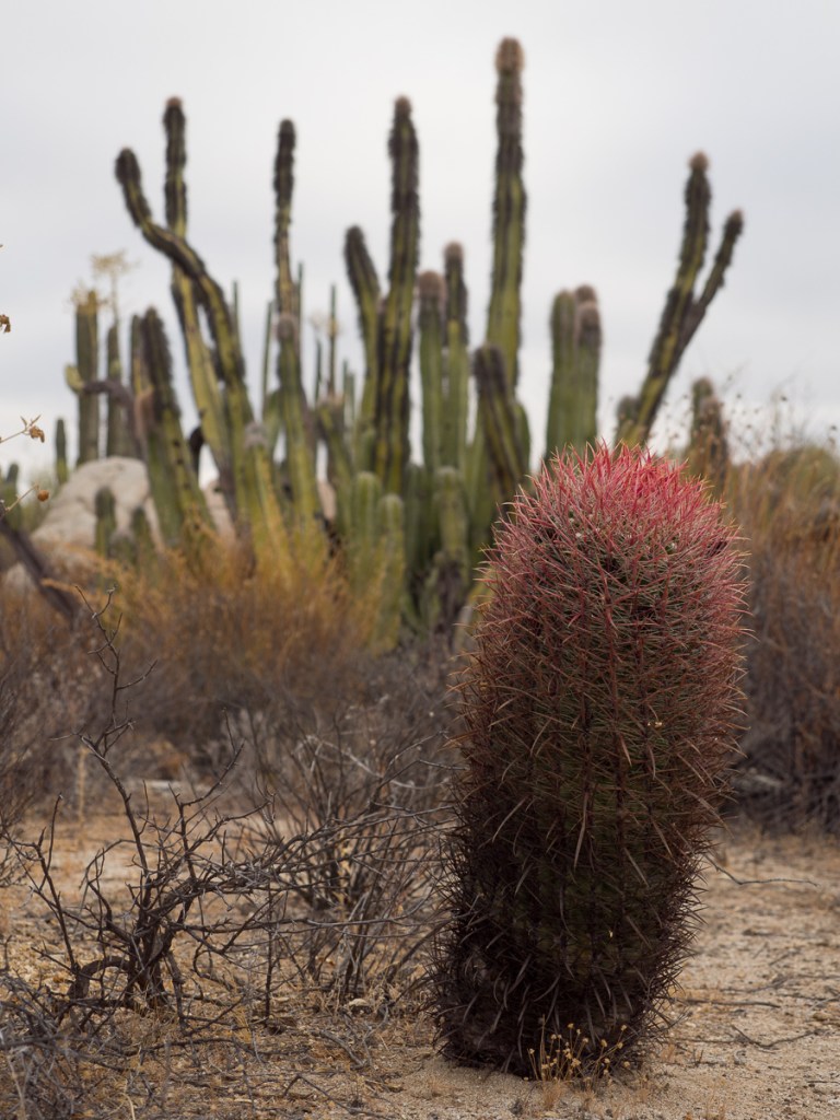
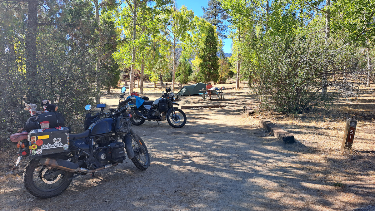
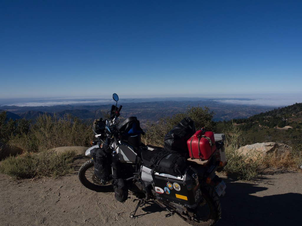
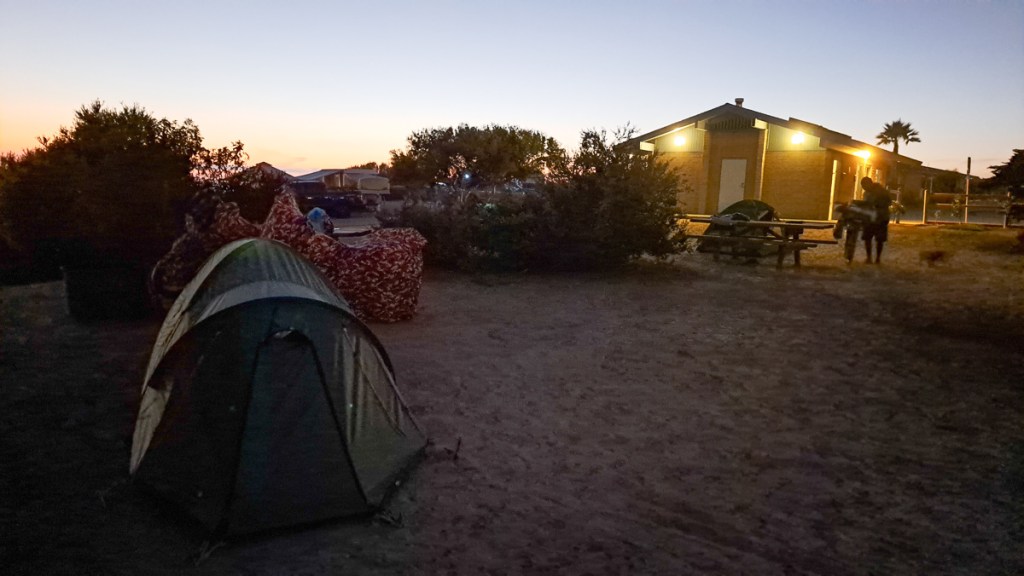
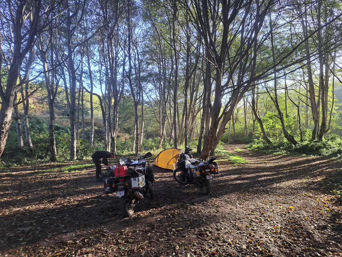
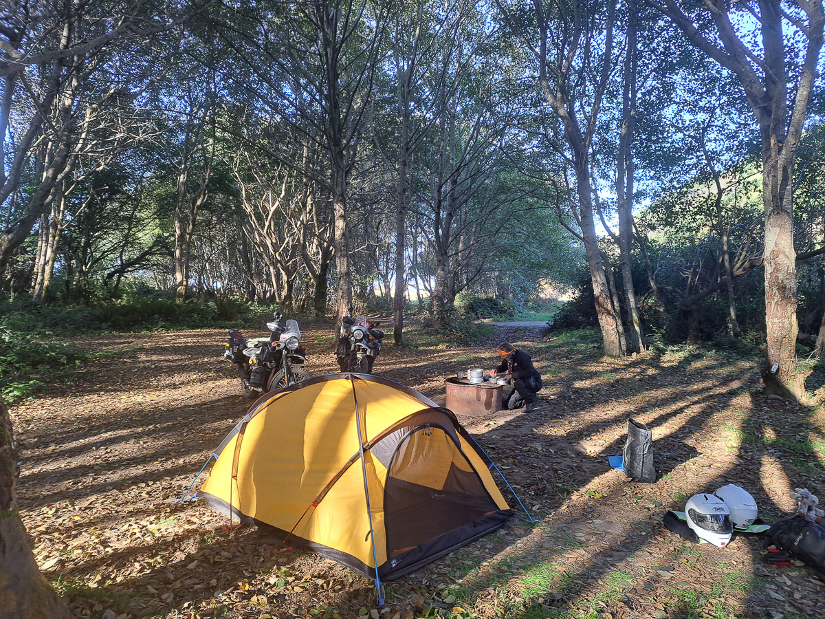
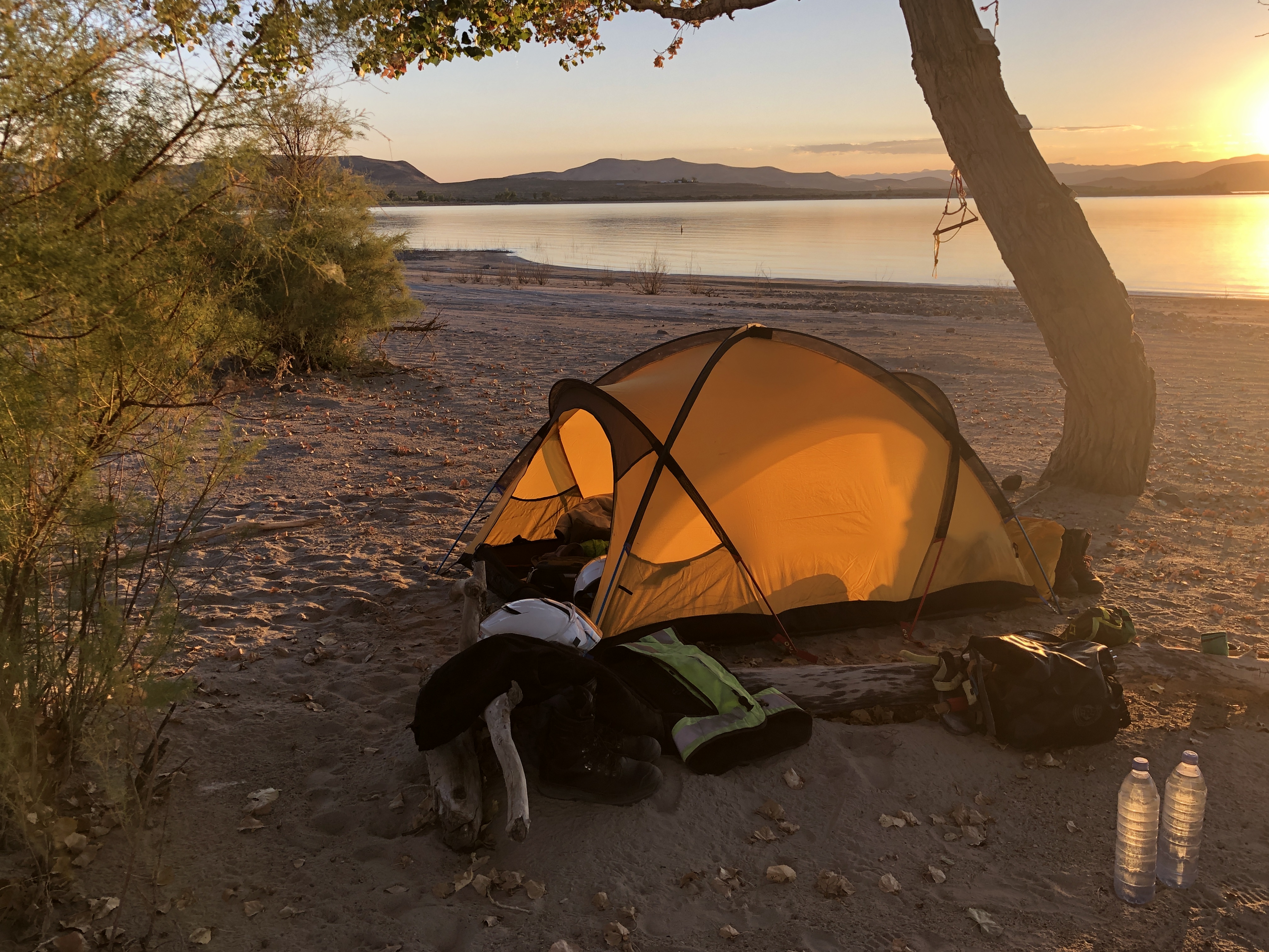
The country side we passed through changed from sparsely covered desert to a rich environment with many desert plants thriving. Despite my resolution to not camp in Mexico on the grounds of personal safety we did camp at Cataviña. We’d just passed a police station next to a deserted motel when we came across a small community: a campsite with two motorbikes and a tent inside a perimeter fence, opposite a taco shack and a fuel stop. Encouraged by the gated entrance and bikers already camping we went in and were enthusiastically greeted. We were staying then. Alexandros spoke reasonable English and encouraged our efforts in Spanish. He’d also done the southern half of our planned trip and gave us the book he’d written pointing out the pages that recorded his crossing of the Darien gap. ‘Three weeks for the bikes,’ he said. ‘Three hours by plane for us.’ We spent a fabulous evening sharing tales. A surprise bonus was the campsite’s tour of the desert by truck to see the painted caves just up the road and off in the desert.
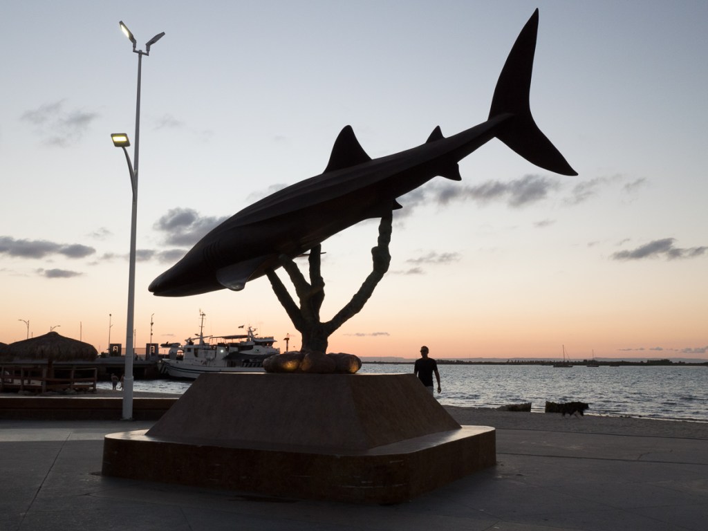
So, we’re off! ¡Vamos! Well, now we stopped in the lovely resort of La Paz, there is the ferry terminal, but it’s so nice we’ll pause awhile.
The sensitive reader might look at the last few posts, and the dates, and wonder why we don’t seem to be making much progress in a southerly direction. At times, so have we. The zig back from Flagstaff to California’s northern coast was for touristic reasons, but otherwise we have been having a rather frustrating time of it…
We slowly circled around Reno trying to coordinate our AirBnb, the arrival of tyres, then the arrival of sprockets.
We planned a 3 day rest and IT stop at Big Bear (a ski resort, quiet and cheap in September), which extended when we had an IT crisis when our picture store disk failed, and a major crisis in our family at home.
We ordered some stuff from Amazon for delivery to a locker somewhere on day X, but then they said day Z, and it finally turned up on day Y.
The lawyers dealing with Clare’s 2022 motorcycle accident claim on the IoM organised an MRI scan in Mexico, but trying to choose a date when we’re moving and they are glacially dynamic meant we were hanging around in California for a week or two.
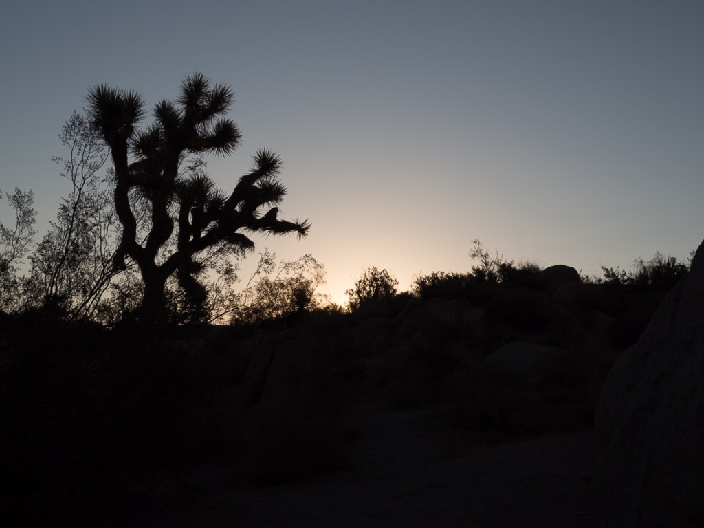
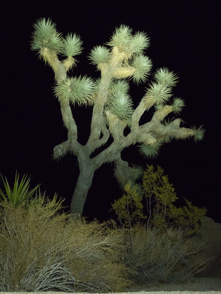
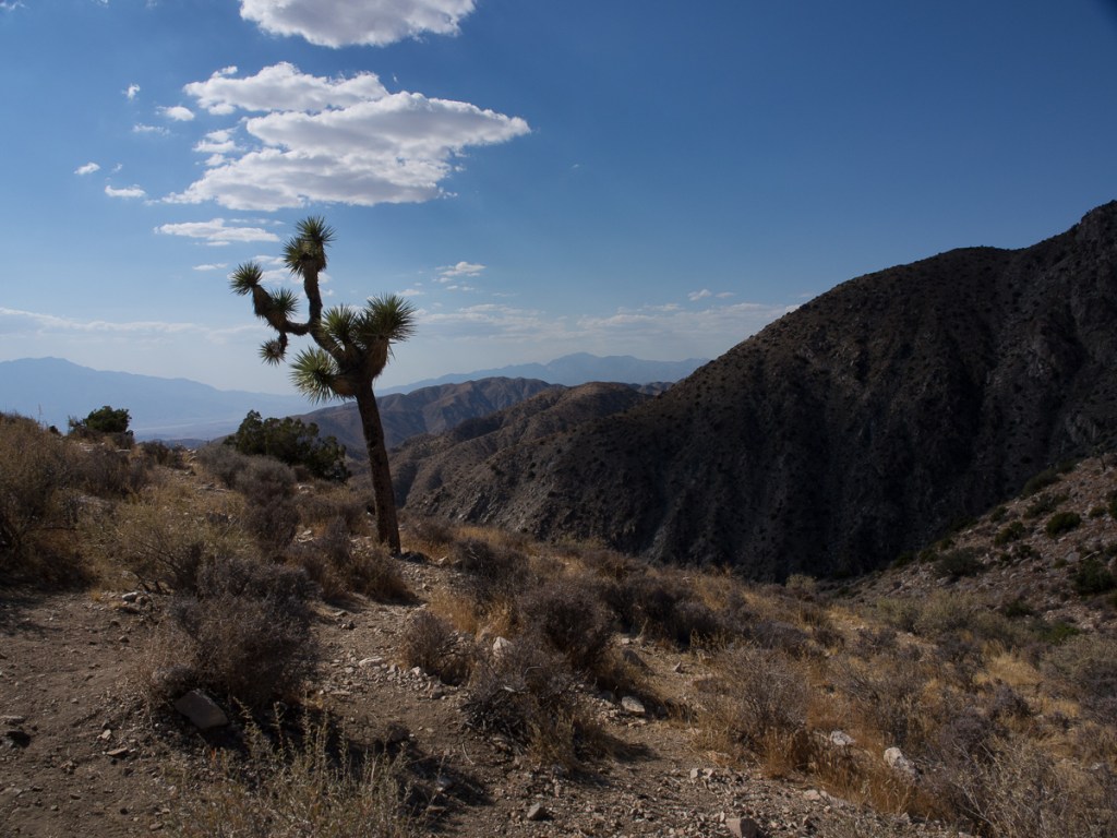
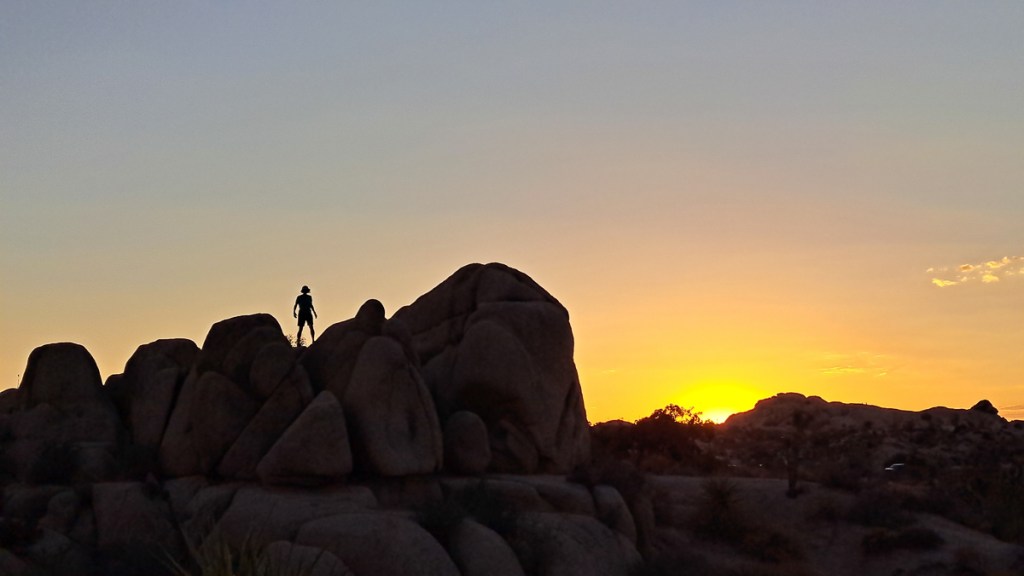
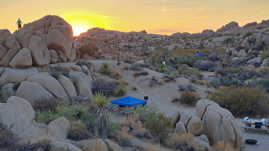
So we thrashed around a bit! It has to be said I’m more tolerant of stopping in odd places than Clare is! Joshua Tree National Park was well worth the two days there, though boy was it hot. And, maybe our first California crowded campsite – some pretty noisy neighbours, with a heavy stereo habit. Lots of nice photos though.
We were learning, or re-learning, an important lesson. In southern California, we’ve been alternating between coast and inland, and low and high, quite often within a day, and it’s really drumming home the lesson of how the temperature depends on altitude, and is different at the coast. As we left Joshua Tree NP, we descended (was it?) 1000m from the baking hot Mojave Desert, to the bonkers hot Colorado Desert. Fortunately we’d timed it well (early), so temperatures were muted. But it was very clear how the vegetation changed: Joshua trees vanished, ocotillos and smoke trees appeared, amongst other changes. Them tough ‘ole creosote bushes were in both though.
Salty Salton Sea was 72m below sea level and insanely hot – remember this is late September – and we really felt for the (presumably) Mexican workers picking in the huge fields of fruit and veg. Their convenience store, though, was one of the best we’d seen for a while. We legged it though – could not take the heat.
Now, our Amazon order: Maps, parts, and pants. Now, like most people, I’d heard of “Palm Springs”, the millionaires playground, but for some reason, thought it was in Florida. It ain’t, and I’d ordered our stuff to an Amazon locker right in it. Interesting. Madly hot – why is PS even here? – but very well kept. Lots of grass. Lots of posh shops. Lots of posh cars. Same endless traffic lights as most US cities. It’s a shame it was so hot, as it would repay a photo session – but not wearing motorcycle armour. We found a lovely campground, Hurkey Creek, forty miles away up a wonderfully winding hill road. But it was frustrating having to base there three days.
Still killing time, we decided to venture to San Diego to check out some moto clothing, and pick up the next oil change kit (Northern Mexico being rather short of RE dealers). The beach-side campground reminded us why we hadn’t much enjoyed this stretch when we cycled it in 2017 – crowded and madly expensive. And why do US state & national campsites penalise motorcyclists with “extra vehicle” charges! Still, I enjoyed an extended dip in the Pacific, failing to bodysurf in the nice little breakers: It was too chilly for Clare, and when I got out the second time, I was pretty cold. I somehow hadn’t expected that, right at the south of golden California, the boardies would all be wearing full wetsuits.
Finally, searching for a campsite within a short ride of the Mexican border, we stumbled across the campsite for Palomar Observatory. High up, shaded by pines, it was almost too cool. We took the nice walk to the 200-inch telescope and its museum.
Unfortunately our last 2 nights in the USA were again marred by noisy campsite parties. It’s probably fair to say California has cemented it’s place as our least favourite state, though it’s undoubtedly beautiful. Still, we’ve only ever visited 11 states…
Death Valley had been on my wish list from the beginning. Gid, however, was vehemently against it. He is far more sensitive to the heat than I am. Gid had bought mesh biking kit from the UK thinking that he would rather try to layer up and be slightly cold whilst I had brought full winter kit. Recently I have purchased summer gloves and mesh trousers but I’m still in my full on winter jacket. I just open up the zips, shrug occasionally to circulate some cooler air, boil a bit but seem to get by. Gid has also had problems with becoming slightly faint when he didn’t realise how hot he was getting. On one occasion when we did stop he was seriously affected. Heat is an issue for him and Death Valley is seriously hot.
I hadn’t given Death Valley a second thought as we’d set off from San Francisco back towards southeast California, for a last bit of tourism before the real adventure resumed at the Mexican border. To begin, we were aiming for the Yosemite National Park. Stopping for fuel on the way in I chatted to a couple of bikers swapping the normal stories. Where have you been? Where are you going? I spewed forth with the ‘On our way to Yosemite bit’ while they replied they were doing Death Valley tomorrow. ‘How are you going to do that?’ I asked. Not even realising that it was ‘just down the road’ at that point. Right off HYW 395. They explained that they were booked into accommodation near the start of the access road and planned to be riding by sunrise. We said our goodbyes but the seed was now festering in my head. If they could do it …
I relayed the discussion to Gid who’d not been there through the conversation and declared that I was going to do it. He didn’t have to come I said we could meet up on the other side. Gid was very uncertain about it but was at least not panning the idea but it was clear that if I did it he would come too. Later in Yosemite Nat. Park we met more bikers. They had crossed Death Valley. ‘You’ll never see anything like it anywhere else in the world,’ one biker said and went on to describe some of the sights. ‘It’s the right time of year’, he continued, ‘End of September and February/ March are best times to do it’.
Gid was starting to show some interest and looked at where we might find accommodation near the start as packing up the tent to be on the road by five would be tricky. After leaving Yosemite, we agreed to visit the Lone Pine Visitor Centre situated at the end of the road leading to Death Valley to get an accurate weather forecast and find out more information.
Arriving there and off my bike first I strolled in full of confidence now that we could do this. I asked the advisor if I could have an up-to-date weather forecast for Death Valley.
‘On the screen’ he replied without moving a muscle. I looked at the screen which displayed a load of text.
‘No it’s not’ I replied.
‘It’s a rolling screen, it’ll be back,’ he added.
This was 4 in the afternoon and the temp was high forties. He produced a newspaper style information brochure which I opened up to show the map. Gid had joined me by now and asked how long it took to cross Death Valley and which bits were likely to be most challenging. The advisor spewed out a load of statistics and information way to fast for me to comprehend. I explained that I wasn’t familiar with a lot of the terminology he was quoting to me. Please could he talk slowly so that I could have a chance to get my head around it. He stated unfathomable feet rather than miles. I work in centigrade he was quoting Fahrenheit. ‘It’s very hot out there,’ he restated. He was aware I clearly wasn’t absorbing this.
I told our story of the biker who had said that this was a good time of year to do it and the guy who had setting off at day break to get across before the temperatures got too hot. ‘It’s hot by mid morning,’ he said. Still rattling out his friendly advise at a rate that I could barely take in. ‘This isn’t fall here. Fall hasn’t started yet! It’ll be another month before we get fall. End of October beginning of November the temperatures drop, that’s the time to go if you really want to do it. That or end of March /April.’
Ok we’d got it we’re one month too early.
Gid asked how long it takes to cross Death Valley. Using the map he broke the route down into three sections giving a time for each bit. Two and a half hours at the national speed limit of 60mph. We wouldn’t be achieving that. ‘Stay on the main road,’ he said. ‘That way if you do run into trouble you’ve got a chance that someone will pass you by. A couple of German lads went along this other route,’ he showed us a smaller road on the map. That’s the one that had attracted me because it passed to lowest point in the park. ‘They got into trouble and they made it into the papers for all the wrong reasons. They were on their own and they didn’t make it.’ Not that way then. Gid questioned how many people travel along the main road. ‘Oh you might expect someone to pass you every five mins,’ he said. ‘There’s two mountain ranges. After the second range you’re down into Death valley. Then you’ve got to climb out of the valley. Then what are you going to do? You’re straight into the desert. It’s mighty hot out there!’ He was talking to us in an exasperated fashion.
Gid pointed at a couple of towns on the map. Our advisor’s retort was, ‘They’re just names on a map. There’s nothing at those places. That one’s got about five buildings, that one’s not got much more. You won’t find accommodation down that road.’ I explained that we intended to head on down that road to Joshua National Park. He nearly exploded. ‘You’re just not getting this are you. This area to the east of Death Valley is all desert! It’s all extremely hot. I wouldn’t advise you to visit Joshua National Park. That’s going to be extremely hot too!’
We left the visitor centre with our tails between our legs. We would need to get up at four in the morning. Sunrise is five, we’d been told. It would take us 1 1/2 hrs to reach Death Valley from the nearest town. Then 3 and a half to cross it with no photo stops. We’d be pushing 11am by the time we got across when we can expect the temps to be getting seriously hot. On air cooled bikes it was all looking seriously doubtful.
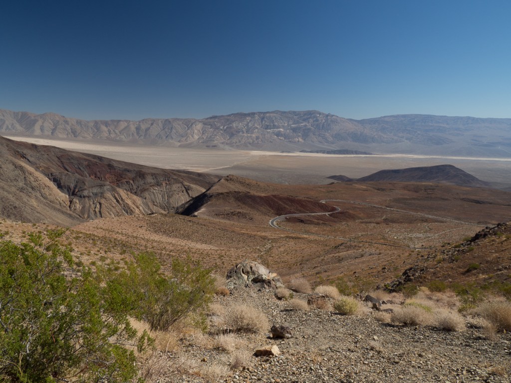
We agreed that crossing Death Valley wasn’t on for us but decided to visit the first viewing point inside the National Park, Father Crowley Point, and from there ride down into the first valley to take the Panamint Valley road back out. The view was spectacular. The road delightful.
Our route to the turn off in the valley took us past a Panamint Springs and its store. We stopped to get a drink. The cheerful young man in there said, ‘It’s been a hot one this year. Up in the 50s’ – Phew he was talking centigrade. ‘You’re in Death Valley National Park so you can get the sticker,’ he chuckled. We got the sticker.
After San Francisco, we thought we’d had enough of the coast for a bit, and we’d both been a little frazzled by the extra population compared to our recent months in the mid-west. So we headed back inland, aiming south for Yosemite, the Mojave desert, and Mexico.
We set off cutting south below San Francisco across rolling hills, all golden brown with occasional trees sticking up. The route was fine until we got snarled up in endless smallish towns. All with endless traffic lights where we were stuck in the sun. Stop start boil all the way. We got out of that by cutting further east and heading along much smaller roads, ending camping at Don Pedro Lake – a huge but deserted site, shared only with numerous woodpeckers. We both stripped off and jumped straight in.
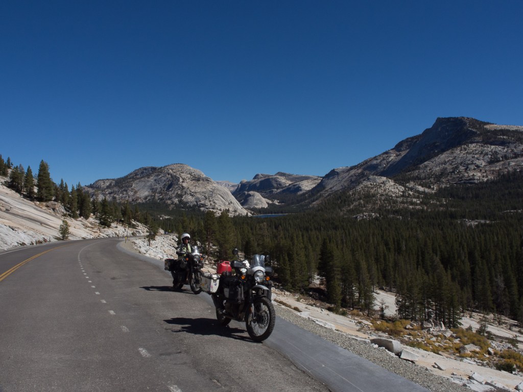
From there is was easy enough to get onto the 108 for the Sonora Pass dropping down into the Yosemite National Park and then on down the Hwy 395. Brian had recommended the 395 and it was coloured on the map as a scenic route. The first of the two highways was beautiful with a number of winding roads and high passes. The Sonora Pass, the highest of them all, being quite spectacular with beautiful views spreading out before us. From there we swept down towards Yosemite.
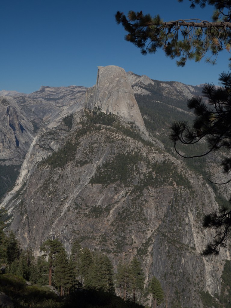
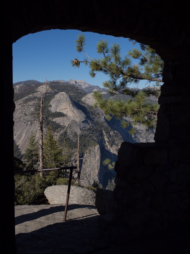
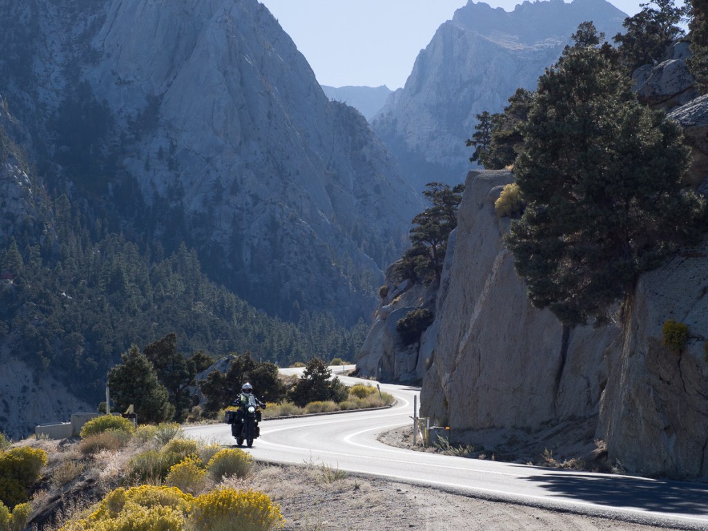
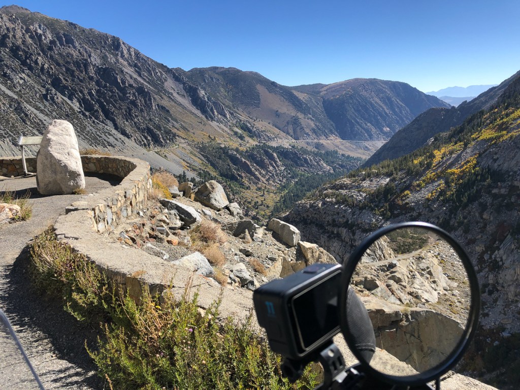
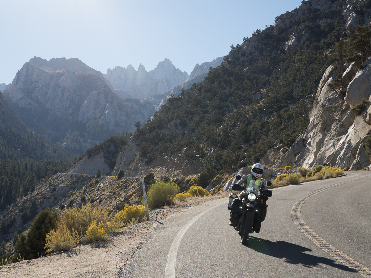
Can you see Mt Whitney?
We couldn’t actually stay in Yosemite, having, again, arrived in a National Park on a Friday. But it’s a fairly small park, and Saddlebag just outside (chilly at 10,000ft!), then Tuttle Creek were hospitable. The latter gave us a day trip to view Mount Whitney, the lower 48’s highest peak (it’s the distant dit-dit-DAH peak in above the cornering motorcycle below).
Death Valley was only a day’s ride away, but that turned into a bit of a saga, with its own posting.
At this point we were feeling the looming pressure of a long overdue blog update and the need to prepare for Mexico, so we hunkered down a few days in underused ski lodges in Big Bear Lake. But – would the town still be there, on the other side of the hill?
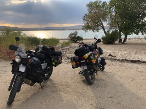
As related in the previous post, we stayed on two occasions at Lake Lahontan State Park near Reno. The first time we arrived there, we didn’t really know what to expect, and were dismayed to find a notice saying swimming was off. But as it was late in the day with no other campsite nearby we proceeded anyway. The tarmacked park road gave way to gravel which as we turned down toward a chosen patch of beach gave way to hard sand, and much softer areas. Across this we proceeded slowly hunting for the most solid surface and seemed, with the odd squirm or two, to reach a ‘parking area’, before the obviously soft looking beach, and its tent-beckoning patch of shady trees.
Lake Lahontan – Idyllic, isn’t it?
The 4x4s, of course, went right down onto the beach. They revved up and sped through what in places was deep soft sand. One, however, clearly picked the wrong route or went too slowly. It sunk a good 8 inches in. Further wheel spins were just cutting deeper. I fetched some broken branch pieces putting them under the tyres. Initially it looked as though they were just going to get whizzed through and spat out but they did hold long enough for some progress to be made. Eventually the vehicle was pulled out by a second 4×4 who, chains attached, gave the mission some real welly.
On our second visit to the same spot at the lake we suffered more excitement. Gid had a squirm or two reaching the ‘parking spot’. I thought I’d picked a good line. However, my bike went into a number of squirms. My feet shot down trying to stabilise the bike. Gid was shouting, ‘Back brake, back brake,’ as I wobbled precariously close to him standing by his bike. Maybe the squirms were our new front tyres? I stayed upright. Just!
That excitement over it wasn’t too long before a second wobbly moment. This was on the approach to Virginia City’s high street on our second visit. It was on a direct, and entertaining route from Lahontan Lake to Reno so we ran it a couple of times collecting parts for the forthcoming bike services. We approached Main Street ascending the steep Six Mile Canyon road. It’s quite a sharp drop down over a lip into that road from Main Street and of course quite a steep tricky climb back up. On our first visit where we had approached up the hill to turn left at the junction I’d made a bit of a mess of it. Luckily I had pulled up to the left side of Gid at the top of the lip and the road was clear so I went straight across. This time – I had a perfect plan. The approach road has several stop signs at minor crossings. You had to slow right down but not actually stop as the visibility was so good. I had given Gid plenty of space as I approached everyone of them. So had the biker tailing me. I could see the Main Street ahead. The approach was very steep crossing one last crossroads and then continuing steeply up the other side before reaching the main street. Or so I thought. Gid stopped as expected at the stop sign but he didn’t immediately proceed. He stayed there! I was much too close now as I had expected him to slow and go, moving on quite quickly. It was just a minor cross roads after all. Wrong! This was the main street and he had to wait for traffic. I pulled up behind him quickly realising my mistake and how stupid this was. I was on such a steep angle that my front brake wasn’t holding the bike. It was sliding backwards. Gid had now moved on but I had a death grip on my front brake. It wasn’t holding! Getting myself together, I balanced enough to put my foot on the rear brake. That held the bike. In first gear, slowly I let out the clutch. Would it have enough pull to move forwards from this spot at this steep angle? The engine revved like hell but gradually it inched forwards. I slowly pulled away. I needed to take a sharp right to go round the parked car and stay on my side of the road. I was moving. Sod the right side of the road. Thankfully the approaching car was coming slowly and was some way back. I gradually pulled round on the wrong side. But I was up.
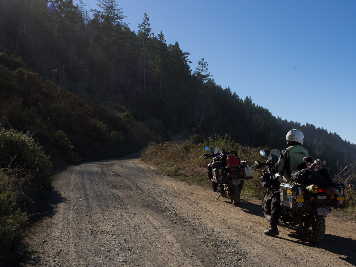
My third mistake was the big one. We’d left the southbound highway, 101, to meander up and down the coastal hills and along the minor coastal road heading south towards San Francisco. It was wonderful! The route twisted this way and that. The views along the beach were beautiful and quite deserted.
We’d ended up in a small village called Petrolia. Following a quick lunch we set off again. The main road, now called HWY1, was just east of us It was the big road all the way into the City and the route the Garmin had displayed. Gid had looked on our Michelin map and checked on his phone and come up with an alternative road across the wilderness nearer to the coast again. Garmin wasn’t happy. Normally once we’ve continued on a route for a while it concedes and reroutes accepting the new alternative. This time it didn’t. It was having none of it. We arrived at the point where Gid declared, ‘It’s left here.’ There wasn’t a road in any sense of what we’d experienced so far. Forrest, an aptly named forestry worker, on his Himalayan, was standing at the corner discussing with his friend, hanging out of a pickup, their next move. The route they had hoped to take was closed so they were heading off along the same track. The pickup driver was a little apprehensive. Forrest was local and assured us all that what we could see was what we would get. And I believed him?
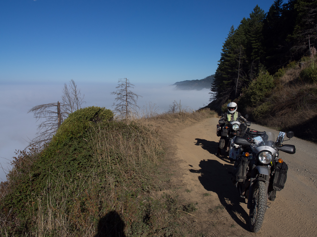
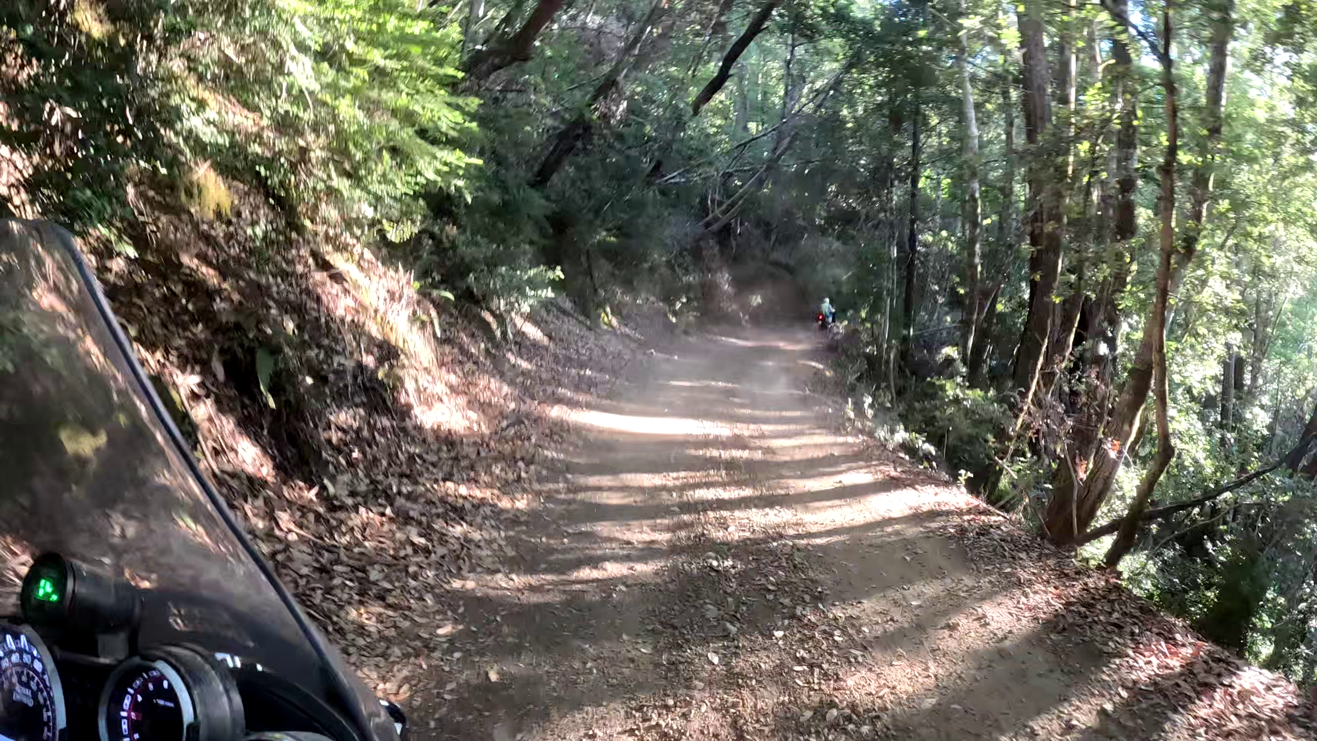
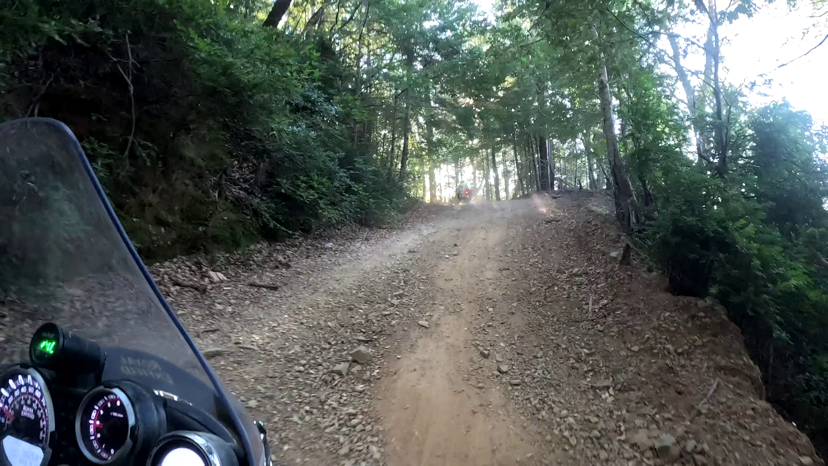
Usal Road it was called. It was dusty dirt, gravel and a good mix of bigger stones disappearing upwards between the trees. But nothing daunting. Away I went. It wasn’t long before we were both distressed. Our route wound its way up and down along a narrow track with an ever deteriorating surface. Soon it had deep gullies carved out by rain coursing down the hillside and diverting down the track. In places these were twelve to eighteen inches deep weaving from left to right exposing rocks, roots and gravel. One minute a single gully the next a delta of grooved out rivulets wound it’s way ahead of us. At one point I suddenly stopped. ‘Left, Gid, left,’ I shouted down the intercom. A deep gulley was opening up diagonally ahead of us, but I’d missed the safe route on the left. The gulley started on the left but was getting far bigger as it carved right. The narrow path wide enough for one tyre took you along the clear side. I’d done this sort of thing on my mountain bike numerous times before but they are a whole lot lighter and easier to throw around. Kiwi Adventurer, a lady we’d met in Canada, had said she swapped her nappies for a motorbike and found off-roading easy. ‘You just open the throttle to raise the front wheel up over the obstacles,’ she’d said. Now I was going to try it. Gid was calling after me, ‘Well what are you going to do?’ I didn’t wait to reply. I couldn’t think this too much I had to get on and do it. I got the bike moving and aimed for the slight dip on my side where I was going to ride over the lump in the middle, rise up the other side of the gully and turn sharply to head up the track again. Miraculously I managed it. Don’t ask me how but along we went again. Gradually it seemed like one roller coaster moment was followed by another. Soon I was berming on my motorbike. In a couple of places the cliff edge curved round in a clear arch above an uneven mess on the track. I knew how to tackle this. I’d encouraged my grandson often enough when he was learning on his pushbike. He’d set off without enough speed to sweep right round and slide down in a heap when only half way. I needed some good firm throttle and the courage to edge the bike perpendicular to the curve.
Unfortunately, we were so focussed on surviving the difficult stuff, that we took no photos, and the GoPro only captured a short bit of the easier stuff, towards the end of the first day. So these pictures only show the easy bits!
All of this was taking it’s toll. My nervous energy was draining. Gid had declared down the intercom, ‘Firstly, I’m sorry for getting us into this mess. And secondly we can’t stop at the half way campsite because neither of us will sleep a wink with fear of what’s to come.’ Forrest had passed us enroute and was stunned when we said this was way beyond our skill level. We’d never done anything like this before. But time was passing, by the campsite we had only an hour of daylight left: We camped. It was slightly reassuring that there were a few dozen other campers, apart from Forrest, with macho trucks.
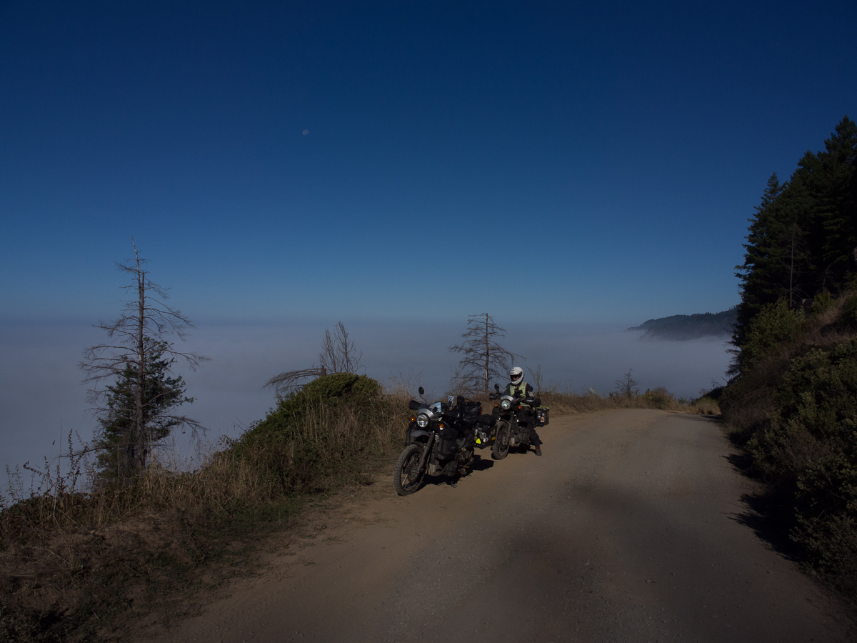
As I lay there, the following morning, contemplating the rest of the route the pines wept for me. Great big splodges landed on our tent. I lay there dreading the moment when I had to get up. I lay there aware of my aching shoulders and forearms. Although the Garmin had not adopted this route latterly, when struggling yesterday, I had been able to see Hwy 1 on it. We had seemed to zig and zag left and right but not make any actual progress towards it. The distance we’d covered, 23 miles at a speed of ten miles an hour, had become a nightmare. Seven miles we still had to cover – new horrors were still to come.
We’d seen one wrecked pickup that had careered off the edge. Jammed in the trees it hadn’t got very far, and looked like it had done so on its roof. The canopy of trees above our heads hadn’t been much of a comfort as the redwoods grow up to 100 metres tall. Look down from the track edge you couldn’t see the bottom! As we set off on the final seven miles we were aware of convoys approaching the beach/campsite. How the hell were we going to cope with meeting a convoy of cars, party intent 4x4s, coming towards us? The sun was also very low – beams carving through the trees.. At times it totally dazzled us. Firstly Gid cried out, ‘I can’t see, I can’t see!’ Seconds later I was screaming too blinded by the sun. The panic in me was rising. Albeit momentarily, I couldn’t even see the road. Gid was leading and beeped his horn at each tight blind bend. He soon stopped as no-one in a car would hear him – sound systems blaring, windows wound up. We did meet a couple of cars. Gid called out, ‘second bike coming’ as he passed them by but one had already moved on towards me. It stopped quickly enough when I came into view but I shook my head at the small gap I was supposed to ride through. It pulled a few extra inches up the edge. I inched past. We finally made it to HWY 1, nerves shredded.
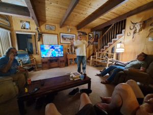
After Reno & Lahontan, we stayed for a few days with our new Bunk-a-Biker host Brian in his mountain retreat, while Gid fiddled with chains, sprockets and swingarms in the garage. It was a great place to be, surrounded by trees up in the mountains in a very quiet area outside town. He had a couple of friends staying and between them they made a comedy trio. Brian was the straight man, Larry the feed and Charlie the clown. It was great fun to be around them. Especially the evening they polished off a bottle of whisky – perhaps a little bit more subdued the morning after.
We were watching baseball the following day and I asked about the superimposed rectangle that kept appearing on the screen and the commentator’s words. ‘That’s a strike!’ Brian stood in front of the TV explaining the rules of baseball. He was simplifying the rules but very focused on giving an accurate account.
Larry interjected, “She’ll never understand that just say it’s this”.
‘Will you be quiet and let me explain!’
Charlie was bouncing about in his chair, chortling and throwing in the odd word just to stir things up.
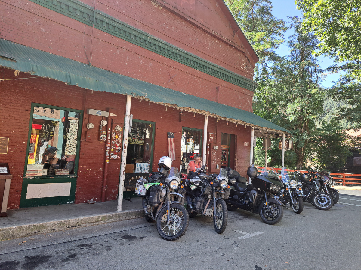
When leaving, the trio very kindly led us out back into Tahoe National Park – it’s bigger than just the lake that we disliked in an earlier post. When they had offered to lead us out I was most concerned that we would hold them up. Their bikes were powerful Harleys and our best speed is 50+. Winding up and down mountain passes we’d be even slower. ‘That’s ok’, they’d chorused. ‘The speed limit is only 50 and no one can go any faster on those roads’.
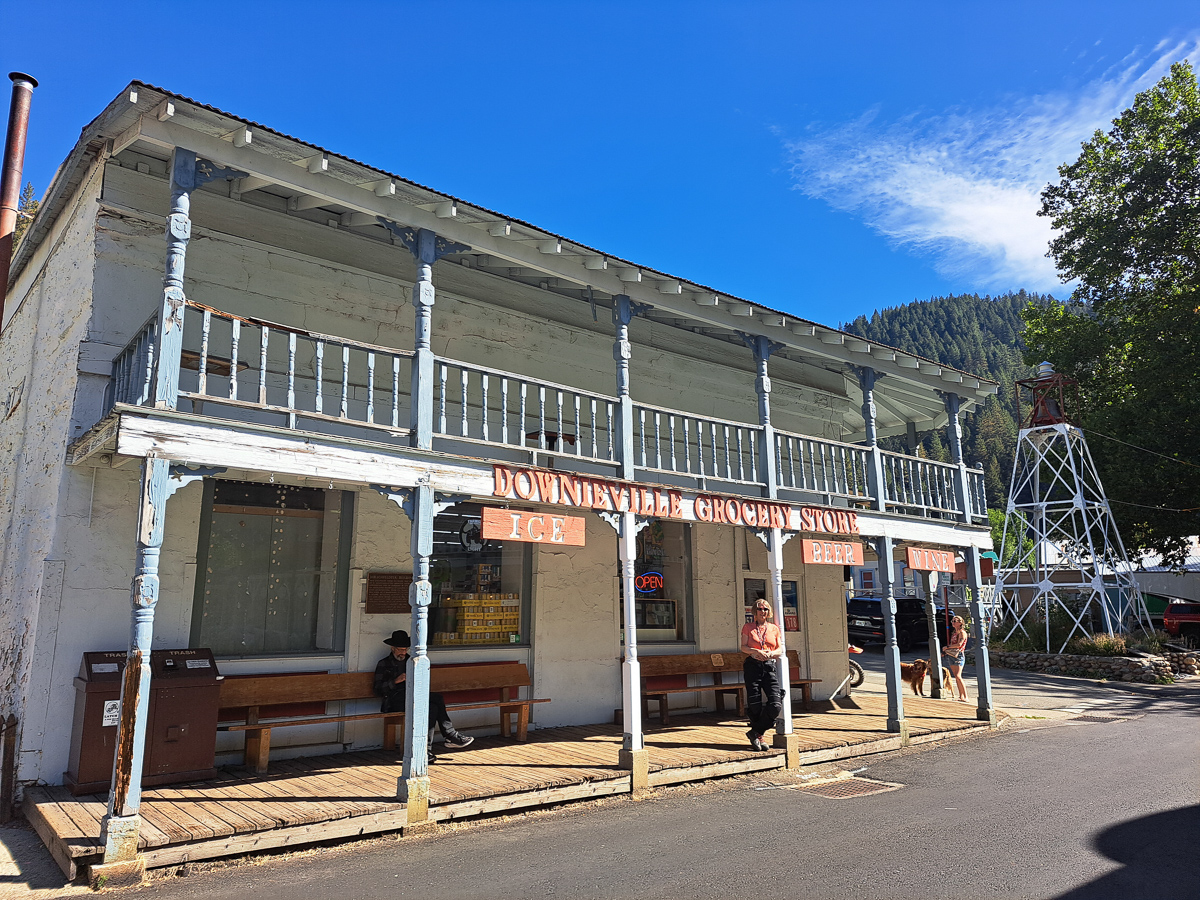
En-route we pulled into a layby to admire the view. Across the gorge was a great view with snow clinging to the mountain tops. We wound our way over the top and down to the breakfast stop. A delightful little old village called Downieville, I wandered off to look at the gallows. The only gallows in America that are still functional the sign states but the one and only hanging was back in 1884.
Following a great breakfast with the lads, four of them now as Richard had joined us, we wandered off to see the town as they set off to do some serious biking. We had our route plotted out – firstly north to the Lassen volcanic park before heading west on the US 36. It was the best road to the coast was the unanimous decision. And no Gid, you couldn’t cut the corner off to reach the Redwood National Park quicker. ‘You’d be missing the best part!’
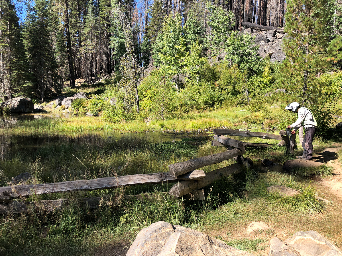
We didn’t do the volcanic park justice. We should have turned right to take us further into the park where we would have seen geysers we’re told but we hung a left more focused on finding a campsite as the daylight was drawing in. The official campground was shut for maintenance, but there was free “dispersed” camping all around, informed the local lady filling her water bottles at the water spring. The only difference really is the lack of a drop toilet (so dig a hole), and a park bench (what are we carrying these chairs for?). So we filled up our bottles and camped.
Dutifully we went the long way round on the 36 and yes it was worth it. Again we went through gorges, valleys and over mountain tops but this time the trees looked half dead but not burnt. The leaves across most of the leafed canopy looked crisp and dull whilst there was a vibrant green sprig somewhere at the top. Were the trees dead or alive?
Trundling along the US 36 heading for the California beaches I was having a rave. ‘Surfing USA – trala la la la’. The odd riff that I remembered from the Beach Boys hit was on replay at full volume – in my head. It was party time, giggling around in my saddle. No 200Watt speakers like the Harleys had – perhaps that’s just as well.
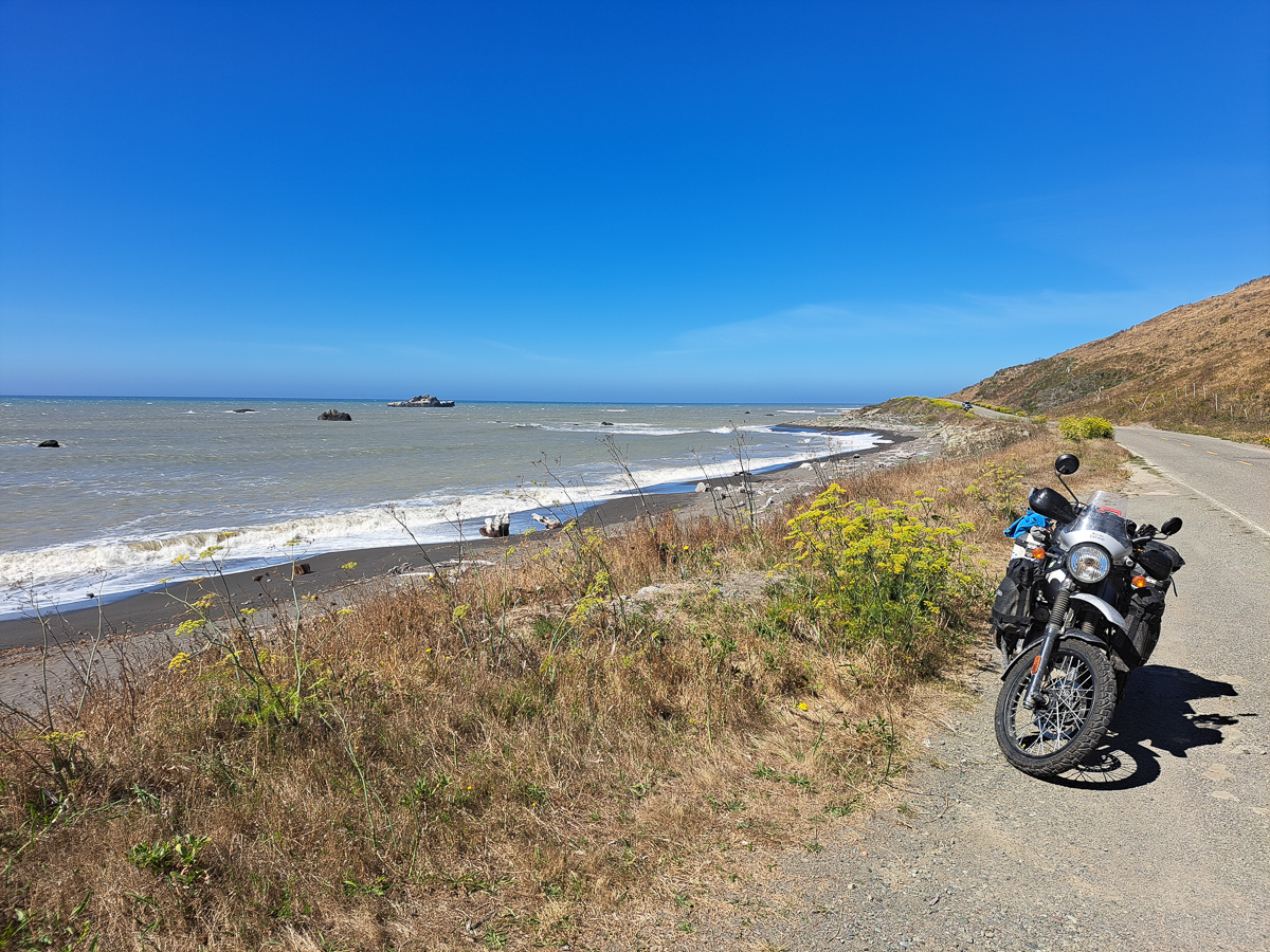
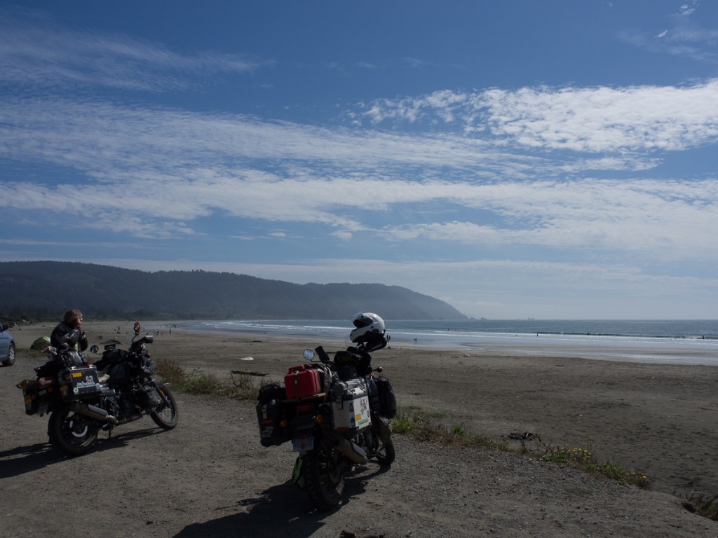
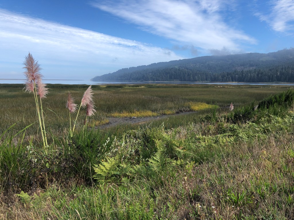
We smelt the sea before we saw it. At Fortuna we’d stopped to put on extra clothing. Down this low by the coast it was cold. Perfectly obvious when you think about it but it hit us as a bit of a surprise. Now heading north up the coast we were equally surprised by the mist. The whole reason why the Redwood trees thrive in this area is the moisture from the sea mist. It keeps the canopy damp. Ferns, slugs and the trees thrive. Our preconceptions of California faded when we saw the beaches – scenic, but minimal waves this week. The few surfers, well dressed up in wetsuits, to keep the chilly California Current at bay were floating around on their boards. Equally, the local towns looked as though they weren’t much benefiting from California’s famous wealth.
OLYMPUS DIGITAL CAMERA
OLYMPUS DIGITAL CAMERA
Camping proved challenging as the National Park was fully booked, we’d arrived at a weekend again – when will we learn? We went further afield to pitch our tent and became tourists for the week exploring the coastal region on foot as well as by bike. The scenic drives were awesome and neck breaking constantly looking up. Yup, they’re big trees.
Our route on down to San Fransico was quite an adventure but the bridge itself was shrouded in mist. Brian was there to greet us at his San Fran residence where later he took us out for a fabulous tour of the city.
Now then, I understand that any literary project (!) needs a theme, or a focus. Well, the theme and focus of this posting is, it’s the bits which interrupted the flow of the narrative in the previous articles. Those are the bits we haven’t photos of – the extensive, super-low-density cities, where scarcely a human is seen, outside an A/C building or an A/C car. Frustrating on a motorcycle, one’s ears might be worn away pulling the helmet on and off – not that said item is compulsory in the mid-west, and one can understand why in this heat. It’s not at all about the very unfriendly Reno Sprouts supermarket whose security ejected us from the car park when we tried to eat the food we’d just bought there, oh no. Well, we are, I suppose, vagrants.
At the time of starting this post, we’ve taken a slice through the mid-west from border state Montana down to Flagstaff in Arizona. Then we’ve turned around and made our we northwest to Reno, Nevada, en-route to picking up the Pacific coast for our run down to Mexico. So it’s a good time to review our mid-west.
The national parks, wilderness and wildlife have been spectacular. But there’s also loads of interest in the not-famous bits: The highways, the quiet towns, the ranges of hills. And, it’s a motorcycle trip, so every so often someone will have to get all anal about bikes. Well, you can guess who writes now, fingers still black from oil changes.
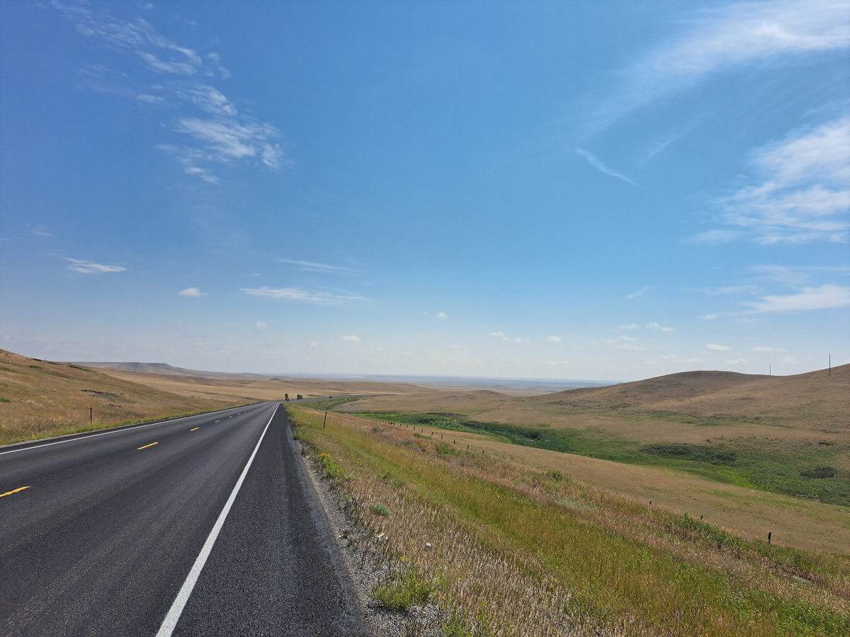
These inland states, abutting the Rockies, are all pretty high. Large parts of Montana, Wyoming, Utah are over 1,000 metres above sea level, if not 2,000 metres. The lowest points in those three are 557m, 945m, 664m – we didn’t visit Colorado, which floats entirely above 1000m. Passes in the mountains routinely exceed 3,000 metres. To think that our travel insurance company’s first policy offer had an altitude limit of 1,000 metres! That would have given us a very odd, frustrating, maybe impossible route, certainly not this inland one. As it is, Highway 89, and our diversions, have been splendid. Most of the roads are lightly trafficked. There are long, long, straight, flat sections, as per the classic photos, but also interesting little towns, hamlets along the way, and every so often, it goes all wiggly to get through a range of hills or mountains. Highway 50, east to Reno, is bleakly spectacular. We nearly had to resort to the fuel cans, it was so empty. Clare’s Garmin – I have no idea why it was even turned on – produced gems like “Turn left in 150 miles”. But such long runs make the stops more interesting.
And being summer, far from the sea, it’s hot in the daytime. Very hot, although locals say it gets a lot hotter. Clare forked out for some basic mesh riding trousers, her posh Staedler suit getting too hot. I was in mesh from the start, but was latterly in not a lot underneath (sorry). As soon as the bikes halted, we made a rush for shade, ripping off gloves and helmets as we scuttled. It was often much cooler overnight, so camping was still ok, especially if there was shade for us after getting up. And from Montana, onwards, increasing as we prairie’d south it was prone to very wet thunderstorms in the afternoon or overnight.
At some of the stops, time itself seemed to be running a bit slow. Some of route 50 follows the old Pony Express route, and at Middlegate, an old Pony Express stop and the only gas for miles, no, leagues, four generations of the road house’s family were in the bar, albeit only the latest was working (and was she busy!). What was it like in great grandma’s day? We were too tired and thirsty to ask her.
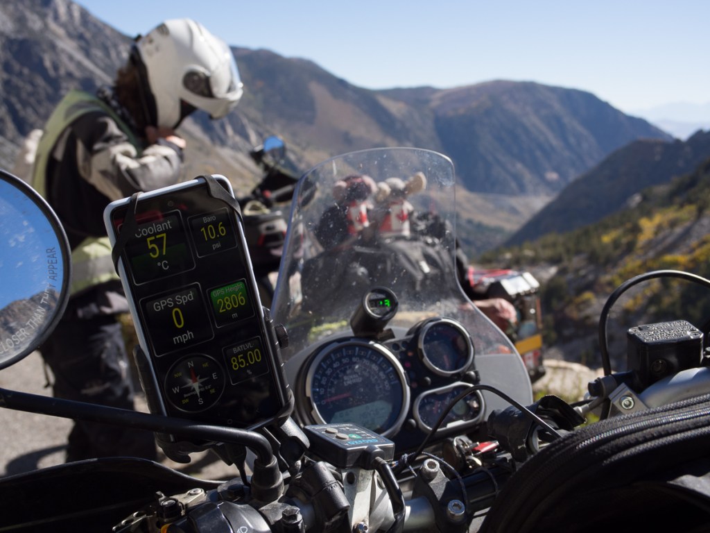
The bikes have been struggling a bit. Let’s hope we get the math right here. A rough rule of thumb, apparently, is that an unsupercharged piston engine, like our Himalayans’, loses 3% of its power for every 1,000 feet of altitude. So over 6,000 feet or 2,000 metres, we’re down from 24hp, to 20hp. Quite a difference, and we’ve been well over that at times.
Look at the top right diagnostic – about 70% of a sea level value. This was in Yosemite.
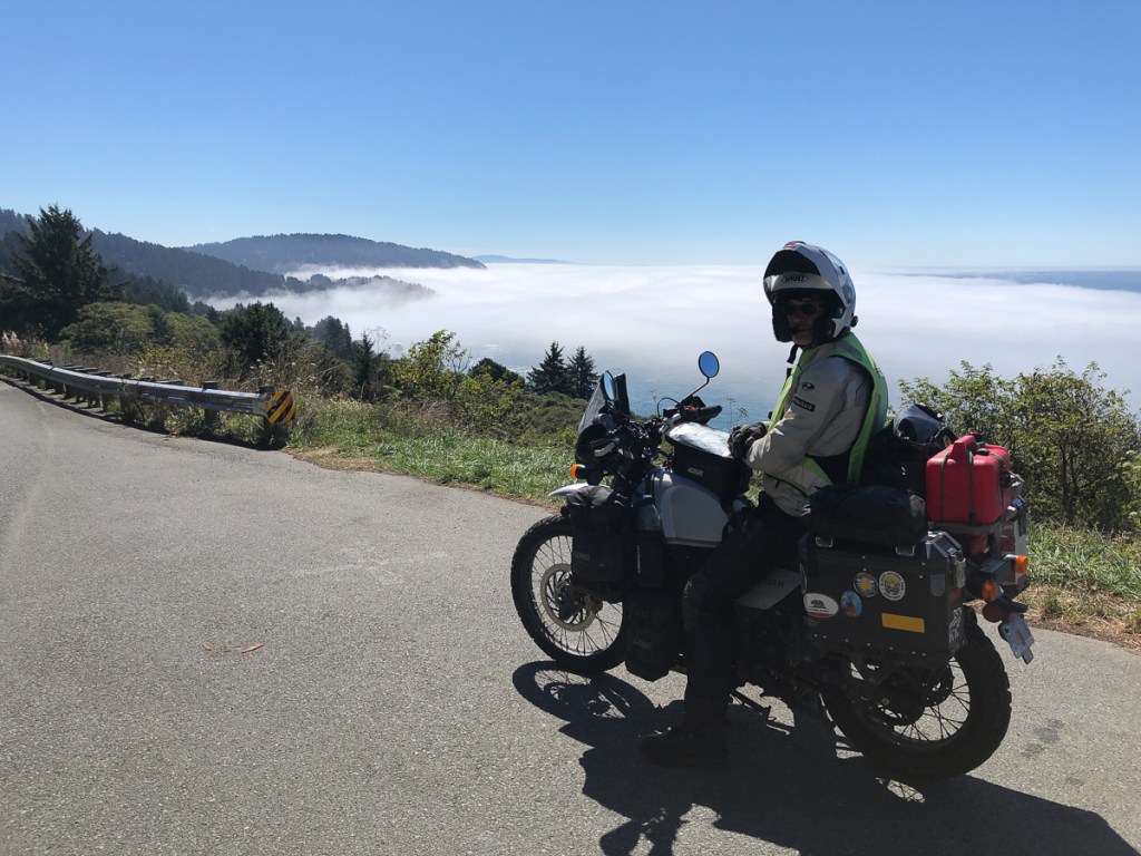
And – thanks to the wonders of our Bluetooth diagnostic connectors, we can see our engine (oil) temperature go up and up, in the thin, hot, air. Some advice is that engine oil will start to deteriorate over 150C, and trying to keep it under that, at 2,000metres, in 37C air, often keeps us down to 40mph on climbs, even though the bike will manage a lot more. Descending to the northern California coast (cool and foggy), the bikes recovered a hearty spring in their step, and would again cruise at 60mph – although that’s rather noisy in our helmets, 55mph is a lot better. It’s a good job we’re mostly on quiet roads. In rural areas, as anywhere, the drivers are fine, but standards, courtesy, and personal space concepts are much eroded in cities. Only one guy tried to give us an earful: wheel in one hand, gesticulating wildly at us with his phone in the other, it’s most likely he’d looked up from his texting, and seen us at the last minute. I’m not sure that’d been our fault.
We’ve been trying to keep fit, despite leaving behind all our swimming and cycling and tennis. Clare’s got a skipping rope, and I (Gid) try to go for a run every so often. “Swimmers lungs” Clare rarely notices the altitude, but I was thinking I’d got really unfit, until I twigged I was running uphill at over 2,000 metres. Some of these runs feel quite exotic – out the back of the campsite, there’s often a trail. Deserted. Nobody visible, not even a plane in the sky. No sound except wind and birds and squirrels scuttling away. Well, and me puffing if it’s uphill. Another new running experience was Lake Lahontan, where I managed maybe 5Km barefoot on the firm sand beach.
Let’s finish with some random mid-west Americana and highways.
Apologies, we’re a little behind with our blog: It’s now October, and this relates our time in Arizona and Nevada, 25th Aug to 7th Sept. More soon!We also had a bit of an IT disaster and lost a lot of Clare’s pictures from August and September, so the imagery isn’t what it should be.
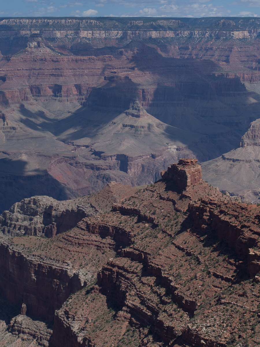
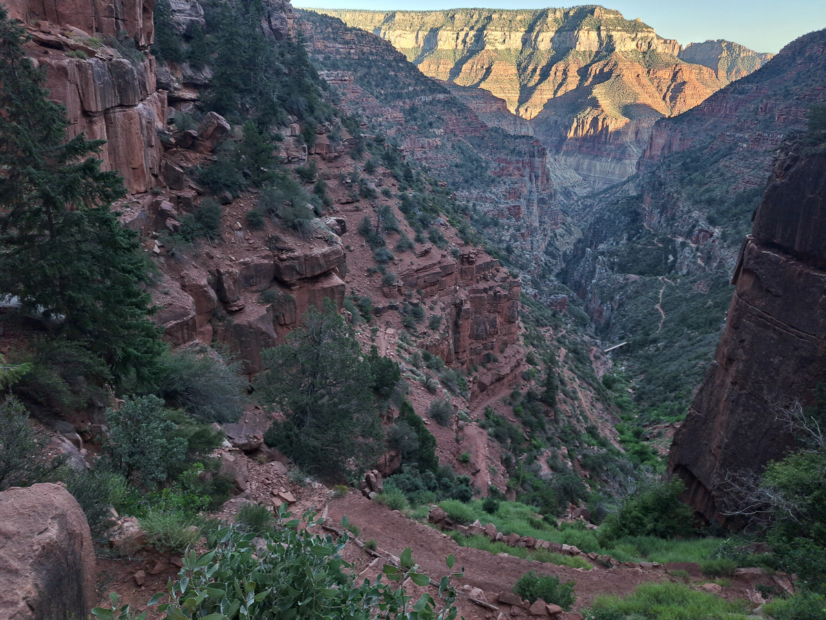
Next on the list of must see destinations was the Grand Canyon. Having done our homework we knew that the Northern rim was thought to be the more spectacular of the two. We set off from Flagstaff heading in totally the wrong direction – southwards. We wanted to take in the scenic roads that were either marked on the map or had been recommended by other bikers. But we were in luck – to get to the northern rim – we had to ride along the southern rim – bonus! Being a weekend the super route out and round to the south was rather over crowded and we were happy to get out of it but crowds were something we were going to have to get used to as we reached the more populated areas.
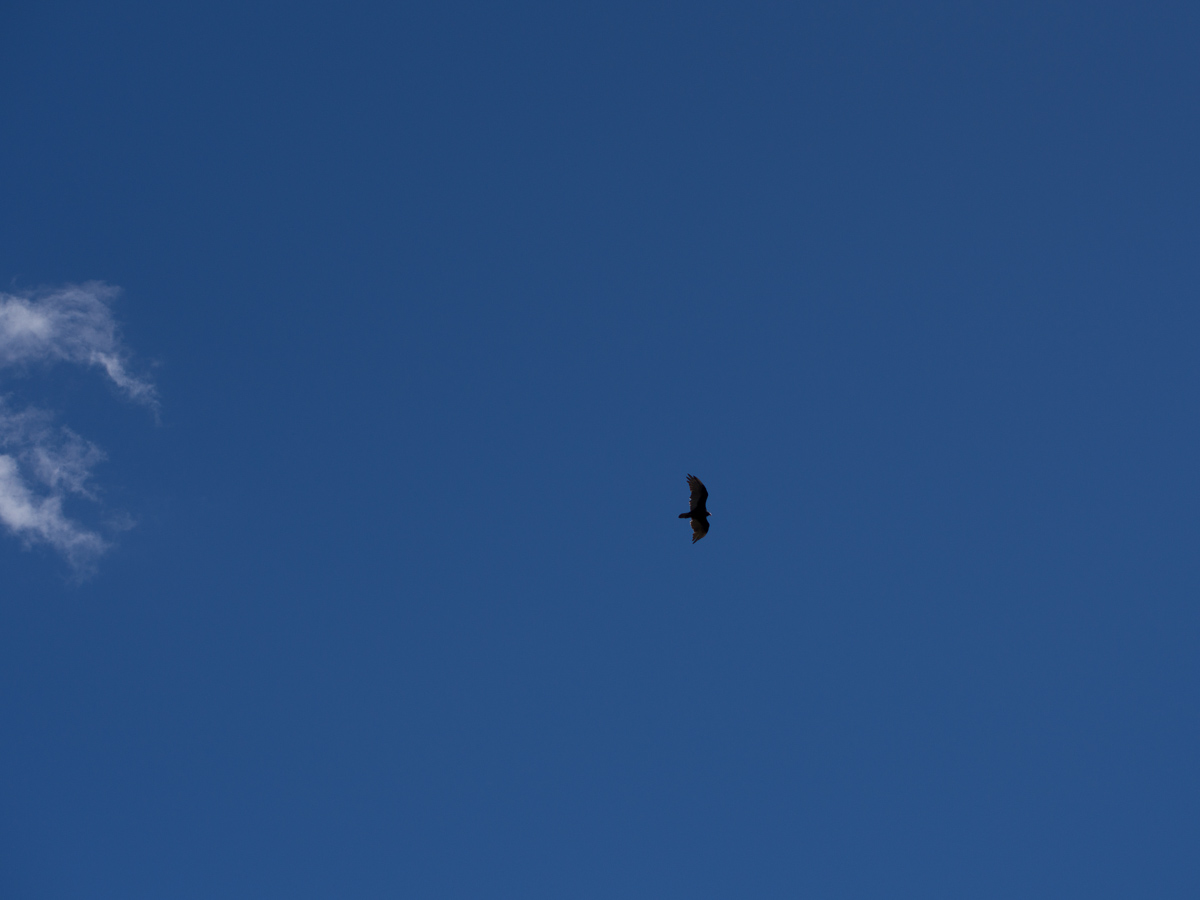
Along the southern rim we stopped at three vista points and learnt that the gorge was formed by opposing tectonic plates clashing and forcing each other up. This created a raised plateau. From there the Colorado river cut through the rock. Because there is not enough information left geologists don’t know why the river didn’t take an easier route around the outer edge. The high levels of silt carried by the river have carved a deep gorge which continues to cut its course to this day. The gorge was beautiful but the vultures stole the day. Several vultures and some falcons rode the thermals swooping to and fro right in front of us. ‘Have you got it? Have you got it?’ we cried as another swept past.
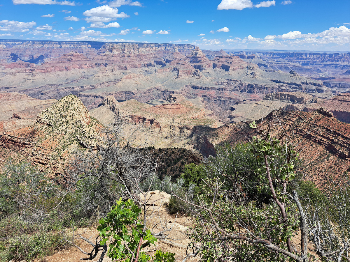
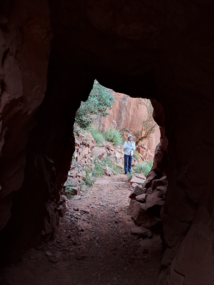
Up at the Northern rim an elderly park guide was enthusing to us about the benefits of doing the North Rim road. He told us that there were many viewing points and it was good use of our time. But Gid was keen to do one of the walks. Neither of us considered the whole day North Kaibab trail. An 8 mi down 8 mi up marathon but we did think we could do one of the shorter ones. Was there time for both? ‘Of course there was,’ I exclaimed. And off we went.
On the rim road the information boards were very useful although I couldn’t see the ‘obvious’ fault lines on the southern side of the canyon. We were excited to glimpse the Colorado river on a number of occasions as we stopped and started along the route. We seemed to have swapped the birds for some views of the murky river. I was pleased we’d seen both sides.
We hurried back to the start of the scenic tour road to pick up the hiking trail. It was 5:15 when we set off on what was described as a 2-4hr hike. We had torches and had been advised to take more water which we dutifully got. Our walking speed is middling on most timed trails so I was predicting our return at around 8:15. It’s dark by 8. On a very uneven track how good was my torch? Gid normally leads down hill and me coming back up, but I set off at a fair pace. I wasn’t messing around we needed to speed this up. Meeting a few people along the way was encouraging. They were all on their way back but it was still nice to know we weren’t totally alone. A few ‘not far now’ comments gave us encouragement but meeting a father and young daughter a few hundred metres short of our destination, Supai Tunnel, was quite a surprise. We went through the tunnel, gazed down at the zig zagging path disappearing into the depths of the gorge and were ready to turn back. One couple we’d met had done the whole day hike. They’d set off at 8 in the morning and were on course to make it back completing their trek in just under 16 hours.
We made it back in good time just about catching up with the youngster and her dad. Amazingly we did the round trip in just over two hours with just enough daylight, to pack our kit and set off back to the campsite.
We hadn’t got far the following morning before stopping for fuel. Parked on the apron was a Royal Enfield Continental GT. Paying for our fuel in the garage it was obvious who the Enfield belonged to. This distinguished gent with a broad grin, a thick red beard and plaited hair readily admitted it was his bike. We asked him about the unusual racking system he had and his tin seat. Out we went to look at them. He enthusiastically told us about his project to reduce the weight of the bike. He lifted up the tin seat shaped to fit the gap between the metal rods and read from the bottom what the old seat had weighed and what his new tin seat weighed. He proudly declared weight the saving. He repeated this exercise with the side guards which were now leather flaps with another recorded saving. The next project was the rear rack he declared. That was trickly though as it had to take the cat. At first I thought the bag of empty 5lt water bottles somehow housed the cat. The cat, his travelling companion he informed us, was out prowling around back at camp. The cat, he told us, could only manage three hours at a time on the bike. With that saddle I’m sure I couldn’t manage any more.
Jamie Burns, the distinguished gent, had never been to Scotland even though he was directly related to Robert Burns the infamous Scottish poet. ‘I can’t go!’ he exclaimed. ‘I’d have to set foot on English soil and I’ll never be doing that.’ A little later Gid pointed out the he must share some considerable empathy for the Native Americans with the atrocities that they suffered at the hands of the new settlers. But he seemed to be handling American soil ok.
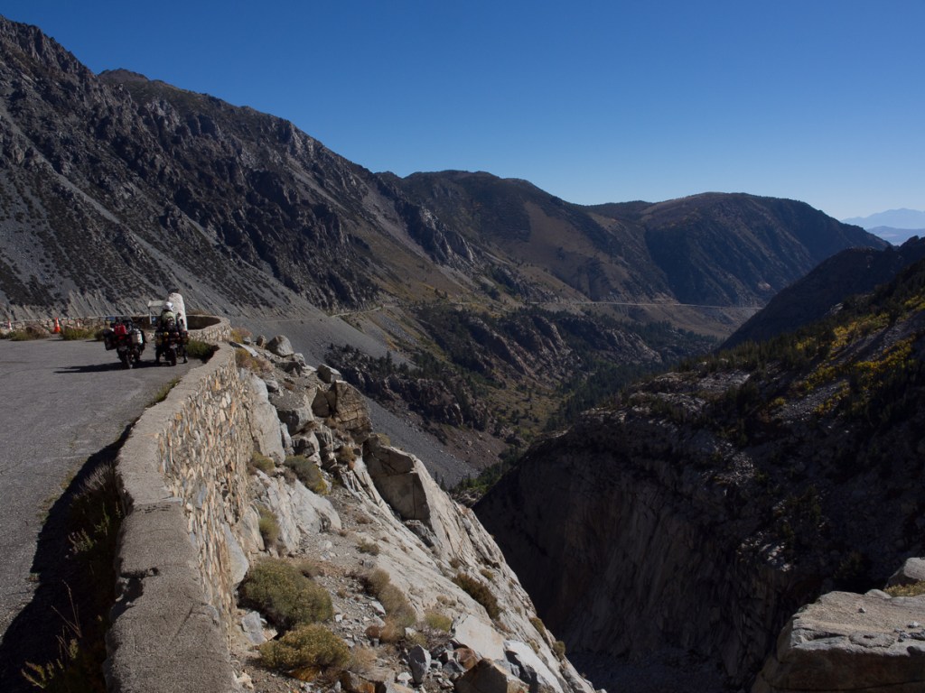
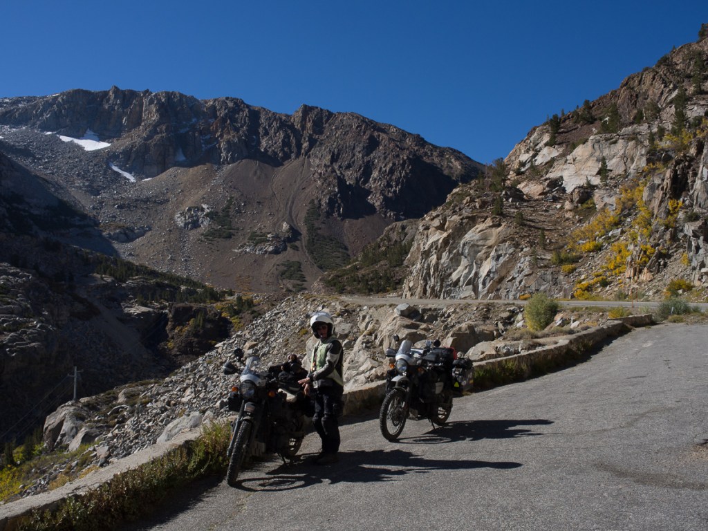
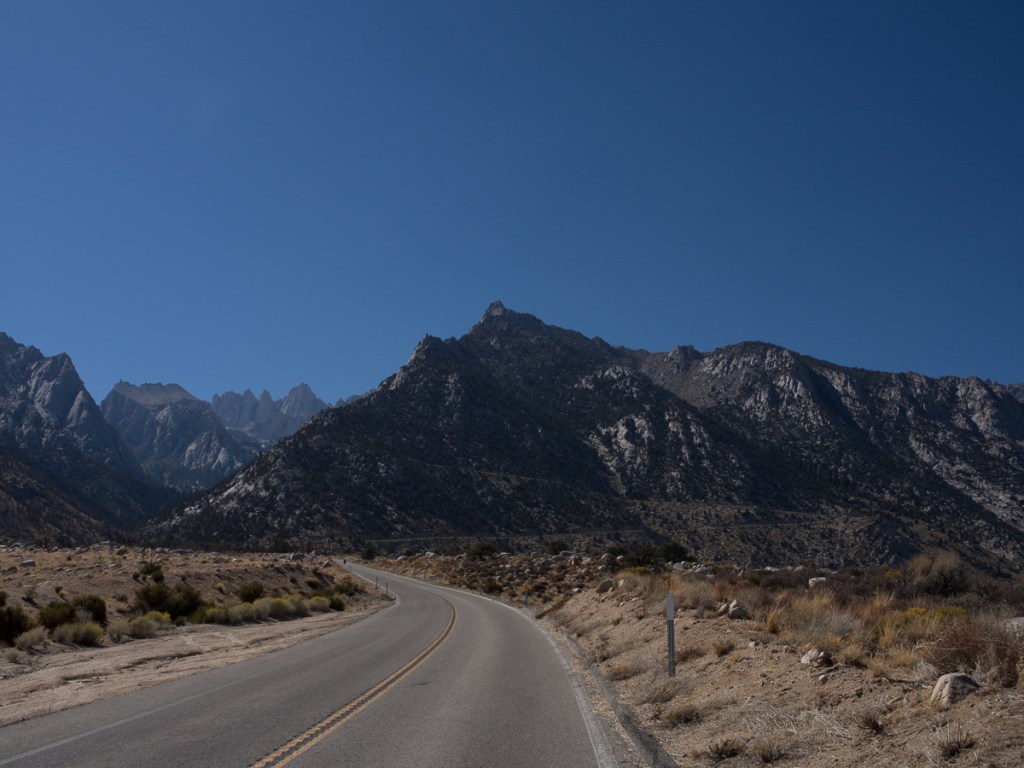
The Grand Canyon, Petrified Forest and our stop in Flagstaff ticked off Arizona: We were making good Pan-Am progress towards Ushuaia, on the southern tip of Argentina. Next stop Mexico? Nope. North westwards to northern California. We couldn’t miss the Pacific coast and the redwoods. So we turned, heading back north up towards the northern tip of California. We aren’t fond of megopolises, so for the second time, we avoided Salt Lake City, and this time, Las Vegas too progressing diagonally between them. We’d soon have 12000mi under our belts so we chose Reno, Nevada, for a service stop. It’s big enough to have everything, but not oppressively huge. Airbnb host Tyler was ok with us changing oil in the shade of his carport, and Royal Enfield dealer Eurobikes had got the service parts and our three new tyres in.
We headed westwards towards Reno along Highway 50 crossing the often empty Nevada, which passes just south of Reno. It’s dubbed ‘the loneliest Highway in America’ and served us well as it had little traffic. The section we travelled from Ely to Silver Springs traversed great plains where there was very little to see except the next mountain range to cross. It took ages crossing each plain, then we’d ascend up the mountains. Most roads carve a pass through the summit with rocky cliffs towering on either side. Pancake pass – 1988m – being the unusual one because it was flat.
The Pony Express central change over point at Old Middlegate Station on HWY50 was a wonderful choice for a stopping place, full of memorabilia with posters for ”Wanted’ criminals – Dead or Alive’, legalised prostitution advertisements and pony express riders job offers not to be missed. Providing, that is that, you were under 18 and preferably an orphan who was prepared for high risk and possible death from their chosen employment. The place was stacked with relics from the past both inside and out. A quaint mix of old and modern as the petrol pump boldly claimed ‘no lead’. Not now perhaps but there’s been no shortage of lead flying around this place I’m sure. To add to the authenticity signage pointed out that Ned Kelly’s house was a stone’s throw away.
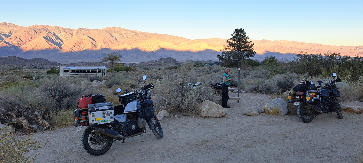
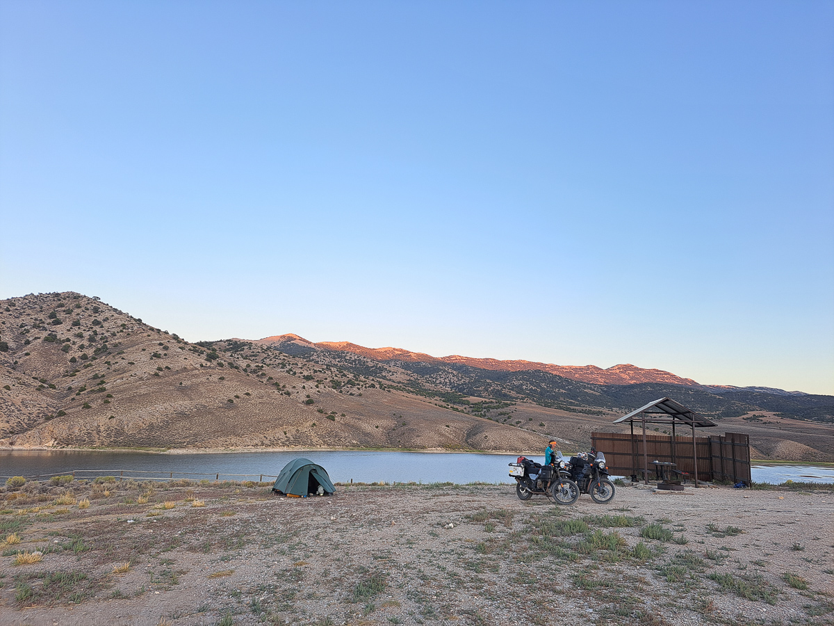
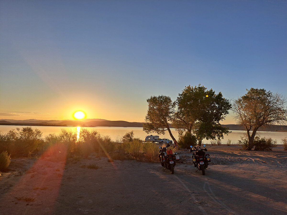
Our arrival in Reno was a little bit complicated, as we’d booked the Airbnb for Sunday onwards, not realising Monday was Labor Day. Eurobikes and almost everywhere would be shut. We needed to be close by Friday night, ready to hit the store Saturday morning to collect the service kits. Experience told us that even ordinary summer weekends could crowd out the campsites leaving us struggling. Lake Lahontan State Park was 30 miles out, a big reservoir with sandy shores, it seemed like a great retreat. We arrived with some trepidation about availability, but paid our fee at the unattended gate. We’d hoped for a pitch we could swim at, but there was a Red Warning stating that the lake was unfit for recreational purposes because the algae levels were unacceptably high. Oh no! But we trundled round the shore, surveying the ad-hoc camping. We found a beach spot facing the sunset: firm sand to park, soft sand and shady trees to camp. One RV right down on the shore was 50 metres away. The next units maybe 200m one way in a thicket, and 1000m the other. On this side of the lake, people were swimming. Definitely one of our nicest sites! We stayed two nights, enjoying a starlit evening chat with the neighbours.
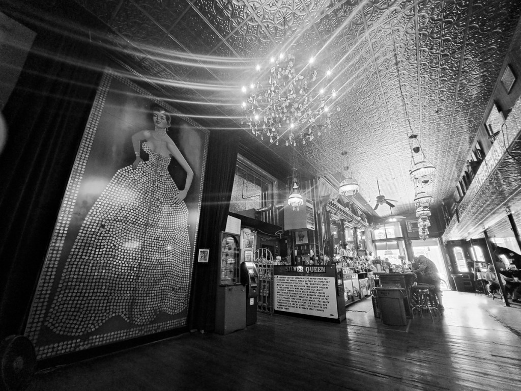
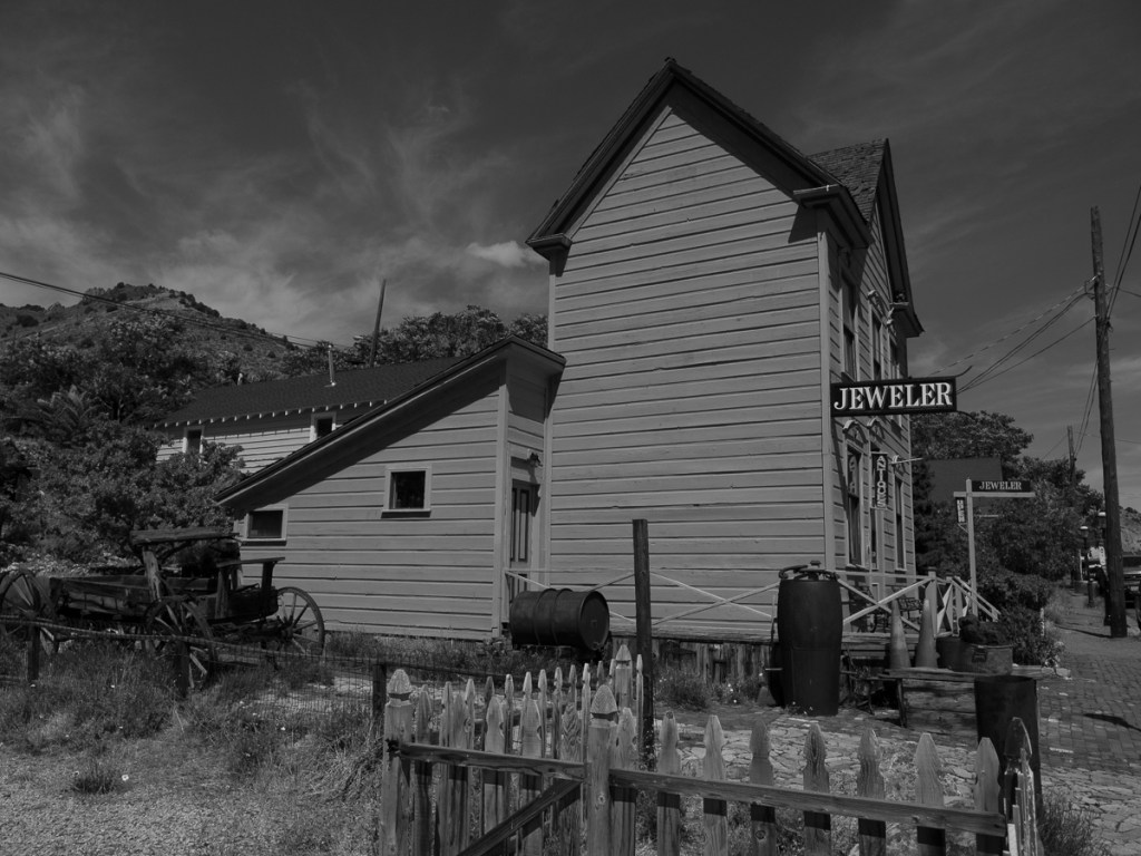
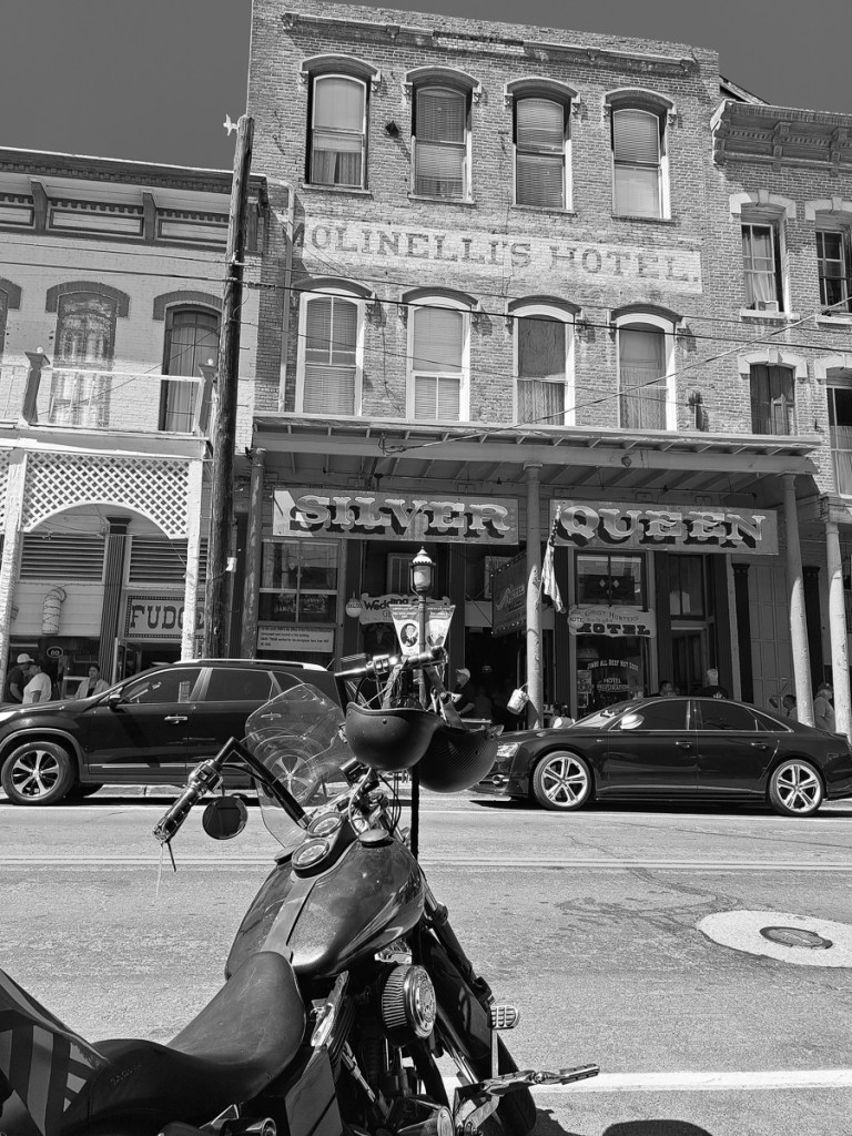
It was a short freeway ride to Reno on Saturday, but to return, we saw a wiggly back route going through Virginia City and tried it. It turned out to be a local bikers’ favourite. Virginia City – City it says. Obviously swayed by the city part of it’s name I was expecting something big. Bigger that is than a half mile main street, and not a lot else. Rather than the boom and bust of many towns where a natural resource is found, Virginia City, once the mountain of silver under the city was depleted, has managed to maintain prominence albeit now as a tourist attraction. Its high street is frozen in the style of 100 years ago with original buildings and facades, as are the rickety board walks beneath the overhangs. There are tourist attractions like: the Silver Queen Hotel where the lady’s silver dress is a floor to ceiling art work modelled in silver dollars mined beneath the city. There are many saloons, some with swing doors, eateries and tat shops, and events like camel races for the more competitive amongst us.
OLYMPUS DIGITAL CAMERA
Mark Twain, at least his wax model, peers out of one window where he used to work as a newspaper reporter. Words such as ‘never let the truth get in the way of a good story’, accredited to him, live on. His famous novels, Huckleberry Finn and The Adventures of Tom Sawyer still make it onto many a reading list. The local museum claiming ‘Of great interest to adults and children’ displays many relics from past life in the area. Virginia City became our regular route between Reno and Lahontan.
The servicing went to plan. Having done it all before it was quicker this time. Now Gid is becoming familiar with the process he’ll let me play too – next service I hope to do the oil changes.
We’d noted the bike chains had needed occasional adjustment, but annoyingly, as we approached Reno, Gid was having to tighten them every couple of days. Knackered. We ordered replacement chains and sprockets at the Reno dealer but RE gave no delivery date. Were they coming from Wisconsin or Chennai? We decided to wait into next week before requesting that they might be posted forwards. The dealership had a branch at the coast and was happy for us to collect them en-route but we couldn’t continue to stay with Tyler. With time to kill we needed a new home.
To get away from the bustle of city while we waited we went off to explore Lake Tahoe. Our Lonely Planet guide book describes it as a very popular location for winter skiing with slightly fewer visitors in summer. Wrong! It, or rather its shoreline, was teeming with people. Adding to the frustration most campsites were closed because the trails were being repaired and supplies were dumped in campgrounds. We u-turned and got out of there as fast as possible, riding right back up the 9,000ft pass we’d come in on, returning to Mt Rose campsite near the top. It was beautiful. Pine trees spread around large boulders – the sort of things that are called erratics in Norway having been randomly dropped by the receding glaciers but here they were at 10000 ft high! It was beautifully peaceful, until the generators started. The site host agreed that it was a beautiful area informing us, with a wry smile, that the noisy school group had left 2hrs ago. It was nice for one night, but we couldn’t think of a better option than returning to Lahontan. The exact same spot, and now the nearest neighbours were maybe 2km away. No cossies needed.
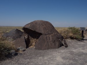
Having missed petroglyphs at the Petrified Trees NP I was keen to see the ones in this area. Grimes Point, the site of the petroglyphs and the Hidden Cave, wasn’t far away and reportedly had the best examples so it had to be done. We would have liked to have seen the Hidden Caves, also at the site, but on contacting the area office to arrange a guided trip we were informed that due to sickness that was off. Thousands of years ago the Hidden Cave appears to have been a site of storage: furs, tools and remains of clothing were found there. It’s under lock and key now to preserve the site for future generations but our wished for visit wasn’t going to happen. On the self guided walk around the petroglyphs, the boards told us that human habitation in the area dates back to 8000 years ago. Lahontan Lake, now some 20-30 miles away where our tent was, would once have been lapping the edge of this area. The boulders, plenty big enough to hide behind, would have been the perfect site to hunt the animals who came to drink. Shaman, responsible to communicating with the gods to ensure a successful hunt, may have been responsible for the pecked or carved rock art.
Finally – good news – the chains and sprockets were in. We’d already been on Bunk-a-Biker and made contact with a friendly soul who offered us a bed, a workshop, and a breaker bar, just over the border in California. We were off again, albeit only for 60 miles.
After the stunning views of Monument Valley, and the rocky heat of Utah, we decided to stop in the small city of Flagstaff, for a few days of motel civilisation over Clare’s birthday. It might also offer some wifi and shops, for practical things. Ok, it was the cheapest motel in Flagstaff, but it was comfy enough, especially after a small tent.
A relaxing few days, that was what it was supposed to be. I’d discovered the Petrified Forest National Park when idly looking through some advertising info. We’d planned our next day – setting off from Flagstaff and doing a relaxing loop along scenic roads. The Petrified National Park was only an hour and a half away. Of course we could do that in a day.
In a day maybe but we set off at 1.30. Gid was totally occupied with trying to pull together the resources for our next bike service, at 12,000 miles. The bike specific service parts, and a location where we’d be permitted to do our oil change (think about it!), the latter needing to have a cover as now we seemed to be subjected to extreme sun and monsoon weather with massive amounts of rain most afternoons. And tyres this time too. Both front tyres are wearing smooth in places and Gid’s rear tyre has worn rather quicker than one would expect, and we had been very lucky in Whitehorse, where we’d previously got tyres, to find shops actually holding stock – normally an order has to be arranged. On top of that our chains were now showing considerable signs of wear. After thousands of miles where they appeared not to wear at all, suddenly Gid was tightening them every 500 miles. End of life was near. Whilst the chains themselves are sort of standard, the sprockets are not – again an order has to be placed… somewhere. Where? When?
Gid’s been quite concerned about his bike pulling slightly to one side, which may explain the fast rear tyre wear. On a number of occasions he has been doing the ‘no hands’ bit to check how true the bike would run. Initially his conclusion was that it was pulling to the right ‘How does yours track?’ he’d ask me. So once again I’d be going down the road with my hands in the air. Mine seemed to run quite true but I wasn’t that keen on going hands free with a fully loaded bike. We’d done this sort of thing on the i2i course back in our early days of learning to motorbike. It was about improving our balance and skills but I will never forget when I very nearly ran into the back of a car when going hands free and reading my comic returning from my newspaper round early in the morning, many decades ago! Gid had tried to correct the error by relieving the fork clamps and next, tweaking the rear wheel alignment to pull the wheel slightly to the left but that had made it worse. A couple of tweaks to the right had improved it but he wanted it professionally checked. The Royal Enfield dealer in Reno, our place of choice, was fully booked for the next two weeks and we’d be there in a few days. Our preferred Reno accommodation, Air B&B host Tyler, with a car port, couldn’t extend our stay to take account of the delays with some of our service parts arriving later than hoped and we definitely needed the shelter to work on the bikes in this weather.
Before leaving America we are going to do one final loop back up and round to take in the coastal road – HWY1 as it’s supposed to be another of the ‘can’t miss’ roads. Another two thousand miles perhaps but that will be our final lap in the US. From there we’ll be down in Mexico. How easy will the servicing be down there? It might be affordable not to do it ourselves (a DIY oil change and check over costs $200 for both bikes, a DIY valve check is $0, USA dealer shop prices are about $1400, this for a 6,000 mile service about every 7 weeks). But everything might well have to be arranged in Spanish.
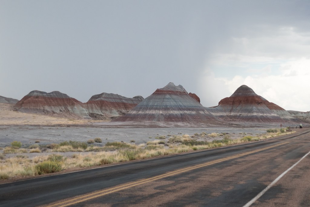
From Flagstaff, starting after lunch, it took us a couple of hours to reach the Petrified Forest National Park. We went into the museum and Visitor centre. Gid had read that in minutes it seemed – I took more than an hour. I knew how petrification took place – vaguely, but found the information fascinating. 200,000,000 years ago back with the early dinosaurs all this had taken place. It explained on a time-line that if a year was the wakening of the journey of life on earth the early life was about the summer, dinosaurs the autumn and man was the last 15mins – 11:45 on the 31st December! Back with the dinosaurs these trees had fallen down into the river/stream been covered in silt and gradually turned to crystal, absorbing colour from the minerals around them.
We wandered off through the exhibits . But again Gid hadn’t been totally ‘in the moment’ as the pressure of the servicing was all consuming. I’d offered on a number of occasions to pull my weight with the mechanics but my approach is far more laid back. ‘I wasn’t even doing my POWDDERSS checks every day,’ he’d chastised me. No, barely once a week to be truthful (Gid says: Not even sure that’s true!). I’d need a lot of support the do my own servicing and clearly it was far easier for Gid to do the lot. Then he’d know it was done properly, was clearly in his mind!
As we wondered round the exhibits I read some of the information but Gid was pressing forwards. I think he did relax into the event but only briefly as ominous clouds were brewing with lightning flashes signalling the storm to come. Once back at our bikes, whilst looking at the weather Gid asked what route were we talking home? ‘Through the park and the Painted Desert‘, I’d replied. He queried if I knew how long it was and suggested that I came back to the Visitor Centre to look at the map. Yep, I knew how long it was and that it would probable take us another hour or so. This was my trip – through the park we went but I had agreed that we wouldn’t stop at any of the other sites along the way. It was rather a dramatic ride, with lightning flashes on both sides of the road and strong winds.
Arriving ‘home’ at eight o’clock Gid was straight into service mode urging me to focus on our campsites for the next week leading up the our arrival in Reno. I’m not sure he’d thought of anything else all day. We’d booked the Air B&B for Sunday night but of course that meant we couldn’t pick up the service parts during the day. I was still in Petrified Park mode. I sat and read the booklet I’d picked up and was rather sad about the things we’d missed – petroglyphs, we’ve seen some before and very much enjoyed their creative form and direct link to so much history, and we’d missed the longest petrified log in the site together with some wonderful views and walks around the Painted Desert – an area of layered rock showing different periods in history as different sediments had left their colours of rock behind – one building on top of the other.
It seems there are more opportunities to see petroglyphs and many areas we have ridden through have got vivid rock colours displaying the high mineral content in this area.