Costa Rica

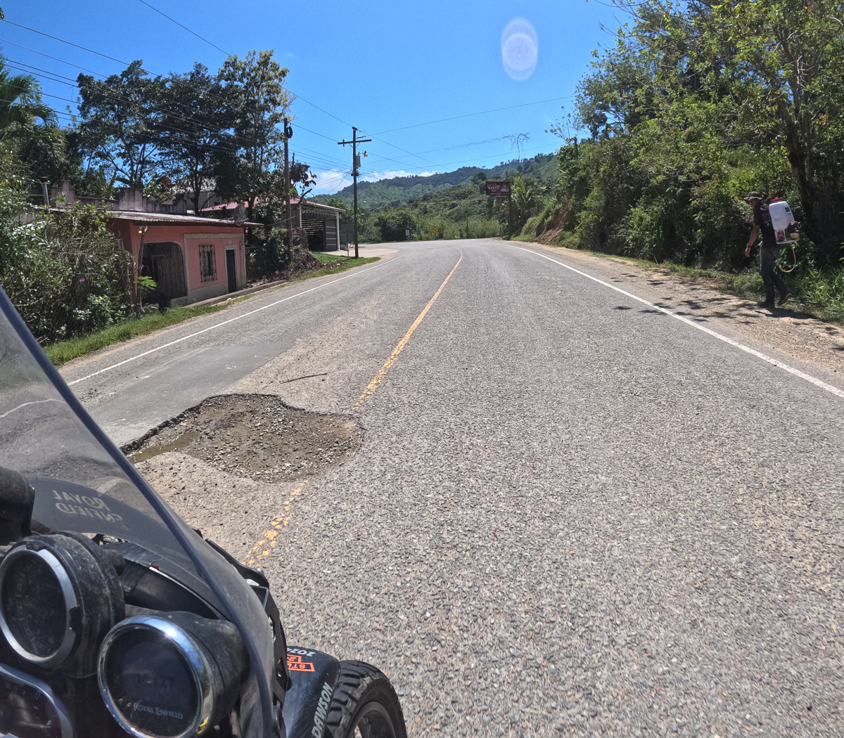
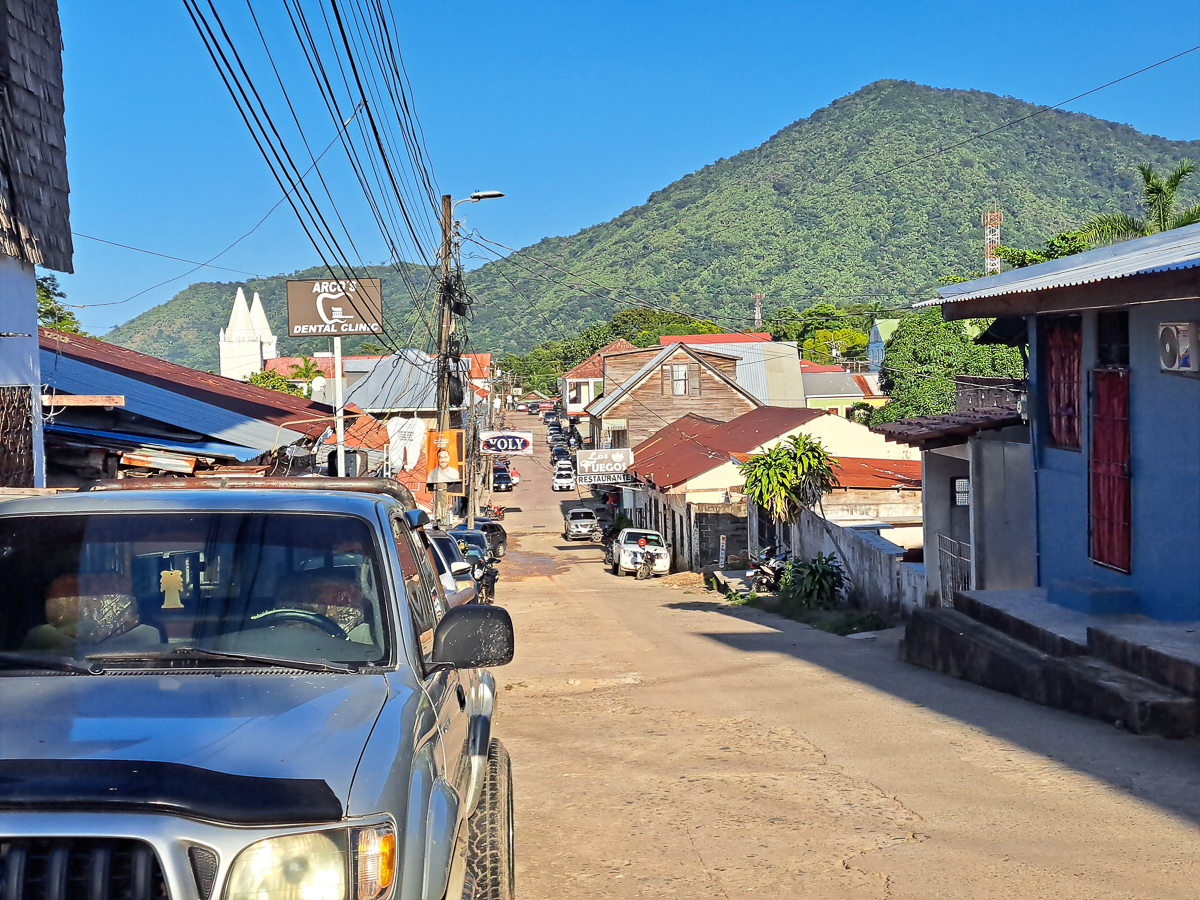
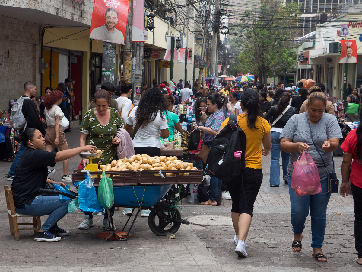
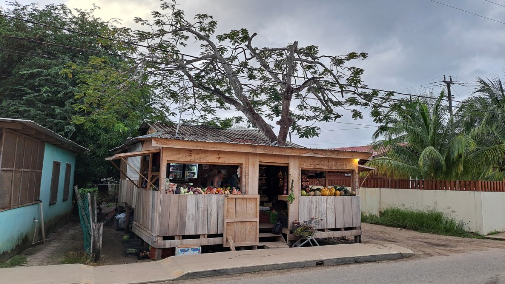
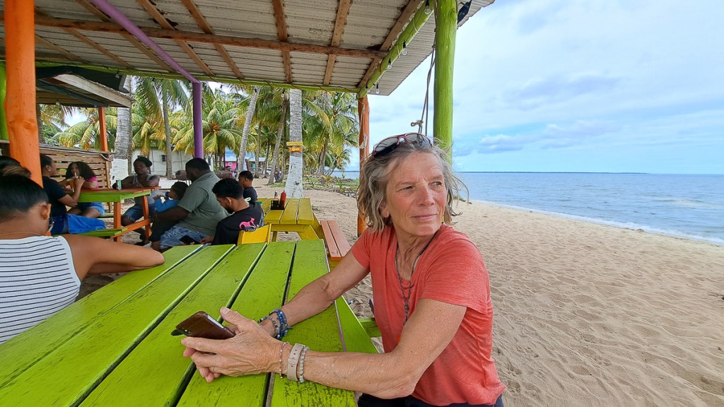
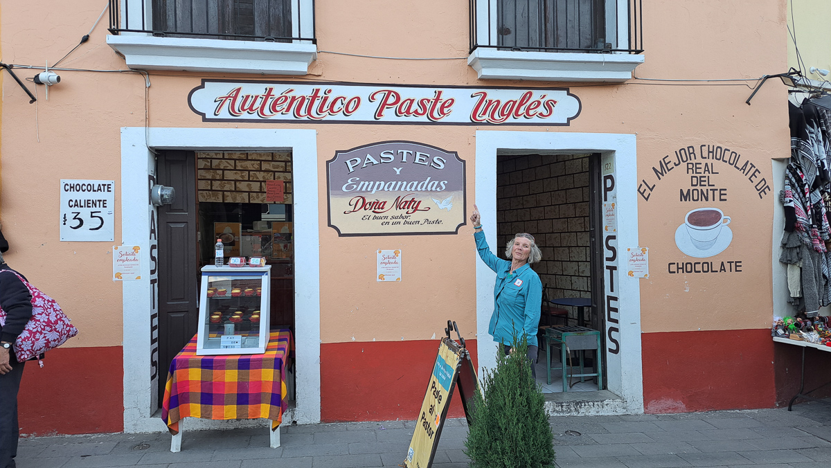
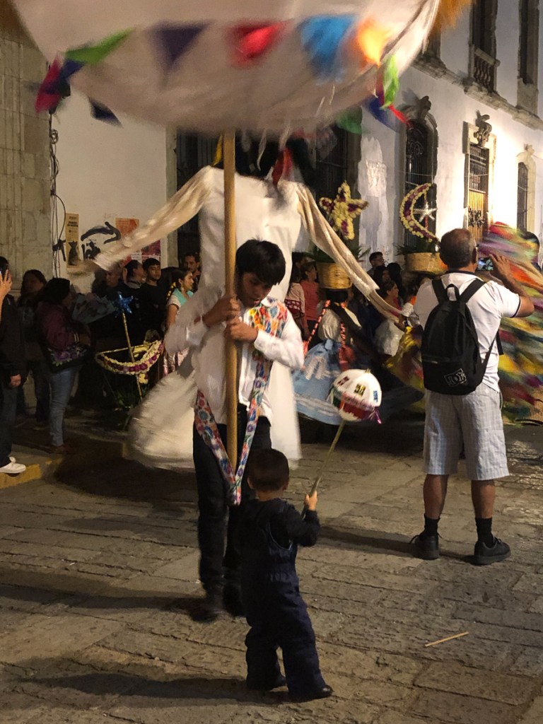
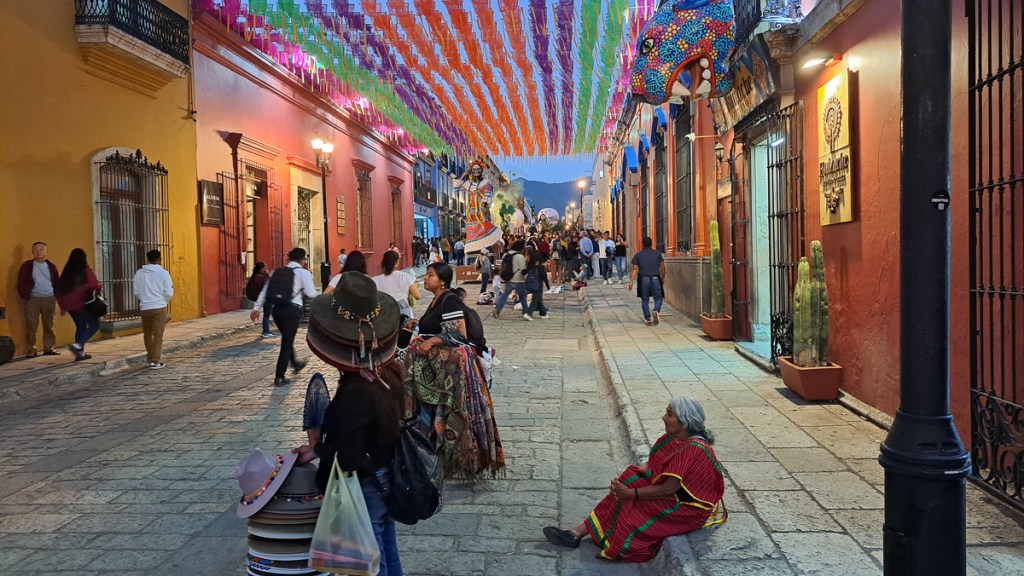
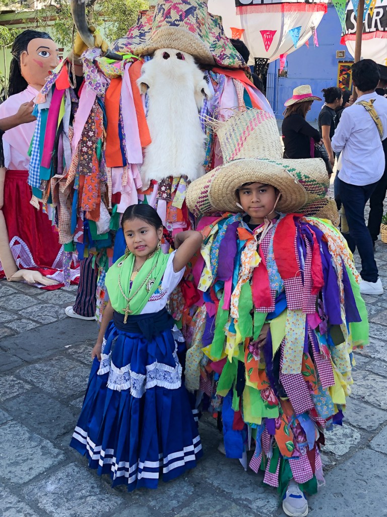
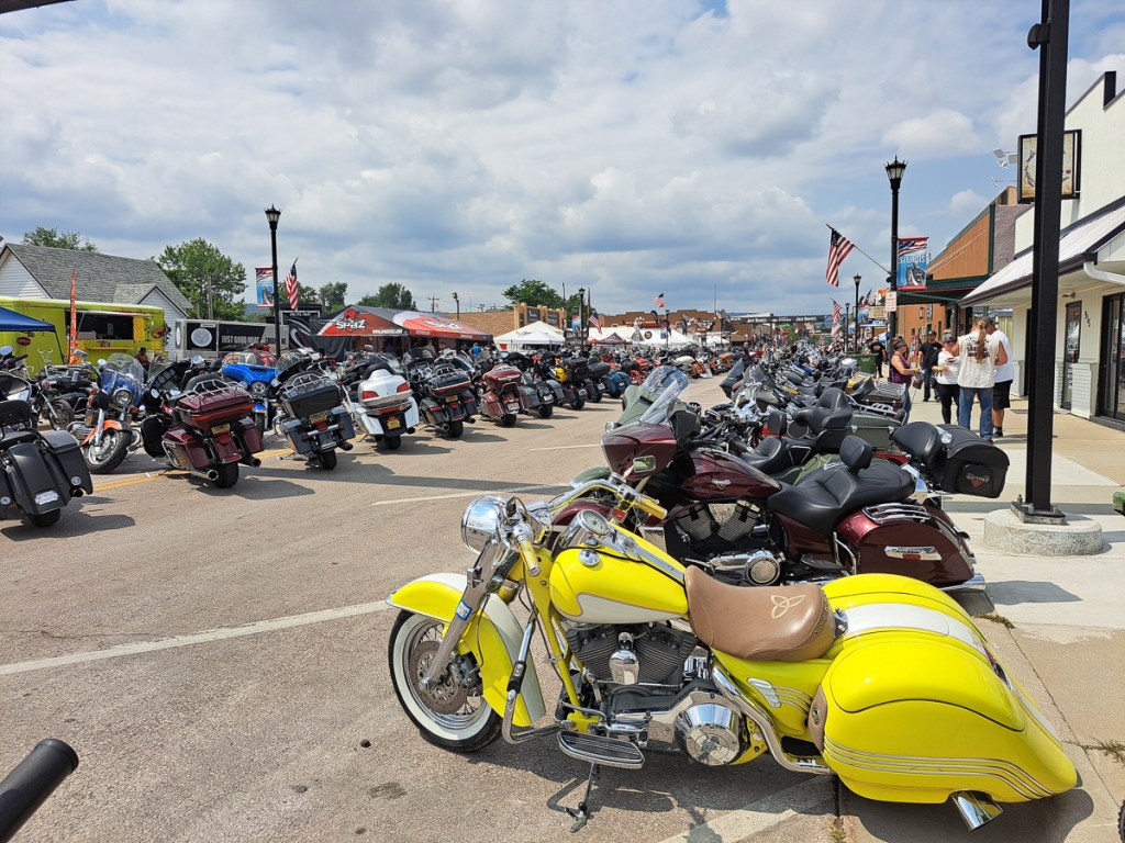
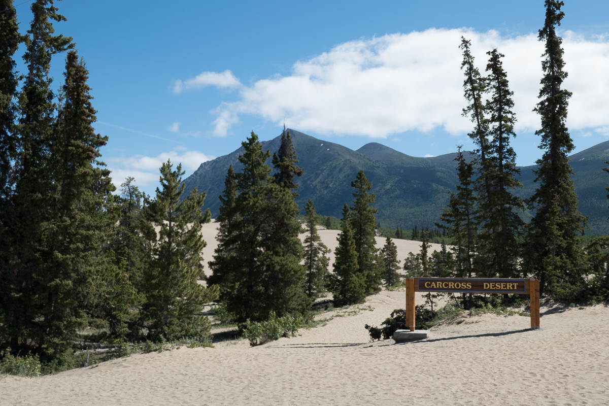
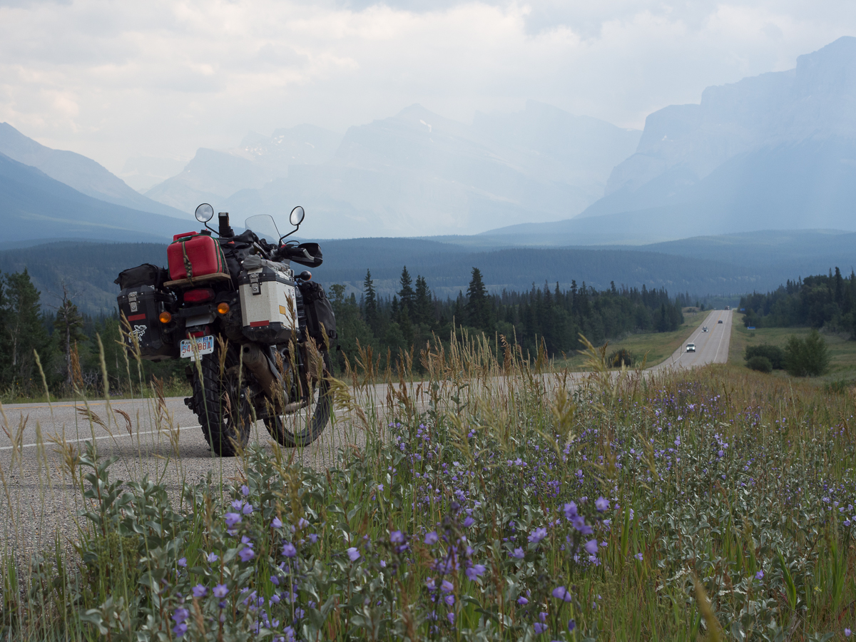
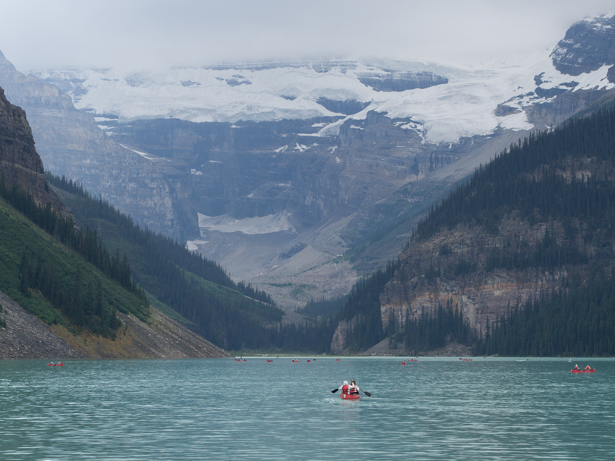
Costa Rica was near the top of my keen to visit countries.  Sadly, it’s obviously high up on a lot of other peoples’ lists too as many areas are full of tourist shops and attractions which are teeming with foreigners.  Everything was top dollar – the costs had rocketed!  Gid hasn’t stopped whinging.

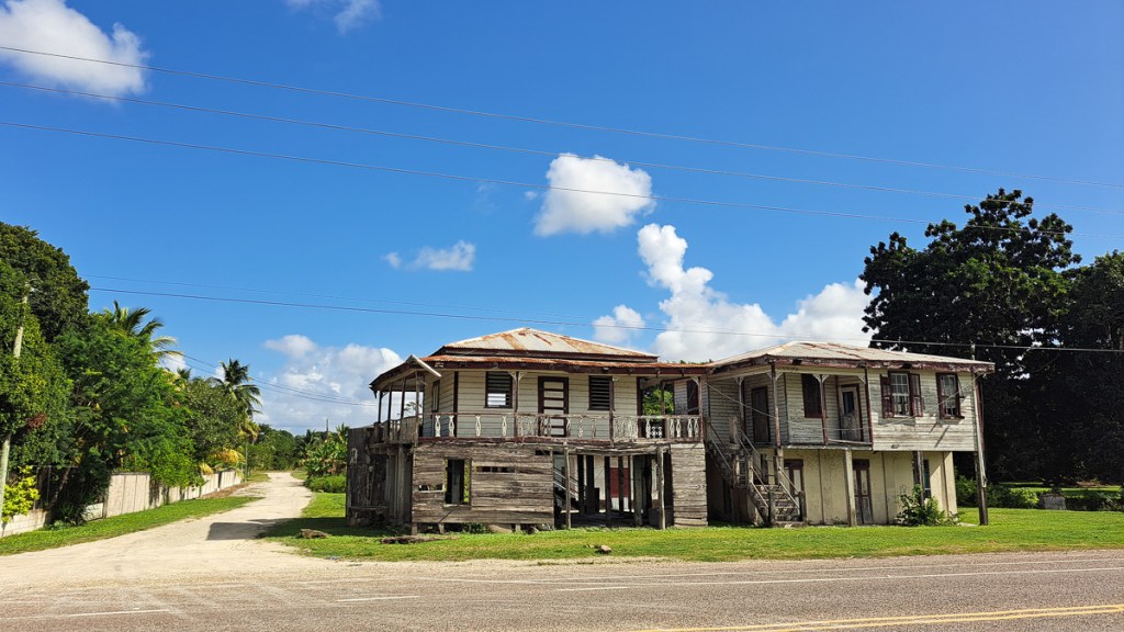
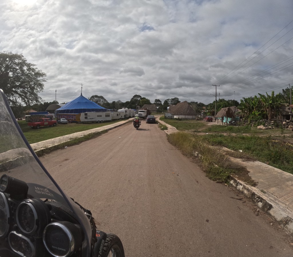
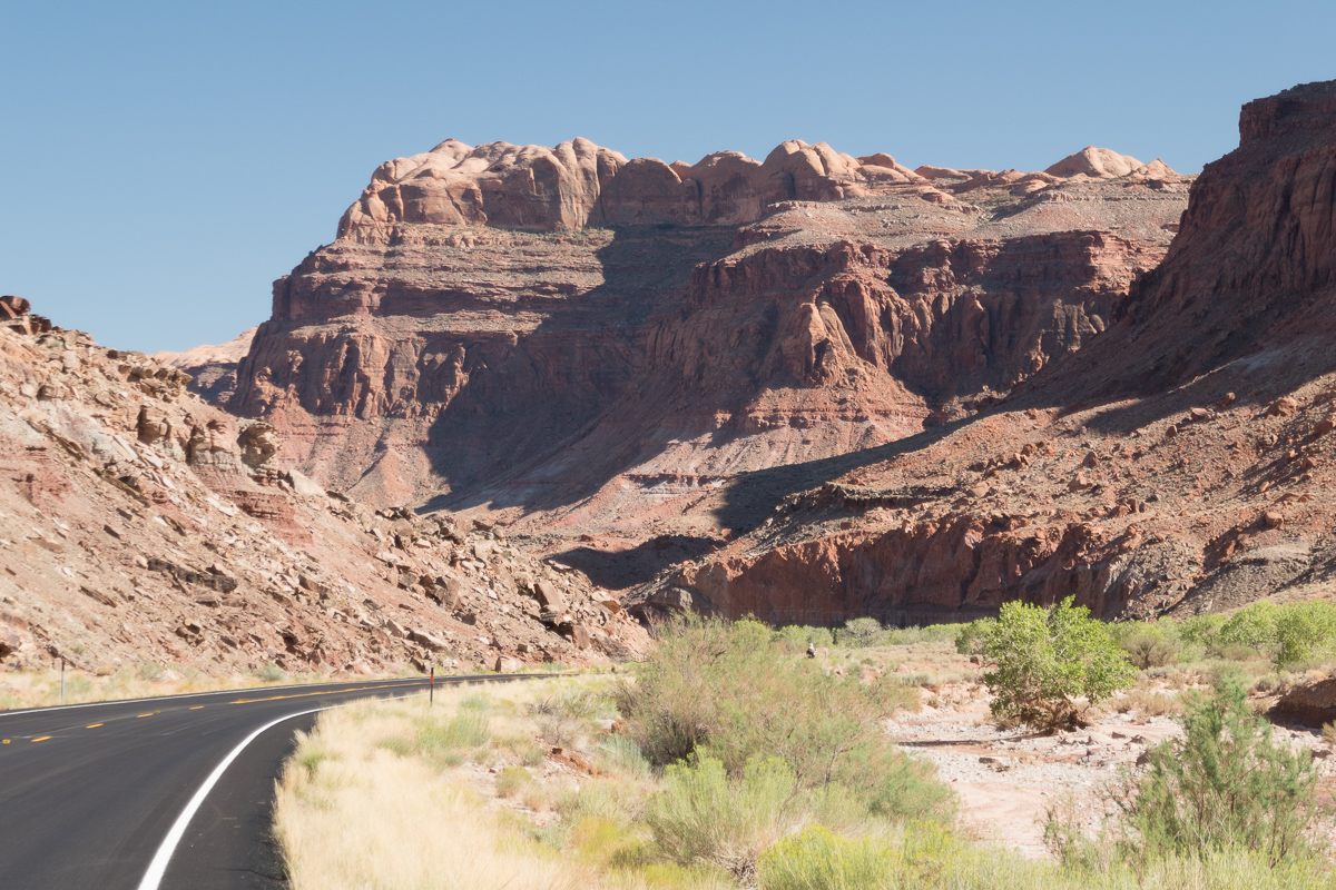
We picked a fair sized town, Liberia, for ease of finding our first accommodation in Costa Rica but found that full.  A motel along the highway just beyond it did the job although the roar of traffic through the night barely stopped.  The dipping pool was one very pleasing bonus after what felt like a long hot day – Central American border crossing days always feel like that, although pouring rain might be even worse.

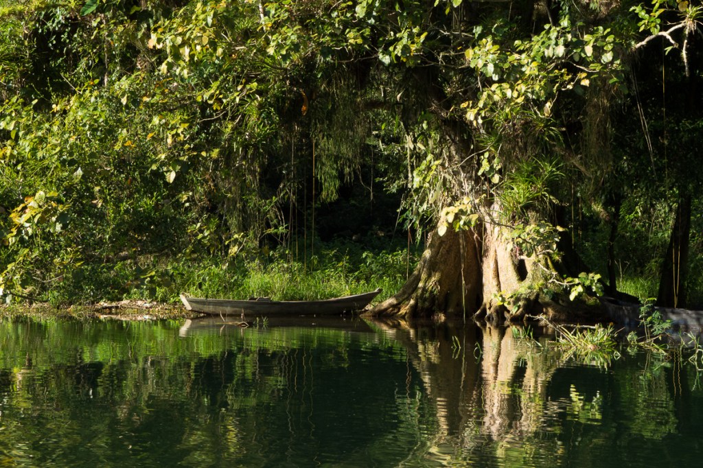
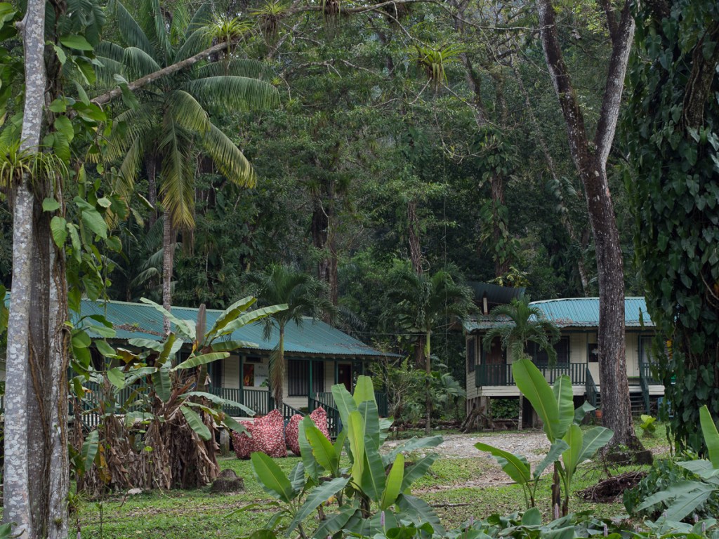
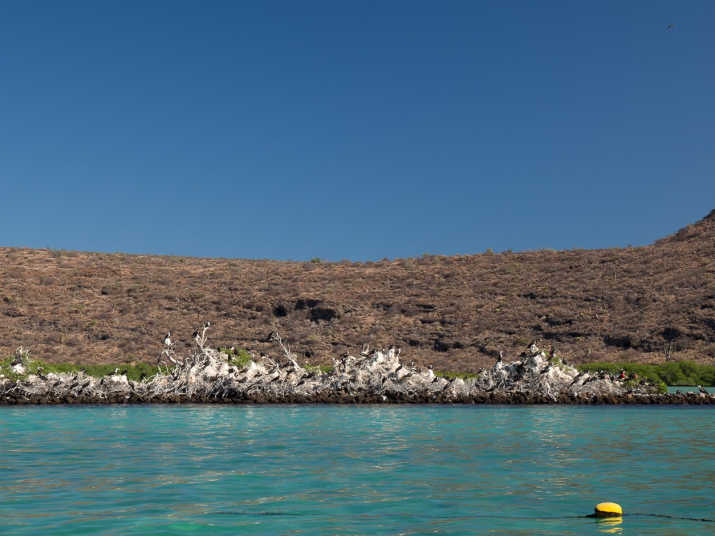
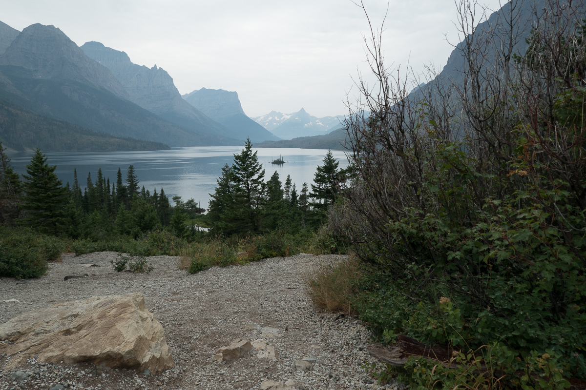
Our second night’s stop was in a much more rural area, right on the edge of Rincon de Vieja National park, where we were told that we could stay for only one night because they had a coach load coming tomorrow – although a campsite was available.  This kind of booking was verified as common by a very nice English couple, who had joined us at the previous night’s motel, having just flown in from the UK and like us found the town up the road full.  They told us their itinerary and explained that when Booking.com says it’s full just phone the place and they’ve probably got space.  ‘The tour companies make block bookings and then can’t fill all the spaces so they’ll have rooms spare’ we were told.  Our hearts sank.  This was supposed to be one of my prized countries to explore and here we were on a roller coaster tourist track.

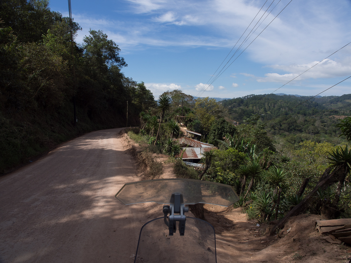
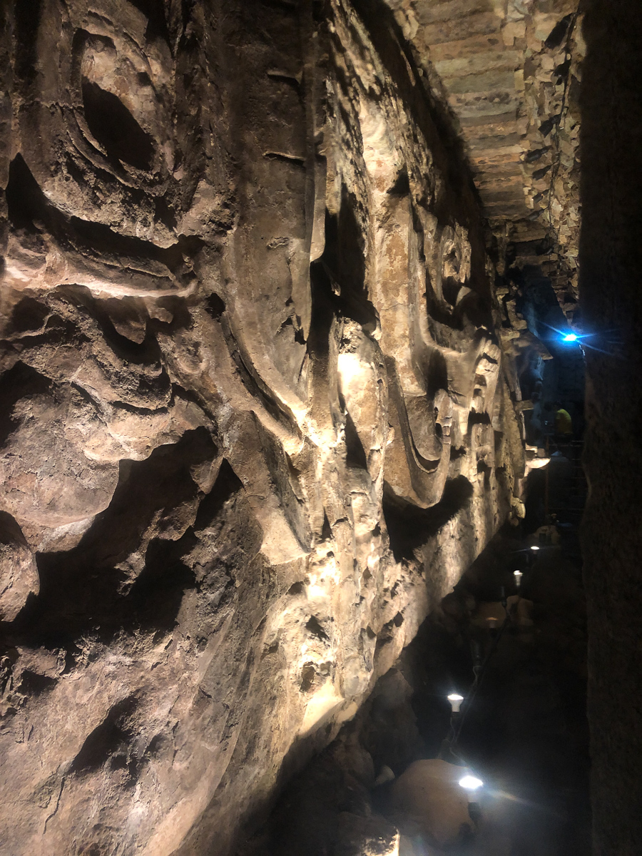
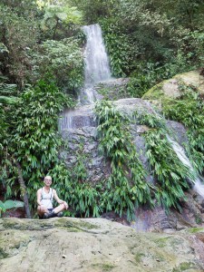
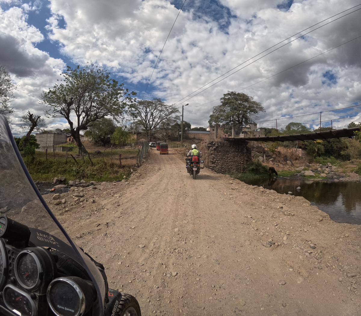
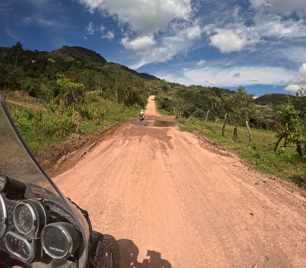
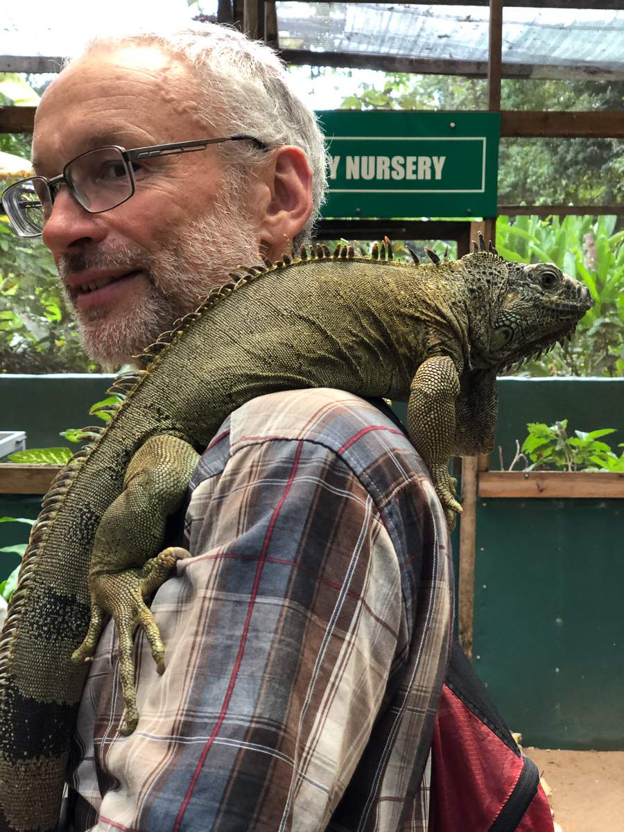
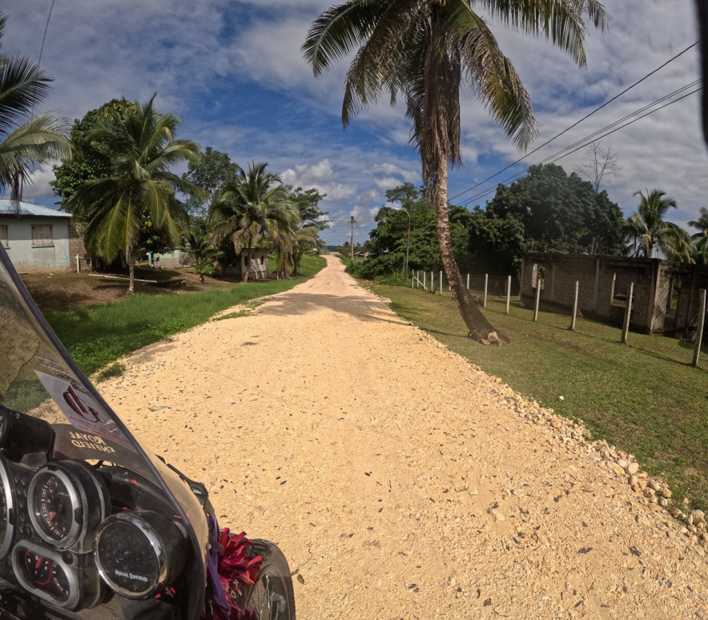
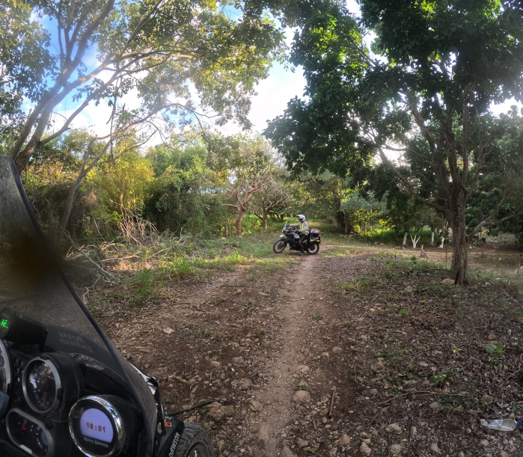
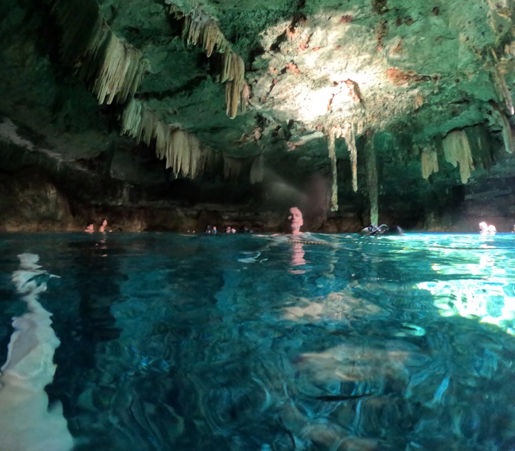
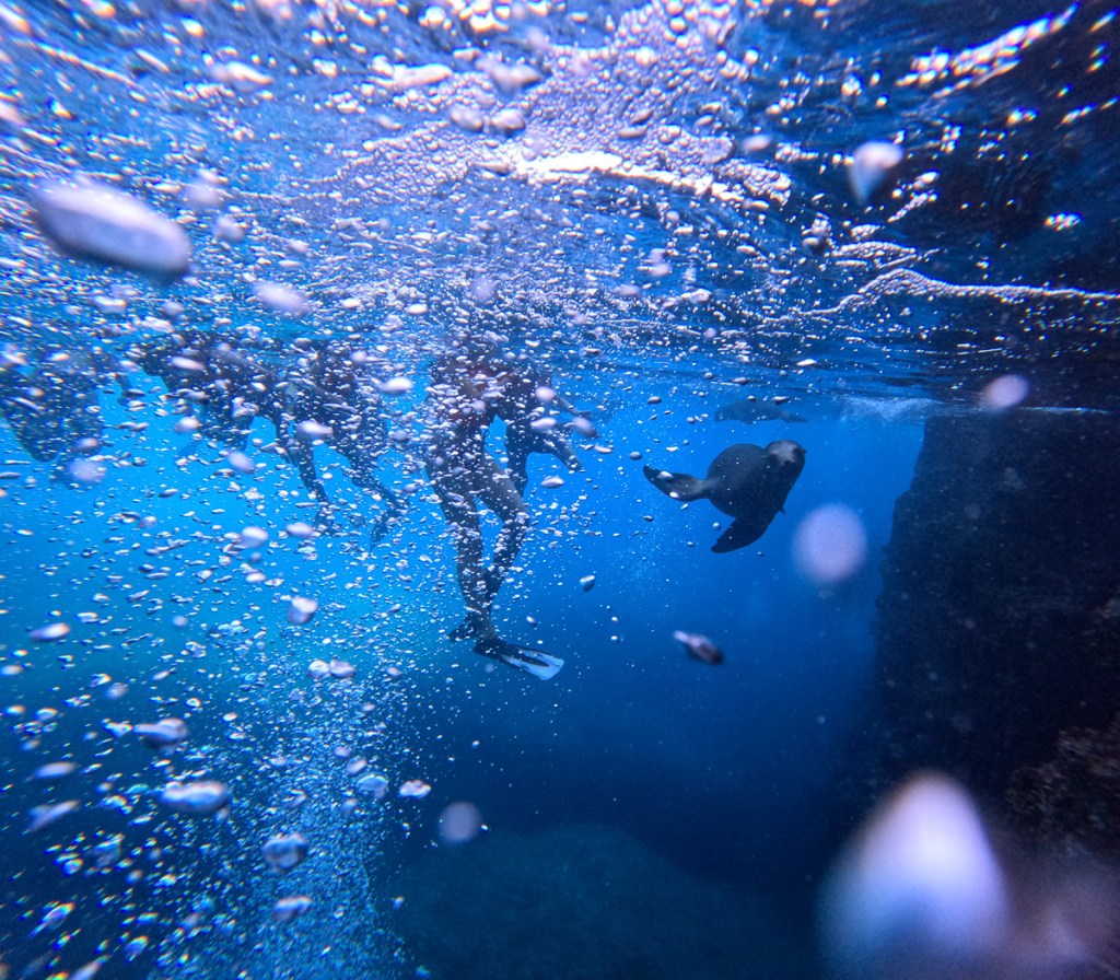
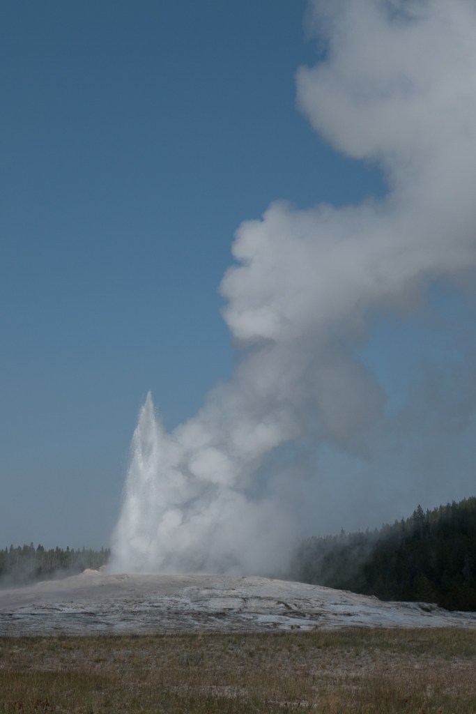
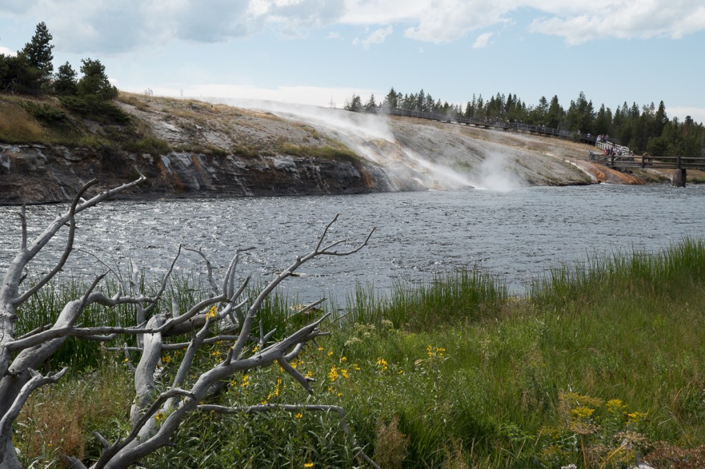
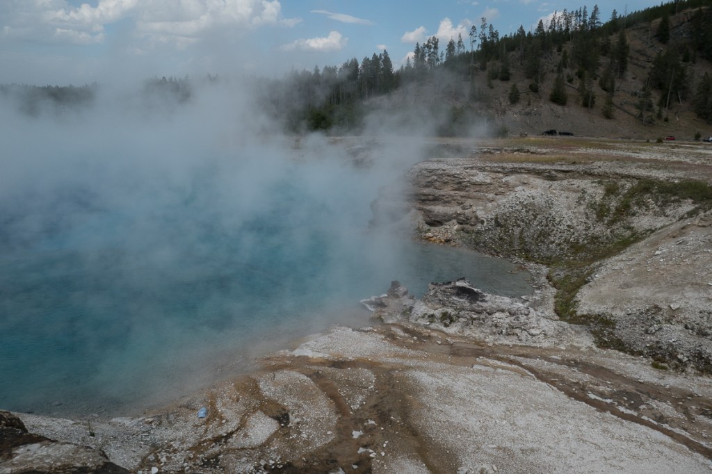
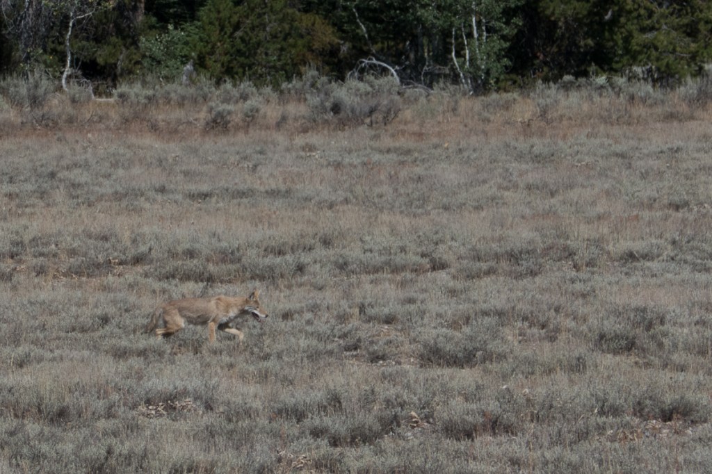
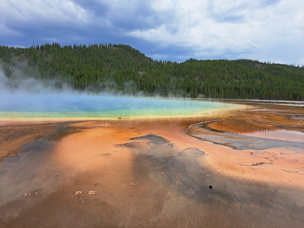
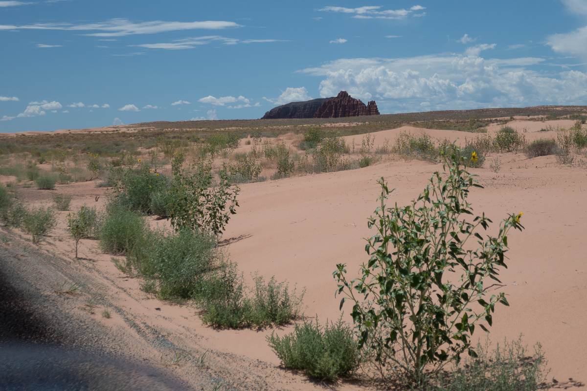
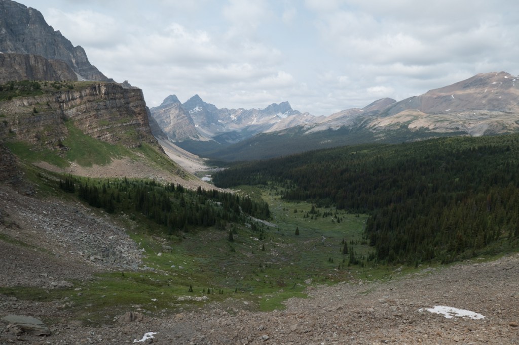
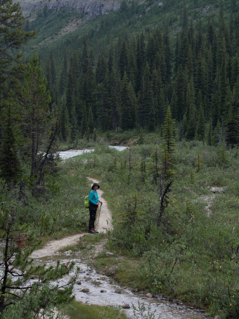
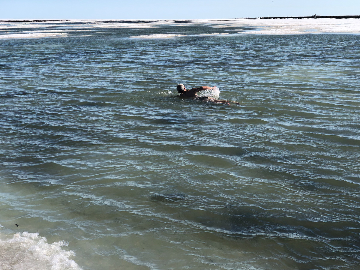
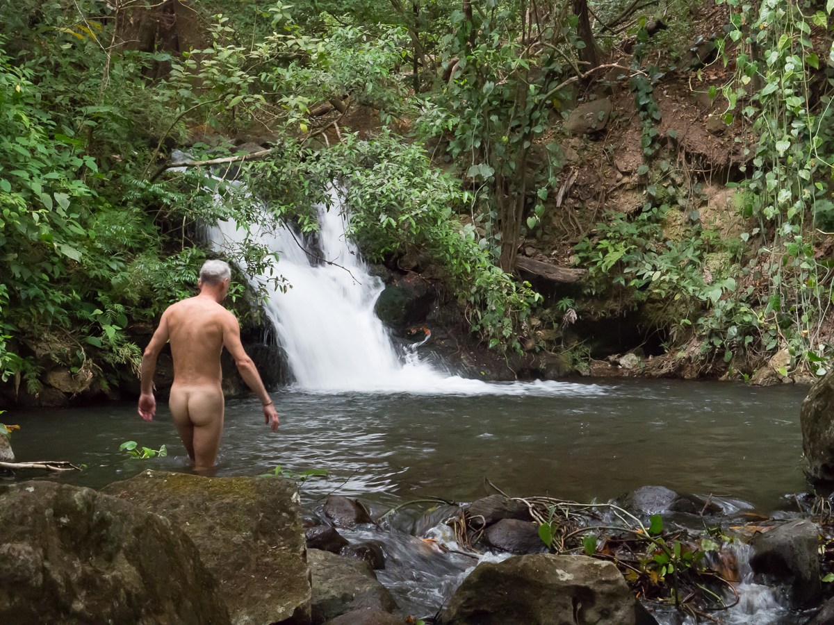
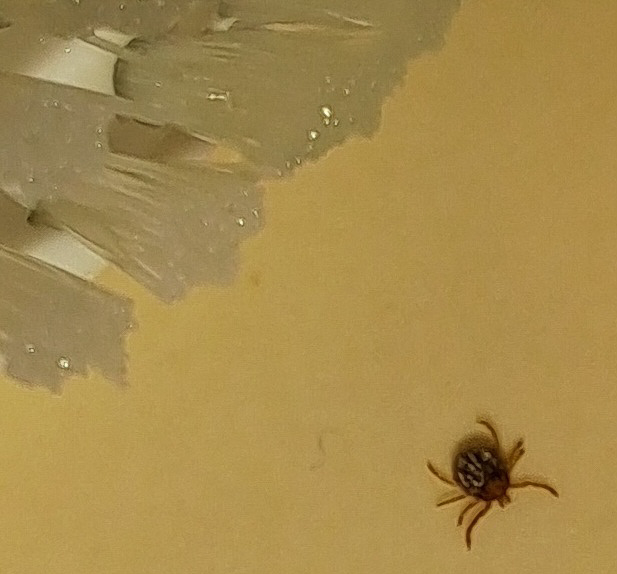
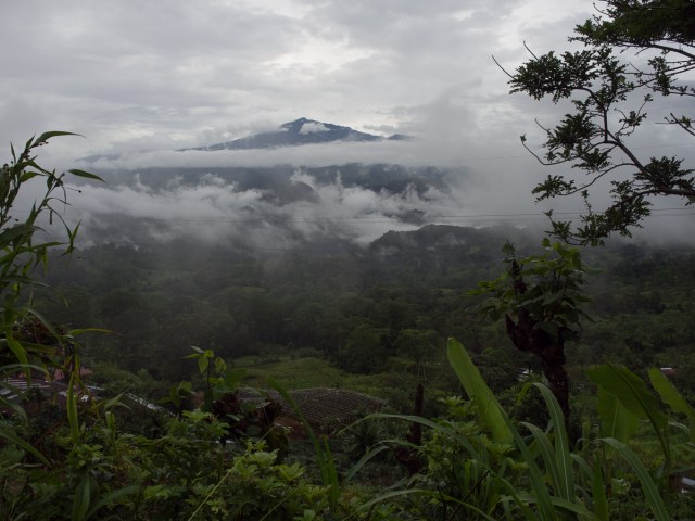
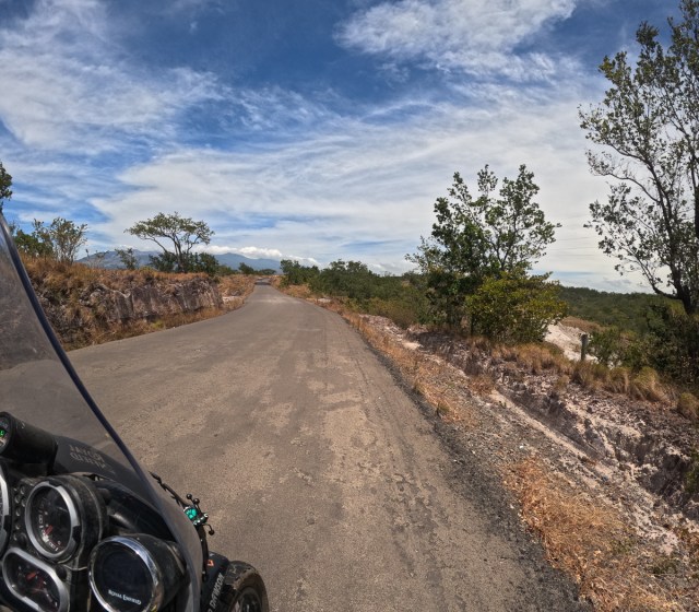
At Rincon de Vieja we did at least get away from the tourist trail approaching via it’s ‘back door’ along dirt roads to a shut gate.  Thankfully a man came out from the bushes, charging us a National Park entry fee he gave us access to the park.   Once settled in our accommodation we took a local walk through the woods to a cataract but got more than we bargained for.  The morning after I woke up at 4:15am in a panic because I had ‘things stuck to my legs’. Bed bugs?  No internet to check!  Ticks we discovered, once our online research told us to count their legs (8). Gid delved into the First Aid kit for the tick remover tool, and we spent a tedious hour clearing each other’s wrinkly bits. Sadly, we found a few more over the next 24 hours. I thought I’d probably picked them up weeing in the woods on our walk but we were both covered in them.  15 – 20 each!  We were still in a state of hysteria when, a few hours later, we piled into a car with two other people to go on a sloth seeking tour near La Fortuna.  With a sigh of relief we settled once the guide told us that there are no deer here so no Lymes Disease but a wash down with alcohol would be a good idea.

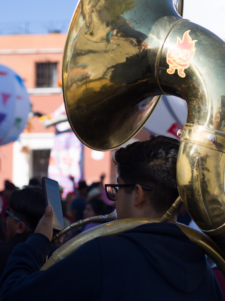
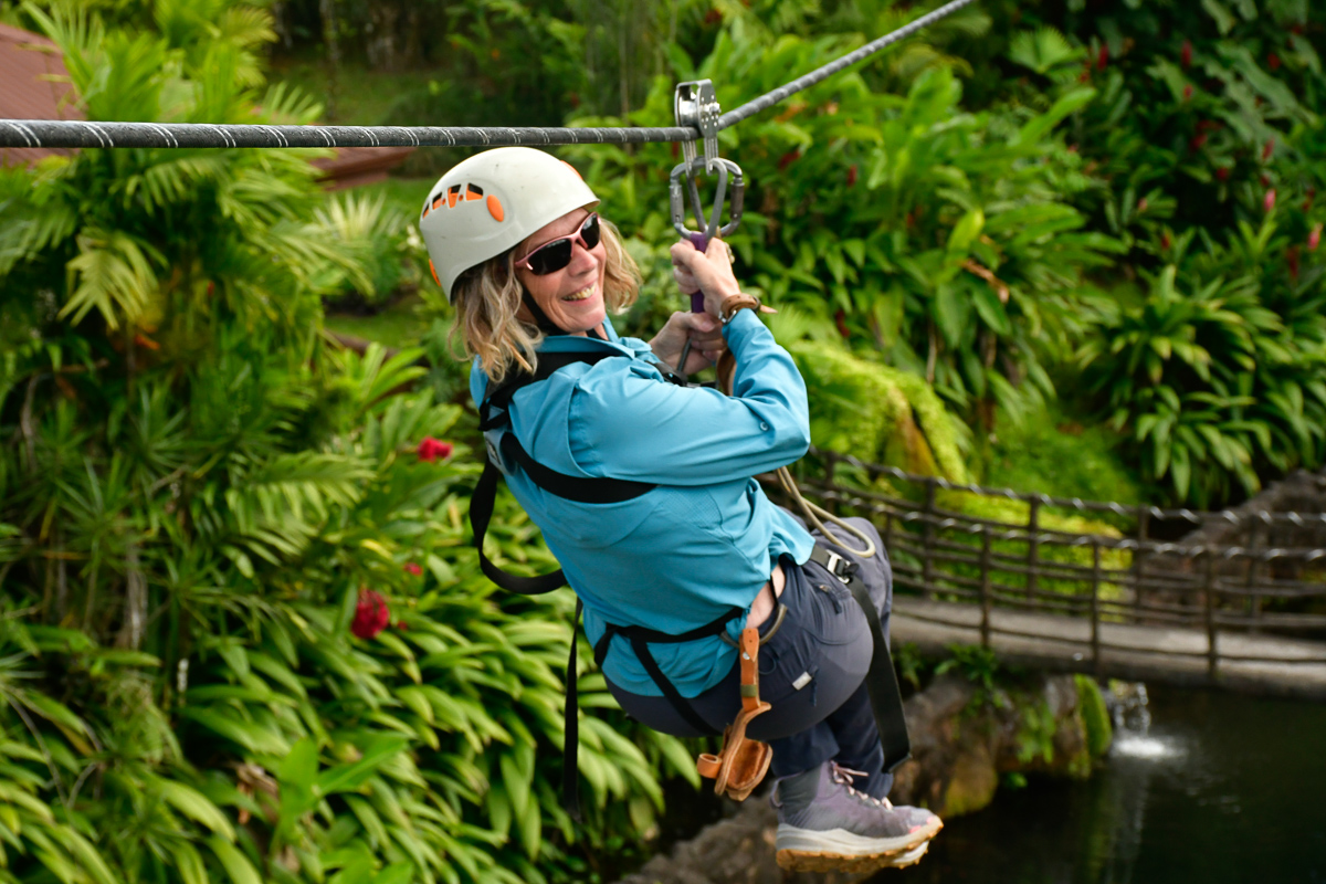
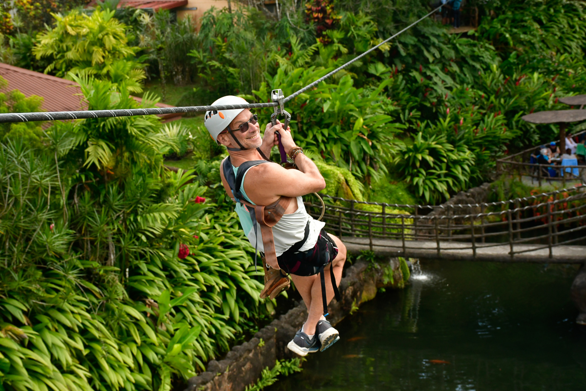
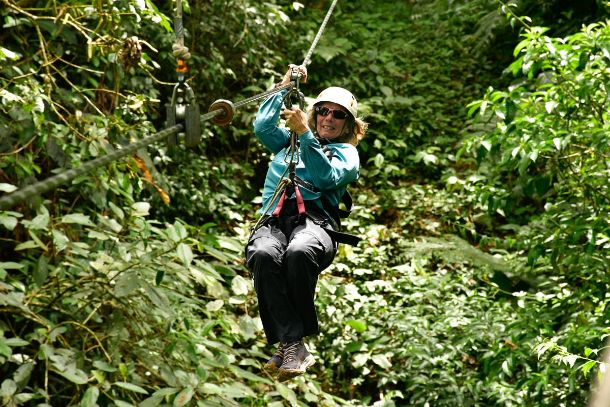
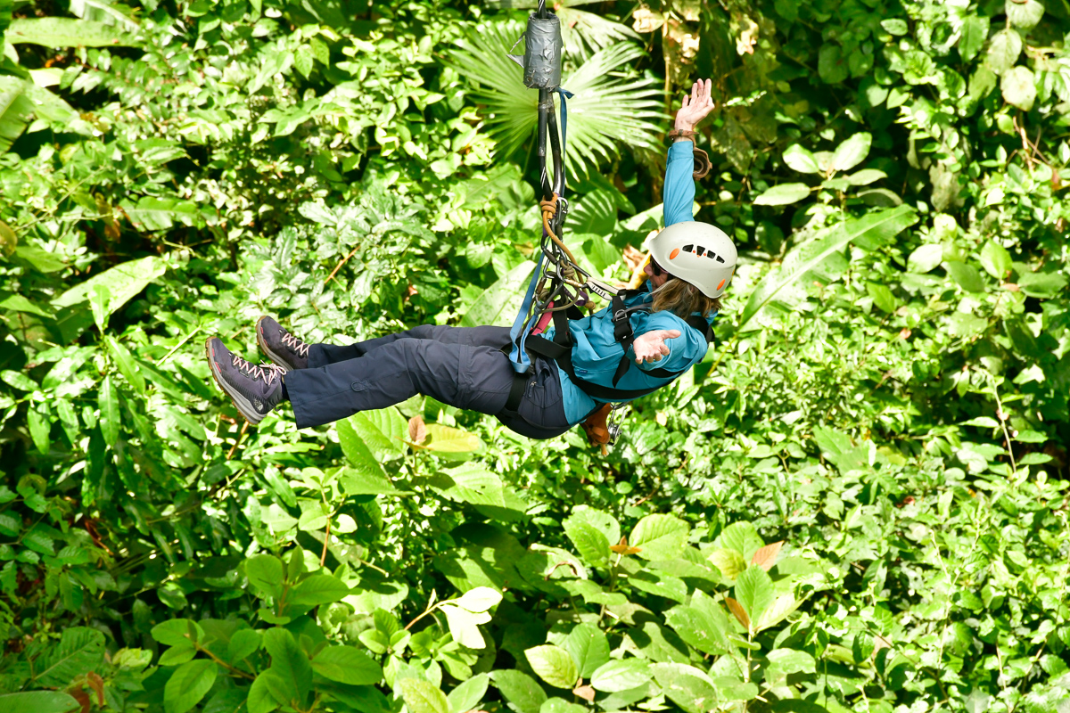
Reaching speeds of 70km per hour is quite exhilarating at first but by La Fortuna’s fifth zipline wire I was a bit ‘Done That’.  Thankfully there was a Tarzan swing line to try out too.  We both enjoyed the ride but wouldn’t seek it out again unlike our fellow zipliner who said she seeks them out and has done many. 

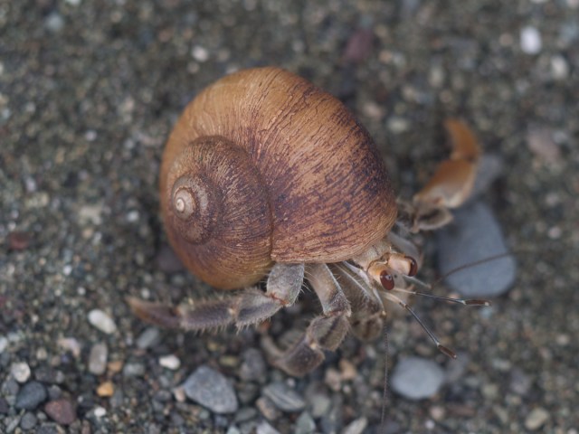
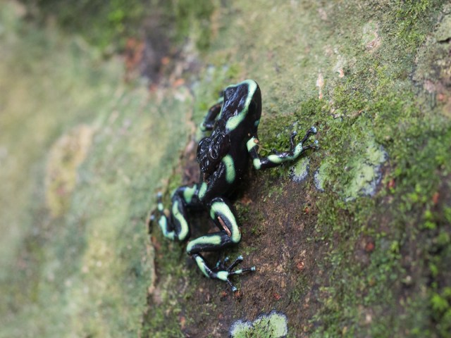
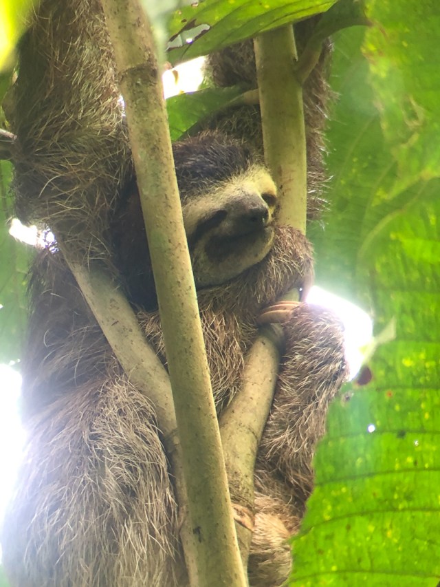
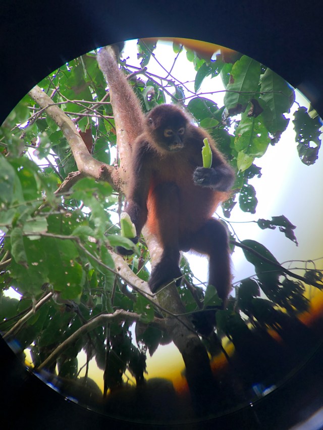
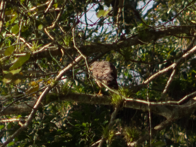
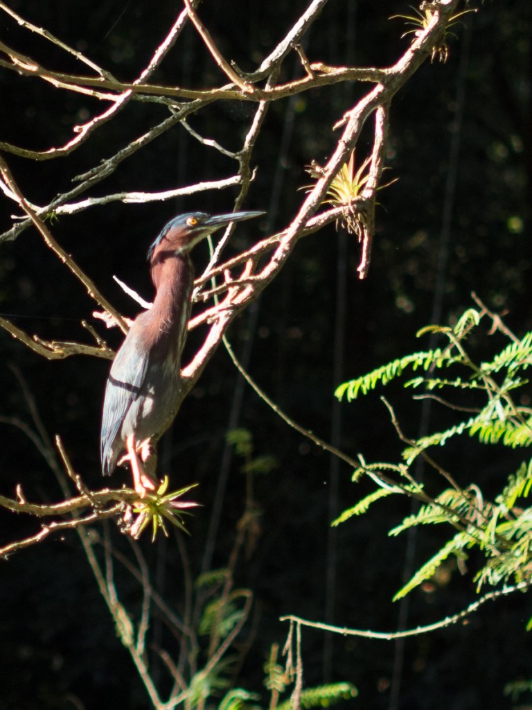
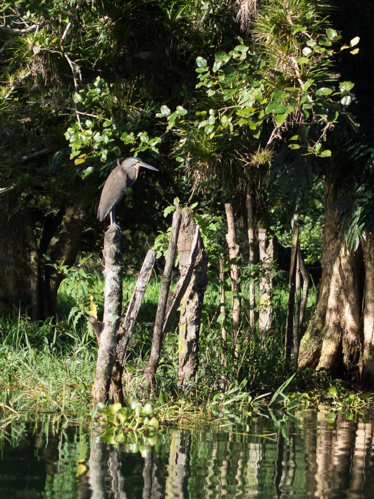
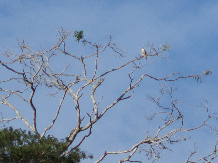
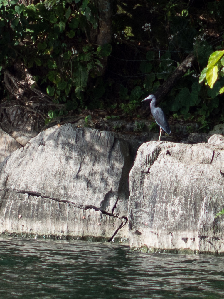
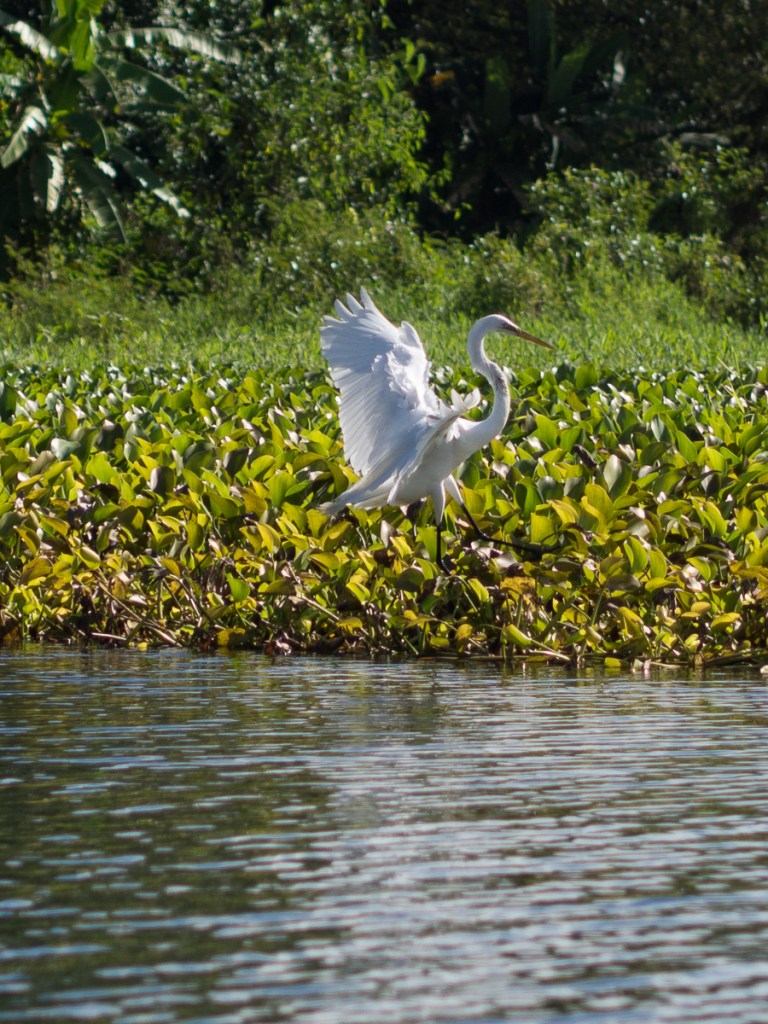
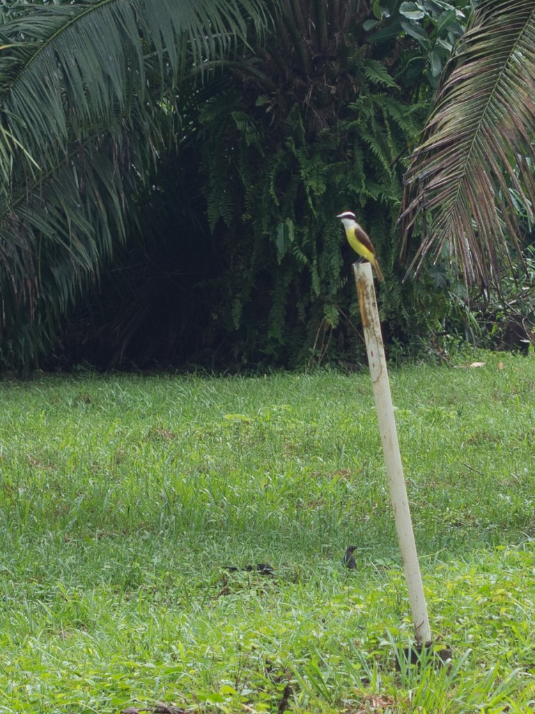
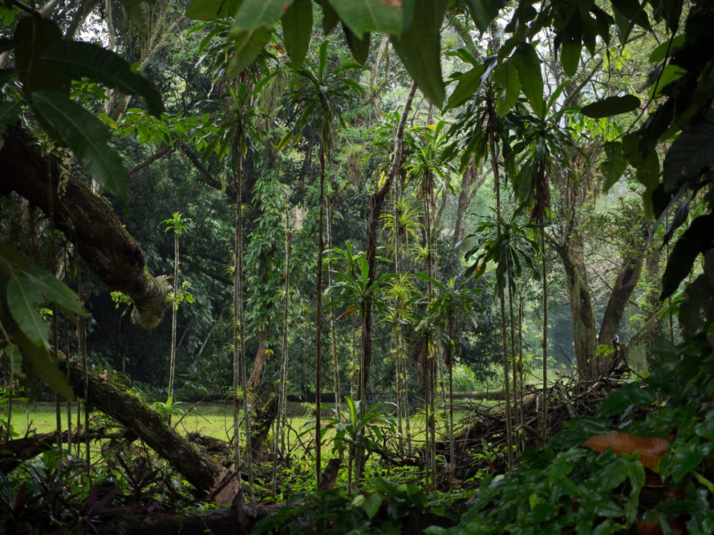
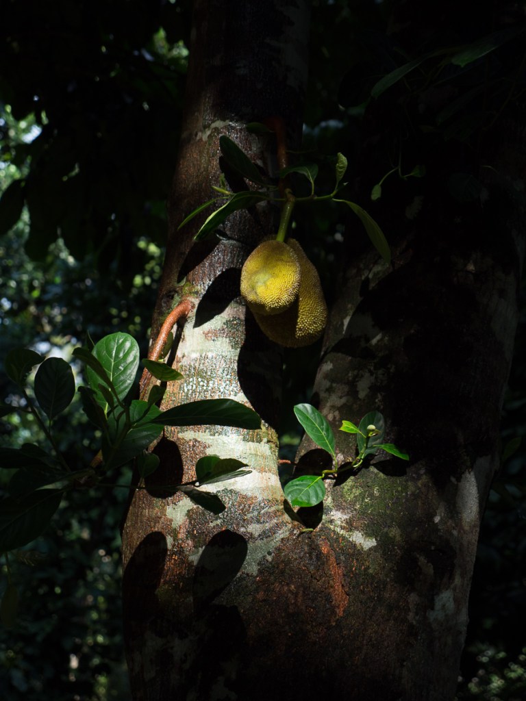
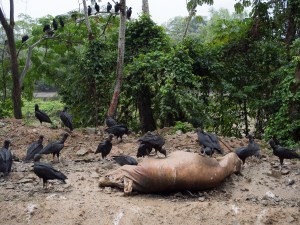
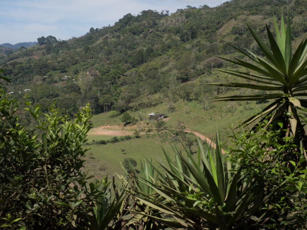
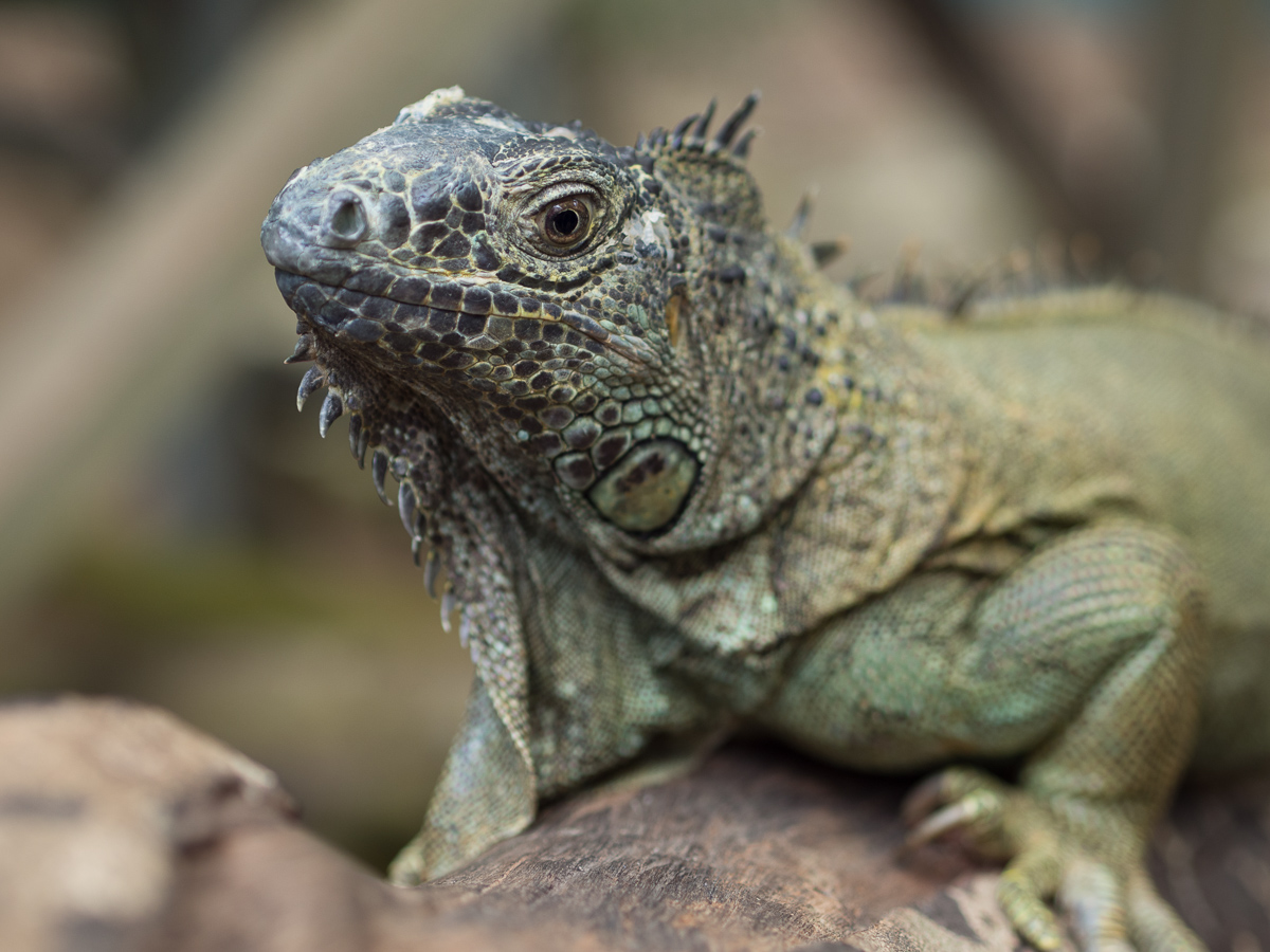
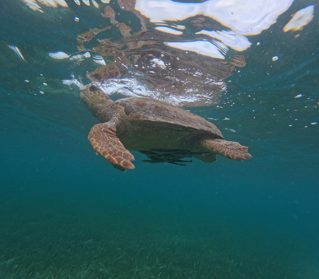
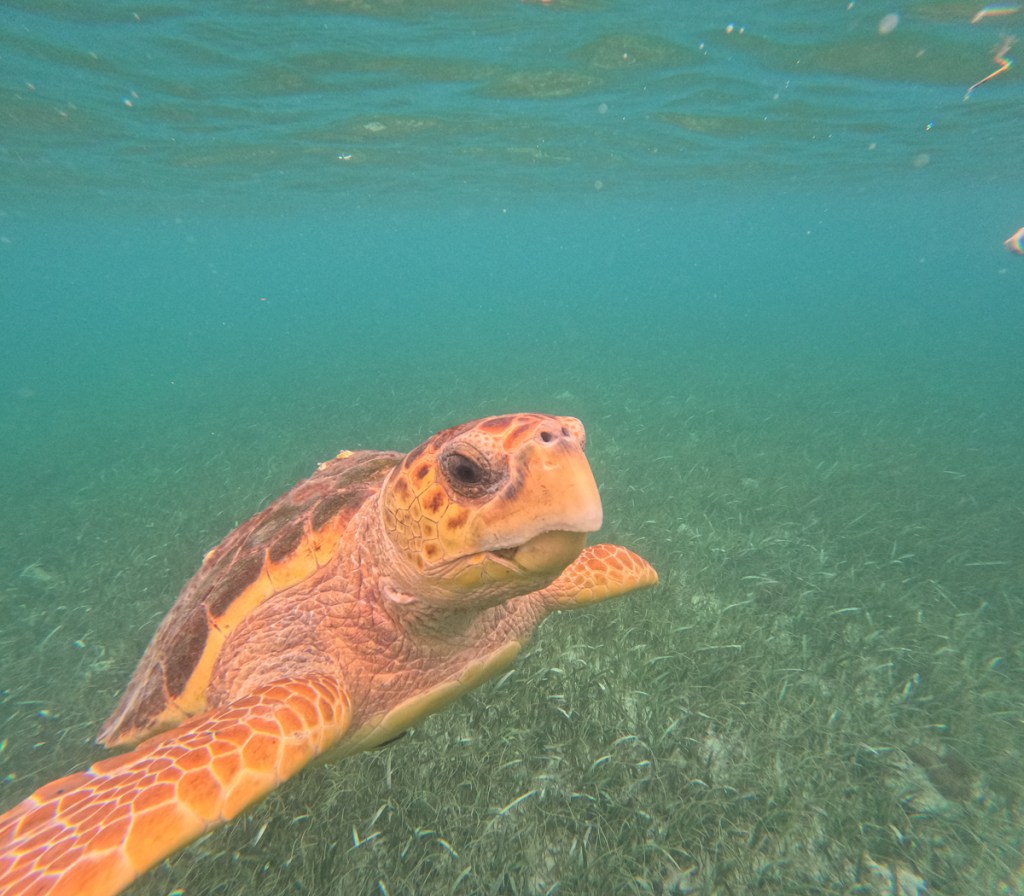
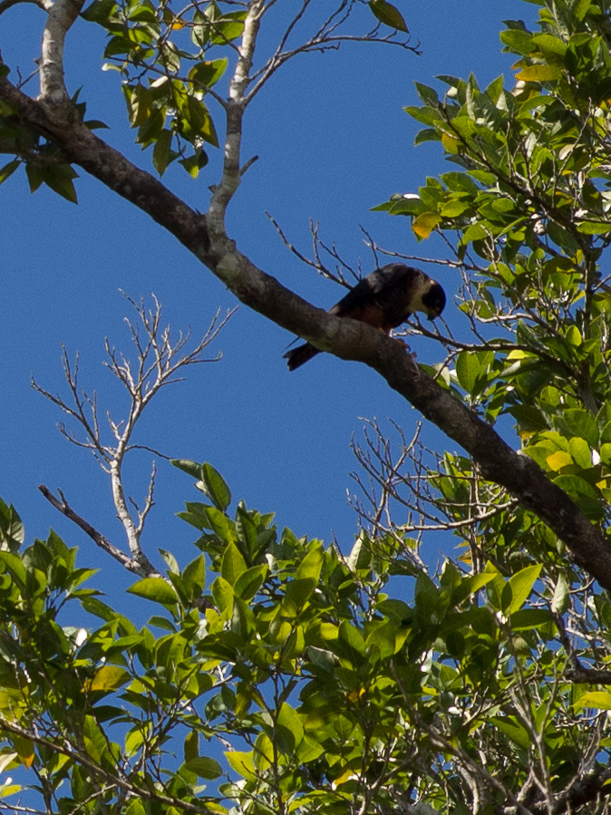
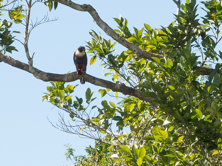
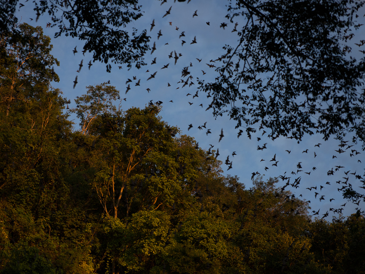
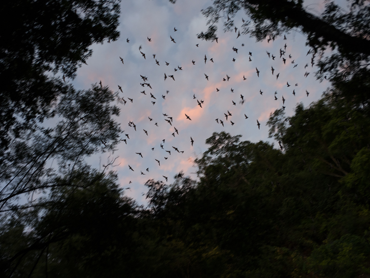
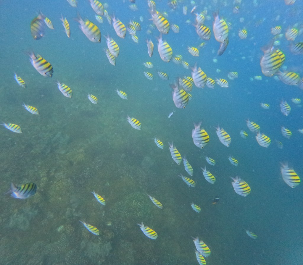
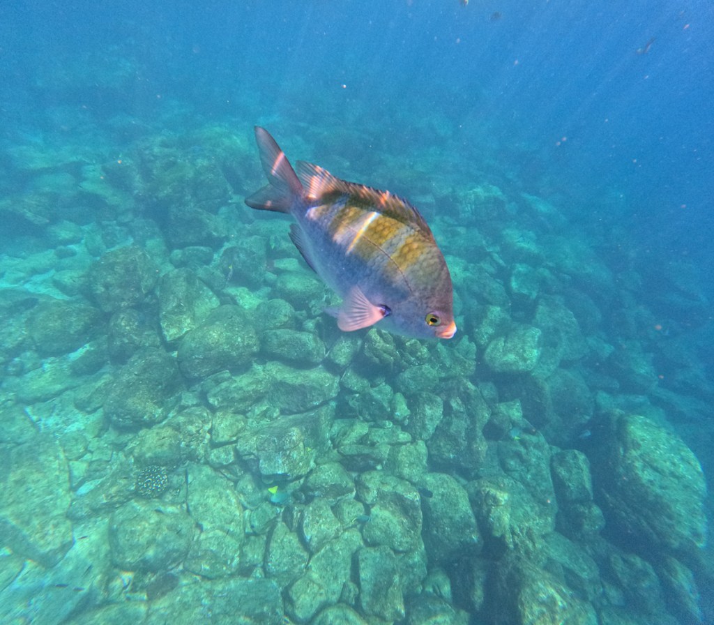
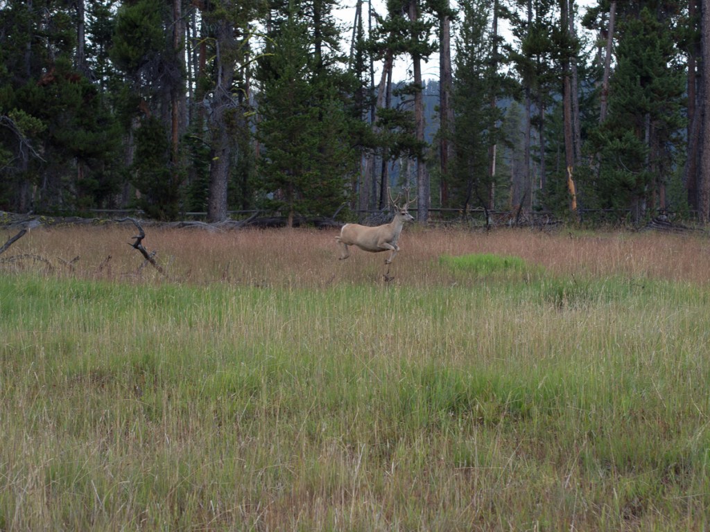
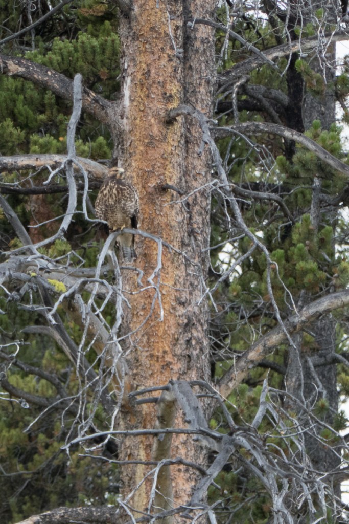
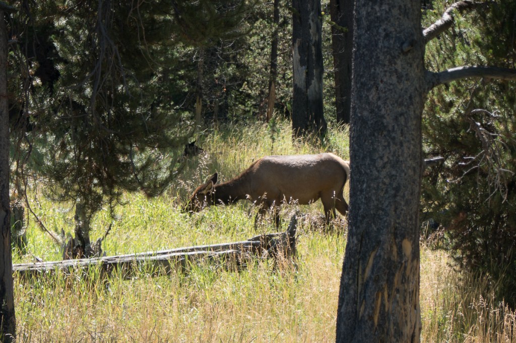
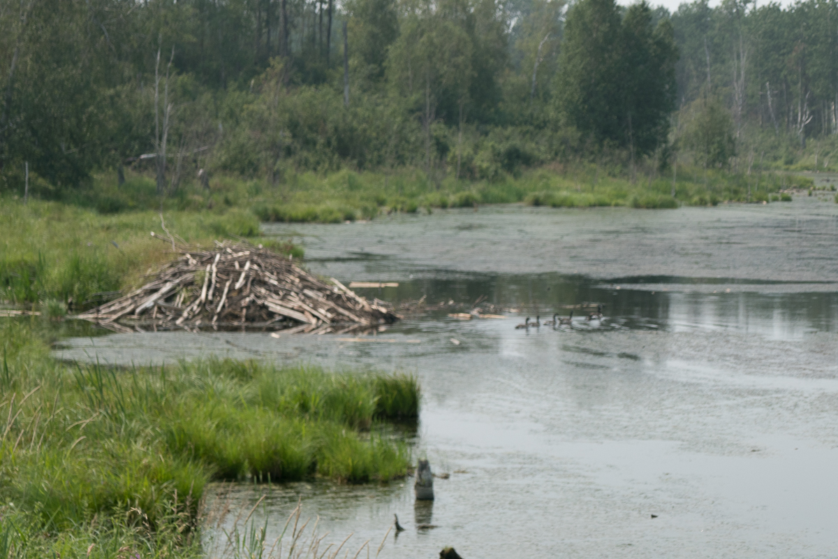
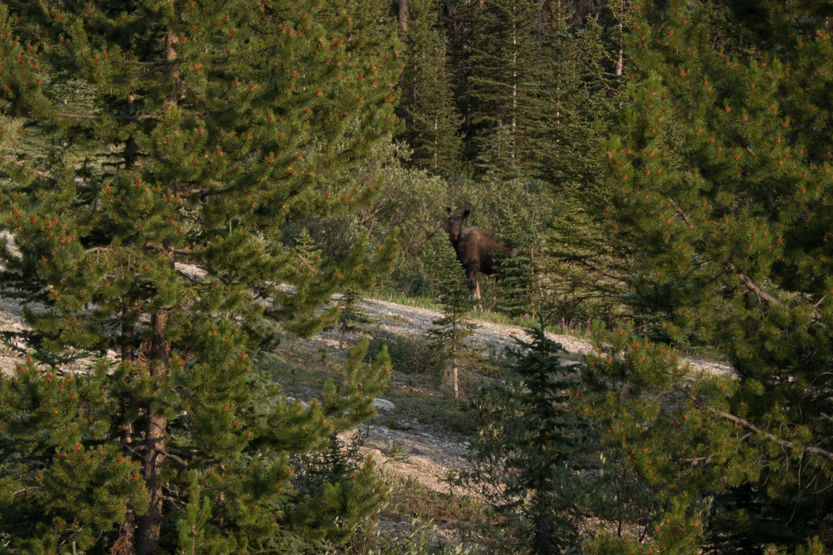
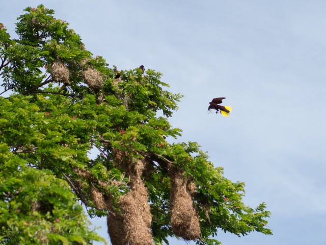
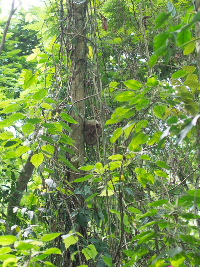
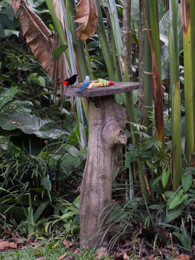
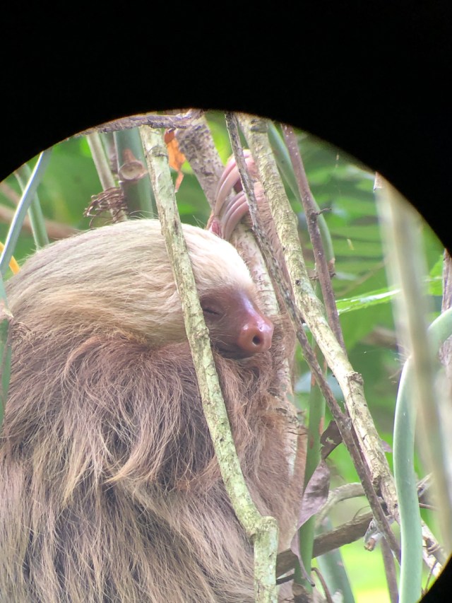
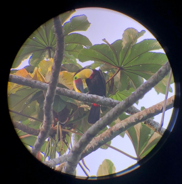
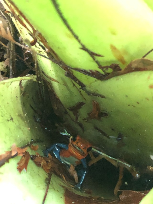
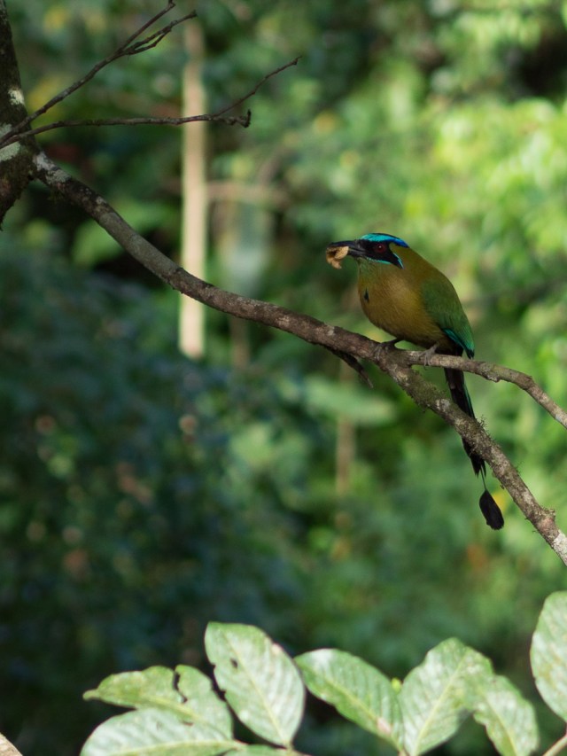
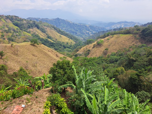
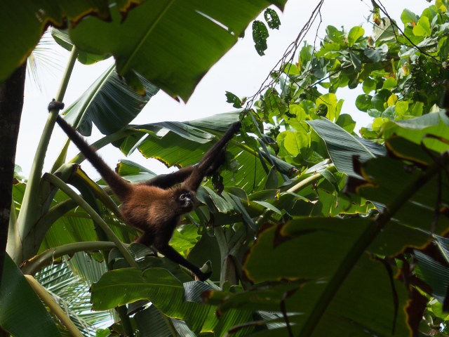
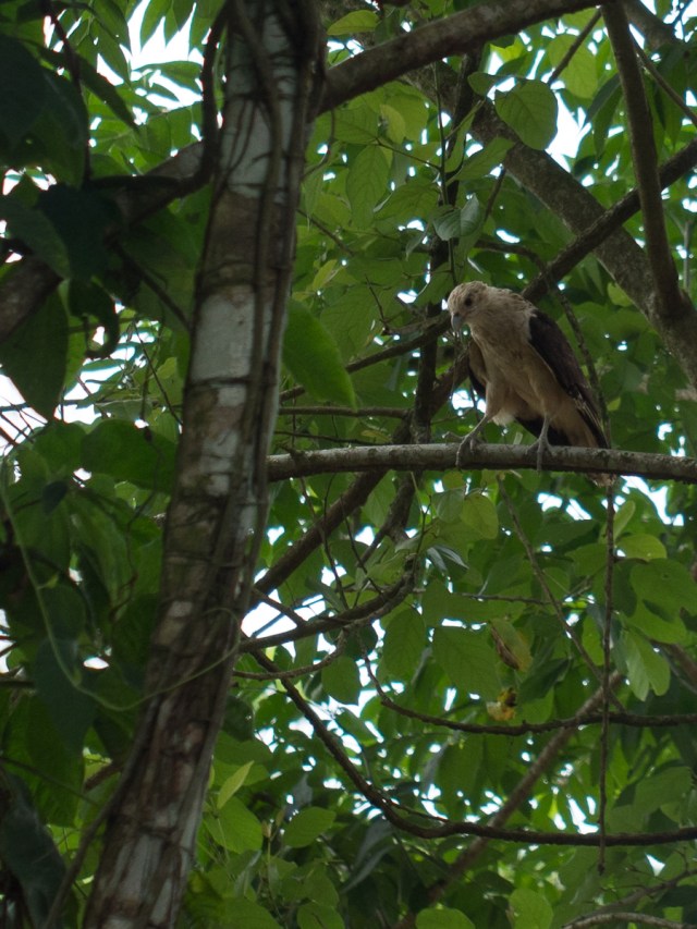
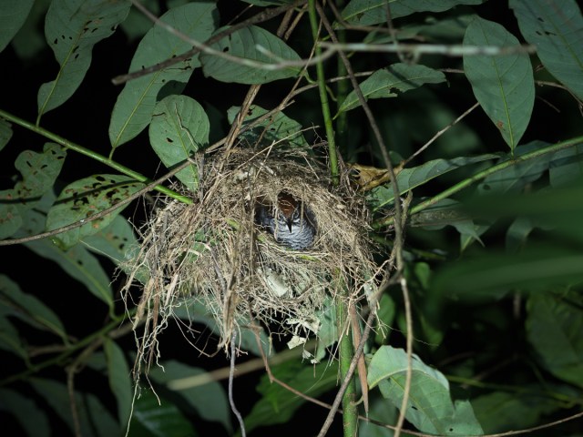
Our sloth tour and bird watching trip, both with guide Jose, had more lasting impact.  Seven sloths with one slightly moving was awesome as were the two different sorts of toucans on our bird watching tour. The local frogs were pretty cool too. Costa Rica is famously good for wildlife spotting, which is much easier with local guides who communally know where the beasties lurk. However, a rather sad observation has been made that the wildlife spotting is easy partly because so much forest has been cleared that the wildlife is now crammed into relatively small areas, separated from each other by grazing and farming clearances. The country clearly manifests a conservation ethic, but like the UK’s, a lot of primary forest is gone. With the realisation of what it’s lost Costa Rica is now trying to regenerate areas of forest.

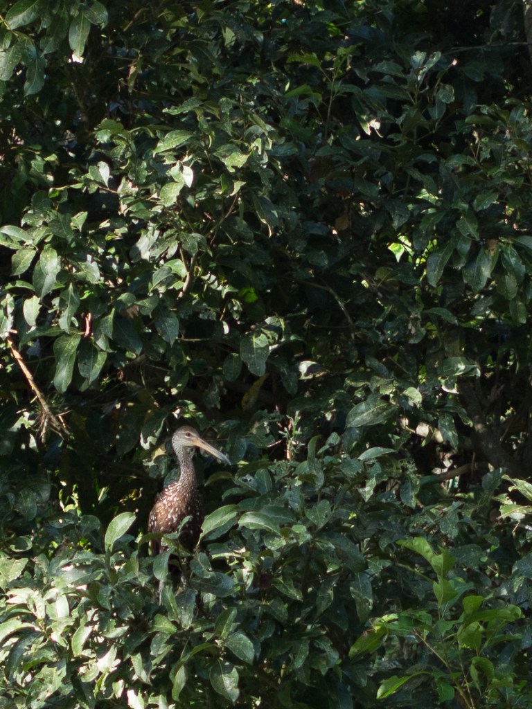
(Photos taken through a spotting scope were taken by the guides, using our phones).
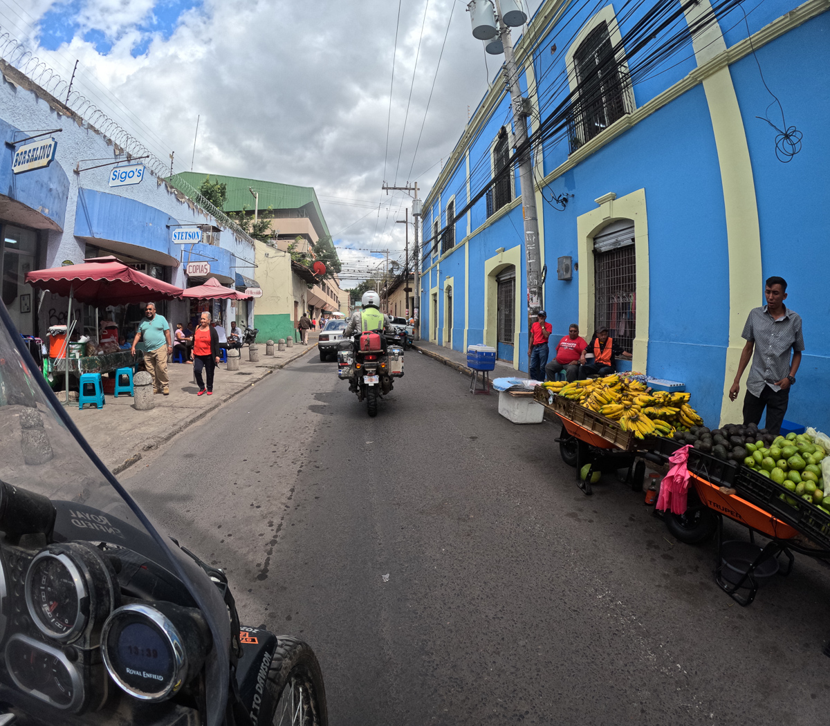
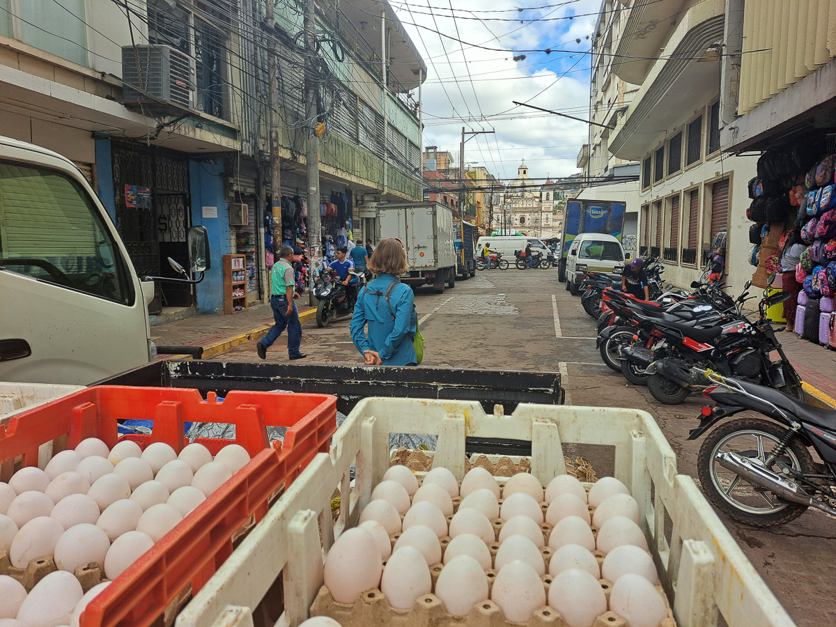
San Jose

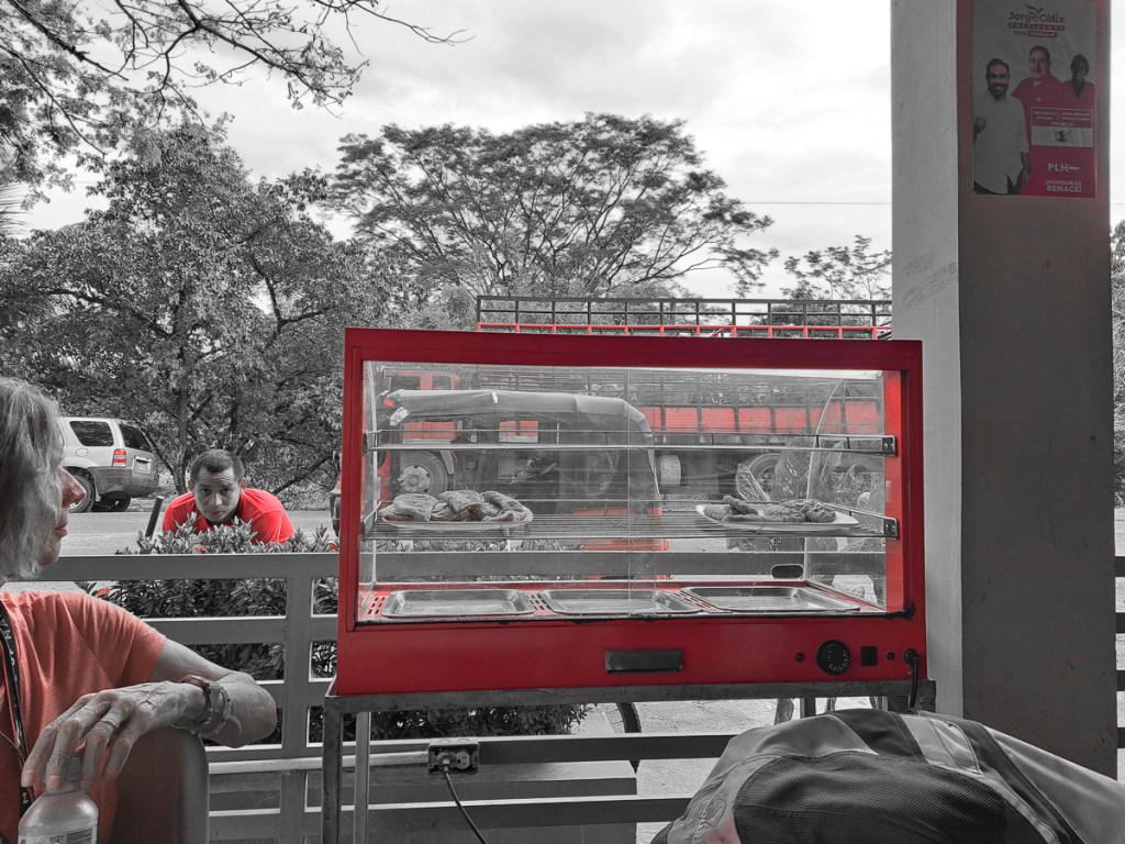
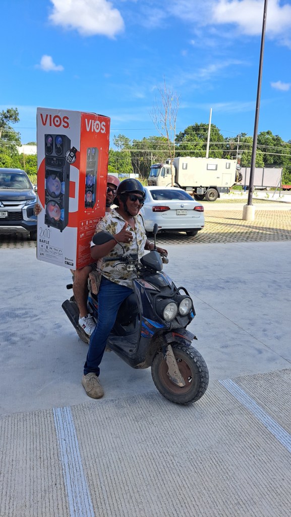
Having indulged in total tourism for a couple of days it was back to more serious stuff.  Our bikes were booked in to be serviced at a main dealer in San Jose and we had two parcels to collect.  One was from the UK.  A collection of lost, broken or never realised it would be so useful items collected by Jo, Gid’s sister, and sent to a DHL collection point.   A second parcel collected by Jared, a Bunk-a-Biker host, who had been kind enough to receive several Amazon orders.  Well, one order came twice and the third not at all.  Such was Amazon and the US postal system.  All gratefully received.  Christmas had come!

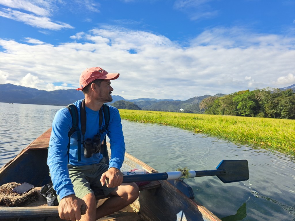
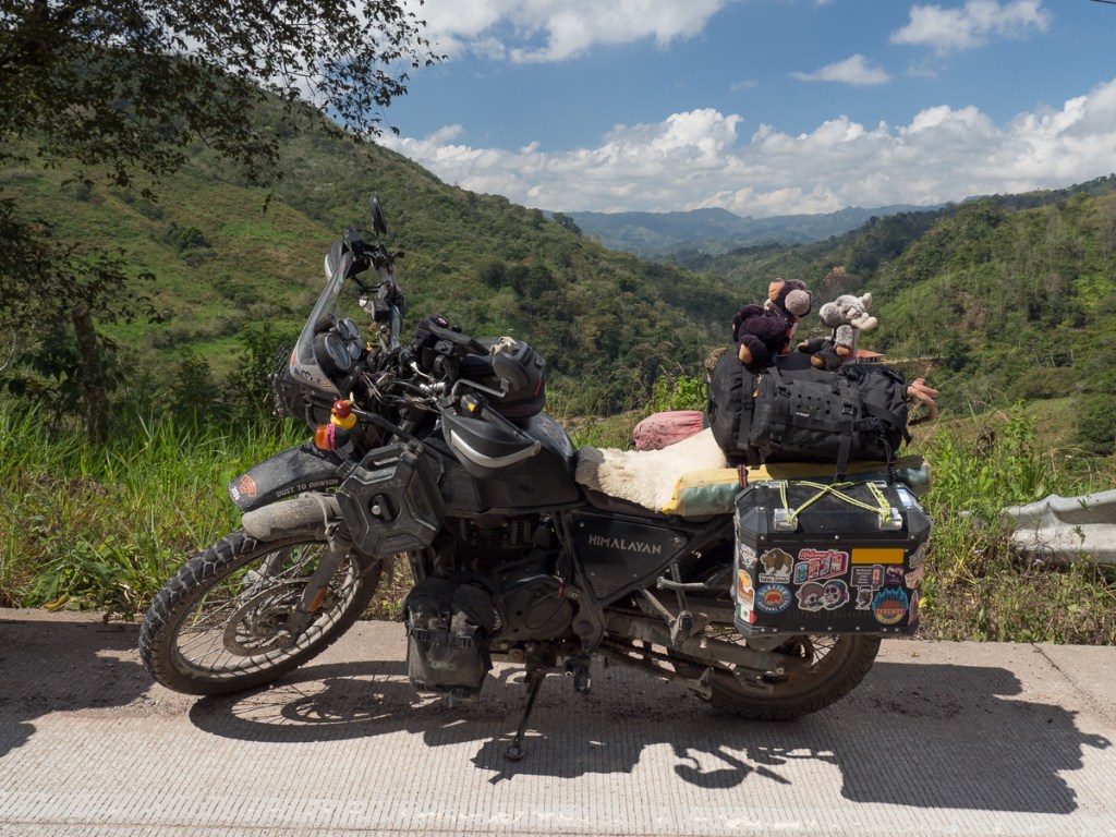
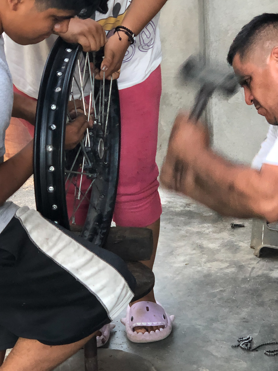
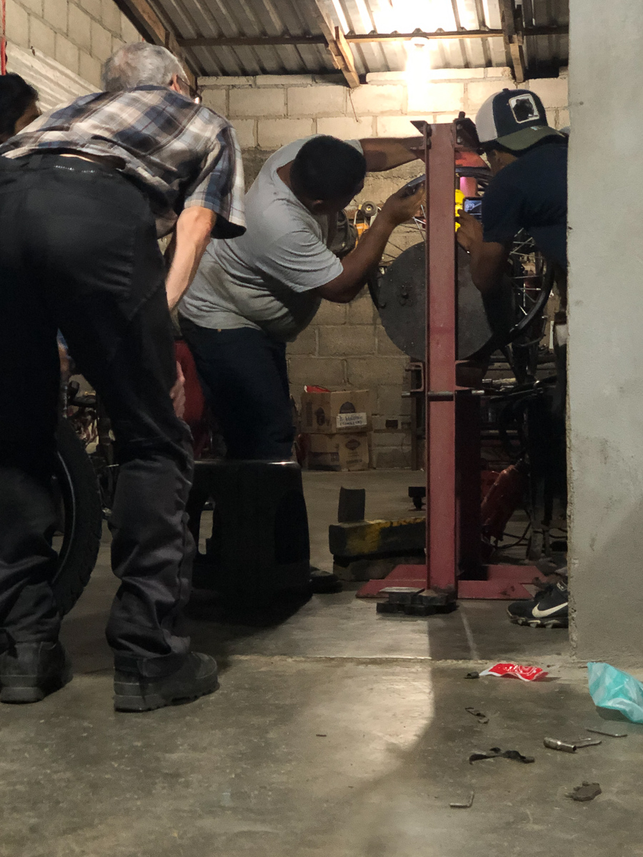
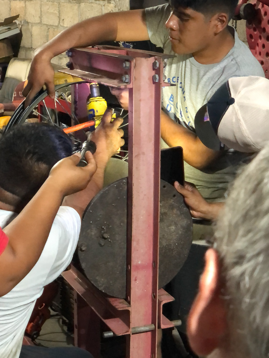
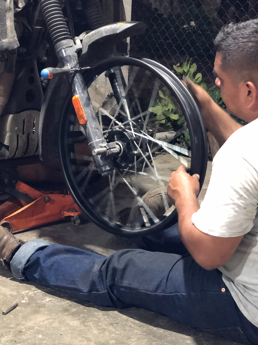
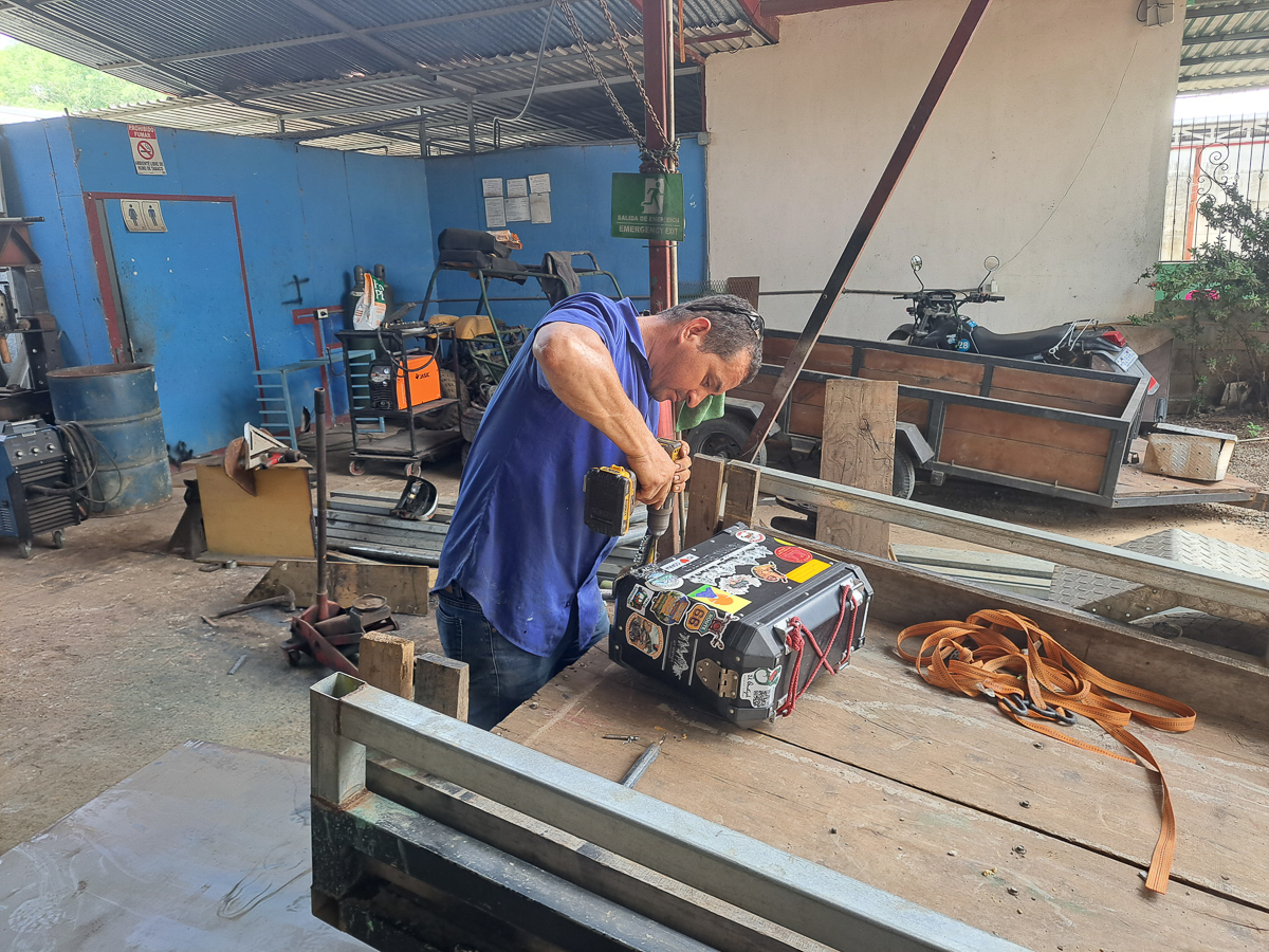
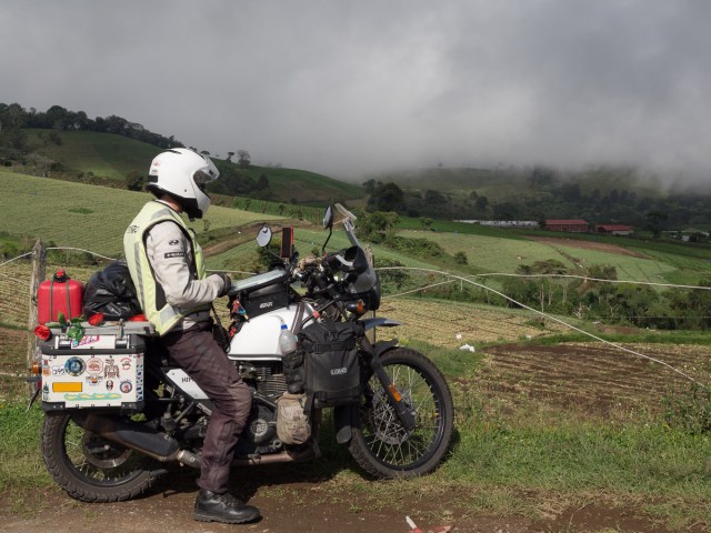
Gid: Although I had done the last few services, I decided to get the bikes professionally listened to at 24,000 miles, and certainly a quality wheel repair was beyond my abilities. My deteriorating front wheel was more thoroughly repaired than it had been in Mexico – the workshop replaced the steering head bearings too, presumably this was a consequence of the last few weeks wobbly front end.  We got new chains, although the current ones were not yet a problem, they had done 12,000 miles or so. We left the tyres, although they give us a dilemma – there’s plenty of tread left by road standards, but at what point will they become a liability on dirt and mud?

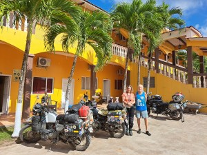
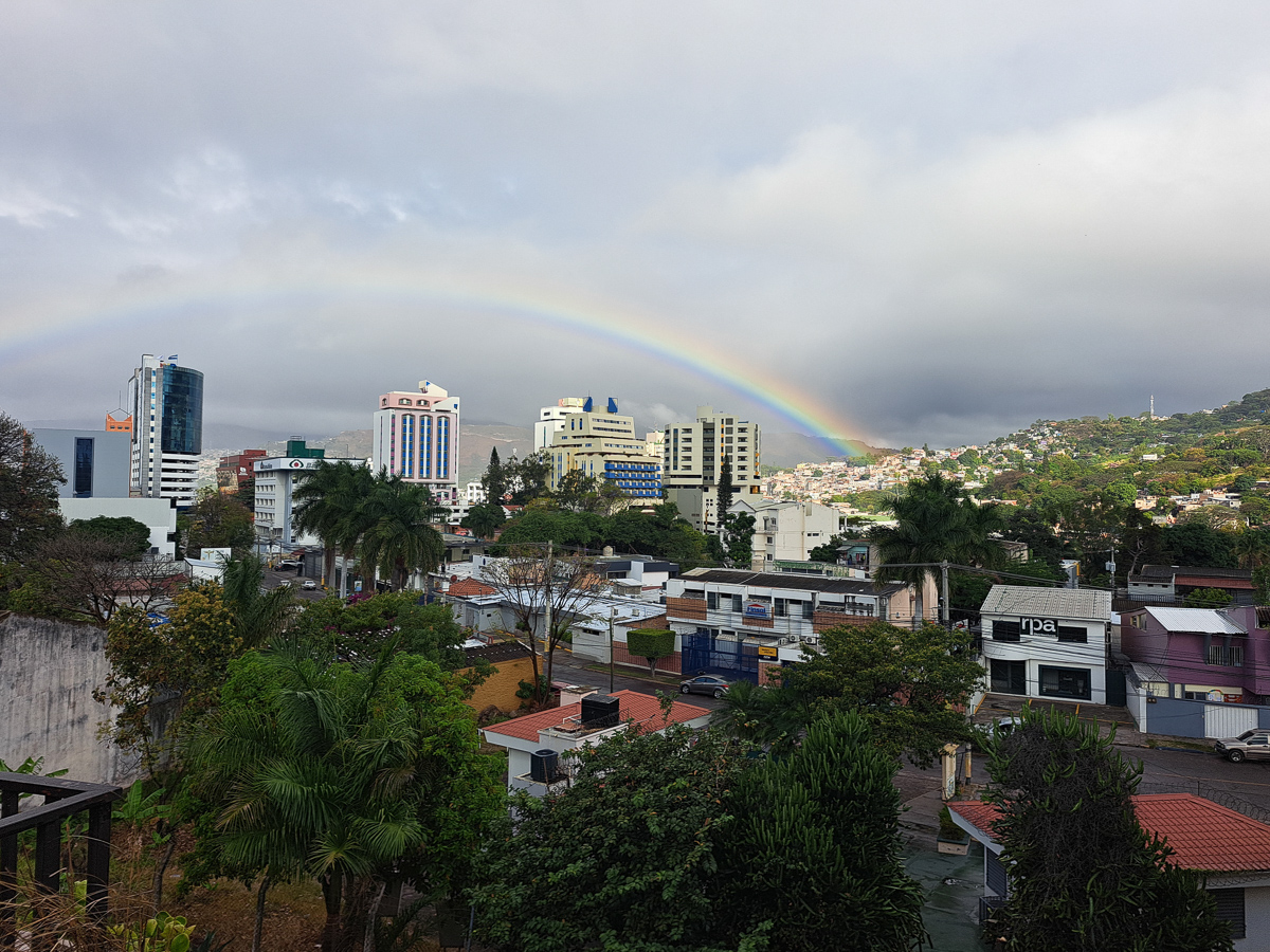
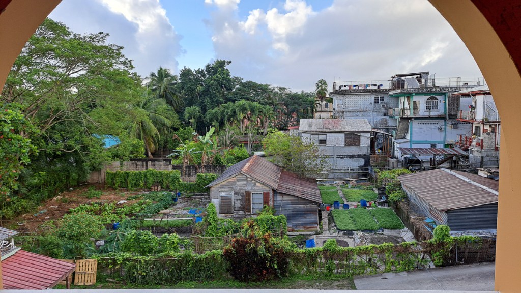
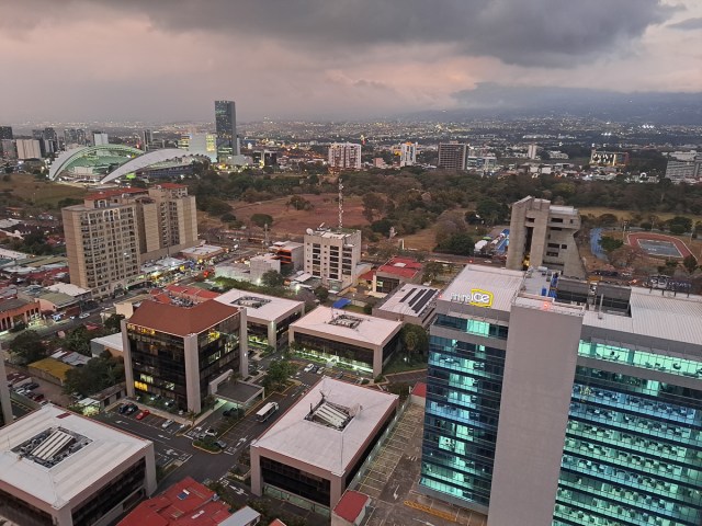
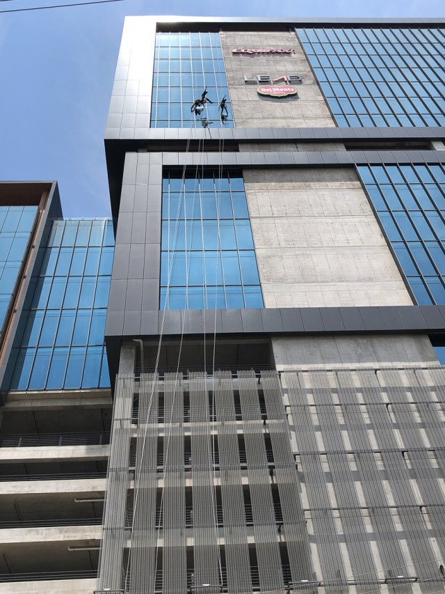
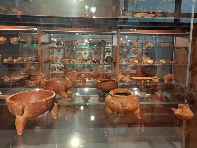
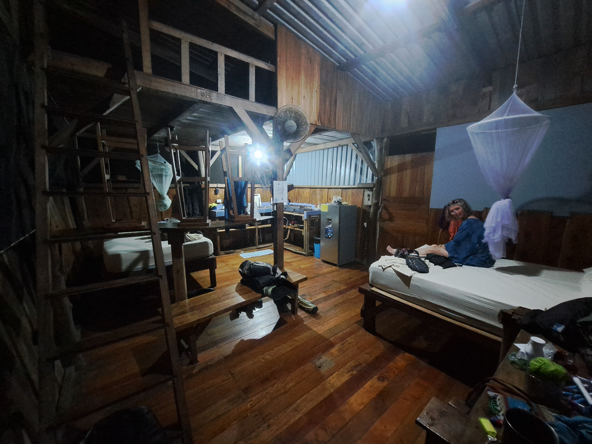
In San Jose, like in Mexico City and Guatemala City, our choice for a place to stay was a yuppie flat complex. This time we were on the 29th floor, in a studio flat, with spectacular views – including views into the next door flats – privacy was a little lacking. The building’s décor was a so-Hispanic mix of really fancy, surrealist stuff, and unfinished blank concrete. But, it had good parking, and a really rather good gym. Legs didn’t really need a gym, with 29 flights of stairs available. There were a few interesting places to visit in San Jose, although, definitely, too many pots in the museum.

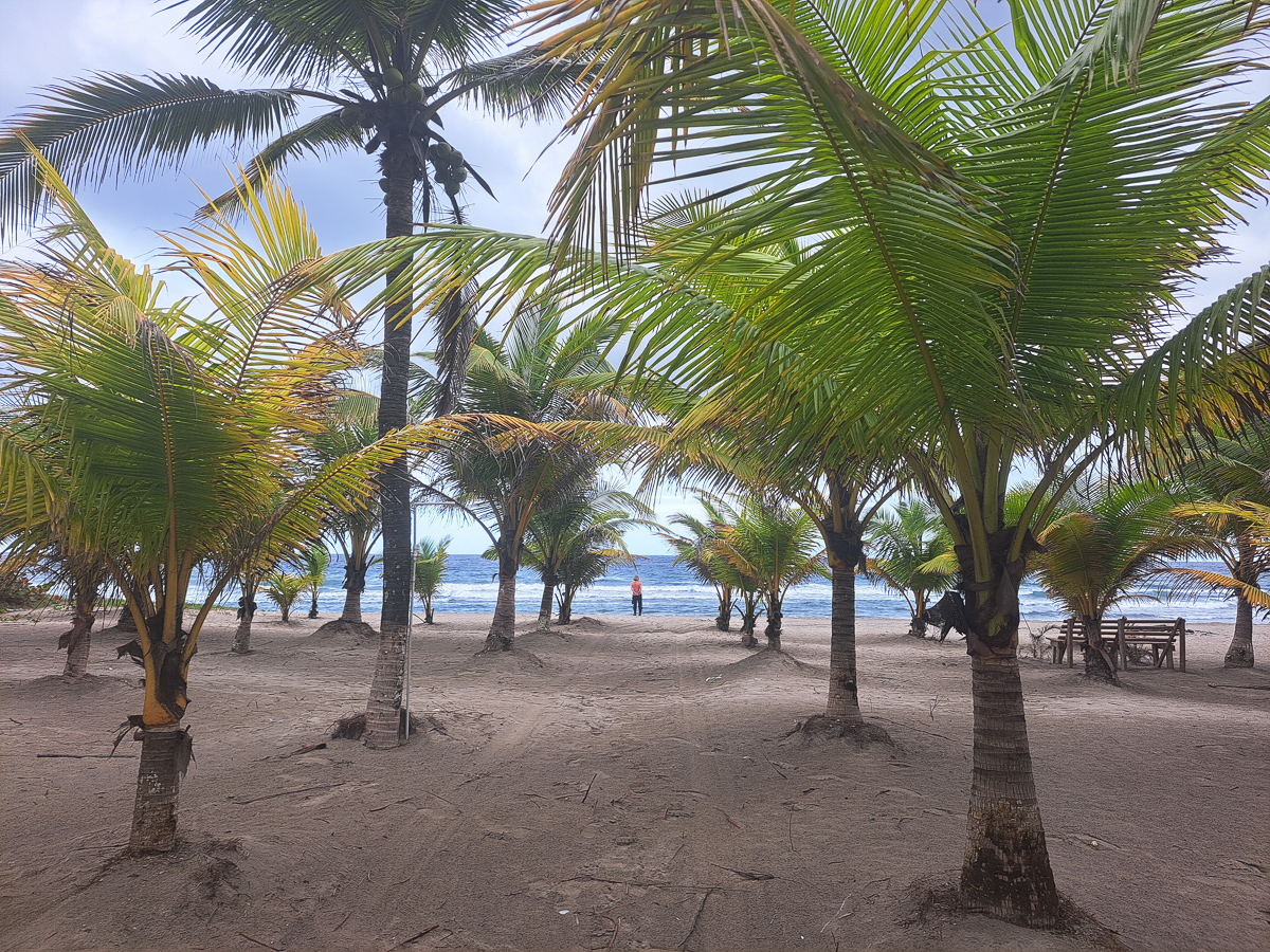
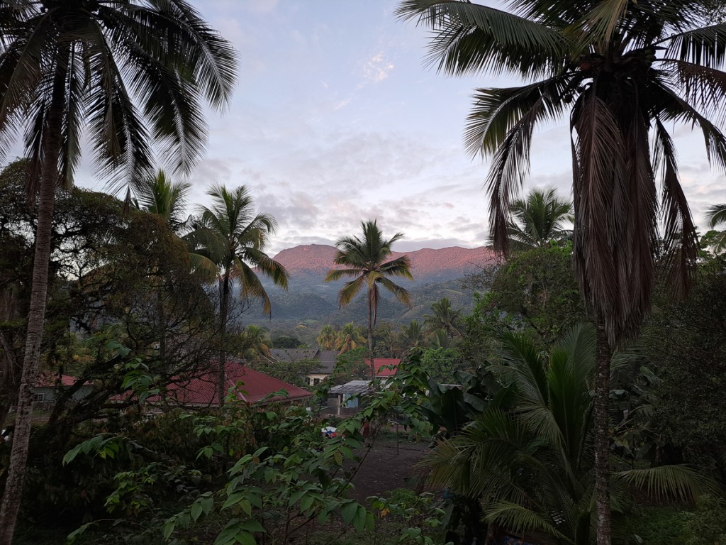
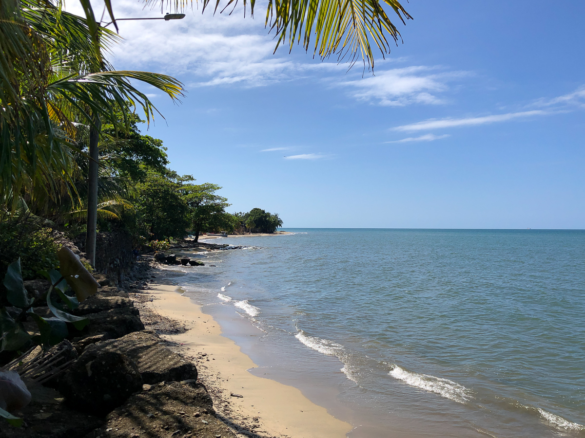
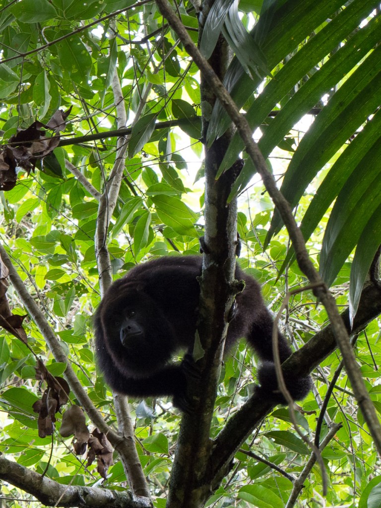
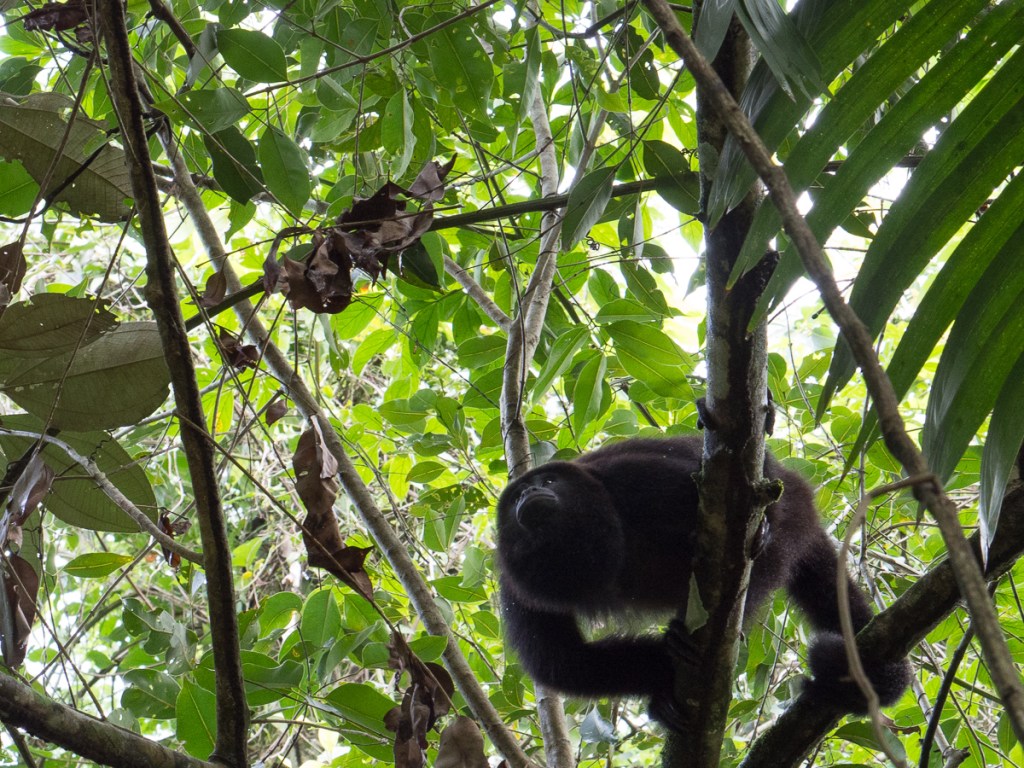
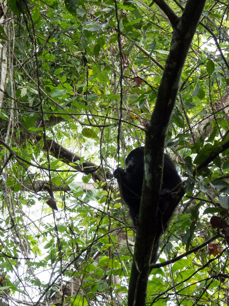
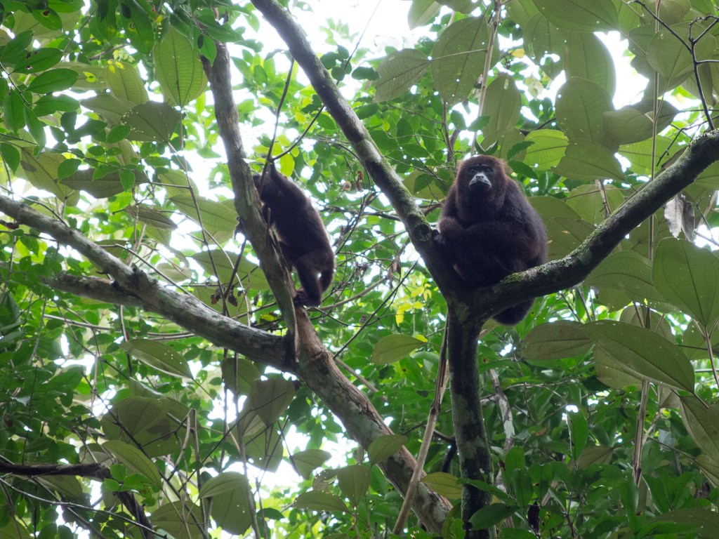
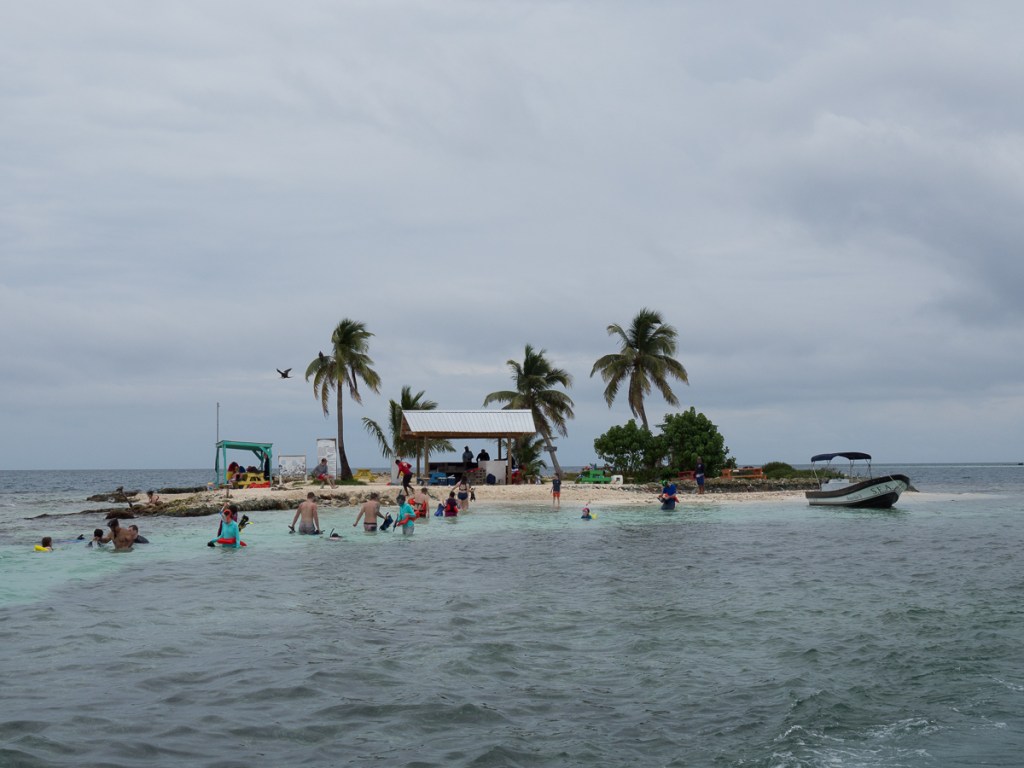
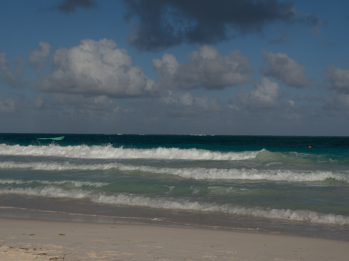
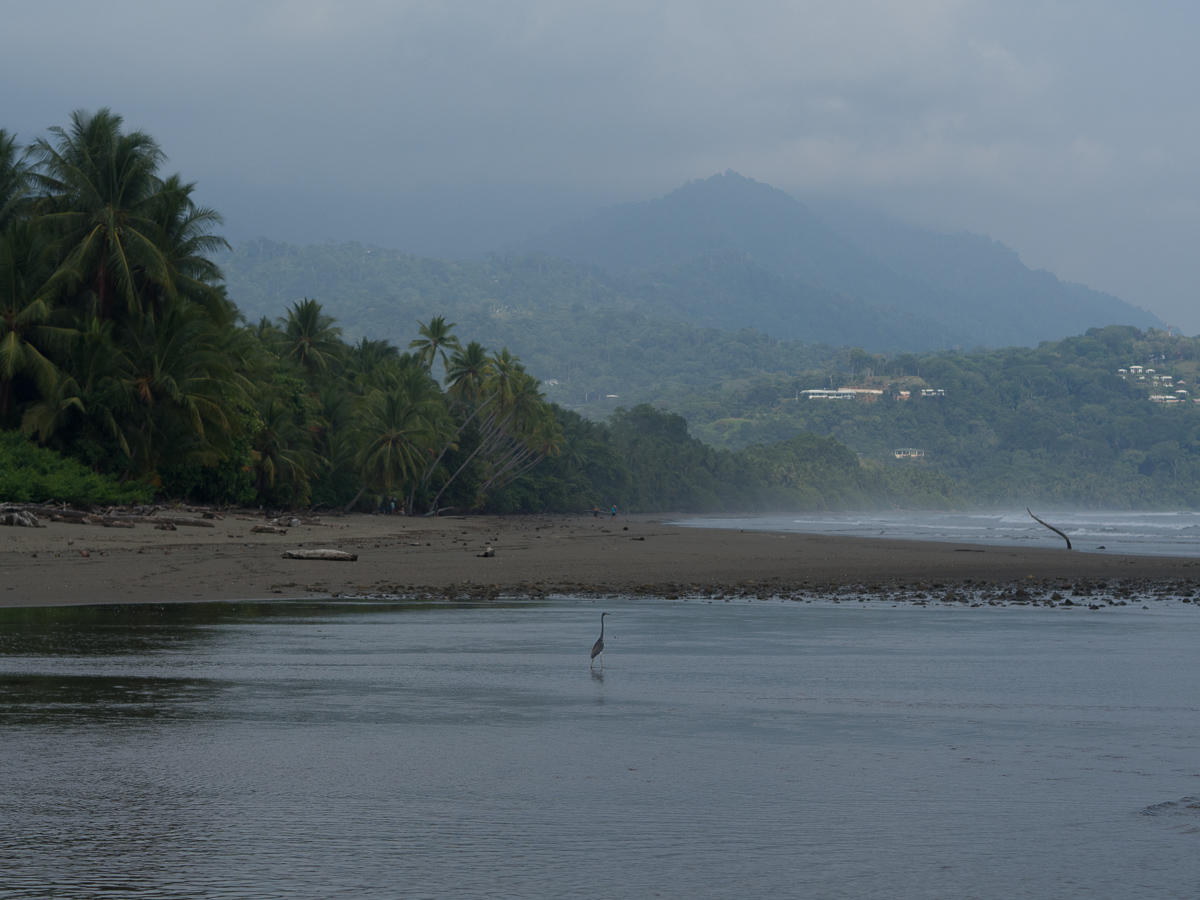
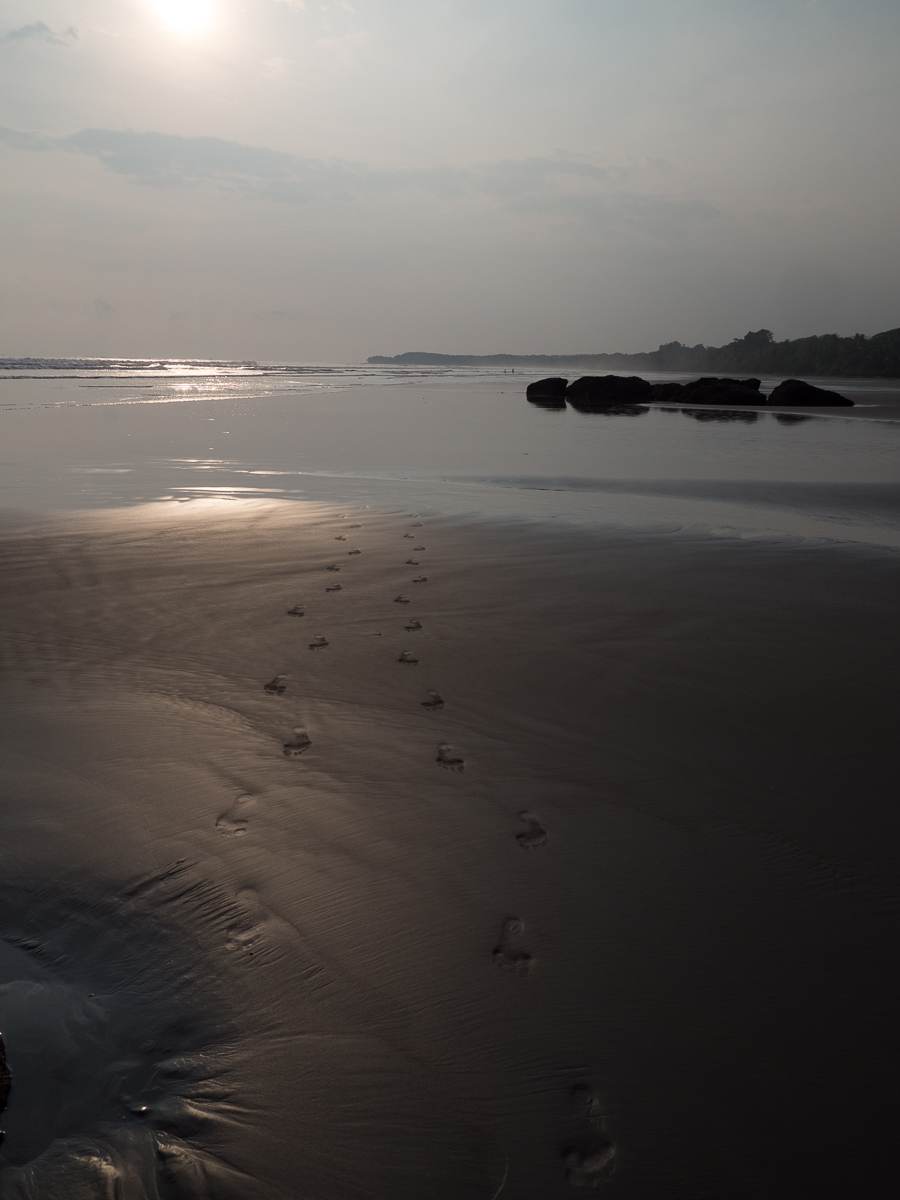
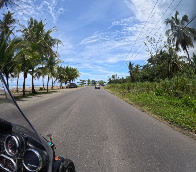
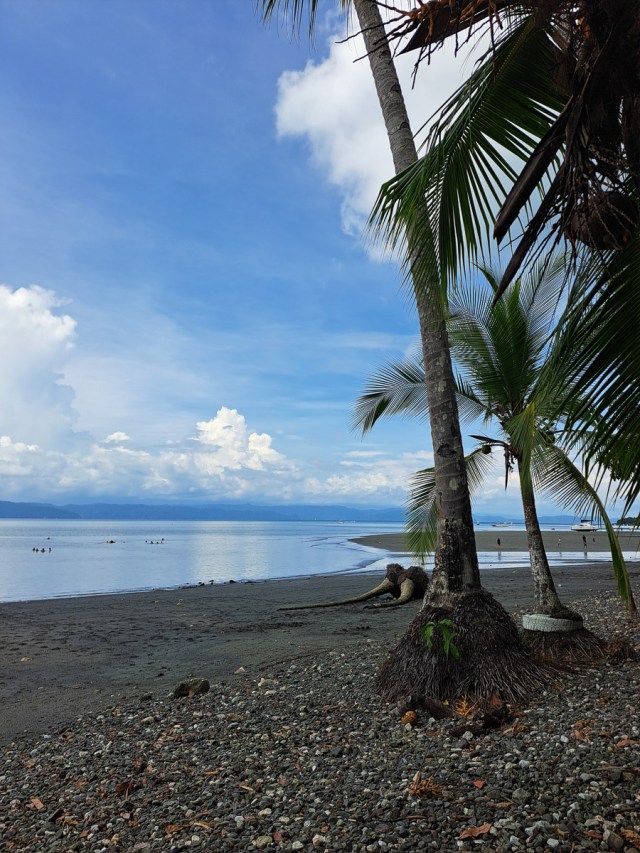
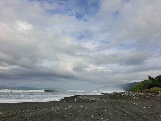
The Pacific beach at Uvita was a spectacular beauty, a cliched arc of pale sand with coconut palms on one side and blue waves on the other – waves and howler monkeys competing.  The serious boardies stay a little to the north, where Dominical has expert grade waves. Uvita has gentler stuff and was sparsely dotted with beachgoers and a few boardies at the small breaks. The sea water was cool bath temperature, barely cooling at all.  Although it was overcast, I was dripping sweat after 1 and a half laps of the beach, while Clare collected sand dollars and admired the agile crabs running over her foot.

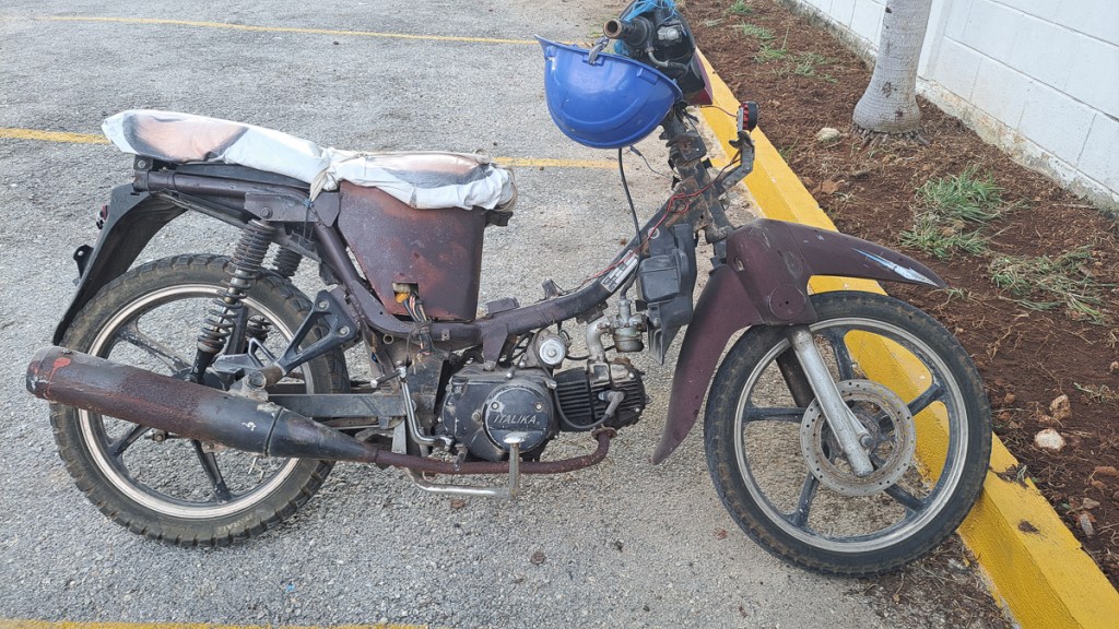
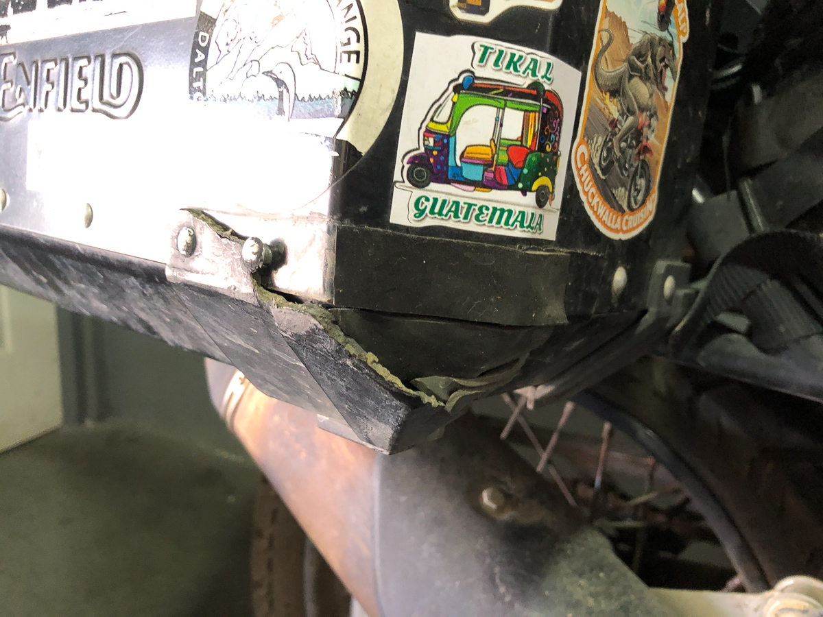
The only outstanding bike job was to fix my rear pannier.  I’d got too close to a truck when lane splitting in Guatemala City, and the truck’s extended wheel nuts took off my rear pannier corner protection.  A lucky escape!  I should never have been that close.  I could have gone flying.  There’s no spare part, so it has to be bodged:  At the coast a local surf board shaper had no interest in slapping some glass fibre on the corner but the metal worker down the road was happy to cannibalise the pannier’s rear inner corner protection to move it the the front outside corner where the pannier is far more likely to need protection even without me trying to vie for space with a trucker.

At this point, riding in drizzle and mist, we realised that our rear lights basically didn’t work, nor did our brake lights. I had fitted “upgrade” LED bulbs from the UK, in Mexico City (USA bikes are sold with ordinary bulb lamps, unlike everywhere else in the world who get LEDs from the get go. I think it’s called a “non-tariff barrier”). Anyway, obviously crap LEDs, as they’d deteriorated to near invisibility in 6,000 miles. Hazards on then, team! Fortunately the replacement spares (also LEDs) that I’d bought in Mexico City, proved nice and bright.

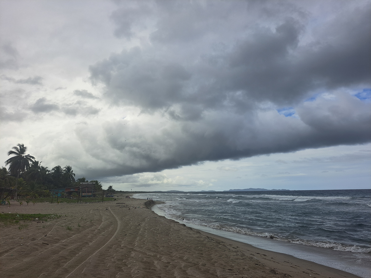
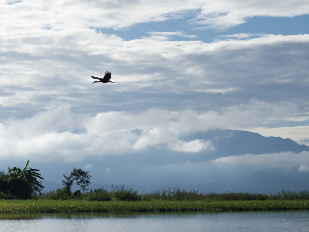
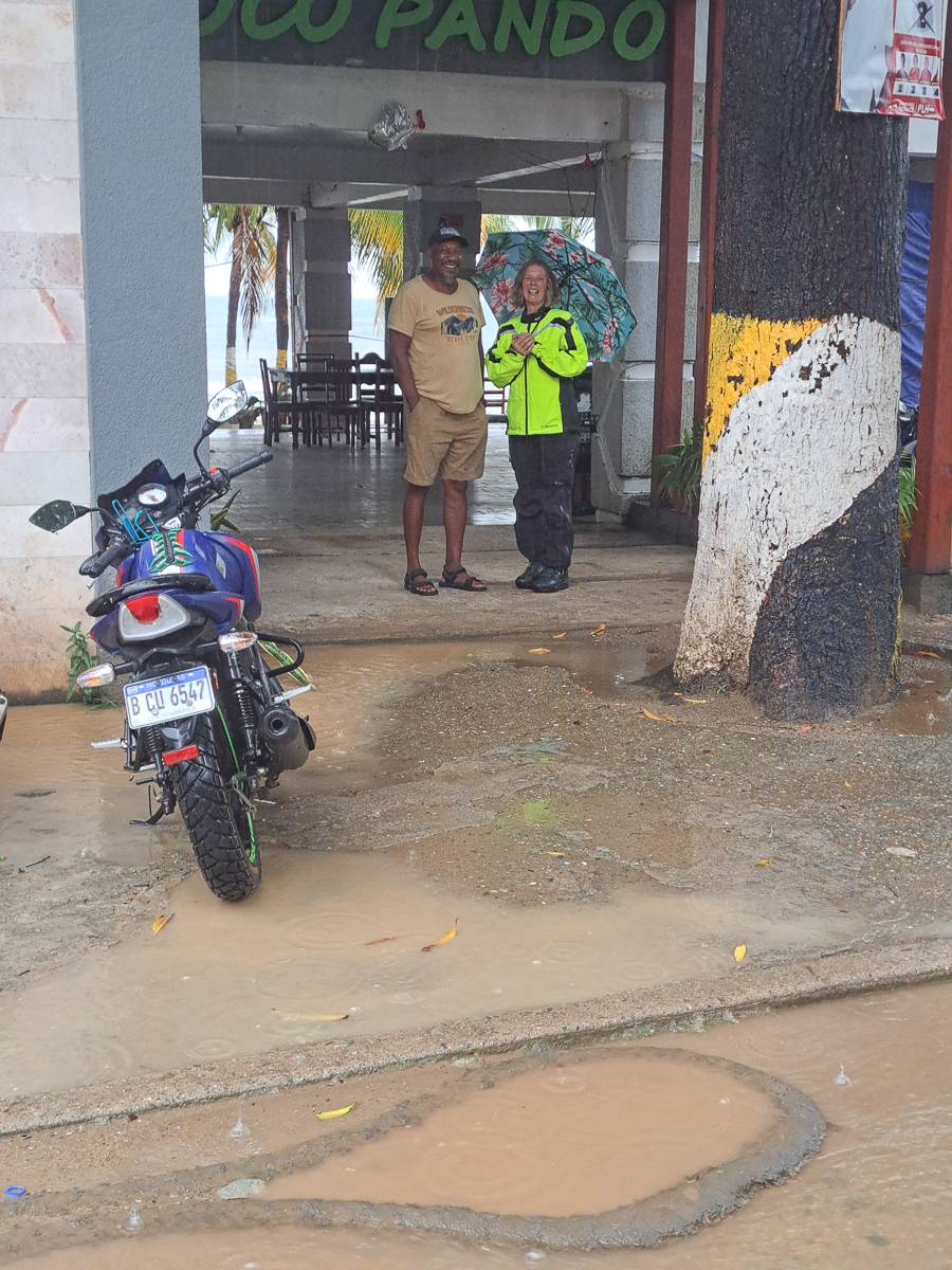
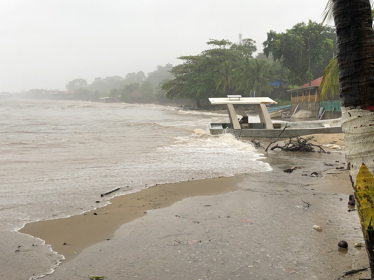
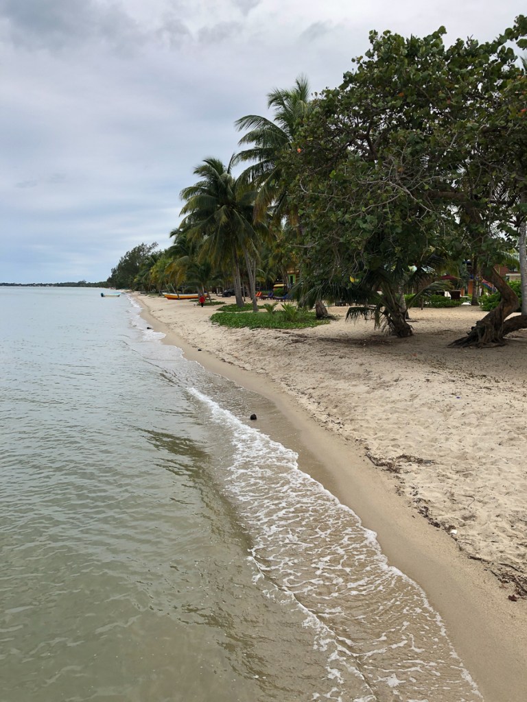
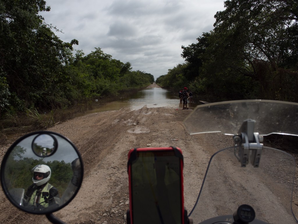
The Caribbean beach at Cahuita isn’t a patch on the Pacific beaches, but that wasn’t why we’d come. Lonely Planet states that despite some development in recent years it has kept its Caribbean vibe.  True enough, Bob Marley’s One Love amongst many other hits were blasting out of several brightly painted eateries along the coastal road.  Alas, whatever we planned here has to factor in the unseasonal cloud and rain that’s visiting us now.  Locals are appalled – it doesn’t do this. ‘Rain at this time of year will ruin the fruit crop.  The fruits will swell and burst!’  But yes, it’s overcast with some torrential showers. It’s one month short of the rainy season so whether we like it or not we need to get our act together to deal with this wet both on and off the bikes.  Two out of three of our recent dawn choruses had been thunder, the third howler monkeys.

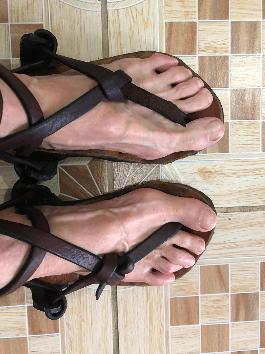
As the “unseasonal” rain continues day after day, gradually confirming that it’s just an early start to the rainy season, we should admit that although unhelpful, it ain’t that bad. Very often, the mornings are fine, with the humidity rising until rain breaks out in the afternoon. A lot of the rain falls overnight – thank goodness for Clare’s brilliant bike covers. We can mitigate it a lot by getting up, and getting going, early. It doesn’t rain every day, either. We do still get caught out occasionally though. And of course, it’s warm rain, being wet is just, well, wet. Not welcome-to-Scotland-in-August-dangerously-hypothermic-wet. Equally, I’ve worked it out now, that if I want to go for a run (which I fail to do weekly), we either have to be at a height of over 1500m, or it has to be raining, otherwise it’s too hot. Which leads to the odd, flapping, flatfooted experience of running in my basic Teva sandals, rather than trainers. Or just occasionally, the treat of running barefoot on a sandy beach.

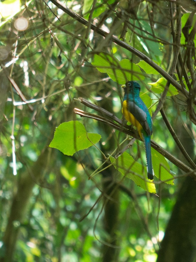
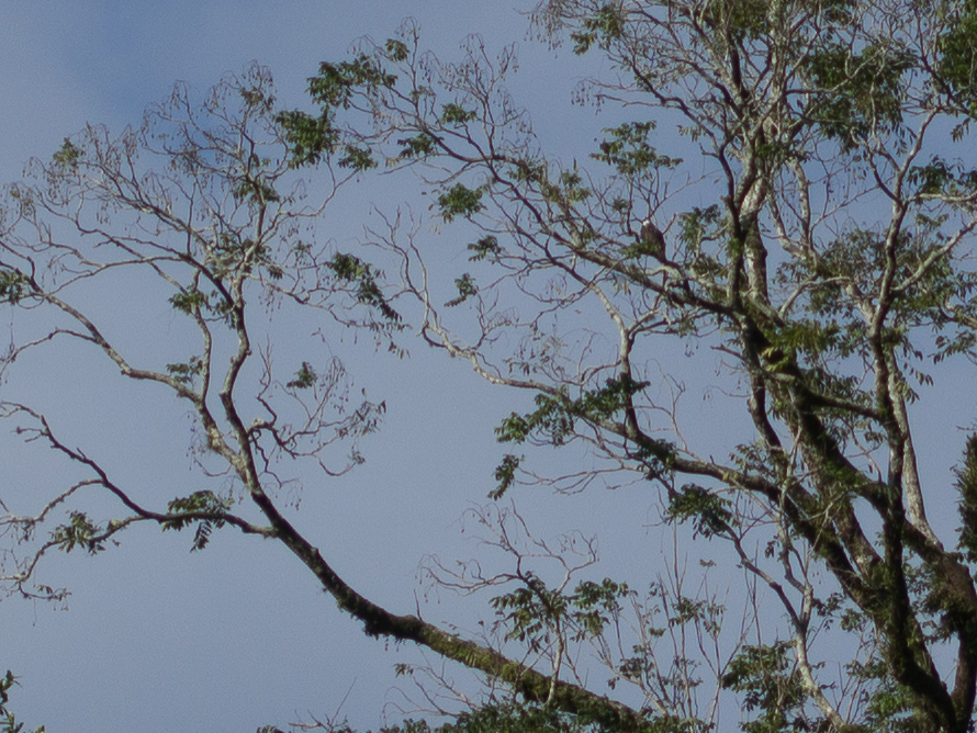
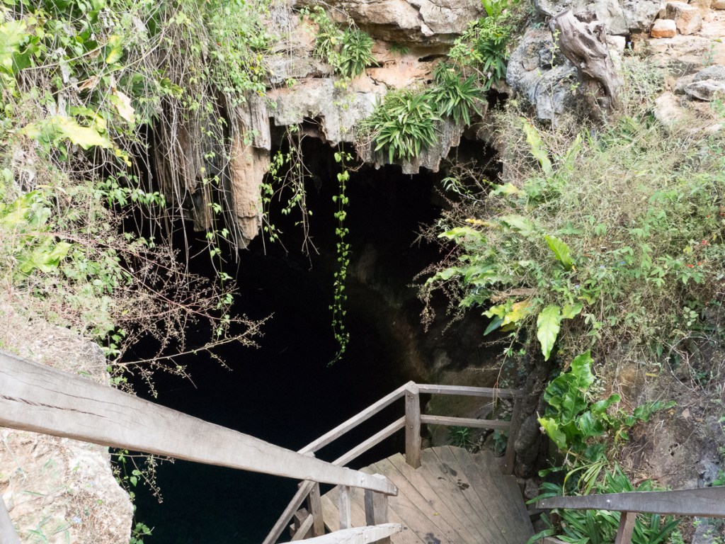
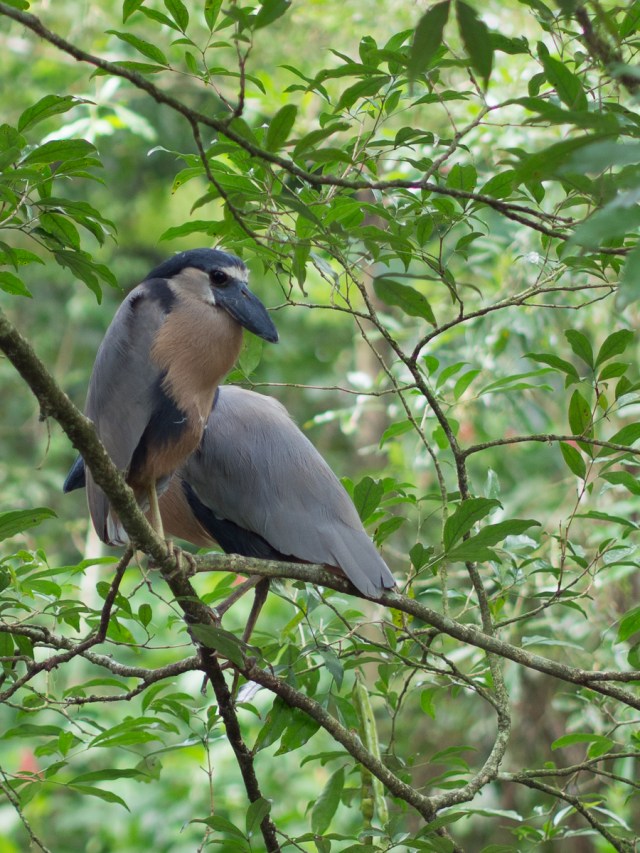
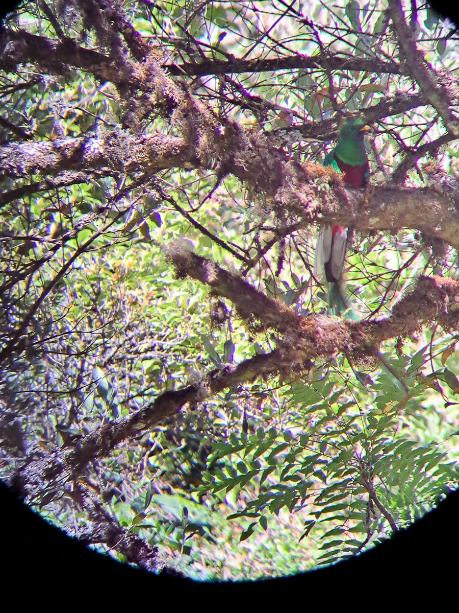
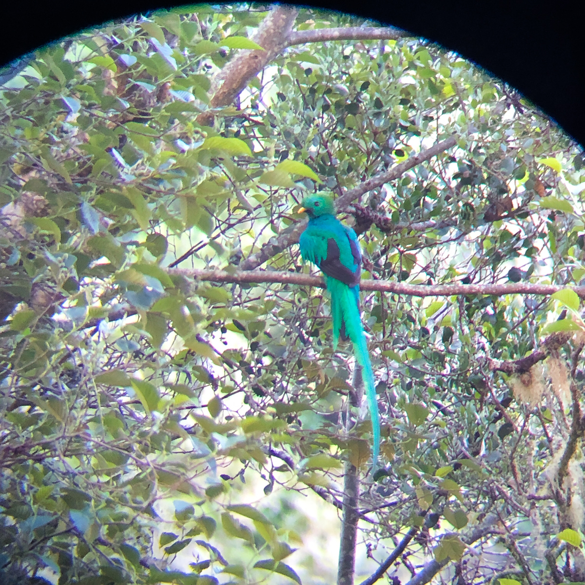
On the Caribbean we visited the Park National Cahuita but on this occasion we went for the option of a guide.  It’s about 50 – 50 whether or not we get a guide but with a guide we are guaranteed to see some prized wildlife in the area – they know where the beasties are, and the guides in an area share sightings.  This was again the case at the Quetzal National Park (actually just outside at San Gerado de Dota).  In the quetzal park we left at 05:30 with our guide Inaki to stand for the nearly an hour with just a few common birds in our view.  Inaki showed his prized pictures of quetzals, the National bird of Guatemala, in this tree to our left and that one behind us justifying why we were standing here.  Then a whirlwind hit.  The walkie-talkie squawked.  Cars were dashing past, we were legging it to the buggy.  There was a mass exodus down the road where every group found a spot to park, jumped out and joined the throng.  Scopes pitched, necks craned told us where the quetzal was. Three quetzals, in fact.

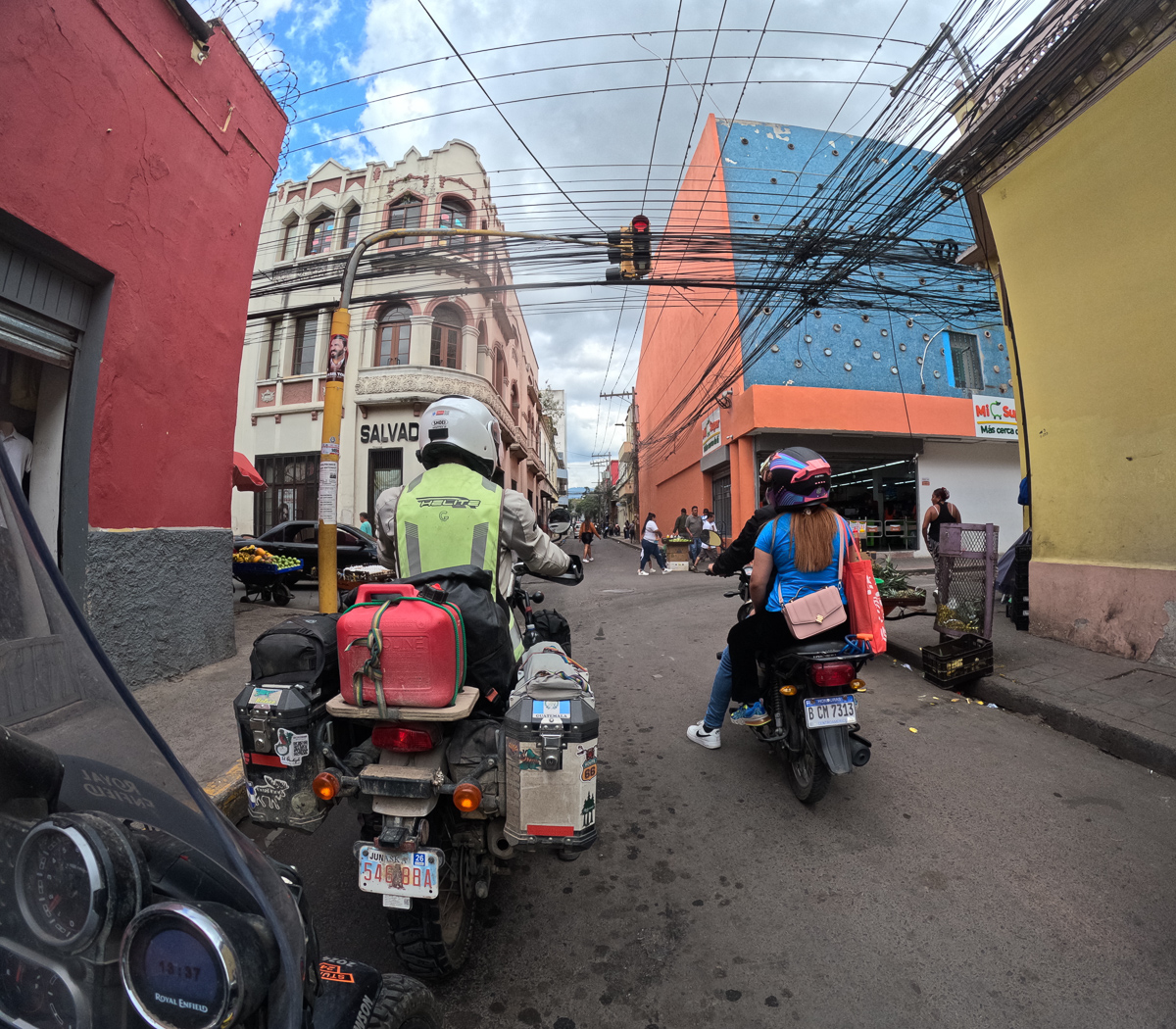
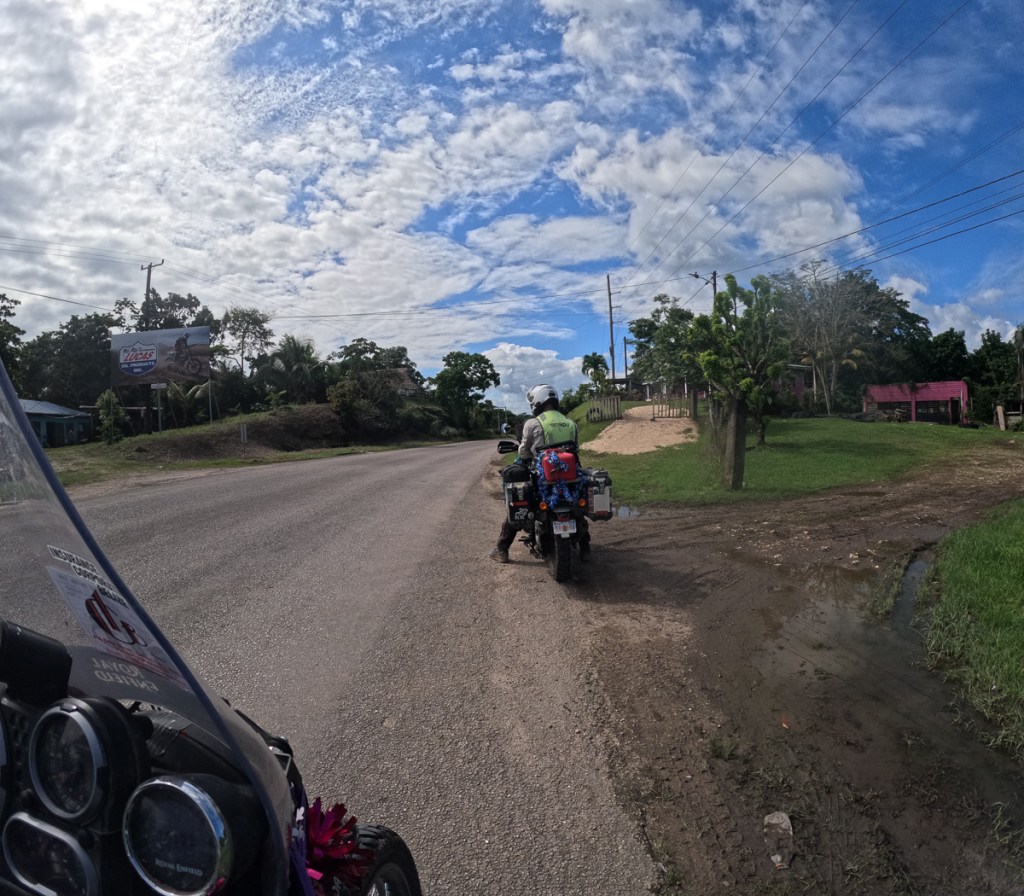
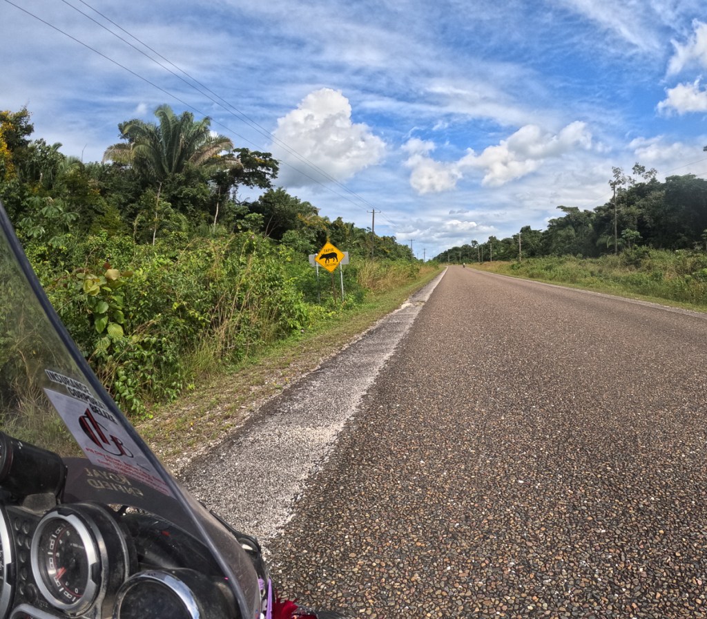
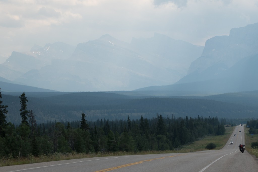
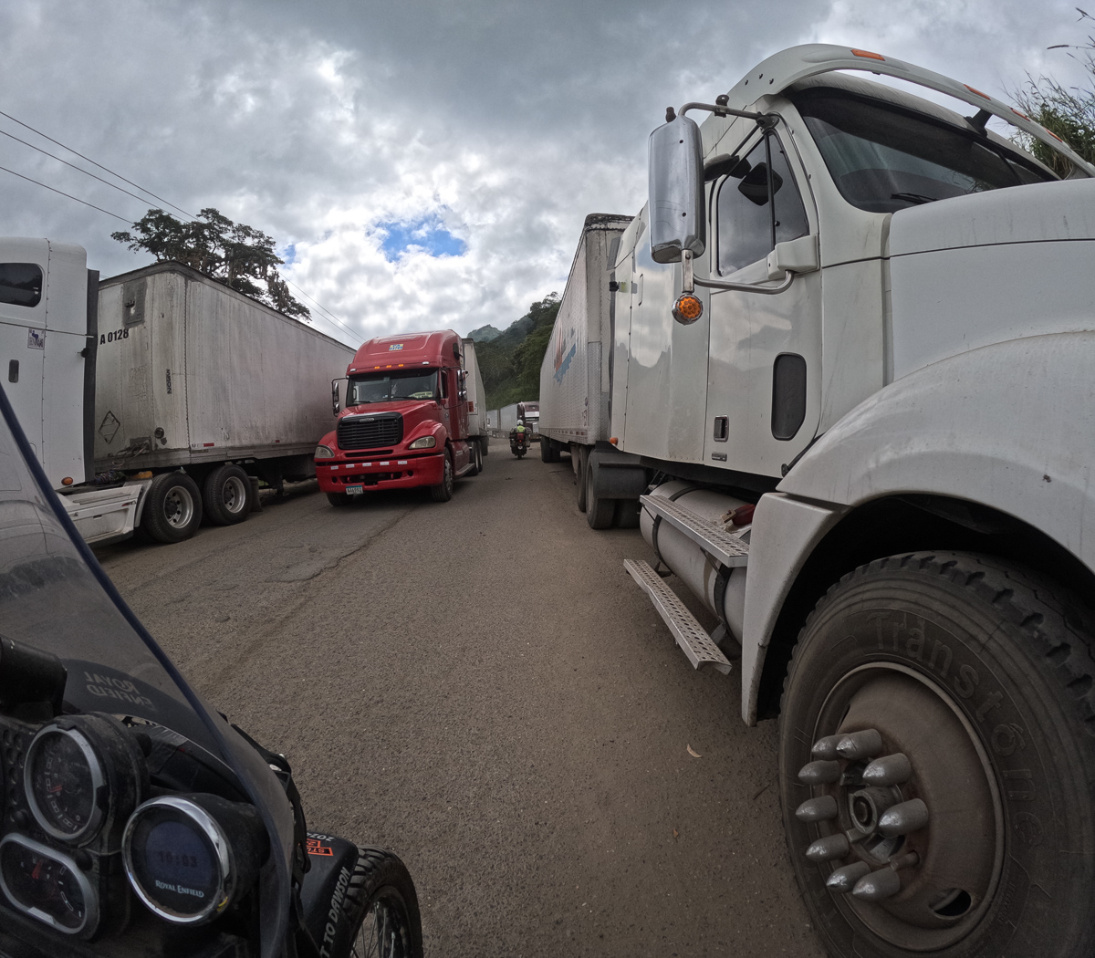
The dual carriageway, CR32, down towards Limon was our first experience of Costa Rican contraflow traffic.  Cars approaching us at speed was somewhat alarming.  ‘What the heck is this?’  A few more expletives passed between us as the odd car, truck or lorry came hurtling along from the other direction right towards us separated by a thin white line.  Initially, some obstacle was placed in the fast lane to force the traffic to merge into one.  Nothing unusual there.  There is often an obstacle in the road.  From there we were separated by the occasional plastic pole set into a small concrete disc.  So infrequent where they that occasionally a car would cross to overtake before weaving back into our lane.  We got kind of used to that but it went a step further on our return.  Out of the blue there were three arrows on obstacles semi blocking our road pointing leftwards across the central barrier.  Gingerly we went across with no further indication that this was correct.  ‘Local traffic,’ Gid said explaining some cars still on the other carriageway.  ‘It’ll soon cut across and join us.’  To be fair on coming traffic did seem to be using one lane but that was of little comfort when we were on our own.  Gradually we caught the traffic ahead but reversing lights were on.  It seemed to be stopped and even backing.   Just before them was a gap in the central reservation.  I was through it closely followed by Gid.  We’d no idea what was going on but had had enough of where we were when the road looked perfectly good to our right.  A few seconds later we could see that the contraflow lane that we had left was blocked.  That’s why the cars were backing up the dual carriageway.  They had to reverse back to the gap.

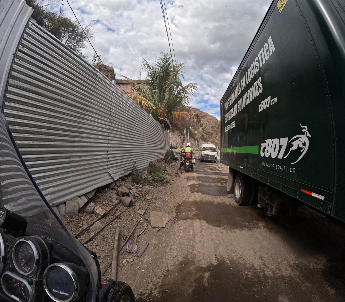
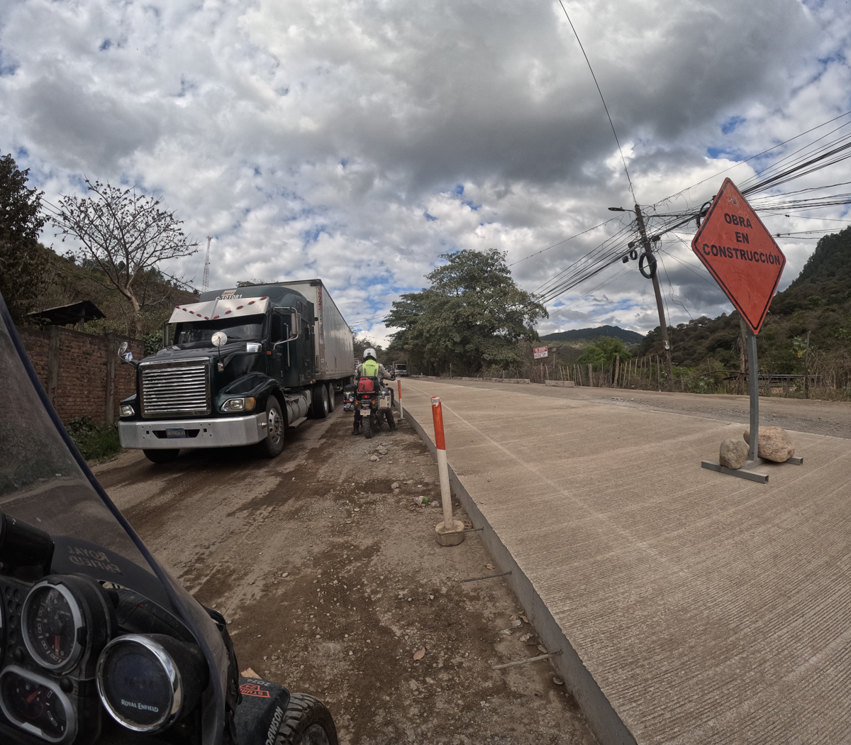
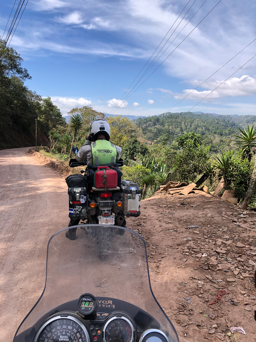
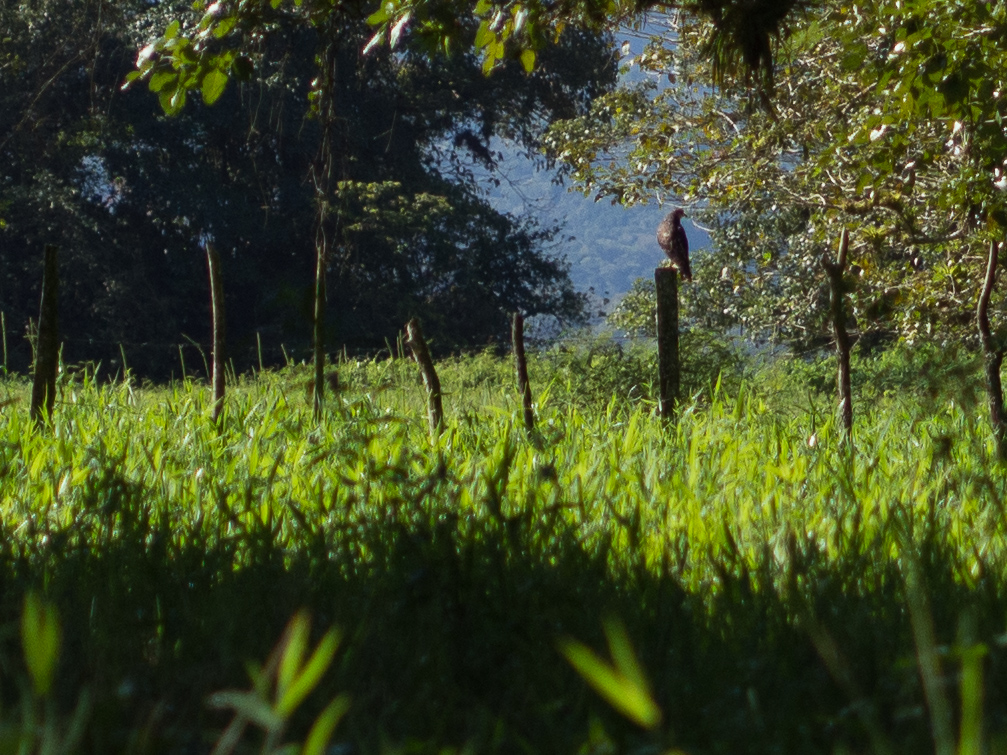
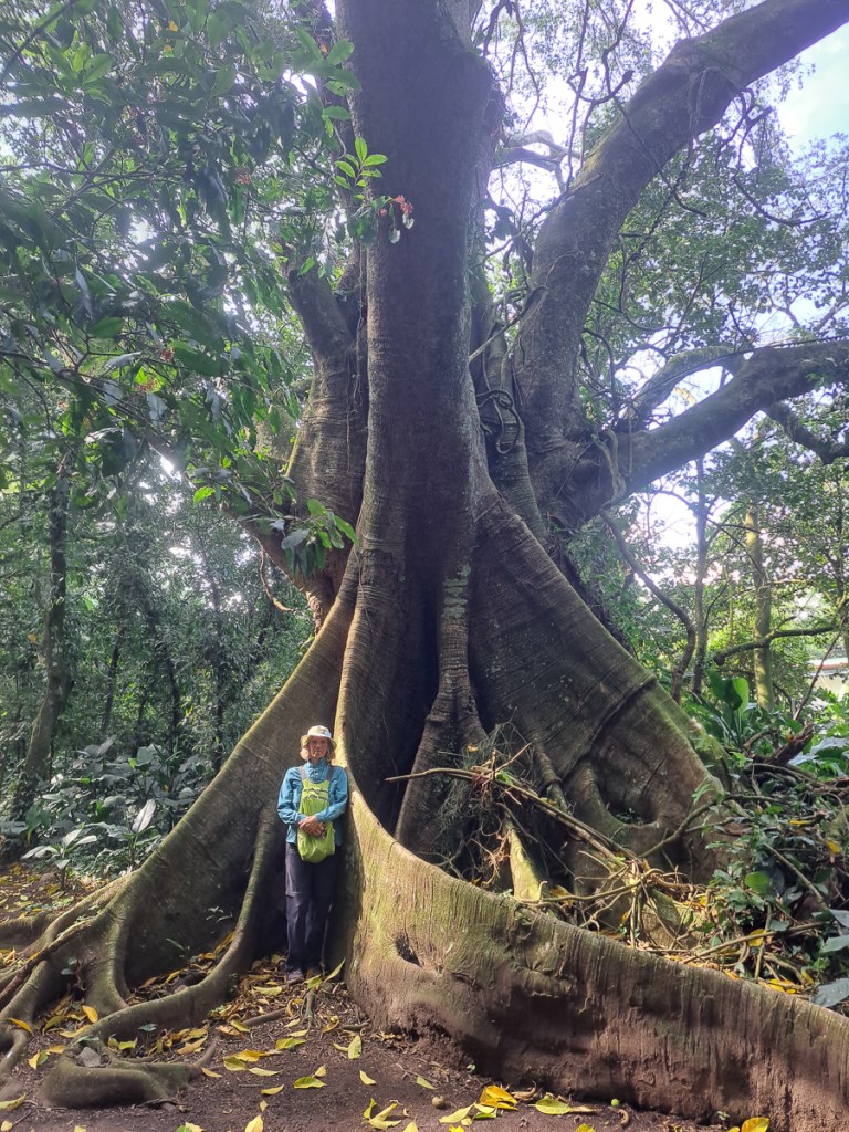
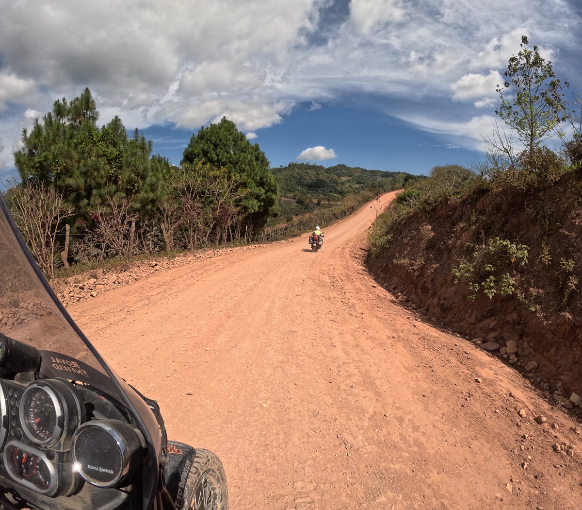
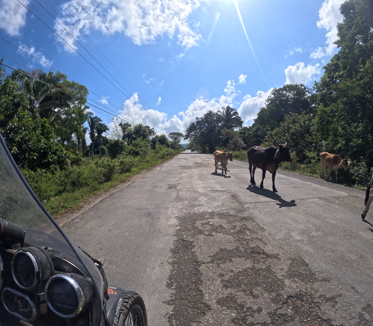
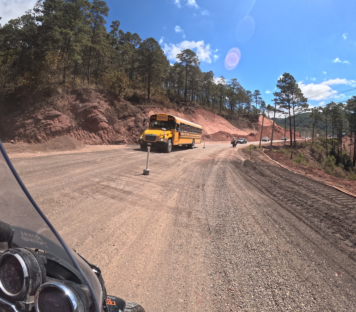
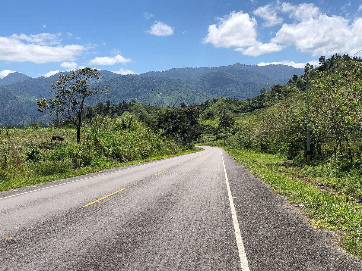
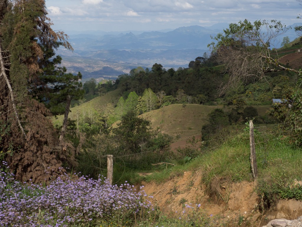
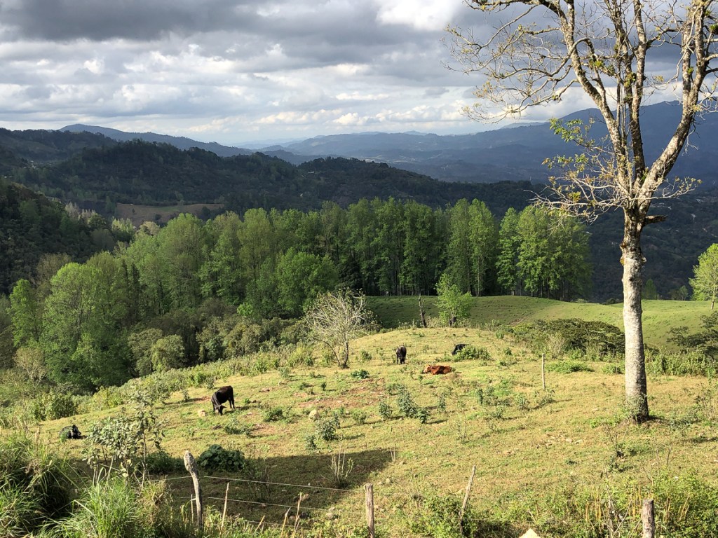
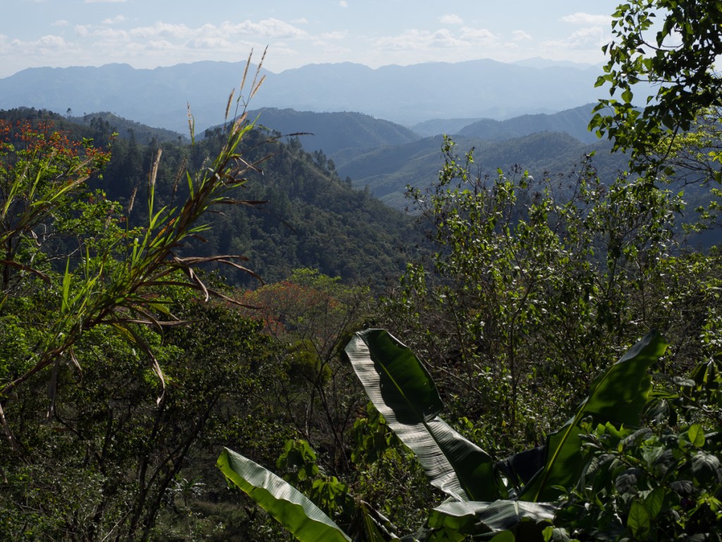
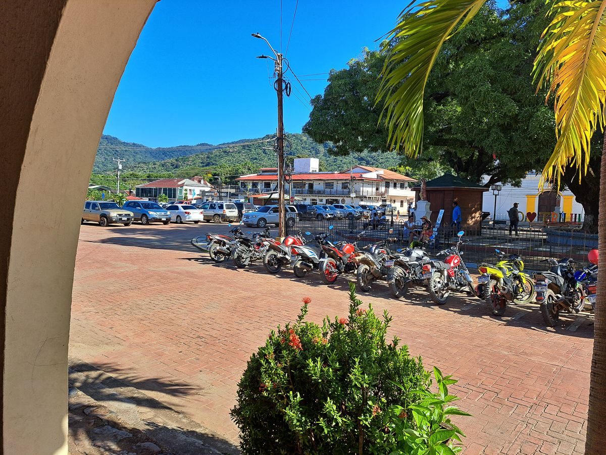
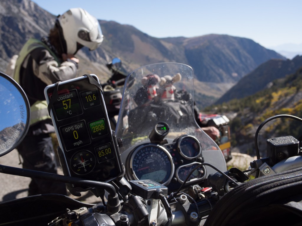
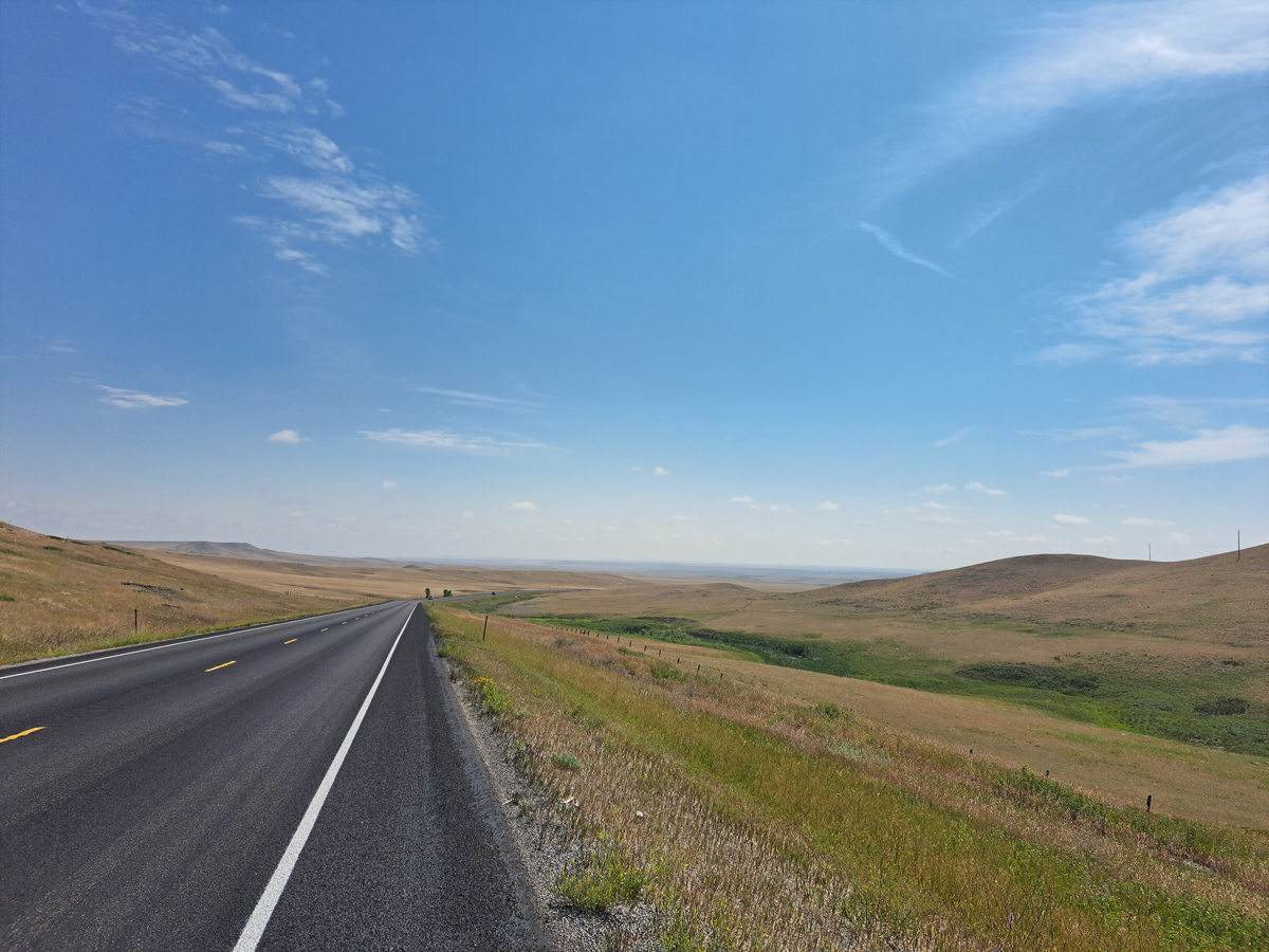
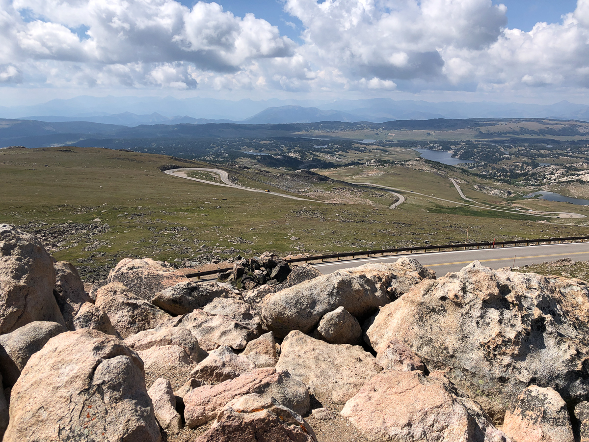
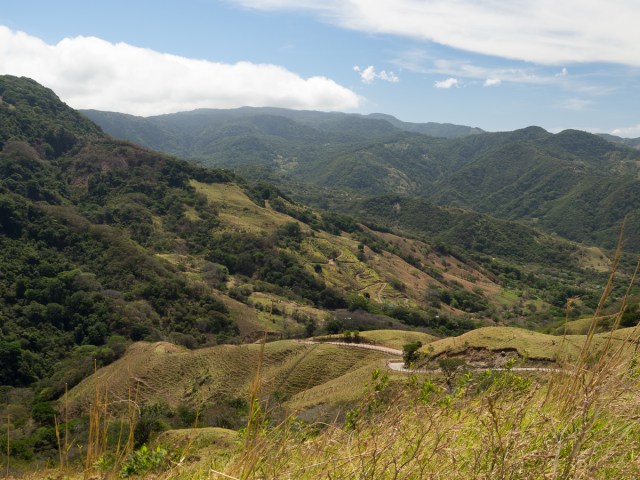
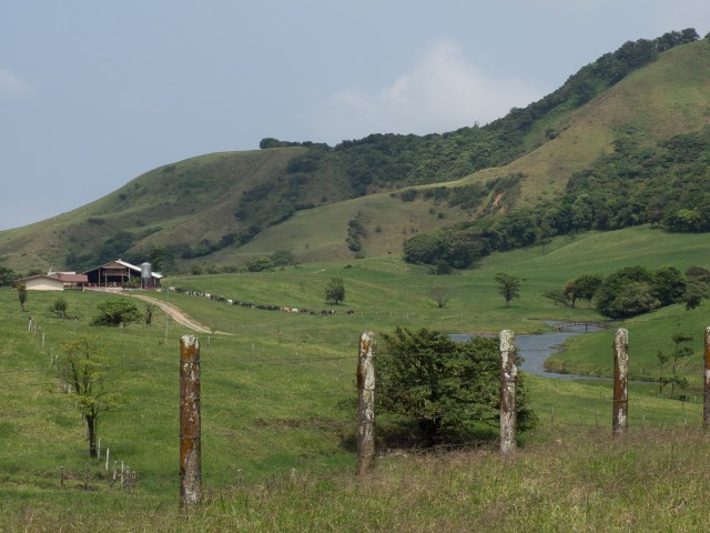
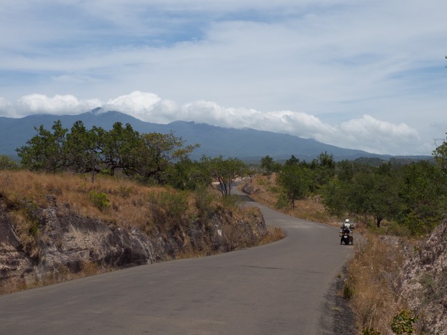
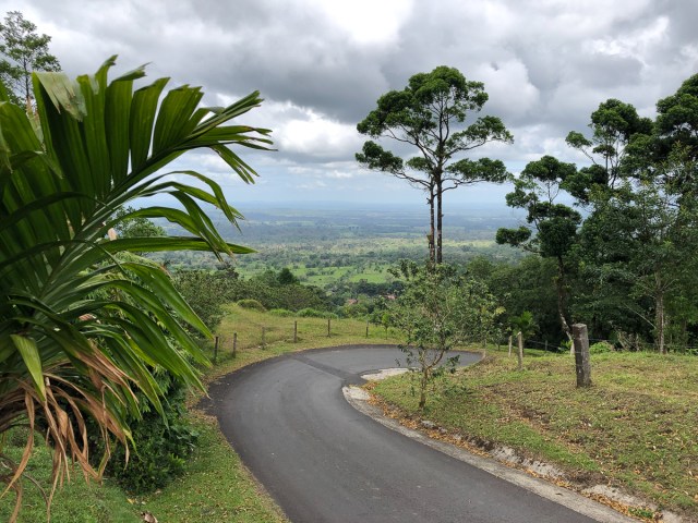
But moaning about the dual carriageway is rather missing the point about Costa Rican roads. It’s not a large country, so with two indented coasts and four mountain ranges up to 3,800m (https://lacgeo.com/mountain-ranges-costa-rica) many of the roads are twisty and steep. I don’t suppose Costa Rican bikers suffer much from “squared off” tyres. The ride from San Gerado de Dota to Puerto Jiminez was pretty much 170 miles of convolutions. Of course, a faster bike than the Him would have livened it up, but with such short sightlines at the incessant bends, going much faster might prove fatal. Often 30-40mph was ample. One thing we are seeing in CR though, first time since the USA or maybe Mexico, is locally registered “big” bikes. Whizzing past us, sometimes, but that’s fine by us, we don’t know the roads at all. Another aspect is that, curiously, as we sweat along in 35°C temperatures, some of the countryside looks like, well, Devon. Rolling hills, green grass, rickety fences, processions of cows heading for the milking shed. Curious indeed.

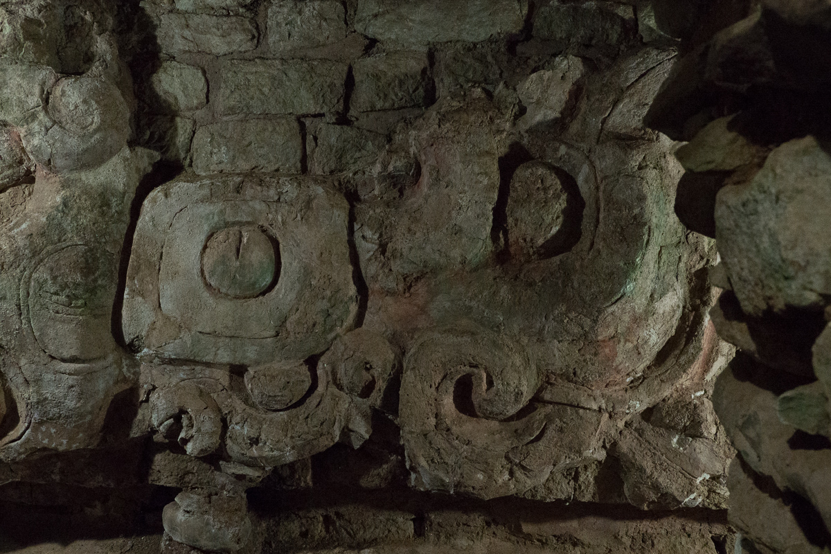
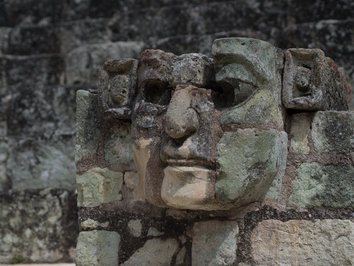
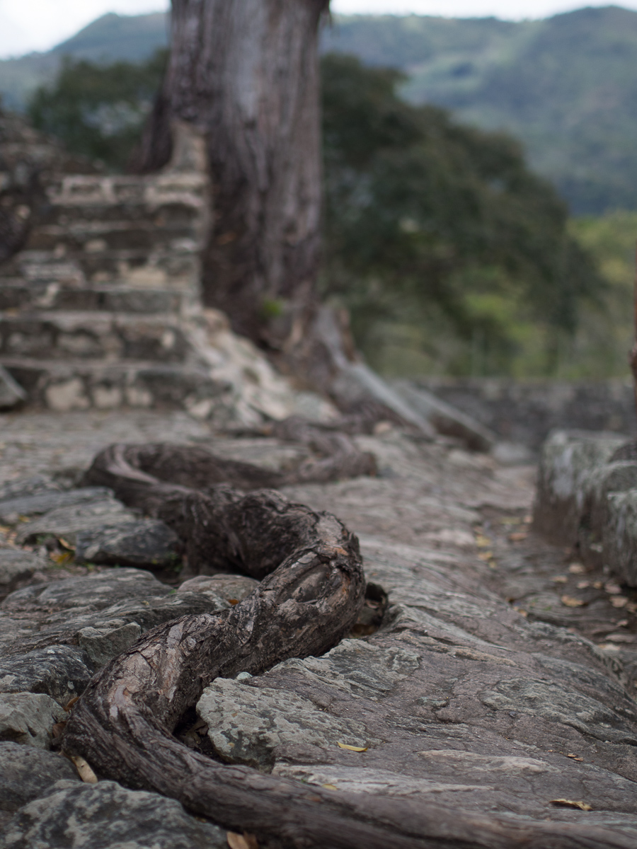
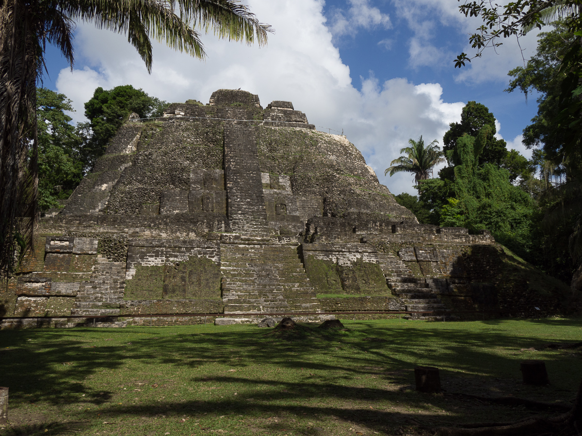
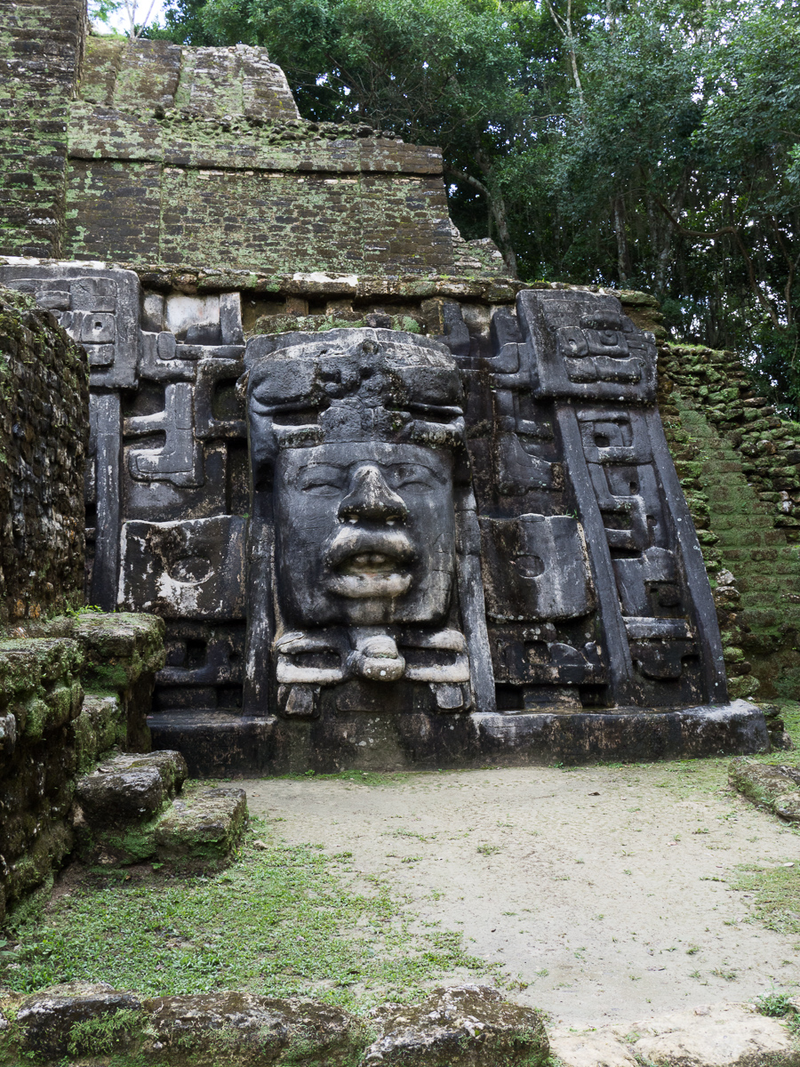
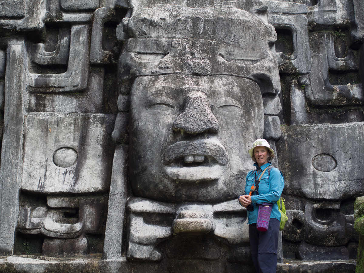
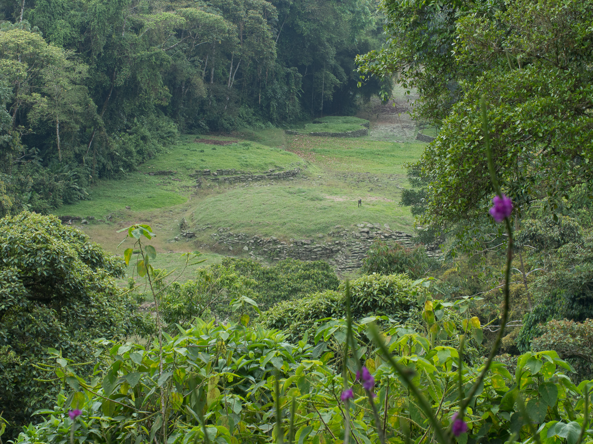
Guayab, our stopping point when returning along this road, is the site of the National Monument.  Pre-Colombian is the most specific information about the people who built this city.  The site is quite small compared to the Mayan ruins we’ve seen as the foundations of the buildings is all that is left together with two water cisterns and a section of road way.

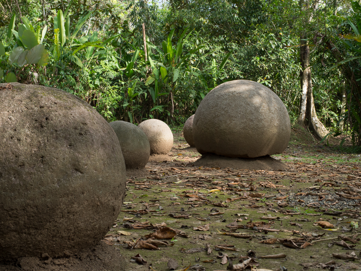
Later we were going to pass the turning to Sierpe which leads to the Finca 6 site – UNESCO listed since 2014 because it is of world significance and interest.  It is again the site of Pre-Colombian civilisations dating from 200BC to 800AD and had many strong similarities to the National Monument at Guayab.  They both had raised circular mounds bordered with large stones where it’s believed a large conical wooden hut was built, with a thatched roof.  The significance of Finca 6 and its surrounding area of lowland was the large stone balls varying from small to 2.6m wide.  The stone balls are, it is thought, a mark of prestige, power and honour when placed outside a house.  Others of the balls were placed to line up with the sun or moon in a similar way to stone henges extensively found in north western Europe which also align with the summer and winter solstices.  Although, similar to the henges, there is much debate as to the precise placing and use of these stone balls.  Only a few are thought to be in their original positions.  Certainly it must be quite an effort to reduce a large boulder to a near perfect sphere using only stone and bone tools, so they were obviously important.

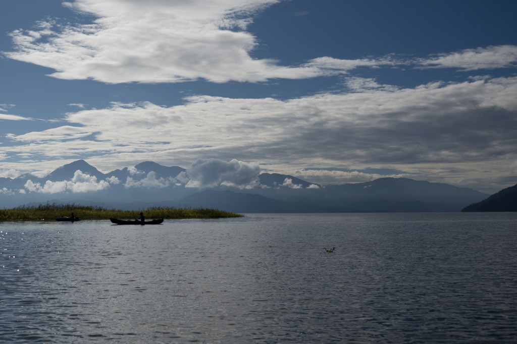
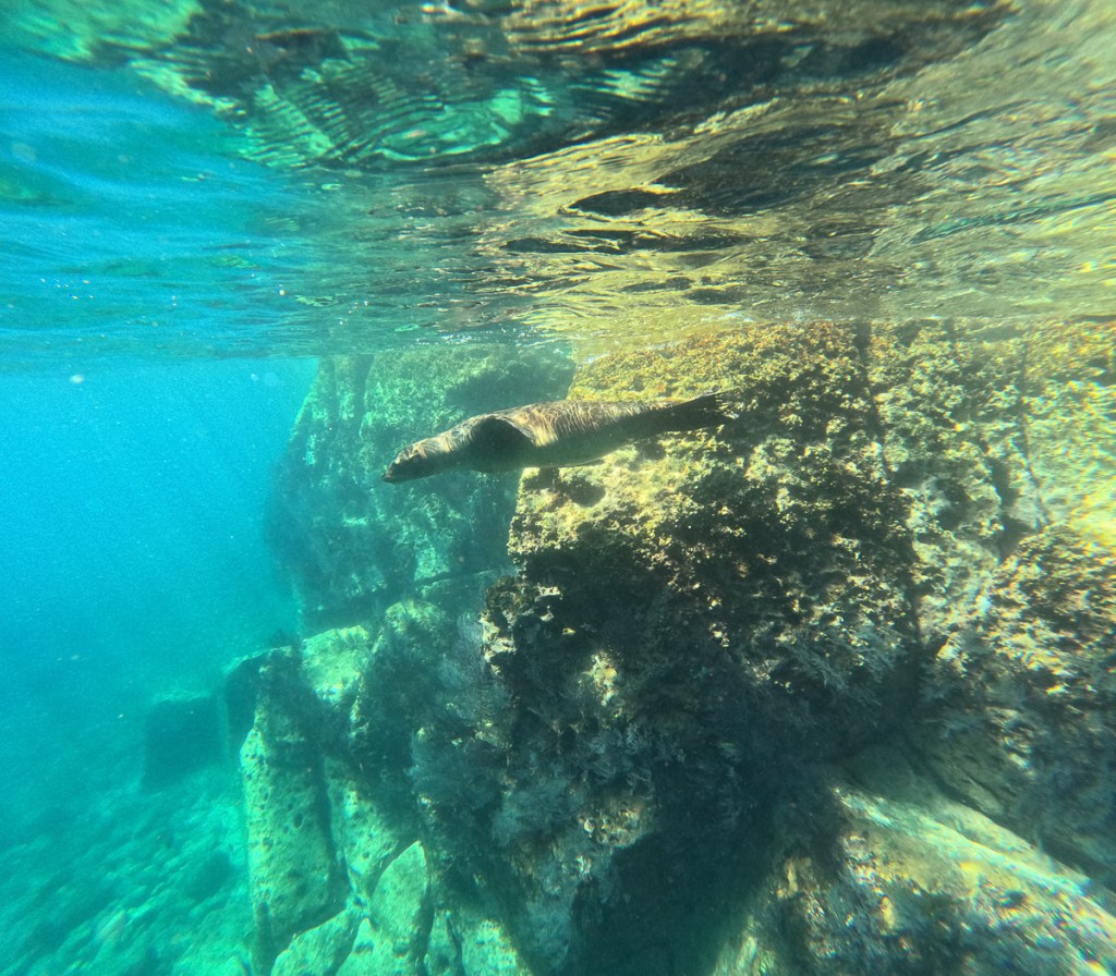
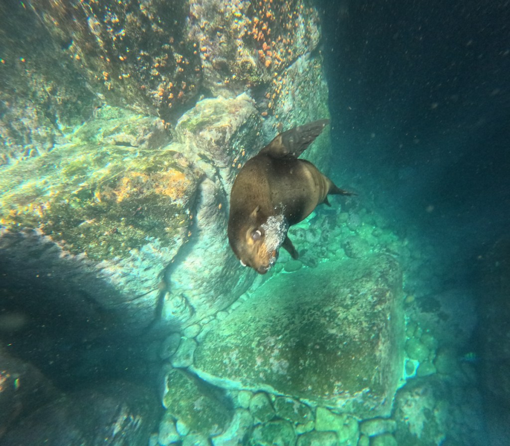
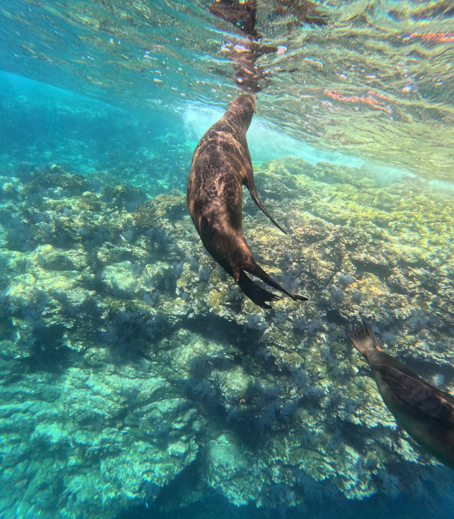
Our last port of call was to the tip of the Oso peninsula, billed as the largest expanse of untouched wilderness in Costa Rica where from Puerto Jimeniz there is a unique opportunity to explore an area of ‘untouched’ wilderness.  At Surco, one tour operator, Sean the young salesman was busy selling us the benefits of a two day, over night trip to explore ‘untouched’ wilderness in the Corcovado National Park.  Despite my saying that I get quite sea sick he didn’t seem to think it was pertinent to tell us that the seas are quite rough at the moment which resulted in one boat flipping a couple of days ago.  He didn’t mention that either!  We settled for the one day more local trip. Oh yes, and it’s Easter: Everyone is on holiday and half of the businesses are shut. But there was quite a lot of wildlife going on at the wonderfully jungly Chosa Manglar hostel we stayed at.

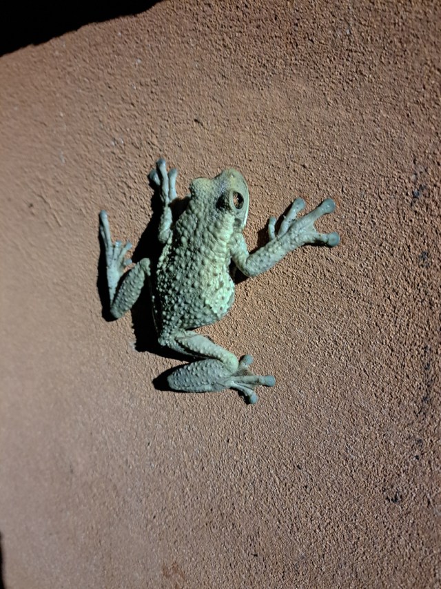
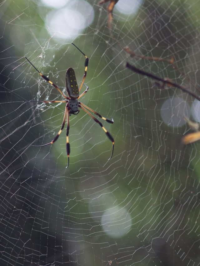
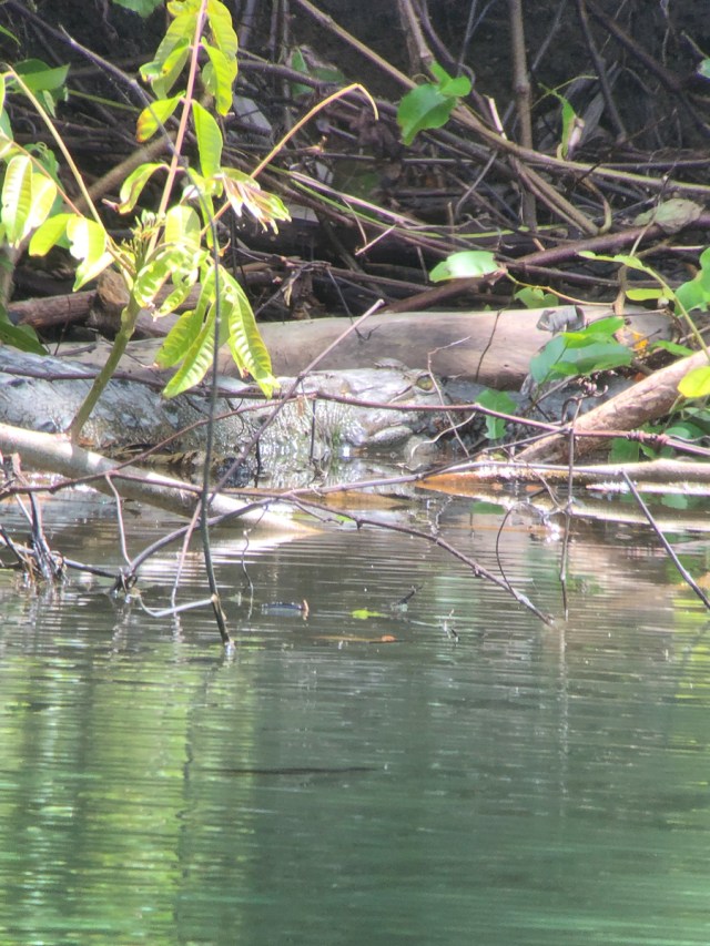
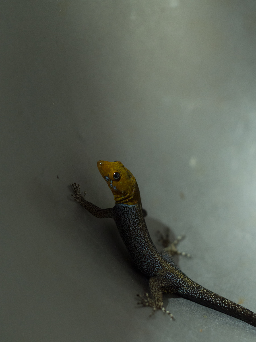
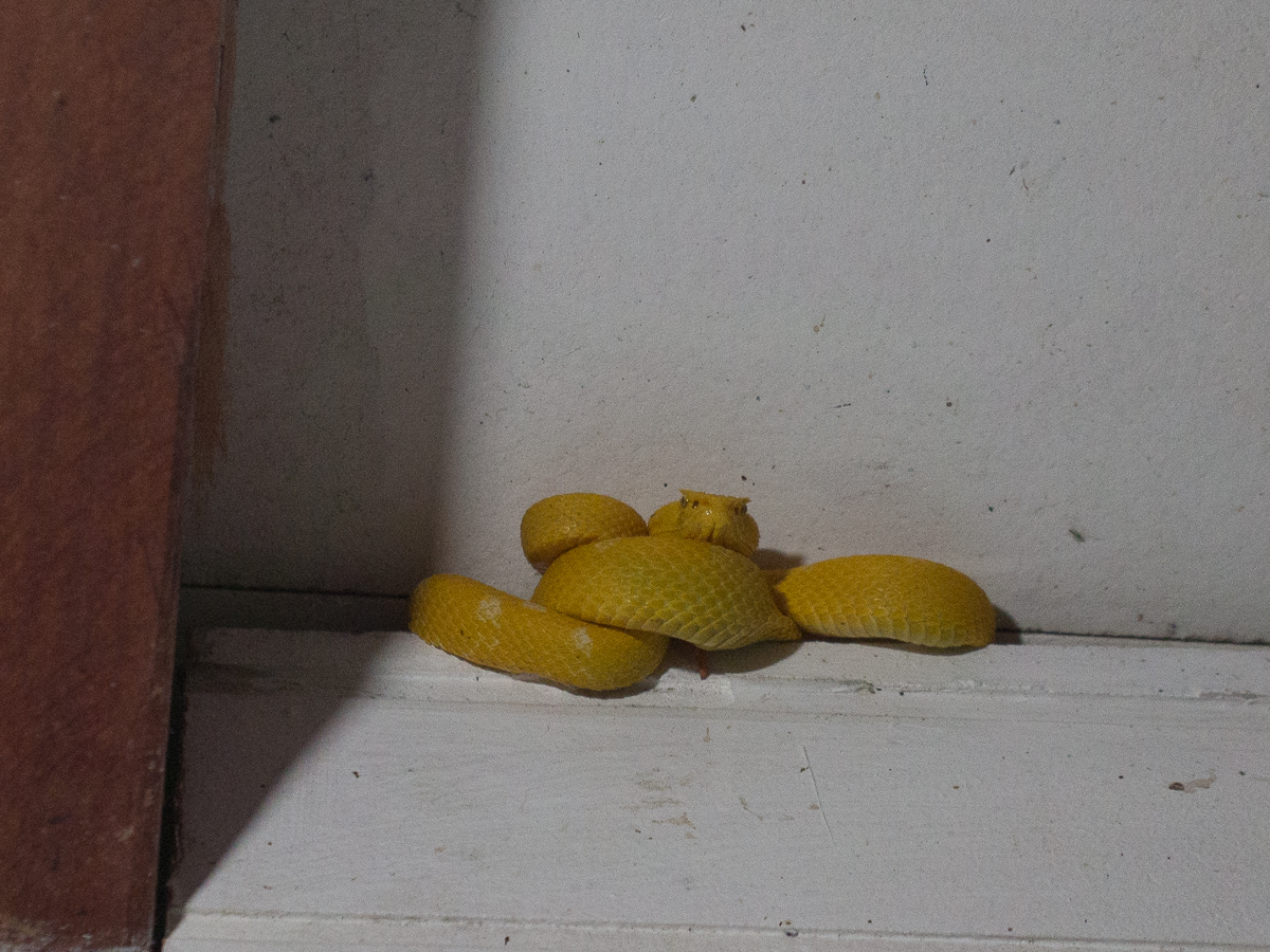
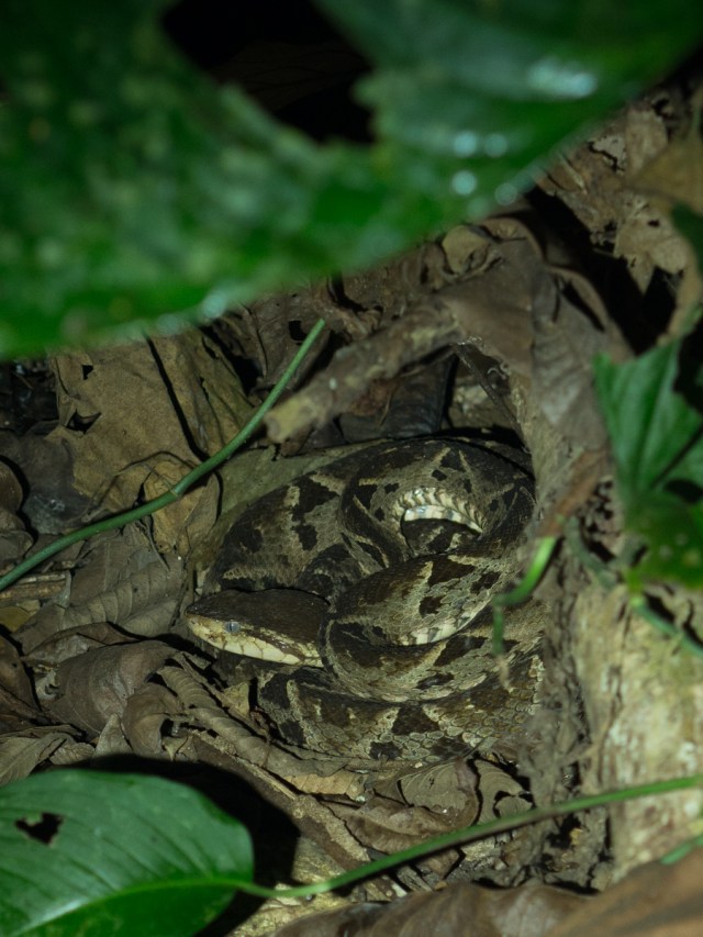
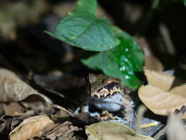
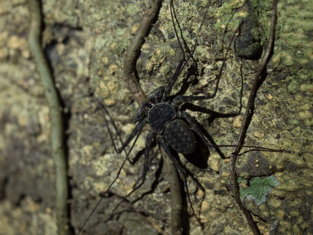
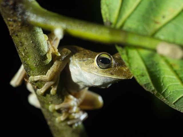
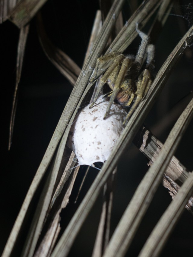
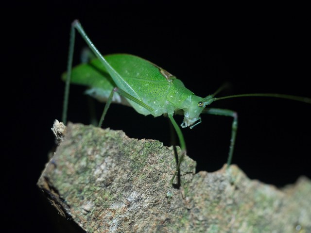
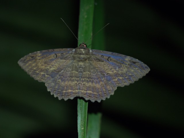
To compliment the untouched wilderness tour we took a local ‘night tour’ with the same Sean.  This was a tremendous success with us seeing numerous frogs, spiders and small things, three or four mammals and a couple of birds but the piece de resistance was a fer de lance snake.  One of the most deadly in Central America.  Gid’s cayman is also pretty cool. And I started getting to grips with the new 60mm macro lens that was the main thing we’d collected from Jared.

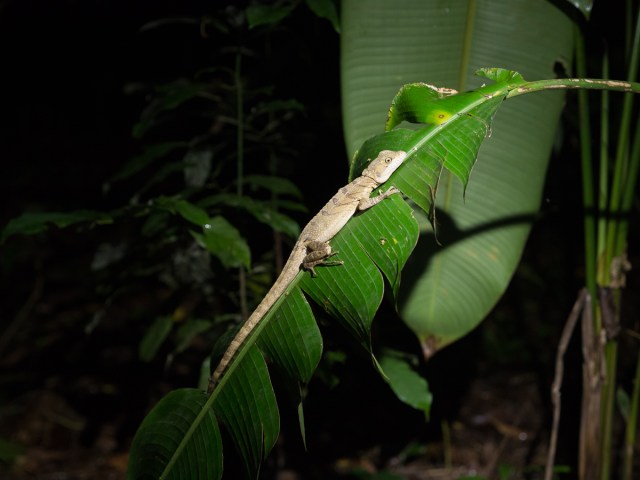
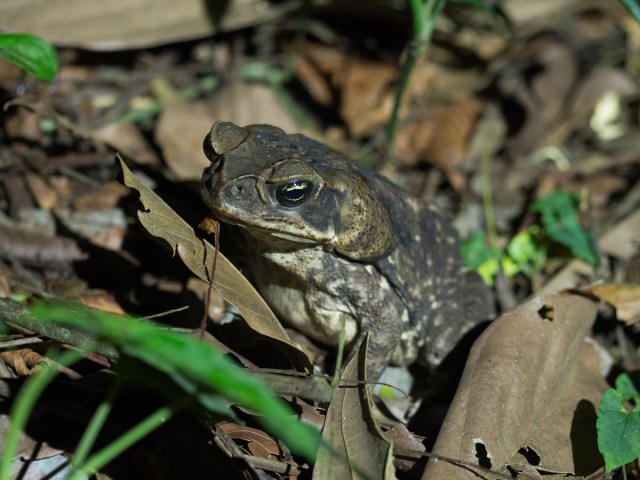
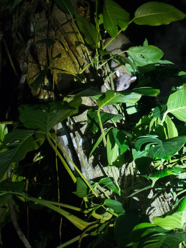
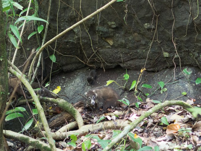
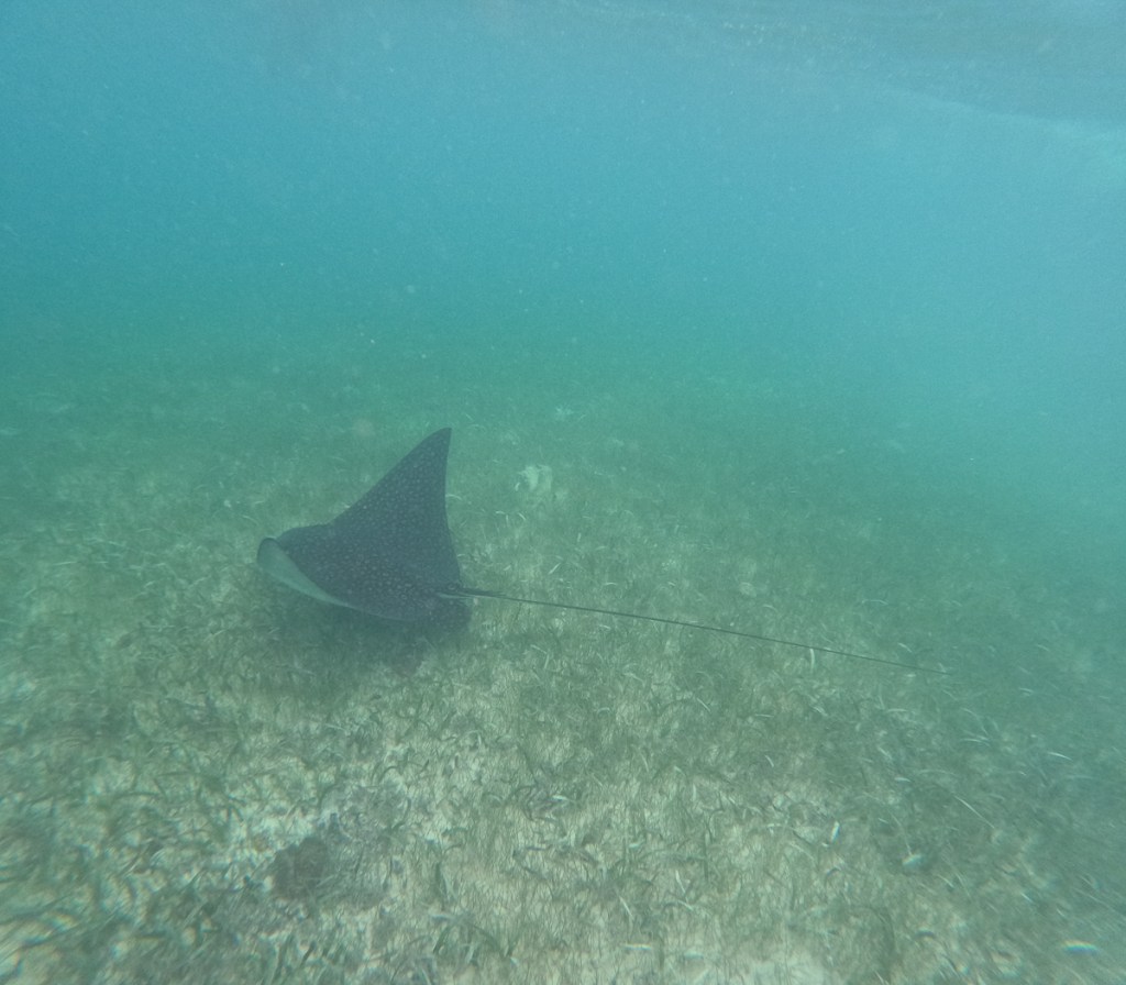
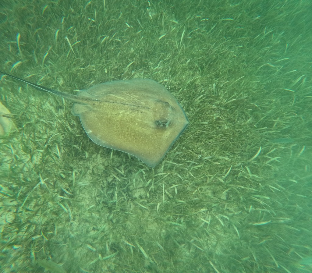
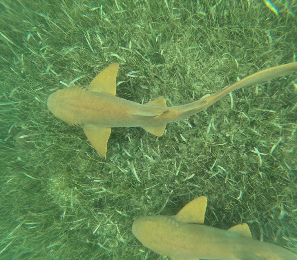
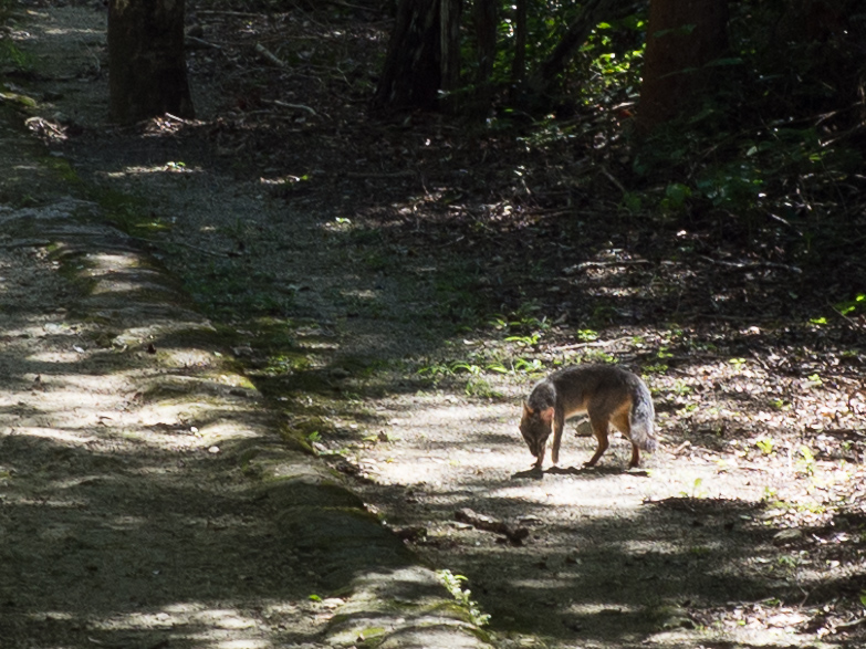
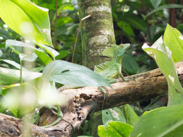
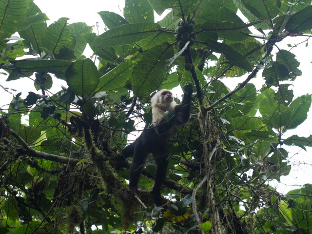
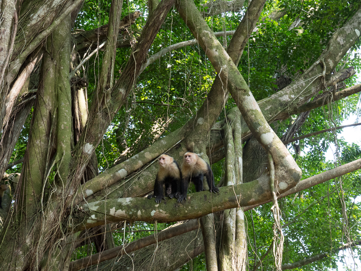
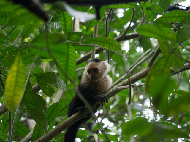
Four percent of the worlds biodiversity is in this small area of Costa Rica, the Corcovado National Park.  The day of our tour we set off full of expectation.  The ‘How to deal with a big cat interaction’ noticeboard raised the stakes.   But let’s get real here.  There were twenty or more of us split into different groups all with tour guides trying to justify their near extortionate charges.  Our guide Esteban, seemed to know the area well.  He was searching one spot saying that the green and black frogs are often here.  Right on cue – here are two.  The local animals must be very familiar with the whole routine and stay a discrete distance away unless they are quite relaxed about the whole performance. We saw families of coatis on our way out and finding them again on our return trip where I was no more than six metres away from the female and her kits.  Overall it was a fun experience with the crocodile and anteater at the top of our best sightings list. The scarlet macaws and squirrel, spider and capuchin monkeys were almost omnipresent and provide excellent entertainment value as did the coatis.

Honduras

After extending our beach stop in El Salvador to allow Gid to rise from his sickbed, it felt good to be back on our bikes and focused on covering distance. Well, some distance – our stops aren’t far apart in Central America, as there’s plenty to see. Most of these countries have nominally a middling population density, but in practice crowded urban areas, and middle density farming on the coastal plain and valley bottoms, leaving very few folks left to populate large areas in the hills or the north, toward the Caribbean coast. Much of which is still roadless jungle. Many of the small communities there are not connected by road to their countrymen. Being roadless, these large areas are not connected to us, either, we’re only in the more populous areas.

Copan Ruinas, our first Honduran destination, was slightly NW from our border crossing. After 2 hours in the border, Aduana, we were fairly focused on making some progress but then reality hit.  The road was still under construction.  Sections of it were near perfect but for some reason it had 2m bands of gravel every 150m or so.  No need for speed bumps here.  The views were beautiful but viewing spots are a luxury seldom found. Other parts of the road were very much still under construction but we soon learnt to go ‘native’.  Honduras is back to swarms of bikes.  At road works they weave their way to the front and beyond given half a chance.  On one such occasion we followed the bikers and a family of cyclists through on to the coned-off raised new road. Ten metres or so before the end of this section the lead bikes peeled off to the left, across the approaching traffic, along a dirt track bordering the road, through the petrol station and down a narrow lumpy path and back onto the road.  I stopped at the start of the footpath.  I wasn’t alone.  A man on his bike loaded with wood stopped too.  We dubiously looked at each other and the kangaroo jumps the bikers ahead were doing along the footpath.  Gid squeezed through.  He got 2/3 of the way along with his bike bucking all over the place and stopped on what seemed like a position stranded half over the next lump. After that moment of route planning, so Gid says, (or buttock clenching), the Him bounced through ok.  With a subtle shake of our heads the guy and I turned back.  We had to wait a short while before we could squeeze out alongside the approaching traffic.  Safe and sound off we went.

A little further along the road we took a turning.  Dirt road the navigation informed us but – wrong,  It was a newly laid 8km stretch of beautiful surfaced road with some wonderful views thrown in as we wound our way up and down mountain sides.  Encouraged by this we took the next dirt road too.  This 30km short cut bypassed a whole big loop around the top Gid informed me.  But no such luck this time. Although a definite road it was dust, gravel, ruts, gulleys, hills, descents and a ford , along which, in the main, a steady dribble of motos overtook us.  That was encouraging as it felt as if it was in constant use servicing the villages and other tracks along the way.  Nearing the end however, three men overtook us but then stayed just in front.  That was unnerving as they should have disappeared into the dust.  Why were they hanging back with us?  Thankfully it wasn’t too far until we were back on the main road.  Our escort went in the other direction.

Copan Ruinas was delightful.  Although another cobbled ancient town it had retained some of its charm because it wasn’t so full of tourist shops or heaving with tourists.  When walking round the ruins themselves we were two out of four people in the place although a couple of groups were arriving as we left.  The main attraction of Copan ruins, another Unesco site, was the option to go down into two tunnels and look at the previous temples.  Because the temples were enlarged by successive kings who wanted their temple to be bigger and better, the carvings on the former temples had been covered and were still in very good condition.  Somehow it felt magical to glimpse at what had been hidden away.

 Archaeological work was very much still in action both on the surface and inside the tunnels which felt as though we were experiencing history as it was being uncovered.  The displays in its mini museum linked the Copan ruins to several of the temple sites that we have already visited. Copan is the last major and most southerly Maya site in Central America.

We decided to traverse Honduras along the northern, Caribbean coast. This has a wealth of cultures with eight different languages being spoken.  One of which is Garifuni – the Caribbean freed slave culture & its partly creole language scattered all along the Caribbean coast from Belize south.   Asking for milk at the local store in Tornabe proved interesting.   It wasn’t Spanish or English is all I can say. The place felt a bit like Hopkins in Belize, except zero tourists, as the locals were of African heritage and mooching around on foot. The only hotel, like most of the other buildings, was right on the beach, with our bikes parked on the sand between us and the sea. Locals wandering past. We had a comfy night, although it bucketed down at some point.

To get there, we’d swing by the famously beautiful Lago Yojoa.   Appealingly, we could stay in a micro-brewery.  When at Lago Yojoa we took another archaeological walk around Los Naranjos.  We were warned that the original temple was made of clay so had been left covered but that hadn’t sunk in until we arrived at the temple to see a relatively small grass mound and nothing more.  Thankfully a small museum at the site’s second entrance had a display informing us about the ruins and its place in history, being very old in Central American ruin terms.

Both of us enjoy birdwatching and one of our best experiences was on Lake Yojoa.  We’d booked onto an early morning bird watching boat trip.  Honduras does boast a wonderful number of resident birds but our own efforts to see them have been fairly pitiful.  Our guide, Mattias, took us off to the canal armed with binoculars.  We hadn’t even reached the water before we were looking this way and that.  Two to three hours passed in perfect bliss as we were paddled along spotting various birds.  The highlight of the trip for me was the osprey.  Sitting high in a tree but clearly visible with binoculars it wasn’t far from a white chested hawk.  The pair were magnificent.  The osprey flew over which Gid spotted first.  Sadly I barely saw it. As we so quickly forget, Gid made notes of the different birds that were pointed out to us, many of them brightly coloured, and announced we’d seen over thirty species.   A few of them like the herons and fly catchers were almost omnipresent.

The botanical gardens at Tela was another attempt to see more wild life.  It was more of an arboretum but occupied a spacious area with signage informing us about some of the species.  We had hoped to see some birds here but in the heat of the afternoon nothing much was evident. We stayed onsite, in a splendid wooden cabin left over from the fruit company days, so the following morning took an amble in the softer light which was much more pleasant but still lacked wildlife.  When preparing to leave our host came to tell us that they was some issue up the track.  ‘Motos would get through,’ she said,  ‘pero no carros!’  True enough!  There had been rain overnight and a land slide. Part of the road was missing.  Cautiously we went through aware that a lot of the area looked sodden.

Gid hasn’t been interested in waterfalls.  To be fair in 2023 we toured Norway where in places there’s a stunning waterfall every 100 metres.  But link a waterfall walk with bird watching and we were off.  Three toucans almost make up for our cumulative zero quetzals. Our stop here was a guest house focussed on the local rafting tourism on the Rio Cangrejal. Right on the rocks by the white water river, it brought back a lot of memories of our paddling days.

Biking back along the muddy & potholed dirt road from the rafter’s guest house towards La Ceiba I had hoped that some of the slimy mud down the lane might have dried out a bit.  No such luck.  The drizzle started as we finished packing our bikes.  That together with last night’s rain ensured that it had remained a slushy, muddy, dirt and gravel road with numerous pot holes and oversized puddles.  Faced with a large muddy puddle and an on coming moto that was going to take the rim around the left hand edge I went for it straight through my side.  My bike squirmed a couple of times, some water splashed over into my boots but a bit of adrenaline kept me going and I didn’t slow down.  ‘ A twist of the wrist’ so the name sake book says will nine times out of ten get you through a problem.  It worked.  I was chuckling, the approaching biker, who had slowed to watch the drama, had a broad smile and gave a thumbs up.  Who else was on the road? – oh yes – an inexplicably abandoned porker.

Sodden was here to stay – we had a lot of heavy showers in Honduras.  We had set off at 9:30 with a 100mi to cover so expected to be there by lunch time.  With just a short lunch break we arrived sometime after three.  The potholes along the way had disintegrated into large areas of mud and broken road.  The traffic ahead of us on both sides was weaving across the road and slowly negotiation the holes.  We picked our way along the main road at times behind tired buses, trucks and tuk-tuks.  Consumed in clouds of exhaust as yet another overloaded knackered out X tried to pull away from the speed bumps or pot holes.  Frequently, at the speed bumps, we sped past.  Once we were officially on a dirt road the surface was in a much better condition.  Thankfully a lot of the traffic had also turned off by then so we were able to make better progress.

Here’s an assortment of Honduran road photos. We take more photos on dirt roads ‘cos there’s usually more to see, and time to look.

And here’s a few photos of what we could see from the road.

As far north-east as we could reasonably go, a couple of days at the beach at Trujillo was to round off our trip to Honduras.  Gid had highlighted the fort and a couple of historic points of interest in the small town. Yes, um, it was indeed small, but attractive enough, once it had stopped pouring with rain.

Leaving Trujillo we soon turned south and headed down a lovely road enroute for the capital city, Tegucigalpa.  It was the best road we’d been on for a while so we were merrily cruising along.   We soon realised that we had a third rider also on a touring bike tailing us.  After a brief roadside stop we agreed to a coffee somewhere ahead.  Steve, a Canadian rider, was on a tour to Panama – his version of the Snow Goose descent south for the winter.  We stopped together for the night and shared food, beer, and stories.  Steve’s BMW RS boxer was five times as powerful as our Himis, but the sporty suspension & position wasn’t so accommodating over speed bumps and potholes. He might have said it wasn’t entirely happy on the low octane gasoline, either.  But we’re all doing it, that’s the main thing.  Forums are full of “what bike for …” discussions, and journalists pontificate endlessly (with a nod to their advertisers!), but the best answer seems to be “the one you have”.  We do seem to be a bit off the moto tourist trail now, we no longer see occasional groups of looming, be-panniered, be-foglamped adventure bikes going the other way, or whizzing past us. Of course, just by time and distance, we’re getting beyond the range of a ride-from-home tour for North Americans with jobs and families needing them back soon.

Honduras’s capital Tegucigalpa was busy but pleasant enough.  After all the usual online warnings about crime, the biggest threat was clearly as a pedestrian trying to cross the roads.  Maybe it was our location, but the traffic seemed more cramped and more urgent than either Mexico or Guatemala Cities.  Tegucigalpa is not reckoned to be much of a tourist destination, although we did visit a few places.  We were in the city because it had a Royal Enfield dealer, one of only 2 in Honduras, and I had discovered some loose spokes in my front wheel. I wanted to be nearby when I had my first ever go at a motorcycle spoked wheel tweak.  In the event, the adjustment seemed to go smoothly, and no parts or help were called upon.

Although our Honduran visas were for 60 days, we were aware that the CA4 group of countries only gave us 90 days from entering Guatemala, so we had to exit both Honduras and Nicaragua, by 29th March. East of Tegucigalpa the Honduras/Nicaragua border hove into sight all to soon, after around 3 weeks in Honduras. Another border to cross, another country to plan. But just before that, Gid misunderstood what he was told about the nightly rate, and our last night in Honduras was rather a splendid indulgence, and a bit of a moto museum, too.

Belize

Belize, our route map shows, has been another case of zigging and zagging about. We didn’t need to come here at all, as it doesn’t span Central America’s skinny land mass. One can pass from Mexico directly into Guatemala. But it’s an interesting place, so of course, we were curious. We dropped in from Mexico, right at the top of the country.

It’s a small country, so it’s possible to go from North to South Belize in a (long) day.  We’d rushed past the fishing village just across the border on the east coast and before we knew it we were a third of the way down the country at the baboon sanctuary.  The baboons – actually yucatan black howler monkeys – were fabulous.  We were barely in the forest before we heard and saw them. Our guide was our first Garifuna encounter, all laid back and charm, in r e a l l y s l o w English, and creole with his mates. For indeed, Belize used to be British Honduras, and the official language is English.

From there we were at the north-west regional hub of San Ignacio – and the “ATM”. ATM is at the top on all of the must see lists.  It’s not the Automatic Teller Machine or Another Tourist Missing but the Actun Tunichil Muknal cave.  Having been there I can see why it’s number one.  It’s stunning!  Our tour guide was ex-military but once we’d got over the ‘I’m here to look after you.  If I give you an instruction please will you follow it’ – shouted to the petit oriental young lady at the front of our group.  On the first of our river crossings to get to the cave she had failed to release the safety rope and float away down the river to a different landing site when Patrick had shouted the command.  The water was chest high on us and had a fair flow so she was probably rather insecure with the idea of letting go of the safety line prematurely.  We soon learnt when Patrick shouted ‘jump’ we echoed ‘how high’.

After the initial blip Patrick proved to be a very nice guy.  He was very knowledgeable about the jungle happily answering some tricky questions from our young undergraduate enthusiast.  Equally, we were soon to find out, he was very knowledgeable about the cave itself.  We crossed the river three times to reach the cave where I have to say, I was pleased to be wearing a buoyancy aid.  I’d quickly given up any hope of keeping my t-shirt dry to try to keep warm.  Once in the cave, having scaled the rocks and dropped down into deep water, we started our one hour wade, swim, clamber; at times making a human chain to get round a deep corner or to cross a deep section as the water gushed past.   We stopped a number of times to admire and investigate the rock formations created over centuries of water cascading down with layer upon layer of calcium carbonate leaving its track.  We finally reached the main attraction.  10 feet above our heads was the start of the massive cavern that had been used as a sacrificial site up until about 900AD.  We clambered up a very convenient rock with a supporting rope attached to it.  At this point we had to take off our shoes to try to minimise the damage made by aggressive footwear. 

We were in the ‘living’ museum.  This was not some mock up but the real thing.  Every thing we saw was as it had been used / left by the Mayans, the Belizeans having made a conscious decision not to excavate it.  Many areas were calcified showing that the water had coursed through this way leaving calcium deposits in its wake. In the 900 and more years since the Mayans were in here, some deposits had built up to a few inches thick, blurring and obscuring the thousands of broken sacrificial pots. The thickness of the deposits helps with dating the offerings, which generally, went deeper and deeper into the cave as time went on.  In a sub equatorial rain forest with 82 inches of rainfall a year there is never any shortage of rain water.  Well, except in about 900AD – climate change and drought are the leading theory for the demise of the southern Maya cities.

Seven skeletons were present, deep in the cave system. Some of the remains were in a heap where it is supposed that they had been washed down in the flow of water before being glued in place by calcification.  Each had been sacrificed.  Archaeologists tell us that towards the end of the greater Mayan society the rain fall was less reliable and there was a change in the sacrificial offerings, brought on, perhaps, by desperation.  Initially the skeletons were of older people but what is believed to be the last two are young males. This greater sacrifice was of young males was thought to be in an effort to please their gods who would they hoped provide more rain.  One boy, believed to be twelve is considered to have been bound up and left to die whilst not far away was the skeleton of a seventeen year old boy although he was laid out flat.

Unfortunately for us, cameras, phones and other lumps are forbidden following an accident where a camera was dropped on the 12 year old’s skeleton’s skull.  It now has a letterbox shape hole in it where the camera landed. Therefore we took no photos, except of Patrick selling Clare his patented old tyre sandals.

A brief diversion from the same base of San Ignacio, was the local Green Iguana Sanctuary. These have some endangerment so they’re captive bred there, then released. The Black Iguana, in contrast, is very common, and we saw them all over the place: The two on the log, actually in Belize Zoo, are sneaky visitors, not captives.

The Belizian roads are in a better condition than the Mexican roads.  Their speed bumps are better labelled and they seem to have three sorts.  One sort – a set of three narrow rumble strips you barely have to slow for and another a well marked smooth mound, then there’s single or double rows of metal domes that usually make the bike wriggle alarmingly.  They do have some potholes but nothing like the near total disintegration of the road that we frequently experienced in Mexico.  There are probably less roads as well as the population of Belize is quite small so perhaps less traffic.  Decent main roads and short distances made Belize pretty uneventful on the motorcycling front. Off the main routes it’s back to dirt roads but because of the recent flood in Mexico and the current heavy rainfall we’ve stayed off those.  The combination of rain and soft sandy mud, or slimy mud will make them pretty dodgy places to be on two wheels.

We’re back to the Caribbean coast for Christmas. We broke the journey to the beaches at Maya Centre where we took one guided night stroll and another guided day stroll in the Cockscomb jungle – nope, no jaguars. One frog, one turtle and two catfish is hardly an exciting haul but the red brocket deer in daylight was a pleasant surprise. Belize has made a point of having a lot of nature reserves, although they do mostly seem to be on land unsuitable for agribusiness type farming. But – revelation – here’s a chocolate making tour. Guess who dived straight in? We’re taken off to Narciso’s chocolate farm, where we learn about the fruit, and the beans, and the 6 day fermentation and 7 day drying. Then to the factory where they’ve been roasted. Robert directed the procedure: taste “nibs”, grind them, mix in the cane sugar (grows everywhere in Belize), and extra cocoa butter. Scraped into the mould, place in fridge for 5 mins. Eat. Very yummy! The chocolate drinks here are something else, too.

Beach village Hopkins, recommended by a number of people, is a vibrant colourful small town full of very friendly Caribbeans and wooden shacks.  People were happy to stop and chat, many with a cause or two that we should contribute towards.  One chap offering us magic mushrooms and a number of cannabis bars along the street might explain the very relaxed vibe to the place. Hopkins is presumably run by the ladies as the chaps all seem to be relaxing around their omnipresent beer bottles. 30 miles south on the coast is Placencia.  Wow is it different!  The road in is lined with concrete barricaded mansions interleaved with “plots” – prominent Private Keep Out warnings with For Sale banners and ‘gated’ developments available.  It’s a bit of paranoid “me-me-me” Florida dropped into the “hey man” Caribbean coast.  At the end of the peninsula is the main village of Placencia.  The village itself is back to colourful Caribbean settings but millionaire’s row has left its mark, it feels a bit phoney and fleecing compared to Hopkins, albeit in much better repair.  Our main beggar in Placencia wanted money for an eye operation, whereas his colleague in Hopkins claimed to be a shaman…

Belize is about the size of Wales, but only ~400,000 citizens inhabit it. Having been part, not of the Spanish Empire, but the British (a legitimisation of piracy and unrestrained logging), it speaks English, has yards, and miles. Interestingly, the Belizeans couldn’t say if the petrol was sold in US gallons, or Imperial, although Gregorio from Maya Centre reckoned the measures were short!  I went into a hardware/motor parts store to buy an M8 bolt for my pannier rack, but almost everything was in inches (I know not if Imperial or American SAE): Bizarre, indeed as they do have quite a few pre-90s American pickups and lorries which will be SAE, but 90% of their vehicles will be metric. They have Charles III as monarch, which led to some very odd conversations, so I’m not sure what they’re told about his role. Elizabeth II, pictured at around 1965 I think, still graces the banknotes and still seemed close to their hearts. And Philip, we were proudly told, visited them in 1985 and planted that tree.

The country is an ethnic melting pot. Whereas Mexico seemed mostly like a creamy soup of well, Mexicans, Belize is sort of ethnically lumpy stew, different peoples in different places or roles. Is this a result of Mexico being freed of external rule in 1821, but Belize’s being in the British Empire well into my lifetime? It seems the Mayans dominate the southern countryside, putting them in charge of the jungle and the important chocolate supply. The (germanic, white) Menonites often stay quietly on their large farms, and do most of the food and deforestation. The garifuna dominate the coast, catching fish, tourists, and the odd beer or splif. The numerous north American expats like secure gates, big houses, “private” signs, and, naturally, F150 pickups; they run a lot of the tourism businesses, stating their prices in US dollars, not always clearly so, and much the same prices as US prices too (perhaps to pay for their USA medical insurance?). Whereas greengrocers and restaurants are often Spanish, every large village has are two or three medium-sized supermarkets, selling the same broad selection of goods, and always, it seems, run by merchants of Cantonese descent. I’ve probably missed someone out – Wikipedia has more detail and yet more. They all seem to get along just fine. Belize is officially English speaking, but as a tourist, it would be helpful to know the Spanish, Creole and Cantonese for “shall I charge the tourist double?”, although the north Americans charge most of all, and then you realise it’s in US not Belizean dollars, a fixed 1:2 rate doubling it again.

Southern seaside village Placencia was our Christmas break choice.  Snorkelling was on the plan but we didn’t know much more about it.  We planned a four night stop in the backpackers hostel, hoping it would be a lively community over the Christmas break.  When we arrived it was only us; a few more travellers did turn up, but it stayed pretty quiet.  Mark and Sheila, the owners, were very helpful and pleasant but we couldn’t help notice the For Sale sign as we came in.  The nearly new hostel is three miles out of town so we’re wondering if it’s too far out for backpackers who frequently occupy hostels but have no transport (although the hostel has bikes and the buses are cheap).  The village itself seemed to have plenty of tourists on Christmas breaks. The dive centre had space tomorrow, 24th Dec., but that’s it until 2nd Jan.  We booked up for tomorrow.

Kitted out we set off and were told it would take an hour to reach the coral destination.  The sea was flat so we zoomed along with little discomfort.  Our snorkel guide explained the ropes.  We were going to circumnavigate the little island.  He would narrate and had a pointy stick to draw our attention to certain features.  Once in the water I was off keen to make the most of our forty minutes.  The kit worked well and I could dive down to take photos although a lot of the corral was barely three feet beneath us.  On a couple of occasions I got left behind and was redirected back to my group.  It was fabulous.  The seaweeds were moving with the flow.  Fish darted to and fro or just nonchalantly drifted past. The coral and fish were colourful and gorgeous.

Once lunched on the island we were off to the second site.  Here we were told we would see turtles, nurse sharks and sting rays.  Yep, they were right.  It was stunning.  Barely in the water I watched a white spotted eagle ray swim past.  It seemed huge!  The graceful flapping of its ‘wings’ seemed poetic.  So slow was the motion as the ray glided along.  Mindful of its tail that must have been at least six feet long I didn’t get too close.   Minutes later I’d seen a few other smaller rays but was anxious that turtles and nurse sharks were also on the list.  I heard an ‘over there’ call directing me past one of the other boats.  As I approached it the sea bed was disturbed.  Cursing inept snorkellers who must be putting their fins down I circled round the outside of the sand storm.  Wrong!  It was nothing to do with snorkellers.  I watched a nurse shark wiggle down on the ocean floor and with a thrust spurt up leaving a sand cloud behind it.  It was in this area that I also found the turtle with cleaner fish nibbling under its tummy.  Wow, how beautiful!

Nurse Shark

To cap it all on our way back we happened upon – or our captain found – a school of dolphins.  Eight fins were visible at one point. Some came very near to our boat swimming alongside occasionally jumping. One even did a completely airborne breach.

Christmas day away is weird when you are used to spending it with family.  What were we going to do?  Family phone calls made we were at a loose end.  Supper would be late so we could use the day light but we still didn’t have a plan.  There was another village, Sein Bight, to the north, much closer than Placencia, but devoid of tourism. We wandered off to it having been warned that a number of places would be shut.  Having topped up our supplies in the only open supermarket we reached the other end of town before cutting through to the beach for the walk home.  In this local’s village it’s no problem reaching the beach but back nearer to our accommodation it was ‘Private’ access again.  We weren’t sure where we would cut back to the road.  We stopped at a bar on the beach.  A rickety Caribbean owned place to sup and admire the palm tree framed view of the sea.  The owner chatted to us asking if we were going to come back later in the afternoon to see the Christmas Day tradition.  He told us people dress up and go around the houses.  We’d be able to take photos, video, whatever. We ambled back along the beach, and cut back to the road through a smart resort, wondering if we only got away with that because we’re white like most of the guests and none of the staff.

At two o’clock it was pissing down.  Three o’clock it had cleared up. Off we went back to the beach shack to find out more.  We found the procession.  It was awesome.  Drummers thumped out a rhythm while youngsters performed a traditional dance, shells on their knees to add to the beat.  Wanaragua (mask) is a dance performed in pink mesh masks and white shirts creating a satirical representation of the white slave masters.  The dance is a part of the South Belize heritage which is passed down the generations and we were lucky enough to experience this tradition.

We’d come into Belize a bit haphazardly, and now decided to retrace our steps northwards, to the second city of Orange Walk, to see the Mayan ruins at Lamanai. We wimped out of the 30km wet dirt road access, and took the tourist launch which meant we had, unusually, a tourist guide, Amit, with his no 1 badge. He was genuinely informative, more so than what we usually gleaned from signage. Old friends might be intrigued to know that Holpitan, the name of the people who built Lamanai, means canoe people, but they were called Yucatec by the Spanish.

Our brief interlude of English over, we next head to Guatemala, and it’s Spanish* all the way to Ushaia…

*Ok, Brazil is Portuguese, if we divert west.

Meandering through Mexico

Mexico had such impressive pre-hispanic ruins that we gave them their own post. So what else did we do in Mexico? We certainly zigged and zagged. North and east of Mexico City to start with, then south to the Pacific coast, then north east again to Yucatan. Cheap, basic hotels are readily found in most small towns, but we generally pre-booked to stop in tourist hotspots.

After Mexico City and Teotihuacan, we travelled a short day’s ride to Real de Monte the Mexican home of Cornish Pasties and a British style graveyard dating back to the 1880s.   Cornish miners were encouraged to travel the world to find work back in 1880s when Cornwall’s mining industry was collapsing.   One intrepid group had arrived in Real de Monte.  Families had packed up shipping everything from personal possessions to heavy mining equipment, and not forgetting the recipe for their prized pasties, to their new homes.  The streets were littered with signs for Traditional Pasties, and we’d arrived amidst some kind of fiesta.  It had to be done.  We tried a few.  My first mouthful almost reduced me to tears as the chilli, not a modest amount, scorched my mouth.  I courageously swallowed it washed down with copious amounts of cold drink.  Now my whole throat was on fire.   ‘No chilli / Sin picante!’ became a new phrase in my Spanish vocabulary.  Our Cornish friend, Tony, complained that they weren’t properly crimped.  Neither were they limited to swede, tatties and mince.  An interesting take was the rice pudding version. We tried a few others over the next few days.

Arriving in the town had been an interesting experience.  Once off the main intertown route the streets were pretty much all cobbled.  Garmin was navigating us to hotel accommodation which Gid often sorts out on-line, but had not this time.  We would stop, he’d speak to the receptionist and a decision was made – yes or no.  On this occasion, complicated by it being a bank holiday weekend, the first nice looking accommodation was deemed too expensive.  We tried a couple of others which were full and ended up heading off out of the city centre. It was, naturally, rather warm, and compounded by the steep 45 degree cobbled lanes – a number of them being blocked by bollards necessitating a u-turn, or festivities linked to the bank holiday, I was getting rather fraught.  Across the valley we’d seen an orange hotel halfway up the hill and headed for that.

Not so simple.  The sinuous narrow roads were blocked by delivery trucks, the street names weren’t visible and who knows whether this road would actually go somewhere.  The sat nav didn’t distinguish between the tiny streets and twittens with staircases.  We ended up going far too high up the hill and clearly needed to head back down to find the orange hotel.  Gid was leading.  The road got quite narrow heading steeply downwards.  I refused to go.  Very quickly Gid realised it wasn’t such a great idea (steps, bollard) and was trying to u-turn.  Nope that wasn’t going to work either.  He accelerated at the grassy bank thinking that he might progress a little bit up it and then be able to roll back.  Wrong!  The front wheel went down not up, now he was stuck in the hole.  I had to get off and help but was on quite a slope myself.  I managed to turn my bike around by going into an entrance to my side.  “Reception”, it said on the side of a rather grand looking building.  Staff rushed out.  They were keen to check my non-existent booking. I needed to help Gid.  ‘Esposo stuck’, I repeatedly said pointing over my shoulder in a down the lane direction.  Communication established two guys rushed off to pull Gid backwards.  Minutes later he arrived by my side.  After thanking the staff he asked me if we were going to continue looking for cheap accommodation.  He must have seen the glare on my face as he conceded we were staying here, in possibly the most expensive boutique hotel in town. While there, Clare found that nearby was a rather exciting via ferrata course. She did (Clue: Photos not taken by Gid!).

Another box to tick was ‘the best roads in Mexico’.  The Mex-175 was regularly near the top of the lists especially the section from Oaxaca down to the coast.  Gid wasn’t that fussed about going to the coast but I was keen to ride one of Mexico’s top roads.  Alex, in Mexico City, had told us it was through jungle which added to the intrigue.  The road itself was a delightful mountain road, full of twisties some of them very tight.  A little unsettling was the contrast between the bright sunlight which was at times dazzling and being plunged into darkness as we cornered round the base of another ravine especially as the road surfaces are very unpredictable with ruts & ridges, gravel & gullies, pot holes and generally broken surfaces in the mix.  Not to mention topes (speed bumps), which vary considerably from signed, smooth sloped, rising mounds to severe unmarked, abrupt, high lumps.

Later we were on the Mex-190 which I think I preferred.  The road surface was generally a lot better and the bends were more sweeping meaning we could maintain a higher speed throughout the twisties.  The, at times, frequent cow on a yellow warning sign had vanished with a slinky big cat replacing it.  Later came an explanation – you might see one of Central America’s last remaining big cats but it is illegal to purchase a jaguar the signage declared.  Sadly we didn’t see one.

Pot holes which locals sometimes very kindly fill with anything from leaves and sticks and more usefully small rocks are everywhere. Cones are not unknown in Mexico, but absent officialdom, locals put rocks out, sometimes even painting them, usefully marking subsidence at the edge of the road.  The lack of any such notification on a section of subsidence caused Gid a flutter or two when he nearly took the nearside round one “pothole” only to discover that the road was completely missing.  The road had subsided down a small cliff.  We’d just passed subsidence on the opposite side of the road with an approaching car not far from it.  The height difference was about a foot which would have hit the undercarriage of most cars angled between the two.   I wondered how the approaching car was going to handle it and had luckily taken the higher section when we hit the same problem going round a mountain bend. In quite a few places, the villagers seem to dirt-fill potholes in the village, then stand in the middle waving a hat for change. This also happens by a tope, or, they put cones out to bring the traffic to a near halt. Unfortunately, a motorcycle doesn’t have a change pocket (HD or BMW might, electric of course), so we don’t contribute. Similarly we leave unremunerated the occasional jugglers, snack sellers and screen wash merchants at traffic lights.

It can be tricky to get the correct balance between making progress and going slowly enough to avoid all the pot holes, especially when dappled shade makes the surface hard to see.  It’s far better to be some way behind the vehicle in front especially through towns but not always possible because, inevitably, as a gap appears someone will overtake and fill it.  Among days of biking we’re going to get it wrong somewhere.  On one such occasion Gid hit a large hole at speed, the front suspension and tyre both bottoming out.  He yelped!  The bike felt ok but he could see the fork legs vibrating from 50mph – the cruising speed for these roads & bikes.  At an approaching village we stopped for lunch and to asses the damage.  Yep, he’d flattened a section of his rim, with four loose spokes. The massive front tyre* looked unscathed, and the tube obviously hadn’t split. We decided we could limp on but Gid was obviously disappointed and concerned.  He explained that there was a problem with his bike to the waitress who cheerfully said the mecanico de motocicletas was across the road 10 metres down a dirt lane.

Moments later we were in his yard amongst an assortment of relics and a jumble of tools straining our Spanish to explain the problem.  “Si, ahora”. He could fix it, right now.  Verily he did.  Off came the wheel, then the tyre.  Out came the dead-blow hammer. Bing, bang, bong.  Fixed.  Well almost.  Gid tried to explain about the wheel balancing and the need to mark where the tyre was situated to be balanced on the rim. Such interference was politely resisted, but our man – Tito – was very careful to line up the bolts to show the order of reassembling.  That worked well until one of his offspring, keen to be a part of the intrepid fixing of the European’s bike picked up Gid’s disc that had been carefully placed on a seat, bolts all in place and put it upside down on the ground.  That part was reassembled but back to front.  To be fair, it was very much a family affair as one person held this or that while dad walloped it. 

This process got the rim all but circular.  Unfortunately Gid had hit close to the balance weights, which Tito couldn’t replace, so didn’t take off, so that bit wasn’t hit and was still a little flat.  Tito was sure that he could do a better job so into the workshop they went.  The wheel was placed on a big bearing press and a jack wedged in to try to press the last flattened part into shape.  The result was pretty good so the bike was reassembled.  Tito took a considerable time, with the traditional screwdriver fixed onto the forks as a guide, to tighten the spokes so that the wheel ran true.  And it did.  It must’ve taken 2 hours, albeit interrupted by other things.  We guess that straightening moto wheels must be pretty common on that road, and fortunately the Him’s are steel rims with spokes. The charge was very modest indeed, we tipped a bit, and later added him to Google maps and Open Street Map – his business was undetectable to the phone generation, which clearly included his daughter, who was inseparable from her device.

*Tyres: Dunlop Trailmax Mission, 21″. It has huge knobbles for highway and dirt, deep tread, and weighs about twice the stock tyre, or indeed most front tyres. We both commented on the bike’s loss of steering response when we put them on. But they’re versatile, tough (fingers crossed) and long-lasting.

At the coast we stopped at Zippolite, a wonderful Pacific beach resort.  It’s also Mexico’s only legal nudist beach, and a dangerous one.  No, no –  it’s because of the rip currents, it’s not a place for much swimming or beach toys. The beach boys, on the other hand, were out in force (did you see that!?).  We did a tiny swim – there sure were strong rips- but it was nearly sunset. Gid’s still wondering if he should have done his morning run along the beach starkers – but none of the other runners did.

Although Mexico has around twice the UK’s population, it is much bigger – each Mexican has, nominally, over 4 times as much space as a Brit. So there’s a lot of wild country and wildlife. From the Pacific we headed north to Frontera on the opposite, Caribbean Sea, coastline, and took a river trip into the Pantanos de Centia nature reserve.  Our hotelier had a mate, that old chestnut, who appeared very promptly at our hotel door, introduced himself as Negro Chon, and outlined the deal.  It sounded fine, just exactly what we were looking for and he could pick us up from the hotel.  All of this was agreed from our hotel room. 

At 9:30am promptly Chon was there.  And so was his car!    It hadn’t passed an MOT in the last 30 years.  No self respecting scrappy would touch it!  Gid, who’s normally quite particular about working seat belts, got in the front, relieved, I think, that the door did actually shut (allowing for a certain amount of visible daylight around the edges).  I climbed in the back.  The door almost shut.  Thankfully it wasn’t likely to rain.  I needn’t worry about seat belts – the  attachment point didn’t exist nor was the seat actually attached.  In fact the whole car, inside and out, was totally rusty, wrecked or ripped.  Off we went.  It did seem to work.   Around town Chon was perfectly cautious but once on his local road he changed up a gear.  Chicane Chon would have left any grand-prix driver in his wake the way he spun the wheel weaving left and right avoiding the pots holes, using the dust along the tree lined edge and back to the other side. The boat trip with his son-in-law was tame by comparison, but we did glimpse a croc – eeek! – and a multitude of diverse herons as well as other birds.

The next mission was another set of ruins, Calakmul, but this time in the jungle that covers the south eastern part of Mexico. The site is quite large, but isolated with a slow, narrow, jungle access road. Pootling along it, ocellated turkeys were little concerned about our bikes, and Gid glimpsed silhouettes streaking across the road, one probably a marmol or ocelot, and later we saw a grey fox. A day later, still based in the town of Xpujil, we visited some much smaller, quieter ruins. For 30 minutes we sat quietly on top of a small structure, at treetop height. To our right, a bat falcon polished off something more like a small chicken than a bat, and on a path ahead of us a grey fox lounged in the sun. Perfecto.

That evening we rode back down the road to the “bat volcano” and watched 3 million bats stream out of a cave at sunset.  The second largest bat cave in the world.  Talking to a Scottish couple at the event they exuded excitement about the cenotes they had been to.  It had become a theme in their holiday to explore as many as possible.  They were telling us the merits of this cenote over another.  We’d not even heard of these sinks holes / caves, many open to the public to swim in, which are abundant in this area of Mexico. Yucatan is dry on top, but made of limestone, it’s riddled with underground watercourses, many quite near the surface. Cenotes are formed when the roof collapses. Many are connected, and scuba diving them is popular.  Our new Scottish friends had said that they were often warmer than their hotel swimming pool.  Our posada (inn) in Xpujil barely had a shower.

But first, we had to return the maybe 40Km to Xpujil. In the dark. We knew there were a few big dangerous potholes on this stretch, but at least we had ample time and knew where to go. It was still terrifying at times. In daylight, we observed that Mexican vehicle lights are quite random – all sorts of flashing colours, indicators/hazards used according to all sorts of strange thought processes, none of them in the UK highway code, brake lights left broken.  At night – well, Mexicans driving at night either have very little or total trust to the gods, or fit huge LED lamps that only half of drivers dip. Even though traffic was light, it was scarey – statistics confirm that it’s a massacre. Our worst moment on this ride was when truck B decided to overtake truck A with us oncoming. The road there was actually quite wide enough to do this, but the b*st*rd didn’t dip his huge LED floods and didn’t indicate that it intended to pass (they never do).   We were completely blinded as it pulled out into our lane and couldn’t see the road 2 metres in front. It had taken us a while to realise what was going on, because most truck drivers did dip, and the relative positions weren’t clear in the dark. We pretty much came to a scrambly halt, unsure if in front of us was ditch, pothole, or road. It confirmed that riding at night in these parts was a very bad plan.

On a brighter note we spent much more time on larger single-carriageway roads, but the excursions were more interesting. Two of the pictures are points where we gave up and backtracked: One road shown clearly on the sat nav shrank and shrank until it completely ended in a logging camp. Another road was flooded out for maybe 50 metres.

A bit of research had us concerned at the cost of entry to some of the cenotes. Undeterred Gid came up with an area close by that had a few.  He picked one that we visited enroute the following morning. It was fabulous!  We’d become a bit wary as two of our selected underground attractions in the area had been closed since Covid.  One was a cave system with paintings the other was an underground water system.  Both shut.  The chosen cenote was open, cheap and not highly populated. We descended about 5m down a wooden stair, to water level.  There were two small diving groups who disappeared downwards to explore the cave system joining it to other cenotes in the area but the surface space was pretty much clear, except for their bubbles.  The natural lighting was beautiful clearly lighting the stalactites and different colours around the cave.  A guy who seemed experienced at the qualities of different cenotes told me that this one was one of the best because it had crystal clear water and you, together with the fish, could swim about in it.  He commented that some of them are rather pokey holes with murky water.  ‘The ones nearer ground level can be cold’, he added.

Looking at our Mexican travels on the map, there’s quite a zig-zag, but now we were getting to the end of the road Mexico. We decided to stop for a couple of days to catch up the blog and plan next steps. The east coast of the Yucatan peninsular is more beach resort than history, scenery and nature. We chose Tulum.  Tulum the town had every tourist facility at a US price, but we found somewhere cheapish.  After a stroll around Tulum’s small, but very scenic ruin, one of the few in Mexico to have been walled, we wondered down to the beach.  But the sun went on strike at the sight of Gid’s bethong’d behind.  Overnight it poured down with warm rain and into the next gloomy day which didn’t clear until the following afternoon making it perfect for updating the blog.

Wanting to finish this leg of our trip with something more Mexican we set off along the back roads and were rewarded with many rural villages.  We had hoped to stay in an isolated nature reserve at Noh-Bec where we might see the elusive jaguar but the rain thwarted us.

Not able to make it to Noh-Bec, Bacalar, a low budget traveller town on a big freshwater lagoon, became our final Mexican stop. The signage on the board walk notified everyone that swimming was fine but stay 3m away from crocodiles and not to feed them.  At the other end of the town the fort, Spanish built back in 1729 now a museum, was very informative.  It outlined the succession of invaders from the Spanish perspective.  In the mix was Sir Frances Drake.  Whilst the text acknowledged that Queen Elizabeth 1 had given him a knighthood, to the Spaniards he was no more than a bandit.

Let’s sign off the Mexico blog posts with a reminder of Mexico’s colours.

And so to Belize…

La Paz

The small city of La Paz sits near the south end of the Baja California peninsula. From there we would take the ferry to the mainland. La Paz faces into the Sea of Cortez, which divides Baja California from the mainland. The sea is warm, shallow and sheltered, attracting wildlife. It’s a beach hotspot.

We intended to spend a few days in La Paz but it was such a wonderful location it turned into a week.  I’d marked on the map that swimming with whale sharks was a possibility but knew little else – information online was confusing, so we’d check that out when we got there. 

Our Casa Buena accommodation was a real hit as it had a very comfortable room, a social area and a swimming pool that you could actually do lengths in.  15m wouldn’t qualify for a training pool but was wonderful to push off, stretch and not stub your fingers on the other end. And, apparently, Itchy Boots stayed here when she came through.

The town itself is a tourist resort which has managed to find the balance between tourist tack and a functional Mexican town.  The promenade provided access to the golden sandy beach although the advice was not to swim from the town’s waterfront.  There were plenty of cleaner beaches further along.

On our arrival in La Paz we pulled over at the posh marina (not inside, it wasn’t free!), and the gatehouse attendant dug out a jolly fellow called Oscar, who did boat trips, only to find out that the sharks are seasonal and won’t be in for another month but the boat trips to the island of Espiritu de Santa are still happening. ‘You’ll be able to swim with sea lions,’ he enthused.  Sea lions, they’ll do.  ‘Lunch on the beach and snorkelling over coral reefs during the afternoon.  Arriving back about 5,’ he continued.  Great!  But we couldn’t go for at least two days because the winds were too strong and the harbour was closed. 

The ferry from La Paz to Mazatlan goes three times a week and we had to be in Mexico City by 30th Oct. Putting our crossing back two days was still perfectly achievable. We instantly extended our stay visiting the museums and wandering around the town to fill the days.  The Baja California Sur Regional Museum was as to be expected – stairways to well organised rooms, displays annotated in Spanish, QR codes available for English translation.  The second museum was a real treat.  The Museo de la Ballena y Ciencias del Mar was a sandy grit base with three shacks housing exhibits with plenty more aquatic bone collections outside.  Pickled brains were a blast from the past and reminded me of my supper the night before which luckily Gid ate.  Hippopotamus and whales were on the same display and one of the earliest separations on the time line.  There were also a few electronic displays in Spanish but the cooling fans were the biggest attraction.

We started to understand where things were in town, and appreciate the steep price gradient as one got nearer to the Malecon (promenade). Speaking of which, Gid chose the statue of Jacques Cousteau as a running turn-around point, but couldn’t find him the first time and fell short. The run had to be completed by 8am, as by then it was getting much too hot. Locals knew that, the prom is pretty busy 7-8 but everyone soon vanishes, emerging again just before dark.

We arrived at the jetty at the appointed time ready for our boat trip.  The wind had died down but the sea was still producing some big swells.  We were one of two couples booked in for the ‘swim with sea lions’ boat trip, along with an extended family.

We set off full of expectation. It soon became evident that it was too rough for our crew.  As to be expected really, the swell was still up.  The two children were whimpering as the boat bounced along spray flying high.  Once we were heading away from the shelter of the land the chop became more intense.  Our plaining hull rose over one wave crashing onto the next covering us in spray. One wave came over the bow and ran a river down the footwell over our feet.  The children panicked. It might swamp the boat. The next wave we jumped had us all briefly zero-g above our seats. Gid and I would thrive on this excitement being seasoned sea-kayakers but the two children instantly burst into tears.  That was the end of that.  Sea lions were off!  The day turned into a snorkelling over coral in the sheltered bays exercise.  It was pleasant enough, and scratched our “beach itch”, but not what we had paid for. 

As we set off for home from our snorkelling pursuits Andrea, our guide, announced that we would visit the nearby lighthouse rock as it was reported that sea lions were there.  I assumed that they had had radio communication with the other tour boats in the area.  A smile was back on my face.. It wasn’t far to the rocks which we circled in the boat looking for sea lions.  Nothing!  Andrea asked who wanted to snorkel anyway.  Gid and I jumped at it but the rest were set for home.  We were quickly ready and in the water.  Circling the lighthouse rock the visibility was great on one side but less so on the other.  Just as we were ready to call it a day a squeal of excitement alerted us.  A single sea lion swam lazily past us.   Success!?

At breakfast the following day our German friends exuded enthusiasm for their trip where they had made it out to the island.  They were full of how wonderful the experience had been – swimming with numerous sea lions.  They talked of how close the sea lions came, the acrobatics they performed, the babies on the rocks and the unmistakeable bark of the sea lions.

It had to be done.  We extended our stay at the guest house again.  Thankfully we hadn’t booked the ferry yet – back that went another two days.  Once on the mainland we had to make Mexico City in three days now.  Perfectly do-able providing everything went well.

Our second boat trip was a totally different experience.  A more professional set up that cost twice as much but our guide, Andrea, gave a more extensive dialogue about the marine biology and geology we passed along the way, and more of a look at the local birds too.  It cost twice as much but was worth every peso. And, the sea was now flat.

Indeed, we swam with numerous sea lions.  They came really close, performed superb acrobatics, the babies were on the rocks and the unmistakeable bark of the sea lions surrounded us. 

California Sea Lions – A pup and (probably) an adolescent male. No, those aren’t the tasty fish.

More videos here!

And there was another delicious ceviche lunch – a food we’d never heard of before La Paz.

Ejected! Rejected!

Now then, I understand that any literary project (!) needs a theme, or a focus. Well, the theme and focus of this posting is, it’s the bits which interrupted the flow of the narrative in the previous articles. Those are the bits we haven’t photos of – the extensive, super-low-density cities, where scarcely a human is seen, outside an A/C building or an A/C car. Frustrating on a motorcycle, one’s ears might be worn away pulling the helmet on and off – not that said item is compulsory in the mid-west, and one can understand why in this heat. It’s not at all about the very unfriendly Reno Sprouts supermarket whose security ejected us from the car park when we tried to eat the food we’d just bought there, oh no. Well, we are, I suppose, vagrants.

At the time of starting this post, we’ve taken a slice through the mid-west from border state Montana down to Flagstaff in Arizona. Then we’ve turned around and made our we northwest to Reno, Nevada, en-route to picking up the Pacific coast for our run down to Mexico. So it’s a good time to review our mid-west.

The national parks, wilderness and wildlife have been spectacular. But there’s also loads of interest in the not-famous bits: The highways, the quiet towns, the ranges of hills. And, it’s a motorcycle trip, so every so often someone will have to get all anal about bikes. Well, you can guess who writes now, fingers still black from oil changes.

These inland states, abutting the Rockies, are all pretty high. Large parts of Montana, Wyoming, Utah are over 1,000 metres above sea level, if not 2,000 metres.  The lowest points in those three are 557m, 945m, 664m – we didn’t visit Colorado, which floats entirely above 1000m.  Passes in the mountains routinely exceed 3,000 metres.  To think that our travel insurance company’s first policy offer had an altitude limit of 1,000 metres!  That would have given us a very odd, frustrating, maybe impossible route, certainly not this inland one.  As it is, Highway 89, and our diversions, have been splendid. Most of the roads are lightly trafficked.  There are long, long, straight, flat sections, as per the classic photos, but also interesting little towns, hamlets along the way, and every so often, it goes all wiggly to get through a range of hills or mountains. Highway 50, east to Reno, is bleakly spectacular. We nearly had to resort to the fuel cans, it was so empty. Clare’s Garmin – I have no idea why it was even turned on – produced gems like “Turn left in 150 miles”. But such long runs make the stops more interesting.

And being summer, far from the sea, it’s hot in the daytime.  Very hot, although locals say it gets a lot hotter. Clare forked out for some basic mesh riding trousers, her posh Staedler suit getting too hot.  I was in mesh from the start, but was latterly in not a lot underneath (sorry).  As soon as the bikes halted, we made a rush for shade, ripping off gloves and helmets as we scuttled.  It was often much cooler overnight, so camping was still ok, especially if there was shade for us after getting up. And from Montana, onwards, increasing as we prairie’d south it was prone to very wet thunderstorms in the afternoon or overnight.

At some of the stops, time itself seemed to be running a bit slow. Some of route 50 follows the old Pony Express route, and at Middlegate, an old Pony Express stop and the only gas for miles, no, leagues, four generations of the road house’s family were in the bar, albeit only the latest was working (and was she busy!). What was it like in great grandma’s day? We were too tired and thirsty to ask her.

The bikes have been struggling a bit.  Let’s hope we get the math right here.  A rough rule of thumb, apparently, is that an unsupercharged piston engine, like our Himalayans’, loses 3% of its power for every 1,000 feet of altitude.  So over 6,000 feet or 2,000 metres, we’re down from 24hp, to 20hp.  Quite a difference, and we’ve been well over that at times. 

Look at the top right diagnostic – about 70% of a sea level value. This was in Yosemite.

And – thanks to the wonders of our Bluetooth diagnostic connectors, we can see our engine (oil) temperature go up and up, in the thin, hot, air.  Some advice is that engine oil will start to deteriorate over 150C, and trying to keep it under that, at 2,000metres, in 37C air, often keeps us down to 40mph on climbs, even though the bike will manage a lot more. Descending to the northern California coast (cool and foggy), the bikes recovered a hearty spring in their step, and would again cruise at 60mph – although that’s rather noisy in our helmets, 55mph is a lot better. It’s a good job we’re mostly on quiet roads. In rural areas, as anywhere, the drivers are fine, but standards, courtesy, and personal space concepts are much eroded in cities. Only one guy tried to give us an earful: wheel in one hand, gesticulating wildly at us with his phone in the other, it’s most likely he’d looked up from his texting, and seen us at the last minute. I’m not sure that’d been our fault.

We’ve been trying to keep fit, despite leaving behind all our swimming and cycling and tennis.  Clare’s got a skipping rope, and I (Gid) try to go for a run every so often. “Swimmers lungs” Clare rarely notices the altitude, but I was thinking I’d got really unfit, until I twigged I was running uphill at over 2,000 metres.  Some of these runs feel quite exotic – out the back of the campsite, there’s often a trail.  Deserted.  Nobody visible, not even a plane in the sky.  No sound except wind and birds and squirrels scuttling away.  Well, and me puffing if it’s uphill. Another new running experience was Lake Lahontan, where I managed maybe 5Km barefoot on the firm sand beach.

Let’s finish with some random mid-west Americana and highways.

Back In The USA

So, we’re across the 45th parallel – back in the USA.

Once in the “contiguous USA” our plans were some what sketchy.  We had three months and knew we wanted to leave going into Mexico travelling down the Baja peninsula.  We had the big three National Parks earmarked, Yellowstone, Grand Canyon and Death Valley plus the HWY 89, recommended by National Geographical magazine and Dave in Edmonton, highlighted on the map.  Dave and my cousin Debbie had both suggested things to see but somehow we hadn’t digested that into a formulated plan of what to do and see enroute.

Hwy 89 took us straight into Montana’s Glacier Park.  The scenic park road, Going to the Sun, took off westwards to a height of 2026m and seriously down the other side on mountain twisty roads.  We were in a line of traffic doing the tourism trail but that didn’t seem to matter as everyone was progressing slowly admiring the fabulous views of mountains overlapping mountains – great recessions disappearing into the distance, stopping to take the must have photos at the named features.  Fortunately we did too as the return route was marred by rain.  It started out as drizzle that was supposed to stop by lunch time and indeed it did.  However as the afternoon progressed so did the returning rain.  Slight droplets to start with but slowly gaining in intensity without us seeming to notice. I hadn’t taken my normal rain precautions.  Eventually it pissed down!  By then it felt too late to fuss about the rain, we focused on finishing the trip.  Once back at the start we cowered in the lodge drinking cups of tea. Umming and erring about our options we finally caved in and booked a room.

The following day my GoPro video camera, mounted on my handlebar, with the USB lead sticking out, was sick.  It was sodden.  Apart from visible water in the battery compartment it became evident that there was condensation inside the screen.  Gutted at my stupidity we set about trying to rescue it from what seemed like its inevitable journey into the bin. A day on the bike with the battery door open revived it. Don’t know how I got away with that one!

Gid decided he wanted to go and see the site of Custer’s last stand. Now it’s got a more sensitive or politically correct rename, after the location in which it took place, Little Big Horn.  We trundled along enjoying the undulating scenery and nodding donkeys, noticing also the considerable lack of campsites.  We spotted a small camping sign in the middle of nowhere some way before a lonely bar and u-turned to go back and check it out.   Thankfully there were a couple of people out the back.  One was the owner. Yes, we could camp.  Even better we could kip in the chalet that was still being fitted out. 

The Horse Thief Bar at Sunset

Eddie, the new owner of the Horse Thief Bar, was very pleased to put us up and spent the next hour or two telling us how he ‘d just got back from Sturgis with a new machine: a rather wonderful looking sage green & cream Indian motorbike complete with leather paniers and dangling tassels that he caressed. 

Eddie, at the Horse Thief Bar

Eddie was horrified to think that we were going to Little Big Horn and not Sturgis.  After all, Sturgis is an internationally acclaimed bike rally that was on this week – just another few hundred miles down the road!!   We would love it he was telling us.  The town comes to a standstill because of all the motorbikes!

Sturgis it is then.  I’d read about it back in the UK but considered it too far east.  Another 440mi to be precise.  A twelve hour day later we arrived in the dark after a long hard flog into headwinds.  But at least we’d identified a campsite in advance and could ride straight in.

Hog Heaven, a temporary campground was one of eight that encompassed the small town of Sturgis, South Dakota. It was $80/night, but well organised, spacious, and not at all squalid as English festival campsites notoriously are.

Sturgis, the bike rally, attacks hundreds of thousands of bikers every year for the one week long event.  Now aging and many trailing their bikes to the event the numbers are starting to drop off.  Some of the roads in the town were closed for bikers use only and the town was packed with tents and displays of biker kit and paraphernalia, not to mention plenty of opportunity to test ride and buy bikes – Harleys and Indians being the key brands.  Live music was playing all day in the town and at our campsite every evening creating a real party atmosphere.  A programme of events included: best beard and moustache, Jack Daniels tasting and BBQ, show us your boobs, although many didn’t need to enter any competition to tick that box.  Scanty was the ‘clothing’ of some of the ladies about town.

The event is popular not only for the entertainment in Sturgis but also for the fabulous roads in the SD Black Hills, which offer half a dozen of the best bikers routes we’ve experienced in the US in one relatively small area.  Roads like The Black Hills & Bad Lands, Devils tower, and Needles HWY are all comfortable day trips that attract bikers year on year for the multiple hairpins and twisties.  Iron Mountain road is another favourite with it’s multiple twisties and natural narrow tunnels.  One such tunnel had flaggers at each end because of it’s length and narrowness.  It was quite something to emerge into the path of at least fifty bikers waiting to go through.  All behind the flag man.  Mt Rushmore was another popular site to visit. 

The buzz lasted beyond the event itself but after four days we were ready to move on still discussing the amusement of this or that.  On a more sobering note we arrived back at Little Big Horn for a history lesson on the disposable nature of treaties and how the needs of Native Americans have been frequently marginalise for the benefit of the White Settlers.  It’s been easy to see where the Indian reservations are as we ride along because there is an air of greater poverty and run downness.  Plus a few stray dogs – well, maybe “stray” is the anglo-centric view, perhaps they’re communal as in many Muslim countries.

Yellowstone National Park in Wyoming was next.  A truly stunning place!  We approached from the north riding the spectacular Beartooth pass, wondering how even a National Park was going to trump this.

It did!  Panoramic views of pastures with bison was the first wow point.  Towering cliffs with mountain goats was a close second as was the mummy grizzly with two cubs.  The latter both in the distance but still fantastic to see.  From there the list continued to grow with birds of prey, elk, deer, coyote but the most impressive things were the geysers, blow holes and steaming sulphur pools. 

Yellowstone is one of the biggest geothermal & hydrothermal areas in the world.  It is still an active volcano!  Old Faithful is a geyser that has been closely monitored for decades to explain exactly what is taking place for it to blow every 90 mins-ish.  Because the earth’s magma is only 5-7 kilometres below the ground in this area it heats the land and precipitation significantly.  Rain water and snow-melt that seep into the land down cracks etc heats up very quickly.  In the blow hole of Old Faithful there is a constriction near the top causing a greater amount of pressure as the rising hot water gets trapped.  It finally explodes upwards with great force causing the geyser.  The temperature at ground level when the ‘explosion’ takes place can exceed that of boiling water.

Another key feature is the Grand Prismatic Spring which has rainbow colours that look straight out of photoshop.  It is caused by bacteria and other microorganisms that can withstand the extremely high temperatures.  As the water moves away from the central point it cools and different microbes can grow and concentrate causing different colours the further away from the central point.  Another wow moment!

An alert reader may have spotted that our Route 89 plan was taking us through the third vertical column of states: Montana, Wyoming, Utah and finally Arizona. There were odd side trips and corners cut – Sturgis is in South Dakota, and somehow we were in Idaho for a bit. Gradually ticking off the Must See Sites, Yellowstone segued into Grand Teton National Park (nearly as interesting and much less crowded) then we passed through Utah, which was stunning rock, rock, rock, but not so prominently named until we dropped into Monument Valley, on the Utah/Arizona border.

To get into Monument Valley, we were out of the almost continuous named National Forests into an area of desert.  The transition from one to the other had us riding along roads with sparsely spaced mainly fir trees through rocky canyons until the trees disappeared altogether and the vista was thinly spread scraggy shrubs and sand.  Gradually the shrubs disappeared too.  During this time the wind increased significantly until we were both squealing through the intercom about the severe cross wind and sand storm streaming across the road. We were not quite horizontal but getting there!  A large transporter overtook us causing the usual draught where we pinged away from the vehicle as the wind was blocked and true to form as it passed we got sucked into it’s wake but were very promptly spat out as the strong side wind caught us again.

This took place against a back drop of dark ominous clouds ahead of us to the left and right.  Lightning jaggedly illuminating them sporadically.  Our focus was fixed firmly on the small spot of blue sky and white clouds directly ahead separating the two.  If only we could get there before being engulfed in the pending storms to its sides.  What do you expect, a trucker at a gas station had told us.  ‘This is the start of the monsoon season!’  Certainly our focus has moved on from mosquitoes and is now firmly on how to cope with the 38+ degree temperatures that lead into the rain storms where the temperatures drop to 14 degrees within minutes.

But these stormy conditions usually didn’t last long. Seeking shade was more common.

Meandering Around in a Meaningful Way

Our route is currently weaving around ticking the boxes of you must see this and must see that.  Skagway was the first of these.  The route down was through more awesome scenery but equally the town itself was of special interest.  We camped at Dyea a small hop round the peninsula from Skagway.  Back at the turn of the 20th century Dyea was a thriving town building up from ‘nothing’ to accommodate the gold rush influx of hopeful prospectors.  There, was the start of the infamous Chilcott Pass route over the mountains en route to Dawson City.  The alternative route, the White Way, was from Skagway through lower land but with thick mud and rivers.  Both routes were extremely hard.

The Canadian government, concerned about the influx of people resulting from the gold rush, and the impact this would have on local services (which were, err….what exactly?), insisted that each person crossing the border from the USA had to bring two years worth of supplies so that they could maintain themselves for the duration of their stay.  This led to enormous packs that took many, many trips up the frozen stairway of the Chilkoot Pass.  Entrepreneurs  made light of the ordeal by selling potential prospectors sacks that could help transport their belongings up the 1500 steps cut in ice and be used as a ‘sled’ to speedily descend back down the snowy slopes to retrieve the next load.  Unfortunately the sacks had to be durable which led to increase in the weight to be transported.  Other ingenious ideas also blossomed but many people and horses died failing to survive the extreme conditions.  One such place on the White Way is named Dead Horse to mark where hundreds if not thousands of horses died on the trail. But today, road and rail run easily over White Way, Dyea is simply vanished, and Skagway is a cruise ship destination with a main street where one can indeed buy a ton of souvenirs.

The second, 3,000 mile, service at Anchorage had unleashed the full potential of our Royal Enfield Himalayans, well, 5,000 rpm of it.  We’re now cruising at a staggering 55mph.  Andrew, at The Motorbike Shop, had chuckled that we’d barely notice the difference from the running in speeds. Later on when loosened up more, we find the engine will cruise at 60-65mph with a bit of chatter but no real distress. However, the in-helmet wind noise at that speed, with only a small screen, gets a bit painful. Not to worry!  One advantage of being so slow is we have plenty of time to take in the views and observe the wildlife.

The views have been staggering.  Riding east into the Yukon on the Alaskan Highway led to spectacular panoramic views as wide valleys opened up.  Flowers edged the road side, rivers meander across the valley floors.  The only thing missing was the sheep alluded to on the signpost.  We went from the snow topped mountains of Alaska into the more rolling, greener, countryside of the Yukon and the change was refreshing. A short leg in BC was even greener, and now we were seeing small scale agriculture, too. Continuing on from BC into Alberta the mountains had gone replaced by expanses of arable land.  Hay bales in one field a tractor ploughing the next. Initially they were quite small but soon spread to a considerable expanse. Nearing Edmonton, prairie farms started to appear, miles upon mile of crops, mostly mown hay, rape (canola) and barley, but also oats, wheat, linseed as we turned south. And every second field had a nodding donkey extracting oil.

The wildlife has been fabulous.  On this last stretch we’ve only seen one grizzly bear but plenty of black bears.  The black bears are smaller but we’re told, that just means they take longer to maul you to death.  One person is usually mauled every year, Dave in Edmonton tells us.  Erron, a local guy we met at Mosquito Creek campsite added that a doctor and his wife where killed walking out from Banff this spring.  Bears he was telling us, ‘can go from zero to 30 mph just like that.  They are soooo fast.’  Safety around bear strategies include bear bells to ring out ‘dinner time’ and playing dead.  ‘It’s great to practise,’ Larry, at Toad River campsite, laughed, ‘because you soon will be’.  Studies have suggested that the machos who carry a gun will be too slow to draw and aim it.  So it’s bear spray, the counter attack, or nothing.  The bison along the Alaskan highway were beautiful too, all recorded on GoPro video. A few deer have also skipped across the road ahead of us. Two bounds and they’re gone.  But the one that got away was probably the most spectacular.  It started as a small dot.  Our first thoughts were could it be a bear.  ‘No!  It’s flapping and it seems to be two small dots’, I exclaimed.  It could be something blowing in the wind but road tyre debris doesn’t flap and is too heavy to blow in the wind.  Slowly it revealed itself as two birds.  Ravens probably, there’s quite a few of them around.  Nooo!  One of them has a white head.  All too late to start the GoPro it flew up from it’s road kill meal swooping right across our path – a beautiful full wing spread of a bald eagle a few metres in front of us.

We have great respect for the wild life we are passing and pay heed to the warning signs around, one of which states, ‘Don’t stroke the hairy cows’. When riding down through Elk Island Provincial Park, Gid was calmly and slowly easing past a lone male bison which was on the other side of the road when it turned and gave chase.  From my vantage point some 15 – 20 metres behind it looked as though it got pretty close!!!  Seems like the lone males might be a bit less relaxed about traffic than the breeding herds we’d often passed earlier. Perhaps this guy had the hump ‘cos he’d missed out on the lady bison this year.

The Alaskan Highway, our initial route across Canada, was hastily started back in 1941, initiated by the American government .  The Americans were concerned about a possible Japanese invasion into Alaska following on from the Pearl Harbour bombing.  In conjunction with the Canadians the road was built in 15 months but the invasion never came.  It did however prove useful as a supply line to the Soviets. Having got to Summit Lake and admired the wildlife and views along the way we turned back because the route ahead to Fort Nelson was described as flat and boring with the town itself not up to much.  We headed back to Watson Lake to take the Cassiar – Stewart Hwy south.  Many people we’d spoken to considered this the better of the two routes.

Turning left along the Hwy 16, heading east again, small towns again getting bigger sprawled ahead of us. Some abandoned ramshackle properties, the odd one still inhabited.  Mine Road, Pit Lane giving clues to former communities.  Prince George Town, in recent terms was quite big.  It spread out ahead of us barely making a mark on the sky line with it’s one or rarely two story buildings.  Heading north from there took us back into mountains, lakes and the spindly, wizened black spruce oozing resin.  The black spruce’s high flammability the reason many wild fires take hold and spread so quickly.

The temperatures of at least 10 degrees higher than normal have caused havoc with forest fires in the north of Canada.  In the Yukon the fire between Dawson City and Whitehorse was still an issue three weeks after we initially heard about it.  Canoeing races down the River Yukon had been stopped because of fire sweeping across the river.  Riding across BC we’ve seen evidence of fires with mountain views being obscured and that distinctive bonfire smell in the air.  At Johnsons Crossing the campsite owner dismissed our inquiry about safety saying, ‘Yer, there’s a fire. It’s down the valley and across the river so won’t affect us here.’   It’s great to have something other than bears to worry about at night.  As we rode further on again the tell-tale smell was still in the air, smoke was wafting across the sky line to our left but on the right smoke was billowing up into the sky.  Getting closer we could see one helicopter with a water bomb and two small aircraft circling in the area.

Riding south down the Cassiar – Stewart Highway, a part of our backtracking, took us straight into the scene of a big forest fire from back in 2010.  The skeletons of black spruce trees still stood with new growth at their feet but clearly it’s going to take some time to be anything other than the scene of a forest fire.  The following year a second fire hit the area but it’s spread was restricted because of the previous burn out.  Evidence of past fires is very clear throughout our travels in all but the prairies which we entered near Edmonton.

While in the Edmonton area Jasper had made headline news as there was a severe forest fire raging to the north.  A northerly wind was blowing it down onto the town.  The news updates were looking grim.  Two days later it was stated with impending gloom that the town was likely to burnt down that night.  It did. Our route down the famously scenic Hwy 93 through Jasper was not going to happen.  Sadly a large part of the town was demolished by fire.  The rain came the following day but was probably too insubstantial to have much impact on the well established forest fire. Current opinion in the news is that it may take three months to be truly extinguished.

Having ridden down Hwy 21 where we enjoyed the delightful lush rolling pastures of the prairies and visited the tourist attraction Dry Island Provincial Park where the buffalo/bison were herded over the top of the cliff, we yet again, cut back westwards.   We did however manage to ride over the Saskatchewan Pass on Hwy 11 linking Hwy 22 with the midpoint of Hwy 93.  It was initially very unclear as to whether the junction would be open to traffic.  Thankfully, closed down Jasper was some way north on and we were able to turn south, after being royally shafted by the gouging prices at Saskatchewan Crossing.  (A micro can of gas cost us £15).  Along the linking pass towards the Jasper end was another interesting study of forest fires.  The ground in one area of thinned out burnt spruce had a magenta hue – fireweed was doing its rejuvenation job, while in the next 10 to 20 km there were areas with green 1m high trees, 2 m trees etc. clearly demarking the zones of previous fires and the progress of regeneration.

In  Alberta a second less publicised fire line is currently across the top of the province. Yet again residents have been evacuated.  This fire has had a more widely felt impact as fuel prices have been affected due to the risk to the oil fields.  400km south, in Edmonton, the air is tainted with a mild smoky mist.

On our meandering we spent a few days in Edmonton, our first ever Bunk-a-Biker stay.  Dave and Ardis were fabulous hosts.  A biking couple themselves we had lots in common and great stories to share.  Gid was very fortunate to be able to complete a service on both bikes and we were treated to many of the cities points of interest.  Edmonton being a target town because of the Royal Enfield dealer for service parts and just in case there were any warranty issues with the bikes.  Our stay was so good it was a bit of a wrench to say good bye but I was starting to get twitchy about making progress again and Gid had even had a rest day.  Our fabulous hosts had made a few suggestions as to the great routes they had taken and would recommend.  Tips like this have informed a lot of our route. So wonderful was our experience together that Dave and Ardis gave us each a parting gift.  Like many Americans and Canadians their bikes of choice are Harleys.  To our surprise they presented us with parting gifts.   We are now the proud owners of some Harley magic as our bells reach down to keep the evil road demons at bay.

Another visit that was hard to leave was to my cousin, Debbie, just down the road from Edmonton in Ryley.  Debbie and her Mom, Barbie, the latter whom we’ll visit in Calgary, had visited us in England forty years ago so it’s clearly time that we popped by.  Debbie and her husband Robin also talked of areas of interest that we might pass on our travels and made suggestions of places that are too good to miss.   I was quite surprised by how many interests we shared and how well we got on.  Thank you, Debbie, for my Labradorite bracelet.  Another charm to protect me on my way.  We clearly need these lucky charms if Gid’s bison experience, above, is anything to go by!

Starting our route across the Saskatchewan pass into the Rockies we went into the second area to display the ‘No Cellular signal for 230km’ sign.  The first had been along the Alaskan Hwy where we ran into problems around Muncho Lake.  We had wanted to camp in that area but were always too late, arriving at any time after five.  A number of the sites could be prebooked but not if you were on the road with no signal.  It was the same thing on the Saskatchewan Pass.  We were prepared to pay a little extra to get a campsite with more facilities.  A flush toilet – luxury, potable water – great.  As it happened Crimson Lake campsite, at the start of the pass, talked the talk but couldn’t deliver.  The initial site they offered us was unsuitable because it was on a slope and had a puddle where it would seem that recent flood water had collected.  When I pointed this out they were happy enough to move us but the hoped for shower was off!  Along Hwy 93 and 1A the scenic route through the Rockies from Jasper to Banff we had the same problem.  It was in the 230Km no cellular phone signal area.  We’ve been to Alaska before in 2012 and had hired a satellite phone.  It was expensive, bulky and certainly didn’t do internet.  We didn’t consider we needed one on this trip but hadn’t anticipated large areas where we couldn’t use our cell phones.  Along the highway through the national parks we could turn up at about a quarter of the campsites the rest had to be pre-booked which we were unable to do.

Most campsites are pretty basic, so we often went for a dip in the local stream or lake  That’s typically where the campsites are – next to lakes or rivers but up in the Rocky mountains where the temperatures had dropped from the highs of 33 degrees back to 9 the mountain streams weren’t so appealing.  Even the wilderness hostel a couple of hundred metres away from our campsite had no showers.

We reached our Air BnB in Calgary several days after this plight.  Gid was very business like suggesting we make a plan and maybe shopping was the first priority.  I was already half stripped and on my way to the shower.  He was quick to follow.

Our time in the Rockies has been fabulous.  We’ve done the classic tourist stuff, Lake Louise and Banff.  Jasper is off limits for reasons explained above but the event that will put it in our anals of special occasions is the trail we took up to Mosquito Pass.  Three of us set off.  Simon, a young man visiting the area on his own and wisely not brave enough to head off solo in bear country had joined us.  I was jingling away.  Well aware of the jokes – ‘How do you tell Black bear skat?  By the berries.’  ‘How do you tell Grizzly bear skat?  By the peppery smell and the bells.’  Gid and Simon nattered away.  Hopefully that was noise enough!

We climbed up, frequently crossing the creek. We were surrounded by mountains, towering up above us.  And spruce trees.  We were expecting meadows, which were referred to on the information boards at the start of the trail, but every new view seemed to meet and exceed our expectations.  Simon armed with binoculars stopped regularly to spy for wildlife.  Once we broke free of the tree line and cut across the stony track at the head of the valley again the views were breath taking.  On we went imagining that we’d seen the best.  How wrong could we be.  Eager to go just a bit further we continued on.  The top flattened out to the most amazing meadows.  Trumping that was the golden eagle that flew just a few metres above the meadows in search of ground squirrels 30m or so to one side.  I had only just said, ‘With so many ground squirrels where are the birds of prey?  You can’t have one without the other!’  This spectacular bird soared through.   It looked rather black I thought for a golden eagle.  Golden being the key word.  The following morning Simon brought his book of North Canadian Birds.  There it was pictured, the golden eagle – black, in the mountains (seen at over 2200m it ticked that box), solitary, lives on ground squirrels etc, nests in the mountains.  It certainly was a golden eagle!

We will be rather sad to leave Alaska and the Western area of Canada behind so special are they from this and previous trips.  We certainly haven’t been disappointed to visit them again.  At  Anchorage on flying in the American border guard told us that to restart our three month American travel visa we needed to spend a meaningful trip in Canada.  Visiting my relatives was on the agenda right from the start.  One month and visiting family was certainly a meaningful trip!

And we’re still having a big dither about our route through the USA. In the USA Highway 89 is scenic, we’re told, will keep us away from most big cities and in some beautiful places. But it’ll be August, and these are some of the hottest parts of the United States. Maybe the Pacific coast would be a more sensible, cooler route, especially if we can avoid the megacities and megacosts of California?

Getting Up To Speed – Starting on the Pan American

Our flight to Anchorage was a great improvement over the last time we came here – thankfully. This time all our bags made it too. Based at Melissa’s AirBnb with all we need (bed, space, covered workspace for fettling motorbikes and a helpful host), we strolled over to The Motorcycle Shop (TMS) where Andrew McConnell was very helpful and there’re the bikes. A slick operation later and we’re off to the insurance place. All is good, the quote for us foreigners comes up fine. But. But the actual insurance co only takes cards … that have zip codes. Oops. Cue an afternoon of thrashing about. Unfortunately a Friday afternoon. Which isn’t enough to sort it. Paperwork is sure stressful. But, anyway, we leave with a one week’s cover.

It also turns out that getting a local SIM card isn’t entirely simple either and certainly not cheap. In the UK I pay £6/month for a good enough service. Last summer, in Latvia, my SIM for Europe was about €10/month. Here, there’s nothing below about $30/month. Wow. And the only card we’ve tried so far in my phone, wouldn’t work – we’re told none will. AAT, $40/mo 15GB, works in Clare’s, but what a price!

One gallon milk bottles are a rather daunting prospect for a motorbike tour. Customers are advised that they can only purchase two bottles. Some of the shelves in the store were also running low of stock too. Very covid-esque. Local news told of a propellor being broken on the supply ship which had failed to reach its destination. Thankfully powdered milk was still available. Sorted! But it did start to explain why goods at least are so expensive.

Fully loaded we set off for Seward as our first 300mi initial running in trip. A max of 3000 revs means our top speed is 40mph. We soon observed the signage that states ‘5 vehicles following – pull over and let them pass’, which seemed to work well enough. Gave us time to check out the locals…

Seward Highway Traffic

The Seward Highway, featured in ‘501 must take Journeys’ is indeed very picturesque. Views across sea inlets to snow topped mountains are all very dramatic but the road itself is rather dull. Although it follows the coastline and gently sweeps in and out my lasting impression is of it being on an American highway – mainly broad with long sweeping curves on the sections when it isn’t dead straight. But at 40 mph it doesn’t really matter. Running in a Himalayan is a slow process.

The Himalayan could be described, as Itchy Boots (an infamous motorcycle tourer and blogger) has said as, ‘under powered and over weight’. That’s rather harsh but probably right. I was highly amused to see that the Owners Manual states a maximum speed of 70mph. It’s low down torque and overall speed make it a perfect bike for mountain climbs with sight seeing. In second gear it pulls steadily up the steepest pass. Even when the throttle is released, because of deeper gravel or a series of pot holes etc., the speed drops off but is perfectly happy to pick back up again.

We made it down to Homer, a thriving peninsular with a mix of commercial and tourist activity. A sign displayed that short term parking was no more than seven days but the tourist scene has a board walk of all the familiar niceties- ice creams, snacks, coffees and a few attractions. Undoubtably the star of the day was a bald eagle consuming some road kill perched on a sign across the road. A close second was a moose with her newly born calf we’d seen along the way.

Homer Resident

Back from Homer, and our fleeting visit to Seward, we handed the bikes back to TMS for the first run-in 300 mile service. It has to be said shop servicing is expensive up here, especially in peak time – now! But we’re beginning to realise that everything is. Got them back, and spent the next 24 hours adding our previously prepared and brought accessories to the bikes. Gid’s appeal on the ADVRider forum, for loan tools or covered space (posted before Melissa, our host, had offered her garage), raised a few great offers, as well as alerting the locals to the presence of two ‘clueless’ Brits: Thus Mark, a frequent ADVRider contributor, accosted us with a friendly tease about our English voices as we perused the chain lube at TMS. The best offer though, was from Tim, who invited us into his spacious workshop, where we admired his various moto projects before cracking on with final jobs needing tools we didn’t find it sensible to bring. As icing on the cake, Tim treated us to a lesson in tubed tyre dismounting and mounting, for puncture repairs. We hadn’t got around to this back home – our experience is with tubeless and the “worms”.

Finally, we set off North. The wrong way! But really (or anally), one has to start at the “start”, and the northern end of the Pan American Highway is Deadhorse on the coast of Alaska’s North Slope.

Dead Horse, the end of the road, is not a town but an industrial camp that supports the Prudhoe Bay oilfields

The Dalton Hwy Guide 2024

Just thirty people live there all year round with an influx arriving for the summer season, although a lot of construction is in the winter as ice is more stable than the ground.

That step north, and back, was possibly the most challenging riding we’ll encounter for many months. It requires carrying extra supplies. Not just food and water but also gas – a new one for us (spot the 2 gallon gas can in the photos). The longest hop between gas stations or food outlets is 240 miles. Gid’s bike runs for approximately 210mi including his tank’s reserve of 50mi. That’s taking it right down to the fumes before topping up from his reserve container. Mine for some reason does an extra 30mi per tank. Obviously my smooth and economic gear changes, optimum tyre pressures, unaggressive acceleration make all the difference! The Camping is (mostly) free though which includes a drop toilet but usually no water unless filtered from a stream: So the bikes were loaded up with gas and drinking water. Once at Deadhorse basic rooms at about $220-$260/night are little better than a run down dormitory block, although with private rooms and comfortable but after a couple of days on challenging roads it had a shower and felt like a palace.

To reach Deadhorse, iconically the start of the Pan American, the Dalton Highway is the only road, built as a “haul road” for the oil industry, and it has a reputation for being challenging.

The road is narrow and has soft shoulders, high embankments and steep hills. There are lengthy stretches of gravel surfaces with sharp rocks, potholes, wash boarding and, depending on the weather, clouds of dust or slick mud, Intermittent sections of pavement can de deceptively smooth, until unexpected and sometimes very deep potholes. Watch out for dangerous curves and loose gravel.

The Dalton Highway Visitor Guide Rev 2024

Dear Reader – don’t think we’re all alone: We’ve already lost count of the number of other folks we met who are also attempting (or, rarely, finishing) the PanAm. In our “camp” at Deadhorse, two cyclists had flown in to start. We met bikers doing it. There are those military looking German-registered 4×4 trucks at regular intervals. Names, alas, have already slipped our minds. There are also many bikers on shorter adventure rides (Short? Rhode Island to Deadhorse – try asking Google for a route) and on tarmac, Harleys and the like.

On our way north, three bikers arrived in Coldfoot, one of the very few settlements and gas stations along the way. They had just come in from the north over the Atigun Pass, where the Dalton climbs over and through the Brooks Range. There, the guide book informs us, storms can dump snow at any time of the year. They looked worn out. Conversation sparked off and one chap exclaimed that they had had a really difficult time getting up the northern side of the pass to the elevation of 1422m as they had had to cope with thick mud. Their bikes were certainly extremely dirty. He paused for a moment and said that on reflection it had been worth it but we should expect a tough time.

We had a couple of hours or so to ride before reaching the pass. Our route up seemed fine but we’d been warned that the northern side was much steeper and that we could expect the temperature to drop significantly. From our own monitoring of the recent weather forecasts of the area up to Prudhoe we knew we could expect fog or freezing mist. Temperatures further north at Prudhoe had been as low a 1 degree C. Freezing mist would be a new one on us.

Both of us must have been pondering the ordeal to come and how we would fare. We had contemplated doing some off-road courses this last winter but the weather was so wet in the UK and our bikes at home were fitted with 70/30 tyres, not knobblies that are suitable for mud. Gid on his first off-road effort back in the UK covered 100m before sliding into a tree, whereas, on a different occasion I had made it a whole 10m before the front wheel slipped away from beneath me in mud. Our bikes, now fully loaded, with the same 70/30s tyres weren’t going to cope well in extreme mud.

Our trip over the Atigun Pass was awesome. The wind and strong sunshine had dried out any mud and the truckers had flattened it. We only saw the merest hint of mud. My concern was burning my brakes out on the way down the steep mountain side. In fact, we were lucky with the weather the whole trip: No mud, no snow, and the freezing fog burnt off at Deadhorse, giving a clear view of mountains 120 miles away.

I was retelling the tale to a cheerful flag man who controlled traffic at one of the road work stops. With large machinery working along the road passing traffic is guided behind pilot trucks through the road works. He proclaimed in a slow American drawl, ‘That ain’t thick mud’. He continued with a broad smile across his face, ‘But they like their story so we’ll let them run with it.”

One week earlier, he exclaimed they had had 1 1/2 foot of snow in a day. ‘It only cleared a couple of days ago,” he said. The snow and subsequent ice had been the cause of a wide-load trucker veering off the edge of the road down the embankment. We’d passed that a few miles back. Its load of pipes had already gone. The truck itself would be salvaged just as the other three up ahead had already been retrieved.

Southern ascent of the Atigun. No mud today!

Our spin chilling moment was when faced with crossing 20m of freshly tipped rubble, forming a low berm along the centre of the road. The side-dumper truck, whose load needs a vehicle with 16 axles along its 20 metre length, was blocking the lefthand carriageway. Our pilot car merrily jumped and bounced across it. Well … we made it! But not without some heart stopping moments as the bikes bucked and jerked their way across. On our way back this memory was still with me but there was no sign of where the work had been. All was smooth and flat. I shouldn’t have been surprised as the Dalton Hwy had taken a mere 159 days to construct the entire length of the road back in 1974, describe by many as a ‘momentous feat’. Of course they’d finish that bit in 24hrs!

Most of the campgrounds are provided by one or other of several apparently competing public bodies, and follow a formula of lots of space, gravel to pitch on, a sturdy restroom hut with pit toilets, picnic tables, bear proof rubbish and food bins – and that’s it. Usually no water supply other than treat it yourself from a stream. On reaching Galbraith Lakes, a fabulous spot in the lee of the Brooks mountains on the slopes down from the Atigun Pass we realised we didn’t have enough water. A previous campsite had got the water filtration kit out of the packing. Using our tiny hiking/emergency filter confirmed it as a back breaking lengthy process. Signs at Galbraith stated that the stream leading into the lake was highly contaminated with giardia. Either, boil the water rapidly for 5 mins – our biggest saucepan is 1.5 lt and how much gas have we got? Or, filter it to reduce the risk. Yep, we’ve got a filter. We decided to ration our water.

Most campsites provide bear proof rubbish bins and food lockers but on one occasion the food lockers were missing even though a sign declared that there was bear and wolf activity in the area. Gid cunningly fitted his food panier with an alarm exclaiming, ‘That should be enough to scare them away’ Revisiting the panier a little later it all seemed to work ok as off went the alarm. Equally, he’d lined he entrances to our tent with throwing rocks in case of a bear or wolf attack. Relieved at our cunning we relaxed into a deepish slumber. It wasn’t ’til the morning when I went to retrieve our breakfast that we learnt that Gid had failed to reset the alarm.

On the northern side of the Brooks range the land is cold, flat, featureless Tundra. Very little can grow. The permafrost 1ft down limits the depth of roots and the resulting height that bushes etc can grow. The plants have developed strategies to deal with the harsh conditions. Some of the spruce trees although they look emaciated might well be 100yrs old. The dark buds of the Blackish Oxytrope plant absorbs the sun’s heat at the onset of spring, whilst still under the snow. Thus warming and melting the surrounding snow to get a head start.

At Galbraith lake we spotted our first caribou. It was a snow patch that moved which was pointed out to us by a Wild Life and Fisheries ranger who was there with a group of children. Caribou eat lichen which is a nutritious, high energy food but in the last few years the snow has melted during winter and frozen leaving the lichen covered in ice. With their food source inaccessible the numbers of caribou have adversely suffered.

Further north we started to see muskoxen. The art of spotting them if they weren’t near the highway was to look for semi rotting hay bales. Voila – now you’ve spotted muskoxen in moult.

We survived the Dalton Highway! And, of course, got a few stickers.

Places to Go, Things to See – Tourists in Florida

Turning down into southern Florida we had the wind ahead of us yet again but our spirits were high as we started to realise we had made time to spare. Shedding the extra layers as temperatures rose up into the eighties was also delightful.
Camping in comfort for three nights with Warm Showers host Jim, put us back in tourist mode as we visited Tallahassee in neighbour Jethro’s car. Despite being the capital of Florida, Lonely Planet is fairly dismissive of the city saying a couple of days is plenty. We found one did the trick – In the Museum of Florida History I was fascinated to learn that ‘dug out’ canoes were in fact burnt out and the trees initially burnt down – coaxing the shape out of the wood with mini fires and scrapping out the charcoal. None of this sawing and chopping malarkey for these Indians. The museum also laid out some of the ebb and flow of peoples across what became Florida. Our second stop was the Florida State Capitol.  The one building houses all the political part of Florida’s government, but, wisely, they only meet for politics for about 1/4 of the year. The panoramic view from the 22nd floor was unusual due to the nearby abruptness of the city limits whereafter the tree line went as far as the eye could see.
Wakulla Springs, as the name suggests, has a fresh water spring, that’s notably warmer than the winter sea. Many creatures are tempted to enjoy this, indeed it extends the northern limits of manatees and probably other species too. It’s been a peaceful spot for many years, the beasties have lost their fear of man, and don’t run away. Viewing the manatees from a tower and a boat tour,  which also gave us our first full on experience of wild alligators, introduced what became very special in Florida – the wildlife. Manatees, turtles, wading birds, iguanas, armadillos and, did I mention alligators?  were all exceptional. A few days later, at Crystal River, we paid our tourist dollars for a chance to swim with manatees.

This slideshow requires JavaScript.

 There were so many herons they can have their own panel!

And that’s leaving out the pelicans, ibis, spoonbills and storks, the other leggy, beaky, wady things. To be fair, bird watching opportunities had been superb pretty much since Galveston, south of Houston. The flat country was often wetlands, which always attracts birds. But in Florida the birds were tamer. Alas though, we never spotted the rare American Crocodile, only alligators.
Turning down south, accommodation prices rocketed and that was when you could find any. RV parks greeted us with, ‘There used to be tents here, but I haven’t seen any for … years‘.  Pitch late, strike early and the ever present dog walkers are none the wiser of our camping if you’re prepared to take the risk.
We stumbled through to an emergency stop in Fort Myers with Warm Showers hosts Dennis & Divina. After a day of reassurance there, they were encouragingly suggesting something would turn up and we’d find places to camp as we cycled along the Keys, we decided to hop across to Key West, on the assumption that it would all work out.. The Florida Keys are one of the region’s big attractions, so we boarded the ferry from Fort Myers, full of anticipation, with the intention of sneaking up on Miami from the south.

In Key West we got the T- shirts before yet another search for somewhere to camp. As luck would have it we got a space for two nights at our second try for a mere $69/night. Later at Key Largo the warden at John P State Park stated they tried to help get bikers and hikers off the road at night. We couldn’t have a regular site there, they’d been all booked up months ago, but they could let us on the group camp site as it wasn’t being used that night. Although there were no immediate  facilities, except a tap with, to our surprise, a three foot long iguana staking it out, the full amenities weren’t far.  Actually, it was so nice that we begged to stay for another night – allowing us to hire their kayaks for a potter. Another time, a very friendly Chinese man offered us some scrubland, we bought supper at the grill next door – who agreed to leave the back loo unlocked – and that was another night sorted.
Finally, WarmShowers saved the day near Miami with the spacious grounds of Steve’s church. After a good nights sleep, having been disturbed only by his resident peacocks, Steve grinned when we said we were going on to Miami Beach. Bit of a party town he chortled. And verily, our hostel was a bit unhappy about our bikes while selling  pub crawls to topless nightclubs to the rest of the guests. After a day there, one suspects it should be called Miami Breach as frequently areas of flesh broke free from their defenses. In some items of clothing elastic triumphed over gravity in its effort to hold back the wobbling flesh. Tho I do believe there is a beach.
But before heading into Miami and boxing up the bikes, we were keen to see the Everglades proper and so with the prospect of more alligators we headed inland again – especially as we’d managed to book a campsite! The wind on our backs made the excursion, together with the 15 mile lap round the Shark Valley gator trail, delightful.
The trail, along with the frequent sightings in the stream by the roadside, took our gator count well up to the one hundred mark in a day. A kaleidoscope of birds: storks, cranes, ibis’, a wide variety of herons, and the egret family, all flying up in alarm as we cycled past. Trucks and cars they don’t mind, but bicycles must be unfamiliar on Hwy 41.
On the next day, our last cycling day in the USA, we’re back into the headwind. On this occasion it also rained for a while, although more like Thailand’s warm monsoon than Texas’ freezing rain.  Bank holiday, roadworks, big city, with added Cuban machismo – Gid recorded three near misses on the Miami approach. We found a crack in Clare’s worn rear rim – outlasting the other rear rim by a mere 3000km or so. And Hailey told us our dear old cat had died. Quite a day!
Besides the beach at Miami Beach, there’s a little bit of culture too. They’re very proud of their art deco hotels and buildings, and make a bit of a them of it. Like El Paso’s unexpectedly Victorian mansions, it reminded us of home, a mix of Brighton’s hedonism, Shoreham Beach’s geography, and Worthing’s architecture: But writ large, spacious, and so much sunnier!

We’ve had a great time in the USA, it’s another country where the permitted visit length (90 days) isn’t really enough. We’ve seen so much, and been aware of so much more we’ve skipped. Plus, we were crouched down as far south as possible, to avoid the cold. But now, after the wide open spaces and newness of Australia, New Zealand and the USA, we’re back off to Europe, perhaps appropriately to one of the cities that first sent forth European adventurers to claim the New World, Lisbon.

Although we used Warm Showers a little in Indonesia, Australia and New Zealand, it was in the USA where we used it most. Here’s our complete USA thank you list, there were a few others we had offers from but missed (starting with the nice Californian  lady we met back in Pushkar). Thanks to all, and we’d love to accommodate you back in Sussex.
  • Oscar – LA
  • Dan & Pat – Phoenix
  • Hal, Jay – Safford, and the history tour
  • Deborah & Clayton – Duncan
  • Nick –  Silver City
  • Bonnie, Lake Roberts, not actually WS, but so kind she must be an honourary!
  • John & Donetta – Las Cruces
  • Greg & Cindy, Matt – Victoria – and good luck with round-the-USA later this year!
  • Ryan – Houston
  • Mike & Peggy – Crystal Beach, and again in Port Neches
  • Melissa & Elvin – Grand Chenier
  • Will & Kathy – New Iberia
  • Martin – Inlet Beach
  • David – Blountstown, who remembered a friend from Worthing, Tim Lezard, who cycled round the world a few years ago.
  • James (and Jeffro) – Medart
  • Divina & Dennis – Fort Myers
  • Steve- Kendall near Miami
  • Max – for advice in Miami Beach