Meandering Around in a Meaningful Way

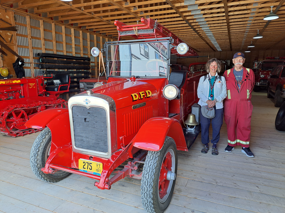
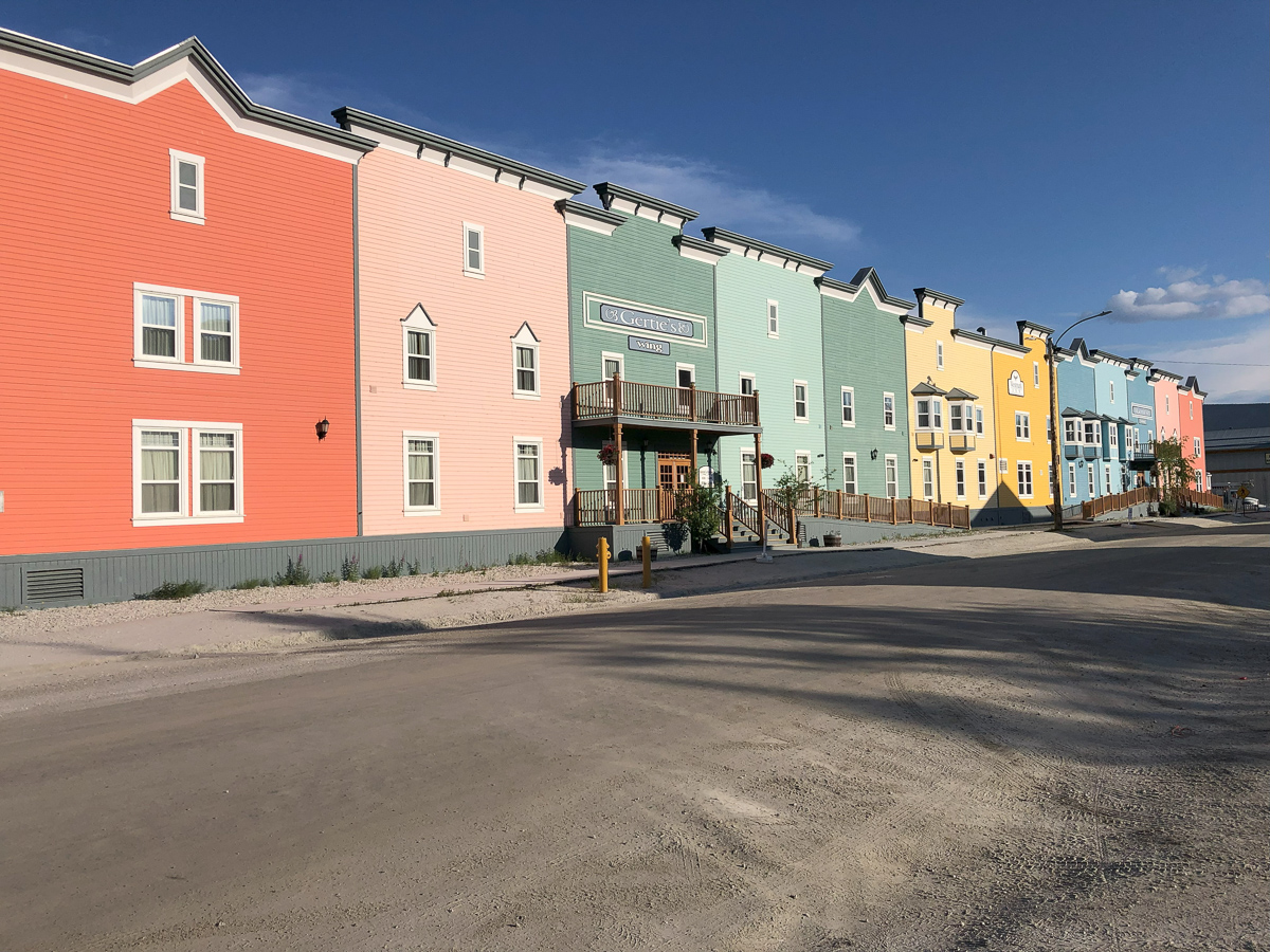
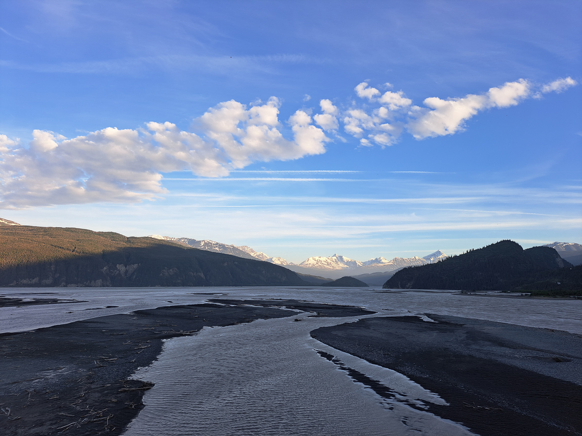
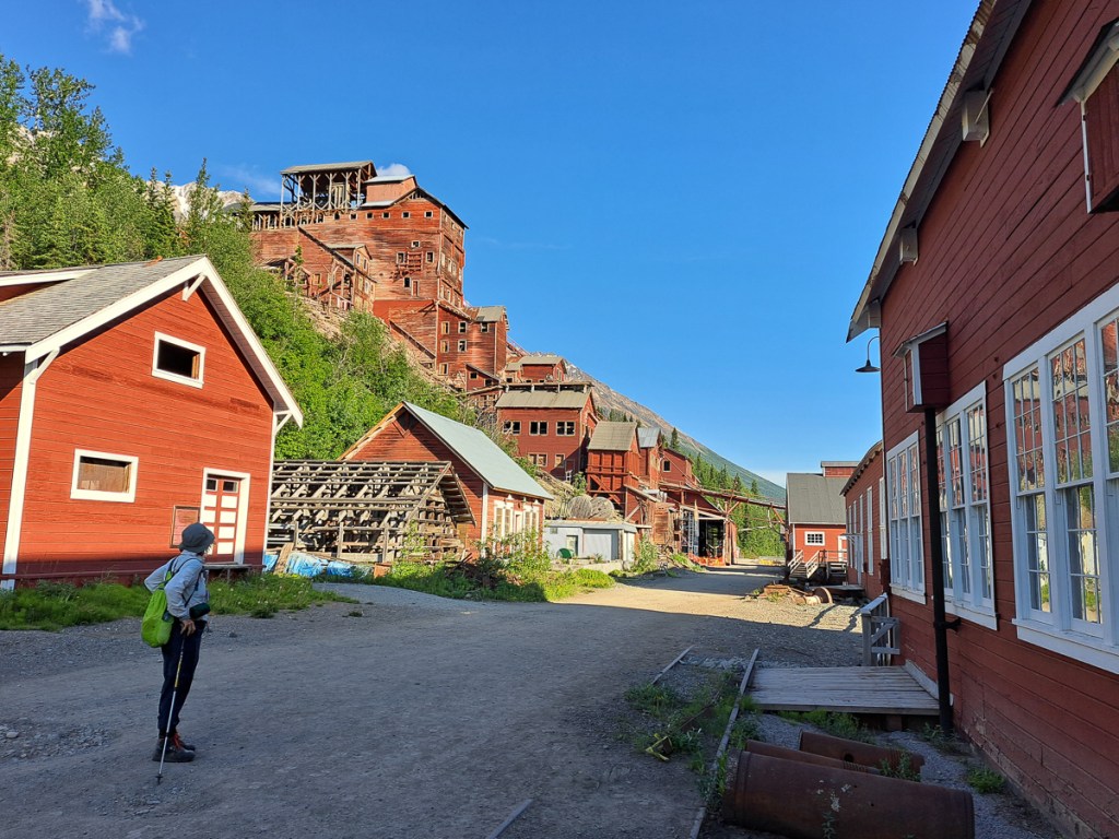
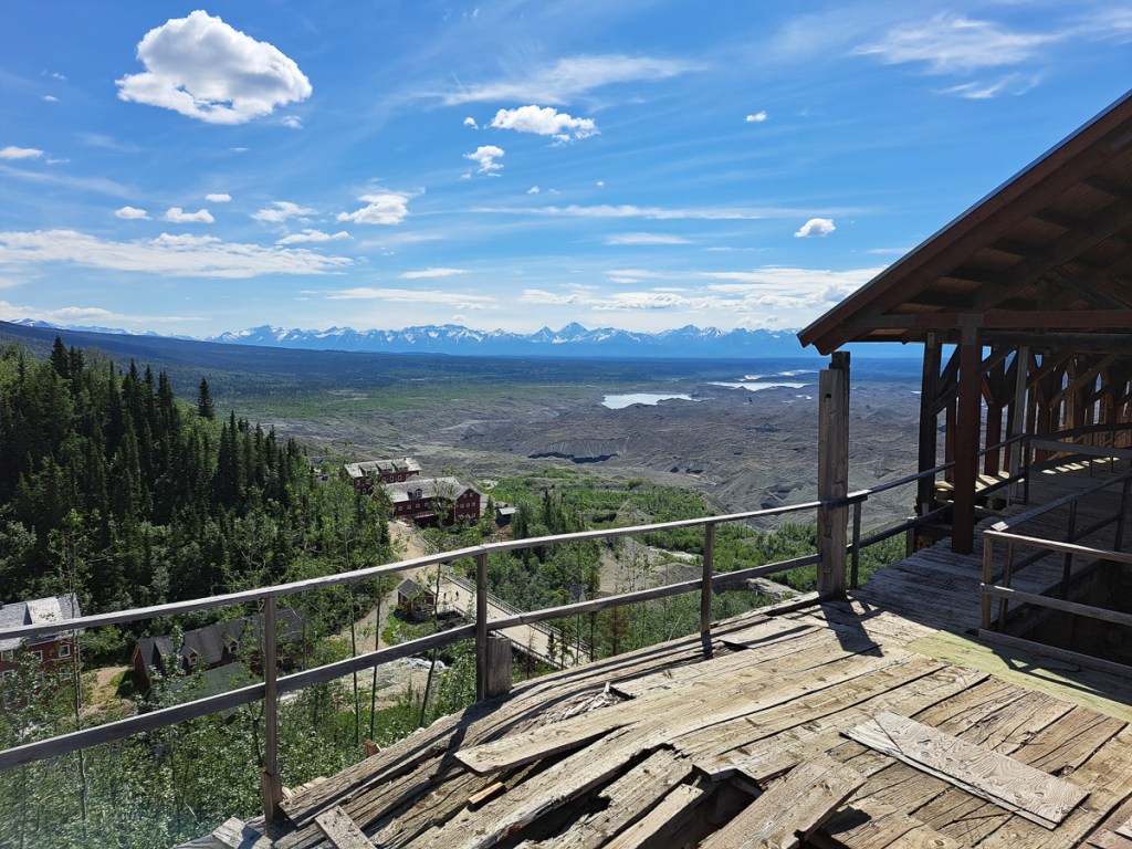
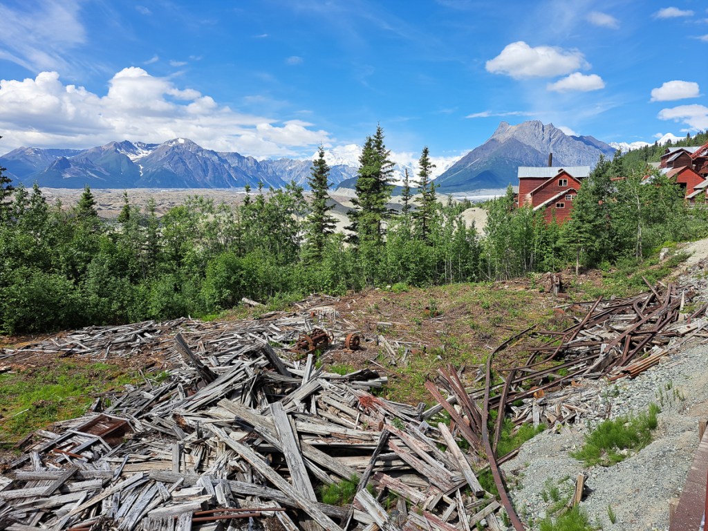
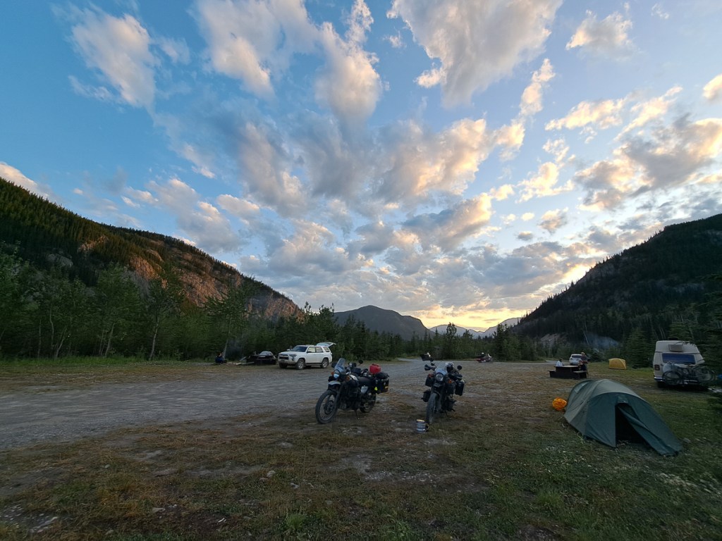
Our route is currently weaving around ticking the boxes of you must see this and must see that.  Skagway was the first of these.  The route down was through more awesome scenery but equally the town itself was of special interest.  We camped at Dyea a small hop round the peninsula from Skagway.  Back at the turn of the 20th century Dyea was a thriving town building up from ‘nothing’ to accommodate the gold rush influx of hopeful prospectors.  There, was the start of the infamous Chilcott Pass route over the mountains en route to Dawson City.  The alternative route, the White Way, was from Skagway through lower land but with thick mud and rivers.  Both routes were extremely hard.

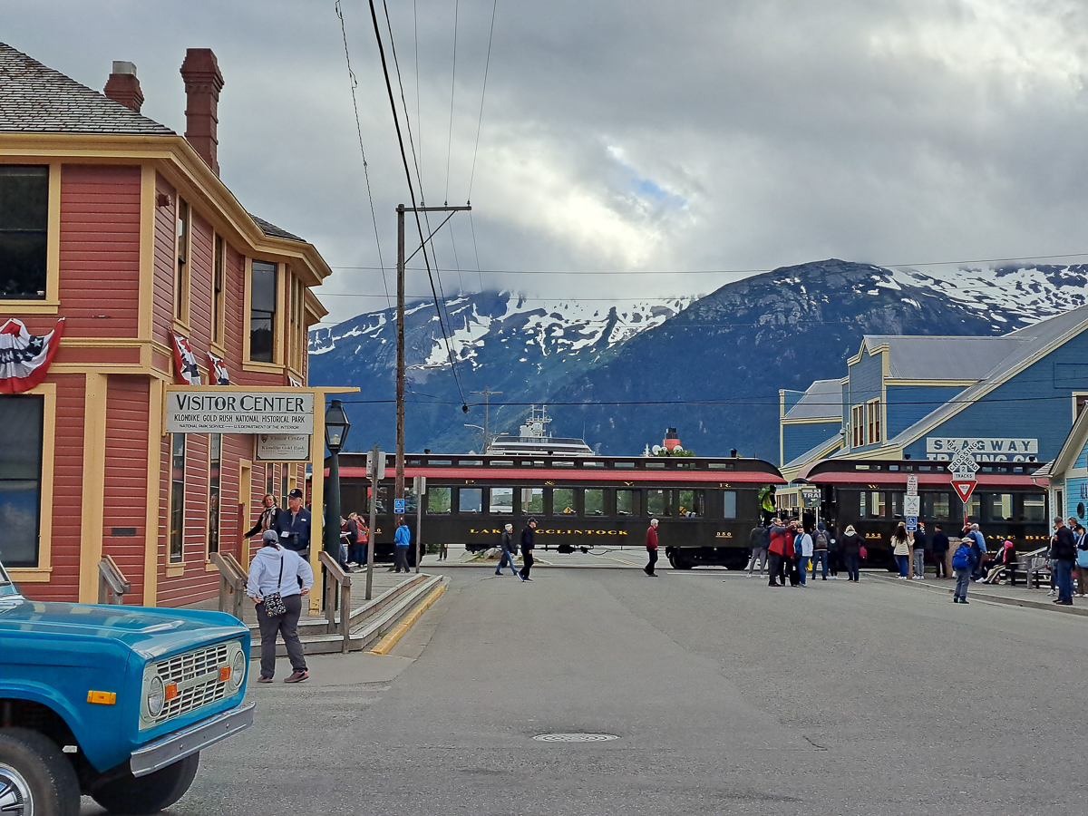
The Canadian government, concerned about the influx of people resulting from the gold rush, and the impact this would have on local services (which were, err….what exactly?), insisted that each person crossing the border from the USA had to bring two years worth of supplies so that they could maintain themselves for the duration of their stay.  This led to enormous packs that took many, many trips up the frozen stairway of the Chilkoot Pass.  Entrepreneurs  made light of the ordeal by selling potential prospectors sacks that could help transport their belongings up the 1500 steps cut in ice and be used as a ‘sled’ to speedily descend back down the snowy slopes to retrieve the next load.  Unfortunately the sacks had to be durable which led to increase in the weight to be transported.  Other ingenious ideas also blossomed but many people and horses died failing to survive the extreme conditions.  One such place on the White Way is named Dead Horse to mark where hundreds if not thousands of horses died on the trail. But today, road and rail run easily over White Way, Dyea is simply vanished, and Skagway is a cruise ship destination with a main street where one can indeed buy a ton of souvenirs.

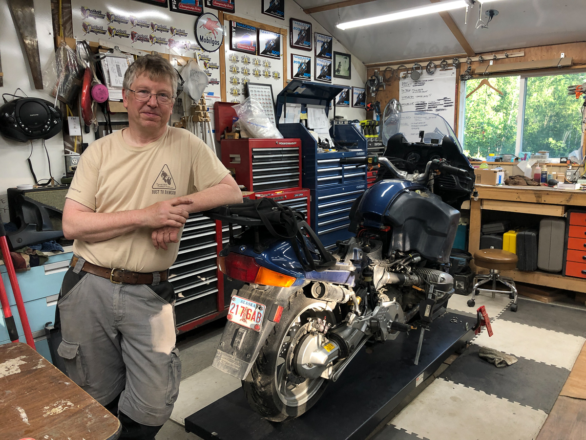
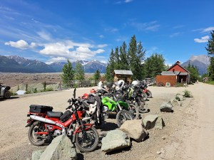
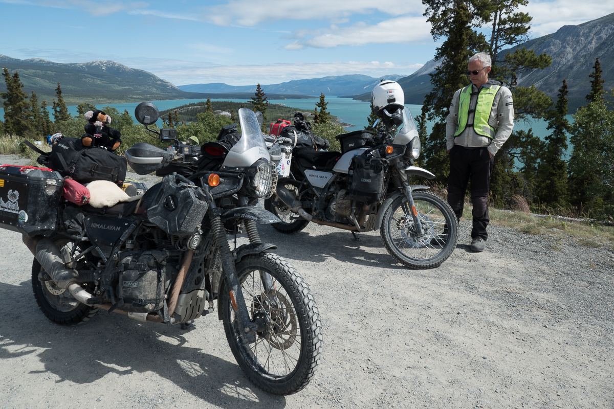
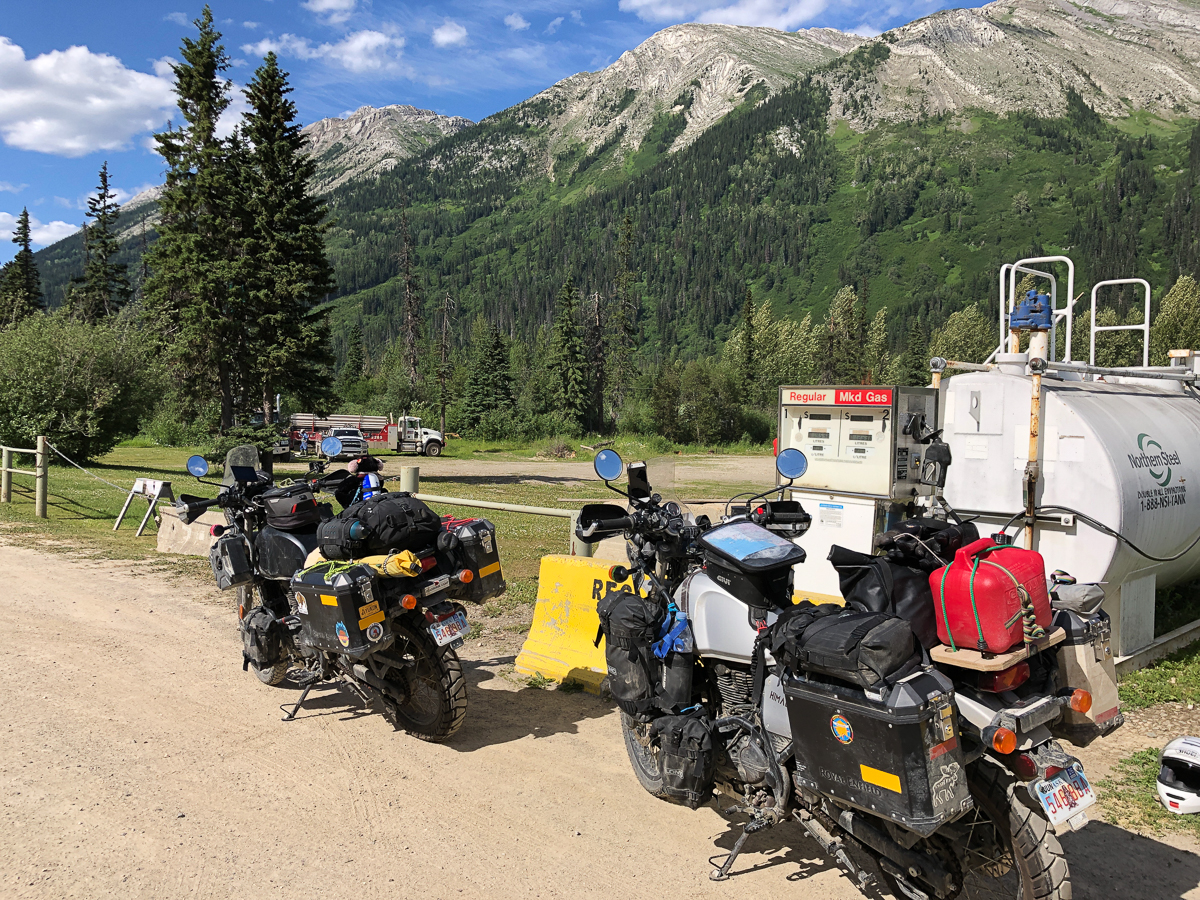
The second, 3,000 mile, service at Anchorage had unleashed the full potential of our Royal Enfield Himalayans, well, 5,000 rpm of it.  We’re now cruising at a staggering 55mph.  Andrew, at The Motorbike Shop, had chuckled that we’d barely notice the difference from the running in speeds. Later on when loosened up more, we find the engine will cruise at 60-65mph with a bit of chatter but no real distress. However, the in-helmet wind noise at that speed, with only a small screen, gets a bit painful. Not to worry!  One advantage of being so slow is we have plenty of time to take in the views and observe the wildlife.

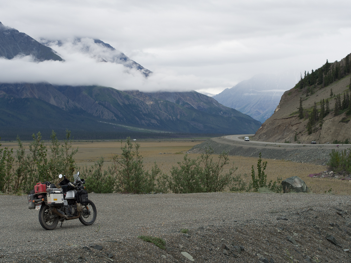
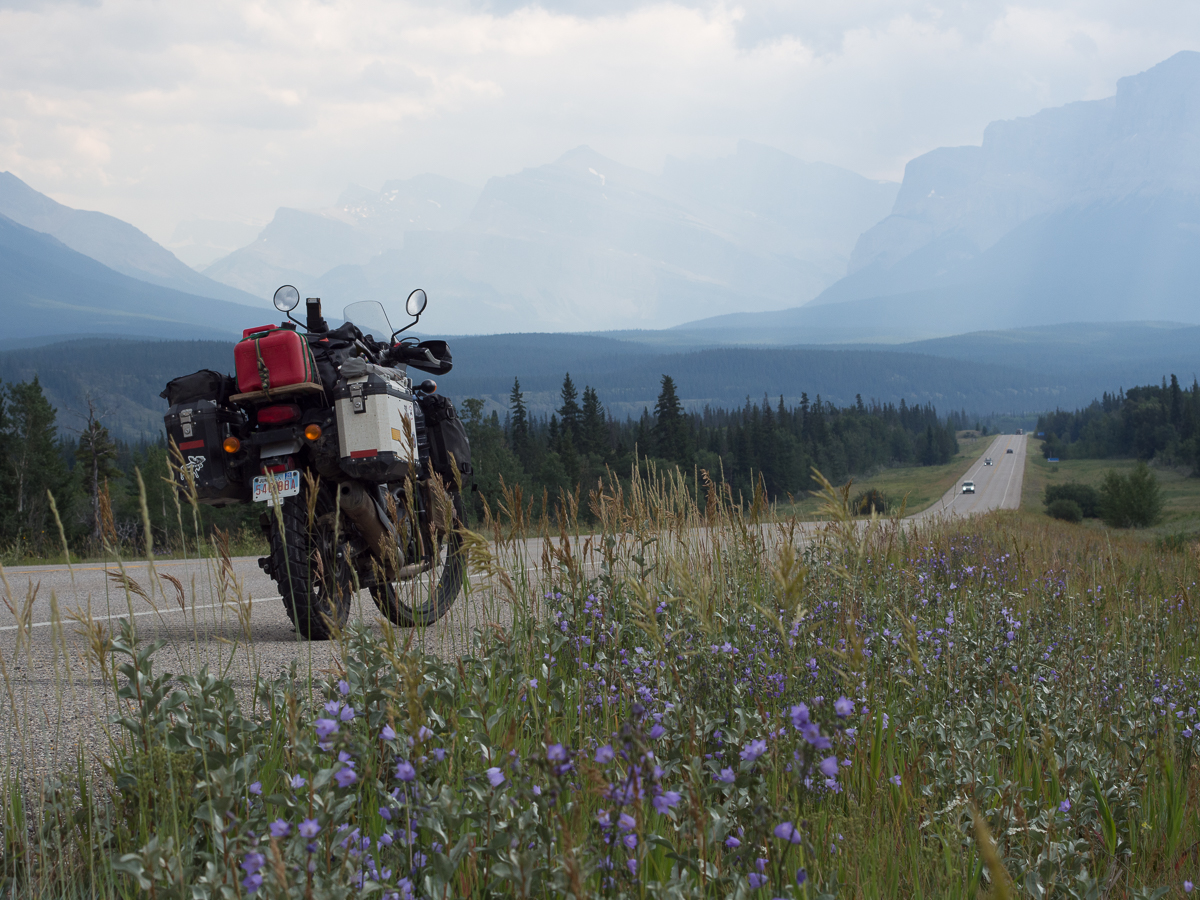
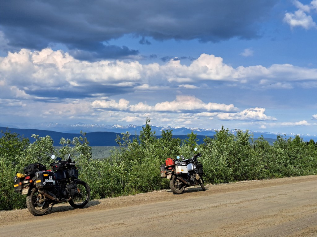
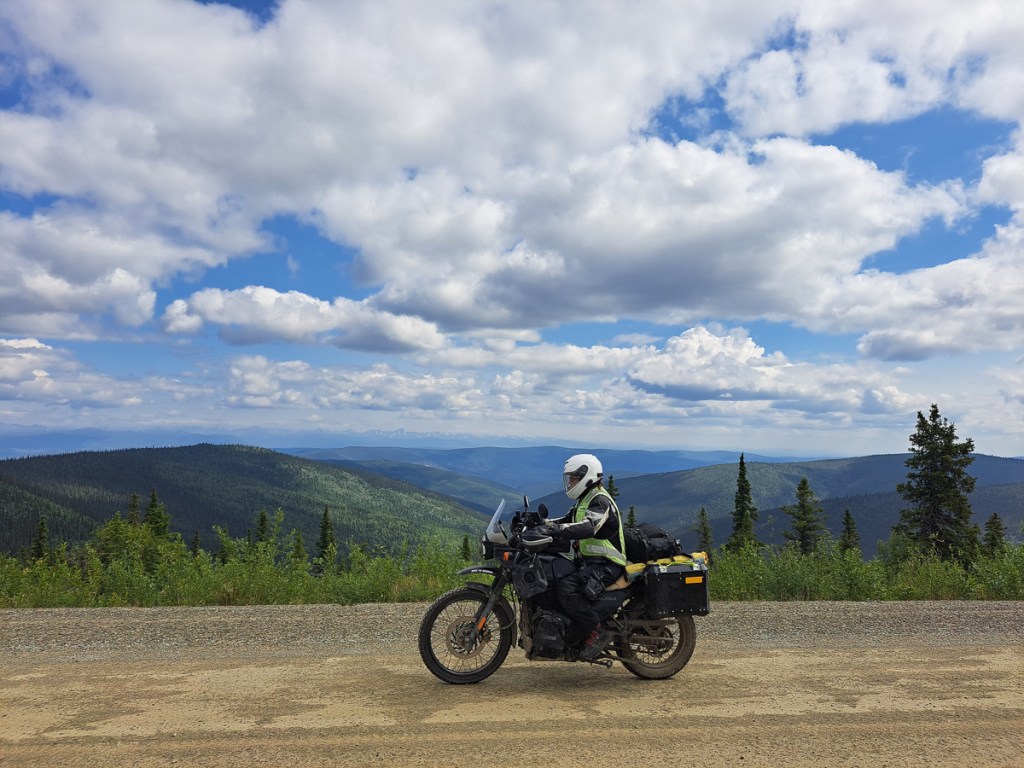
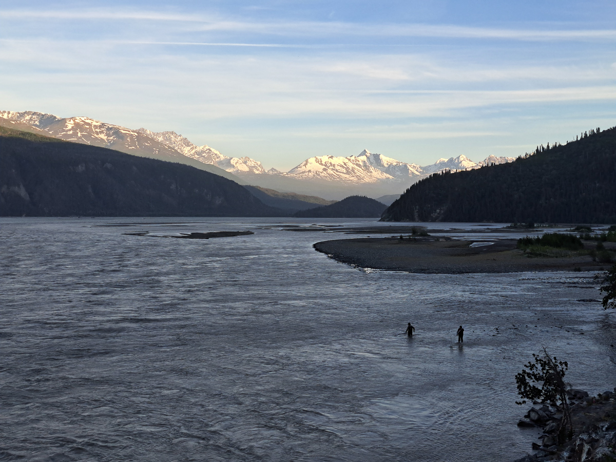
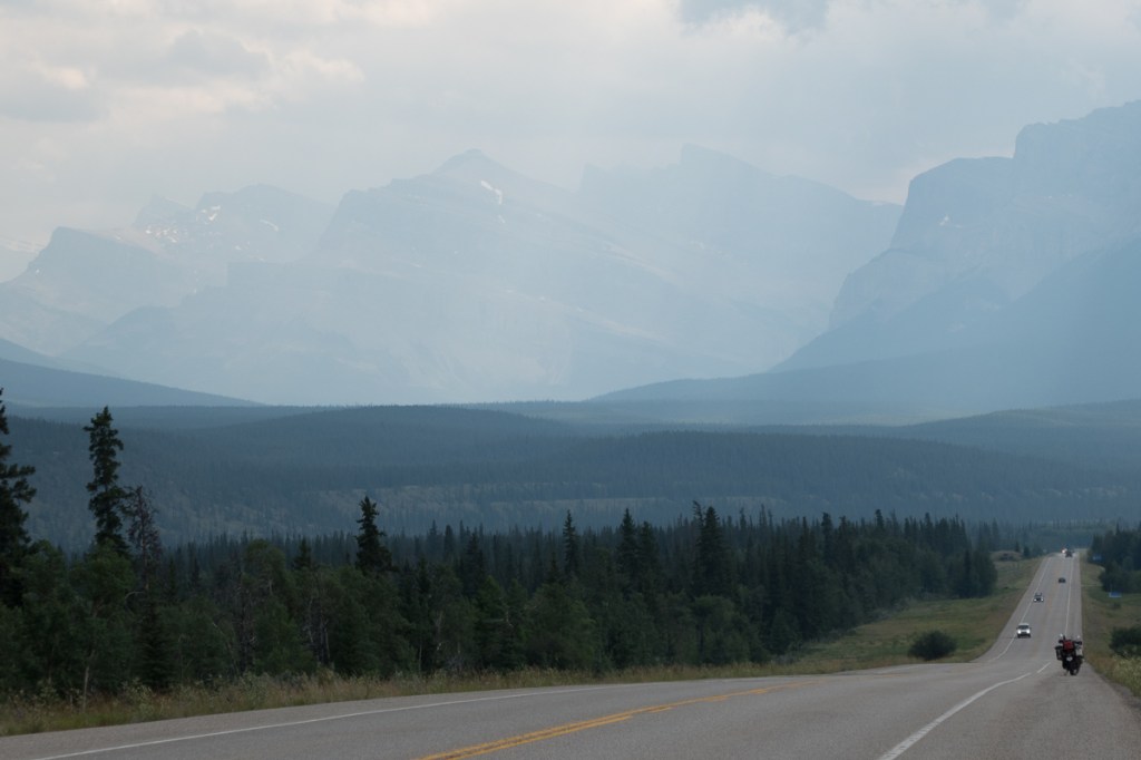
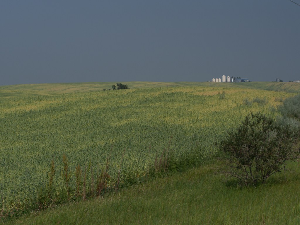
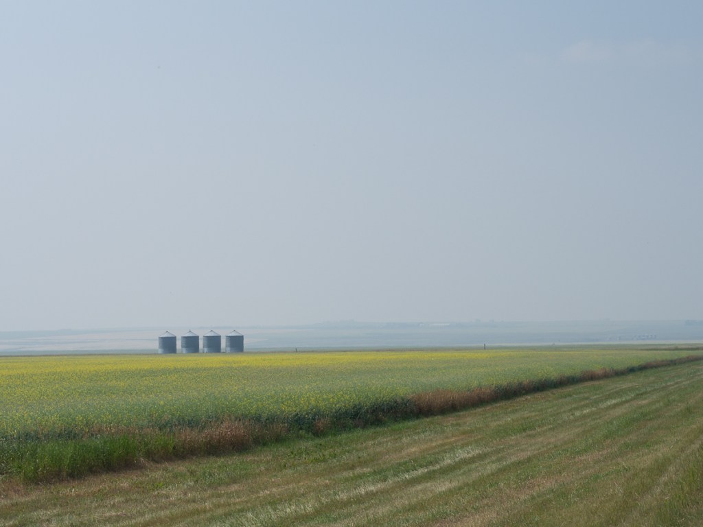
The views have been staggering.  Riding east into the Yukon on the Alaskan Highway led to spectacular panoramic views as wide valleys opened up.  Flowers edged the road side, rivers meander across the valley floors.  The only thing missing was the sheep alluded to on the signpost.  We went from the snow topped mountains of Alaska into the more rolling, greener, countryside of the Yukon and the change was refreshing. A short leg in BC was even greener, and now we were seeing small scale agriculture, too. Continuing on from BC into Alberta the mountains had gone replaced by expanses of arable land.  Hay bales in one field a tractor ploughing the next. Initially they were quite small but soon spread to a considerable expanse. Nearing Edmonton, prairie farms started to appear, miles upon mile of crops, mostly mown hay, rape (canola) and barley, but also oats, wheat, linseed as we turned south. And every second field had a nodding donkey extracting oil.

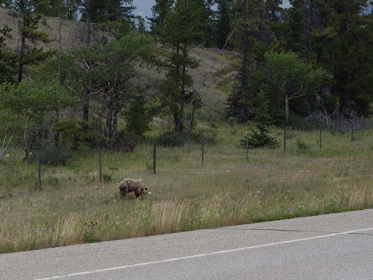
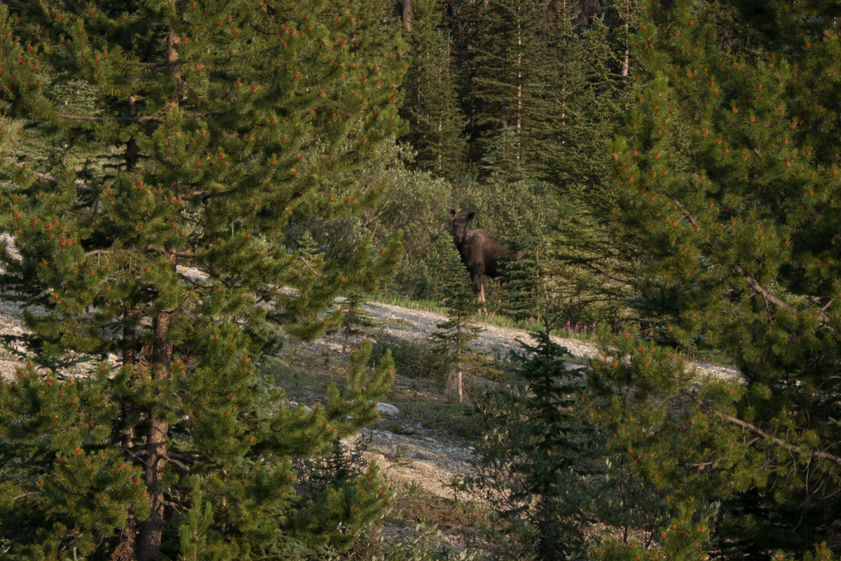
The wildlife has been fabulous.  On this last stretch we’ve only seen one grizzly bear but plenty of black bears.  The black bears are smaller but we’re told, that just means they take longer to maul you to death.  One person is usually mauled every year, Dave in Edmonton tells us.  Erron, a local guy we met at Mosquito Creek campsite added that a doctor and his wife where killed walking out from Banff this spring.  Bears he was telling us, ‘can go from zero to 30 mph just like that.  They are soooo fast.’  Safety around bear strategies include bear bells to ring out ‘dinner time’ and playing dead.  ‘It’s great to practise,’ Larry, at Toad River campsite, laughed, ‘because you soon will be’.  Studies have suggested that the machos who carry a gun will be too slow to draw and aim it.  So it’s bear spray, the counter attack, or nothing.  The bison along the Alaskan highway were beautiful too, all recorded on GoPro video. A few deer have also skipped across the road ahead of us. Two bounds and they’re gone.  But the one that got away was probably the most spectacular.  It started as a small dot.  Our first thoughts were could it be a bear.  ‘No!  It’s flapping and it seems to be two small dots’, I exclaimed.  It could be something blowing in the wind but road tyre debris doesn’t flap and is too heavy to blow in the wind.  Slowly it revealed itself as two birds.  Ravens probably, there’s quite a few of them around.  Nooo!  One of them has a white head.  All too late to start the GoPro it flew up from it’s road kill meal swooping right across our path – a beautiful full wing spread of a bald eagle a few metres in front of us.

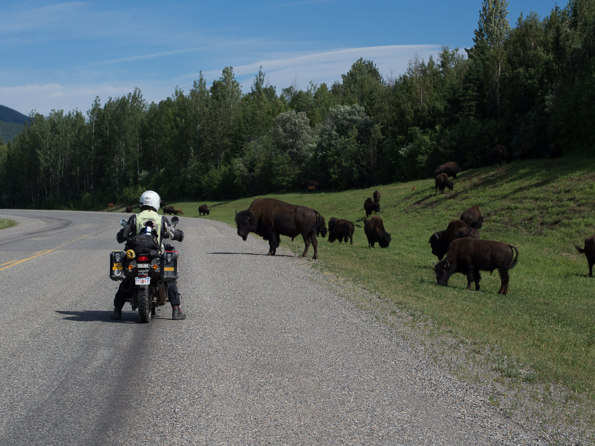
We have great respect for the wild life we are passing and pay heed to the warning signs around, one of which states, ‘Don’t stroke the hairy cows’. When riding down through Elk Island Provincial Park, Gid was calmly and slowly easing past a lone male bison which was on the other side of the road when it turned and gave chase.  From my vantage point some 15 – 20 metres behind it looked as though it got pretty close!!!  Seems like the lone males might be a bit less relaxed about traffic than the breeding herds we’d often passed earlier. Perhaps this guy had the hump ‘cos he’d missed out on the lady bison this year.

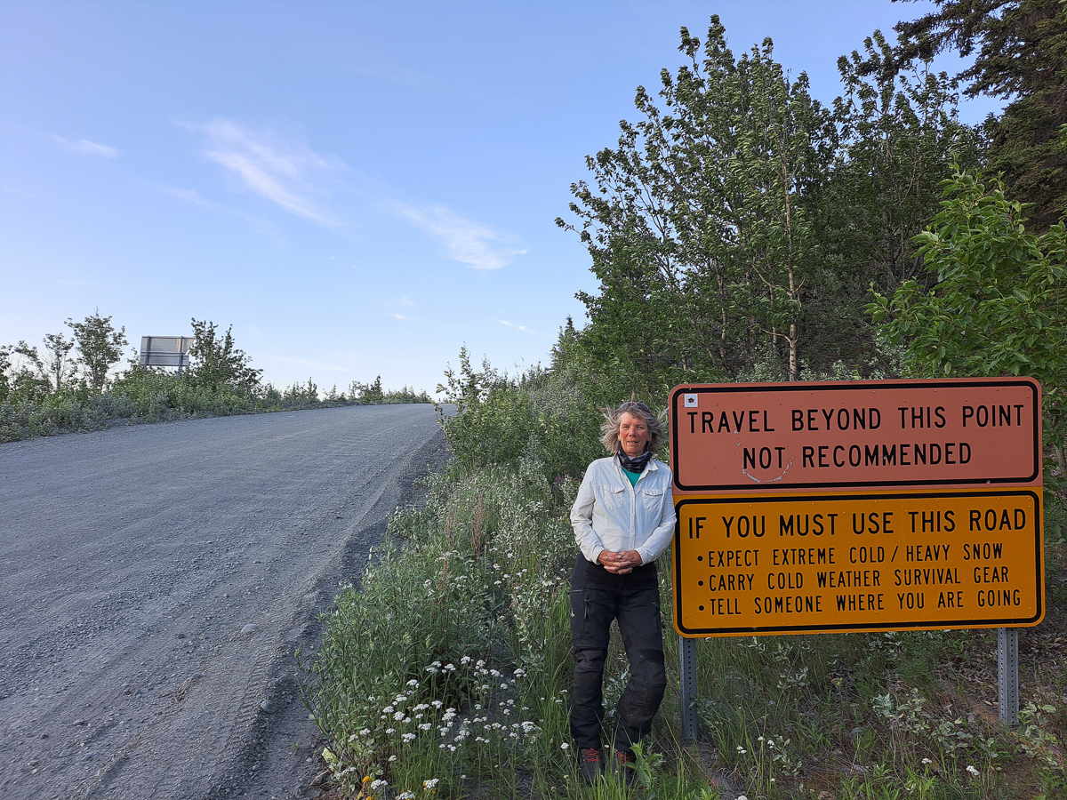
The Alaskan Highway, our initial route across Canada, was hastily started back in 1941, initiated by the American government .  The Americans were concerned about a possible Japanese invasion into Alaska following on from the Pearl Harbour bombing.  In conjunction with the Canadians the road was built in 15 months but the invasion never came.  It did however prove useful as a supply line to the Soviets. Having got to Summit Lake and admired the wildlife and views along the way we turned back because the route ahead to Fort Nelson was described as flat and boring with the town itself not up to much.  We headed back to Watson Lake to take the Cassiar – Stewart Hwy south.  Many people we’d spoken to considered this the better of the two routes.

Turning left along the Hwy 16, heading east again, small towns again getting bigger sprawled ahead of us. Some abandoned ramshackle properties, the odd one still inhabited.  Mine Road, Pit Lane giving clues to former communities.  Prince George Town, in recent terms was quite big.  It spread out ahead of us barely making a mark on the sky line with it’s one or rarely two story buildings.  Heading north from there took us back into mountains, lakes and the spindly, wizened black spruce oozing resin.  The black spruce’s high flammability the reason many wild fires take hold and spread so quickly.

The temperatures of at least 10 degrees higher than normal have caused havoc with forest fires in the north of Canada.  In the Yukon the fire between Dawson City and Whitehorse was still an issue three weeks after we initially heard about it.  Canoeing races down the River Yukon had been stopped because of fire sweeping across the river.  Riding across BC we’ve seen evidence of fires with mountain views being obscured and that distinctive bonfire smell in the air.  At Johnsons Crossing the campsite owner dismissed our inquiry about safety saying, ‘Yer, there’s a fire. It’s down the valley and across the river so won’t affect us here.’   It’s great to have something other than bears to worry about at night.  As we rode further on again the tell-tale smell was still in the air, smoke was wafting across the sky line to our left but on the right smoke was billowing up into the sky.  Getting closer we could see one helicopter with a water bomb and two small aircraft circling in the area.

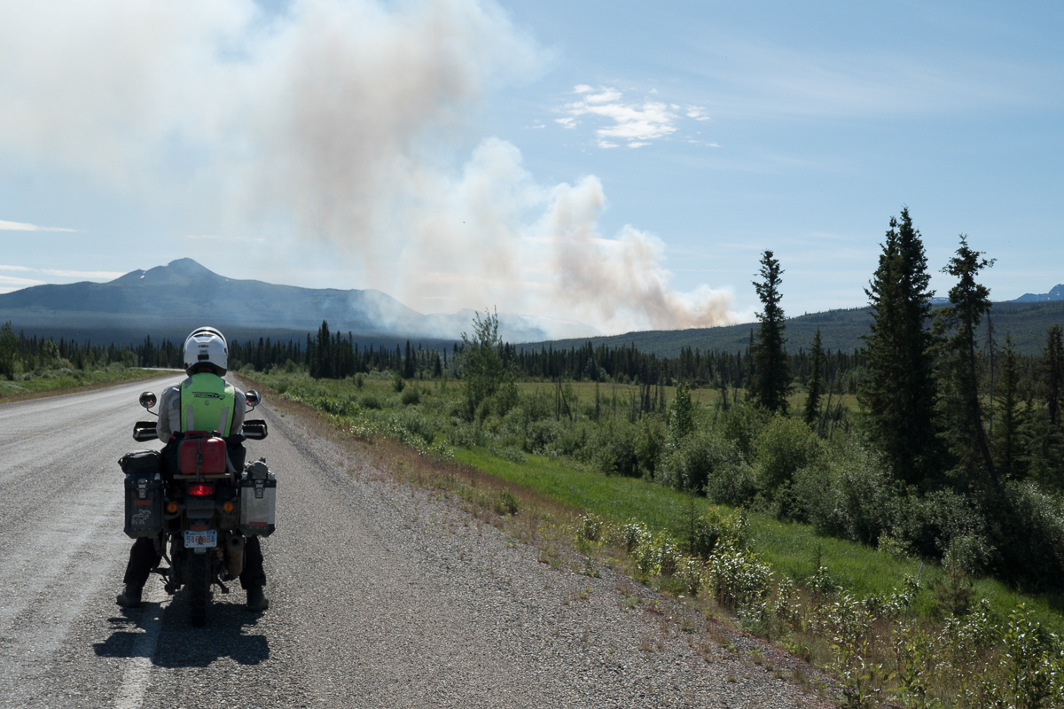
Riding south down the Cassiar – Stewart Highway, a part of our backtracking, took us straight into the scene of a big forest fire from back in 2010.  The skeletons of black spruce trees still stood with new growth at their feet but clearly it’s going to take some time to be anything other than the scene of a forest fire.  The following year a second fire hit the area but it’s spread was restricted because of the previous burn out.  Evidence of past fires is very clear throughout our travels in all but the prairies which we entered near Edmonton.

While in the Edmonton area Jasper had made headline news as there was a severe forest fire raging to the north.  A northerly wind was blowing it down onto the town.  The news updates were looking grim.  Two days later it was stated with impending gloom that the town was likely to burnt down that night.  It did. Our route down the famously scenic Hwy 93 through Jasper was not going to happen.  Sadly a large part of the town was demolished by fire.  The rain came the following day but was probably too insubstantial to have much impact on the well established forest fire. Current opinion in the news is that it may take three months to be truly extinguished.

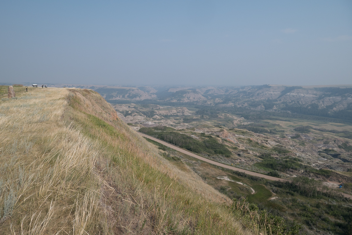
Having ridden down Hwy 21 where we enjoyed the delightful lush rolling pastures of the prairies and visited the tourist attraction Dry Island Provincial Park where the buffalo/bison were herded over the top of the cliff, we yet again, cut back westwards.   We did however manage to ride over the Saskatchewan Pass on Hwy 11 linking Hwy 22 with the midpoint of Hwy 93.  It was initially very unclear as to whether the junction would be open to traffic.  Thankfully, closed down Jasper was some way north on and we were able to turn south, after being royally shafted by the gouging prices at Saskatchewan Crossing.  (A micro can of gas cost us £15).  Along the linking pass towards the Jasper end was another interesting study of forest fires.  The ground in one area of thinned out burnt spruce had a magenta hue – fireweed was doing its rejuvenation job, while in the next 10 to 20 km there were areas with green 1m high trees, 2 m trees etc. clearly demarking the zones of previous fires and the progress of regeneration.

In  Alberta a second less publicised fire line is currently across the top of the province. Yet again residents have been evacuated.  This fire has had a more widely felt impact as fuel prices have been affected due to the risk to the oil fields.  400km south, in Edmonton, the air is tainted with a mild smoky mist.

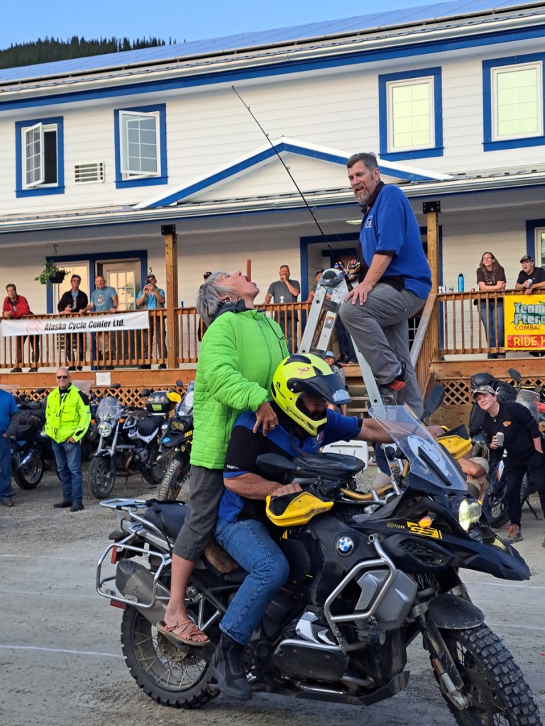
On our meandering we spent a few days in Edmonton, our first ever Bunk-a-Biker stay.  Dave and Ardis were fabulous hosts.  A biking couple themselves we had lots in common and great stories to share.  Gid was very fortunate to be able to complete a service on both bikes and we were treated to many of the cities points of interest.  Edmonton being a target town because of the Royal Enfield dealer for service parts and just in case there were any warranty issues with the bikes.  Our stay was so good it was a bit of a wrench to say good bye but I was starting to get twitchy about making progress again and Gid had even had a rest day.  Our fabulous hosts had made a few suggestions as to the great routes they had taken and would recommend.  Tips like this have informed a lot of our route. So wonderful was our experience together that Dave and Ardis gave us each a parting gift.  Like many Americans and Canadians their bikes of choice are Harleys.  To our surprise they presented us with parting gifts.   We are now the proud owners of some Harley magic as our bells reach down to keep the evil road demons at bay.

Another visit that was hard to leave was to my cousin, Debbie, just down the road from Edmonton in Ryley.  Debbie and her Mom, Barbie, the latter whom we’ll visit in Calgary, had visited us in England forty years ago so it’s clearly time that we popped by.  Debbie and her husband Robin also talked of areas of interest that we might pass on our travels and made suggestions of places that are too good to miss.   I was quite surprised by how many interests we shared and how well we got on.  Thank you, Debbie, for my Labradorite bracelet.  Another charm to protect me on my way.  We clearly need these lucky charms if Gid’s bison experience, above, is anything to go by!

Starting our route across the Saskatchewan pass into the Rockies we went into the second area to display the ‘No Cellular signal for 230km’ sign.  The first had been along the Alaskan Hwy where we ran into problems around Muncho Lake.  We had wanted to camp in that area but were always too late, arriving at any time after five.  A number of the sites could be prebooked but not if you were on the road with no signal.  It was the same thing on the Saskatchewan Pass.  We were prepared to pay a little extra to get a campsite with more facilities.  A flush toilet – luxury, potable water – great.  As it happened Crimson Lake campsite, at the start of the pass, talked the talk but couldn’t deliver.  The initial site they offered us was unsuitable because it was on a slope and had a puddle where it would seem that recent flood water had collected.  When I pointed this out they were happy enough to move us but the hoped for shower was off!  Along Hwy 93 and 1A the scenic route through the Rockies from Jasper to Banff we had the same problem.  It was in the 230Km no cellular phone signal area.  We’ve been to Alaska before in 2012 and had hired a satellite phone.  It was expensive, bulky and certainly didn’t do internet.  We didn’t consider we needed one on this trip but hadn’t anticipated large areas where we couldn’t use our cell phones.  Along the highway through the national parks we could turn up at about a quarter of the campsites the rest had to be pre-booked which we were unable to do.

Most campsites are pretty basic, so we often went for a dip in the local stream or lake  That’s typically where the campsites are – next to lakes or rivers but up in the Rocky mountains where the temperatures had dropped from the highs of 33 degrees back to 9 the mountain streams weren’t so appealing.  Even the wilderness hostel a couple of hundred metres away from our campsite had no showers.

We reached our Air BnB in Calgary several days after this plight.  Gid was very business like suggesting we make a plan and maybe shopping was the first priority.  I was already half stripped and on my way to the shower.  He was quick to follow.

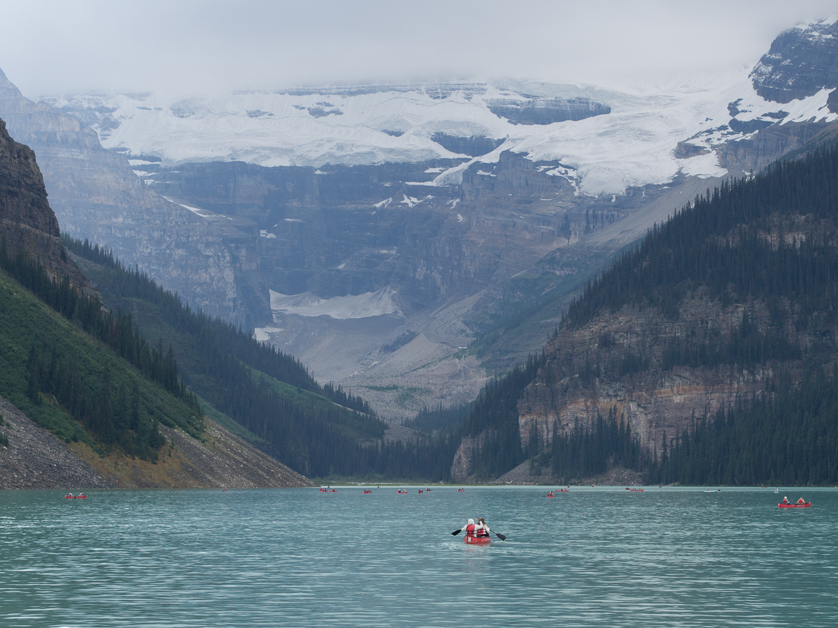
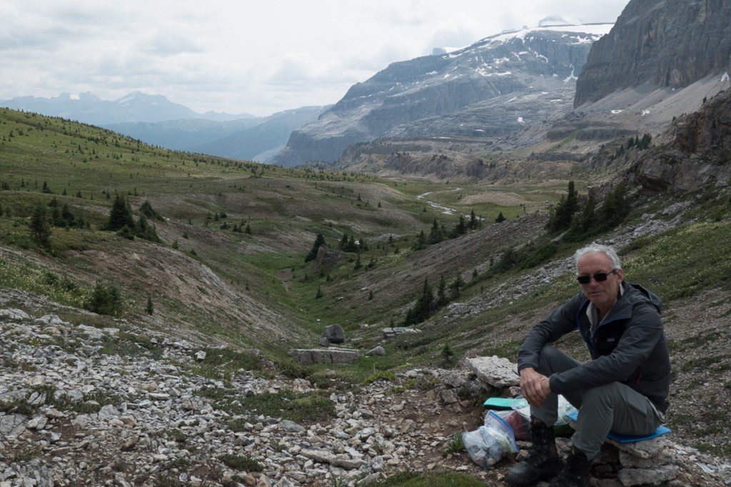
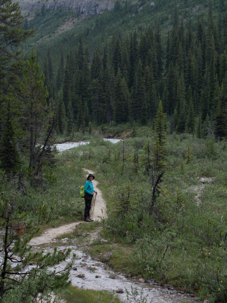
Our time in the Rockies has been fabulous.  We’ve done the classic tourist stuff, Lake Louise and Banff.  Jasper is off limits for reasons explained above but the event that will put it in our anals of special occasions is the trail we took up to Mosquito Pass.  Three of us set off.  Simon, a young man visiting the area on his own and wisely not brave enough to head off solo in bear country had joined us.  I was jingling away.  Well aware of the jokes – ‘How do you tell Black bear skat?  By the berries.’  ‘How do you tell Grizzly bear skat?  By the peppery smell and the bells.’  Gid and Simon nattered away.  Hopefully that was noise enough!

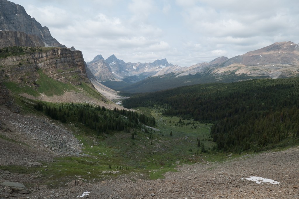
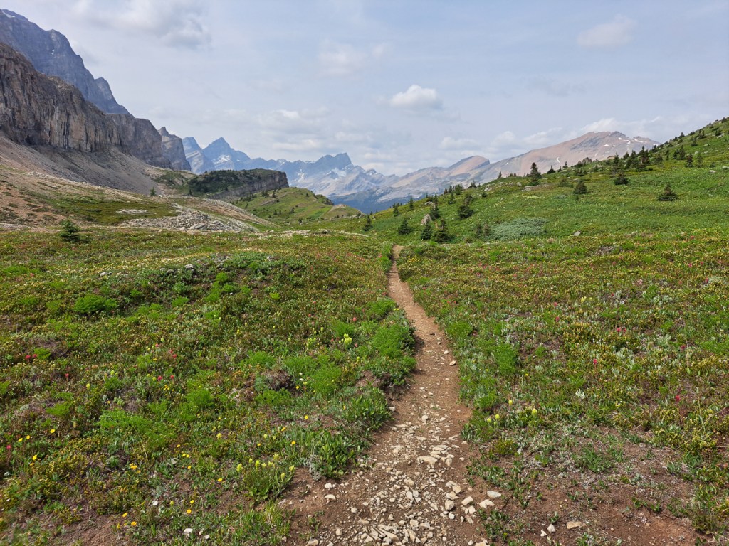
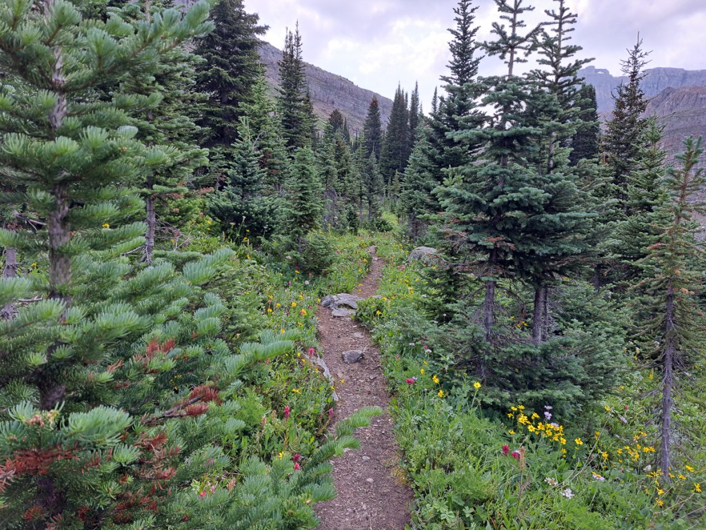
We climbed up, frequently crossing the creek. We were surrounded by mountains, towering up above us.  And spruce trees.  We were expecting meadows, which were referred to on the information boards at the start of the trail, but every new view seemed to meet and exceed our expectations.  Simon armed with binoculars stopped regularly to spy for wildlife.  Once we broke free of the tree line and cut across the stony track at the head of the valley again the views were breath taking.  On we went imagining that we’d seen the best.  How wrong could we be.  Eager to go just a bit further we continued on.  The top flattened out to the most amazing meadows.  Trumping that was the golden eagle that flew just a few metres above the meadows in search of ground squirrels 30m or so to one side.  I had only just said, ‘With so many ground squirrels where are the birds of prey?  You can’t have one without the other!’  This spectacular bird soared through.   It looked rather black I thought for a golden eagle.  Golden being the key word.  The following morning Simon brought his book of North Canadian Birds.  There it was pictured, the golden eagle – black, in the mountains (seen at over 2200m it ticked that box), solitary, lives on ground squirrels etc, nests in the mountains.  It certainly was a golden eagle!

We will be rather sad to leave Alaska and the Western area of Canada behind so special are they from this and previous trips.  We certainly haven’t been disappointed to visit them again.  At  Anchorage on flying in the American border guard told us that to restart our three month American travel visa we needed to spend a meaningful trip in Canada.  Visiting my relatives was on the agenda right from the start.  One month and visiting family was certainly a meaningful trip!

And we’re still having a big dither about our route through the USA. In the USA Highway 89 is scenic, we’re told, will keep us away from most big cities and in some beautiful places. But it’ll be August, and these are some of the hottest parts of the United States. Maybe the Pacific coast would be a more sensible, cooler route, especially if we can avoid the megacities and megacosts of California?

Alaska, after the Dalton

So, having found our way to the top, or at least, a top, of the Pan-American Highway, how do we go south? The Pan American isn’t a road as such, or a route, it’s more of a concept. So, we might go this way, or that way. South, somehow. It also kept the option of diversions open – if we didn’t actually have a route.

I’d read about the D2D back in February and was mystified by the constant refrain of ‘It’s Not a Rally’.  So what was it?

Alaskan steaks!

Clearly, seeing as it was an adventure biker event and we were ‘in the area’ we needed to find out.  And, it’s definitely south of Prudhoe, and only a weeny diversion away from our route back to Anchorage. Oh, and over the border in Canada. We’d booked in On-line but were aware that they were expecting ‘larger than ever numbers’.  The main events took place on the Friday but tickets for the meal, one of the main events, went on sale 12 midday on Thursday.  They were sold out by 5 when Nate, a young American from Rhode Island, who shared our camping pitch, tried to buy one.

To be honest it was Fairbanks that we had come from as that was when we turned east and headed for firstly Tok, then Chicken and on to Dawson but we were expected to say Anchorage as nothing else made much sense.  If the conversation with our new acquaintances developed we’d explain that we’d flown into Anchorage, bought our bikes there, already done the Dalton and headed over to Dawson when returning from that.  Yes, we’d come across the Top of the World road. 

The Top of the World road (TOTWR) is precisely that.  It rises up to about 1000m for over 100km.  It undulates from one pass to another at times sweeping round corners to display fantastic views of the snow topped Mount Sorenson range or tree filled valleys below. It peaks at the little border post where it got to 1280m.  On our way back we had been told that caribou were migrating and passing across the road up by the border post.  When we arrived one guy checked our documents while the other was clearly scouting the area for caribou.

Our route across TOTWR had had it’s moments.  Gid was leading along the paved road, a perfect surface as many highways start.  When about 10miles in there was a black patch.  A lot of the repairs are in different colours from the original surface being produced from the natural materials nearby – sand, mud, black tarmac (shipped in),  grey rock compressed to gravel (if you’re lucky) .  Gid’s voice came blasting through the intercom.  ‘Shit, shit! That’s deep’. He’d clearly had a wobble.  ‘That’s deeep!’  With barely time to stop myself I came to a stand still, in it.  Not 6 inches as he’d said but definitely a good 4.  Chatting to some bikers later others had clearly been there to with equal tales of surprise and dismay. All happy to laugh about it now it was history.

Other excitement on the TOTWR occurred the following day.  One chap exclaimed that he’d had a heck of a time coming across in 6 inches of snow.  Mark, a new friend who is part Indian, an avid rider and has lived in Alaska all his life reiterated this saying that he wouldn’t have made it if it hadn’t been for the tracks of the car in front of him.  A third person in a car was also dazed by the weather up there.  All agreed it was six inches deep. The latter continued that he’d seen 3 or 4 flash fires from the lightening. In our first two days in Dawson we’d got used to the oppressively hot mornings and thunderstorms in the afternoons.

1% of Alaska burns out every year.  To give that some perspective, 2% of Alaska is populated.  The fires are left to burn out as that is a part of natural regeneration.  The old burns down, clears the leaf litter and debris all of which rejuvenates the soil. The roots of the plant Fireweed are fire resistant so it regenerates quickly.  It’s also a prolific seed producer which in turn brings in the birds, squirrels etc.  And off it goes again.

Whilst all was clear for our way back to Anchorage, where we were getting the bikes serviced, it wasn’t the case one week later when we returned to Tok, the launch point for the TOTWR. Revisiting Eagles Claw campsite, a bikers campsite at Tok, the chatter was all about the road being closed between Dawson and the more southerly town of Whitehorse, because of forest fires.  It had been closed for a couple of days and we were strongly advised not to go that way.   The following morning the road closure was confirmed by the Yukon news station.  Several days later it was still closed with one or two trips being lead with a pilot car, as a lady hoping to make the journey was telling me.

So, the D2D. Bikes were arriving from all points. The widest possible range of old and new adventure bikes, and a few brave cruisers (Hi Behr, hope the 34-year-old Electraglide made it home to Germany!). The poker run turned out to be – in the continuing good weather – an enjoyable 60 mile or so loop along local dirt roads, stopping at places of interest to draw a card. When we looked a bit nervous on the surface in places (read – slow), Nate was good enough to stick with us as others whizzed past. In the end, only one little bit felt challenging, but we’re definitely slow. The ride looped back to Dawson for a jolly good natter with other bikers at the steak feast prepared by Dawson Fire Department (proceeds to local charities). Then outside for the biker games, which definitely planted ideas for our RoSPA SMART training team back home. Mark appeared again here, as a bit of a star (opening the slow races – on his Ducati). And, as well as the (informally) organised events, an awful lot of chinwagging, and I suspect, beer too.

We hadn’t twigged before we got there, but Dawson City is the famous historic town at the centre of the 1898 Klondike gold rush. Well, it wasn’t historic then, just a gravel bank that the local Athabaskan Indians appreciated as a summer camp. They withdrew as swarms of smelly prospectors turned up by boat, and built a camp. Enterprising non-prospectors quickly built a town. After the gold was gone, it quieted down a lot, and now is reinvented as a living memorial to the gold rush (ahem, tourist town), with still a bit of a supply centre for the remaining local miners. Many of the buildings have stood still although some explained that many decades of the permafrost melting and re-freezing beneath the buildings had shifted the foundations severely.  Now some are decidedly wonky.

That big grey thing is a gold dredger. These gigantic barges were winched through the river bed, banks, and shoals, washing gold out of the gravel. A reminder that for all the romance of “panning for gold”, the early 20th century was an industrial age.

Dawson City is at the confluence of the Klondike and the bigger Yukon, and the river boats came downriver from Whitehorse.  Sourced with snow melt in BC, Canada, just kilometres away from the Pacific south-west coast of Alaska it heads north and inland and has carved a route out all the way to near the Bering Strait 1,980 miles away. The fast flowing water that passed our camp site was thick with silt. It’s hard to imagine it frozen solid throughout the winter.  Sufficiently so that it will take the weight of fully laden trucks as clearly the 24hr ferry can’t operate. During the months of non-drivable ice, the part of the city over the river is isolated.

Photographs recorded the harsh conditions and ill-prepared prospectors.  The latter was reiterated throughout the graveyard where tomb stones displayed the names of failed young hopefuls at the tender ages of 26 / 27.  The paddle boat graveyard was another vivid record of a by-gone days although the structures to lower the boats into the water still existed, as well as one hauled-out old timer to tour.

The Dalton Highway especially is billed as long distances between any services, but other, more workaday routes in these parts still strain the endurance of riders and, especially, motorcycle fuel tanks. The main road (really, it is!) from Anchorage/Wasilla/Palmer to Tok, had my bike 60 miles into reserve before the well-named Eureka Lodge around halfway provided fuel, coffee (25 cents!), food, and more bikers. The Top of the World road also involved a bit of vapour running, and those roads weren’t the only ones. Gid’s Himalayan seems to have a rather panicky fuel gauge, but also it seems to be thirstier than Clare’s. Maybe it’s just more loaded or bulky. The big bags on the front tank bars do provide a lot of weather protection, though. 60 miles into reserve (as in, the dashboard flashes, there’s no tap), gives a total range of something over 200 miles (haven’t actually conked out yet), and then there’s 2 gallons (~8 litres) in the can on the back. Clare’s front tanks total 6 litres, so we probably both have around 300 mile range.

On these long connecting roads, there will be a few small communities along the way but nothing more than a few scattered dwellings that are in a full tank distance.  The sheer distance between places is remarkable for a mere Brit. That’s not just Alaska – now we’ve moved into the Yukon, although the scenery and signage differs, the immense distances and rare communities continue.

From Wikipedia:

  • Alaska – 665,384 square miles, population ~733,000 (nearly a square mile each), the main part is roughly 1,500 miles long and wide.
  • Yukon – 186,272 square miles, population ~45,000 (about 4 square miles each), around 1,000 miles along the two short edges.
  • Great Britain – 80,823 square miles, population ~66,000,000 (about 1/743rd of a square mile each), 600 x 300 miles.

Highways are frequently numbered and often named. The longer ones, unless they really are major arteries are typically some part dirt road.  Even on metalled sections, ‘repairs’ are frequently areas of gravel spread across the road sometimes for 100m or so and have been known to cover several miles. The weather isn’t friendly to roads. Spring melt floods regularly wash away anything in their path, so some parts simply aren’t worth making up nicely as they’re re-laid annually. And often there’s frost heave or problems with permafrost – many roads are basically millions of pounds of gravel laid onto the permafrost, again, it maybe isn’t worth making a nice finish. But gravel roads can’t take much traffic before they corrugate, and the dust is a major hazard which prevents high density/high speed traffic. So, dirt roads rule in the sticks. They’re a lot better than Latvian ones though, loose tomato sized rock surface and pretty tight bends were frequent there.

The Dalton or the Dempster?

Sitting in our armchairs at home we’d barely heard of the Dempster, not until it was featured in Motorcycle News just the week before we flew out.  A pair of tour leaders exclaimed that it had been on their bucket list for a while and they’d just achieved it.  That was our first awakening to it’s existence as a biker road.  Out here it’s definitely the one to do.  ‘You’ve got to do the Dempster!  The Dalton just dumps you in an oil field,’  one enthusiast was trying to persuade me.

Although some of the resident bikers in Anchorage we’d spoken to have never done the Dalton and don’t intend to, because of the difficulties in riding it, it’s clearly yesterday’s challenge.  As we’d continued on our travels around Alaska bikers told of their Dempster ordeals. 

‘Six inches of thick mud all the way’, one grave looking soul who’d just finished it told us. 

’80 kph is the only way to crack it. That way you just fly over the pea gravel.’ 

Wallowing around in the Canadian gravel, some pea sized, some egg sized, which, all agreed was dug up from the river bed and smooth felt like walking on marbles, as opposed to the Alaskan mountain gravel that is crushed and jams together when pressure is applied, was not a great option.

‘It took a while of wallowing to even think of trying it but it worked!’ Richard exclaimed still pumped up with riding at 80Kph across the gravel and beaming from the success.  Luckily our 24hp bikes probably won ‘t get to 50mph in deep gravel (who knows?). What a relief.

So, all these dirt roads and wobbly moments – what was the damage? Luckily, we haven’t yet had a spill on these Himalayans. That compares to 3.5 drops of our UK Himalayans, in few miles. But Gid’s bike had been on the deck twice by now. Once, after dismounting in a highway rest area, on a seemingly well chosen surface, the bike decided to lie down. BANG went the airbag vest as the leash pulled out, leaving Gid standing bemused and squashed beside it. No damage apart from a £25 airbag cartridge. The other time, in Safeways’ car park, after shopping, Gid pulled a little on a loading strap, and the bike just toppled. The strap was on the left, and the bike toppled right. It’s a known defect of the Himalayan 411 that, designed partly in the UK, and otherwise Indian, it prefers to be parked on the left hand side of the road’s camber. Especially when loaded. In other words, the side-stand is too darn long! Clare’s UK 2018 bike got an adjustable, but driving on the left, Gid’s UK 2023 seemed to indicate the defect was fixed. Not so. And the forums confirmed it. A solution was needed, we can’t carry on crossing the road to park when there’s population.

We’d headed back into Anchorage for the bike’s 3,300 mile service. We figured it best to have this done at the shop because they know what noises a Himalayan should make, and it might help with any future warranty issues. We also picked up our proper Alaskan plates and title documents.

Tim at Wasilla, having helped us previously when setting up the bikes, had generously offered to shorten our side-stands. We’d had some delays in Anchorage. Getting lost on the way out didn’t help. But when we finally arrived at Tim’s another mate had turned up with an unexpected extra elderly BMW to salvage. Didn’t know BMW did orange bikes. Inexorably, our offer to treat Tim and his wife to a feed was defeated by the clock. Heather, Tim’s wife, generously fed us! A sheepskin seat cover also came our way. What a lovely generous chap! Clearly he’ll need to visit us in the UK.

A couple of people had mentioned McCarthy while we at the Eagles Claw. ‘The place is a copper mine museum and it’s about 60mi on a dirt road but that’s ok once you pass the fishing bridge,’ Stranded Strommer Steven, waiting for parts for his broken down V-Strom had told us.   ‘And you can bike across the footbridge to get there.  Cars can’t but bikes can’.  That clinched it.  I had visions of a suspended rope walk bridge that I could cross on a motorbike.  It was straight out of some of the videos I’d watched of Vietnamese ladies, infants on their backs, careering up the side of mountains on heavily loaded 125s.  Now I had the chance of crossing something in dare-devil fashion. Nervous anticipation was quick to set in.

The road up there was no problem. It was somewhat corrugated but corrugation, mud and gravel in moderate doses were no problem now. Then there was the fishing bridge. Smooth wide concrete across a braided gravelly river. The word was out, the salmon were coming in. There was an air of excitement. It was evening and pickups were arriving regularly, parking on the gravel banks and everywhere else. The river was shared by the rod guys, the wader guys dipping nets wielded at the end of 20ft poles and the bald eagles over head. Spectators watched along the road side. It was definitely a community event, although we didn’t see so much success. After the fishing bridge there was a worrying road sign, clearly designed to deter traffic from proceeding, but actually apart from the road being a bit narrower than before, it was nothing to worry about.

The village of McCarthy, 1km after the narrow but extremely solid metal footbridge we had ridden over, offered tourist facilities and a general store with the usual frustrating mix of things one doesn’t really want, Alaska’s slowest Wi-Fi, and cheapest ISO propane bottles. We rode on to Kennecott where we joined a Kennicot mine tour (Both spelt correctly). Fascinating: Back in the early 20th century it made a ton of money for the owners, and was abandoned in 1938 when the copper ran out. Keen to do some walking we were back the next day, plagued by mozzies at first as we walked along the dingy old wagon road, and on past the mill to visit the glacier. Our first real walk since we got here. And, Ting-a-ling, we remembered the bear bells! Knackered, we dined out that night – luxury. Actually, Alaskan groceries are so expensive that cheaper eat out options are pretty competitive.

From McCarthy (Hwy 10), we headed back to the main road, but this time turned left, heading south-east: towards Canada on the Alaskan Highway. Although Alaska is huge, it has few highways – we probably had traversed most of the metalled ones outside of cities.

It was, rather tidily, July 1st when we crossed the border. Clare’s “tiny bear spray” turned out to be, formally, “pepper spray”, ie for defence against humans not bears, not allowed in Canada, so she had to fill in a form and surrender it. While she did that, I idled round the bikes, and found another missing bolt (running total 3 lost plus 1 tie-wrap, and 2 loose). Easily fixed, but we need to watch our stock, despite commercial and Tim’s replenishments. Well, as we head into Canada, it’s only 2,000 miles until the bikes need another service (perhaps done ourselves this time), and the rear tyres, especially Clare’s, look pretty worn (after only 5,000 and 4,000 miles respectively). So we were already thinking of a service stop.

The full range: CT125 to GS, we’re in the middle.
Eureka Lounge was a vital fuel stop – and good grub. As tour guides Moto Quest know.

Our month in Alaska is done. The overwhelming impressions are: Space, sun (!), empty dirt highways, moose at any point, friendly helpful folks – and a lot of motorcycles.