Entering Mexico – Baptism by Fire and Paper

We’d spent the previous afternoon filling in the forms at the campsite.  Gid’s android translated the info into English.  Mine didn’t.  I felt as though I was signing my life away with a blindfold over my eyes.  He was feeling challenged with his own form and didn’t need me constantly quizzing him.  We finally got there.  Paid up, two forms.  Copies of this, copies of that.  But one of them said we needed a paper copy and please arrive at the border with it.  We were crossing the border on a Sunday and suddenly we needed a paper copy.

On the way out of our Palomar campsite we’d called into the local convenience store.  The part time lady cheerfully said she’d ask the manager for a print as they did have a printer.  It all seemed quite hopeful.  The manageress arrived flushed and in a considerable flap.  ‘I do wish you hadn’t offered to do this,’ she admonished her assistant.  Despite three heads trying to solve the problems it was not going to happen – passwords, signals, connections – the list goes on.

Gid was keen to try the few random shops we passed.  I was more, ‘Of ‘cos they’ll let us in.  Are they really going to send umpteen tourists away?’  One more failed effort just before the Mexican border left us with no option.  We progressed forwards.  It all seemed very relaxed.  There were a few officers there in uniform but they just waved us through.  Gid exploded.  ‘We can’t just go through. We need our paperwork stamped and the bikes need to be registered.’  He conveyed this to one guy who casually pointed to the office at the side and told us to go through the barrier and come back to do the paper work!

The Mexican immigration office was to the right on a one-way street.  With no access to it we had to park further down the road and walk back.  The señor in the office was very patient as we tried to locate, from among the umpteen forms we’d saved, the ones that he wanted.  We emailed them to him so that he could print them out.  Stamped and dated off we went.  The vehicle importation was equally trouble free once we’d sorted out which paperwork equated to which bike and whose it was. Our recently hard-won, but very elementary Spanish hadn’t really been challenged, but it had had a little outing.

In.  Now we needed some Pesos.  Going down the main drag I spotted an ATM sign.  We pulled in behind a car.  Gid jumped off his bike and in he went.  Moments later un hombre policia appeared pen in hand opening the pages in his ticket book.  He pointed to the writing on the side of the kerb and said what must have been, ‘No Parking’.

‘Un momento, Un momento,’ I cried, calling to Gid through the intercom that he was about to get a parking ticket.

‘I’ve just put my card in, I can’t come now,’ he anxiously replied.

The policia was gesticulating that Gid’s bike needed be to moved.  I indicated that I would move it.  But of course as I swapped bikes mine was now illegally parked.  I was trying to wiggle Gid’s bike round mine when Gid reappeared.  Thankfully the policia seemed to despair of this comedy act and walked away.  Two bikes two riders, money, we were off.

As we set off down the road Gid informed me that a high proportion of the population have never taken a test.  Pay a little extra and the licence was yours is what most Mexicans did.  Somehow I was sensing that and the signage wasn’t as clear as we’d got used to either.  There were stop signs used in the same way as in the US but the accompanying stop line had been erased – some of the signs had suffered over the decades of time.  I ploughed straight through one.  Thankfully no one was coming.  Later we learnt that irrespective of red lights, Alto signs and what ever, ‘Get eye contact!’ before progressing, that’s the important thing. Things seem a little “loose” compared to the UK, Spain or USA, but it works on civility yet is not remotely in an Indian or Indonesian league.

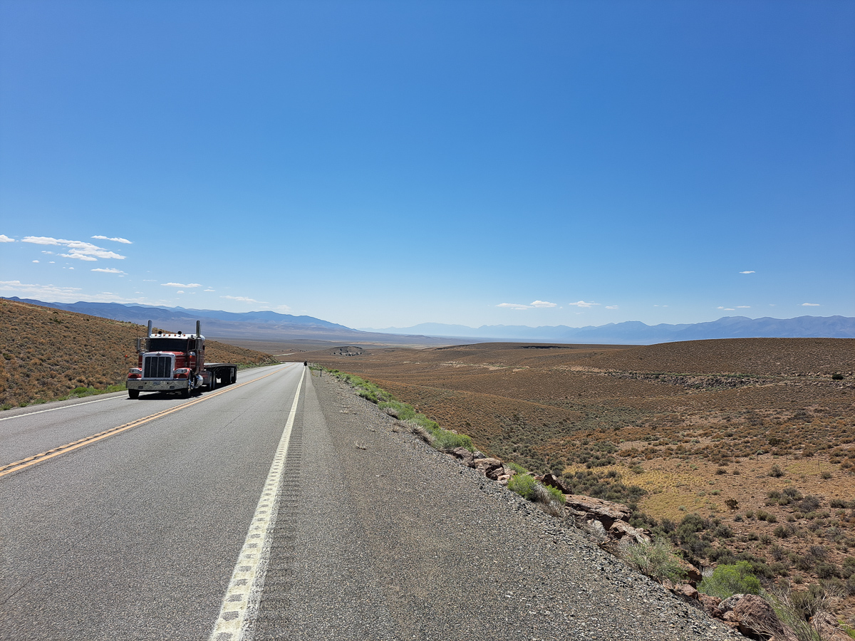
Further down the road I was overtaken on the hard shoulder. A car just came careering past me on the inside.  Wow!  What was that?  The next half hour was a sharp learning curve.  The hard shoulder albeit much narrower than the road lane was regularly used to over take.  One vehicle straddled the solid white line that demarked the hard shoulder while the overtaking vehicle straddled the central solid yellow line.  All sorted then.  One good thing was that as the hard shoulder served as a lane, of sorts, it wasn’t full of debris. The crap was piled high in the pull outs and off the side of the road.  No $1000 fine here for littering.

Another surprise was the trucks passing along through the towns and along the highways with armed soldiers masked and in full uniform standing in the back.  Regular check points along the roads also told of the extent of the drugs problem in Mexico, a lot of it driven by the trade over the border in the USA.  The nearest we got to being searched was one bored pair of young military guys asking where we had come from and where we were going.  Other vehicles, mostly northbound, had numerous inspectors with torches pawing all over their trucks.  The bigger the vehicle the more extensive the search.  We settled into the new regime. The road to Ensenada passed through a scenic wine making area, and wasn’t heavily trafficked – a great introduction once we’d worked out the hard shoulder plan.

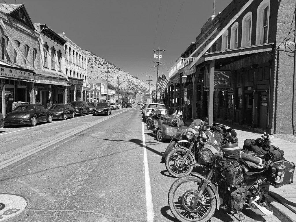
Ensanada was our first destination, for very prosaic reasons. But it was a joy to visit. The internet-booked motel was just fine, and after months in the western USA and Canada we could again wander around a town. While none of the pavements were consistently flat it had a centre we could amble through enjoying the atmosphere. Gid could have stayed a few more days, but after all the delays I was keen to get on. The plan was to travel the length of the Baja peninsular, then ferry across to the mainland. Interestingly, it was two weeks before the famous Baja 1000 desert race. We decided not to enter.

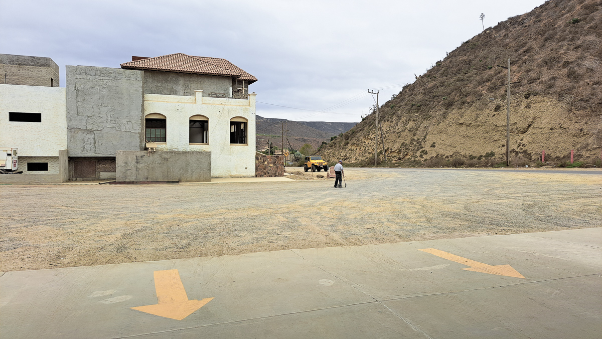
We’ve visited Spain a number of times and the similarities here were stark.  In some towns with buildings set back from the road, many things were broken down or in need of repair with the occasional thing half built while others had large murals and were brightly painted with bougainvillea adorning the walls. Whereas the western USA has almost everything in town concreted over, in the pueblos the road had a wide apron of dust – of course, everything was coated in it unless it moved.

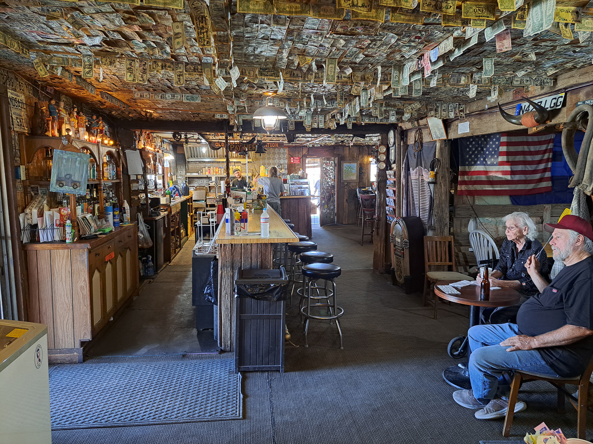
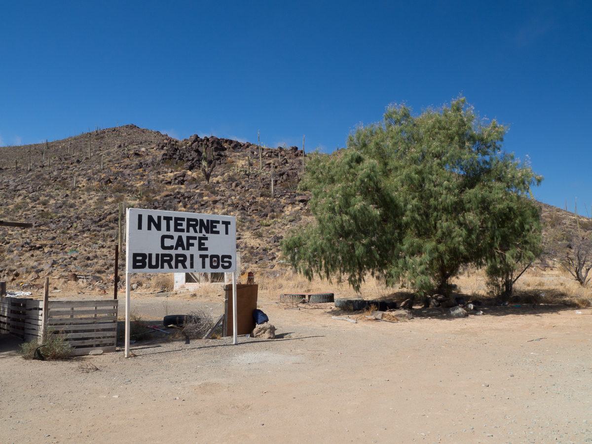
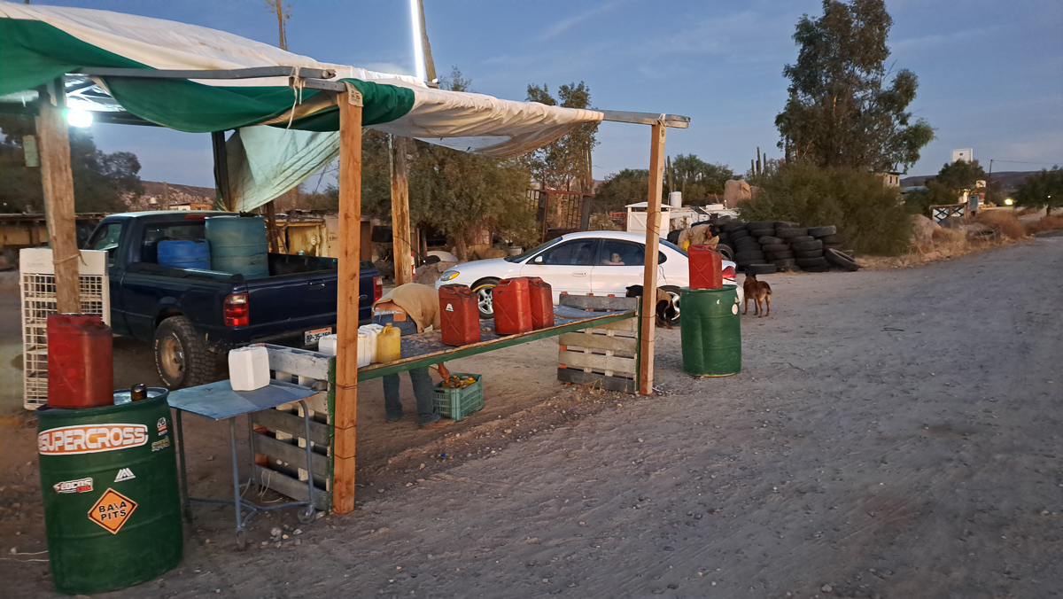
We’ve travelled fairly extensively across the globe, and it was a pleasure to see again local, improvised, low key services along the road. Home made as well as printed signs are common, and as Baja California is both very sparsely populated, and not highly developed, sometimes we needed to see that “man with a can” gas stop, or the little stall selling burritos (we hadn’t even been entirely sure what a burrito was). And every café had a “wifi” sign – the wifi may well have been the most reliable service. There were many “proper” gas stations, but interspersed with can men whom we really needed at least once pricey though he seemed. Very sugary pop is also always available, more difficult is avoiding it!

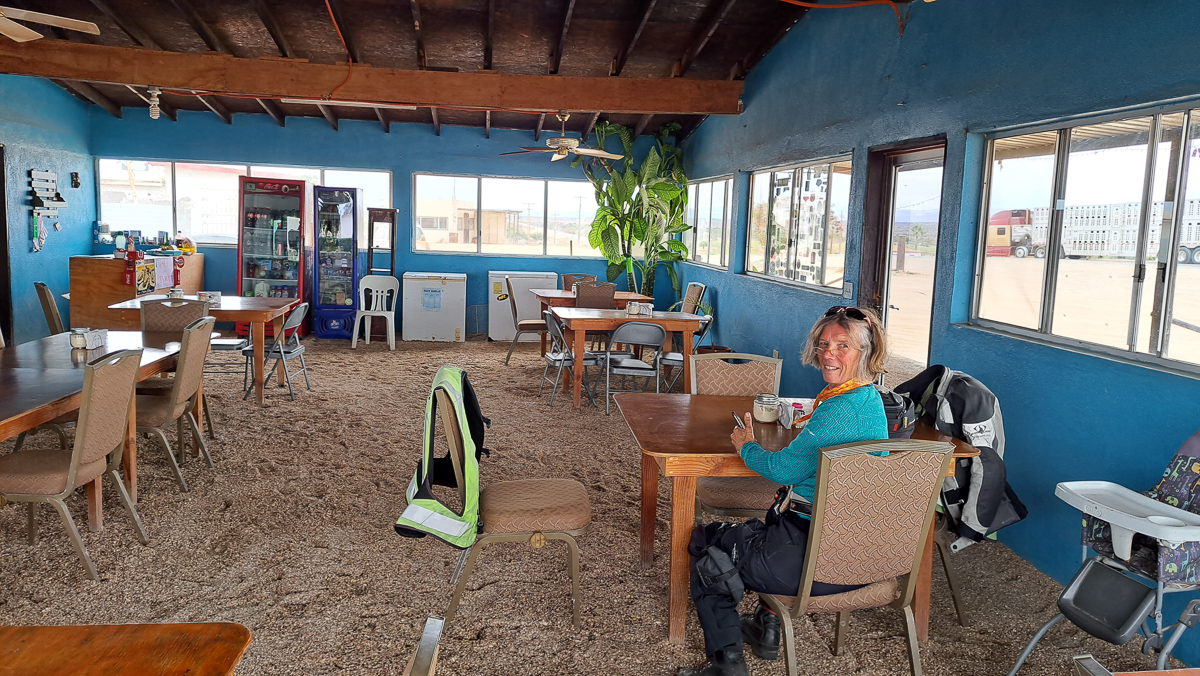
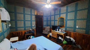
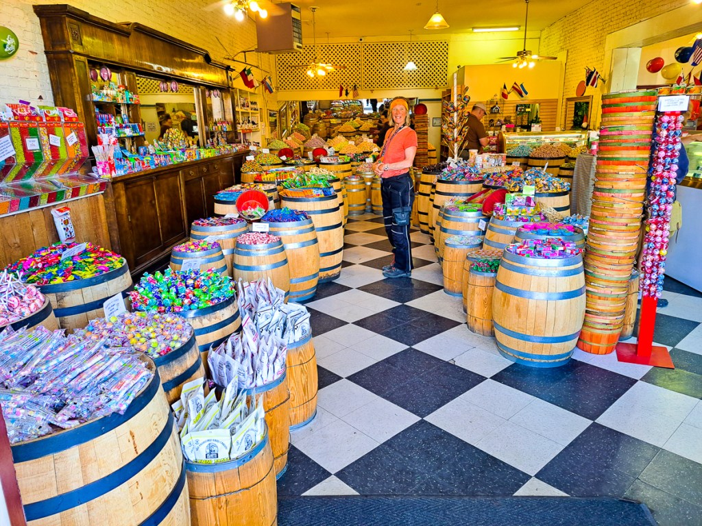
Another change – to us – is an expected one. In the USA we tended to avoid the trafficked and expensive megopolises, and skip from scenic park to scenic park, camping. In the less developed parts of the world, there are fewer campsites, debatably less safe, and our pounds go a lot further. So we tend to reverse the pattern and skip between cheap hotels in towns. Cheap hotels here can be jolly nice, usually best not booked through a big website – local rates are cheaper. El Hotel Frances was a memorable 19th century historic building, in rather mid-western style (but of probably tropical hardwood), but most are pretty new, Hispanically concrete. None has yet approached in cost the San Diego campsite!

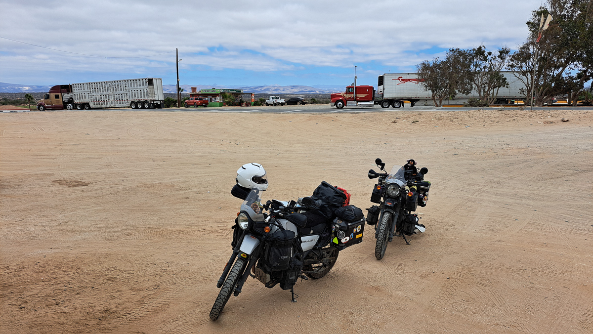
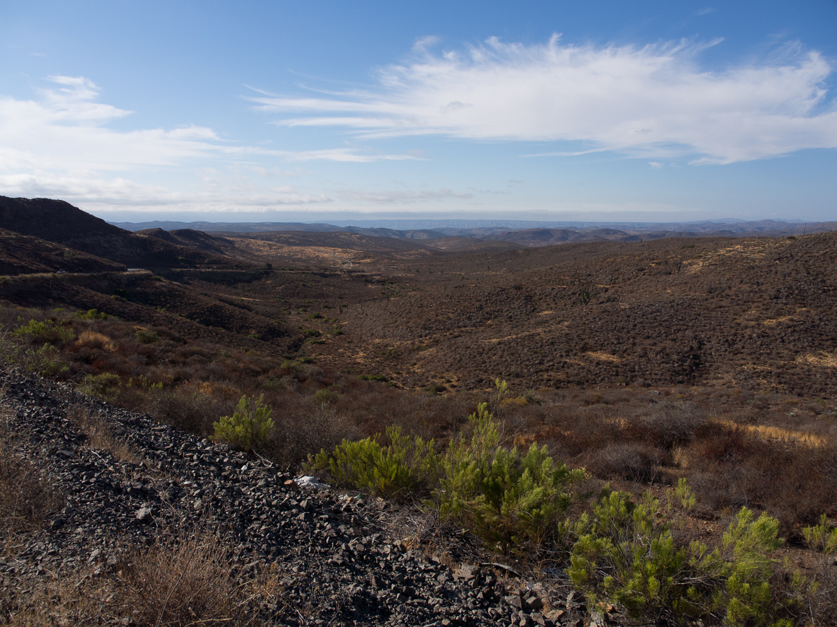
We still felt very wary of much adventure in Mexico and there’s only one main road down through the Baja peninsula which was generally ok, two lanes, little traffic, and relatively few slow bits through pueblos.  Occasionally it was a pristine new surface but at times a pitted pot-holed mess – no worse than our home town in the UK, but that’s not a 60mph road.  On our Himalayans we didn’t need to lose much speed to plough through whatever the road surface threw at us.  Along the grotty sections we even overtook some cars and trucks.  We passed a road repair team on a couple of occasions.  It was a truck loaded with tarmac and some spades.  The truck stopped. Out jumped the team.  One filled the hole, another raked it flat while a third flagged the approaching traffic.  All sorted.  Move on.  They had their work cut out!  More dangerous than the overtaking, and the potholes, was probably the occasional livestock, rare in the first place, that had gotten out of the fenced ranches and now munched at the roadside.

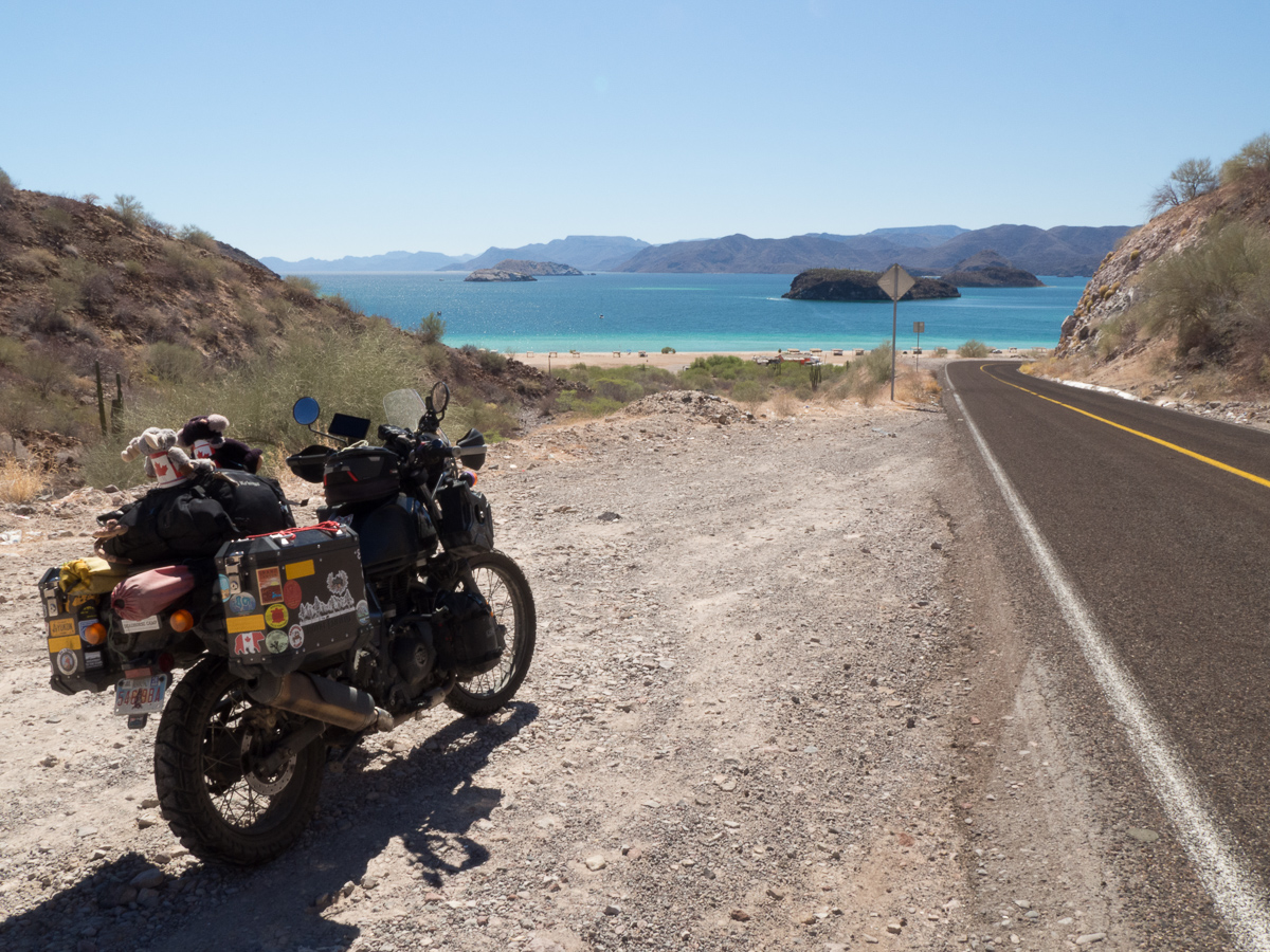
But plenty of the roadside was also lovely to look at, and especially in the north, quite curvy with fabulous views.

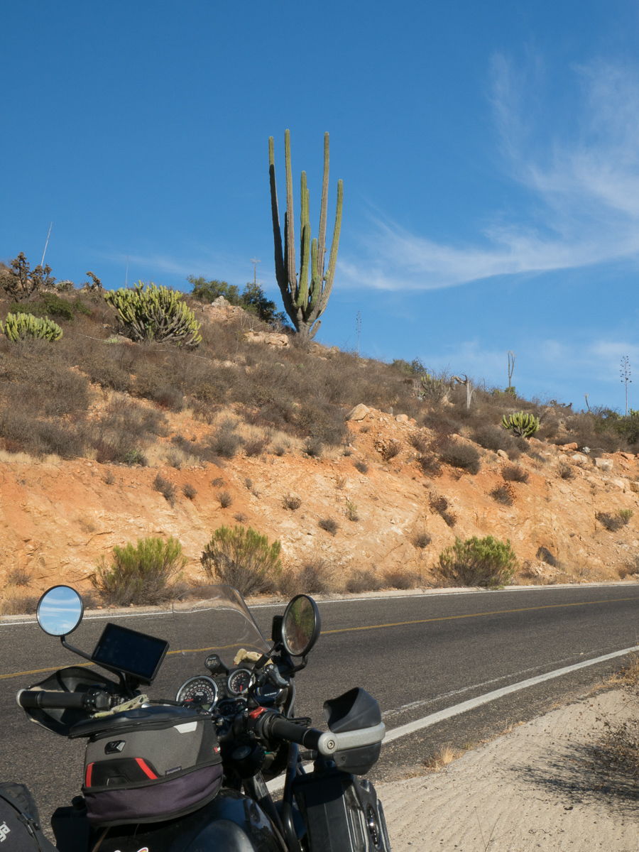
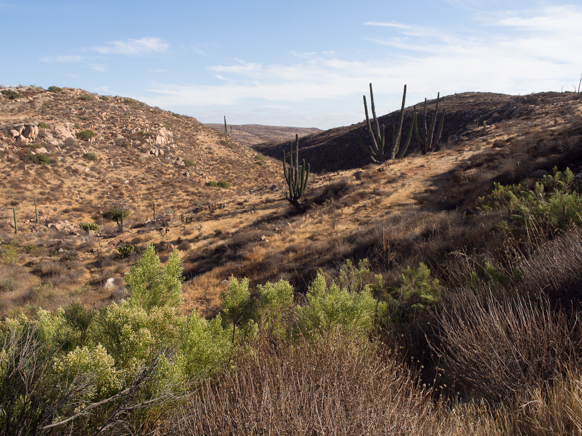
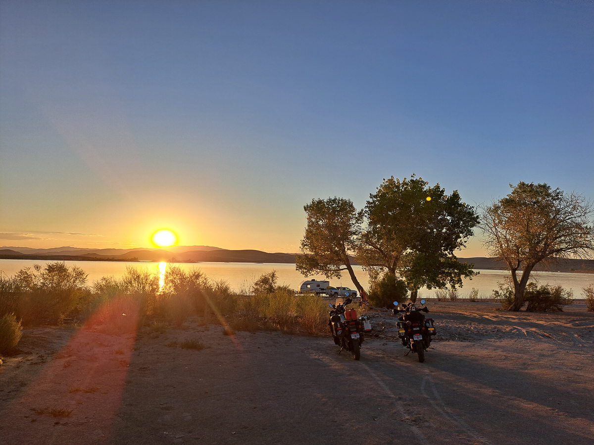
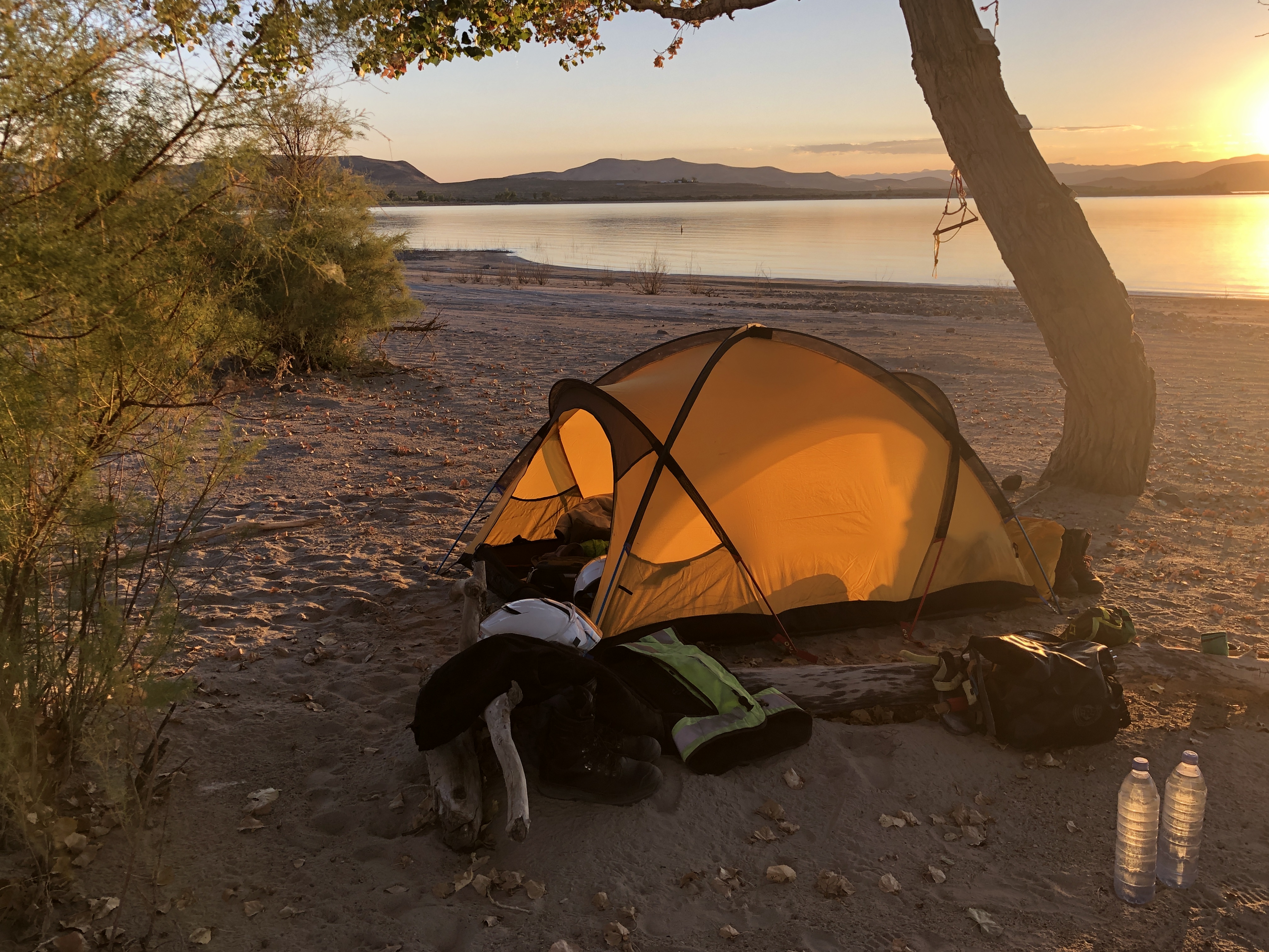
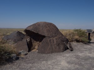
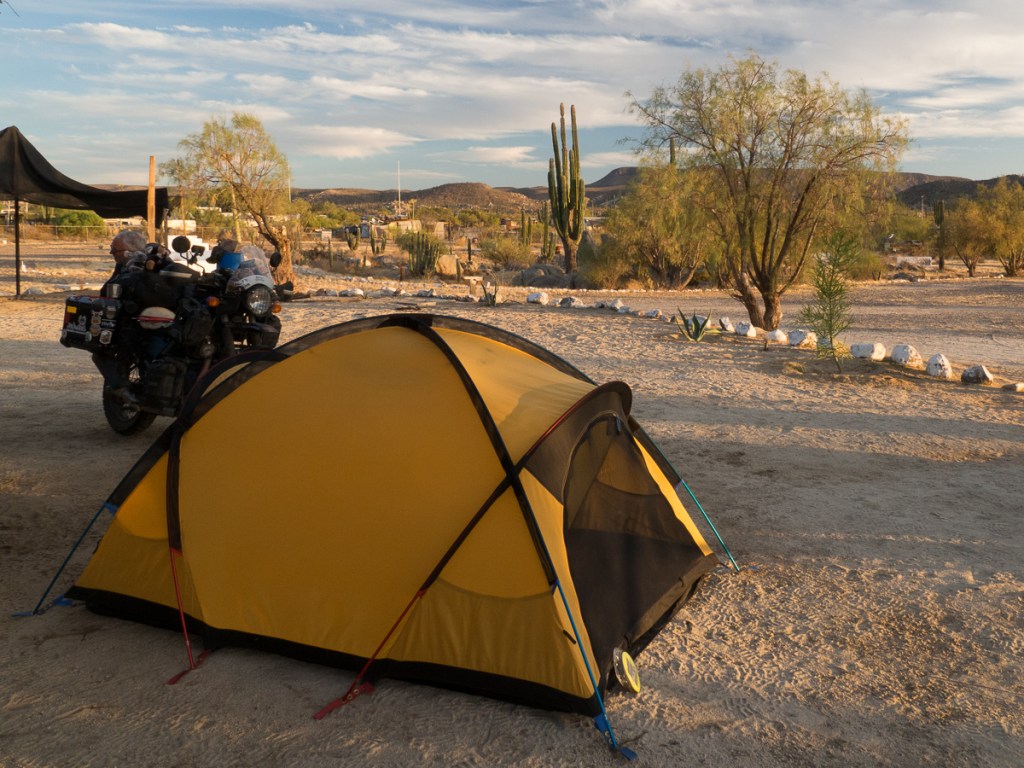
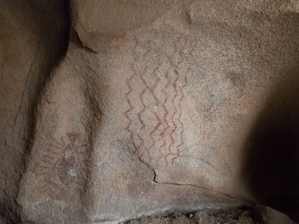
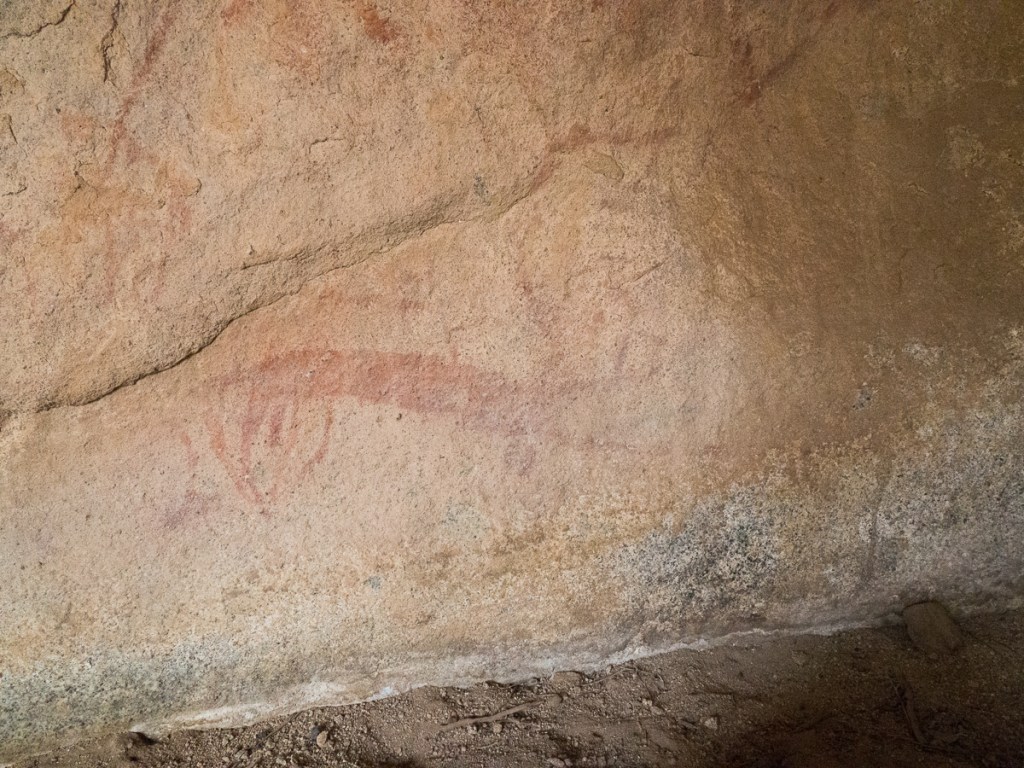
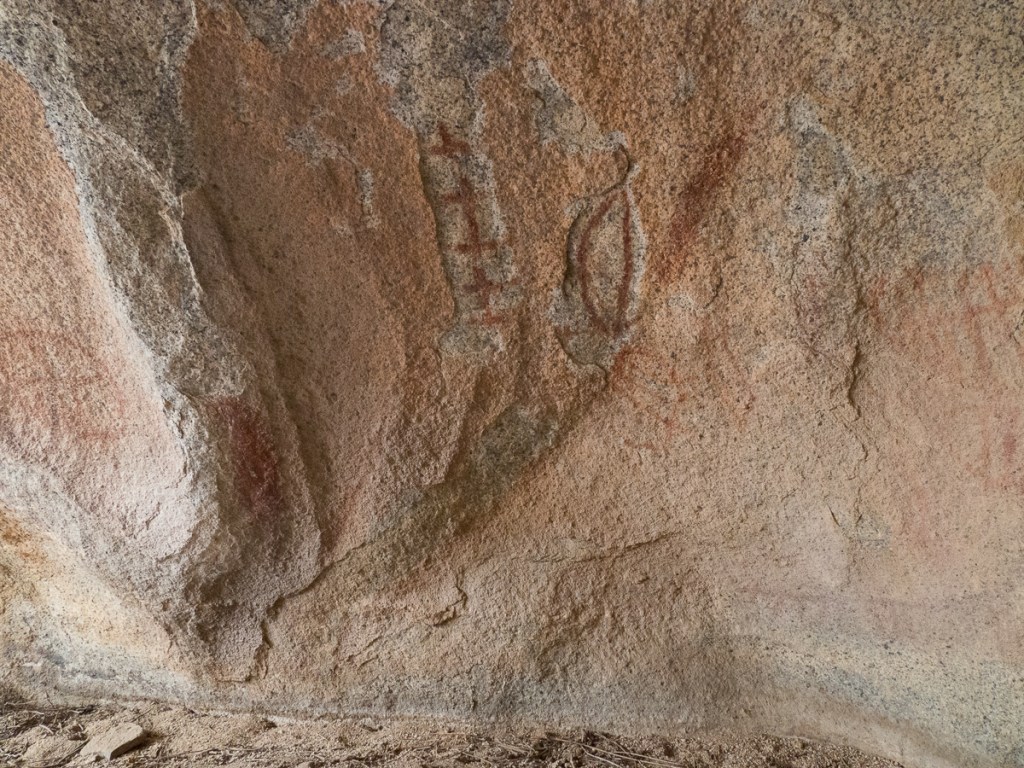
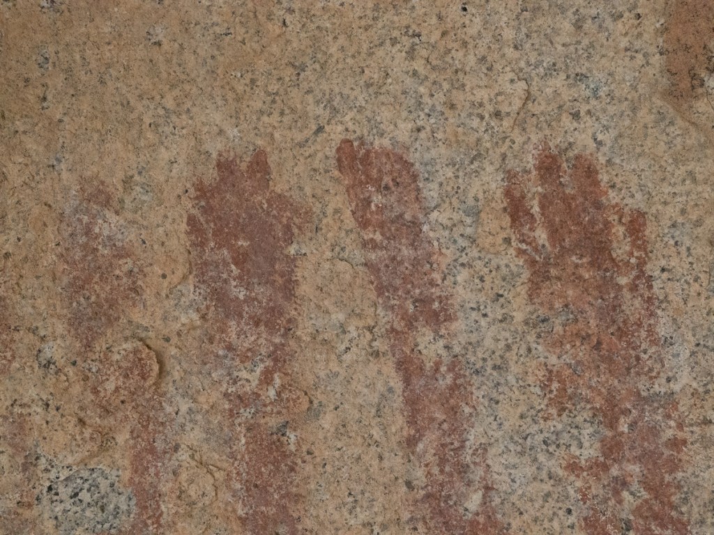
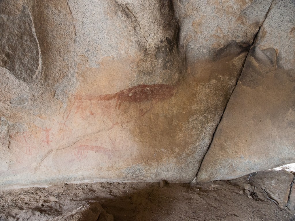
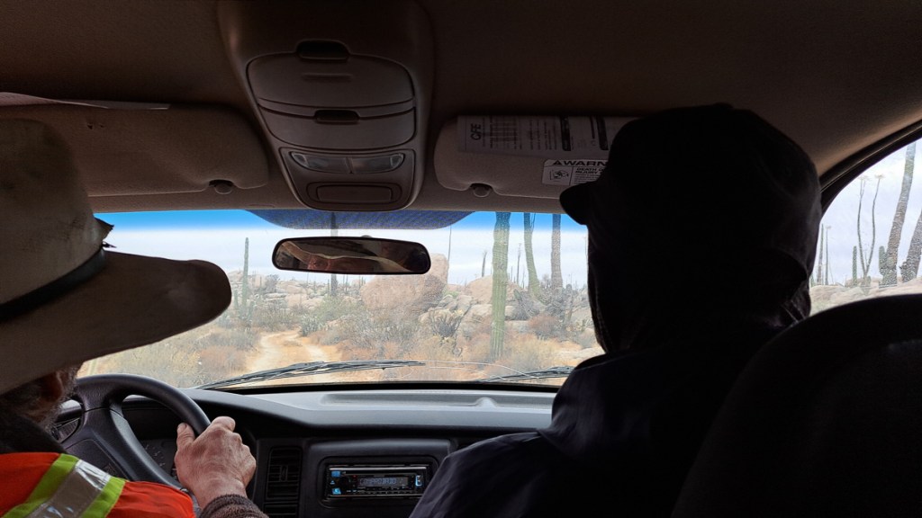
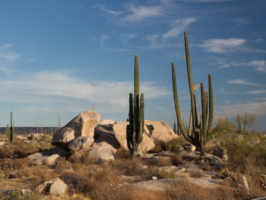
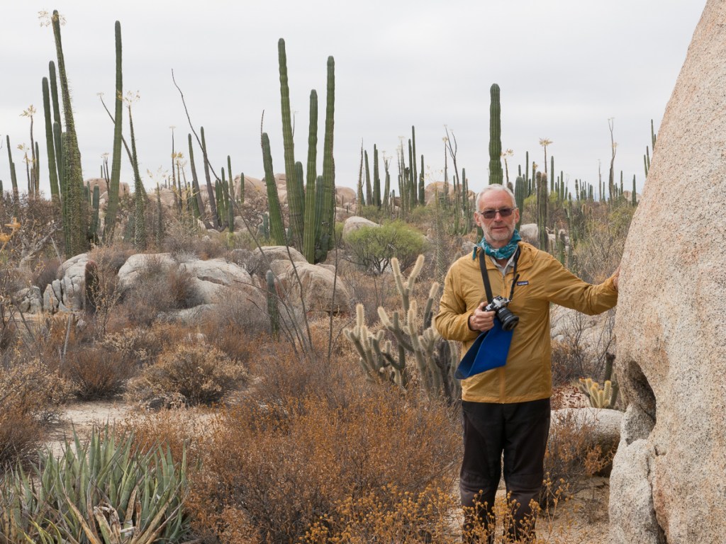
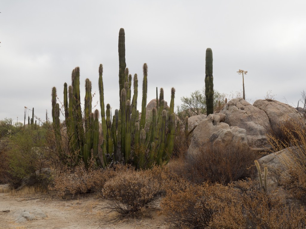
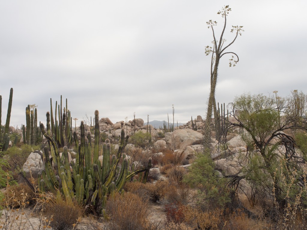
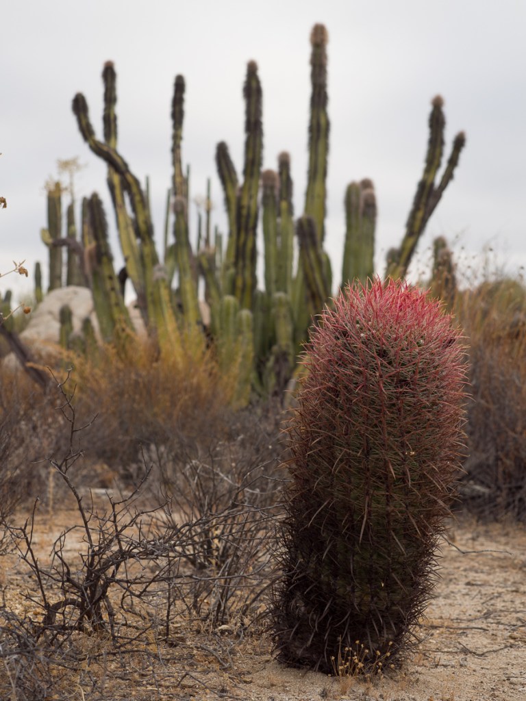
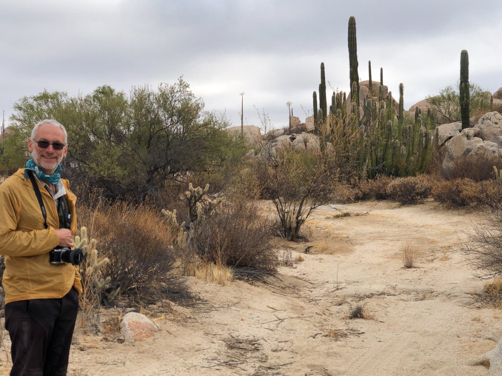
The country side we passed through changed from sparsely covered desert to a rich environment with many desert plants thriving.  Despite my resolution to not camp in Mexico on the grounds of personal safety we did camp at Cataviña.  We’d just passed a police station next to a deserted motel when we came across a small community: a campsite with two motorbikes and a tent inside a perimeter fence, opposite a taco shack and a fuel stop.  Encouraged by the gated entrance and bikers already camping we went in and were enthusiastically greeted.  We were staying then.  Alexandros spoke reasonable English and encouraged our efforts in Spanish.  He’d also done the southern half of our planned trip and gave us the book he’d written pointing out the pages that recorded his crossing of the Darien gap.  ‘Three weeks for the bikes,’ he said. ‘Three hours by plane for us.’  We spent a fabulous evening sharing tales.  A surprise bonus was the campsite’s tour of the desert by truck to see the painted caves just up the road and off in the desert.

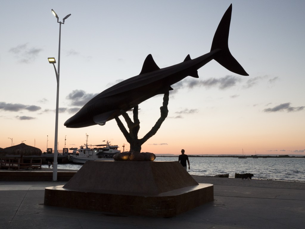
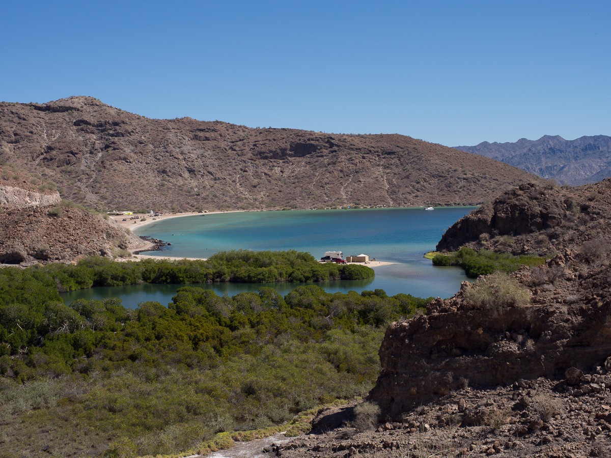
So, we’re off! ¡Vamos! Well, now we stopped in the lovely resort of La Paz, there is the ferry terminal, but it’s so nice we’ll pause awhile.

The Colossal Canyon and the Lonely Road

Apologies, we’re a little behind with our blog: It’s now October, and this relates our time in Arizona and Nevada, 25th Aug to 7th Sept. More soon! We also had a bit of an IT disaster and lost a lot of Clare’s pictures from August and September, so the imagery isn’t what it should be.

Next on the list of must see destinations was the Grand Canyon.  Having done our homework we knew that the Northern rim was thought to be the more spectacular of the two.  We set off from Flagstaff heading in totally the wrong direction – southwards.  We wanted to take in the scenic roads that were either marked on the map or had been recommended by other bikers.  But we were in luck – to get to the northern rim – we had to ride along the southern rim – bonus! Being a weekend the super route out and round to the south was rather over crowded and we were happy to get out of it but crowds were something we were going to have to get used to as we reached the more populated areas.

Along the southern rim we stopped at three vista points and learnt that the gorge was formed by opposing tectonic plates clashing and forcing each other up.  This created a raised plateau. From there the Colorado river cut through the rock.  Because there is not enough information left geologists don’t know why the river didn’t take an easier route around the outer edge.  The high levels of silt carried by the river have carved a deep gorge which continues to cut its course to this day.  The gorge was beautiful but the vultures stole the day.  Several vultures and some falcons rode the thermals swooping to and fro right in front of us.  ‘Have you got it?  Have you got it?’  we cried as another swept past.

Up at the Northern rim an elderly park guide was enthusing to us about the benefits of doing the North Rim road.  He told us that there were many viewing points and it was good use of our time.  But Gid was keen to do one of the walks.  Neither of us considered the whole day North Kaibab trail.  An 8 mi down 8 mi up marathon but we did think we could do one of the shorter ones.  Was there time for both?  ‘Of course there was,’ I exclaimed. And off we went.

On the rim road the information boards were very useful although I couldn’t see the ‘obvious’ fault lines on the southern side of the canyon.  We were excited to glimpse the Colorado river on a number of occasions as we stopped and started along the route.  We seemed to have swapped the birds for some views of the murky river.  I was pleased we’d seen both sides.

We hurried back to the start of the scenic tour road to pick up the hiking trail.  It was 5:15 when we set off on what was described as a 2-4hr hike.  We had torches and had been advised to take more water which we dutifully got.  Our walking speed is middling on most timed trails so I was predicting our return at around 8:15.  It’s dark by 8.  On a very uneven track how good was my torch?  Gid normally leads down hill and me coming back up, but I set off at a fair pace.  I wasn’t messing around we needed to speed this up.  Meeting a few people along the way was encouraging.  They were all on their way back but it was still nice to know we weren’t totally alone.  A few ‘not far now’ comments gave us encouragement but meeting a father and young daughter a few hundred metres short of our destination, Supai Tunnel, was quite a surprise.  We went through the tunnel, gazed down at the zig zagging path disappearing into the depths of the gorge and were ready to turn back.  One couple we’d met had done the whole day hike.  They’d set off at 8 in the morning and were on course to make it back completing their trek in just under 16 hours.

We made it back in good time just about catching up with the youngster and her dad.  Amazingly we did the round trip in just over two hours with just enough daylight, to pack our kit and set off back to the campsite.

We hadn’t got far the following morning before stopping for fuel.  Parked on the apron was a Royal Enfield Continental GT.  Paying for our fuel in the garage it was obvious who the Enfield belonged to.  This distinguished gent with a broad grin, a thick red beard and plaited hair readily admitted it was his bike.  We asked him about the unusual racking system he had and his tin seat.  Out we went to look at them.  He enthusiastically told us about his project to reduce the weight of the bike.  He lifted up the tin seat shaped to fit the gap between the metal rods and read from the bottom what the old seat had weighed and what his new tin seat weighed.  He proudly declared weight the saving.  He repeated this exercise with the side guards which were now leather flaps with another recorded saving.  The next project was the rear rack he declared.  That was trickly though as it had to take the cat.  At first I thought the bag of empty 5lt water bottles somehow housed the cat.  The cat, his travelling companion he informed us, was out prowling around back at camp.  The cat, he told us, could only manage three hours at a time on the bike.  With that saddle I’m sure I couldn’t manage any more.

Jamie Burns, the distinguished gent, had never been to Scotland even though he was directly related to Robert Burns the infamous Scottish poet.  ‘I  can’t go!’ he exclaimed.  ‘I’d have to set foot on English soil and I’ll never be doing that.’  A little later Gid pointed out the he must share some considerable empathy for the Native Americans with the atrocities that they suffered at the hands of the new settlers.  But he seemed to be handling American soil ok.

The Grand Canyon, Petrified Forest and our stop in Flagstaff ticked off Arizona: We were making good Pan-Am progress towards Ushuaia, on the southern tip of Argentina.  Next stop Mexico? Nope. North westwards to northern California.  We couldn’t miss the Pacific coast and the redwoods.  So we turned, heading back north up towards the northern tip of California.  We aren’t fond of megopolises, so for the second time, we avoided Salt Lake City, and this time, Las Vegas too progressing diagonally between them.  We’d soon have 12000mi under our belts so we chose Reno, Nevada, for a service stop.  It’s big enough to have everything, but not oppressively huge. Airbnb host Tyler was ok with us changing oil in the shade of his carport, and Royal Enfield dealer Eurobikes had got the service parts and our three new tyres in.

We headed westwards towards Reno along Highway 50 crossing the often empty Nevada, which passes just south of Reno. It’s dubbed ‘the loneliest Highway in America’ and served us well as it had little traffic.  The section we travelled from Ely to Silver Springs traversed great plains where there was very little to see except the next mountain range to cross.  It took ages crossing each plain, then we’d ascend up the mountains.  Most roads carve a pass through the summit with rocky cliffs towering on either side.  Pancake pass – 1988m – being the unusual one because it was flat.

The Pony Express central change over point at Old Middlegate Station on HWY50 was a wonderful choice for a stopping place, full of memorabilia with posters for ”Wanted’ criminals – Dead or Alive’, legalised prostitution advertisements and pony express riders job offers not to be missed.   Providing, that is that, you were under 18 and preferably an orphan who was prepared for high risk and possible death from their chosen employment.  The place was stacked with relics from the past both inside and out.  A quaint mix of old and modern as the petrol pump boldly claimed ‘no lead’.  Not now perhaps but there’s been no shortage of lead flying around this place I’m sure.  To add to the authenticity signage pointed out that Ned Kelly’s house was a stone’s throw away.

Our arrival in Reno was a little bit complicated, as we’d booked the Airbnb for Sunday onwards, not realising Monday was Labor Day.  Eurobikes and almost everywhere would be shut.  We needed to be close by Friday night, ready to hit the store Saturday morning to collect the service kits.  Experience told us that even ordinary summer weekends could crowd out the campsites leaving us struggling.  Lake Lahontan State Park was 30 miles out, a big reservoir with sandy shores, it seemed like a great retreat. We arrived with some trepidation about availability, but paid our fee at the unattended gate. We’d hoped for a pitch we could swim at, but there was a Red Warning stating that the lake was unfit for recreational purposes because the algae levels were unacceptably high. Oh no!  But we trundled round the shore, surveying the ad-hoc camping.  We found a beach spot facing the sunset: firm sand to park, soft sand and shady trees to camp. One RV right down on the shore was 50 metres away. The next units maybe 200m one way in a thicket, and 1000m the other.  On this side of the lake, people were swimming.  Definitely one of our nicest sites!  We stayed two nights, enjoying a starlit evening chat with the neighbours.

It was a short freeway ride to Reno on Saturday, but to return, we saw a wiggly back route going through Virginia City and tried it.  It turned out to be a local bikers’ favourite. Virginia City – City it says. Obviously swayed by the city part of it’s name I was expecting something big.  Bigger that is than a half mile main street, and not a lot else.  Rather than the boom and bust of many towns where a natural resource is found, Virginia City, once the mountain of silver under the city was depleted, has managed to maintain prominence albeit now as a tourist attraction.  Its high street is frozen in the style of 100 years ago with original buildings and facades, as are the rickety board walks beneath the overhangs.  There are tourist attractions like: the Silver Queen Hotel where the lady’s silver dress is a floor to ceiling art work modelled in silver dollars mined beneath the city.  There are many saloons, some with swing doors, eateries and tat shops, and events like camel races for the more competitive amongst us.

Mark Twain, at least his wax model, peers out of one window where he used to work as a newspaper reporter.  Words such as ‘never let the truth get in the way of a good story’, accredited to him, live on.  His famous novels, Huckleberry Finn and The Adventures of Tom Sawyer still make it onto many a reading list.  The local museum claiming ‘Of great interest to adults and children’ displays many relics from past life in the area. Virginia City became our regular route between Reno and Lahontan.

The servicing went to plan.  Having done it all before it was quicker this time. Now Gid is becoming familiar with the process he’ll let me play too – next service I hope to do the oil changes.

We’d noted the bike chains had needed occasional adjustment, but annoyingly, as we approached Reno, Gid was having to tighten them every couple of days.  Knackered. We ordered replacement chains and sprockets at the Reno dealer but RE gave no delivery date. Were they coming from Wisconsin or Chennai? We decided to wait into next week before requesting that they might be posted forwards.  The dealership had a branch at the coast and was happy for us to collect them en-route but we couldn’t continue to stay with Tyler.  With time to kill we needed a new home.

To get away from the bustle of city while we waited we went off to explore Lake Tahoe.  Our Lonely Planet guide book describes it as a very popular location for winter skiing with slightly fewer visitors in summer.  Wrong!  It, or rather its shoreline, was teeming with people.  Adding to the frustration most campsites were closed because the trails were being repaired and supplies were dumped in campgrounds.  We u-turned and got out of there as fast as possible, riding right back up the 9,000ft pass we’d come in on, returning to Mt Rose campsite near the top.  It was beautiful.  Pine trees spread around large boulders –  the sort of things that are called erratics in Norway having been randomly dropped by the receding glaciers but here they were at 10000 ft high!  It was beautifully peaceful, until the generators started.  The site host agreed that it was a beautiful area informing us, with a wry smile, that the noisy school group had left 2hrs ago. It was nice for one night, but we couldn’t think of a better option than returning to Lahontan. The exact same spot, and now the nearest neighbours were maybe 2km away. No cossies needed.

Having missed petroglyphs at the Petrified Trees NP I was keen to see the ones in this area.  Grimes Point, the site of the petroglyphs and the Hidden Cave, wasn’t far away and reportedly had the best examples so it had to be done.  We would have liked to have seen the Hidden Caves, also at the site, but on contacting the area office to arrange a guided trip we were informed that due to sickness that was off.  Thousands of years ago the Hidden Cave appears to have been a site of storage: furs, tools and remains of clothing were found there.  It’s under lock and key now to preserve the site for future generations but our wished for visit wasn’t going to happen.  On the self guided walk around the petroglyphs, the boards told us that human habitation in the area dates back to 8000 years ago.  Lahontan Lake, now some 20-30 miles away where our tent was, would once have been lapping the edge of this area.  The boulders, plenty big enough to hide behind, would have been the perfect site to hunt the animals who came to drink.  Shaman, responsible to communicating with the gods to ensure a successful hunt, may have been responsible for the pecked or carved rock art.

Finally – good news – the chains and sprockets were in. We’d already been on Bunk-a-Biker and made contact with a friendly soul who offered us a bed, a workshop, and a breaker bar, just over the border in California. We were off again, albeit only for 60 miles.