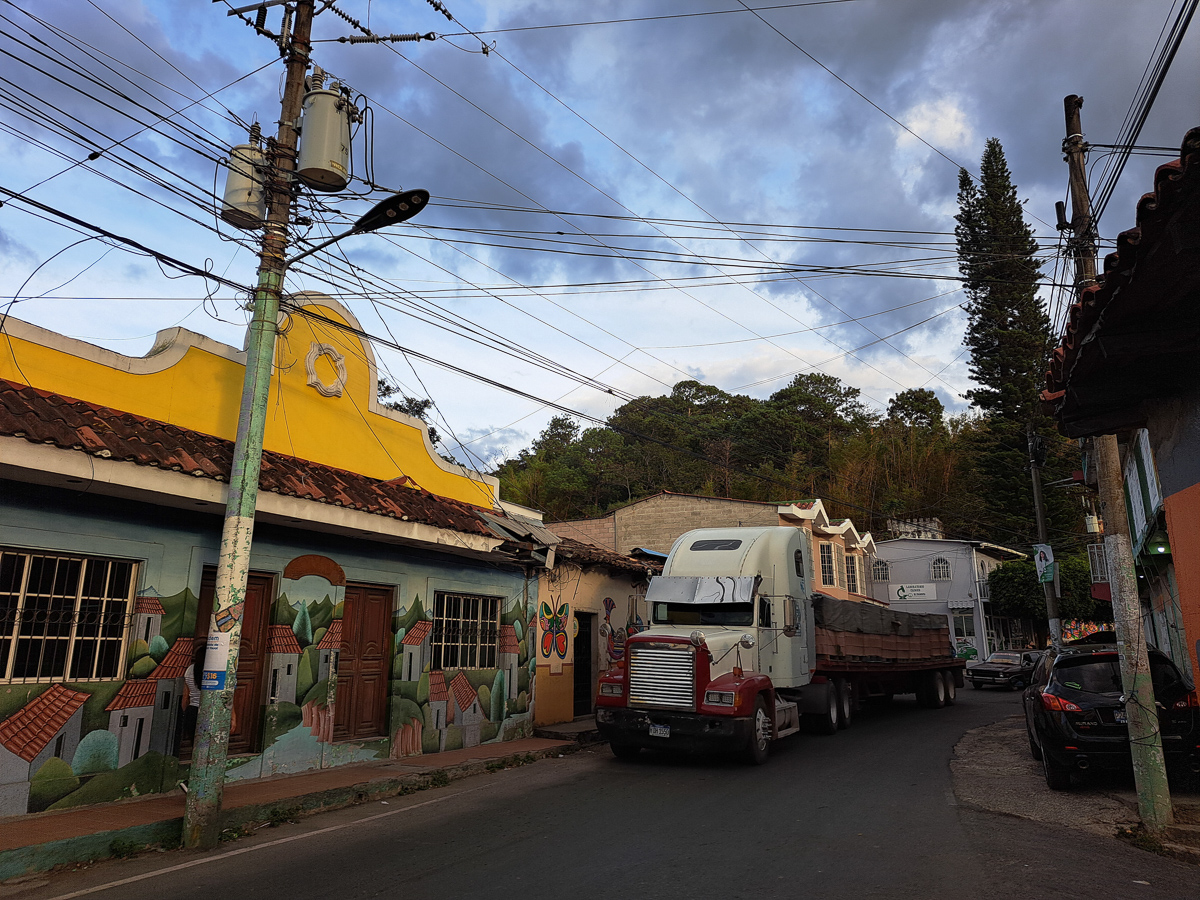
As we entered El Salvador, about the most crowded of the Central American states, and quite prosperous, we were immediately hit by the greater concentration of traffic. Gone were the nippy little 150s, replaced by bumper to bumper SUVs. Gone were the traditional Mayan costumes. Gone were the streams of ladies carrying stacked up wares on their heads. This could have been any town in England. We’ve been on the road now 8 1/2 months, the last 4 in Central America. We noticed that we were getting a bit browned off with our tourism options too. “Shall we go and see X?” Well, maybe not; it’s going to be very similar to the last three Xs we’ve recently seen:
Historic, charming, cobbled, cities of the Spanish Empire – check.
Elegant or elaborated catholic church – check.
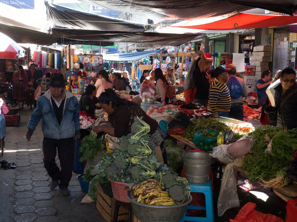
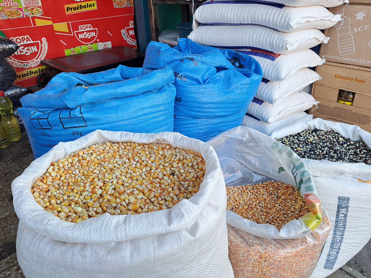
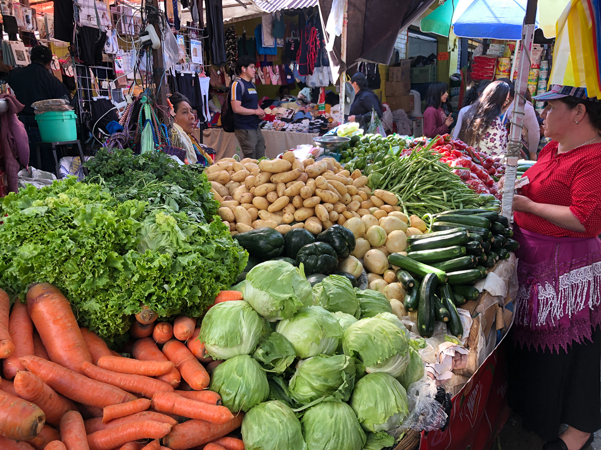
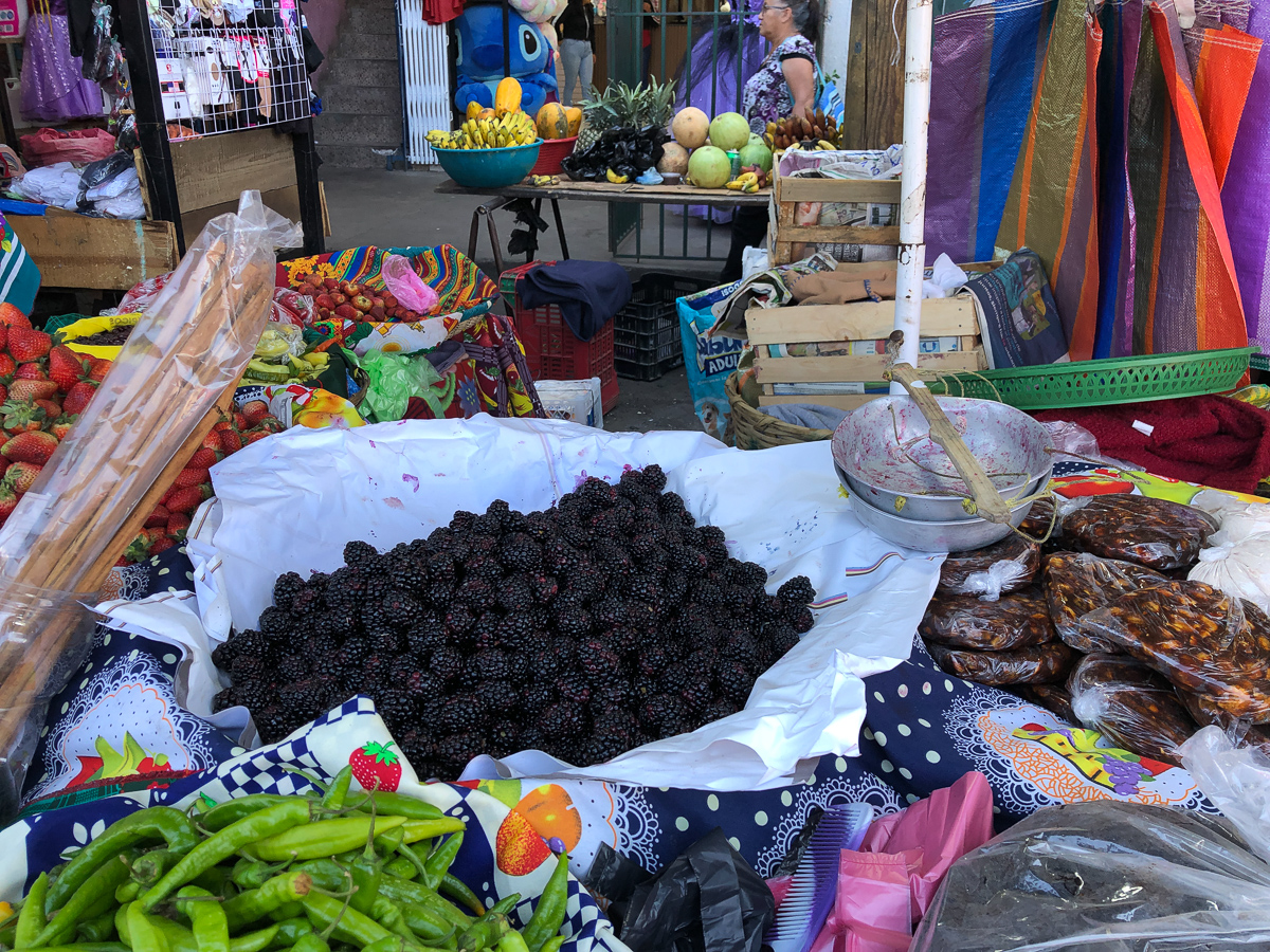
Colourful local market – check.
Mayan ruin – check and check again.
Pre-Columbian anthropological museum – check.
National museum of country since independence – even these are getting a bit samey.
Beach with warm blue sea – check, although it never truly palls.
Volcano hike – Clare sez never again!
Souvenir shops – Gid has seen enough and more.
Weaving School – Still some potential
Spanish School – Not yet ready for more, are we?
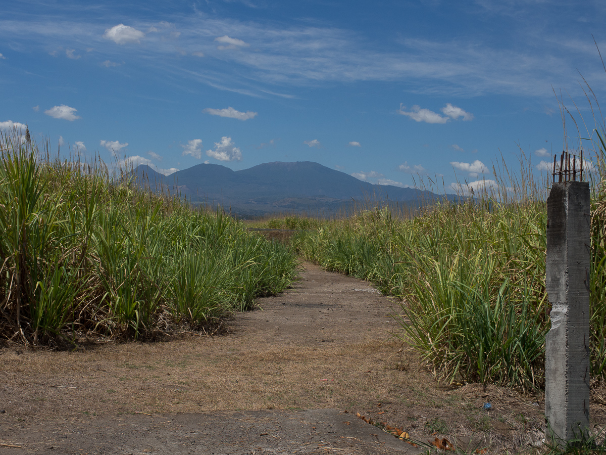
Which was one reason we sort of dipped out of El Salvador. Our fault, not its. We made the mistake of crossing into El Salvador without a plan, other than noting that the obvious way south was initially the much promoted “Ruta de Flores”. We did follow said ruta, but without the intended excursions into charming side-towns it was a pretty unspecial kind of ruta. Reasonably smooth, vaguely bendy, sort of nice countryside, though not many flores to be seen.
And briefly – after it, i.e. at lunchtime, we decided to bomb across this small country to the southeast, and try for a birdwatching boat tour near Jiquilisco in El Salvador’s largest estuary, an Unesco Biosphere reserve. The boats went, apparently, from Puerto de Triunfo. Google showed one hotel, which usually means there’s three or more local joints that would give us a convenience walking distance to the ferry. We ignored Lonely Planet’s 2018 advice to skip the town.
When we arrived in the afternoon, the dockside had proved hard to negotiate on the bikes. The queue of traffic behind us was impatient as were the traffic controllers. They only wanted to grab the parking fee, but we didn’t want to park. We were looking for an hotel and no-one had time to listen to us. There was a cacophony of people wanting something, be it official or commercial but mainly – get out of the way! Both Google and LP were right, there was only one hotel. We eventually we found it in the gathering darkness tucked behind a bingo hall. It was physically good enough. The owner seemed fine until we said one night, maybe two – her face fell. The following morning she rather gruffly announced that we had to be out by 8am or pay a day fee, lousing up our plan of researching the boat trip early by foot and possibly staying another night.
We groused, cleared out quickly, and made a new plan certain now that we would also advise people to miss this place. Back to the west! That sounds crazy, but we had always planned to enter and exit El Salvador in the west. With a direct route from Guatemala into El Salvador there was little choice and Copan, possibly the best ruin site in Central America, in western Honduras wasn’t to be missed, requiring a return to the west (few travellers would voluntarily go through the border paperwork again to save a few miles). We’d visit El Salvador’s seaside instead.
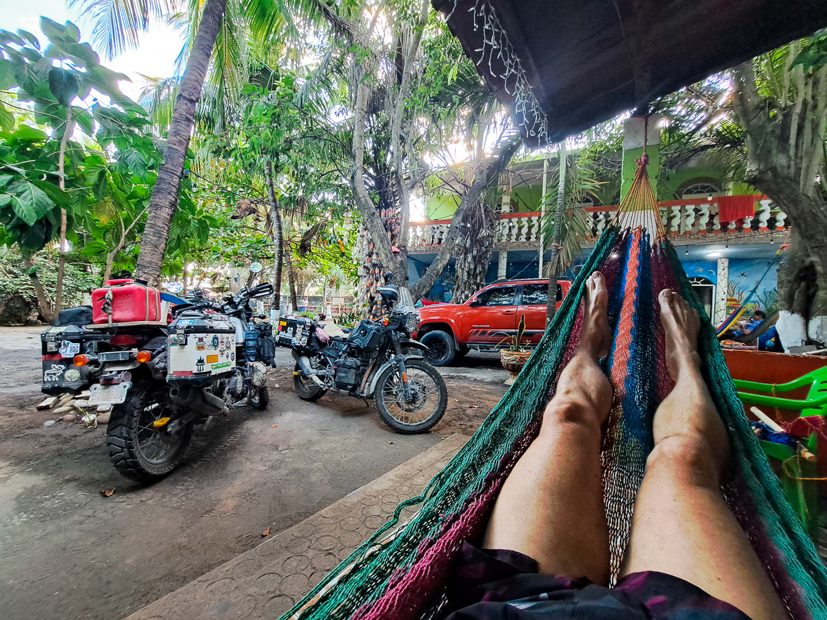
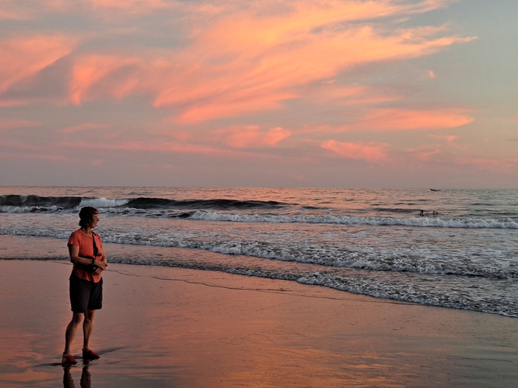
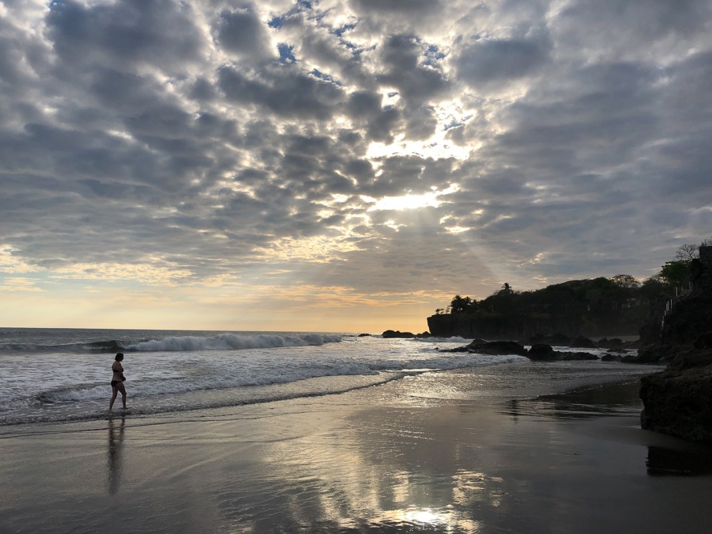
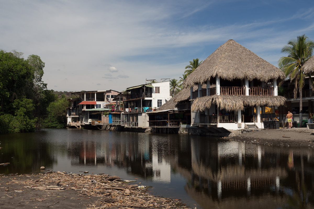
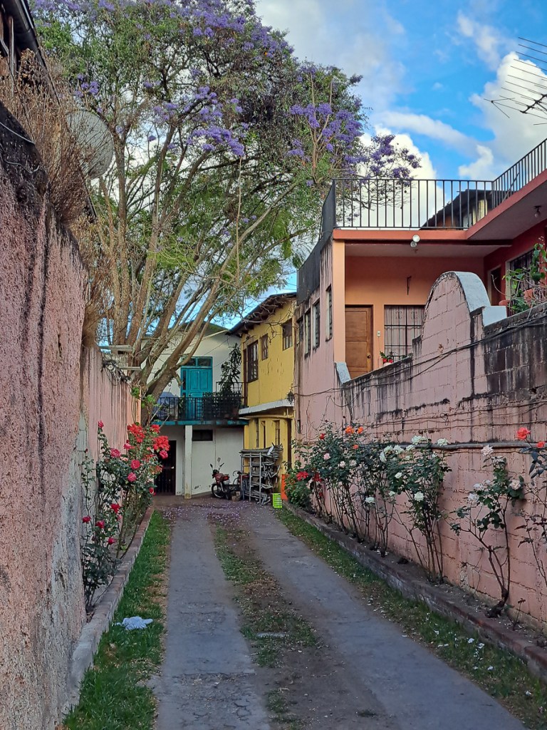
Fortunately, both LP and our hostel host in Antigua had agreed that El Tunco was a nice beach village, with a strong surfing flavour. So we set a GPS pin for there and off we went. An easy ride on a good road, until they decided to dig it all up in La Libertad. That was a very sweaty last 20 miles. But reaching El Tunco, in need of a bed, we lucked right out. Pulling over when we saw three different hotel signs on one bend, Gid disappeared on foot. Two were pricey, shiny concrete boxes for prosperous tourists. Number three was great, locally owned, been there years, day access for locals and kids, big pool, basic restaurant, chickens, dogs, cats and children running loose. A palm shaded aircon room less than half the price of the previous two.
The beach only metres away was great – firm sand, nice little warm waves, free loan of bodyboard. Local fishing boats launched off the beach in the late afternoon returning in time for breakfast. The night’s catch was loaded onto trucks in cool boxes. Our hotel was the first stop. A carefully selected basket full of fish hanging under the scales couldn’t have been fresher.
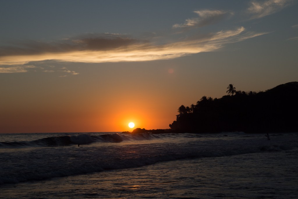
And did we say it was a beautiful beach?
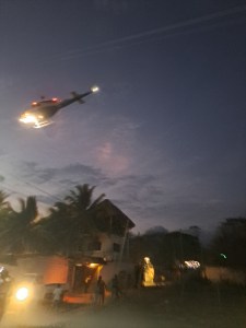
I managed a 5K run by doing five laps of the beach, then succumbed to a cold – in this heat! Thereafter a daily stroll into the surf-dude nearby village for basic groceries was all I could manage. We stopped four nights. One evening was enlivened by a helicopter and lots of soldiers, as El President used a spare field next to our hotel for a visit to – something or someone. El Salvador was redeemed.
But we still legged it to the Honduras border, even though these borders are always horribly tedious, completing the paperwork for the bikes. Hmmm – we could have gone straight from Guatemala to Honduras, saving one border – but El Tunco was nice, even with a cold. We barely scratched the surface of El Salvador’s beauty and interest.
So, what are we left to do in Central America, the countries of Honduras, Nicaragua, Costa Rica and Panama? We have to recapture our mojo. Maybe some more nature hikes, because we really are in the jungle a lot of the time. We’ve not been very successful at beastie spotting so far but what are we scared of?
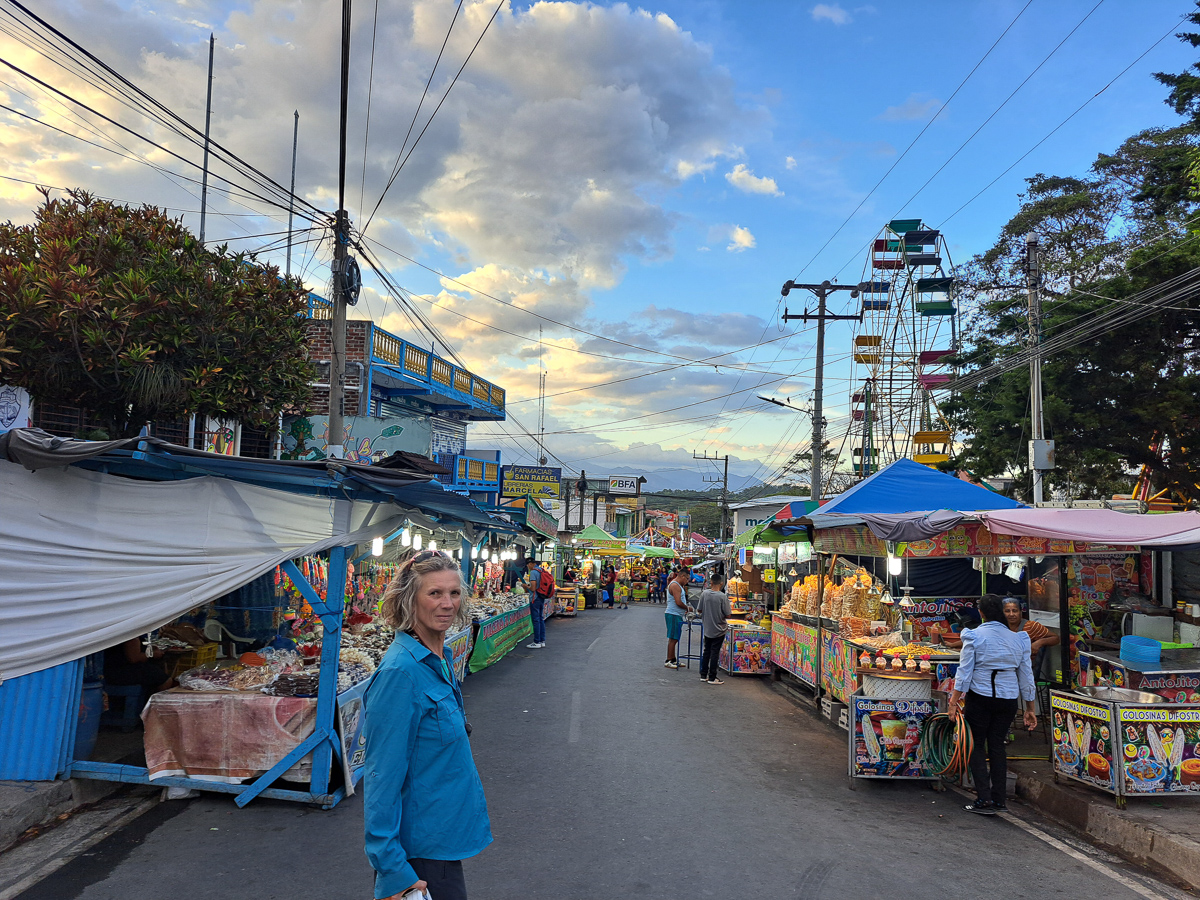
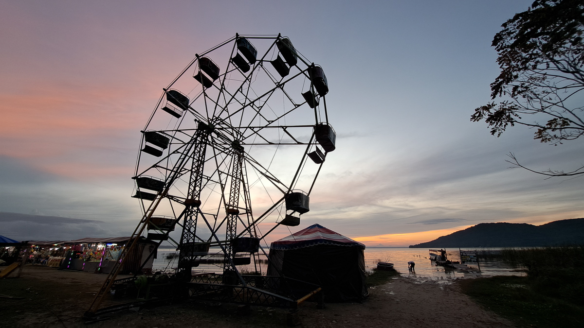
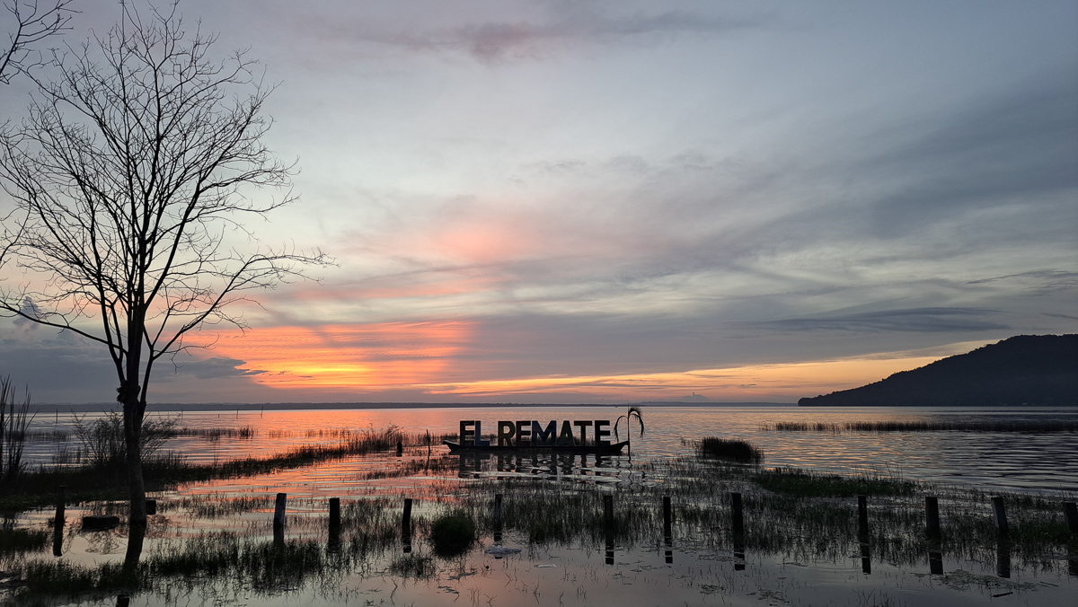
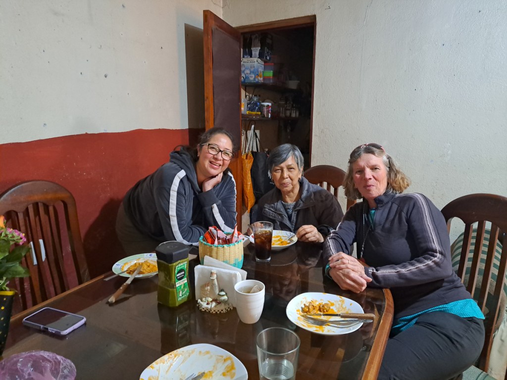
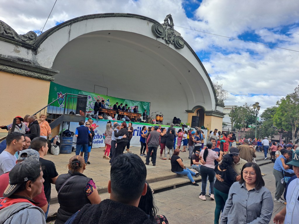
Clare: The first tourist spot heading into Guatemala from Belize is the Mayan site of Tikal. We were both feeling rather pyramid puffed and ruins’ed out but it had to be done. Tikal itself has just a few expensive holiday apartments, way above our budget, so we cruised up and down for accommodation in the nearest village of El Remate. Bingo! A nice little local non-internet hotel. Even a swimming pool it boasted. Pool there was but rather small and murky so neither of us jumped in. As accommodation goes it was fine by our modest standards, friendly staff, bikes parked right by our window, and the gate closed overnight, a roof terrace for a bit of gym. It was new year’s eve, and a fair was in town – Gid took a few sunset pictures, but we both conked out before midnight.
Being on the bus route to Tikal was what really mattered and we duly caught a collectivo the following morning. The driver and conductor were flexible. The sign in the windscreen suggested this route normally finished in a hamlet some way short of Tikal but us and another “wealthy” tourists were too much of a temptation and they diverted for Q50 (£5) each, which initially struck us as extortionate. We weren’t sure if they would take us the whole way to the ruins or just to the ticket office on its outer perimeter. We hoped for the former, but it didn’t matter. ‘It’s only one kilometre down the road to the actual ruins,’ Gid said. The crew started to earn their Q50s as they sorted out our tickets in the queue of “tour” tourists. Thankfully they did deliver us to the ruins as 5 kilometres after the tickets, we still hadn’t reached the site!
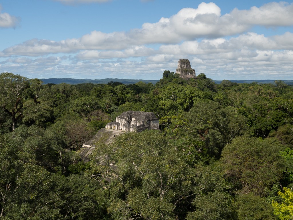
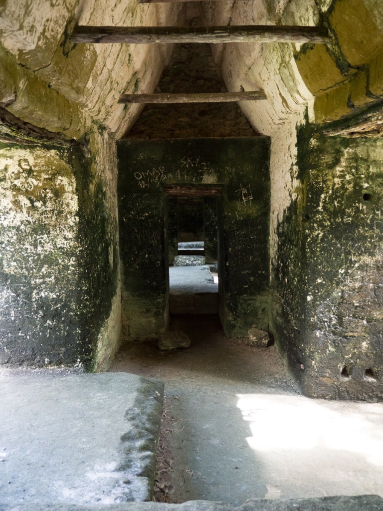
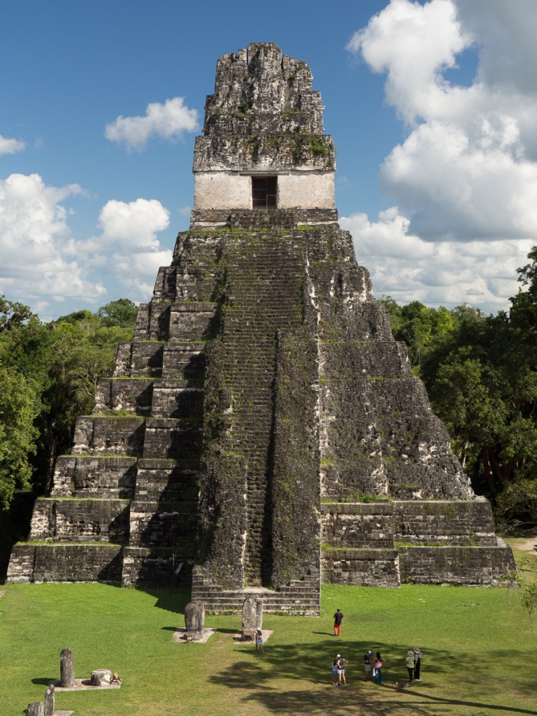
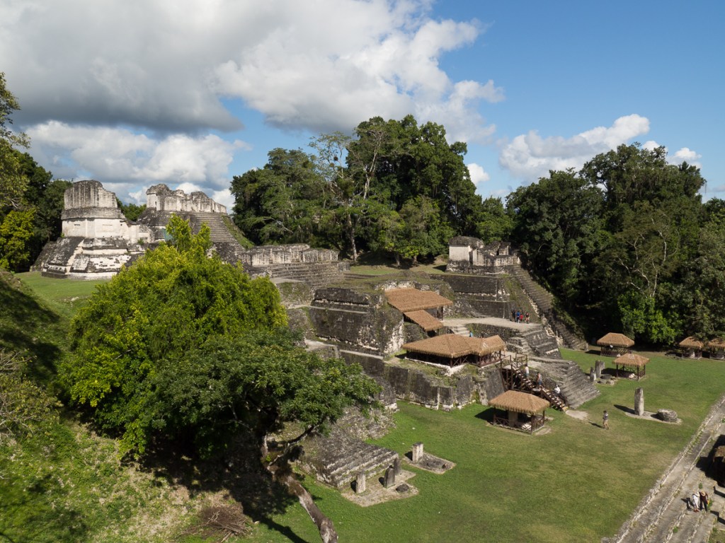
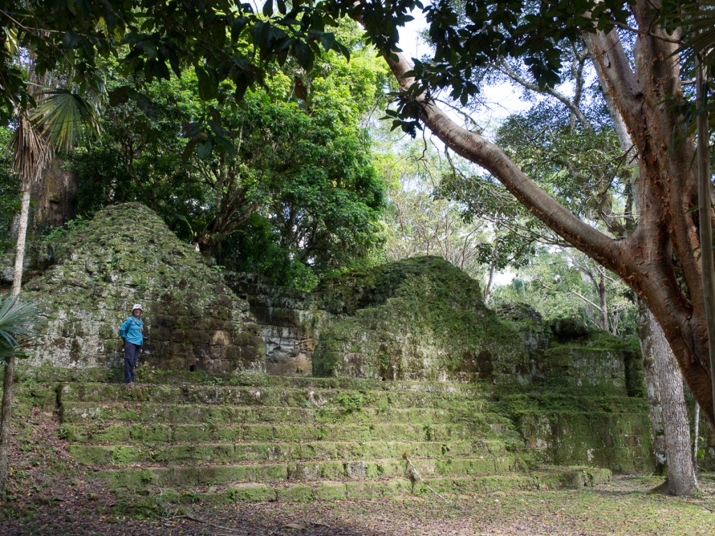
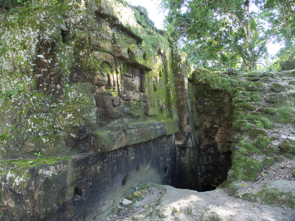
Tikal was unique. The extensive site was spread out amongst the jungle with small tracks joining the buildings (there are still hundreds that haven’t been excavated). We choose from the map which we wanted to visit leaving the central plaza until last. The outer edifices were fairly quiet with a feel of having been recently discovered and left in a more rural state which added to the attraction. Plus, we could clamber all over them. A few which were more delicate – or dangerously steep – had steps up the side with a ledge leading back onto the pyramid near the top which seemed a good compromise. From the top, we had a view over the jungle treetops, with the odd pyramid protruding.
The stepped pyramids are so called because they’re built as layers of successively smaller squares, often with tapering sides. We’ve all seen the great flights of stairs up the front. Except… those stairs are very awkwardly tall and narrow, hard to get up, and ruinous to fall down. It’s all the more curious as the modern Maya, and presumably their ancestors, definitely tend to be short-legged folk, even allowing for them being shortish as well. It would be wonderful to understand why the ancient Maya built them just so.
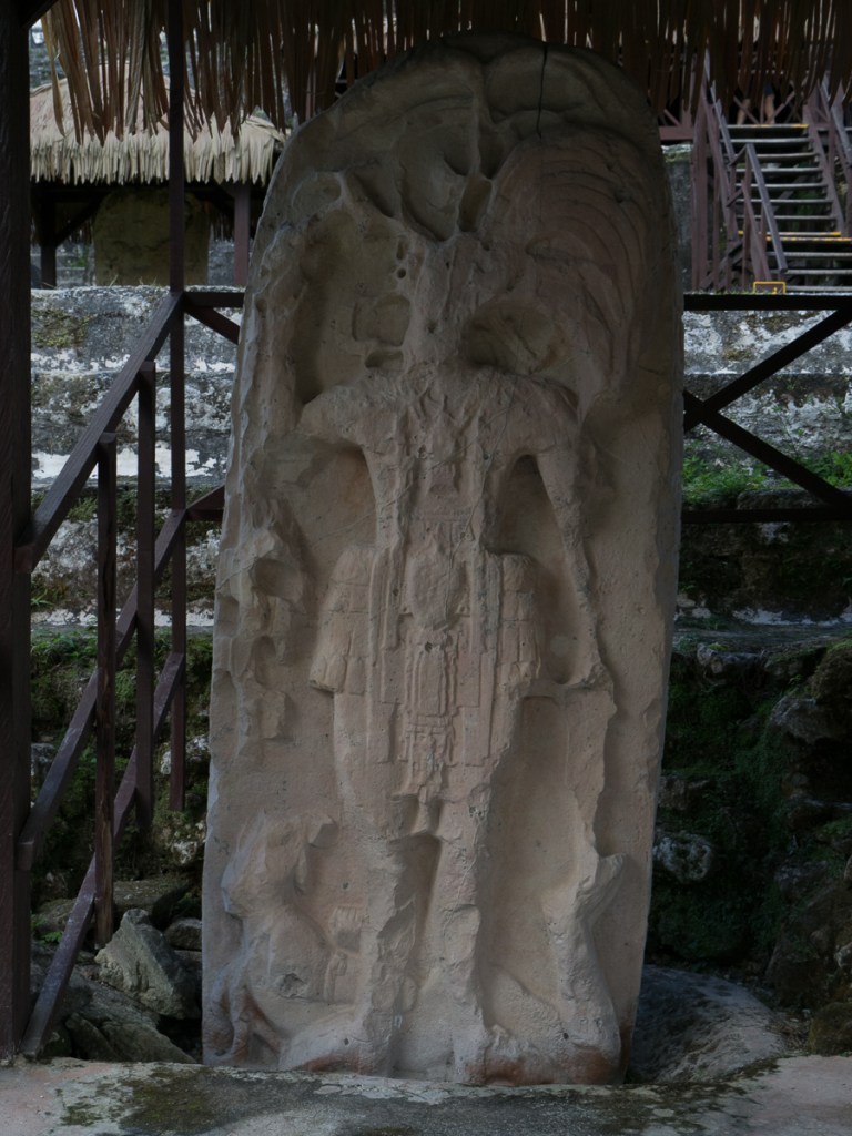
The central plaza was awesome. It had a large pyramid at each end and a maze of buildings/dwellings on each side. The plaza itself had a line of standing stones to one side from which one could readily envisage edged the market place. We clambered all over, taking time out to observe the howler monkeys in the trees overhead and a coatimundi that was snuffling around looking for scraps amongst the ‘Don’t feed the wildlife’ signs.
The island of Flores was next on the tourist trail but didn’t appeal to us. It seemed to be an overcrowded little island joined to the mainland by a causeway.
Gid: Clare didn’t even go to see it, but stayed in bed nursing a cold. I ran around the periphery, once – it was a bit like a miniature St Malo made of coloured cottages, sans croissants. The main drag, on the mainland, was much more interesting – full of motorcycle shops & workshops and hardware shops. My souvenirs from Flores included a SIM card and a useful selection of washers. As in El Remate, a “local” hotel found by cruising around was comfy and a lot cheaper and less touristy than the online offers.
Semuc Champrey was another of the Lonely Planets recommendations and one we plotted into our itinerary. That failed due to us grossly underestimating the time it took us to travel on the northern Guatemalan roads. We finally gave up on swimming in the picturesque limestone pools when we were still 50km away riding in rain with soon to be fading late afternoon light. Enroute our tarmacked surface finished abruptly. Faced with a steep stony but wide track sweeping sharply up a hillside round a corner to err, where? That was the problem. What was round the corner? How far did this gravel with fist /palm/head sized rocks continue for? Ominously, there wasn’t any traffic whatsoever on this stretch whereas we had been accompanied through all the small villages along the way. With a blackening sky overhead we turned back scurrying downhill (video here) into the first hotel we found and just about got inside before the heavens opened. Anyway, it wasn’t going to be much fun in tomorrow’s drizzle scrambling around the rock pools in our swimmers. As it happened it was a stroke of luck, as it really did take us three, not two, days to Quetzaltenango (Xela), and we had not only accommodation booked, but Spanish lessons too!
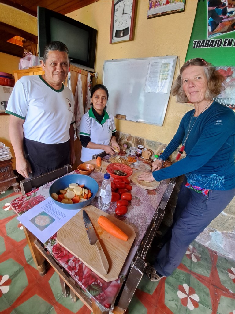
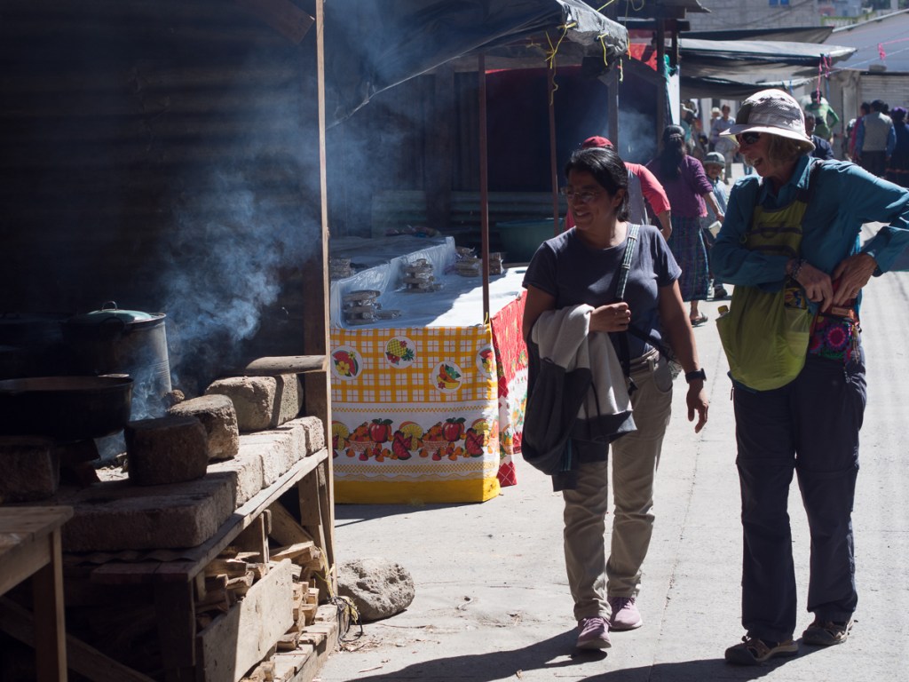
While idling in Flores (Clare had a grotty cold), we’d realised that we’d dropped into a rather tiring pattern of riding for a day or three, arriving at some tourist site and “doing” it, then moving on. Although it broke up the riding, it was pretty remorseless. Whereas when we cycled 2016-2018, we’d ride for several days, with odd rest days, then stop for a few days in an interesting place. That gave a time for a real break. When cycling, the physical break was more appreciated, as churning out the miles, if not too gruelling, is mentally relaxing, but the legs, shoulders, bum suffer. Whereas on the motos, usually the riding isn’t physically demanding (no iron-butt rides for us), but the constant enhanced alertness is very taxing. We decided to change. Lonely Planet suggested Xela was a great place to sign up for Spanish lessons with an immersive homestay. At the last minute, over the weekend, we booked with El Quetzal Escuela de Español!
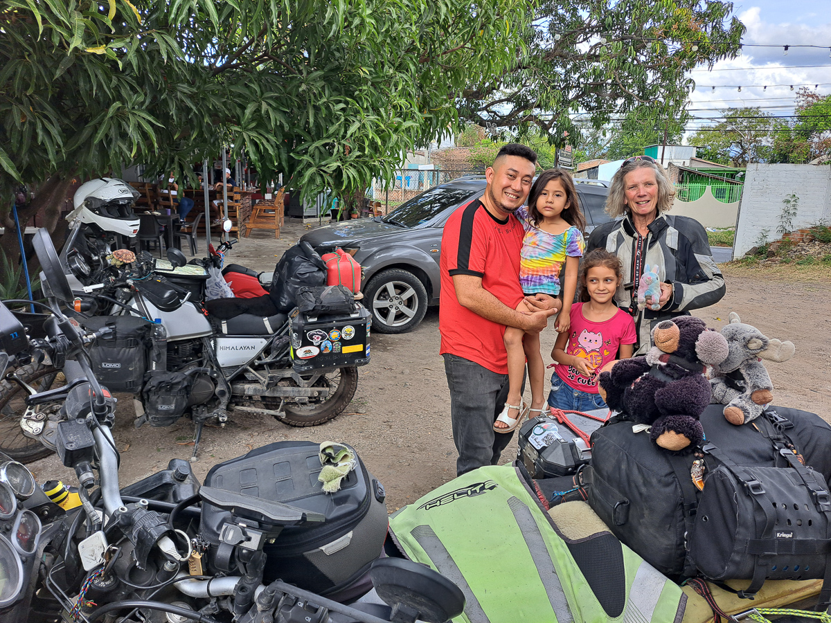
Arriving in Xela mid afternoon, we found our way to El Quetzal. Proprietor Glenda and husband, Daniel, bade us welcome, refined the week’s plan, and posted us to our homestay for the week, where Fabiola and Jenny made us very welcome.
The arrangement was, we had a week of one-to-one Spanish lessons from 2pm to 6pm, and four mornings of outings in Spanish. Spanish was the language with Jenny and Fabiola (actually Jenny’s English was pretty good, but she was very tolerant of our garbled espanol). Claudia was assigned to wear out Clare, and Fernando was to exhaust me. So much for our mental rest!
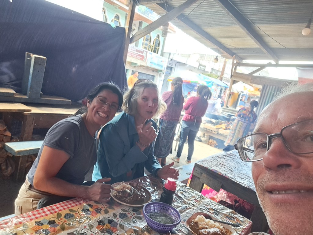
OLYMPUS DIGITAL CAMERA
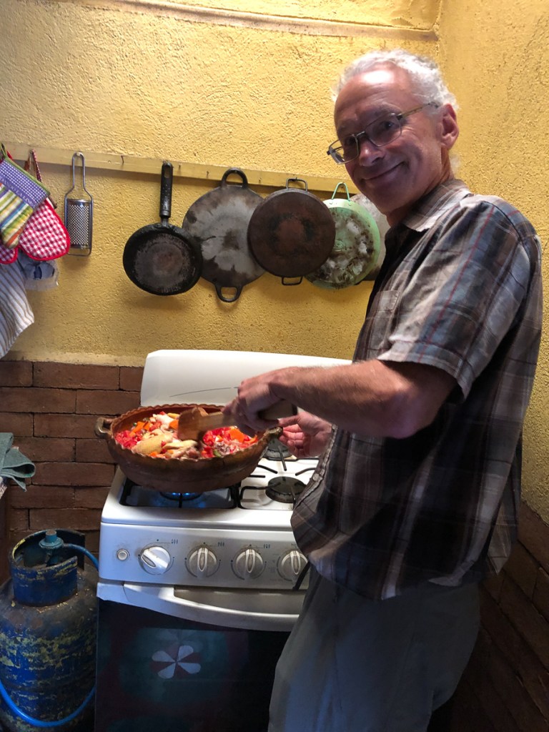
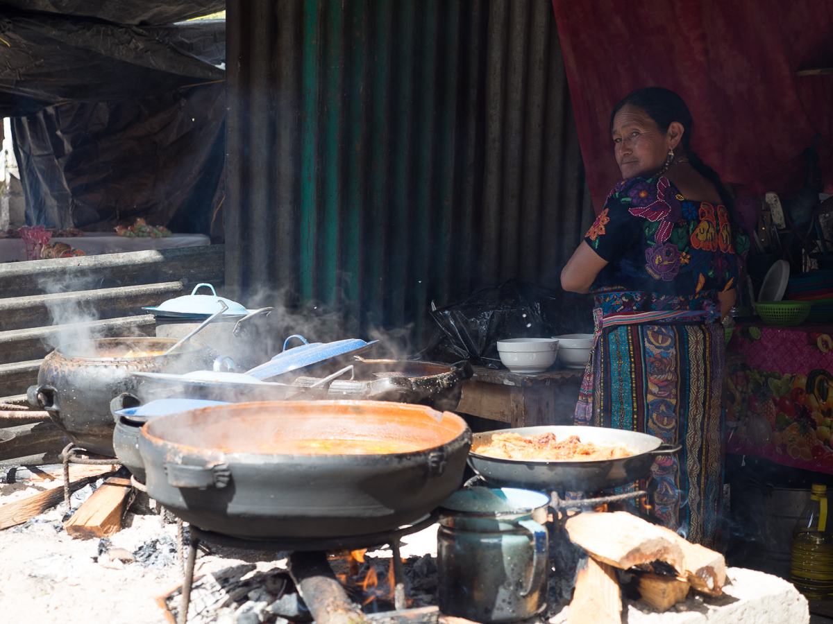
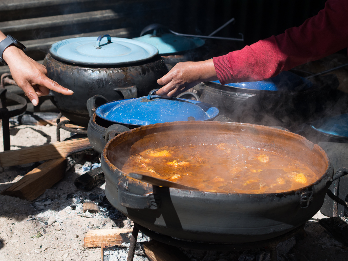
Pollo Guisado
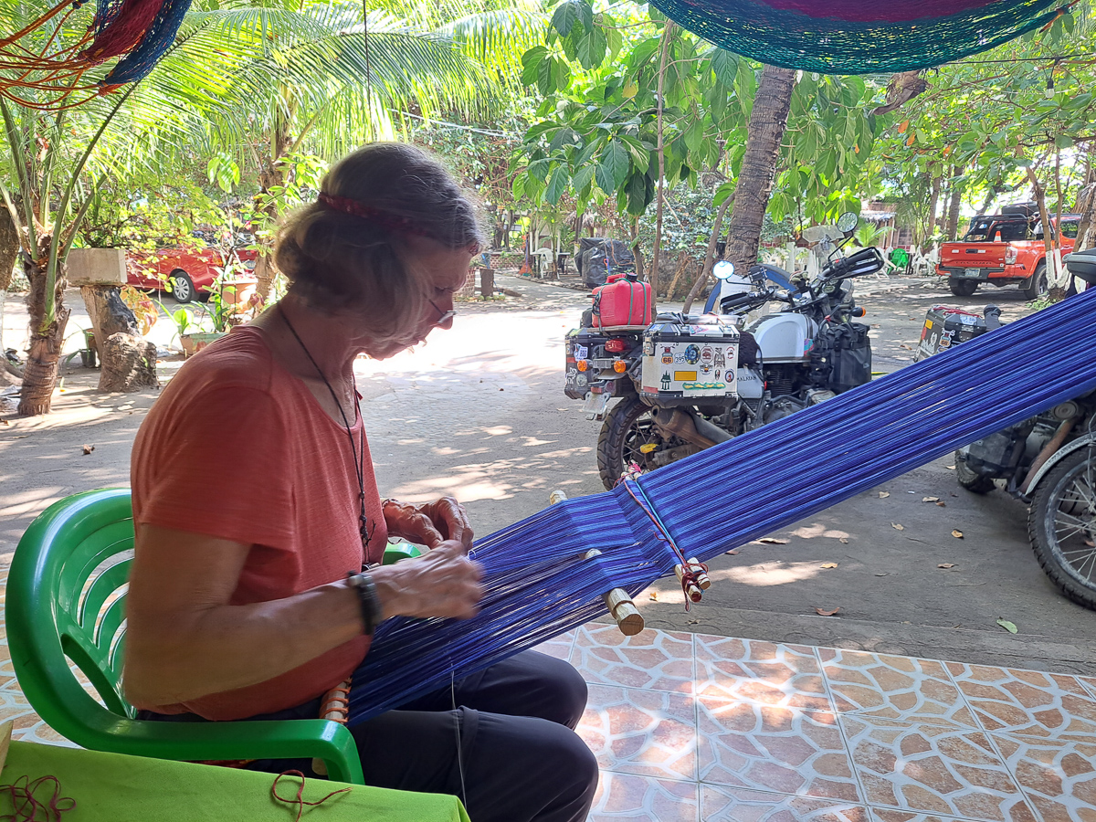
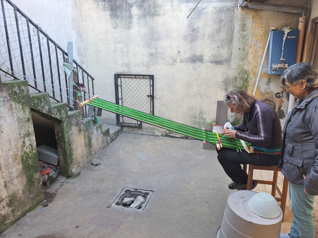
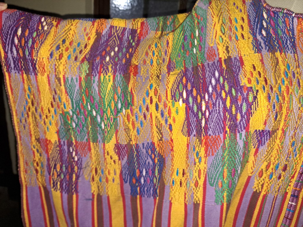
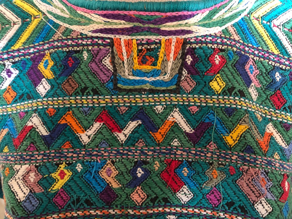
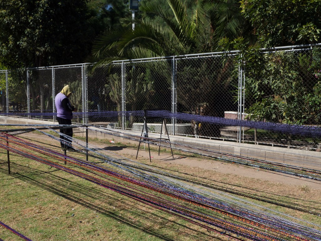
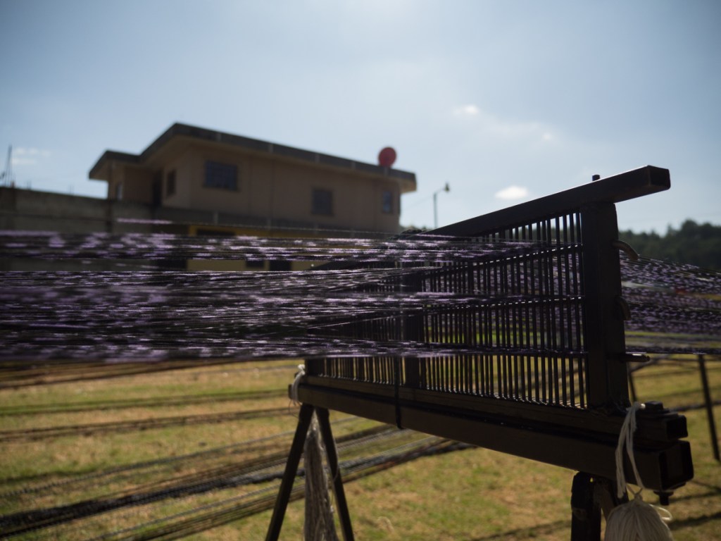
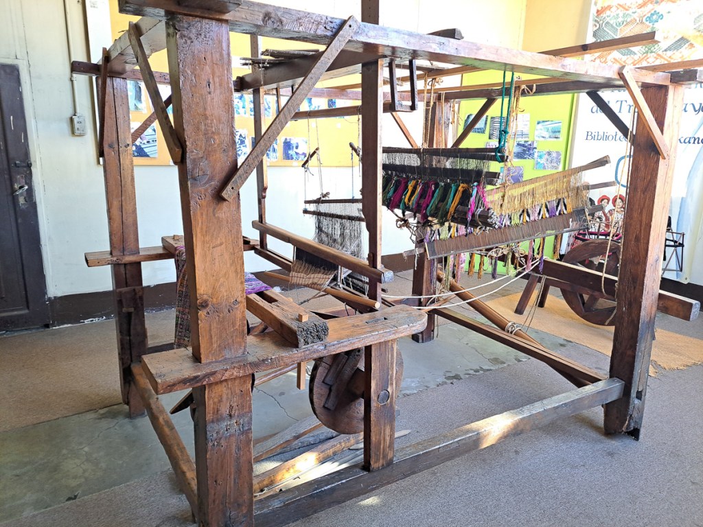
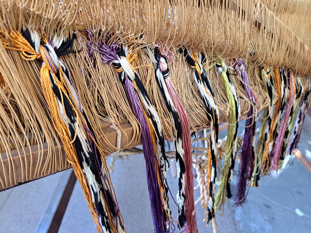
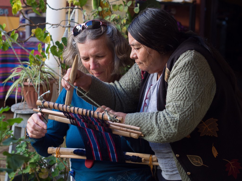
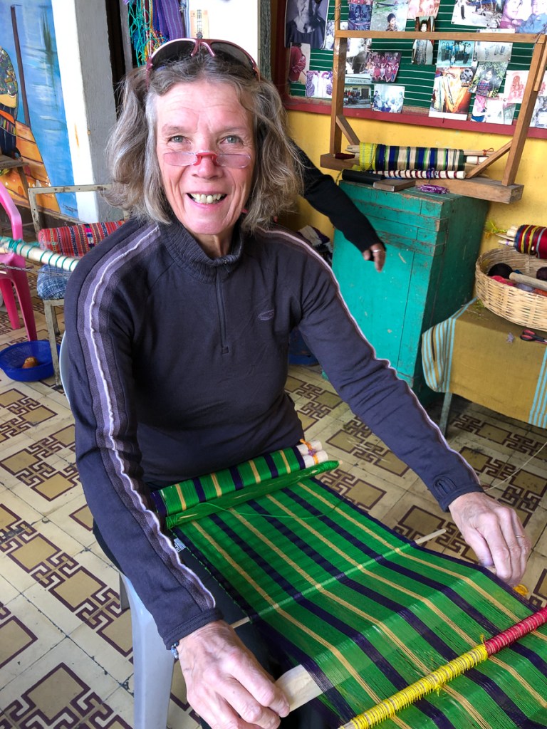
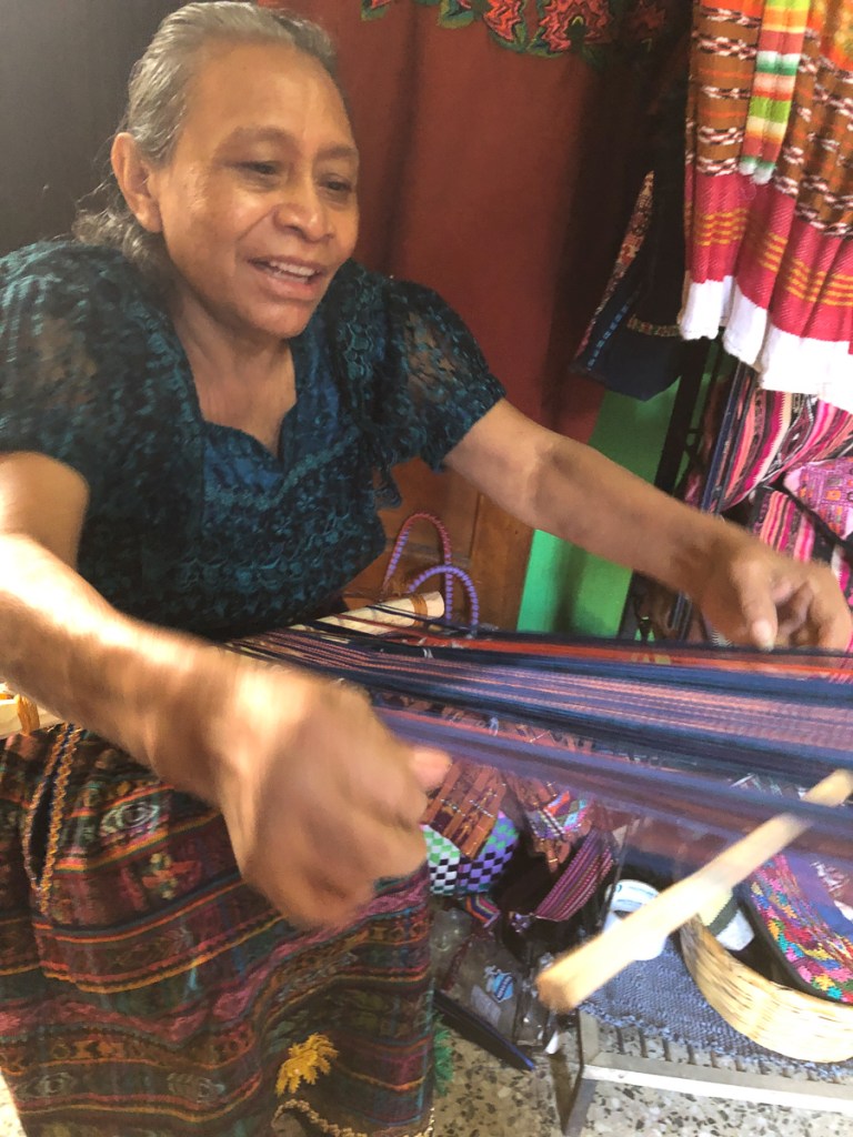
Another attraction of Xela was the presence of schools of traditional backstrap weaving. A taster session as a part of our language course was all it took – Clare was going back for more. Another week in Xela. I continued with 4 hour Spanish lessons, Clare cut down to two, and spent long mornings and late afternoons in the weaving school. By the time we left Xela, we were loaded down with:
Two tablemats from the taster session (one each).
One table runner
Scarf #1
Scarf #2 on its portable loom of sticks and string.
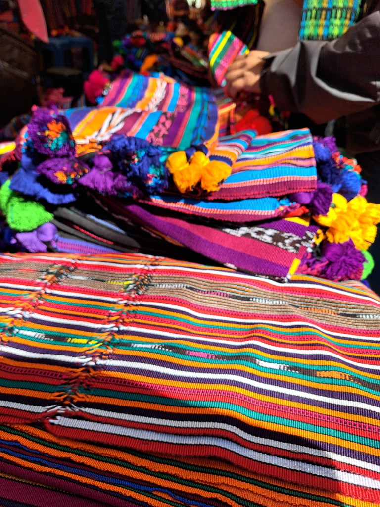
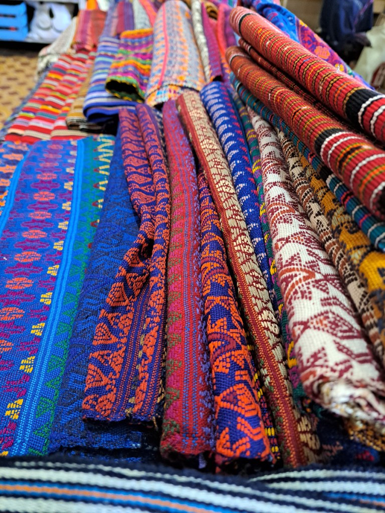
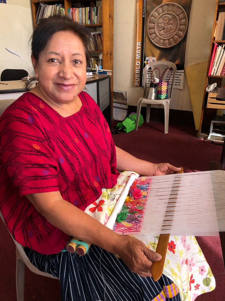
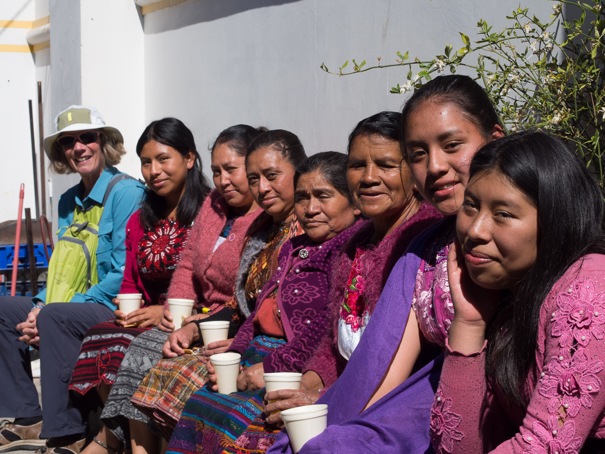
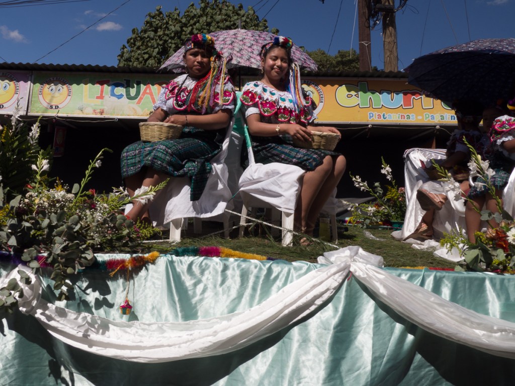
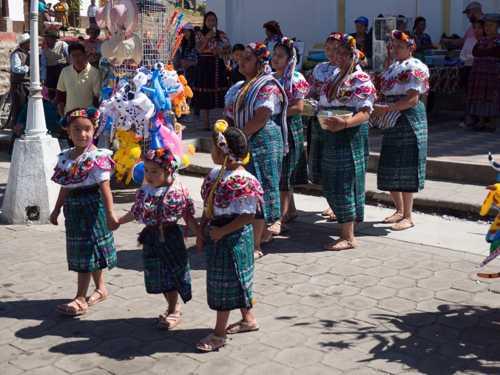
One thing that has been remarkable in Guatemala is the amount of traditional fabric actually worn by the ladies. According to Clare’s spanish teacher Claudia, it’s not cheap, and it’s blooming heavy – multiple layers of heavily woven cotton. But a large proportion of ladies – rural and urban – especially those maybe 35-plus – wear the skirts and blouses every day. It was very notable that as soon as we crossed into El Salvador, this traditional dress vanished.
OLYMPUS DIGITAL CAMERA
When we planned this trip, the Americas were easy to visit in terms of paperwork, but since August 2024, UK citizens need a visa to enter Honduras (in retaliation for our government doing the same to them), and the visa application needs a home country criminal record check. As we hadn’t planned for this, we put hurried arrangements in place paying HMG extra for a fast track, and Gid’s sister, Jo, kindly got it couriered (thanks!) and El Quetzal was a perfect postal destination. As we finished our second week of school, the certificates set off via DHL.
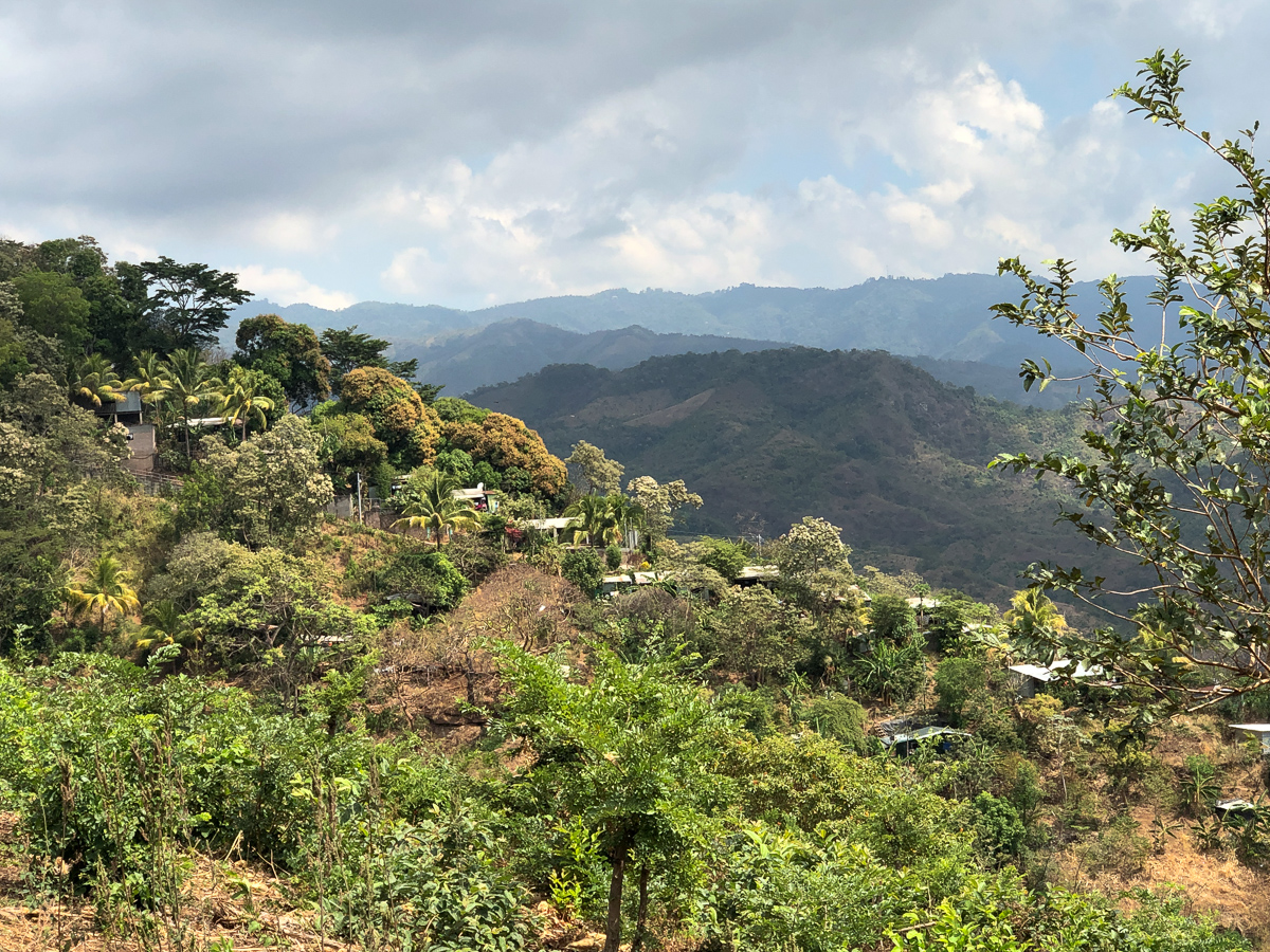
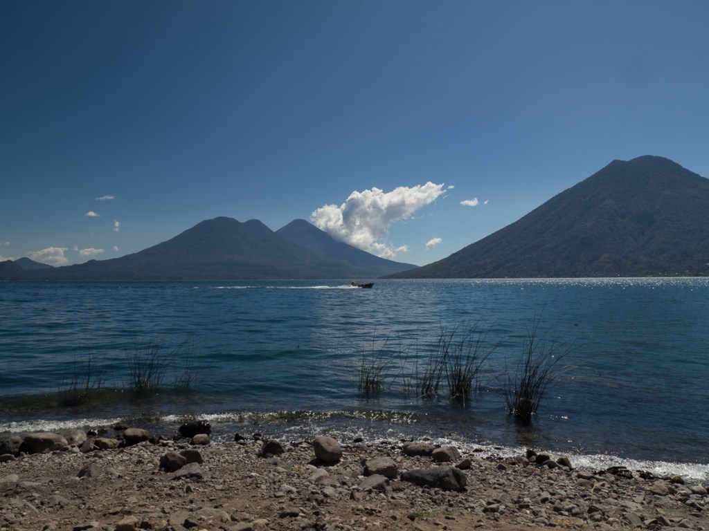
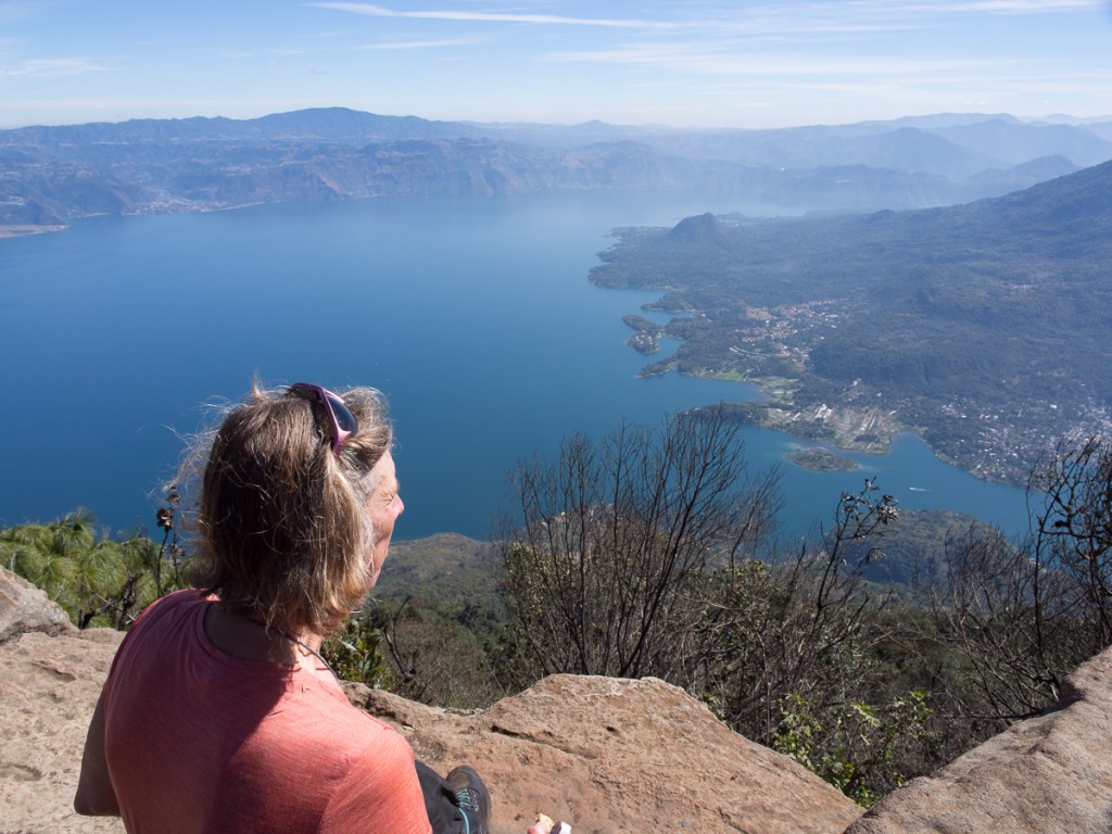
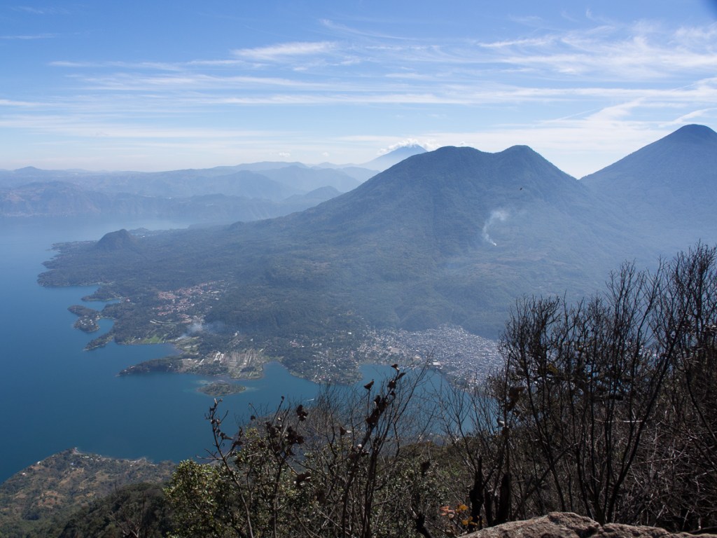
The wait for the courier opened up the perfect time slot to visit Lago de Atitlan. It was maybe half day’s ride away, so an visit. As we approached the famous lake, we stopped at a mirador (viewing spot) near the top of the mountains surrounding the lake. I had looked at the map and knew there were habitations around the lake but was expecting a few villages dotted around the shores. I was horrified. It was so built up! Creeping down the endless tight hairpin bends kept us very focused on the road. Emerging into the cobbled streets of the town there were the familiar highly coloured murals adorning many of the walls juxtaposed with wrecks and rubbish abandoned along the way. Town dogs mixing it with traffic, tuktuks filling every possible gap while Mayan ladies wearing their tradition costumes, baskets on their heads, boldly striding down the streets set a more appealing scene. The roads, we learnt later, are one of the three prime uses for the volcanic rubble which accounts for the random cobbles.
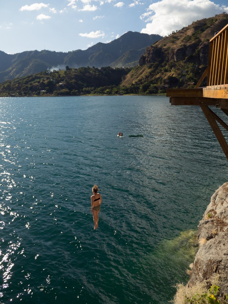
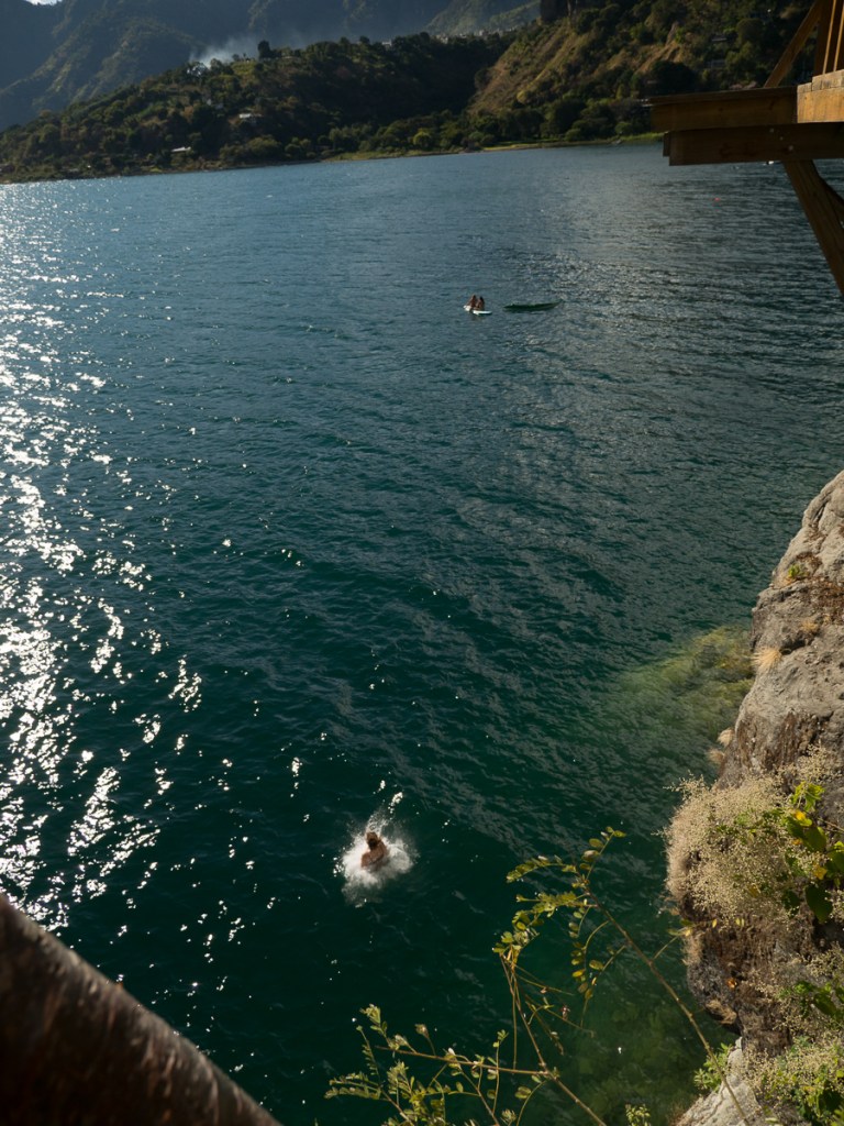
13 metres – and she did it again!
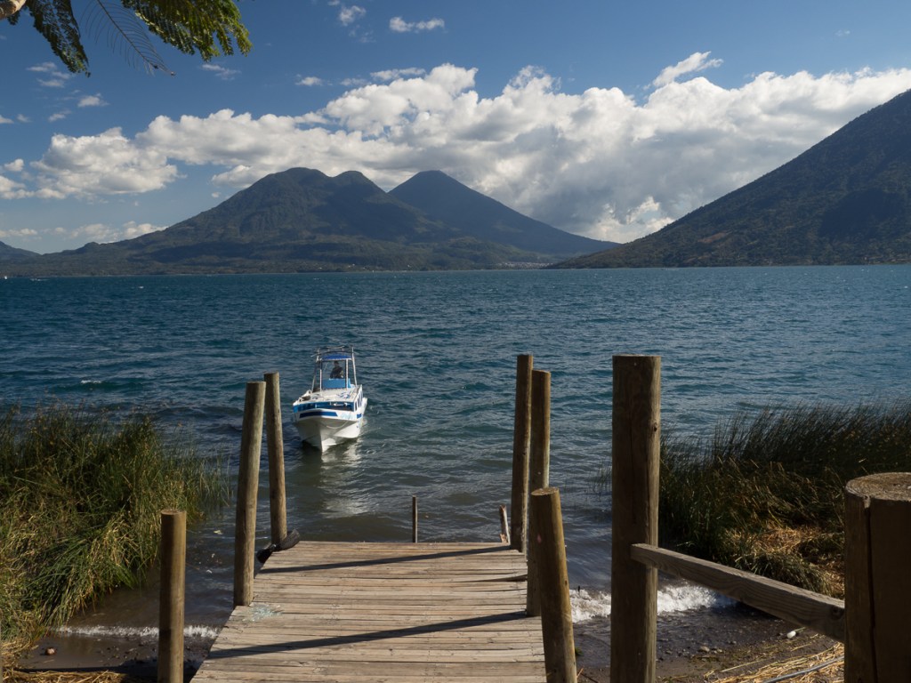
We trundled along San Pedro main street eyeballing possible hotels – could that alley allow us to ride our bikes right into the hotel? I scouted on foot. Sure! Park amongst our family bikes the friendly owner, well, gestured mostly, to be honest! The hotel had the requested lake view if you poked your head out of the door but even better was our easy access to the water across the road. Atitlan is a swimming lake we’d been told. It didn’t take us long to head off down the opposite passageway to assess it. Sharing the path with a deep ‘road water’ run off channel was the first dodgy point but on reaching the lake the piles of rubbish, and locals washing themselves, their laundry and crockery was enough to quell our desire for a dip. A couple of days later however when visiting San Marcos, a small hippy hamlet on the opposite shore, famed for its jumping platform, it had to be done. That activity also showed us where all the young male tourists were, to complement the young women prowling the tourist stalls and cafes. We were definitely the oldest jumpers while we were there!
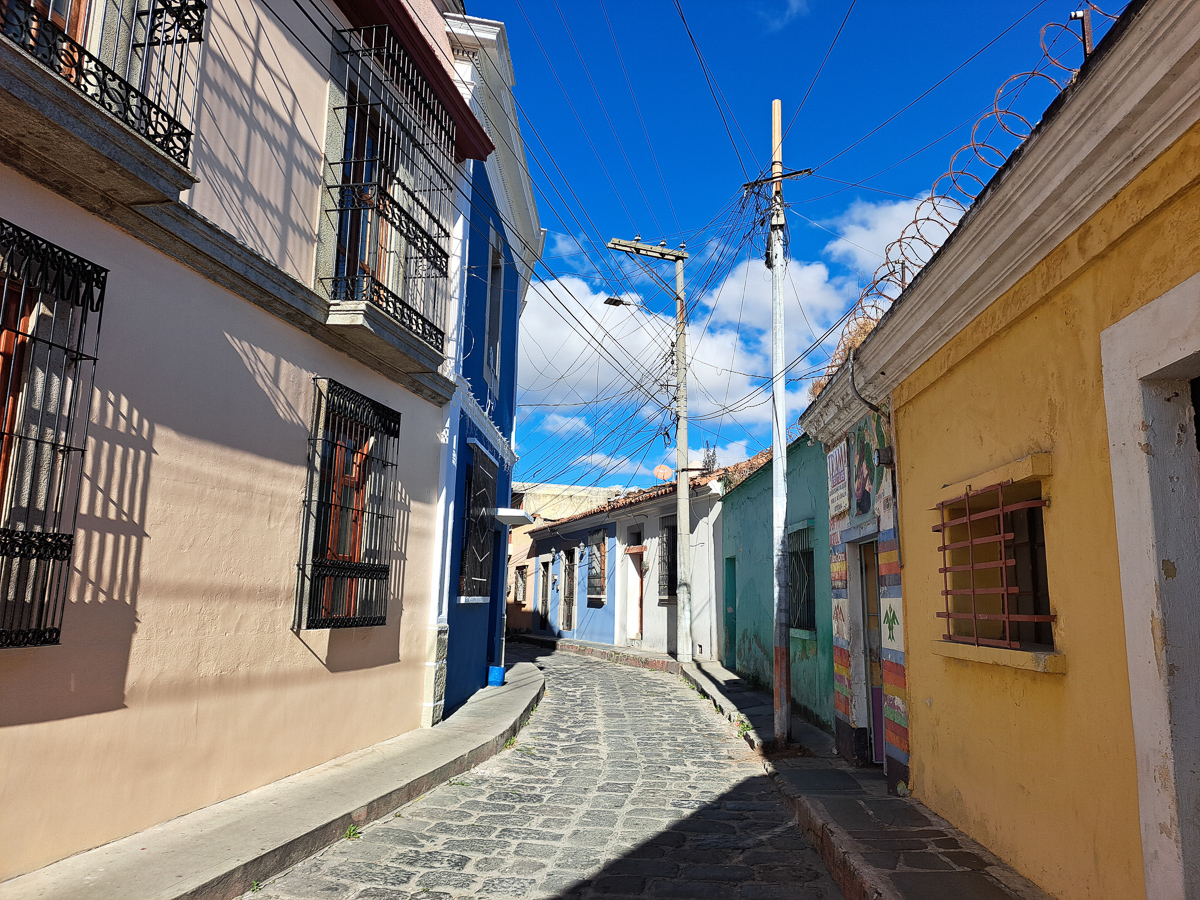
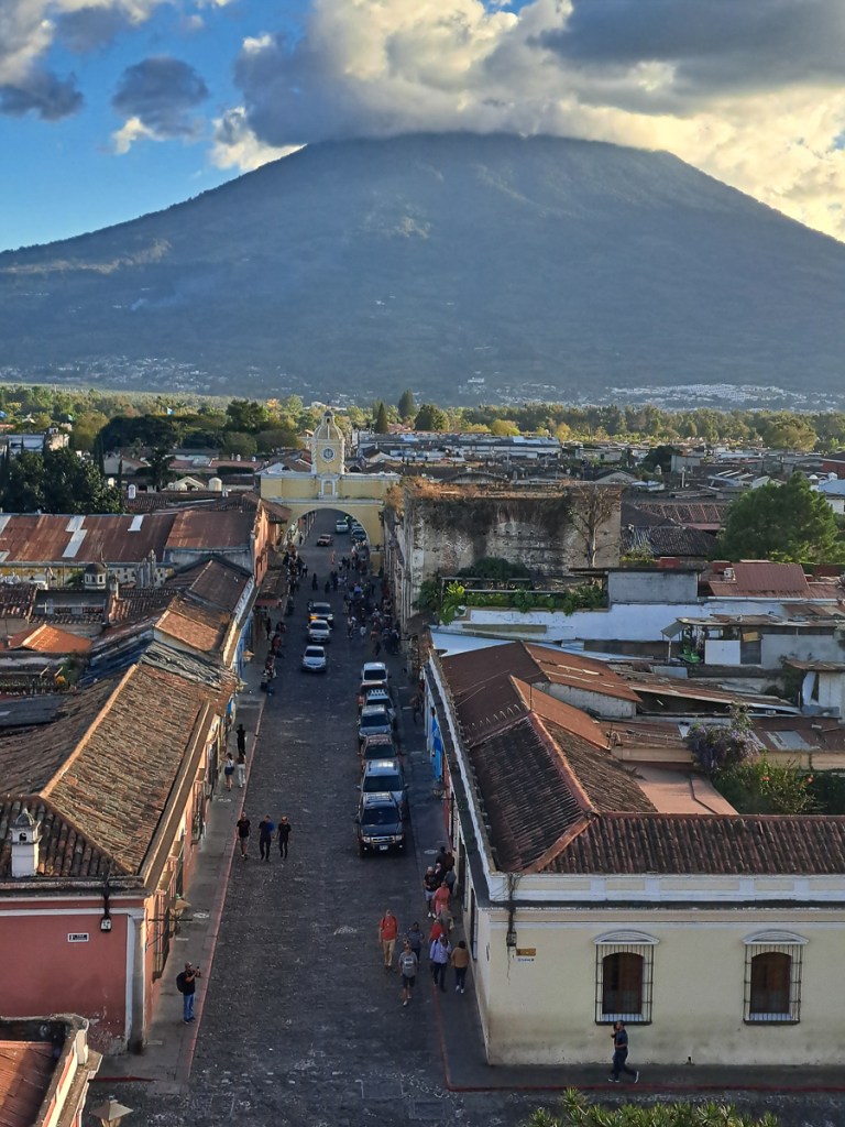
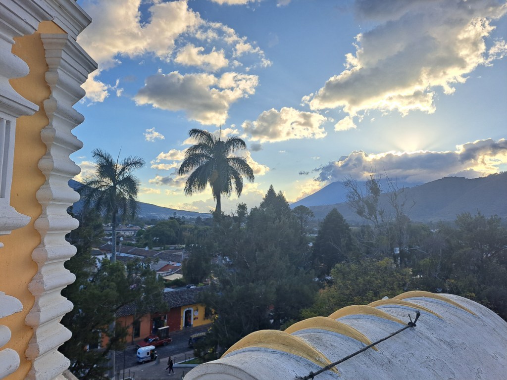
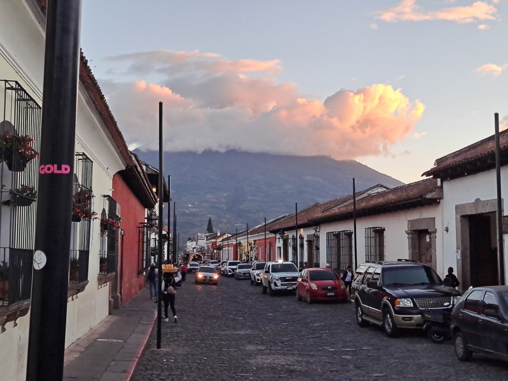
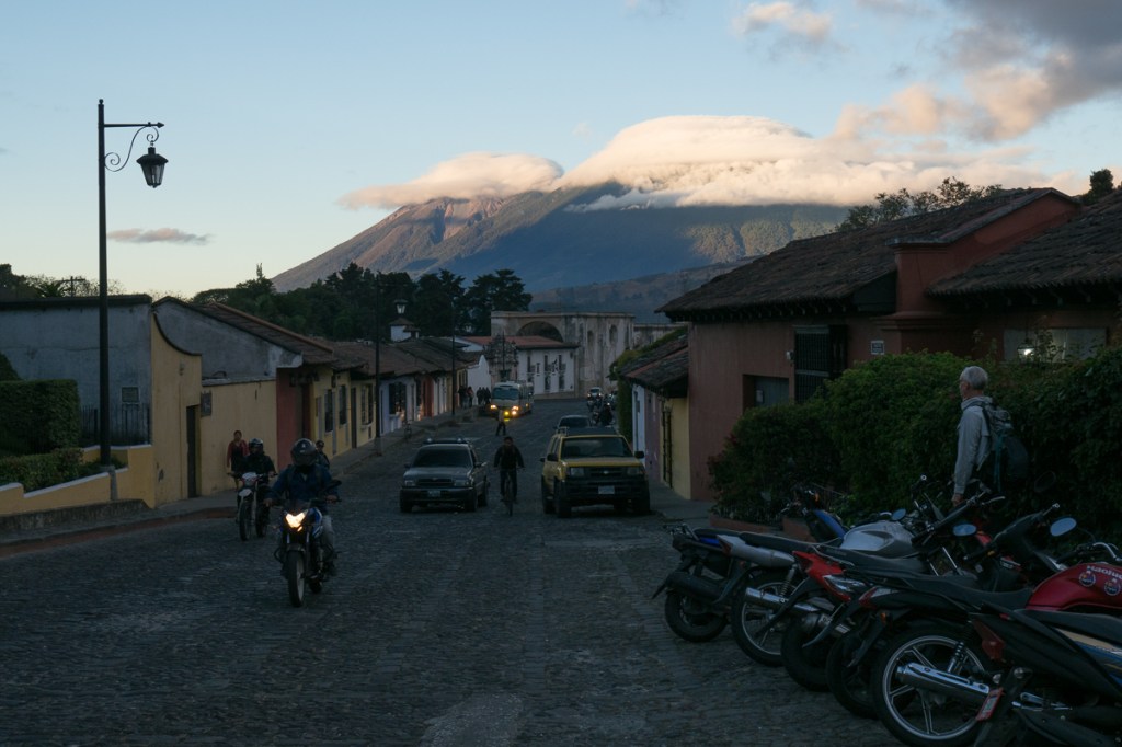
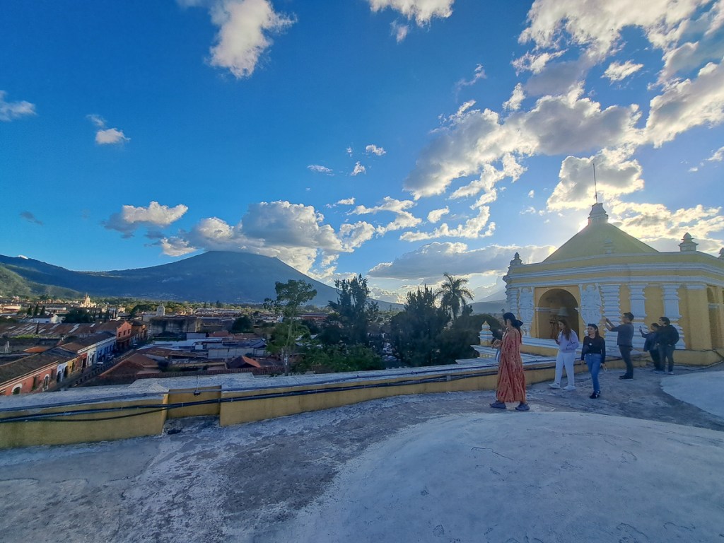
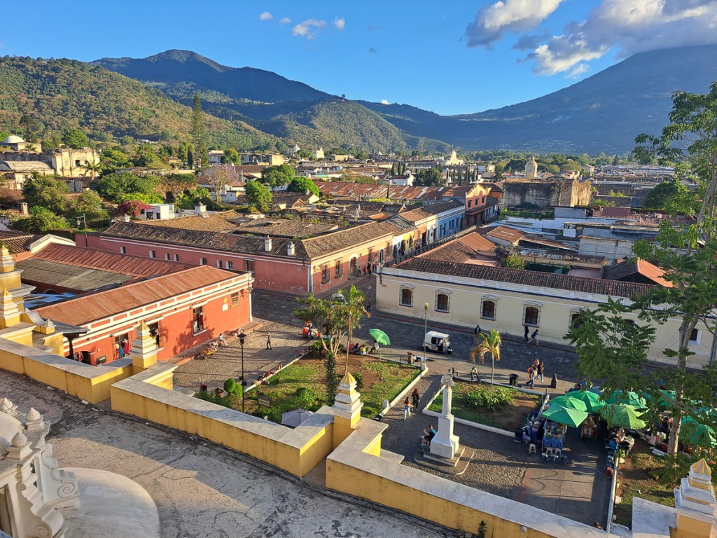
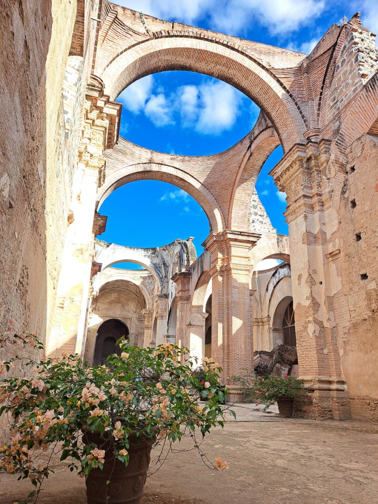
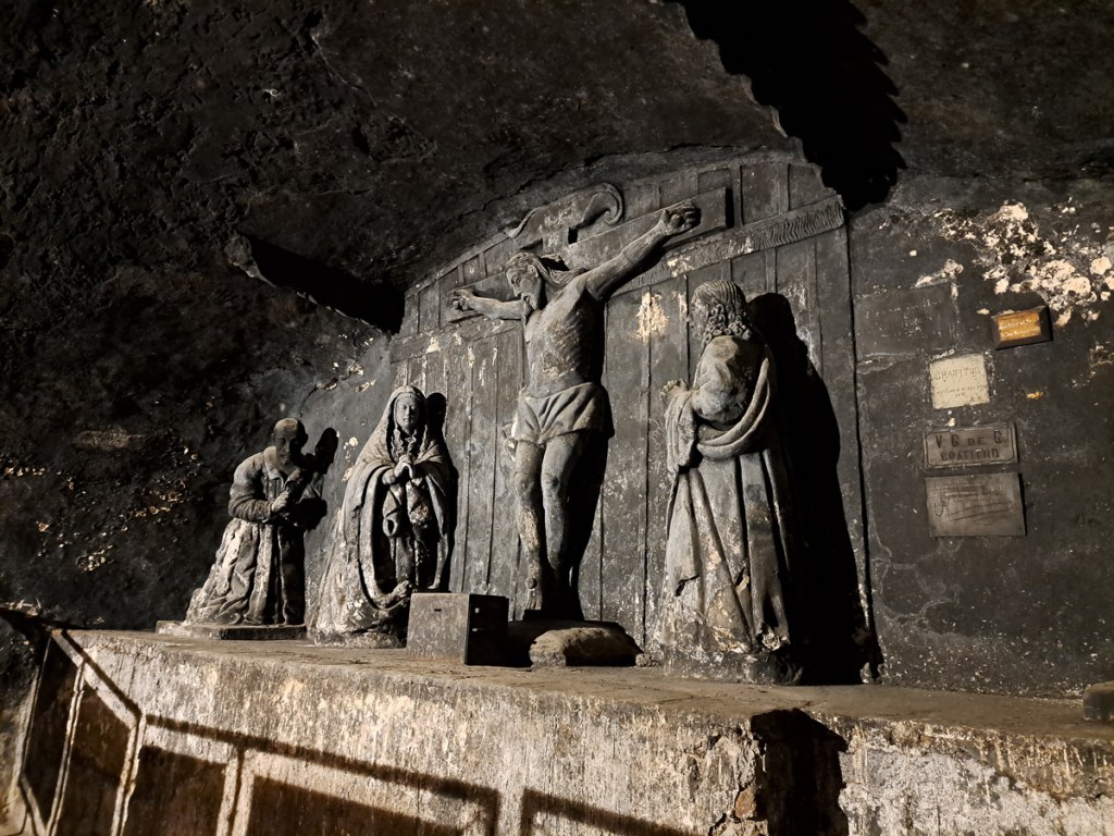
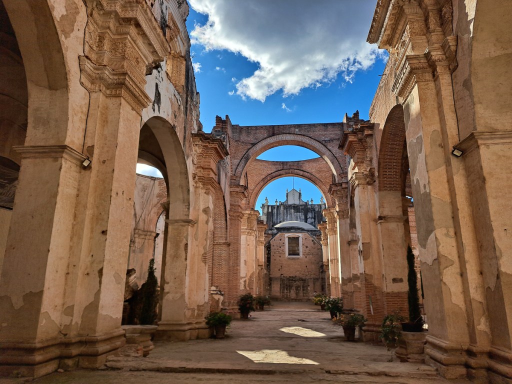
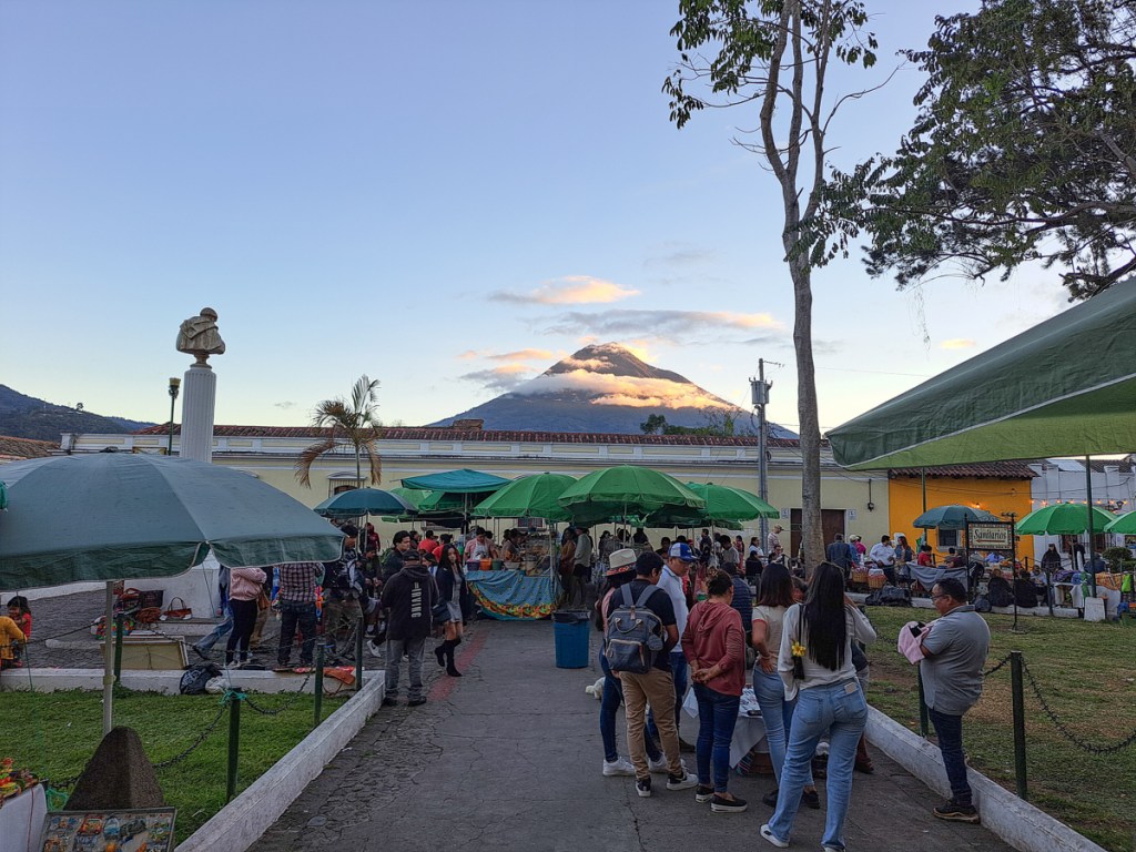
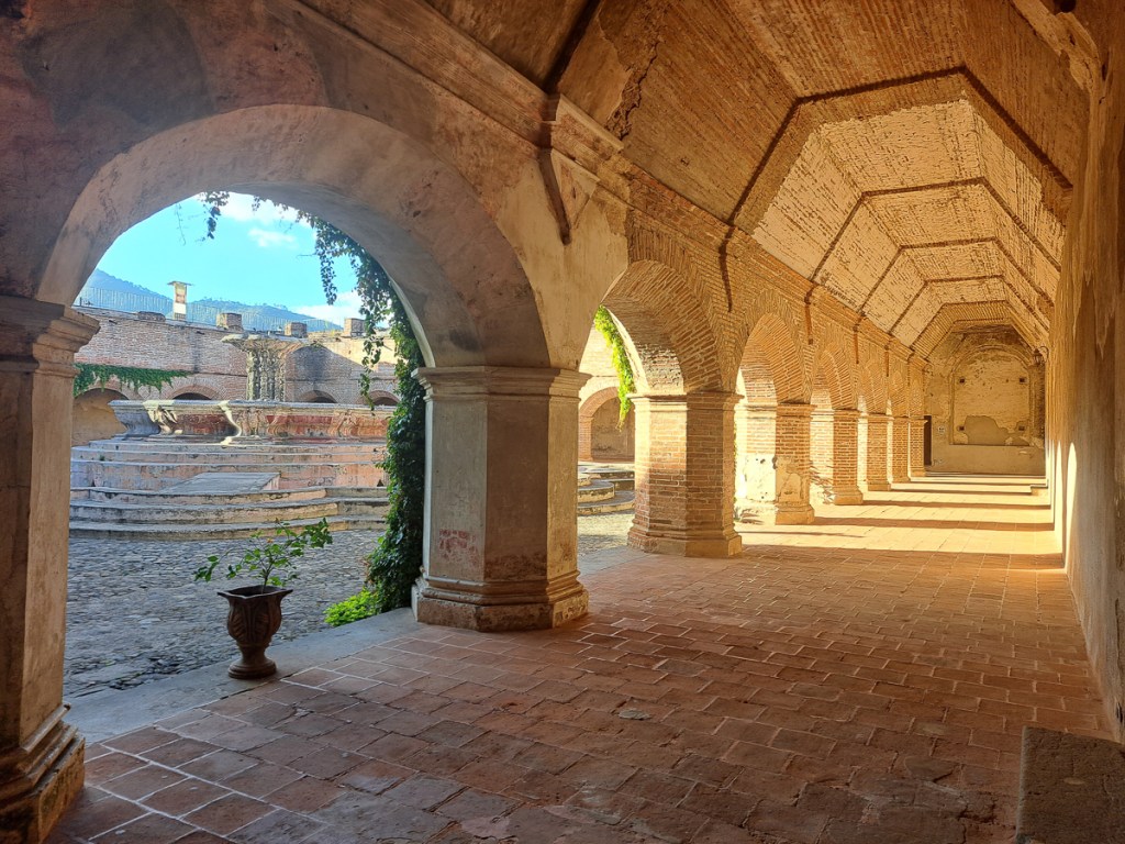
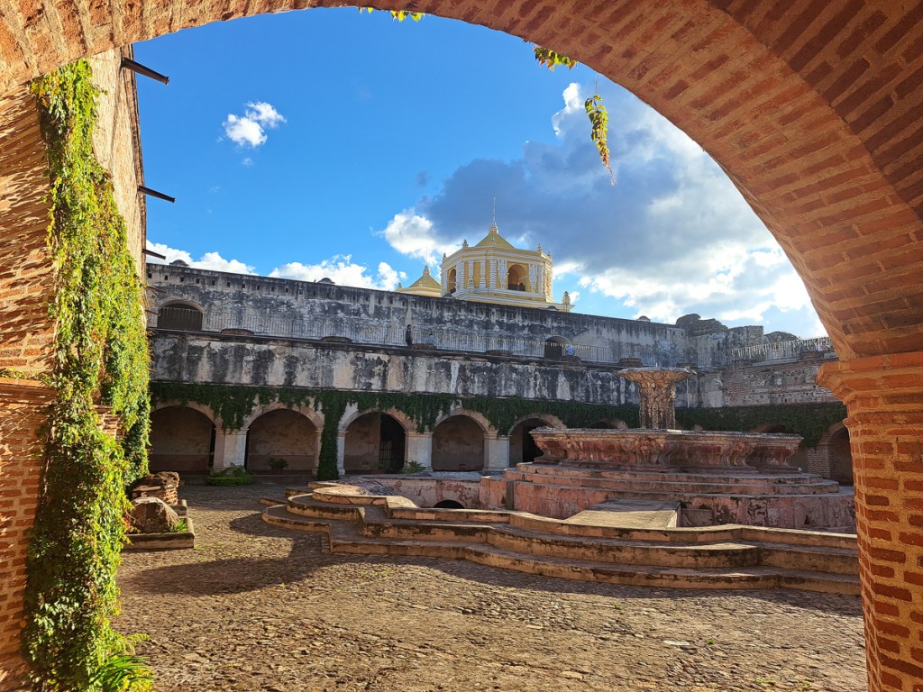
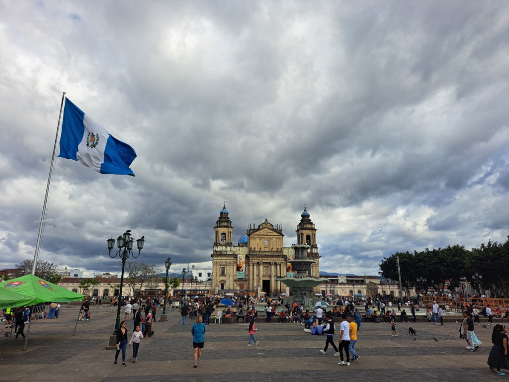
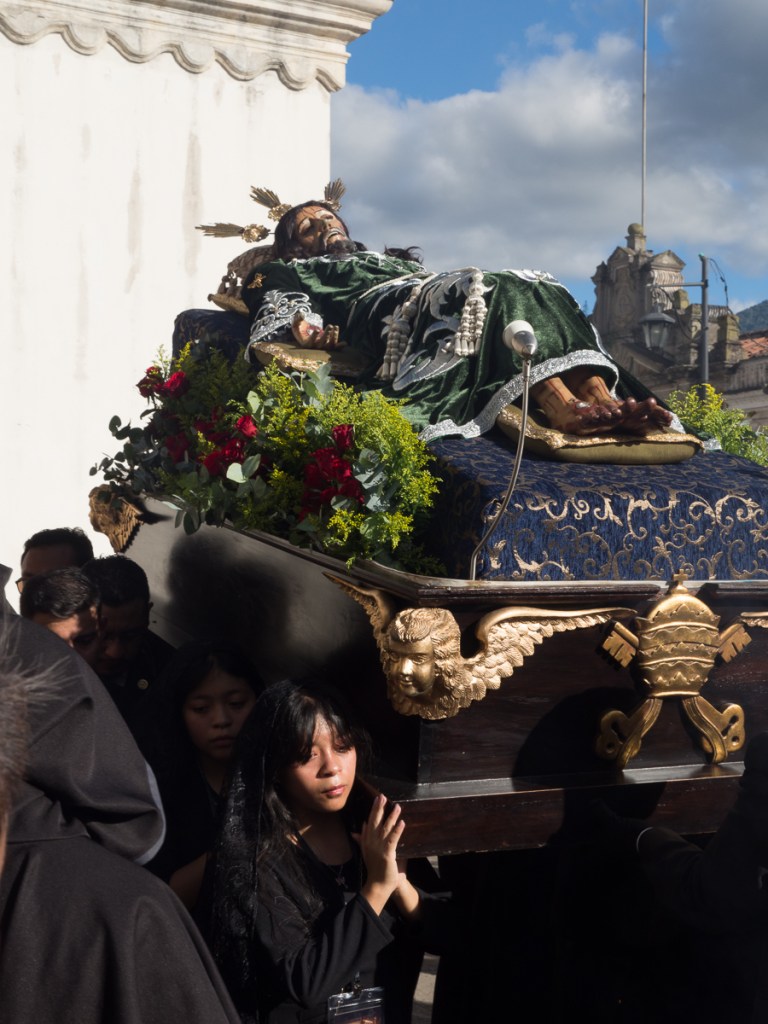
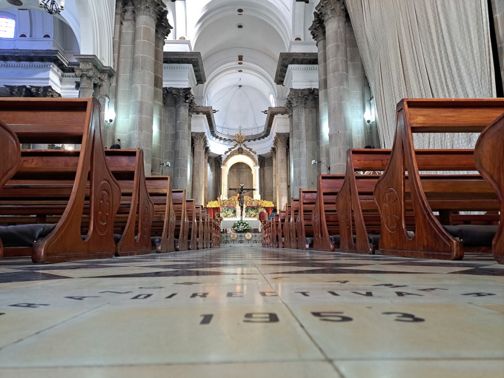
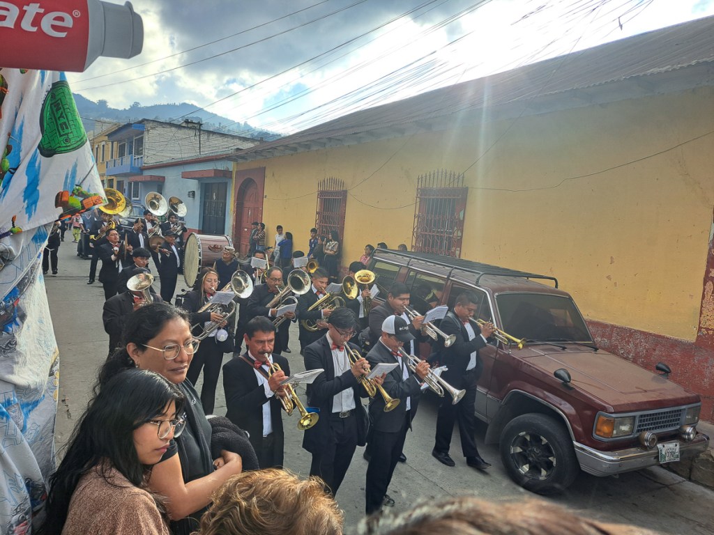
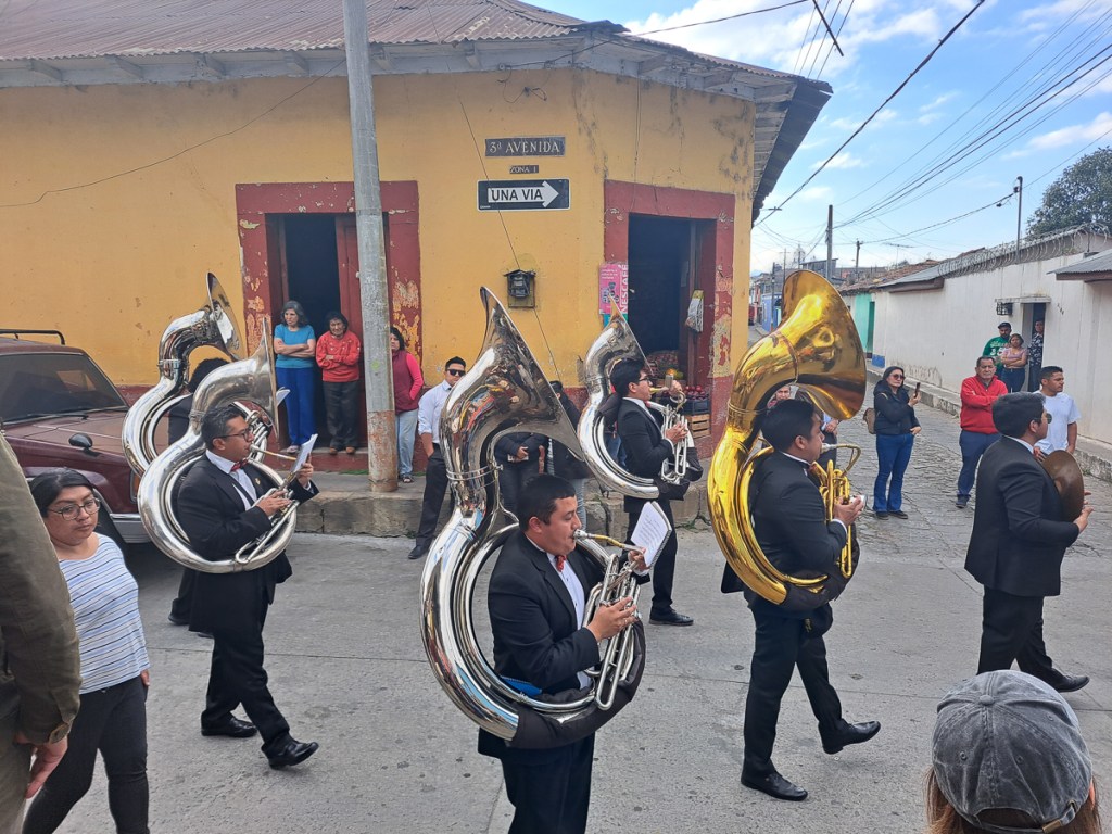
Antigua is a must see in anyone’s book. A UNESCO listed ancient capital city overlooked by menacing volcanoes has numerous ruins following a series of eruptions & earthquakes over the centuries. In 1773, then the capital of Spanish Central America, it was shaken to the ground and the capital was moved, taking the name Cuidad de Guatemala with it, and bequeathing the name Antiqua Guatemala to the ex-capital. Antigua has numerous respectfully painted one storey buildings lining broad cobbled lanes. As a UNESCO city there are very strict rules as to what is acceptable and no advertising slogans disfigure the walls. One has to pass a building and peer in to see what is sold. Open spaces were crowded with street sellers, musical performances and a few omnipresent beggars but pavements themselves were oddly devoid of café furniture and sellers. A procession in connection with the build up to Holy Week took place at the old cathedral. These processions gain in momentum up to Easter Week when the streets of Antiqua are blocked. During the Easter festival the streets, which criss-cross the city, will be lined with flowers and relics from the biblical scenes.
Oddly enough, Antigua has weaving schools, too. It also has jade shops. Clare had been looking forwards to these, and dived in with enthusiasm. Most of the worlds quality jadeite jade comes from the Sierra de las Minas, a few hundred km north, and much finds its way through Antigua to be made into jewellery. But although the city’s buildings were attractive, whether in use or elegant preserved ruins, the place was such a totally tourist town – 20 person long pavement tours and hardly being able to put a foot down without negotiating another tourist – that we both got a bit fed up with it after a day or two. Rather pricey, too.
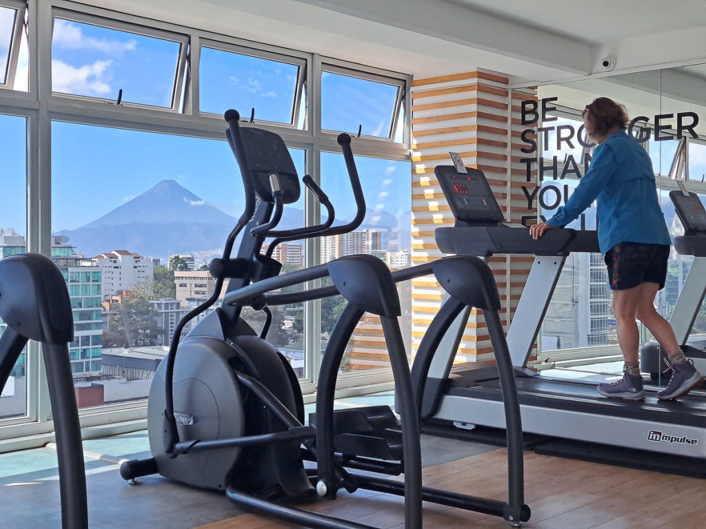
We travelled on to Guatemala city aiming for the the Honduran Consulate to get our visas. Cuidad de Guatemala isn’t much of a draw for tourists, although it does have the modest national museums, and a fine central plaza. It’s the only place in Guatemala with a Royal Enfield dealer (there’s none in Belize or El Salvador), and one of the few with outdoor gear shops. As in Cuidad de Mexico, we chose an apartment rather than an hotel or hostel. Again, it was newer and smarter than anywhere we have lived in at home. Unlike Mexico, this time the district was rapidly gentrifying, new towers springing up in every block. But we could still get a cheap lunch from a street vendor, if we avoided going into the posh malls hungry. I, at least, quite enjoy the buzz of a city, if only for a while. A big draw was that the deal included the gym on the top floor. We could try and get fit for our return to Antigua and the…
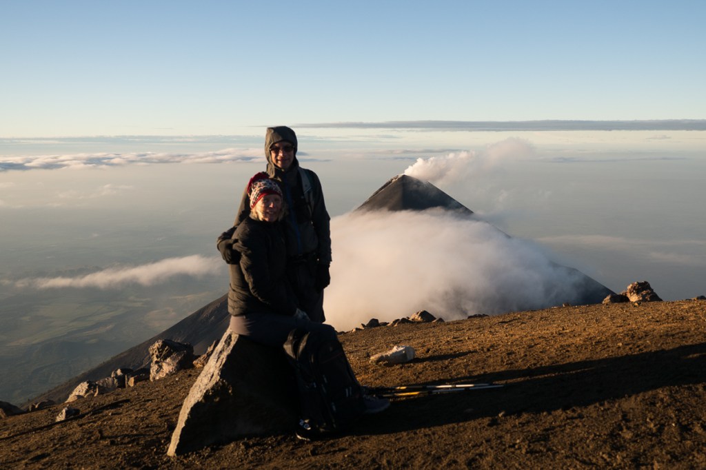
Volcan Acatenango Hike:
Gid has had ‘climb a mountain’ on his bucket list since Alaska. I was not so motivated. I’d managed to avoid a couple of possible climbs riding down through the Rockies and wasn’t keen to change my resolve but Acatenango had added attractions. It came with a base camp sleep-over near the top, a view of an erupting ‘sister’ volcano, Volcan de Fuego, from our campsite and a follow up extra hours hike to the top for the sunrise views the following morning. Whilst it did look enticing we had hiked up the Volcan San Pedro to admire the views of Lago Atitlan two weeks before to a height of 3000m and I had struggled badly. Scary after a lifetime of breezing up things like that. Was I just unfit? Nine months of very little exercise sitting on a motorbike has to take it’s toll. (Gid has taken every opportunity to jump up and down, workout on the yoga mat and go for sporadic runs). Or was it the remnants of my cold and chest infection? Either way I was nervous of committing to a 4 hour plus hike, sold as ‘hard’, up a mountain to near 4000m. Gid was generally unaffected by our Atitlan hike but had foolishly not manicured his feet. The descent wrecked his big toes’ nails as his feet pressed against the front of his boots. The toe nails got infected, to the extent of seeing a doctor who prescribed intensive cleaning, antibiotics and no running for a week.
We enquired at an Acatenango hike tour operator before leaving Antigua and rather hesitantly booked up for two weeks ahead. A bit of breathing space for both of us. We could have a personal guide so could set our own pace, and private hut at the base camp so could have uninterrupted sleep and rest. Gid is very sociable so would miss the cameradie but that was the deal if I was to do it. That gave me two weeks to make some improvement on my health or fitness – laughable really. A good start was our Guatemala City AirBnB in a sixteen floor apartment building so up and down the steps was the first stage, the treadmill in the gym was stage two together with actually using my skipping rope which had started to collect dust. Out walking around Guatemala City for 3-4 hours each day must also have helped. Plus I bought some lightweight fabric boots – our Altberg dual purpose boots are comfy, grippy and robust, but very heavy for a long climb. Altitude sickness pills completed the preparations.
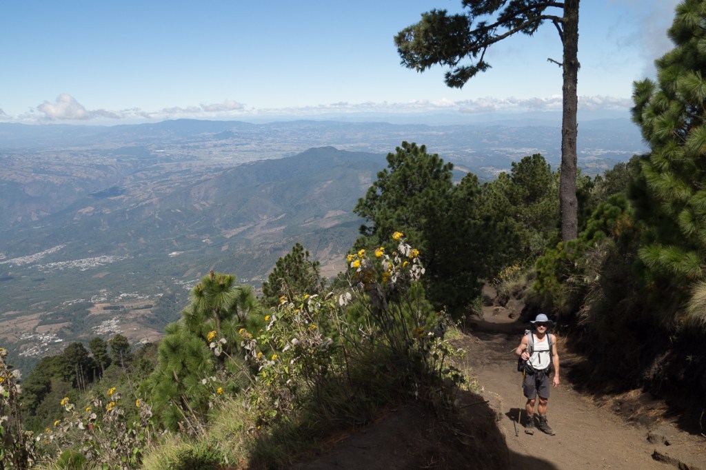
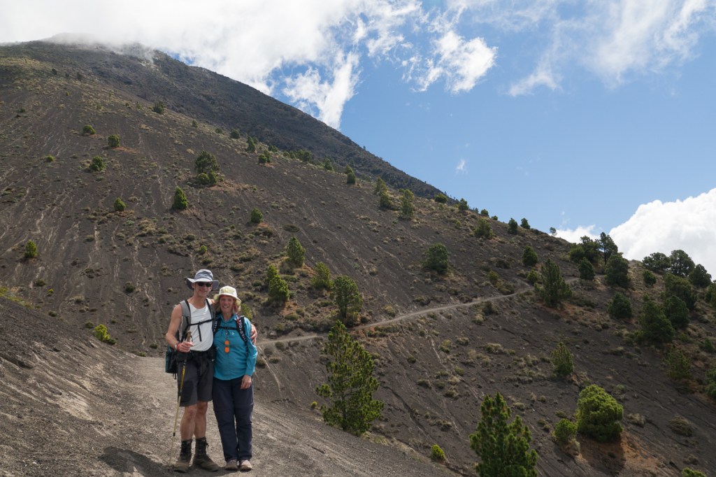
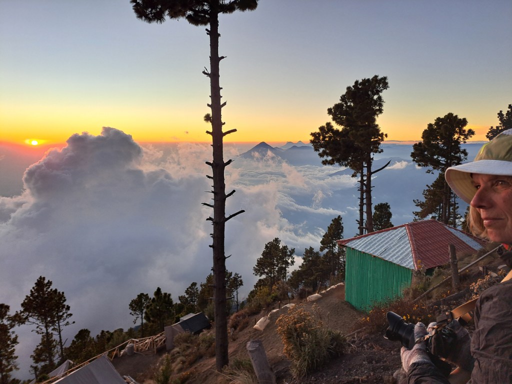
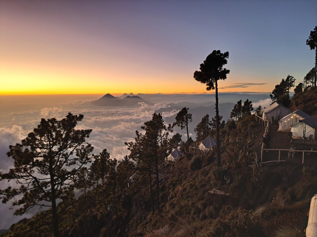
The day arrived. I had to keep my head focused, brain in gear – the next ten steps, the next ten minutes. Keep my head down. Don’t look up – I don’t want to see the bigger picture. Slowly but surely. We had regular stops and snacks but didn’t stop for long. Just keep plugging away. Our guide, Ezekiel, was fabulous. He started by telling us how many minutes it was to the next seated rest area. As we made progress he would tell us how much we had covered and how far to go keeping it all very positive. A stroke of luck was that our tour operator was one of two that had its base further up the mountain side (it has a small camping area, and is accessible by motorcycle). The others’ Ezekiel said were a further hour’s hike down the mountain side. On the climb I chatted to a couple of men and a lady who were on their way down. All three looked nearer our ages than the hordes of thirty somethings that seemed in abundance. The guys said, ‘It’s just a long slog, take it steady and you’ll be fine.’ The lady was equally encouraging. On we went. It was pretty much a dusty footpath the whole way up with some fabulous views – very steep in places and rocky clambering once or twice but nothing remotely technical. We made it in a respectable 4 1/2 hours, to ‘our’ comfy little shed with a fabulous view.
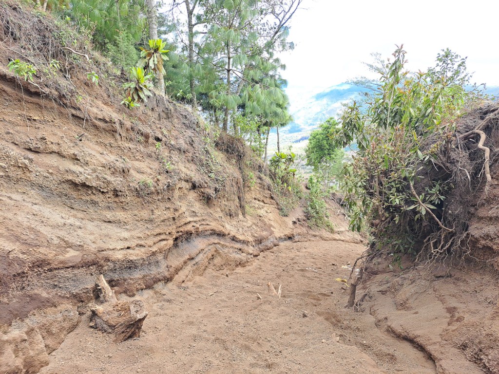
The following morning we made it up to the top. Not quite in time for the sunrise but we still had plenty of low light views. We had decided to have breakfast before leaving camp and taking all our kit so we could continue on our downward route from the top. This would enable us to take a less populated route down, and see different views. After a quick lesson in scree running down a mountainside we bounded down. The volcano’s outer layers are made of volcanic ash and ejected rocks, it’s very fertile for plant life, but also very uncompacted. At times the trail was eroded 3m into the soft surface – the trailside clifflets showed all the layers of successive events. The technique changed to little tip-toe steps down the steep loose sandy gravel. With only one slip between us both proved successful. There are some remarkably dramatic or epic youthful tourist (influencer?) descriptions of the hike online – it’s perhaps a lot harder wearing the wrong footwear whilst trying to Instagram at the same time. While we were both pretty knackered by the end, we weren’t as broken as after the easier San Pedro hike – the training, new boots, and toe care had paid off. In addition, Clare shrugged off a nasty attack of dodgy tummy that she had at the base camp.
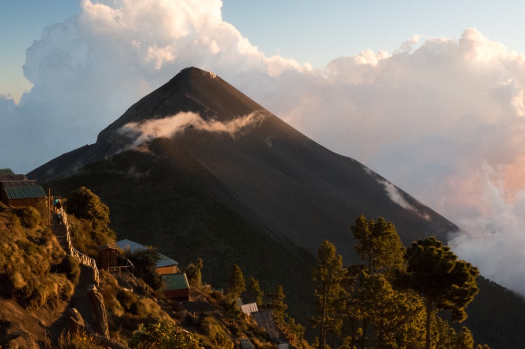
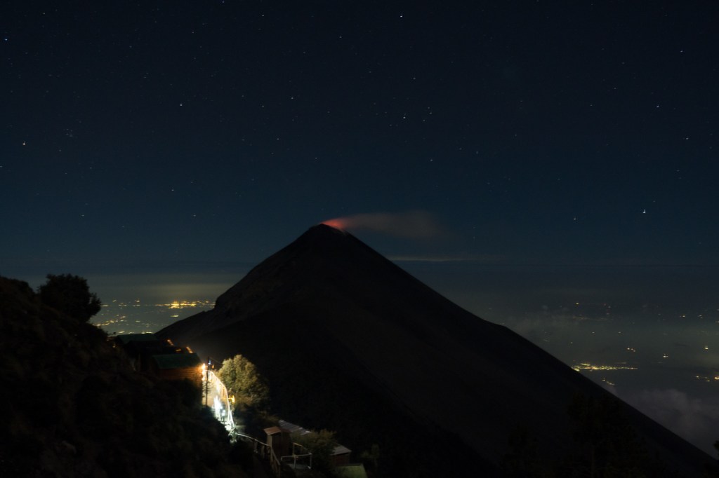
Volcan de Fuego is famous for it’s very frequent low level eruptions – until 18th Jan 2025 – just three weeks before we arrived when it stopped. It has a long history of violent eruptions which resulted, back in 1776, in the capital of Guatemala being moved. Our masseur, a post walk treat/necessity, informed us that it hasn’t been so active over the last twenty years and now they are waiting to see if it’s building up for a big explosion or is actually dormant.
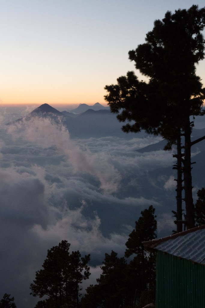
Luckily, girls in our neighbouring hut at the top of the mountain discovered that whilst we couldn’t see any glowing lava with the naked eye that night, cameras and phones could long-expose a red peak (they’re probably more sensitive to infrared than us). During the afternoon we’d been watching steam trails wafting up so knew something was happening. The night before, at 1:15am or so, a tremor had shaken our hotel bed in Antigua, a morning Google said it was 5.5 on the Richter scale. Something was occurring.
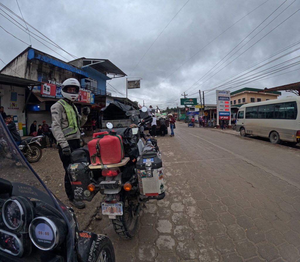
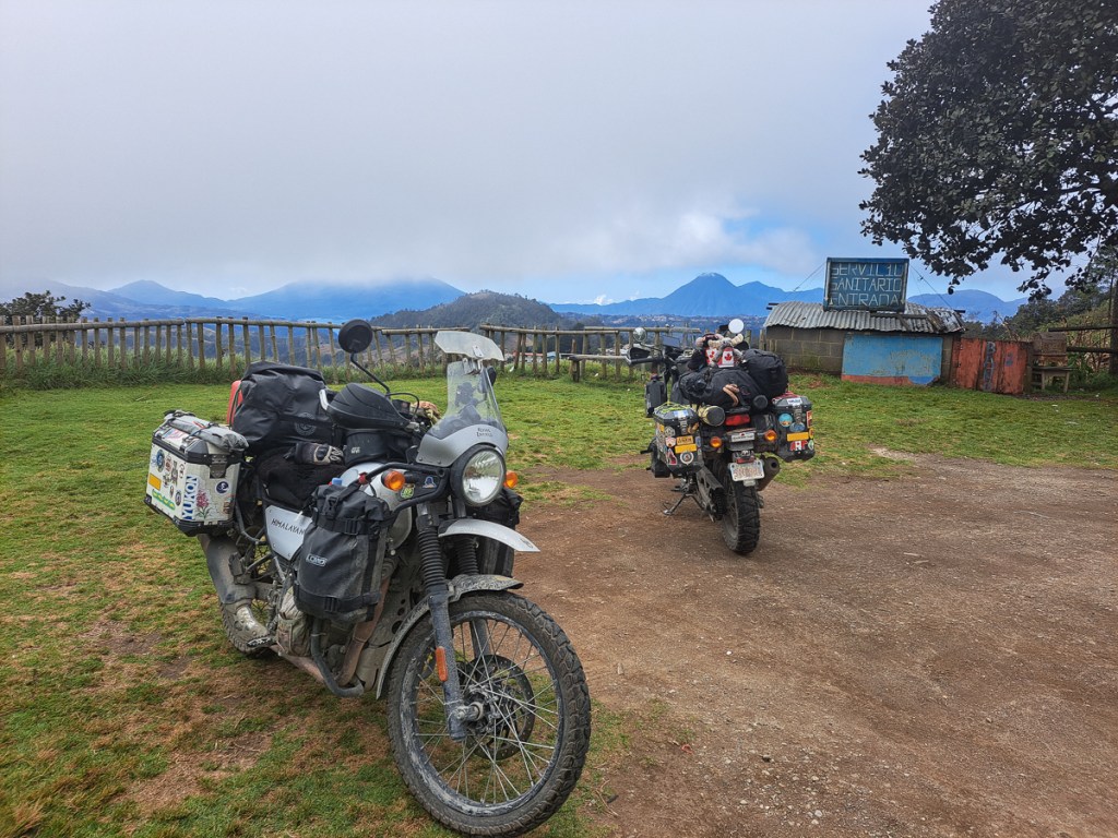
Guatemala – what have we missed? Well, it has to be said that our relatively unadventurous riding style means we didn’t make great loopy diversions amongst Guatemala’s mountain roads and tracks. There’s a lot of fun riding here for those with better skills and bodies. We felt it was too physically risky for us, even when we contemplated hiring lighter bikes and a guide. Even so, of the 90 days we’re allowed in the “CA4”, Guatamala, El Salvador, Honduras and Nicaragua, we’ve spent over 40 days in Guatemala. Most of it stopped in cities.
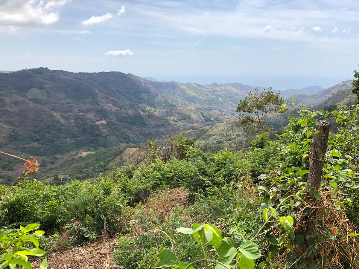
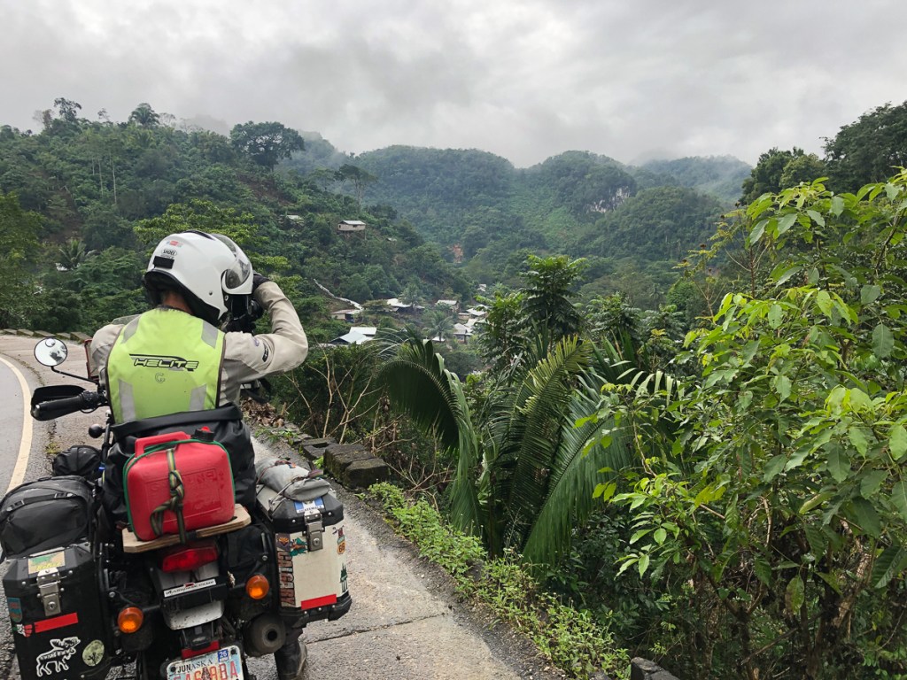
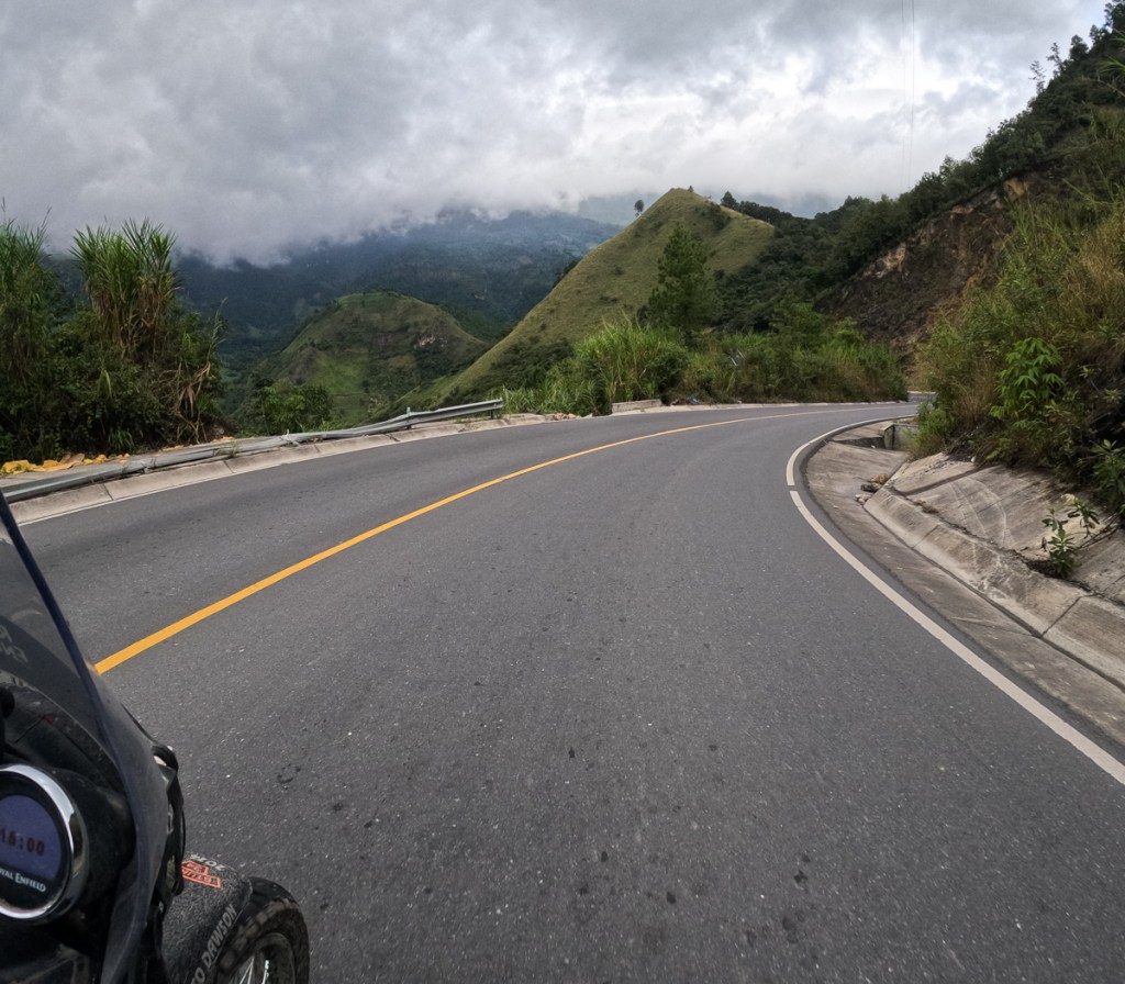
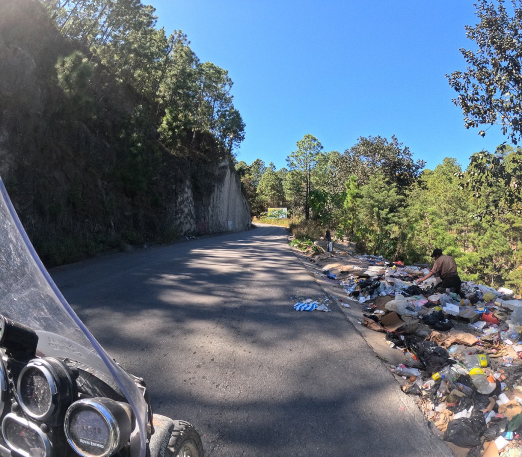
Leaving Guatemala was a strange experience as we had been in cities and towns for weeks. The road to the border was back to rural. Vast expanses of wilderness, valleys and mountains but we were on a relatively busy road, and as is the norm in Central America there are very few places one can safely stop and take a few pics.
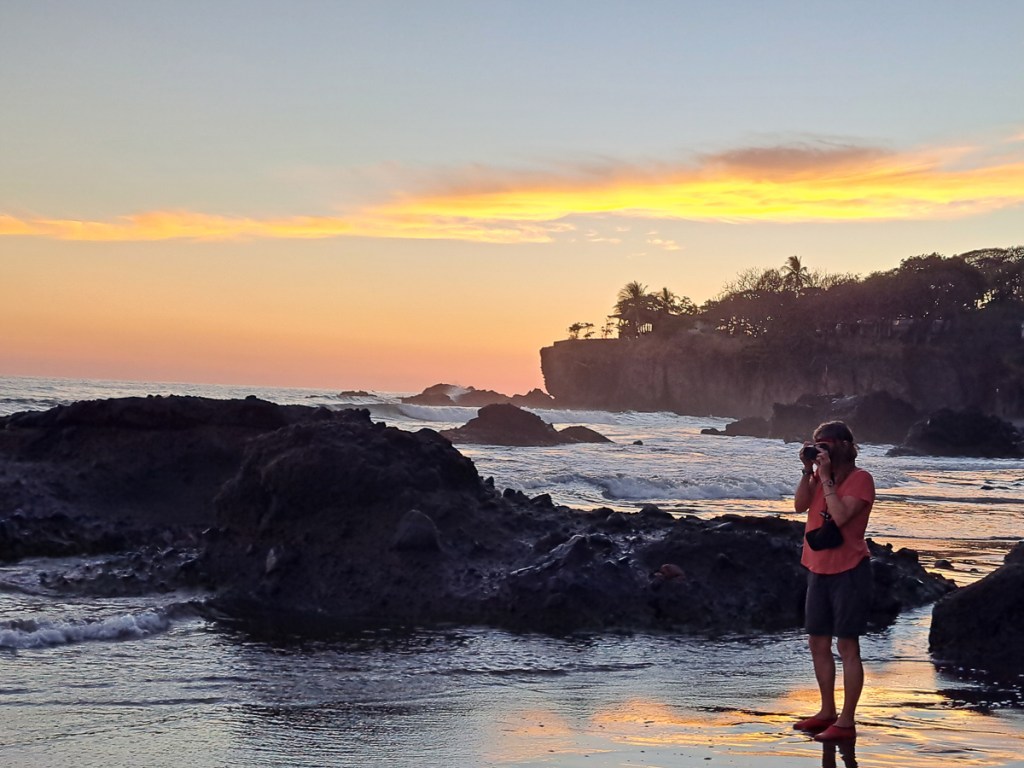
We try and take nice pictures, and occasionally succeed. I, at least, was really impressed by the postcard images by local Marino Cattelan (https://www.instagram.com/cattelanmarino/?hl=en). Lovely. Perhaps our own standards have slipped, or maybe we haven’t the time (great images rarely just happen).
After Mexico, we were lulled into a false sense of security by the smoothish roads in Belize. Except for the road approaching the Guatemalan border. That was full of pot holes, dirt, gravel and was generally broken up in places. At the border the bikes, as usual, demanded more time than we did – numbers had to be checked against documentation- registration and vehicle title, photocopies of driving licences provided, wheels and underneath framework sprayed. The whole process took 2 1/2 hours with the guidance of a local helper, who magically appeared at our sides. Strictly speaking, his services were unnecessary, but he knew where everything was, and probably saved us 30 minutes. No specific fee was solicited, I think we tipped him 50 Quetzals – about £5 – probably too much.
Then – we were back into the bumpy ole Mexican style roads.
Initially we stayed on the main road into Guatemala. The decision was easy as it is the direct route to one of Guatemala’s key tourist attractions – Tikal, which we were keen to visit. After that we went a bit more freestyle.
Until we left Mexico, we had had quite good navigation. My Garmin Zumo XT was the mainstay, and Gid’s cradled and powered Android phone with OSMAnd was backup and a second voice. Both systems often came up with different routes and both maps had a different interpretation of ‘no dirt roads’/’no 4×4 roads’ and other criteria. The Garmin also scores in crowded areas because it verbalises the instructions. ‘Turn right at the traffic lights’ is useful in crowded unfamiliar areas. Although maddeningly, it cuts off the intercom not only while it does so, but for many seconds before and after just at the point when we are trying to discuss the intricacies of our route. OSMAnd verbalises too, but it’s instructions (or mapping) are poor, and utterly useless around slip roads, which it can only display in very limited circumstances.
As a back-up and for planning we always have a paper map, old farts that we are.
But as soon as we left Mexico, Garmin’s North America mapping finished, leaving a blank screen. Occasionally it did show a road but we wouldn’t be on it. It wasn’t a big problem in Belize because it is a small country with relatively few roads. The small scale free tourist map did just fine, although absent from it were the new bypasses of some of the larger towns such as Orange Walk.
Gideon: In Belize we hit quite a bit of rain, so the cradled Android phone was pretty useless. The charging arrangements are not waterproof, and it can’t run all day without power. The Samsung A series phone is nominally waterproof, but water got into the camera, and it now often won’t focus properly. It’s not just waterproofing as such – a phone touchscreen can’t reliably distinguish raindrops from fingerprints. Clare’s Garmin is a totally waterproof device wired into the bike’s main battery and has an outdoors touchscreen (and big buttons), so it isn’t fazed by riding in wet. Thankfully, we’ve just discovered, I can at least download the free Open Street Maps onto the Garmin so we have reliable navigation in rain but now it’s the same data as Gid’s phone, so we lose the useful combination of different mapping systems.
Why not use Google Maps? Well, the basic reason is that one pretty much needs to be online, and in the trickier or remoter areas there’s frequently no signal. Also our IT incompetence and my strange priorities and meanness means that we don’t have a good, mountable, phone which will work on American cellular frequencies. The upside of this is that if some hood does nick one of our phones, we can giggle about their experiences when they try to sell or use it. Clare’s is over a decade old, and its “new” battery holds charge for, well, several hours – if it’s turned off. Mine doesn’t work on American networks, and the camera focus is broken, and has either an expired Latvian SIM, or an expired USA SIM – ideal to leave on the bike.
Speaking of navigation, for those family members unfamiliar with Guatemala (Map here), we entered the country in the little inhabited, jungly, north. Flores is a scenic village on an island, in a lake, in the middle, and Quetzaltenango, Lago Antitlan, Antigua and Cuidad de Guatemala run from west to east along the spine of volcanoes that run about 75km north of the Pacific coast. For the first time on our trip, we actually rode on “the” Pan American. The carreterrewas named on signs. It runs along the north slope of the volcanoes, from Mexico in the NW, out to El Salvador/Honduras in the SE. Most of Guatemala’s 18m population is in this southern part of the country. In retrospect, it’s no surprise that the roads in the north are, err, quite adventurous.
Clare: Heading from Flores down to Xela (Quetzaltenango) was quite eventful. Gid had programmed in the destination and was informed that the 90 odd miles would take seven hours. Cursing the lack of information on the map of Guatemala he assumed that the time required for the trip reflected the mountainous area we were coming into and was quite relieved when he realised he’d set the transport option to ‘boat’. Boat wasn’t so far out. We did wind our way up and down the mountains, the roads were quite little. It was at the bottom of one of them that our road ended at the river. Approaching the tail end of the queue of cars Gid was on my left. I could see the small wooden boat almost full of motorcycles starting to pull away from the shore whilst Gid was looking at the large nearly fully loaded car ferry. ‘We can make it!’ he was saying, urging me forwards. Noticing that the little wooden boat was indeed returning for us I gingerly progressed down the muddy sloping bank none too sure about the prospect of boarding it. Gid, still focused on the car ferry, hadn’t a clue where I was going. ‘The ferry,’ he was saying ,’the ferry!’. Well if that’s what you call it I’m on my way I thought. I stopped 2/3 of the way down none too sure about what I was committing to. Gid by now could see the little wooden boat and was horrified with where I was heading. ‘The Car Ferry!’ he shouted. Too late, half way down a wet muddy bank I couldn’t turn round now. I decided I was going for it, took a deep breath and was internalising ‘Give it some throttle over the metal grid, over the lip at the edge of the boat, then brake hard before I hit everyone else.’ The theory was great. I managed it. I shuffled forward to make room for Gid knowing he would follow. Bless him, he did. The crossing was brief, but about halfway across one of us realised that the boat – floored with loose, gappy, planks – only had a ramp at one end. Sure enough, the local riders, clad in jeans and tees, had all swivelled their 100Kg motos around on the side stand. Oh shit! A loaded Him weighs about 250Kg. Everyone was delayed while we sweated our steeds through 25-point turns wearing All-The-Gear-All-The-Time.
Later that day we still had to reach a sensible place to stop as our actual destination was several hours away. We made the decision to find somewhere to stop at about 3 pm. Plenty of time. The first town we entered didn’t have accommodation with off road parking and it was still early so on we went. By 5:30, and aware that it would be getting dark soon, we were still looking. Just a bit further up the road towards the next town Gid was saying. It sounded promising but an unexpected diversion we were meant to take was blocked off. In amongst a deluge of swearing Gid shouted “next left”.
‘Have you seen it! You are kidding!’ I replied.
‘Well, it’s got to be one of these, it’s a short cut back to the main road,’ he said, urging me on.
We took next left. From the start it was a pretty rough narrow lane. ‘It’s no worse than Mill Lane,’ he assured me, the rough track to our home in the UK. After 10 mins of up and down past houses and homesteads we were about to reach the main road Gid declared. Fast acceleration got us up the next sharp incline but no-one in their wildest dreams could call it a main road. We had an ariel view over the valley of widely spread dirt lanes interspersed with houses and smallholdings. The stone strewn, rutted dirt track under our wheels continued who knew where. We turned back.
Thankfully, approaching the nearest town from the other direction enabled us to see a hotel sign. It had a gated entrance, always a requirement. In we went.
The following morning we had another look at the map and navigation. There didn’t seem to be any reason why OSMAnd had directed us off the main road. The “shortcut” looked ludicrous when we could sit and study it. Gid figured that perhaps the OSM data for the main road had a tiny break in it, or 5 metres of dirt road, so OSMAnd would not route it unless it was allowed to use all the dirt roads (we’ve seen this before, but then the Garmin was working and happy to make sensible compromises). Determined to stay on the main road we set off. It wasn’t long before the surface deteriorated. We had patches of broken road, stretches of gravel and the odd bit of sand. So much so that when we came to a dirt road that was a legitimate short cut we decided to take it. It started off fine and generally was but had some interesting sections of hairpins, gravel, rivulets and ruts. We made our way down the mountain side across the bridge and up the other side. Nearing the top we thought we had made it and were quite surprised to see the road ahead blocked. A policeman directed us to his left waving his arm in a snake like fashion to show the direction of the road. A dust trail to his left confirmed the direction of the road and that other road users were on it. It was clearly a single track lane with very poor visibility because of the dust flying up. We set off not knowing how long this diversion was or what traffic we might meet.
We reached a steep hill and approached it behind a 125 that had come careering past. It whizzed up. Dust flying. Gid was right behind it. ‘1st gear, 1st gear, ‘ he was calling back to me. ‘And plenty of throttle.’ No one was getting up that hill without plenty of throttle but what was about to come down? Thankfully, shortly afterwards we reached to end of the diversion. The poorly surfaced concrete road seemed awesome.
Glamour never rests
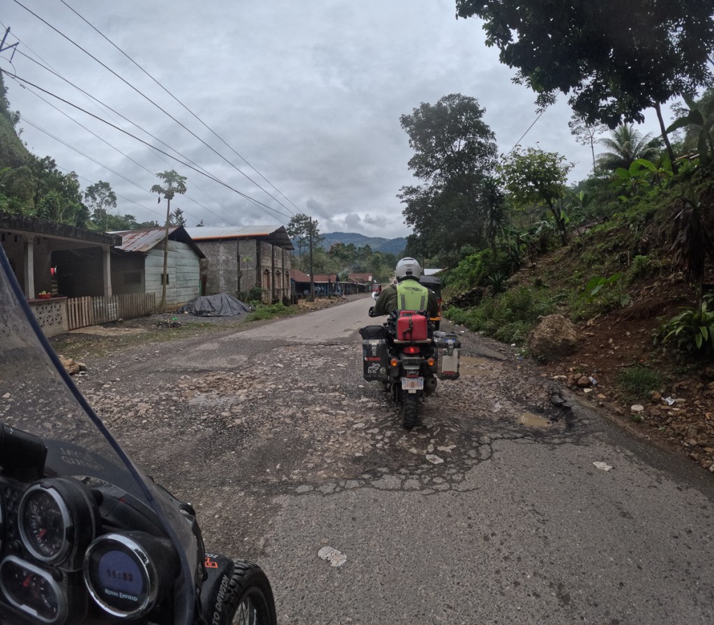
Heading further south in Guatemala we were back on surfaced roads. Belize had offered a respite from Mexico’s endless tupes/speed bumps, but in Guatemala they were back with vengeance. Some are quite brutal – Gid has scraped his bash guard on a number of occasions, and now takes most of them standing.
On the other hand, bikes are a lot quicker across them than anything with three wheels or more. Both us and the local riders get a lot of (slow) overtakes in at the speed bumps especially when they’re one of the few places the chicken buses slow down. Oddly enough, later, in Cuidad de Guatemala where there aren’t speed bumps, we’ve seen quite a few Porsches (I mean real ones, not repackaged Touaregs) – they and similar low vehicles must be pretty much confined in city limits – odd.
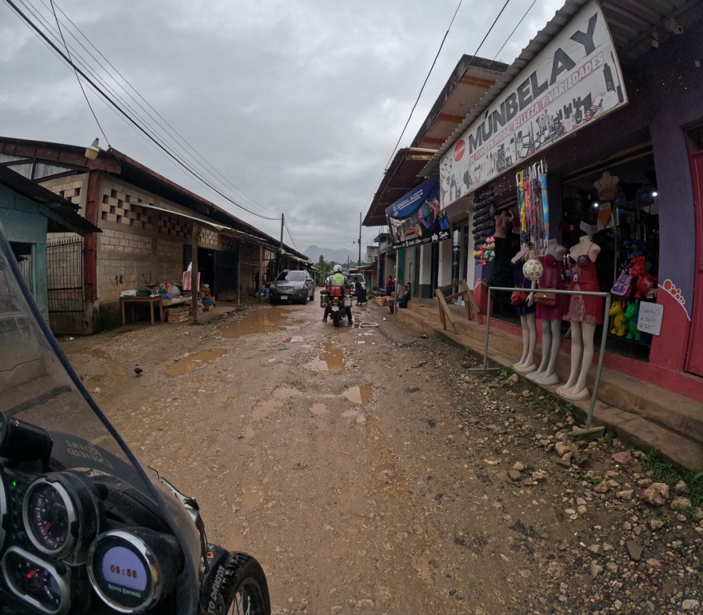
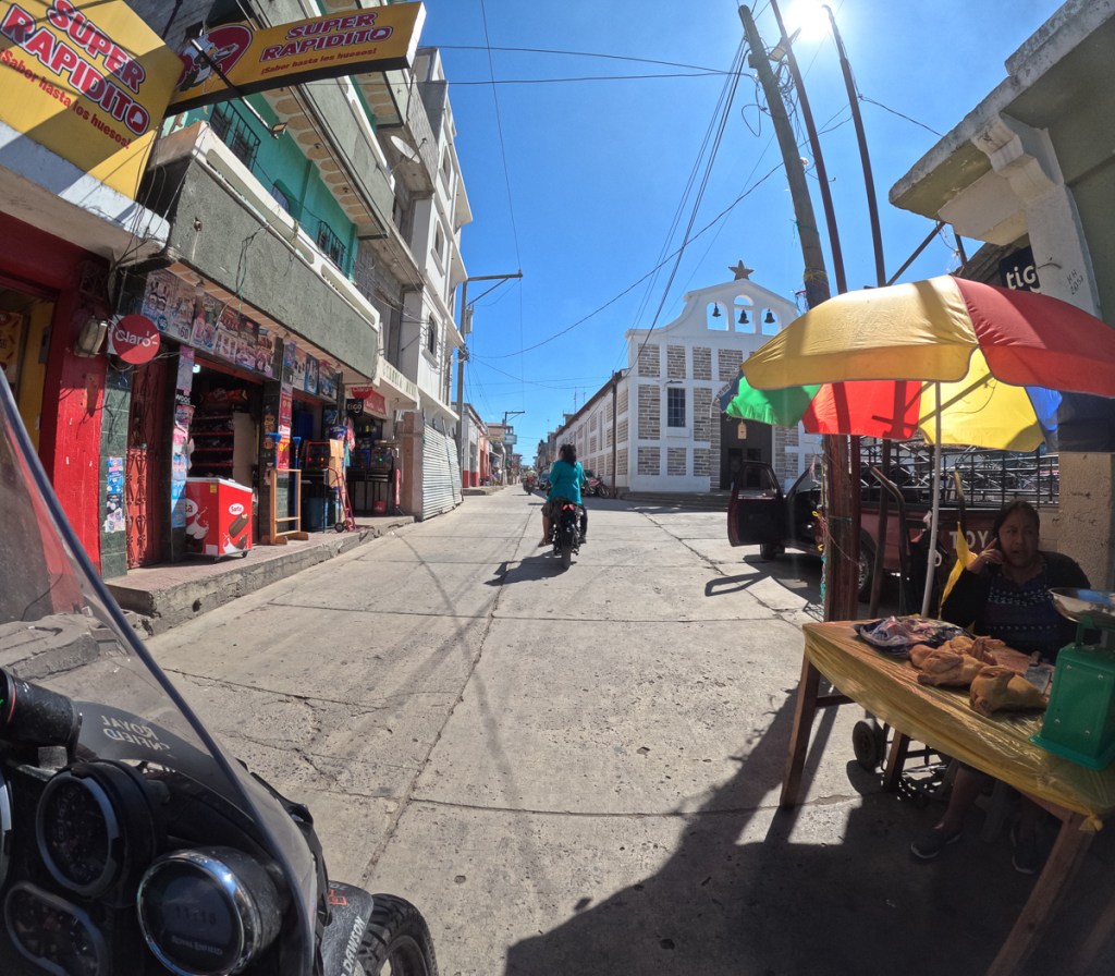
Reaching our destination, Xela, was also interesting riding as in the old town where we were staying it has a great grid of calles and avenidas cobbled with pretty much random rocks. They’re ok at speed, but stuck behind crawling traffic, the bike’s front wheel swerves all over the place. As the streets are so narrow, it’s an irregular grid of one ways, making navigation tricky, and distances much longer than the map suggests.
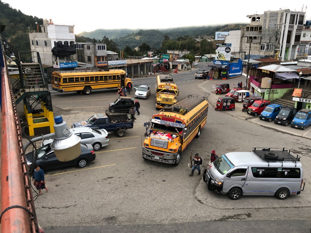
It must have been around this time that we started seeing tuktuks. I don’t think there’s a factory nearby, I think they’re all imported from India. For some reason, they’re almost all red. They seem to thrive in mountain villages, or pueblos & cuidades with tiny streets. They’re geared to labour up any mountainside, but with only half the Himalayan’s engine, and six people aboard, boy, they can be slow. They must be alarming to drive around downhill hairpins, too.
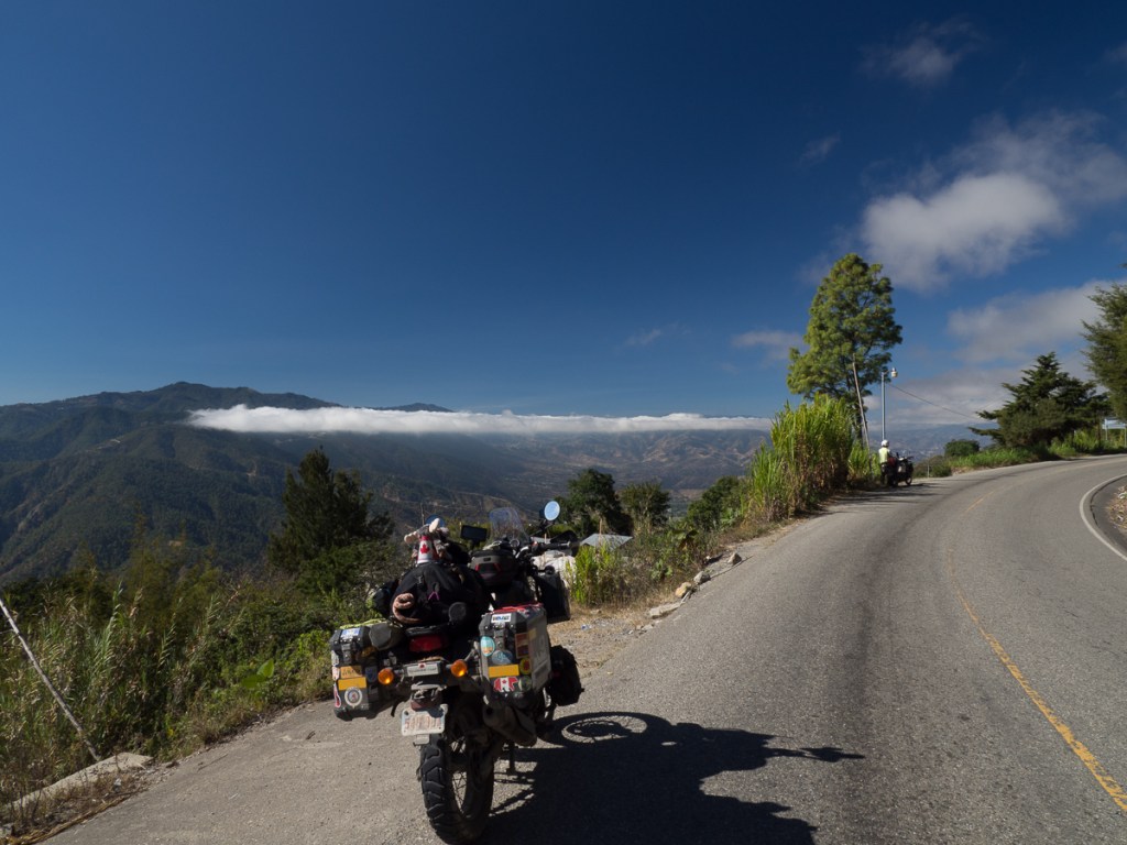
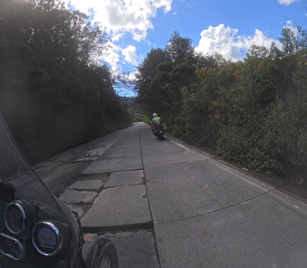
To reach San Pedro on Lago Aititlan from Xela, we turned south-east, aligning us with Guatemala’s volcanic spine. So we encountered the actual Pan American Carretera. Woohooohoo! Here, it’s a mostly well-surfaced dual carriageway. Not, normally, the Himalayan’s favourite domain. But this road corkscrews its way up, down and around the volcanic slopes, and almost all the wiggles are blind, so few folk dare exceed 50mph/80kph even if their vehicle can do so (and many here can’t). The Himis were fine, although a little more overtaking ooomph, or even a lot more, would be appreciated. Still, we tried to exercise restraint: Altogether now: “Drive at a speed that will allow you to stop well within the distance you can see to be clear” (UK HC Rule 126).
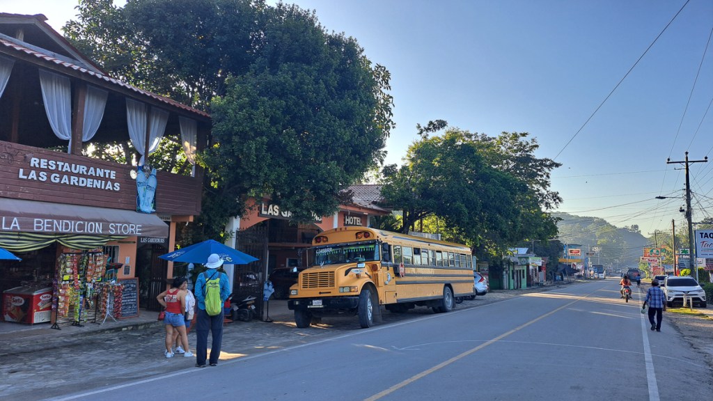
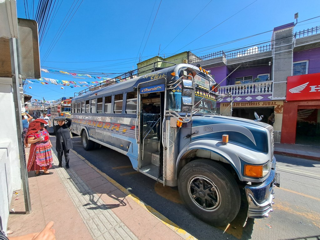
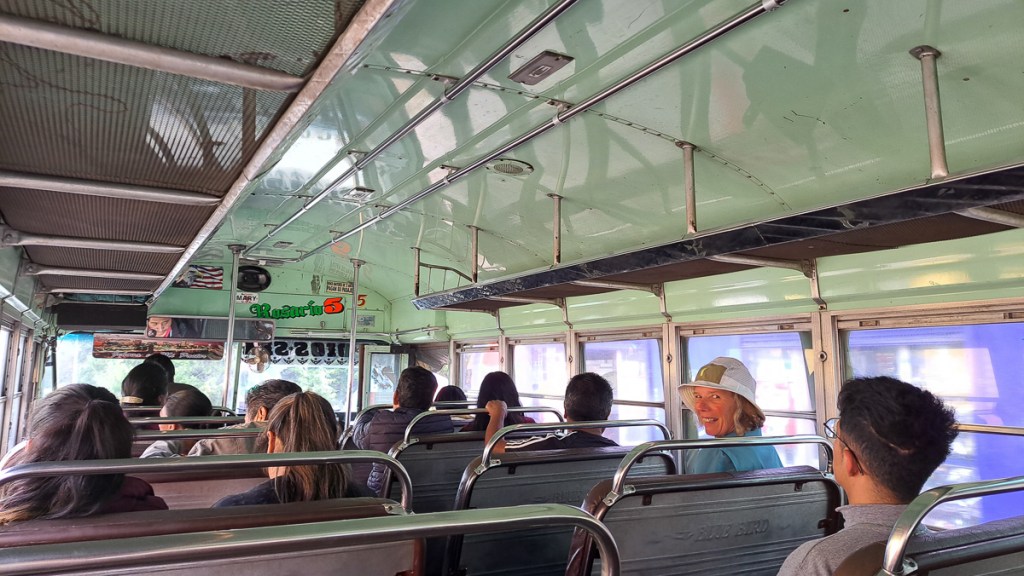
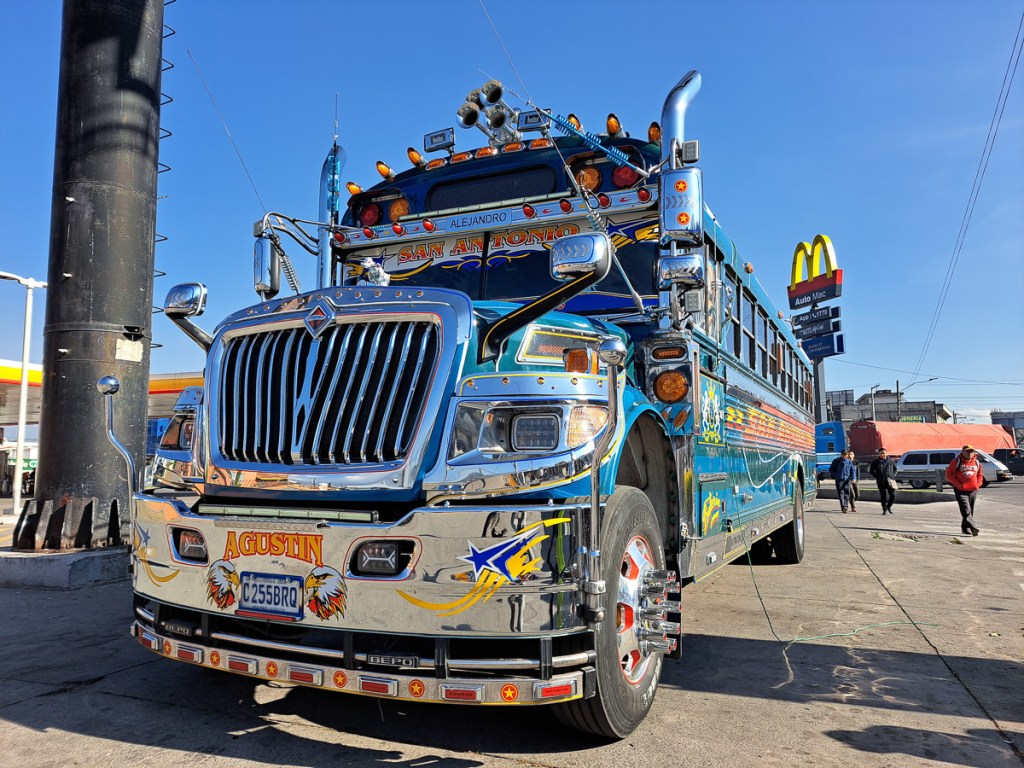
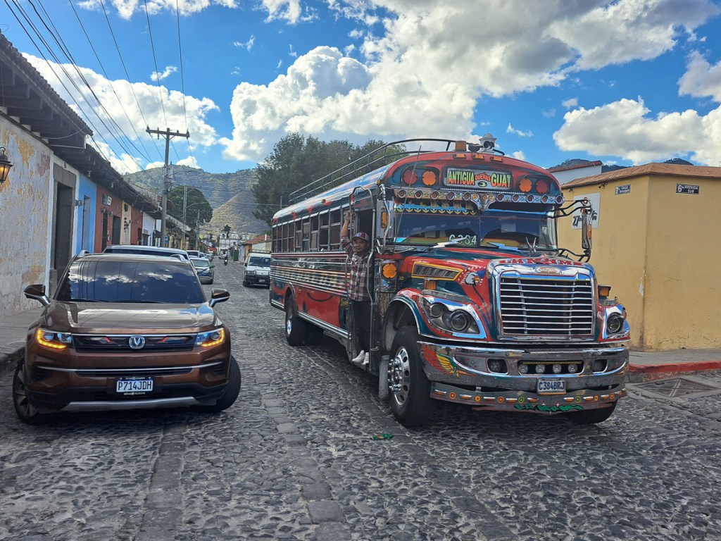
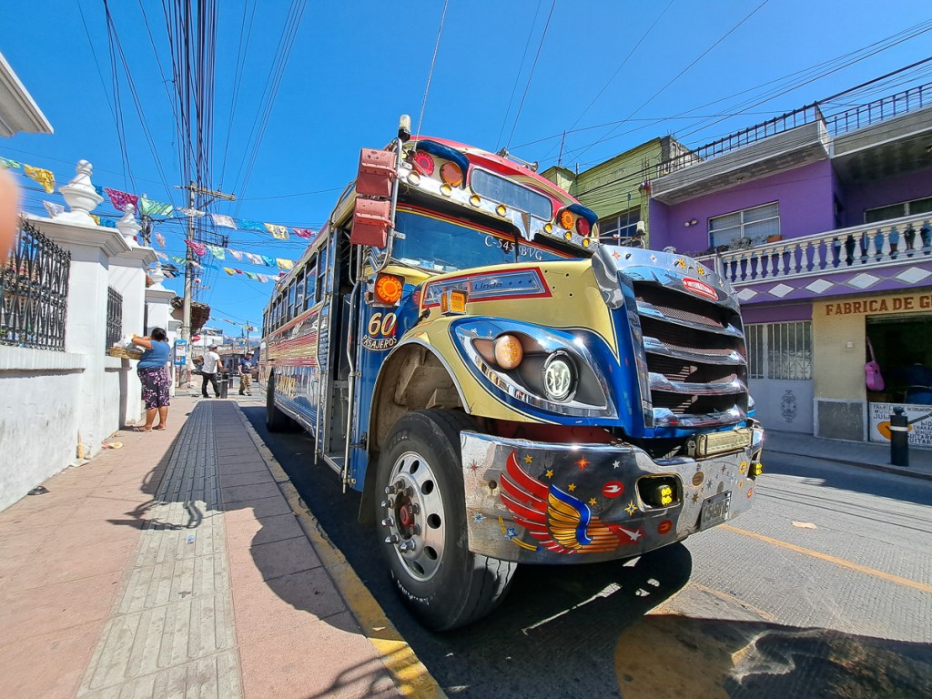
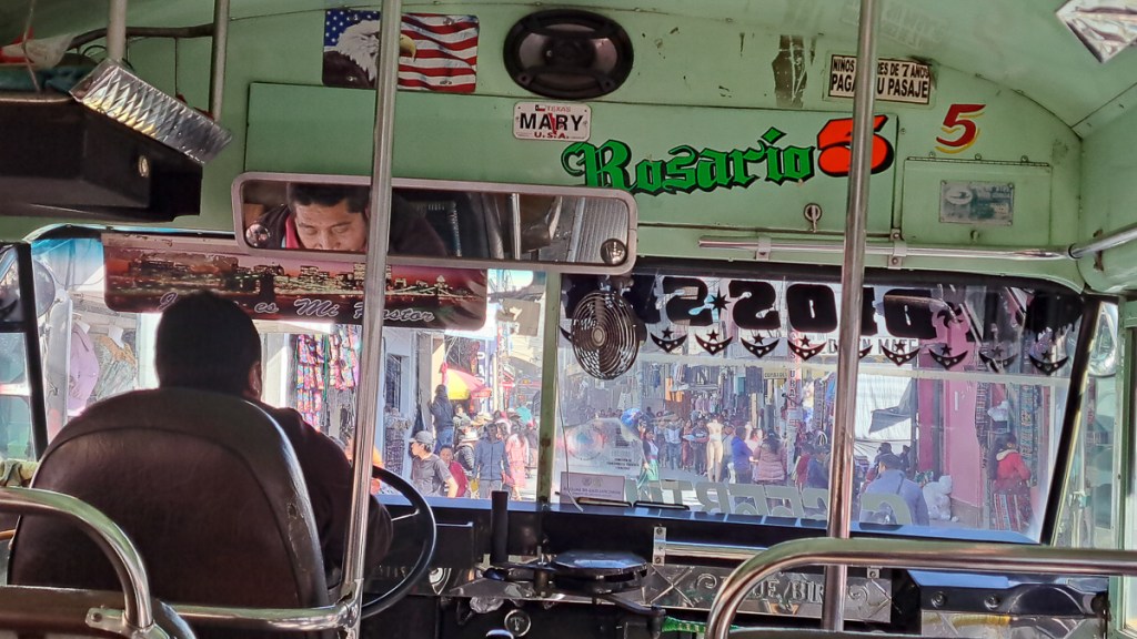
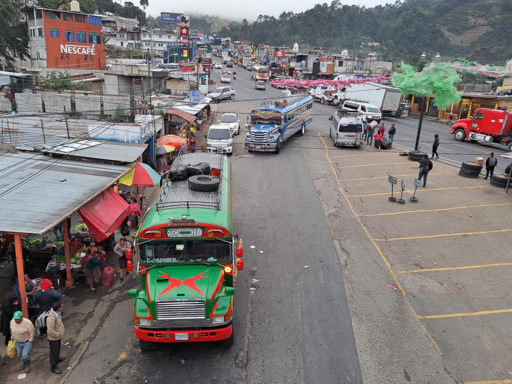
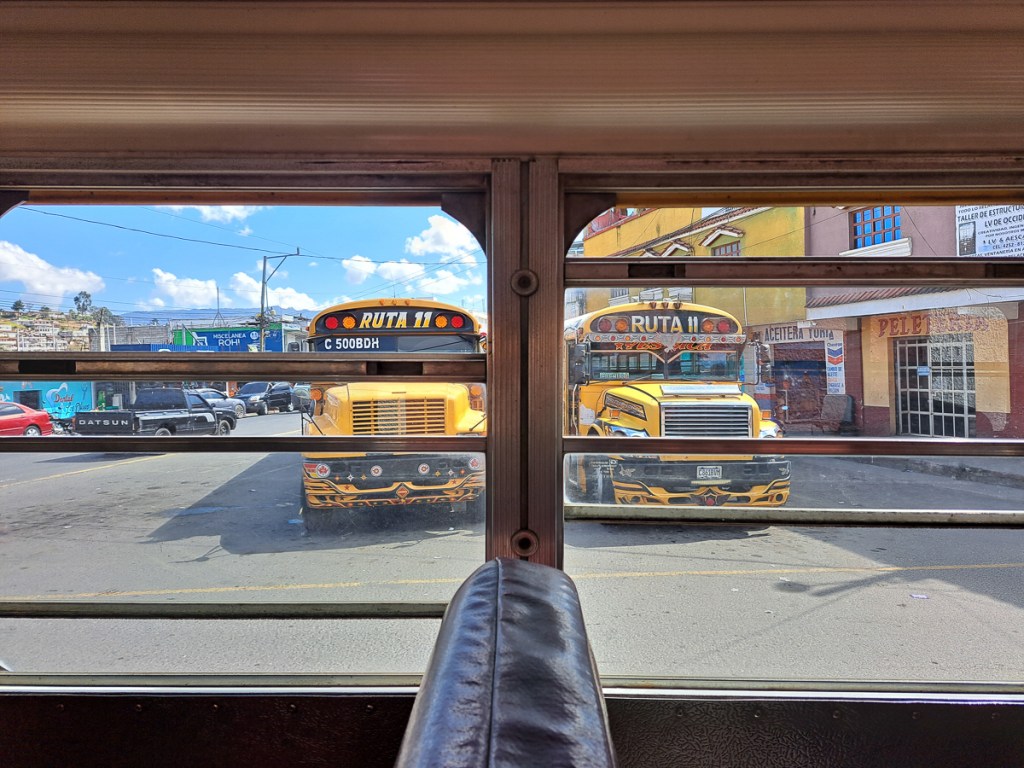
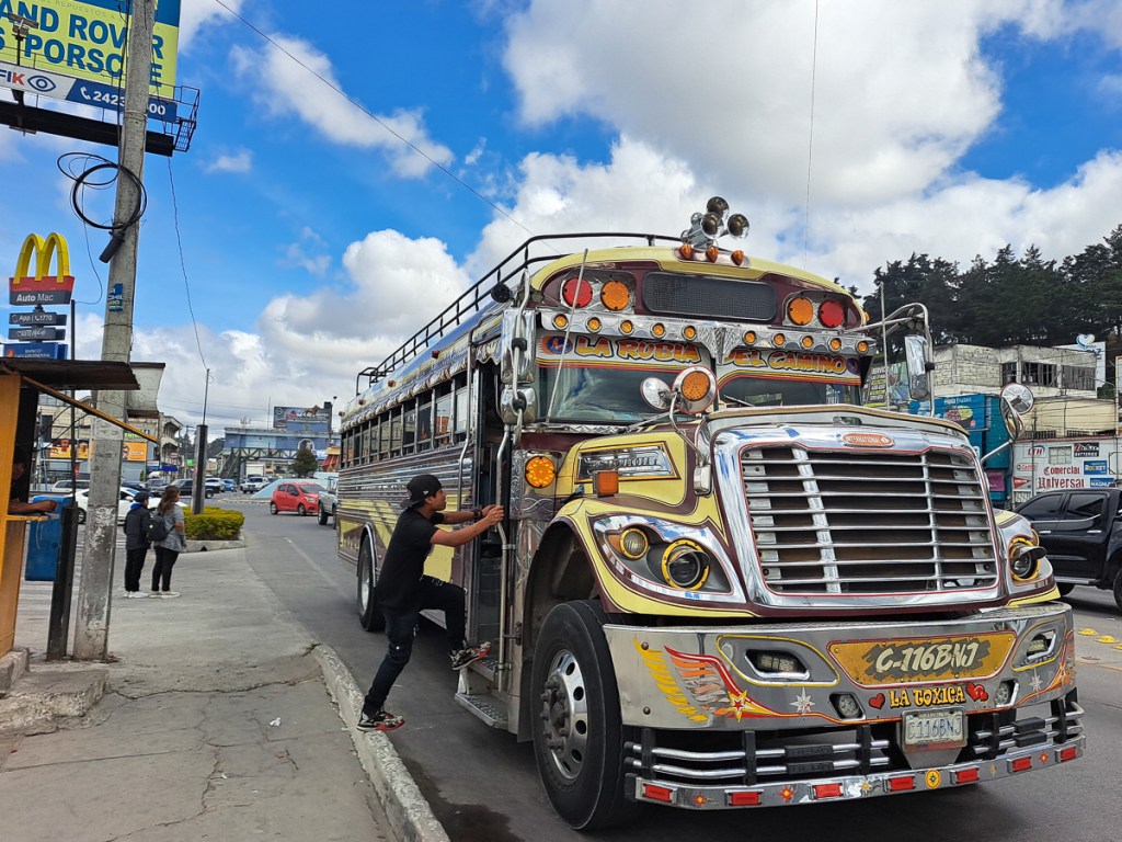
Occasionally we’d be passed, sometimes by a chicken bus – these often belching clouds of black muck from a primitive, or maladjusted (depending on age) diesel engine. USA school buses are tightly regulated, and it seems have to be retired at quite modest mileages and ages. So, like a fair few human retirees, they head south in fleets, and live to a great old age as chicken buses. Often these are brightly decorated, usually they have powerful horns, to blast traffic and alert potential customers. The drivers are not necessarily the most cautious and safety aware of señores, although not remotely in the homicidally obnoxious league of their Indian and Indonesian colleagues (or Aussie truck drivers). So they do tend to hurtle around the bends – after all, the driver saw no obstacle there 2 hours ago, so there can’t be one now, can there? We saw the aftermath of one apparent head-on between a bus and something smaller… the bus seemed to be facing the wrong way at that point. Looked like it’d need a new cab.
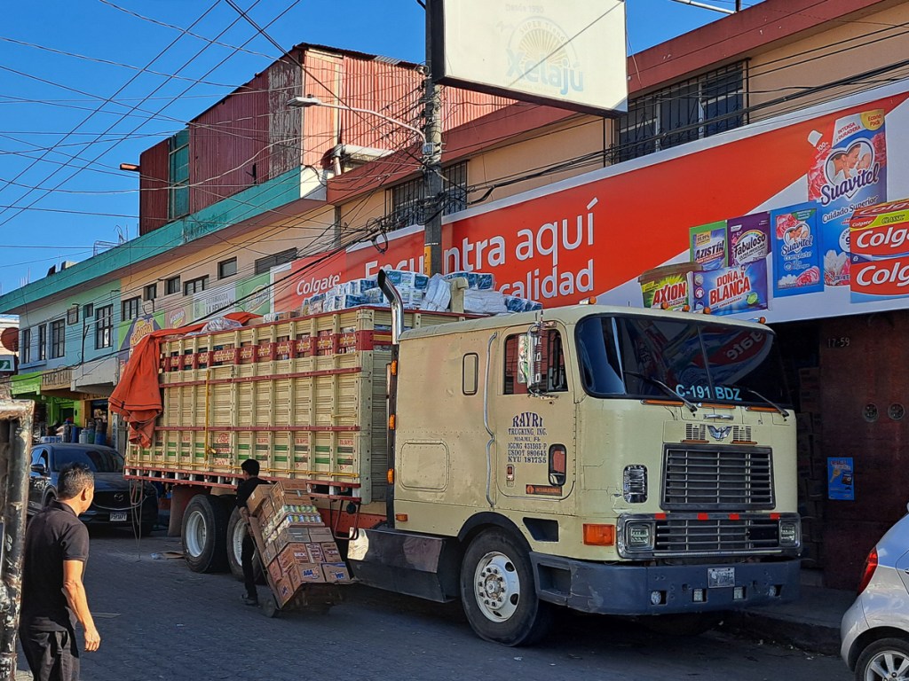
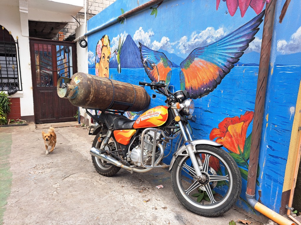
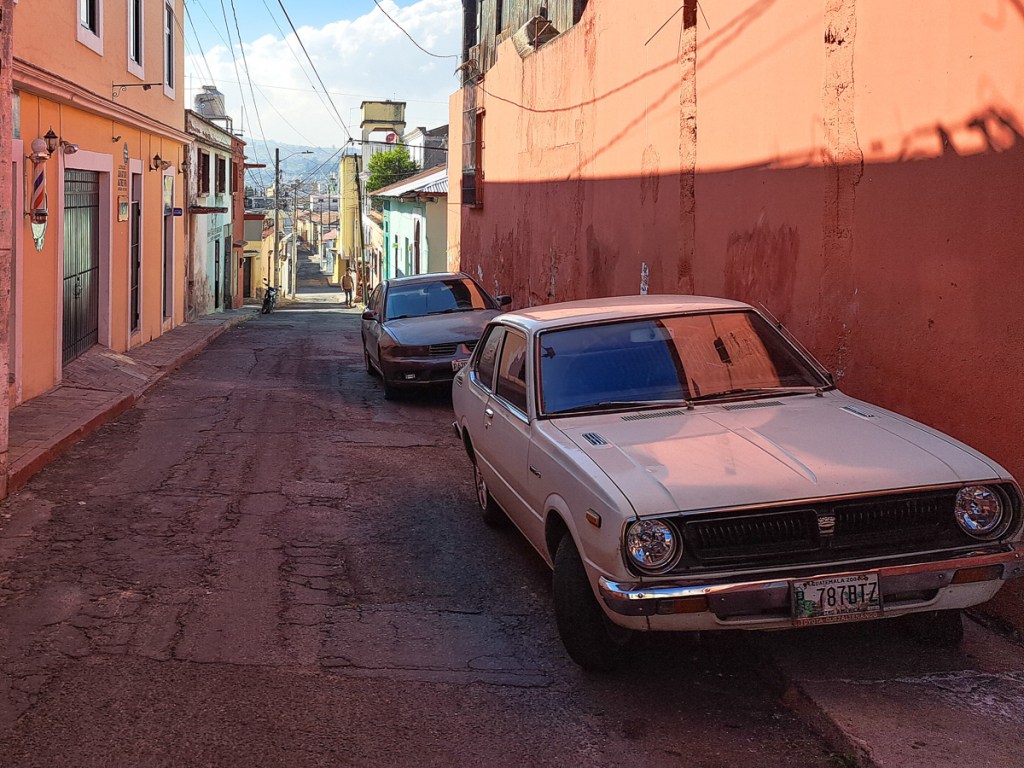
Finally, a few snaps of curios encountered on the roads. If you’re into 70s/80s car and truck nostalgia, or radically optimised loading, there’s plenty to entertain on Guatemala’s roads.
Postscript: Sadly, a week after posting this, 55 people were killed in Guatemala when a chicken bus crashed, and a few days before that, nearly as many died in a bus accident in Mexico. On our way back from our volcano hike at Antigua, our shuttle passed a fatal motorcycle accident, the poor fellow still lying in the middle of the road.


