Our flight to Anchorage was a great improvement over the last time we came here – thankfully. This time all our bags made it too. Based at Melissa’s AirBnb with all we need (bed, space, covered workspace for fettling motorbikes and a helpful host), we strolled over to The Motorcycle Shop (TMS) where Andrew McConnell was very helpful and there’re the bikes. A slick operation later and we’re off to the insurance place. All is good, the quote for us foreigners comes up fine. But. But the actual insurance co only takes cards … that have zip codes. Oops. Cue an afternoon of thrashing about. Unfortunately a Friday afternoon. Which isn’t enough to sort it. Paperwork is sure stressful. But, anyway, we leave with a one week’s cover.
It also turns out that getting a local SIM card isn’t entirely simple either and certainly not cheap. In the UK I pay £6/month for a good enough service. Last summer, in Latvia, my SIM for Europe was about €10/month. Here, there’s nothing below about $30/month. Wow. And the only card we’ve tried so far in my phone, wouldn’t work – we’re told none will. AAT, $40/mo 15GB, works in Clare’s, but what a price!
One gallon milk bottles are a rather daunting prospect for a motorbike tour. Customers are advised that they can only purchase two bottles. Some of the shelves in the store were also running low of stock too. Very covid-esque. Local news told of a propellor being broken on the supply ship which had failed to reach its destination. Thankfully powdered milk was still available. Sorted! But it did start to explain why goods at least are so expensive.
Fully loaded we set off for Seward as our first 300mi initial running in trip. A max of 3000 revs means our top speed is 40mph. We soon observed the signage that states ‘5 vehicles following – pull over and let them pass’, which seemed to work well enough. Gave us time to check out the locals…
The Seward Highway, featured in ‘501 must take Journeys’ is indeed very picturesque. Views across sea inlets to snow topped mountains are all very dramatic but the road itself is rather dull. Although it follows the coastline and gently sweeps in and out my lasting impression is of it being on an American highway – mainly broad with long sweeping curves on the sections when it isn’t dead straight. But at 40 mph it doesn’t really matter. Running in a Himalayan is a slow process.
The Himalayan could be described, as Itchy Boots (an infamous motorcycle tourer and blogger) has said as, ‘under powered and over weight’. That’s rather harsh but probably right. I was highly amused to see that the Owners Manual states a maximum speed of 70mph. It’s low down torque and overall speed make it a perfect bike for mountain climbs with sight seeing. In second gear it pulls steadily up the steepest pass. Even when the throttle is released, because of deeper gravel or a series of pot holes etc., the speed drops off but is perfectly happy to pick back up again.
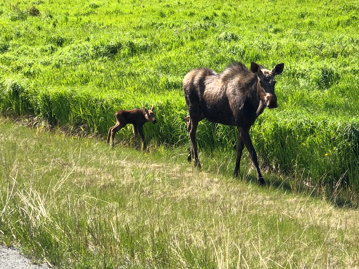
We made it down to Homer, a thriving peninsular with a mix of commercial and tourist activity. A sign displayed that short term parking was no more than seven days but the tourist scene has a board walk of all the familiar niceties- ice creams, snacks, coffees and a few attractions. Undoubtably the star of the day was a bald eagle consuming some road kill perched on a sign across the road. A close second was a moose with her newly born calf we’d seen along the way.

Back from Homer, and our fleeting visit to Seward, we handed the bikes back to TMS for the first run-in 300 mile service. It has to be said shop servicing is expensive up here, especially in peak time – now! But we’re beginning to realise that everything is. Got them back, and spent the next 24 hours adding our previously prepared and brought accessories to the bikes. Gid’s appeal on the ADVRider forum, for loan tools or covered space (posted before Melissa, our host, had offered her garage), raised a few great offers, as well as alerting the locals to the presence of two ‘clueless’ Brits: Thus Mark, a frequent ADVRider contributor, accosted us with a friendly tease about our English voices as we perused the chain lube at TMS. The best offer though, was from Tim, who invited us into his spacious workshop, where we admired his various moto projects before cracking on with final jobs needing tools we didn’t find it sensible to bring. As icing on the cake, Tim treated us to a lesson in tubed tyre dismounting and mounting, for puncture repairs. We hadn’t got around to this back home – our experience is with tubeless and the “worms”.
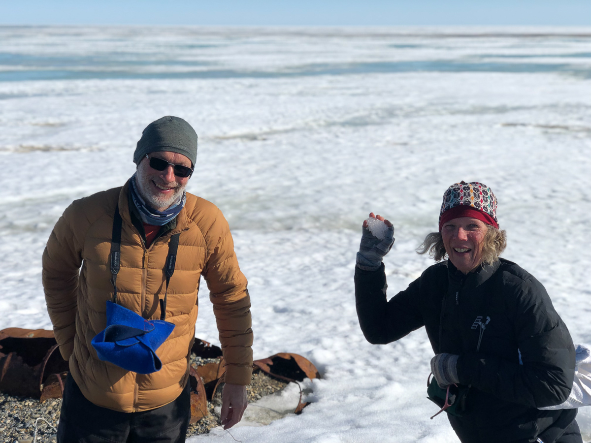
Finally, we set off North. The wrong way! But really (or anally), one has to start at the “start”, and the northern end of the Pan American Highway is Deadhorse on the coast of Alaska’s North Slope.
Dead Horse, the end of the road, is not a town but an industrial camp that supports the Prudhoe Bay oilfields
The Dalton Hwy Guide 2024
Just thirty people live there all year round with an influx arriving for the summer season, although a lot of construction is in the winter as ice is more stable than the ground.
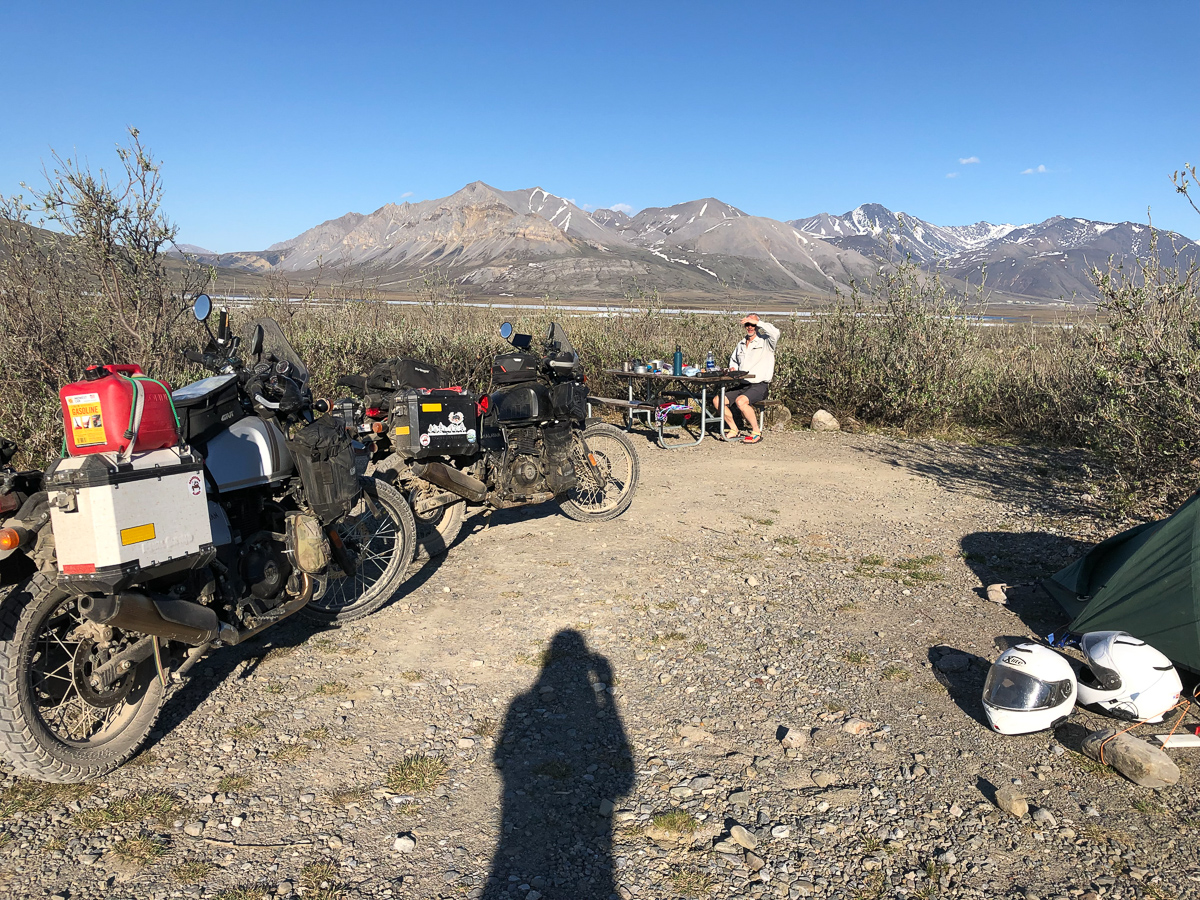
That step north, and back, was possibly the most challenging riding we’ll encounter for many months. It requires carrying extra supplies. Not just food and water but also gas – a new one for us (spot the 2 gallon gas can in the photos). The longest hop between gas stations or food outlets is 240 miles. Gid’s bike runs for approximately 210mi including his tank’s reserve of 50mi. That’s taking it right down to the fumes before topping up from his reserve container. Mine for some reason does an extra 30mi per tank. Obviously my smooth and economic gear changes, optimum tyre pressures, unaggressive acceleration make all the difference! The Camping is (mostly) free though which includes a drop toilet but usually no water unless filtered from a stream: So the bikes were loaded up with gas and drinking water. Once at Deadhorse basic rooms at about $220-$260/night are little better than a run down dormitory block, although with private rooms and comfortable but after a couple of days on challenging roads it had a shower and felt like a palace.
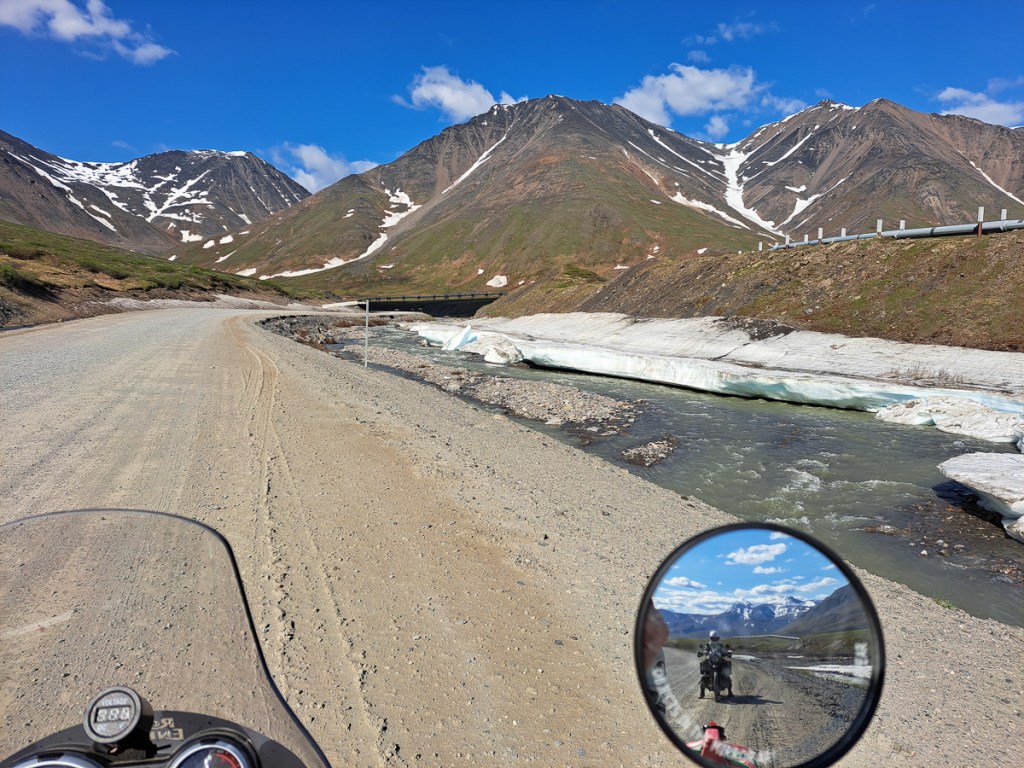
To reach Deadhorse, iconically the start of the Pan American, the Dalton Highway is the only road, built as a “haul road” for the oil industry, and it has a reputation for being challenging.


The road is narrow and has soft shoulders, high embankments and steep hills. There are lengthy stretches of gravel surfaces with sharp rocks, potholes, wash boarding and, depending on the weather, clouds of dust or slick mud, Intermittent sections of pavement can de deceptively smooth, until unexpected and sometimes very deep potholes. Watch out for dangerous curves and loose gravel.
The Dalton Highway Visitor Guide Rev 2024
Dear Reader – don’t think we’re all alone: We’ve already lost count of the number of other folks we met who are also attempting (or, rarely, finishing) the PanAm. In our “camp” at Deadhorse, two cyclists had flown in to start. We met bikers doing it. There are those military looking German-registered 4×4 trucks at regular intervals. Names, alas, have already slipped our minds. There are also many bikers on shorter adventure rides (Short? Rhode Island to Deadhorse – try asking Google for a route) and on tarmac, Harleys and the like.
On our way north, three bikers arrived in Coldfoot, one of the very few settlements and gas stations along the way. They had just come in from the north over the Atigun Pass, where the Dalton climbs over and through the Brooks Range. There, the guide book informs us, storms can dump snow at any time of the year. They looked worn out. Conversation sparked off and one chap exclaimed that they had had a really difficult time getting up the northern side of the pass to the elevation of 1422m as they had had to cope with thick mud. Their bikes were certainly extremely dirty. He paused for a moment and said that on reflection it had been worth it but we should expect a tough time.
We had a couple of hours or so to ride before reaching the pass. Our route up seemed fine but we’d been warned that the northern side was much steeper and that we could expect the temperature to drop significantly. From our own monitoring of the recent weather forecasts of the area up to Prudhoe we knew we could expect fog or freezing mist. Temperatures further north at Prudhoe had been as low a 1 degree C. Freezing mist would be a new one on us.
Both of us must have been pondering the ordeal to come and how we would fare. We had contemplated doing some off-road courses this last winter but the weather was so wet in the UK and our bikes at home were fitted with 70/30 tyres, not knobblies that are suitable for mud. Gid on his first off-road effort back in the UK covered 100m before sliding into a tree, whereas, on a different occasion I had made it a whole 10m before the front wheel slipped away from beneath me in mud. Our bikes, now fully loaded, with the same 70/30s tyres weren’t going to cope well in extreme mud.
Our trip over the Atigun Pass was awesome. The wind and strong sunshine had dried out any mud and the truckers had flattened it. We only saw the merest hint of mud. My concern was burning my brakes out on the way down the steep mountain side. In fact, we were lucky with the weather the whole trip: No mud, no snow, and the freezing fog burnt off at Deadhorse, giving a clear view of mountains 120 miles away.
I was retelling the tale to a cheerful flag man who controlled traffic at one of the road work stops. With large machinery working along the road passing traffic is guided behind pilot trucks through the road works. He proclaimed in a slow American drawl, ‘That ain’t thick mud’. He continued with a broad smile across his face, ‘But they like their story so we’ll let them run with it.”
One week earlier, he exclaimed they had had 1 1/2 foot of snow in a day. ‘It only cleared a couple of days ago,” he said. The snow and subsequent ice had been the cause of a wide-load trucker veering off the edge of the road down the embankment. We’d passed that a few miles back. Its load of pipes had already gone. The truck itself would be salvaged just as the other three up ahead had already been retrieved.
Our spin chilling moment was when faced with crossing 20m of freshly tipped rubble, forming a low berm along the centre of the road. The side-dumper truck, whose load needs a vehicle with 16 axles along its 20 metre length, was blocking the lefthand carriageway. Our pilot car merrily jumped and bounced across it. Well … we made it! But not without some heart stopping moments as the bikes bucked and jerked their way across. On our way back this memory was still with me but there was no sign of where the work had been. All was smooth and flat. I shouldn’t have been surprised as the Dalton Hwy had taken a mere 159 days to construct the entire length of the road back in 1974, describe by many as a ‘momentous feat’. Of course they’d finish that bit in 24hrs!

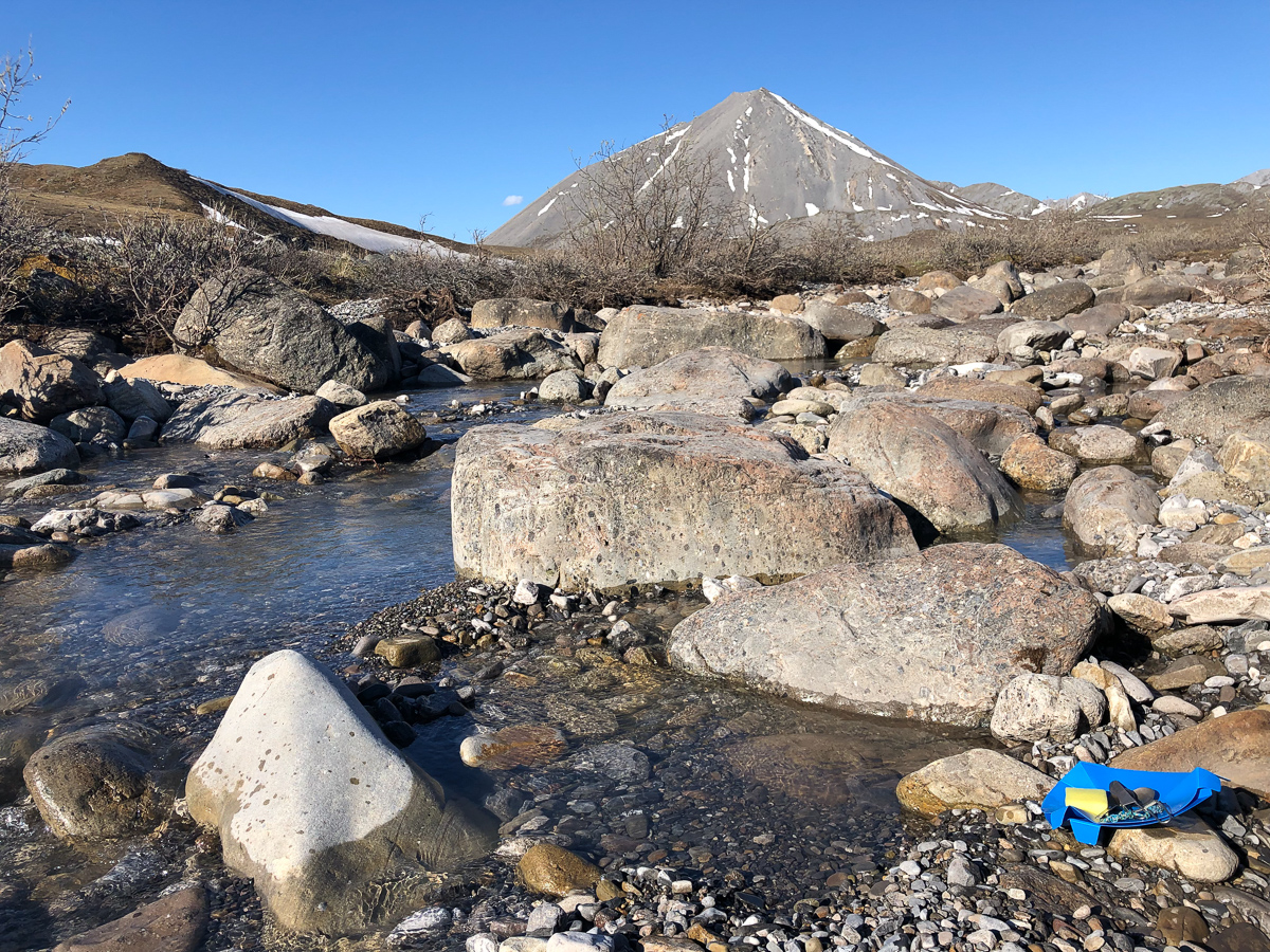
Most of the campgrounds are provided by one or other of several apparently competing public bodies, and follow a formula of lots of space, gravel to pitch on, a sturdy restroom hut with pit toilets, picnic tables, bear proof rubbish and food bins – and that’s it. Usually no water supply other than treat it yourself from a stream. On reaching Galbraith Lakes, a fabulous spot in the lee of the Brooks mountains on the slopes down from the Atigun Pass we realised we didn’t have enough water. A previous campsite had got the water filtration kit out of the packing. Using our tiny hiking/emergency filter confirmed it as a back breaking lengthy process. Signs at Galbraith stated that the stream leading into the lake was highly contaminated with giardia. Either, boil the water rapidly for 5 mins – our biggest saucepan is 1.5 lt and how much gas have we got? Or, filter it to reduce the risk. Yep, we’ve got a filter. We decided to ration our water.


Most campsites provide bear proof rubbish bins and food lockers but on one occasion the food lockers were missing even though a sign declared that there was bear and wolf activity in the area. Gid cunningly fitted his food panier with an alarm exclaiming, ‘That should be enough to scare them away’ Revisiting the panier a little later it all seemed to work ok as off went the alarm. Equally, he’d lined he entrances to our tent with throwing rocks in case of a bear or wolf attack. Relieved at our cunning we relaxed into a deepish slumber. It wasn’t ’til the morning when I went to retrieve our breakfast that we learnt that Gid had failed to reset the alarm.
On the northern side of the Brooks range the land is cold, flat, featureless Tundra. Very little can grow. The permafrost 1ft down limits the depth of roots and the resulting height that bushes etc can grow. The plants have developed strategies to deal with the harsh conditions. Some of the spruce trees although they look emaciated might well be 100yrs old. The dark buds of the Blackish Oxytrope plant absorbs the sun’s heat at the onset of spring, whilst still under the snow. Thus warming and melting the surrounding snow to get a head start.
At Galbraith lake we spotted our first caribou. It was a snow patch that moved which was pointed out to us by a Wild Life and Fisheries ranger who was there with a group of children. Caribou eat lichen which is a nutritious, high energy food but in the last few years the snow has melted during winter and frozen leaving the lichen covered in ice. With their food source inaccessible the numbers of caribou have adversely suffered.
Further north we started to see muskoxen. The art of spotting them if they weren’t near the highway was to look for semi rotting hay bales. Voila – now you’ve spotted muskoxen in moult.


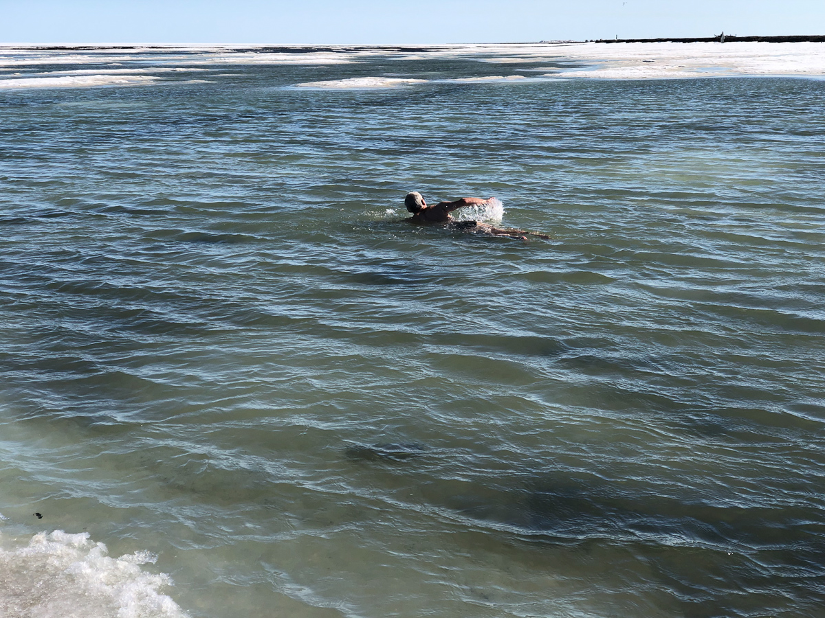
We survived the Dalton Highway! And, of course, got a few stickers.
