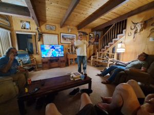
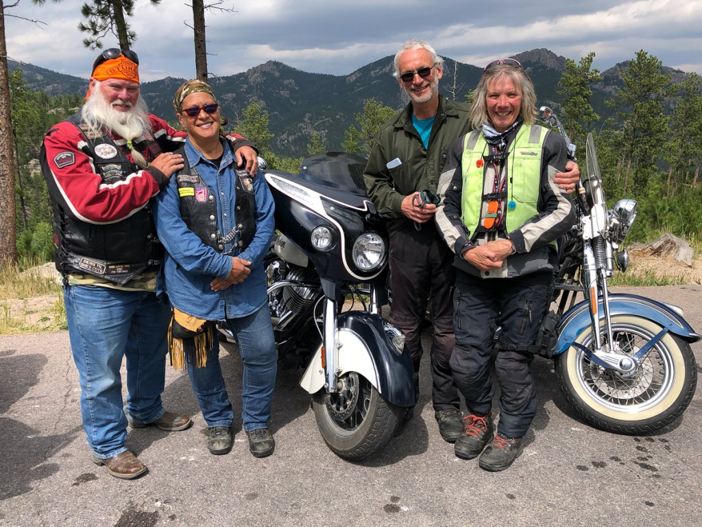
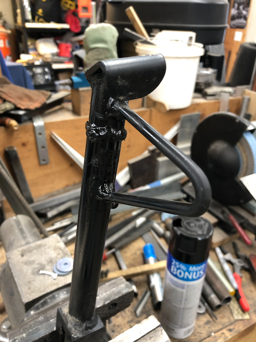
After Reno & Lahontan, we stayed for a few days with our new Bunk-a-Biker host Brian in his mountain retreat, while Gid fiddled with chains, sprockets and swingarms in the garage. It was a great place to be, surrounded by trees up in the mountains in a very quiet area outside town. He had a couple of friends staying and between them they made a comedy trio. Brian was the straight man, Larry the feed and Charlie the clown. It was great fun to be around them. Especially the evening they polished off a bottle of whisky – perhaps a little bit more subdued the morning after.
We were watching baseball the following day and I asked about the superimposed rectangle that kept appearing on the screen and the commentator’s words. ‘That’s a strike!’ Brian stood in front of the TV explaining the rules of baseball. He was simplifying the rules but very focused on giving an accurate account.
Larry interjected, “She’ll never understand that just say it’s this”.
‘Will you be quiet and let me explain!’
Charlie was bouncing about in his chair, chortling and throwing in the odd word just to stir things up.
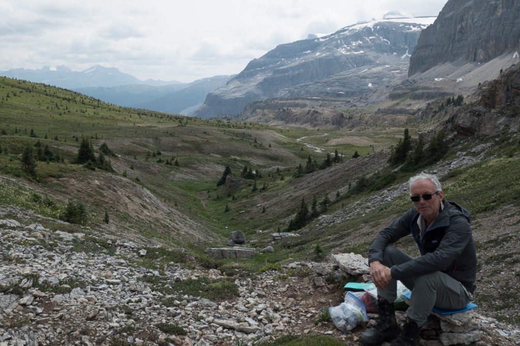
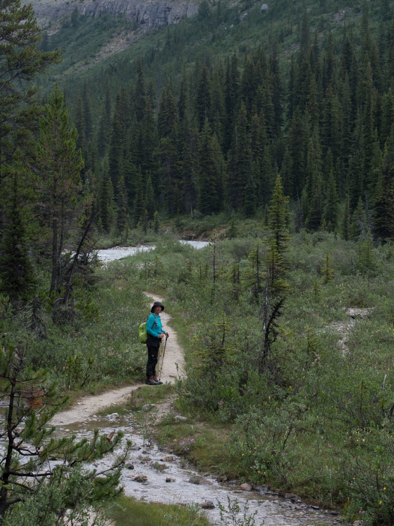
When leaving, the trio very kindly led us out back into Tahoe National Park – it’s bigger than just the lake that we disliked in an earlier post. When they had offered to lead us out I was most concerned that we would hold them up. Their bikes were powerful Harleys and our best speed is 50+. Winding up and down mountain passes we’d be even slower. ‘That’s ok’, they’d chorused. ‘The speed limit is only 50 and no one can go any faster on those roads’.
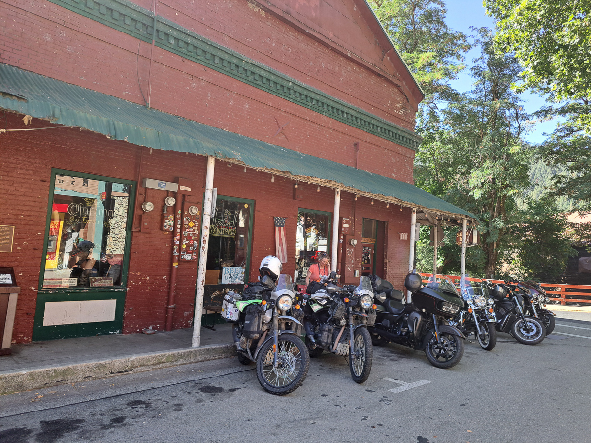
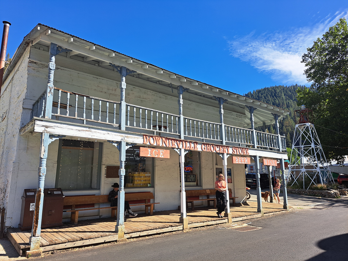
En-route we pulled into a layby to admire the view. Across the gorge was a great view with snow clinging to the mountain tops. We wound our way over the top and down to the breakfast stop. A delightful little old village called Downieville, I wandered off to look at the gallows. The only gallows in America that are still functional the sign states but the one and only hanging was back in 1884.
Following a great breakfast with the lads, four of them now as Richard had joined us, we wandered off to see the town as they set off to do some serious biking. We had our route plotted out – firstly north to the Lassen volcanic park before heading west on the US 36. It was the best road to the coast was the unanimous decision. And no Gid, you couldn’t cut the corner off to reach the Redwood National Park quicker. ‘You’d be missing the best part!’
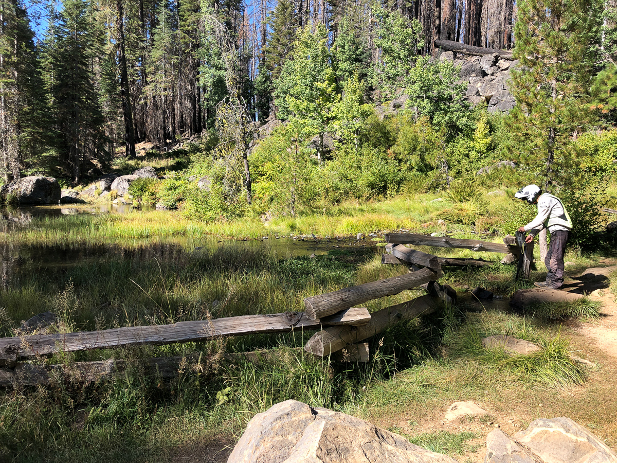
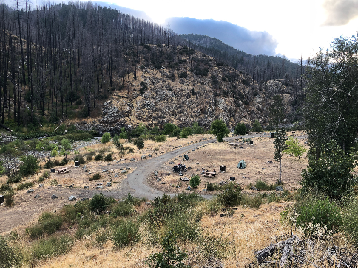
We didn’t do the volcanic park justice. We should have turned right to take us further into the park where we would have seen geysers we’re told but we hung a left more focused on finding a campsite as the daylight was drawing in. The official campground was shut for maintenance, but there was free “dispersed” camping all around, informed the local lady filling her water bottles at the water spring. The only difference really is the lack of a drop toilet (so dig a hole), and a park bench (what are we carrying these chairs for?). So we filled up our bottles and camped.
Dutifully we went the long way round on the 36 and yes it was worth it. Again we went through gorges, valleys and over mountain tops but this time the trees looked half dead but not burnt. The leaves across most of the leafed canopy looked crisp and dull whilst there was a vibrant green sprig somewhere at the top. Were the trees dead or alive?
Trundling along the US 36 heading for the California beaches I was having a rave. ‘Surfing USA – trala la la la’. The odd riff that I remembered from the Beach Boys hit was on replay at full volume – in my head. It was party time, giggling around in my saddle. No 200Watt speakers like the Harleys had – perhaps that’s just as well.
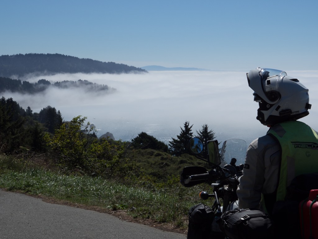
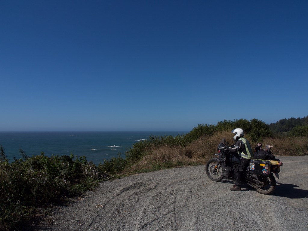
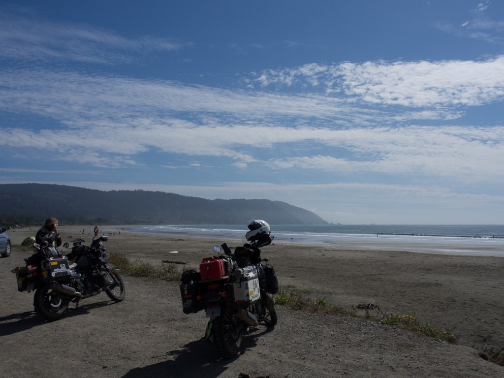
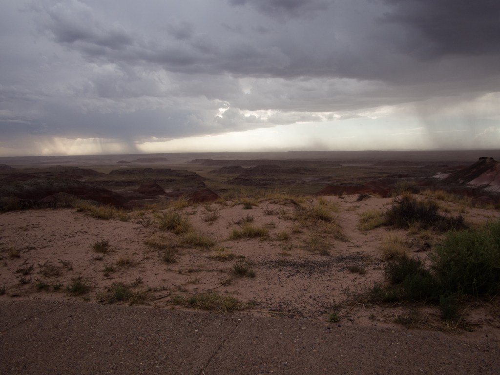
We smelt the sea before we saw it. At Fortuna we’d stopped to put on extra clothing. Down this low by the coast it was cold. Perfectly obvious when you think about it but it hit us as a bit of a surprise. Now heading north up the coast we were equally surprised by the mist. The whole reason why the Redwood trees thrive in this area is the moisture from the sea mist. It keeps the canopy damp. Ferns, slugs and the trees thrive. Our preconceptions of California faded when we saw the beaches – scenic, but minimal waves this week. The few surfers, well dressed up in wetsuits, to keep the chilly California Current at bay were floating around on their boards. Equally, the local towns looked as though they weren’t much benefiting from California’s famous wealth.
OLYMPUS DIGITAL CAMERA
OLYMPUS DIGITAL CAMERA
Camping proved challenging as the National Park was fully booked, we’d arrived at a weekend again – when will we learn? We went further afield to pitch our tent and became tourists for the week exploring the coastal region on foot as well as by bike. The scenic drives were awesome and neck breaking constantly looking up. Yup, they’re big trees.
Our route on down to San Fransico was quite an adventure but the bridge itself was shrouded in mist. Brian was there to greet us at his San Fran residence where later he took us out for a fabulous tour of the city.
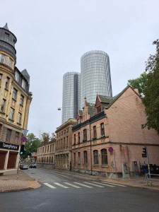
Now then, I understand that any literary project (!) needs a theme, or a focus. Well, the theme and focus of this posting is, it’s the bits which interrupted the flow of the narrative in the previous articles. Those are the bits we haven’t photos of – the extensive, super-low-density cities, where scarcely a human is seen, outside an A/C building or an A/C car. Frustrating on a motorcycle, one’s ears might be worn away pulling the helmet on and off – not that said item is compulsory in the mid-west, and one can understand why in this heat. It’s not at all about the very unfriendly Reno Sprouts supermarket whose security ejected us from the car park when we tried to eat the food we’d just bought there, oh no. Well, we are, I suppose, vagrants.
At the time of starting this post, we’ve taken a slice through the mid-west from border state Montana down to Flagstaff in Arizona. Then we’ve turned around and made our we northwest to Reno, Nevada, en-route to picking up the Pacific coast for our run down to Mexico. So it’s a good time to review our mid-west.
The national parks, wilderness and wildlife have been spectacular. But there’s also loads of interest in the not-famous bits: The highways, the quiet towns, the ranges of hills. And, it’s a motorcycle trip, so every so often someone will have to get all anal about bikes. Well, you can guess who writes now, fingers still black from oil changes.
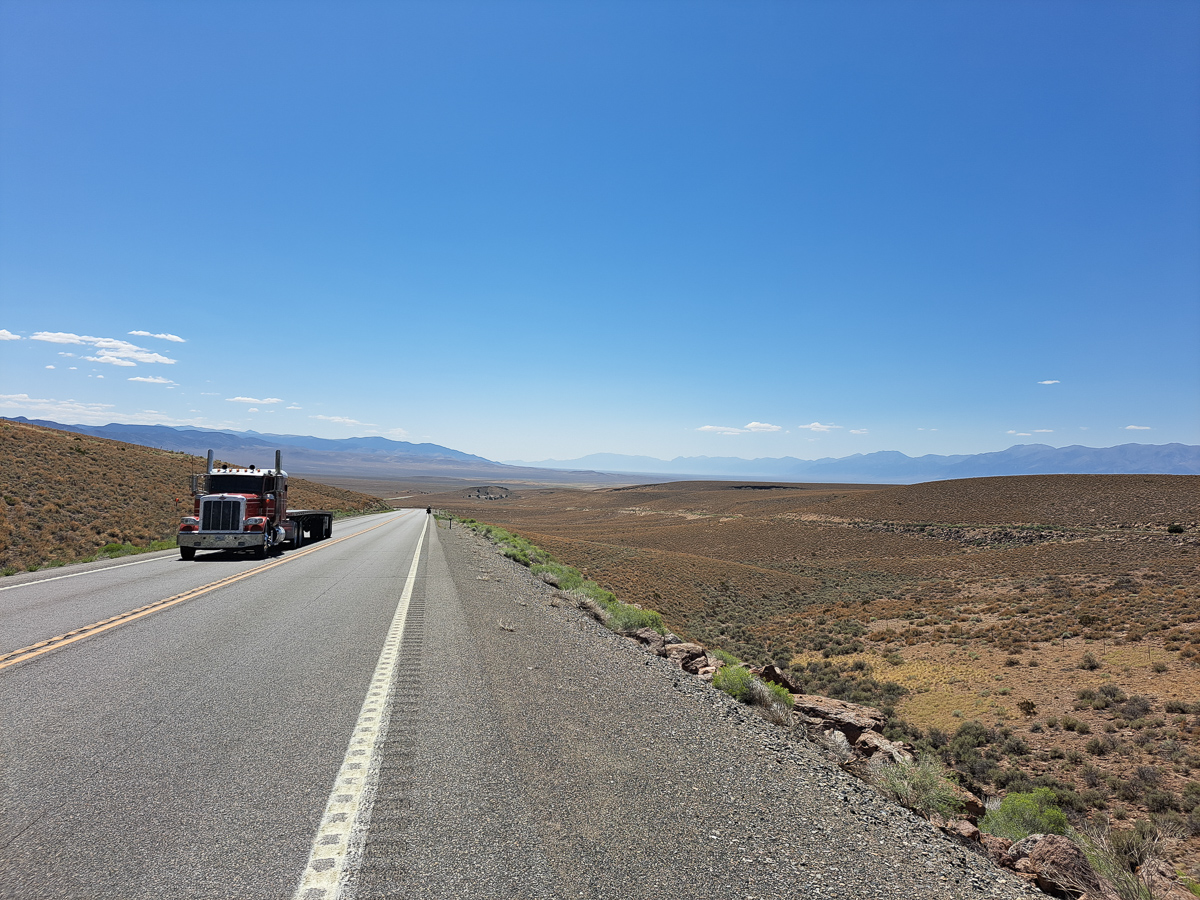
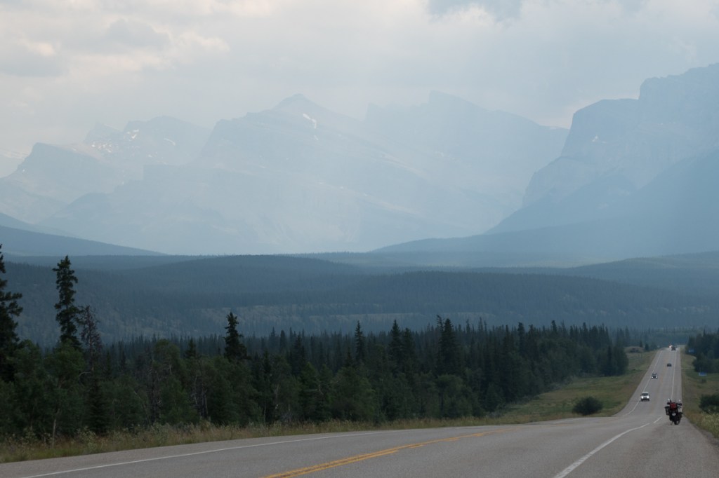
These inland states, abutting the Rockies, are all pretty high. Large parts of Montana, Wyoming, Utah are over 1,000 metres above sea level, if not 2,000 metres. The lowest points in those three are 557m, 945m, 664m – we didn’t visit Colorado, which floats entirely above 1000m. Passes in the mountains routinely exceed 3,000 metres. To think that our travel insurance company’s first policy offer had an altitude limit of 1,000 metres! That would have given us a very odd, frustrating, maybe impossible route, certainly not this inland one. As it is, Highway 89, and our diversions, have been splendid. Most of the roads are lightly trafficked. There are long, long, straight, flat sections, as per the classic photos, but also interesting little towns, hamlets along the way, and every so often, it goes all wiggly to get through a range of hills or mountains. Highway 50, east to Reno, is bleakly spectacular. We nearly had to resort to the fuel cans, it was so empty. Clare’s Garmin – I have no idea why it was even turned on – produced gems like “Turn left in 150 miles”. But such long runs make the stops more interesting.
And being summer, far from the sea, it’s hot in the daytime. Very hot, although locals say it gets a lot hotter. Clare forked out for some basic mesh riding trousers, her posh Staedler suit getting too hot. I was in mesh from the start, but was latterly in not a lot underneath (sorry). As soon as the bikes halted, we made a rush for shade, ripping off gloves and helmets as we scuttled. It was often much cooler overnight, so camping was still ok, especially if there was shade for us after getting up. And from Montana, onwards, increasing as we prairie’d south it was prone to very wet thunderstorms in the afternoon or overnight.
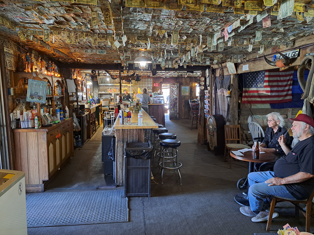
At some of the stops, time itself seemed to be running a bit slow. Some of route 50 follows the old Pony Express route, and at Middlegate, an old Pony Express stop and the only gas for miles, no, leagues, four generations of the road house’s family were in the bar, albeit only the latest was working (and was she busy!). What was it like in great grandma’s day? We were too tired and thirsty to ask her.
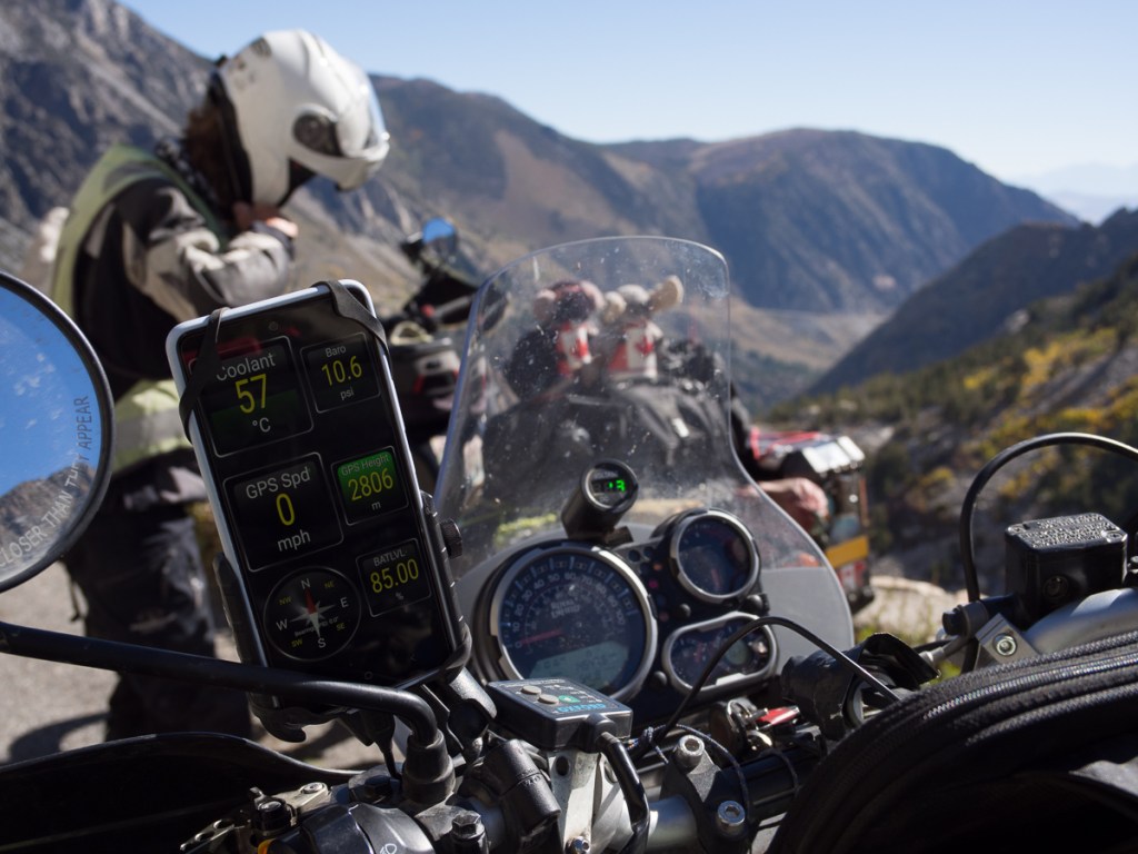
The bikes have been struggling a bit. Let’s hope we get the math right here. A rough rule of thumb, apparently, is that an unsupercharged piston engine, like our Himalayans’, loses 3% of its power for every 1,000 feet of altitude. So over 6,000 feet or 2,000 metres, we’re down from 24hp, to 20hp. Quite a difference, and we’ve been well over that at times.
Look at the top right diagnostic – about 70% of a sea level value. This was in Yosemite.
And – thanks to the wonders of our Bluetooth diagnostic connectors, we can see our engine (oil) temperature go up and up, in the thin, hot, air. Some advice is that engine oil will start to deteriorate over 150C, and trying to keep it under that, at 2,000metres, in 37C air, often keeps us down to 40mph on climbs, even though the bike will manage a lot more. Descending to the northern California coast (cool and foggy), the bikes recovered a hearty spring in their step, and would again cruise at 60mph – although that’s rather noisy in our helmets, 55mph is a lot better. It’s a good job we’re mostly on quiet roads. In rural areas, as anywhere, the drivers are fine, but standards, courtesy, and personal space concepts are much eroded in cities. Only one guy tried to give us an earful: wheel in one hand, gesticulating wildly at us with his phone in the other, it’s most likely he’d looked up from his texting, and seen us at the last minute. I’m not sure that’d been our fault.
We’ve been trying to keep fit, despite leaving behind all our swimming and cycling and tennis. Clare’s got a skipping rope, and I (Gid) try to go for a run every so often. “Swimmers lungs” Clare rarely notices the altitude, but I was thinking I’d got really unfit, until I twigged I was running uphill at over 2,000 metres. Some of these runs feel quite exotic – out the back of the campsite, there’s often a trail. Deserted. Nobody visible, not even a plane in the sky. No sound except wind and birds and squirrels scuttling away. Well, and me puffing if it’s uphill. Another new running experience was Lake Lahontan, where I managed maybe 5Km barefoot on the firm sand beach.
Let’s finish with some random mid-west Americana and highways.
Apologies, we’re a little behind with our blog: It’s now October, and this relates our time in Arizona and Nevada, 25th Aug to 7th Sept. More soon!We also had a bit of an IT disaster and lost a lot of Clare’s pictures from August and September, so the imagery isn’t what it should be.
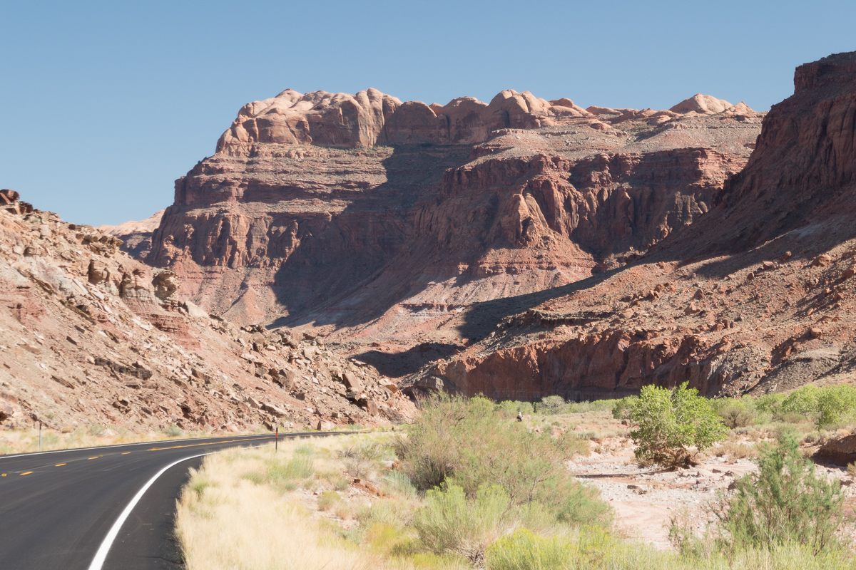
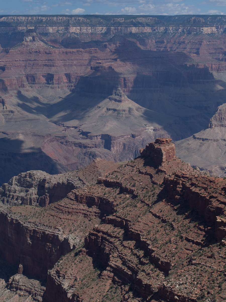
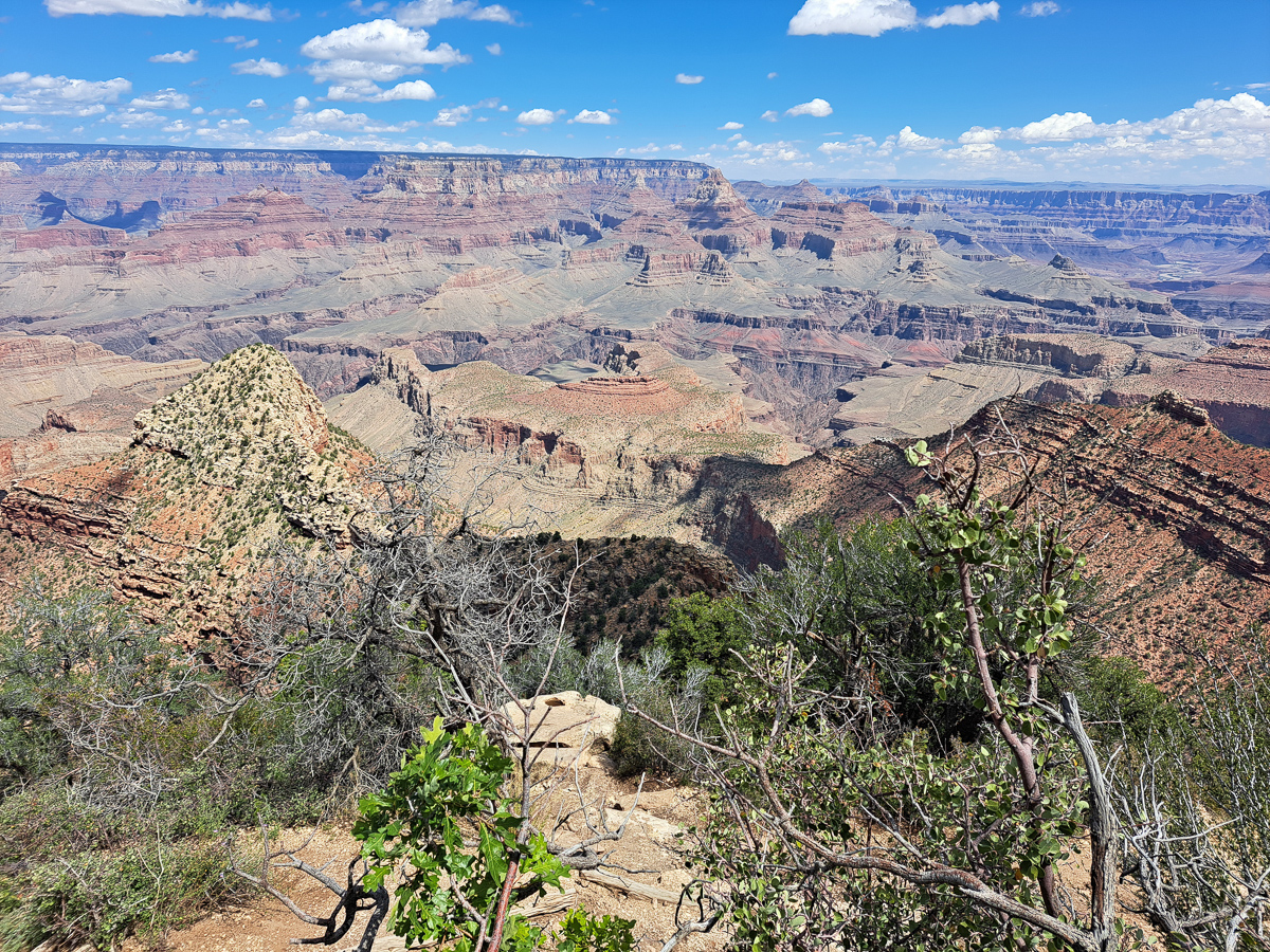
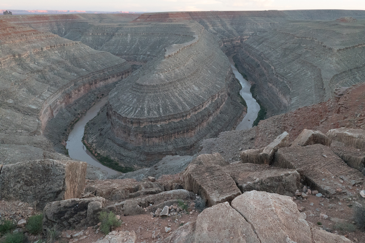
Next on the list of must see destinations was the Grand Canyon. Having done our homework we knew that the Northern rim was thought to be the more spectacular of the two. We set off from Flagstaff heading in totally the wrong direction – southwards. We wanted to take in the scenic roads that were either marked on the map or had been recommended by other bikers. But we were in luck – to get to the northern rim – we had to ride along the southern rim – bonus! Being a weekend the super route out and round to the south was rather over crowded and we were happy to get out of it but crowds were something we were going to have to get used to as we reached the more populated areas.
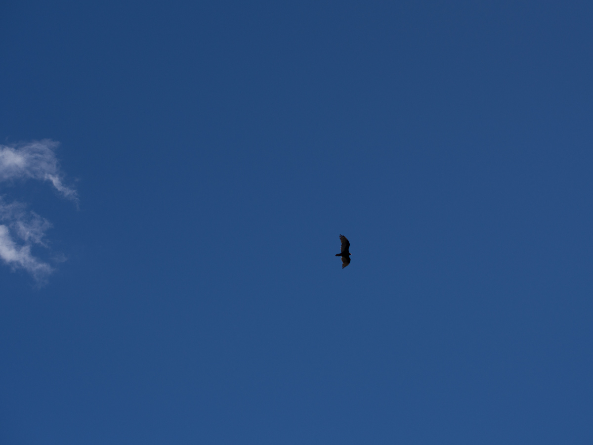
Along the southern rim we stopped at three vista points and learnt that the gorge was formed by opposing tectonic plates clashing and forcing each other up. This created a raised plateau. From there the Colorado river cut through the rock. Because there is not enough information left geologists don’t know why the river didn’t take an easier route around the outer edge. The high levels of silt carried by the river have carved a deep gorge which continues to cut its course to this day. The gorge was beautiful but the vultures stole the day. Several vultures and some falcons rode the thermals swooping to and fro right in front of us. ‘Have you got it? Have you got it?’ we cried as another swept past.
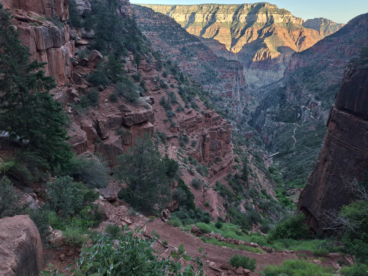
Up at the Northern rim an elderly park guide was enthusing to us about the benefits of doing the North Rim road. He told us that there were many viewing points and it was good use of our time. But Gid was keen to do one of the walks. Neither of us considered the whole day North Kaibab trail. An 8 mi down 8 mi up marathon but we did think we could do one of the shorter ones. Was there time for both? ‘Of course there was,’ I exclaimed. And off we went.
On the rim road the information boards were very useful although I couldn’t see the ‘obvious’ fault lines on the southern side of the canyon. We were excited to glimpse the Colorado river on a number of occasions as we stopped and started along the route. We seemed to have swapped the birds for some views of the murky river. I was pleased we’d seen both sides.
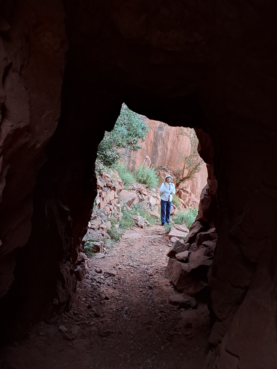
We hurried back to the start of the scenic tour road to pick up the hiking trail. It was 5:15 when we set off on what was described as a 2-4hr hike. We had torches and had been advised to take more water which we dutifully got. Our walking speed is middling on most timed trails so I was predicting our return at around 8:15. It’s dark by 8. On a very uneven track how good was my torch? Gid normally leads down hill and me coming back up, but I set off at a fair pace. I wasn’t messing around we needed to speed this up. Meeting a few people along the way was encouraging. They were all on their way back but it was still nice to know we weren’t totally alone. A few ‘not far now’ comments gave us encouragement but meeting a father and young daughter a few hundred metres short of our destination, Supai Tunnel, was quite a surprise. We went through the tunnel, gazed down at the zig zagging path disappearing into the depths of the gorge and were ready to turn back. One couple we’d met had done the whole day hike. They’d set off at 8 in the morning and were on course to make it back completing their trek in just under 16 hours.
We made it back in good time just about catching up with the youngster and her dad. Amazingly we did the round trip in just over two hours with just enough daylight, to pack our kit and set off back to the campsite.
We hadn’t got far the following morning before stopping for fuel. Parked on the apron was a Royal Enfield Continental GT. Paying for our fuel in the garage it was obvious who the Enfield belonged to. This distinguished gent with a broad grin, a thick red beard and plaited hair readily admitted it was his bike. We asked him about the unusual racking system he had and his tin seat. Out we went to look at them. He enthusiastically told us about his project to reduce the weight of the bike. He lifted up the tin seat shaped to fit the gap between the metal rods and read from the bottom what the old seat had weighed and what his new tin seat weighed. He proudly declared weight the saving. He repeated this exercise with the side guards which were now leather flaps with another recorded saving. The next project was the rear rack he declared. That was trickly though as it had to take the cat. At first I thought the bag of empty 5lt water bottles somehow housed the cat. The cat, his travelling companion he informed us, was out prowling around back at camp. The cat, he told us, could only manage three hours at a time on the bike. With that saddle I’m sure I couldn’t manage any more.
Jamie Burns, the distinguished gent, had never been to Scotland even though he was directly related to Robert Burns the infamous Scottish poet. ‘I can’t go!’ he exclaimed. ‘I’d have to set foot on English soil and I’ll never be doing that.’ A little later Gid pointed out the he must share some considerable empathy for the Native Americans with the atrocities that they suffered at the hands of the new settlers. But he seemed to be handling American soil ok.
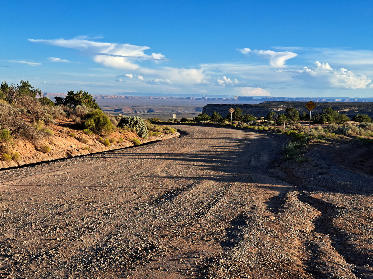
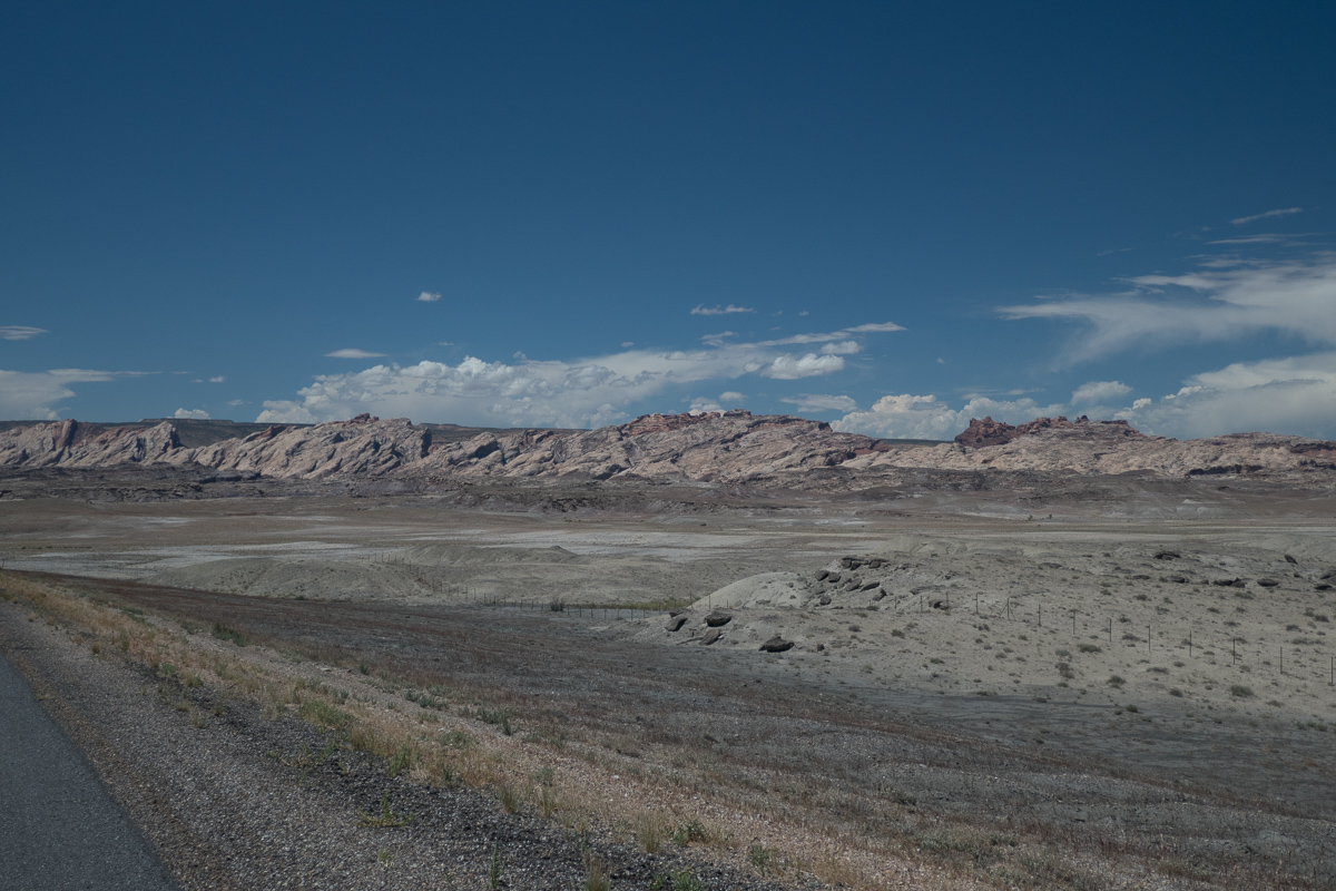
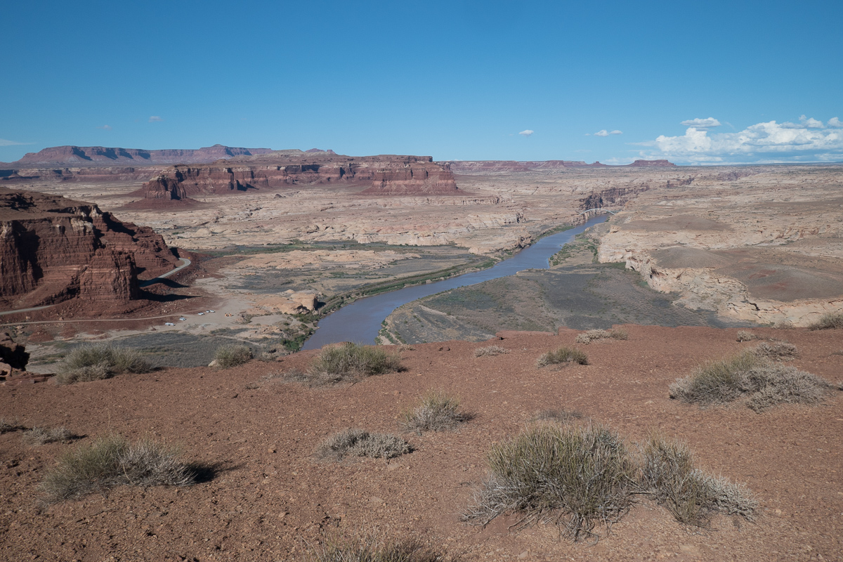
The Grand Canyon, Petrified Forest and our stop in Flagstaff ticked off Arizona: We were making good Pan-Am progress towards Ushuaia, on the southern tip of Argentina. Next stop Mexico? Nope. North westwards to northern California. We couldn’t miss the Pacific coast and the redwoods. So we turned, heading back north up towards the northern tip of California. We aren’t fond of megopolises, so for the second time, we avoided Salt Lake City, and this time, Las Vegas too progressing diagonally between them. We’d soon have 12000mi under our belts so we chose Reno, Nevada, for a service stop. It’s big enough to have everything, but not oppressively huge. Airbnb host Tyler was ok with us changing oil in the shade of his carport, and Royal Enfield dealer Eurobikes had got the service parts and our three new tyres in.
We headed westwards towards Reno along Highway 50 crossing the often empty Nevada, which passes just south of Reno. It’s dubbed ‘the loneliest Highway in America’ and served us well as it had little traffic. The section we travelled from Ely to Silver Springs traversed great plains where there was very little to see except the next mountain range to cross. It took ages crossing each plain, then we’d ascend up the mountains. Most roads carve a pass through the summit with rocky cliffs towering on either side. Pancake pass – 1988m – being the unusual one because it was flat.
The Pony Express central change over point at Old Middlegate Station on HWY50 was a wonderful choice for a stopping place, full of memorabilia with posters for ”Wanted’ criminals – Dead or Alive’, legalised prostitution advertisements and pony express riders job offers not to be missed. Providing, that is that, you were under 18 and preferably an orphan who was prepared for high risk and possible death from their chosen employment. The place was stacked with relics from the past both inside and out. A quaint mix of old and modern as the petrol pump boldly claimed ‘no lead’. Not now perhaps but there’s been no shortage of lead flying around this place I’m sure. To add to the authenticity signage pointed out that Ned Kelly’s house was a stone’s throw away.
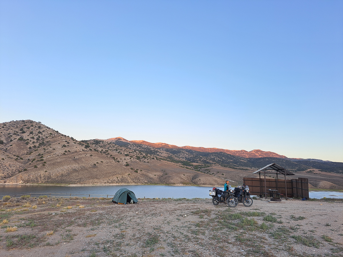
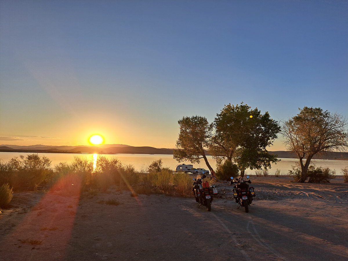
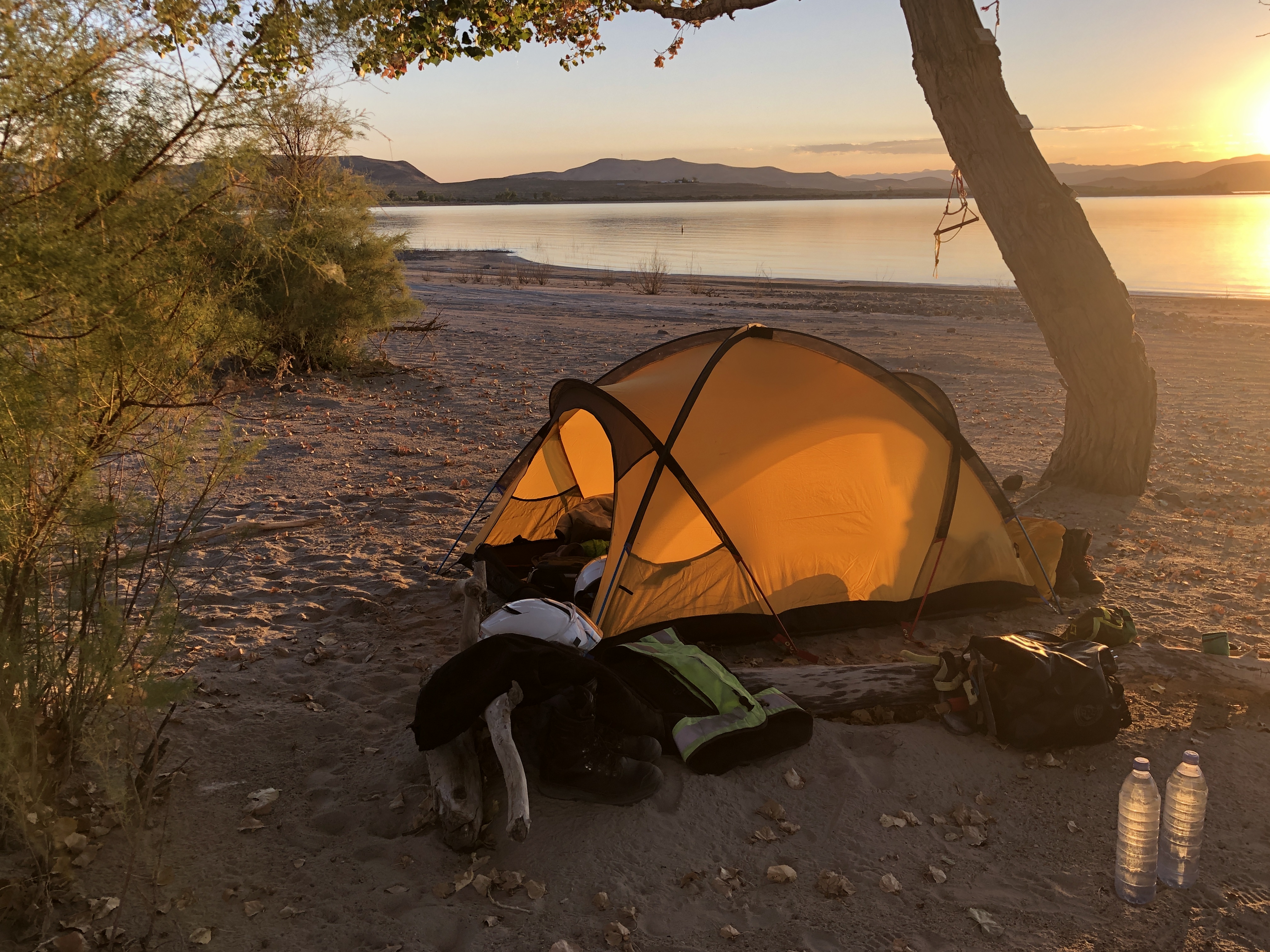
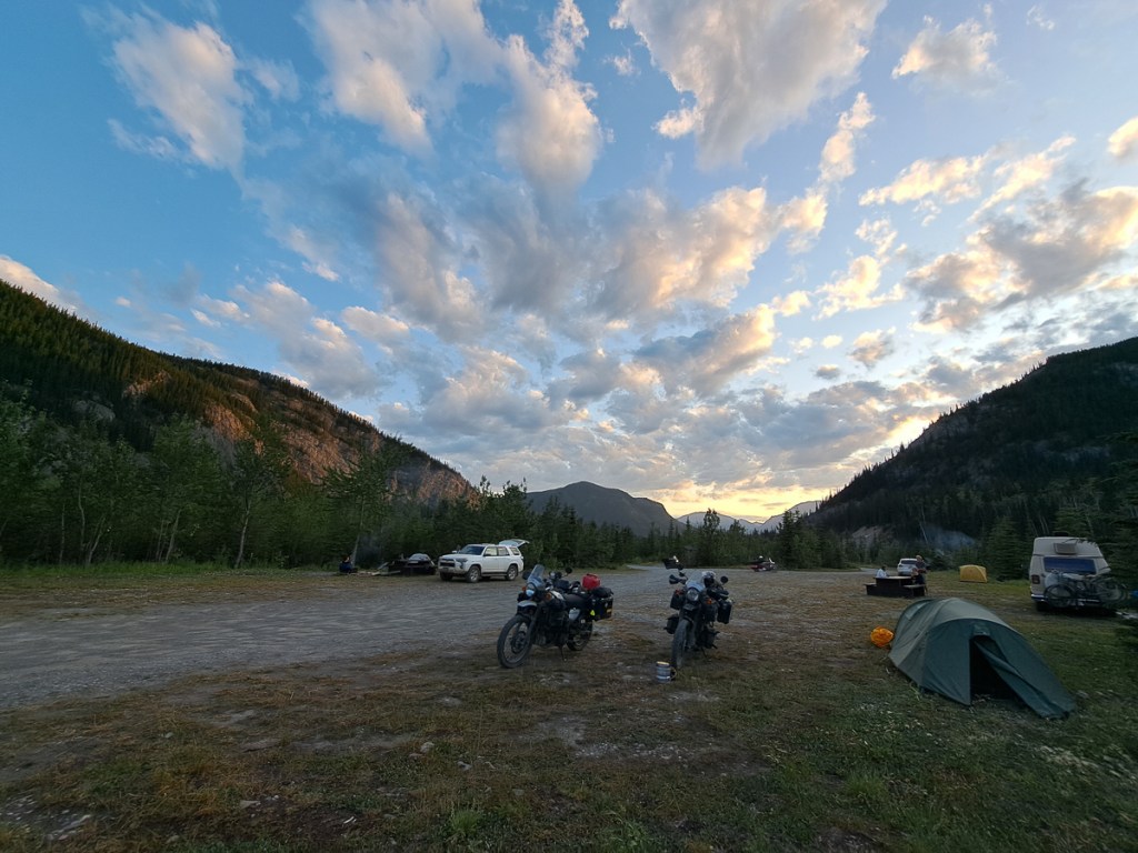
Our arrival in Reno was a little bit complicated, as we’d booked the Airbnb for Sunday onwards, not realising Monday was Labor Day. Eurobikes and almost everywhere would be shut. We needed to be close by Friday night, ready to hit the store Saturday morning to collect the service kits. Experience told us that even ordinary summer weekends could crowd out the campsites leaving us struggling. Lake Lahontan State Park was 30 miles out, a big reservoir with sandy shores, it seemed like a great retreat. We arrived with some trepidation about availability, but paid our fee at the unattended gate. We’d hoped for a pitch we could swim at, but there was a Red Warning stating that the lake was unfit for recreational purposes because the algae levels were unacceptably high. Oh no! But we trundled round the shore, surveying the ad-hoc camping. We found a beach spot facing the sunset: firm sand to park, soft sand and shady trees to camp. One RV right down on the shore was 50 metres away. The next units maybe 200m one way in a thicket, and 1000m the other. On this side of the lake, people were swimming. Definitely one of our nicest sites! We stayed two nights, enjoying a starlit evening chat with the neighbours.
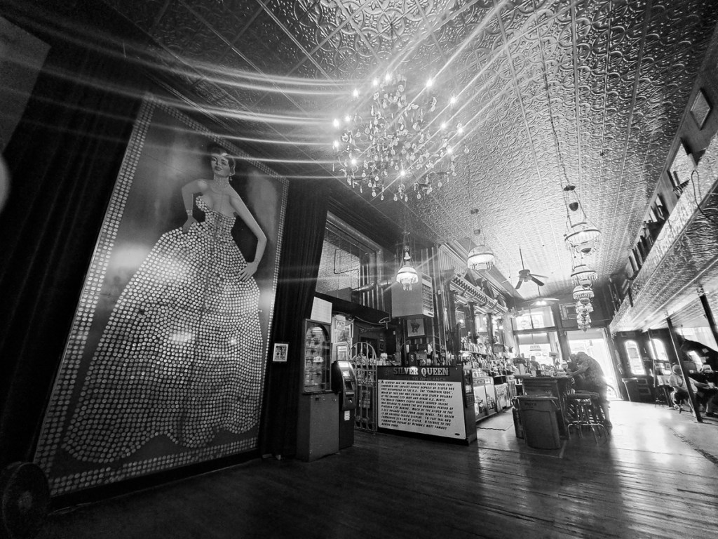
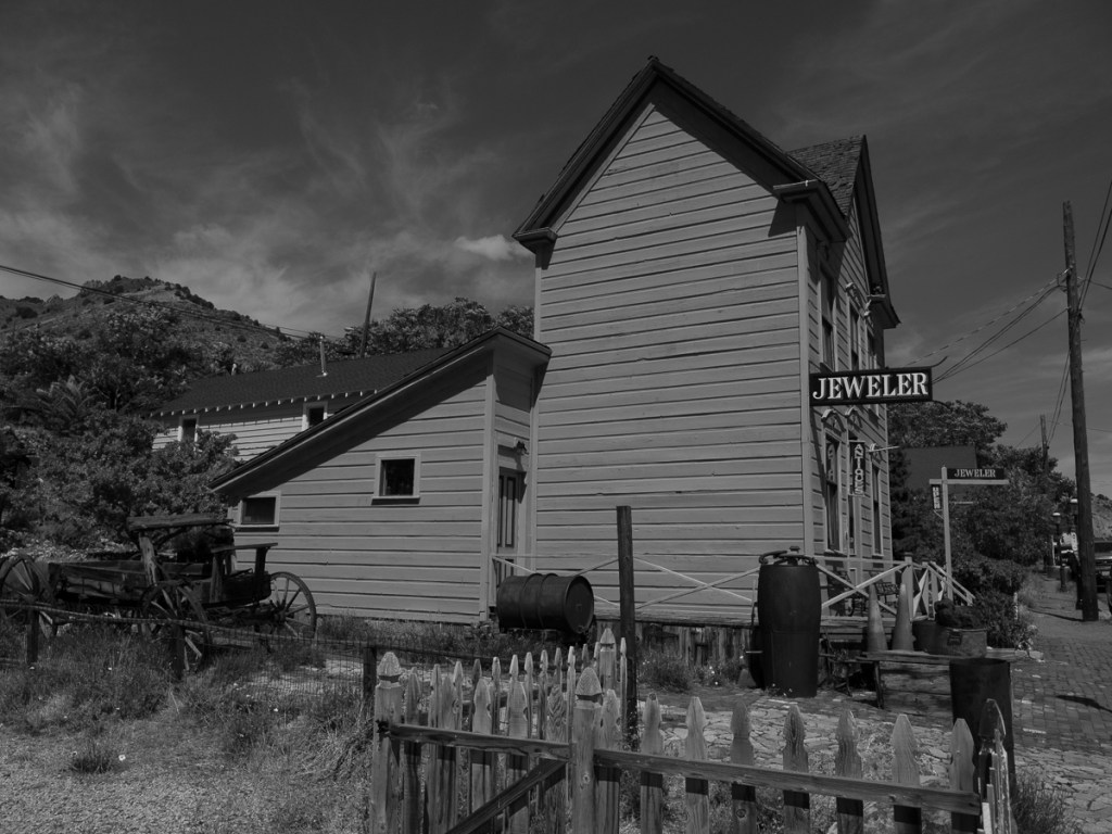
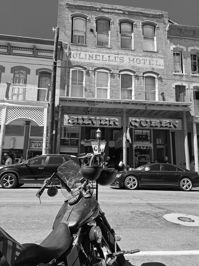
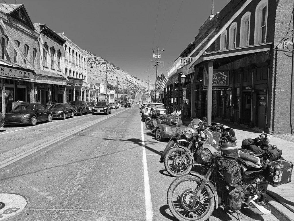
It was a short freeway ride to Reno on Saturday, but to return, we saw a wiggly back route going through Virginia City and tried it. It turned out to be a local bikers’ favourite. Virginia City – City it says. Obviously swayed by the city part of it’s name I was expecting something big. Bigger that is than a half mile main street, and not a lot else. Rather than the boom and bust of many towns where a natural resource is found, Virginia City, once the mountain of silver under the city was depleted, has managed to maintain prominence albeit now as a tourist attraction. Its high street is frozen in the style of 100 years ago with original buildings and facades, as are the rickety board walks beneath the overhangs. There are tourist attractions like: the Silver Queen Hotel where the lady’s silver dress is a floor to ceiling art work modelled in silver dollars mined beneath the city. There are many saloons, some with swing doors, eateries and tat shops, and events like camel races for the more competitive amongst us.
OLYMPUS DIGITAL CAMERA
Mark Twain, at least his wax model, peers out of one window where he used to work as a newspaper reporter. Words such as ‘never let the truth get in the way of a good story’, accredited to him, live on. His famous novels, Huckleberry Finn and The Adventures of Tom Sawyer still make it onto many a reading list. The local museum claiming ‘Of great interest to adults and children’ displays many relics from past life in the area. Virginia City became our regular route between Reno and Lahontan.
The servicing went to plan. Having done it all before it was quicker this time. Now Gid is becoming familiar with the process he’ll let me play too – next service I hope to do the oil changes.
We’d noted the bike chains had needed occasional adjustment, but annoyingly, as we approached Reno, Gid was having to tighten them every couple of days. Knackered. We ordered replacement chains and sprockets at the Reno dealer but RE gave no delivery date. Were they coming from Wisconsin or Chennai? We decided to wait into next week before requesting that they might be posted forwards. The dealership had a branch at the coast and was happy for us to collect them en-route but we couldn’t continue to stay with Tyler. With time to kill we needed a new home.
To get away from the bustle of city while we waited we went off to explore Lake Tahoe. Our Lonely Planet guide book describes it as a very popular location for winter skiing with slightly fewer visitors in summer. Wrong! It, or rather its shoreline, was teeming with people. Adding to the frustration most campsites were closed because the trails were being repaired and supplies were dumped in campgrounds. We u-turned and got out of there as fast as possible, riding right back up the 9,000ft pass we’d come in on, returning to Mt Rose campsite near the top. It was beautiful. Pine trees spread around large boulders – the sort of things that are called erratics in Norway having been randomly dropped by the receding glaciers but here they were at 10000 ft high! It was beautifully peaceful, until the generators started. The site host agreed that it was a beautiful area informing us, with a wry smile, that the noisy school group had left 2hrs ago. It was nice for one night, but we couldn’t think of a better option than returning to Lahontan. The exact same spot, and now the nearest neighbours were maybe 2km away. No cossies needed.
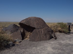
Having missed petroglyphs at the Petrified Trees NP I was keen to see the ones in this area. Grimes Point, the site of the petroglyphs and the Hidden Cave, wasn’t far away and reportedly had the best examples so it had to be done. We would have liked to have seen the Hidden Caves, also at the site, but on contacting the area office to arrange a guided trip we were informed that due to sickness that was off. Thousands of years ago the Hidden Cave appears to have been a site of storage: furs, tools and remains of clothing were found there. It’s under lock and key now to preserve the site for future generations but our wished for visit wasn’t going to happen. On the self guided walk around the petroglyphs, the boards told us that human habitation in the area dates back to 8000 years ago. Lahontan Lake, now some 20-30 miles away where our tent was, would once have been lapping the edge of this area. The boulders, plenty big enough to hide behind, would have been the perfect site to hunt the animals who came to drink. Shaman, responsible to communicating with the gods to ensure a successful hunt, may have been responsible for the pecked or carved rock art.
Finally – good news – the chains and sprockets were in. We’d already been on Bunk-a-Biker and made contact with a friendly soul who offered us a bed, a workshop, and a breaker bar, just over the border in California. We were off again, albeit only for 60 miles.
After the stunning views of Monument Valley, and the rocky heat of Utah, we decided to stop in the small city of Flagstaff, for a few days of motel civilisation over Clare’s birthday. It might also offer some wifi and shops, for practical things. Ok, it was the cheapest motel in Flagstaff, but it was comfy enough, especially after a small tent.
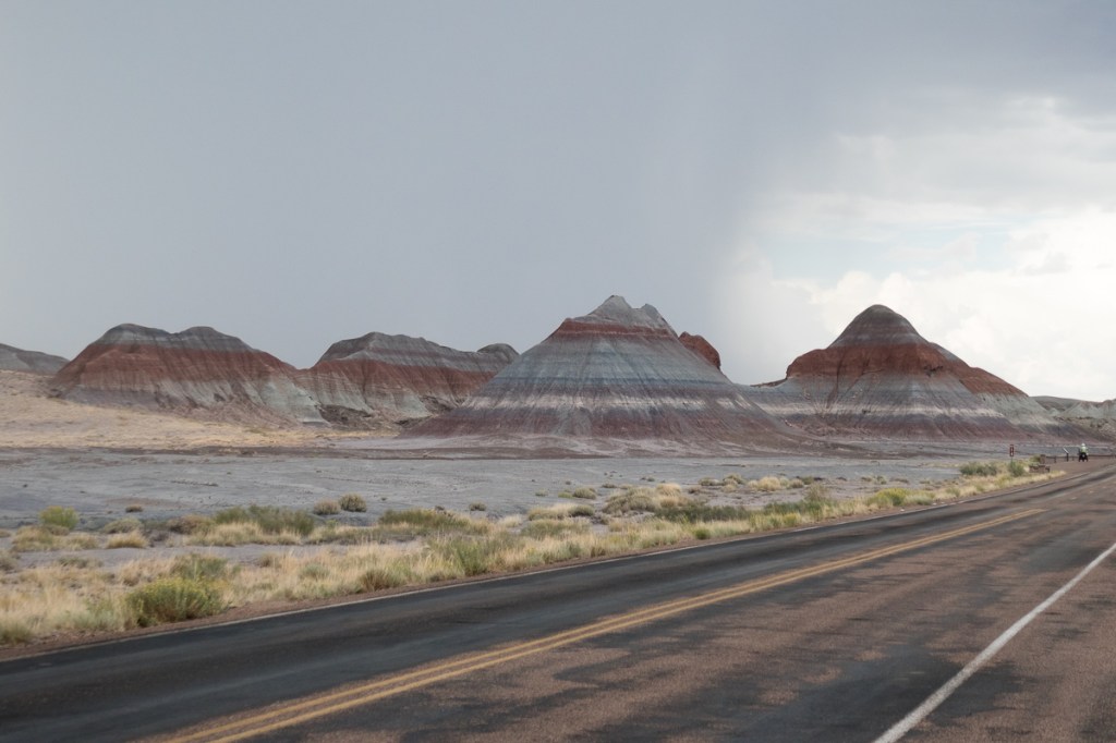
A relaxing few days, that was what it was supposed to be. I’d discovered the Petrified Forest National Park when idly looking through some advertising info. We’d planned our next day – setting off from Flagstaff and doing a relaxing loop along scenic roads. The Petrified National Park was only an hour and a half away. Of course we could do that in a day.
In a day maybe but we set off at 1.30. Gid was totally occupied with trying to pull together the resources for our next bike service, at 12,000 miles. The bike specific service parts, and a location where we’d be permitted to do our oil change (think about it!), the latter needing to have a cover as now we seemed to be subjected to extreme sun and monsoon weather with massive amounts of rain most afternoons. And tyres this time too. Both front tyres are wearing smooth in places and Gid’s rear tyre has worn rather quicker than one would expect, and we had been very lucky in Whitehorse, where we’d previously got tyres, to find shops actually holding stock – normally an order has to be arranged. On top of that our chains were now showing considerable signs of wear. After thousands of miles where they appeared not to wear at all, suddenly Gid was tightening them every 500 miles. End of life was near. Whilst the chains themselves are sort of standard, the sprockets are not – again an order has to be placed… somewhere. Where? When?
Gid’s been quite concerned about his bike pulling slightly to one side, which may explain the fast rear tyre wear. On a number of occasions he has been doing the ‘no hands’ bit to check how true the bike would run. Initially his conclusion was that it was pulling to the right ‘How does yours track?’ he’d ask me. So once again I’d be going down the road with my hands in the air. Mine seemed to run quite true but I wasn’t that keen on going hands free with a fully loaded bike. We’d done this sort of thing on the i2i course back in our early days of learning to motorbike. It was about improving our balance and skills but I will never forget when I very nearly ran into the back of a car when going hands free and reading my comic returning from my newspaper round early in the morning, many decades ago! Gid had tried to correct the error by relieving the fork clamps and next, tweaking the rear wheel alignment to pull the wheel slightly to the left but that had made it worse. A couple of tweaks to the right had improved it but he wanted it professionally checked. The Royal Enfield dealer in Reno, our place of choice, was fully booked for the next two weeks and we’d be there in a few days. Our preferred Reno accommodation, Air B&B host Tyler, with a car port, couldn’t extend our stay to take account of the delays with some of our service parts arriving later than hoped and we definitely needed the shelter to work on the bikes in this weather.
Before leaving America we are going to do one final loop back up and round to take in the coastal road – HWY1 as it’s supposed to be another of the ‘can’t miss’ roads. Another two thousand miles perhaps but that will be our final lap in the US. From there we’ll be down in Mexico. How easy will the servicing be down there? It might be affordable not to do it ourselves (a DIY oil change and check over costs $200 for both bikes, a DIY valve check is $0, USA dealer shop prices are about $1400, this for a 6,000 mile service about every 7 weeks). But everything might well have to be arranged in Spanish.
From Flagstaff, starting after lunch, it took us a couple of hours to reach the Petrified Forest National Park. We went into the museum and Visitor centre. Gid had read that in minutes it seemed – I took more than an hour. I knew how petrification took place – vaguely, but found the information fascinating. 200,000,000 years ago back with the early dinosaurs all this had taken place. It explained on a time-line that if a year was the wakening of the journey of life on earth the early life was about the summer, dinosaurs the autumn and man was the last 15mins – 11:45 on the 31st December! Back with the dinosaurs these trees had fallen down into the river/stream been covered in silt and gradually turned to crystal, absorbing colour from the minerals around them.
We wandered off through the exhibits . But again Gid hadn’t been totally ‘in the moment’ as the pressure of the servicing was all consuming. I’d offered on a number of occasions to pull my weight with the mechanics but my approach is far more laid back. ‘I wasn’t even doing my POWDDERSS checks every day,’ he’d chastised me. No, barely once a week to be truthful (Gid says: Not even sure that’s true!). I’d need a lot of support the do my own servicing and clearly it was far easier for Gid to do the lot. Then he’d know it was done properly, was clearly in his mind!
As we wondered round the exhibits I read some of the information but Gid was pressing forwards. I think he did relax into the event but only briefly as ominous clouds were brewing with lightning flashes signalling the storm to come. Once back at our bikes, whilst looking at the weather Gid asked what route were we talking home? ‘Through the park and the Painted Desert‘, I’d replied. He queried if I knew how long it was and suggested that I came back to the Visitor Centre to look at the map. Yep, I knew how long it was and that it would probable take us another hour or so. This was my trip – through the park we went but I had agreed that we wouldn’t stop at any of the other sites along the way. It was rather a dramatic ride, with lightning flashes on both sides of the road and strong winds.
Arriving ‘home’ at eight o’clock Gid was straight into service mode urging me to focus on our campsites for the next week leading up the our arrival in Reno. I’m not sure he’d thought of anything else all day. We’d booked the Air B&B for Sunday night but of course that meant we couldn’t pick up the service parts during the day. I was still in Petrified Park mode. I sat and read the booklet I’d picked up and was rather sad about the things we’d missed – petroglyphs, we’ve seen some before and very much enjoyed their creative form and direct link to so much history, and we’d missed the longest petrified log in the site together with some wonderful views and walks around the Painted Desert – an area of layered rock showing different periods in history as different sediments had left their colours of rock behind – one building on top of the other.
It seems there are more opportunities to see petroglyphs and many areas we have ridden through have got vivid rock colours displaying the high mineral content in this area.
So, we’re across the 45th parallel – back in the USA.
Once in the “contiguous USA” our plans were some what sketchy. We had three months and knew we wanted to leave going into Mexico travelling down the Baja peninsula. We had the big three National Parks earmarked, Yellowstone, Grand Canyon and Death Valley plus the HWY 89, recommended by National Geographical magazine and Dave in Edmonton, highlighted on the map. Dave and my cousin Debbie had both suggested things to see but somehow we hadn’t digested that into a formulated plan of what to do and see enroute.
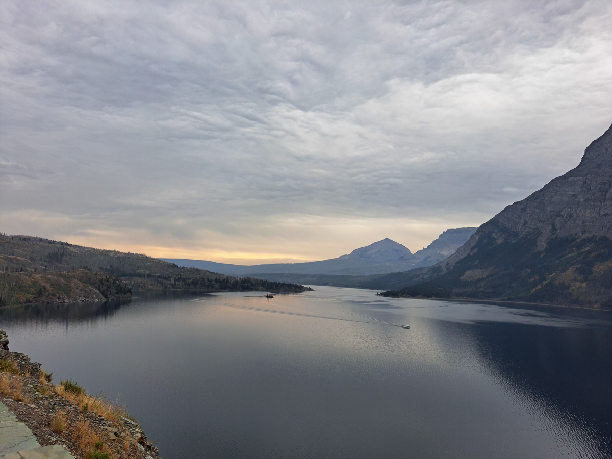
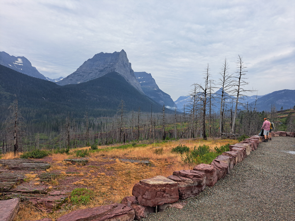
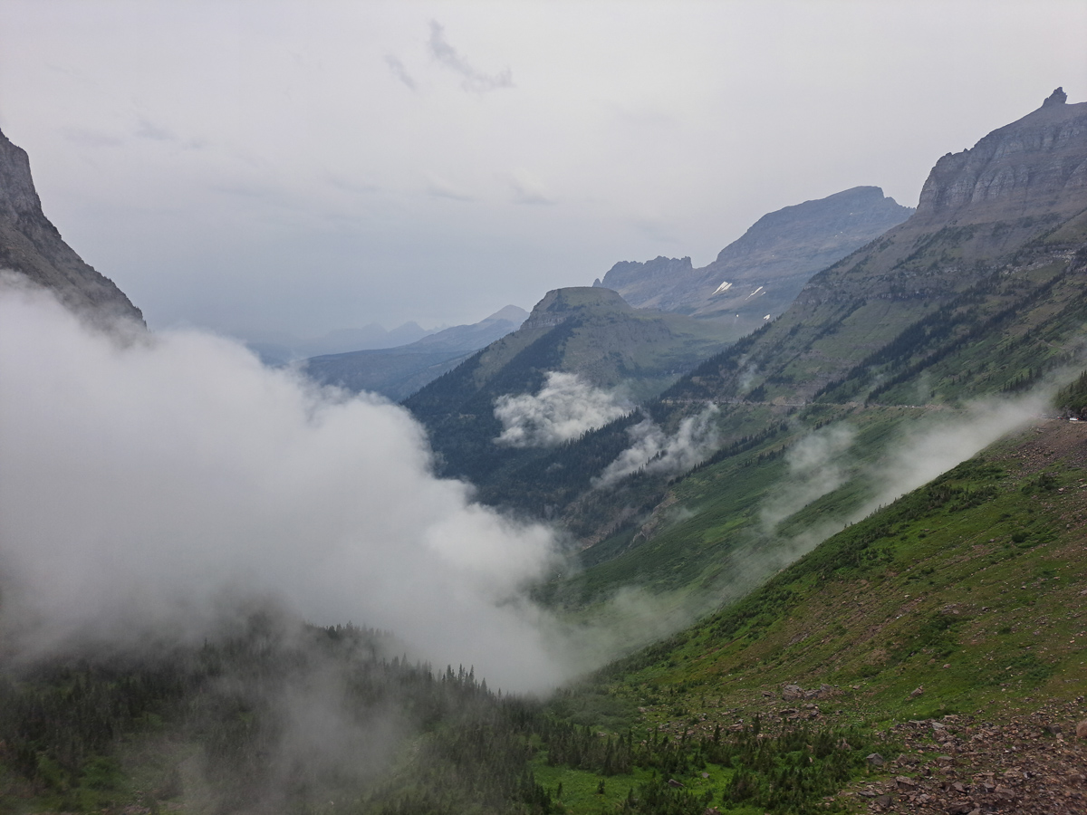
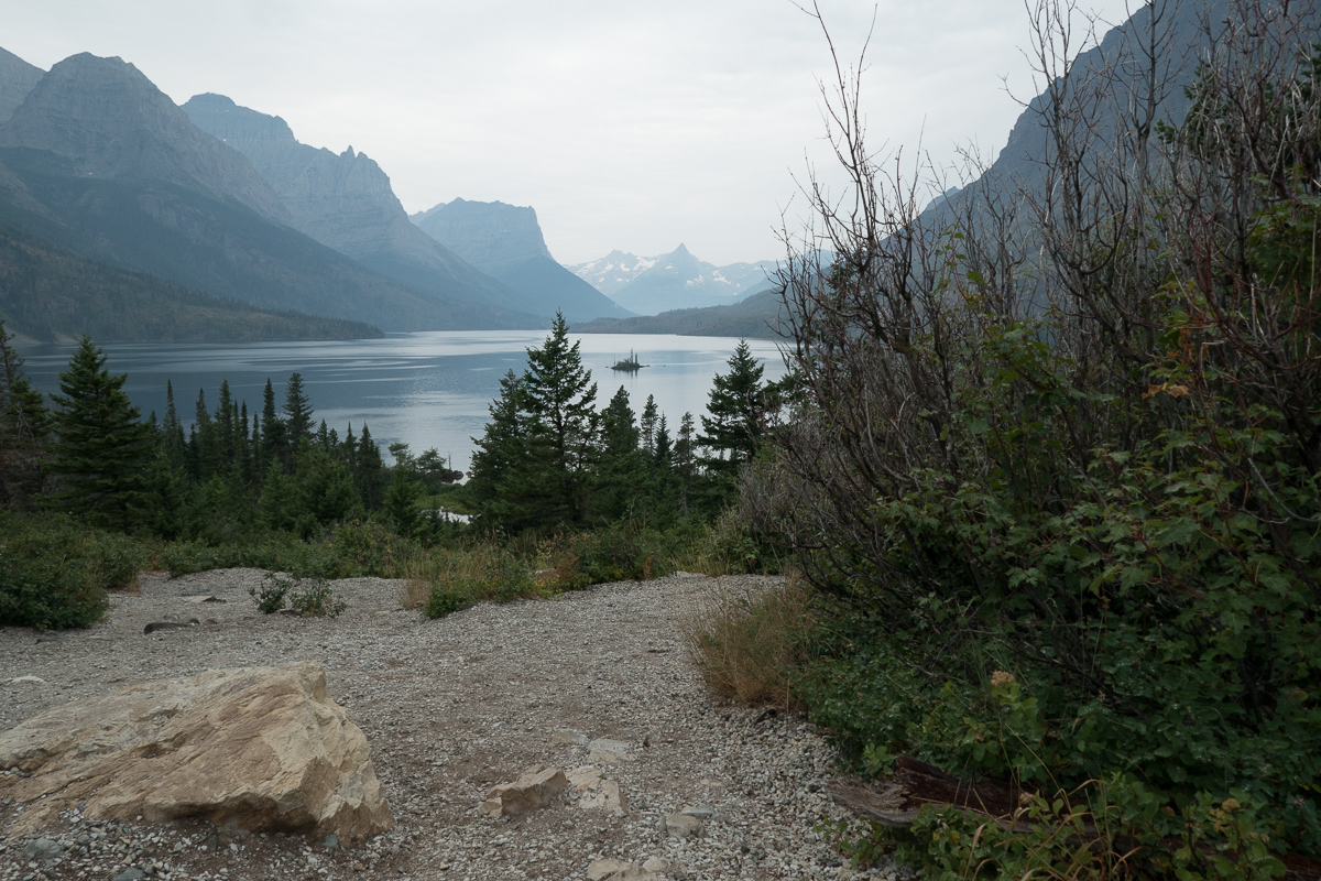
Hwy 89 took us straight into Montana’s Glacier Park. The scenic park road, Going to the Sun, took off westwards to a height of 2026m and seriously down the other side on mountain twisty roads. We were in a line of traffic doing the tourism trail but that didn’t seem to matter as everyone was progressing slowly admiring the fabulous views of mountains overlapping mountains – great recessions disappearing into the distance, stopping to take the must have photos at the named features. Fortunately we did too as the return route was marred by rain. It started out as drizzle that was supposed to stop by lunch time and indeed it did. However as the afternoon progressed so did the returning rain. Slight droplets to start with but slowly gaining in intensity without us seeming to notice. I hadn’t taken my normal rain precautions. Eventually it pissed down! By then it felt too late to fuss about the rain, we focused on finishing the trip. Once back at the start we cowered in the lodge drinking cups of tea. Umming and erring about our options we finally caved in and booked a room.
The following day my GoPro video camera, mounted on my handlebar, with the USB lead sticking out, was sick. It was sodden. Apart from visible water in the battery compartment it became evident that there was condensation inside the screen. Gutted at my stupidity we set about trying to rescue it from what seemed like its inevitable journey into the bin. A day on the bike with the battery door open revived it. Don’t know how I got away with that one!
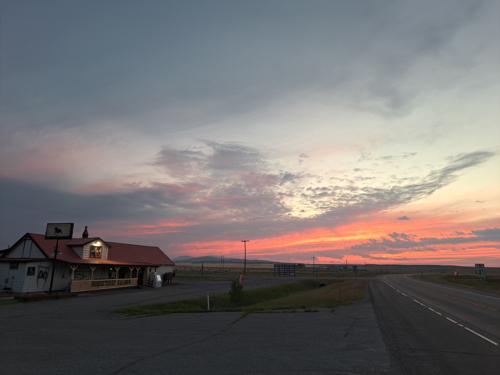
Gid decided he wanted to go and see the site of Custer’s last stand. Now it’s got a more sensitive or politically correct rename, after the location in which it took place, Little Big Horn. We trundled along enjoying the undulating scenery and nodding donkeys, noticing also the considerable lack of campsites. We spotted a small camping sign in the middle of nowhere some way before a lonely bar and u-turned to go back and check it out. Thankfully there were a couple of people out the back. One was the owner. Yes, we could camp. Even better we could kip in the chalet that was still being fitted out.
The Horse Thief Bar at Sunset
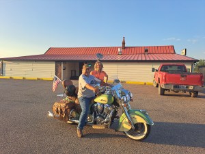
Eddie, the new owner of the Horse Thief Bar, was very pleased to put us up and spent the next hour or two telling us how he ‘d just got back from Sturgis with a new machine: a rather wonderful looking sage green & cream Indian motorbike complete with leather paniers and dangling tassels that he caressed.
Eddie, at the Horse Thief Bar
Eddie was horrified to think that we were going to Little Big Horn and not Sturgis. After all, Sturgis is an internationally acclaimed bike rally that was on this week – just another few hundred miles down the road!! We would love it he was telling us. The town comes to a standstill because of all the motorbikes!
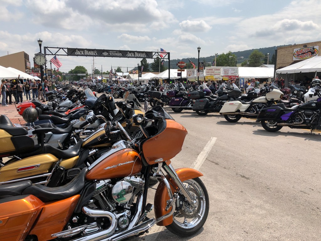
Sturgis it is then. I’d read about it back in the UK but considered it too far east. Another 440mi to be precise. A twelve hour day later we arrived in the dark after a long hard flog into headwinds. But at least we’d identified a campsite in advance and could ride straight in.
Hog Heaven, a temporary campground was one of eight that encompassed the small town of Sturgis, South Dakota. It was $80/night, but well organised, spacious, and not at all squalid as English festival campsites notoriously are.
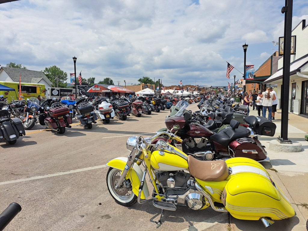
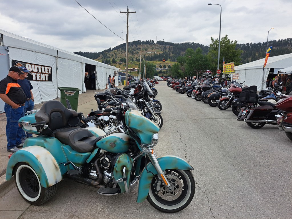
Sturgis, the bike rally, attacks hundreds of thousands of bikers every year for the one week long event. Now aging and many trailing their bikes to the event the numbers are starting to drop off. Some of the roads in the town were closed for bikers use only and the town was packed with tents and displays of biker kit and paraphernalia, not to mention plenty of opportunity to test ride and buy bikes – Harleys and Indians being the key brands. Live music was playing all day in the town and at our campsite every evening creating a real party atmosphere. A programme of events included: best beard and moustache, Jack Daniels tasting and BBQ, show us your boobs, although many didn’t need to enter any competition to tick that box. Scanty was the ‘clothing’ of some of the ladies about town.
The event is popular not only for the entertainment in Sturgis but also for the fabulous roads in the SD Black Hills, which offer half a dozen of the best bikers routes we’ve experienced in the US in one relatively small area. Roads like The Black Hills & Bad Lands, Devils tower, and Needles HWY are all comfortable day trips that attract bikers year on year for the multiple hairpins and twisties. Iron Mountain road is another favourite with it’s multiple twisties and natural narrow tunnels. One such tunnel had flaggers at each end because of it’s length and narrowness. It was quite something to emerge into the path of at least fifty bikers waiting to go through. All behind the flag man. Mt Rushmore was another popular site to visit.
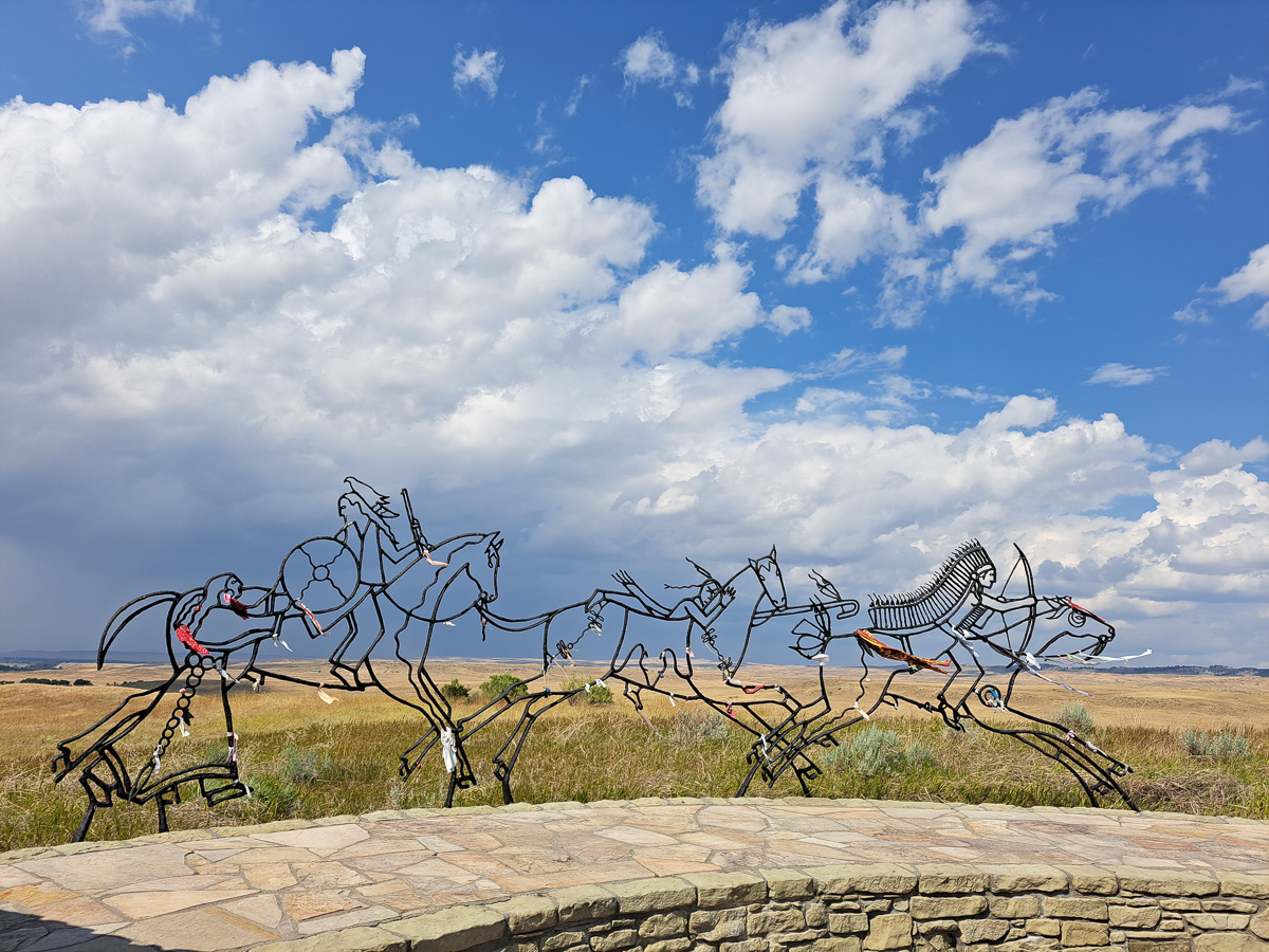
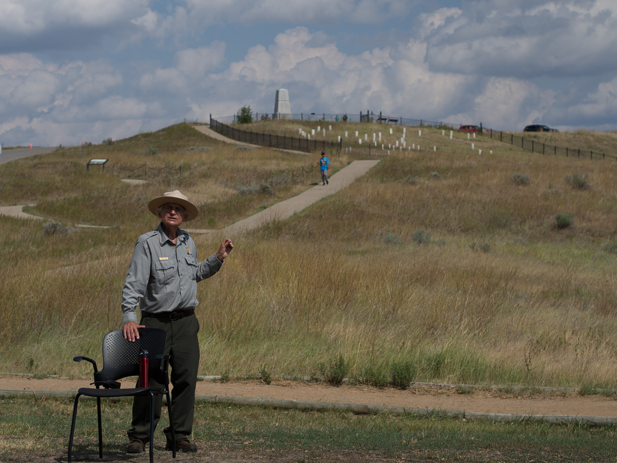
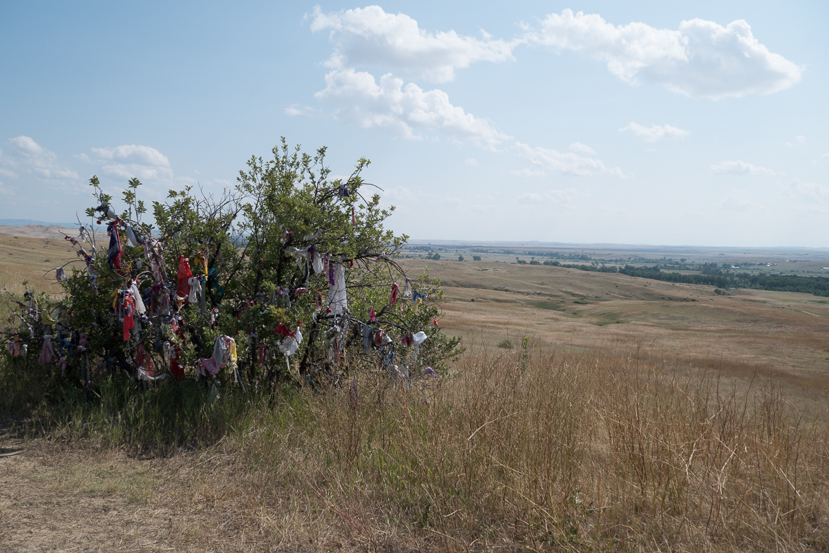
The buzz lasted beyond the event itself but after four days we were ready to move on still discussing the amusement of this or that. On a more sobering note we arrived back at Little Big Horn for a history lesson on the disposable nature of treaties and how the needs of Native Americans have been frequently marginalise for the benefit of the White Settlers. It’s been easy to see where the Indian reservations are as we ride along because there is an air of greater poverty and run downness. Plus a few stray dogs – well, maybe “stray” is the anglo-centric view, perhaps they’re communal as in many Muslim countries.
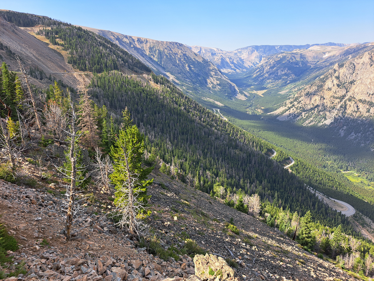
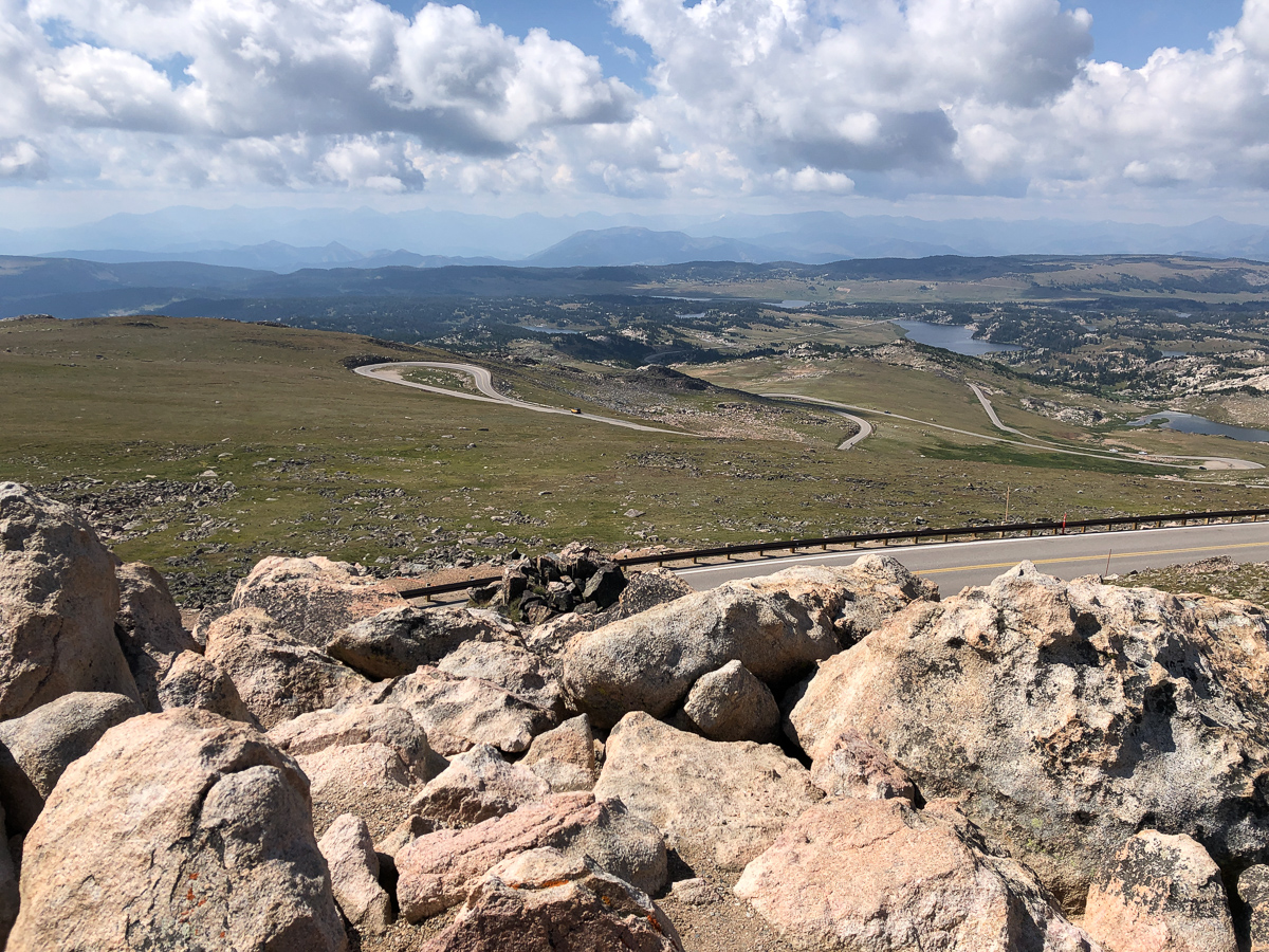
Yellowstone National Park in Wyoming was next. A truly stunning place! We approached from the north riding the spectacular Beartooth pass, wondering how even a National Park was going to trump this.
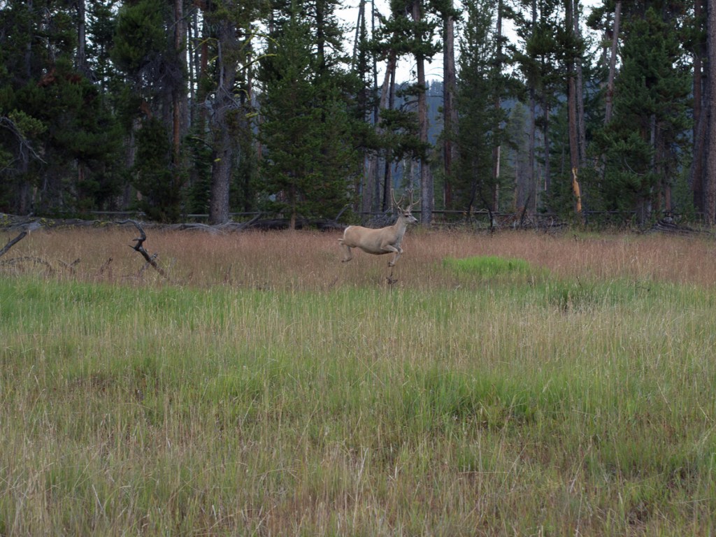
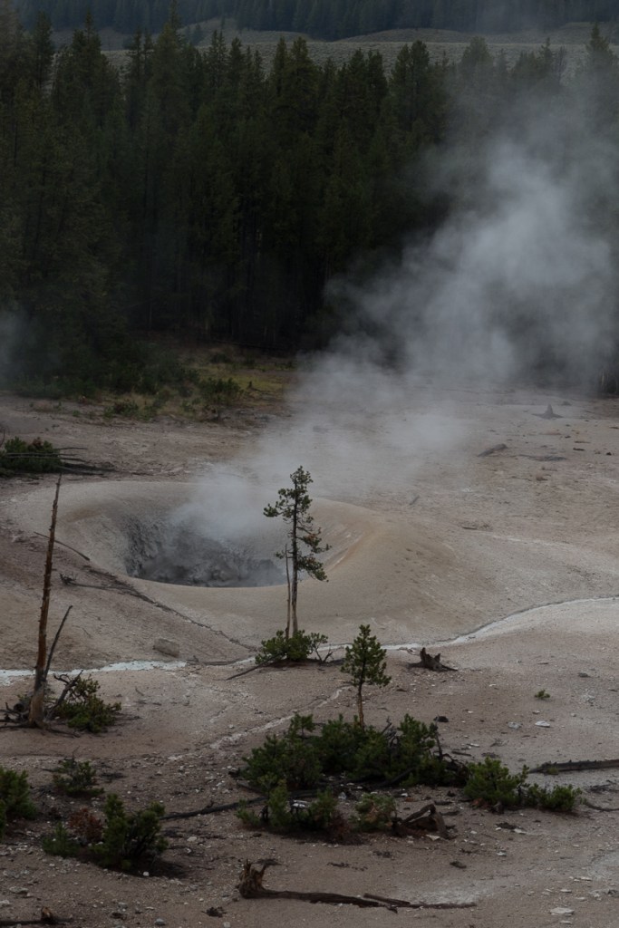
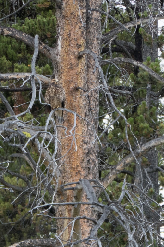
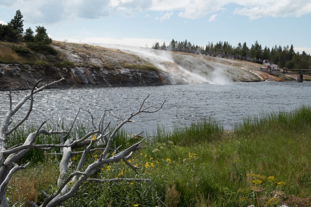
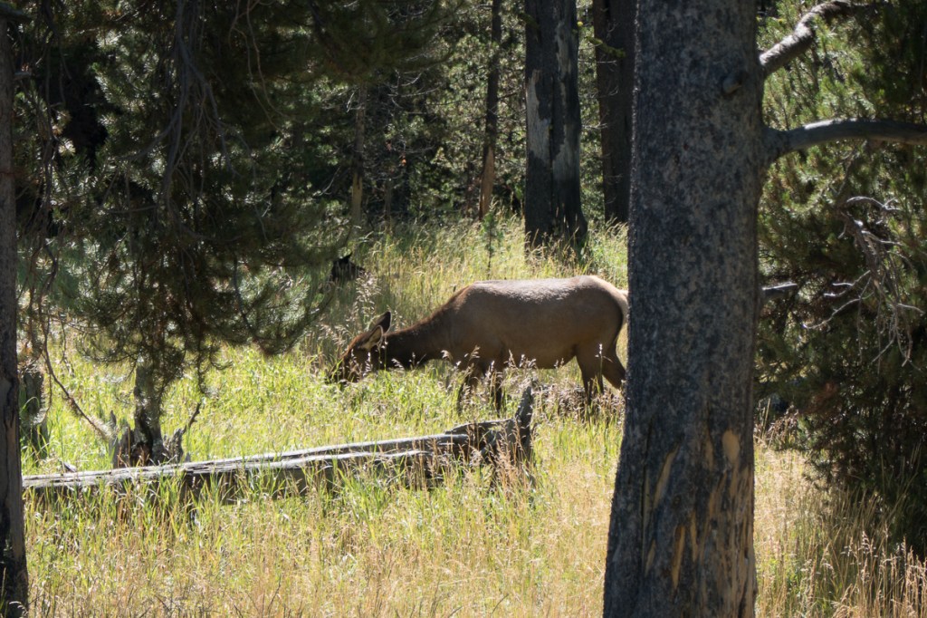
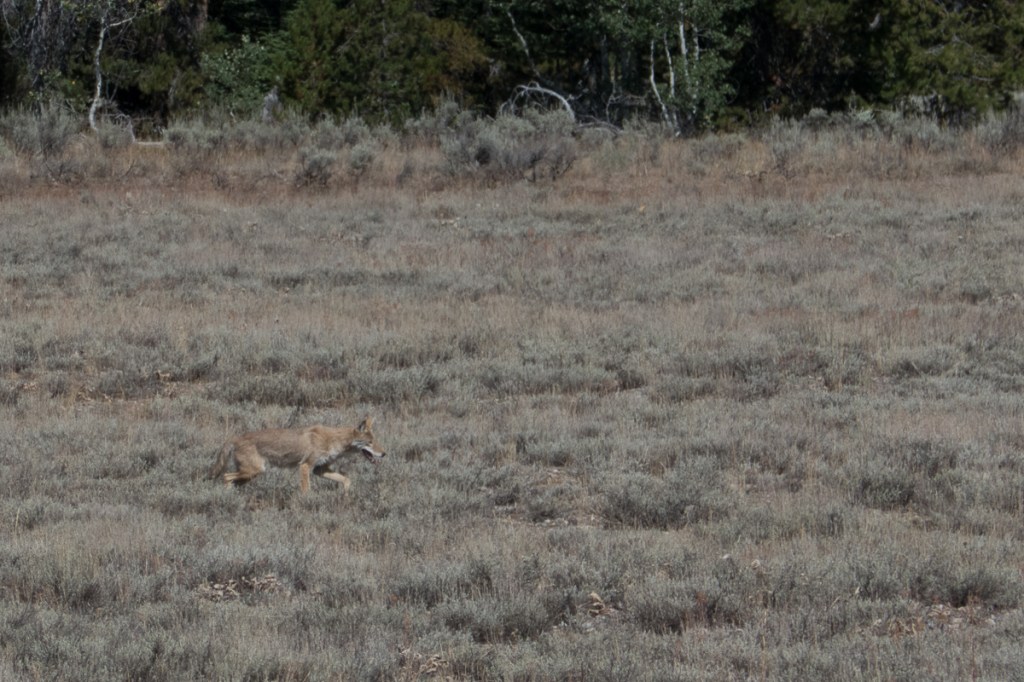
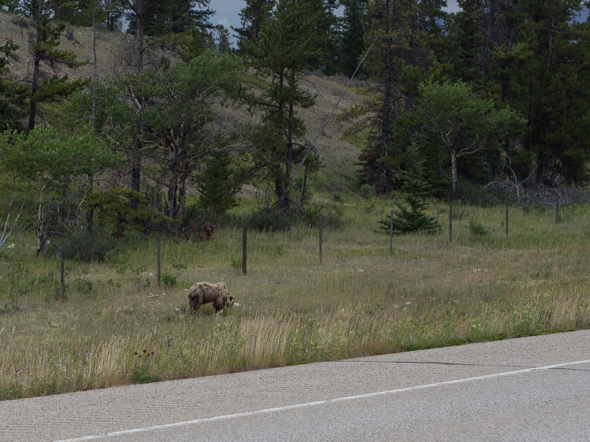
It did! Panoramic views of pastures with bison was the first wow point. Towering cliffs with mountain goats was a close second as was the mummy grizzly with two cubs. The latter both in the distance but still fantastic to see. From there the list continued to grow with birds of prey, elk, deer, coyote but the most impressive things were the geysers, blow holes and steaming sulphur pools.
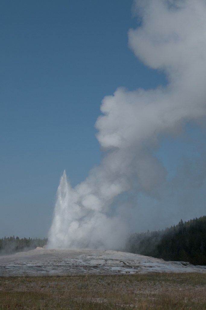
Yellowstone is one of the biggest geothermal & hydrothermal areas in the world. It is still an active volcano! Old Faithful is a geyser that has been closely monitored for decades to explain exactly what is taking place for it to blow every 90 mins-ish. Because the earth’s magma is only 5-7 kilometres below the ground in this area it heats the land and precipitation significantly. Rain water and snow-melt that seep into the land down cracks etc heats up very quickly. In the blow hole of Old Faithful there is a constriction near the top causing a greater amount of pressure as the rising hot water gets trapped. It finally explodes upwards with great force causing the geyser. The temperature at ground level when the ‘explosion’ takes place can exceed that of boiling water.
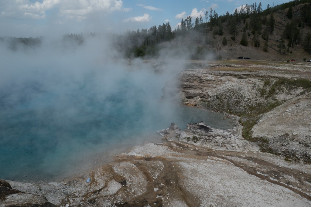
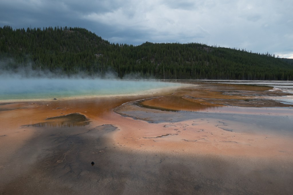
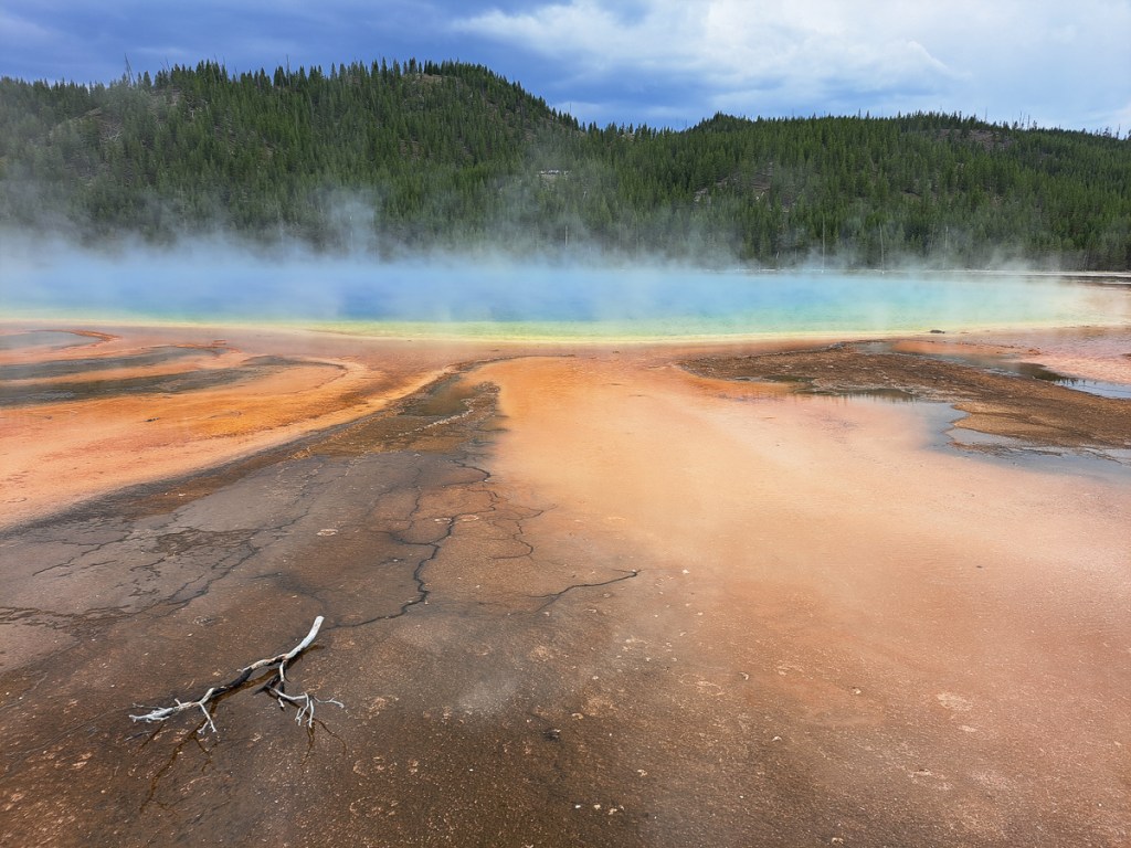
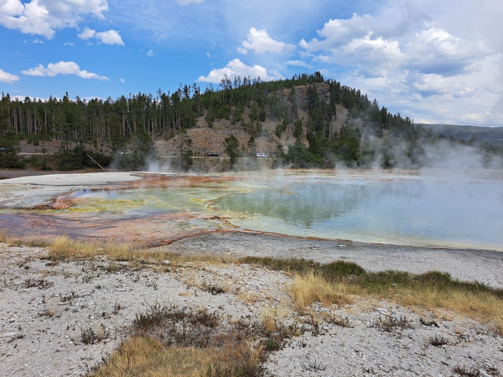
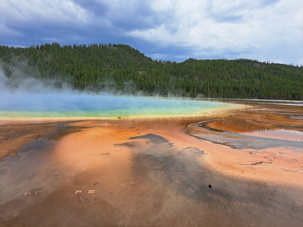
Another key feature is the Grand Prismatic Spring which has rainbow colours that look straight out of photoshop. It is caused by bacteria and other microorganisms that can withstand the extremely high temperatures. As the water moves away from the central point it cools and different microbes can grow and concentrate causing different colours the further away from the central point. Another wow moment!
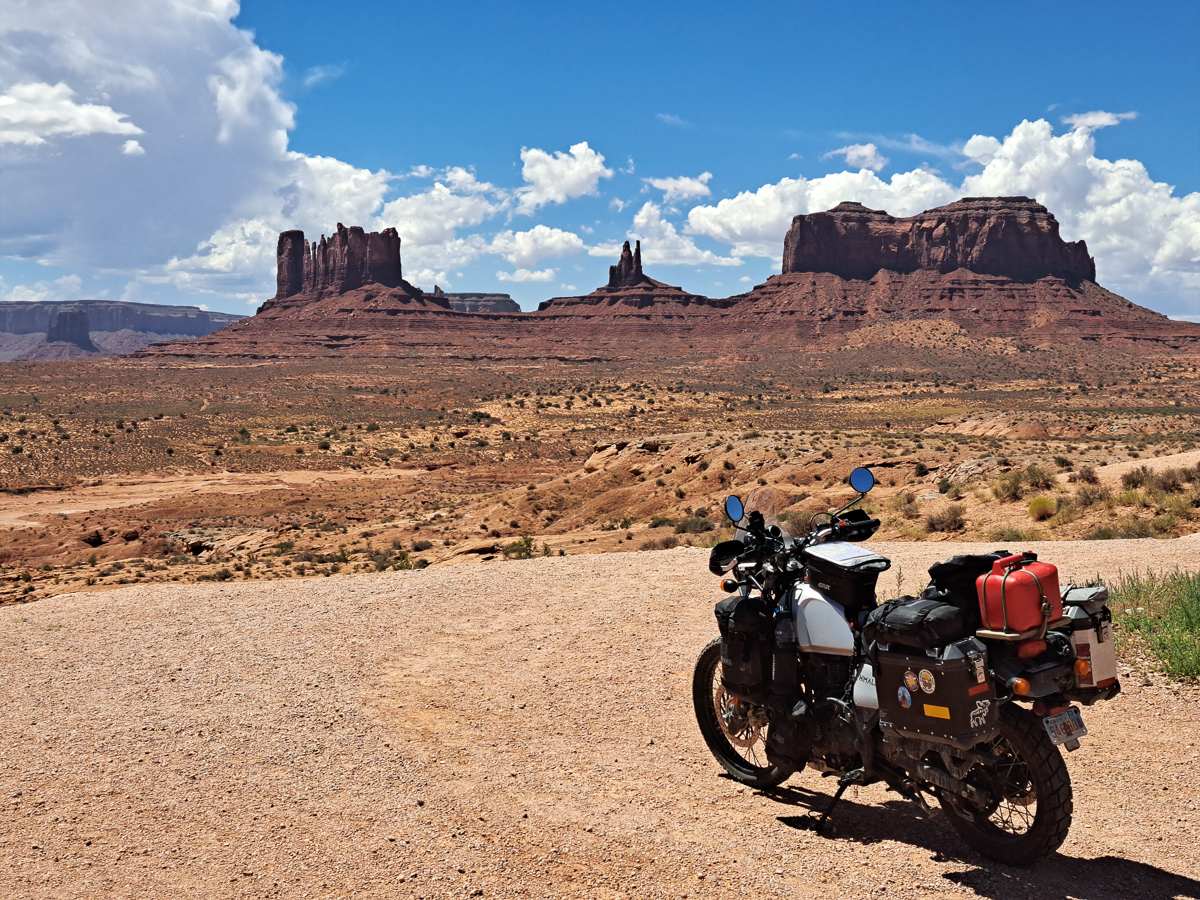
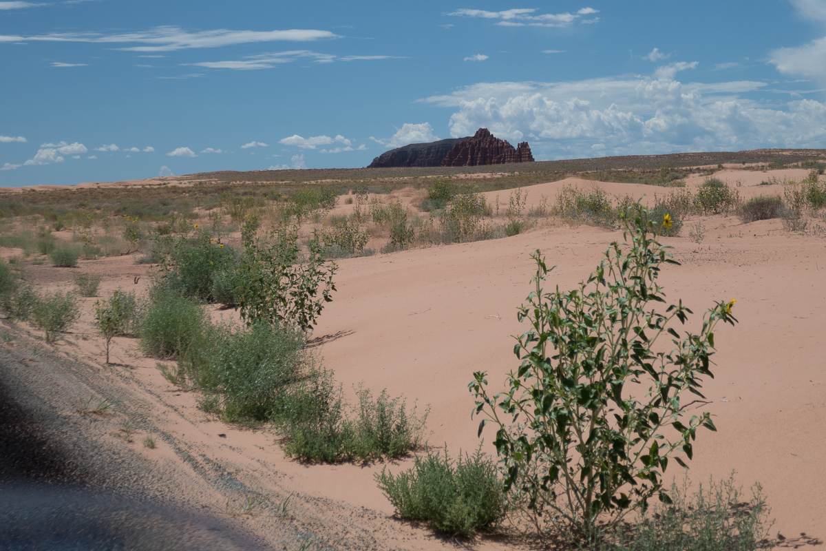
An alert reader may have spotted that our Route 89 plan was taking us through the third vertical column of states: Montana, Wyoming, Utah and finally Arizona. There were odd side trips and corners cut – Sturgis is in South Dakota, and somehow we were in Idaho for a bit. Gradually ticking off the Must See Sites, Yellowstone segued into Grand Teton National Park (nearly as interesting and much less crowded) then we passed through Utah, which was stunning rock, rock, rock, but not so prominently named until we dropped into Monument Valley, on the Utah/Arizona border.
To get into Monument Valley, we were out of the almost continuous named National Forests into an area of desert. The transition from one to the other had us riding along roads with sparsely spaced mainly fir trees through rocky canyons until the trees disappeared altogether and the vista was thinly spread scraggy shrubs and sand. Gradually the shrubs disappeared too. During this time the wind increased significantly until we were both squealing through the intercom about the severe cross wind and sand storm streaming across the road. We were not quite horizontal but getting there! A large transporter overtook us causing the usual draught where we pinged away from the vehicle as the wind was blocked and true to form as it passed we got sucked into it’s wake but were very promptly spat out as the strong side wind caught us again.
This took place against a back drop of dark ominous clouds ahead of us to the left and right. Lightning jaggedly illuminating them sporadically. Our focus was fixed firmly on the small spot of blue sky and white clouds directly ahead separating the two. If only we could get there before being engulfed in the pending storms to its sides. What do you expect, a trucker at a gas station had told us. ‘This is the start of the monsoon season!’ Certainly our focus has moved on from mosquitoes and is now firmly on how to cope with the 38+ degree temperatures that lead into the rain storms where the temperatures drop to 14 degrees within minutes.
But these stormy conditions usually didn’t last long. Seeking shade was more common.
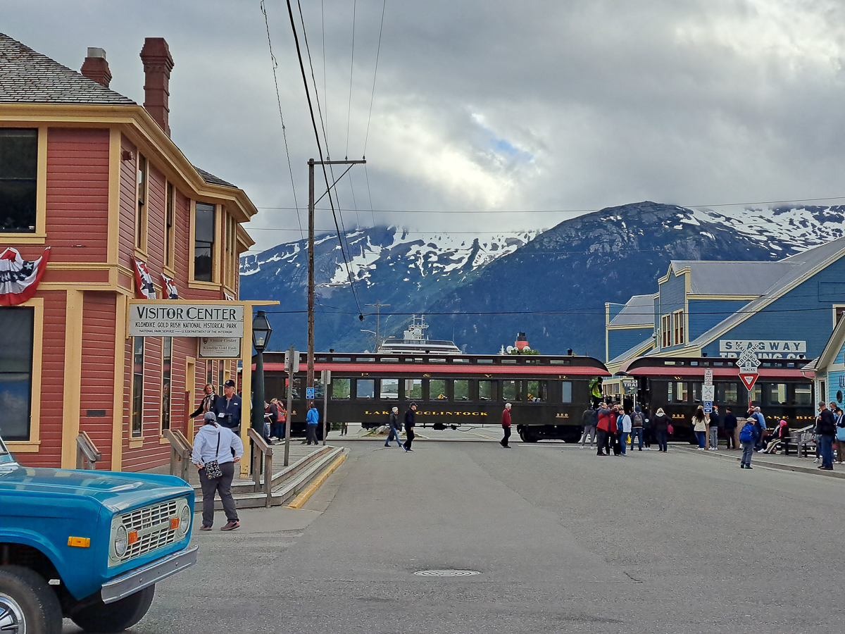
Our route is currently weaving around ticking the boxes of you must see this and must see that. Skagway was the first of these. The route down was through more awesome scenery but equally the town itself was of special interest. We camped at Dyea a small hop round the peninsula from Skagway. Back at the turn of the 20th century Dyea was a thriving town building up from ‘nothing’ to accommodate the gold rush influx of hopeful prospectors. There, was the start of the infamous Chilcott Pass route over the mountains en route to Dawson City. The alternative route, the White Way, was from Skagway through lower land but with thick mud and rivers. Both routes were extremely hard.
The Canadian government, concerned about the influx of people resulting from the gold rush, and the impact this would have on local services (which were, err….what exactly?), insisted that each person crossing the border from the USA had to bring two years worth of supplies so that they could maintain themselves for the duration of their stay. This led to enormous packs that took many, many trips up the frozen stairway of the Chilkoot Pass. Entrepreneurs made light of the ordeal by selling potential prospectors sacks that could help transport their belongings up the 1500 steps cut in ice and be used as a ‘sled’ to speedily descend back down the snowy slopes to retrieve the next load. Unfortunately the sacks had to be durable which led to increase in the weight to be transported. Other ingenious ideas also blossomed but many people and horses died failing to survive the extreme conditions. One such place on the White Way is named Dead Horse to mark where hundreds if not thousands of horses died on the trail. But today, road and rail run easily over White Way, Dyea is simply vanished, and Skagway is a cruise ship destination with a main street where one can indeed buy a ton of souvenirs.
The second, 3,000 mile, service at Anchorage had unleashed the full potential of our Royal Enfield Himalayans, well, 5,000 rpm of it. We’re now cruising at a staggering 55mph. Andrew, at The Motorbike Shop, had chuckled that we’d barely notice the difference from the running in speeds. Later on when loosened up more, we find the engine will cruise at 60-65mph with a bit of chatter but no real distress. However, the in-helmet wind noise at that speed, with only a small screen, gets a bit painful. Not to worry! One advantage of being so slow is we have plenty of time to take in the views and observe the wildlife.
The views have been staggering. Riding east into the Yukon on the Alaskan Highway led to spectacular panoramic views as wide valleys opened up. Flowers edged the road side, rivers meander across the valley floors. The only thing missing was the sheep alluded to on the signpost. We went from the snow topped mountains of Alaska into the more rolling, greener, countryside of the Yukon and the change was refreshing. A short leg in BC was even greener, and now we were seeing small scale agriculture, too. Continuing on from BC into Alberta the mountains had gone replaced by expanses of arable land. Hay bales in one field a tractor ploughing the next. Initially they were quite small but soon spread to a considerable expanse. Nearing Edmonton, prairie farms started to appear, miles upon mile of crops, mostly mown hay, rape (canola) and barley, but also oats, wheat, linseed as we turned south. And every second field had a nodding donkey extracting oil.
OLYMPUS DIGITAL CAMERA
OLYMPUS DIGITAL CAMERA
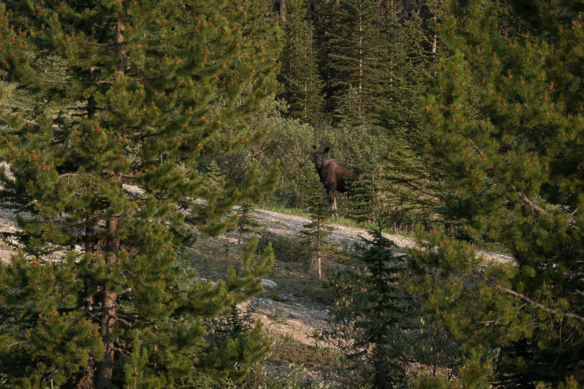
The wildlife has been fabulous. On this last stretch we’ve only seen one grizzly bear but plenty of black bears. The black bears are smaller but we’re told, that just means they take longer to maul you to death. One person is usually mauled every year, Dave in Edmonton tells us. Erron, a local guy we met at Mosquito Creek campsite added that a doctor and his wife where killed walking out from Banff this spring. Bears he was telling us, ‘can go from zero to 30 mph just like that. They are soooo fast.’ Safety around bear strategies include bear bells to ring out ‘dinner time’ and playing dead. ‘It’s great to practise,’ Larry, at Toad River campsite, laughed, ‘because you soon will be’. Studies have suggested that the machos who carry a gun will be too slow to draw and aim it. So it’s bear spray, the counter attack, or nothing. The bison along the Alaskan highway were beautiful too, all recorded on GoPro video. A few deer have also skipped across the road ahead of us. Two bounds and they’re gone. But the one that got away was probably the most spectacular. It started as a small dot. Our first thoughts were could it be a bear. ‘No! It’s flapping and it seems to be two small dots’, I exclaimed. It could be something blowing in the wind but road tyre debris doesn’t flap and is too heavy to blow in the wind. Slowly it revealed itself as two birds. Ravens probably, there’s quite a few of them around. Nooo! One of them has a white head. All too late to start the GoPro it flew up from it’s road kill meal swooping right across our path – a beautiful full wing spread of a bald eagle a few metres in front of us.
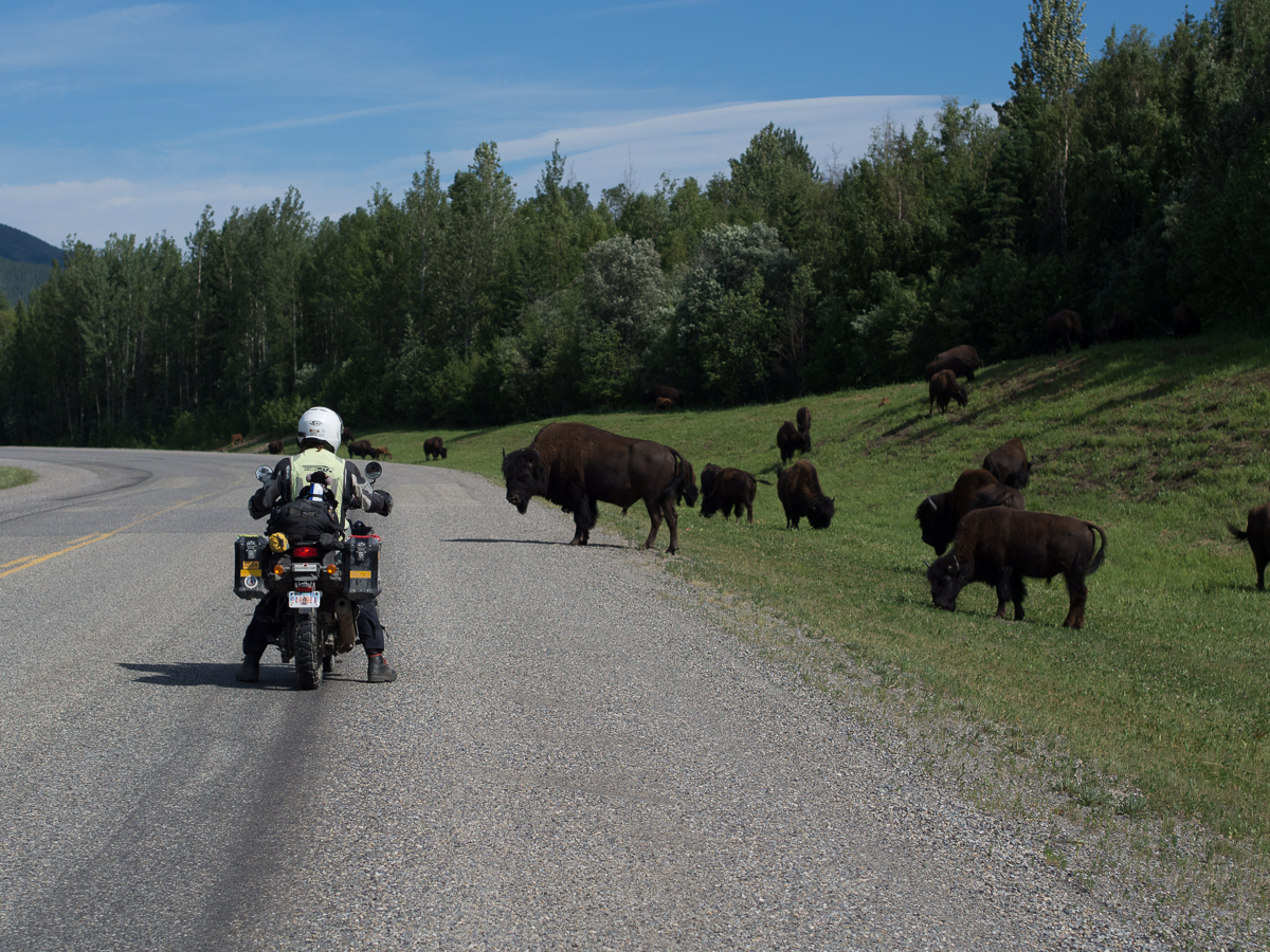
We have great respect for the wild life we are passing and pay heed to the warning signs around, one of which states, ‘Don’t stroke the hairy cows’. When riding down through Elk Island Provincial Park, Gid was calmly and slowly easing past a lone male bison which was on the other side of the road when it turned and gave chase. From my vantage point some 15 – 20 metres behind it looked as though it got pretty close!!! Seems like the lone males might be a bit less relaxed about traffic than the breeding herds we’d often passed earlier. Perhaps this guy had the hump ‘cos he’d missed out on the lady bison this year.
The Alaskan Highway, our initial route across Canada, was hastily started back in 1941, initiated by the American government . The Americans were concerned about a possible Japanese invasion into Alaska following on from the Pearl Harbour bombing. In conjunction with the Canadians the road was built in 15 months but the invasion never came. It did however prove useful as a supply line to the Soviets. Having got to Summit Lake and admired the wildlife and views along the way we turned back because the route ahead to Fort Nelson was described as flat and boring with the town itself not up to much. We headed back to Watson Lake to take the Cassiar – Stewart Hwy south. Many people we’d spoken to considered this the better of the two routes.
Turning left along the Hwy 16, heading east again, small towns again getting bigger sprawled ahead of us. Some abandoned ramshackle properties, the odd one still inhabited. Mine Road, Pit Lane giving clues to former communities. Prince George Town, in recent terms was quite big. It spread out ahead of us barely making a mark on the sky line with it’s one or rarely two story buildings. Heading north from there took us back into mountains, lakes and the spindly, wizened black spruce oozing resin. The black spruce’s high flammability the reason many wild fires take hold and spread so quickly.
The temperatures of at least 10 degrees higher than normal have caused havoc with forest fires in the north of Canada. In the Yukon the fire between Dawson City and Whitehorse was still an issue three weeks after we initially heard about it. Canoeing races down the River Yukon had been stopped because of fire sweeping across the river. Riding across BC we’ve seen evidence of fires with mountain views being obscured and that distinctive bonfire smell in the air. At Johnsons Crossing the campsite owner dismissed our inquiry about safety saying, ‘Yer, there’s a fire. It’s down the valley and across the river so won’t affect us here.’ It’s great to have something other than bears to worry about at night. As we rode further on again the tell-tale smell was still in the air, smoke was wafting across the sky line to our left but on the right smoke was billowing up into the sky. Getting closer we could see one helicopter with a water bomb and two small aircraft circling in the area.
Riding south down the Cassiar – Stewart Highway, a part of our backtracking, took us straight into the scene of a big forest fire from back in 2010. The skeletons of black spruce trees still stood with new growth at their feet but clearly it’s going to take some time to be anything other than the scene of a forest fire. The following year a second fire hit the area but it’s spread was restricted because of the previous burn out. Evidence of past fires is very clear throughout our travels in all but the prairies which we entered near Edmonton.
While in the Edmonton area Jasper had made headline news as there was a severe forest fire raging to the north. A northerly wind was blowing it down onto the town. The news updates were looking grim. Two days later it was stated with impending gloom that the town was likely to burnt down that night. It did. Our route down the famously scenic Hwy 93 through Jasper was not going to happen. Sadly a large part of the town was demolished by fire. The rain came the following day but was probably too insubstantial to have much impact on the well established forest fire. Current opinion in the news is that it may take three months to be truly extinguished.
Having ridden down Hwy 21 where we enjoyed the delightful lush rolling pastures of the prairies and visited the tourist attraction Dry Island Provincial Park where the buffalo/bison were herded over the top of the cliff, we yet again, cut back westwards. We did however manage to ride over the Saskatchewan Pass on Hwy 11 linking Hwy 22 with the midpoint of Hwy 93. It was initially very unclear as to whether the junction would be open to traffic. Thankfully, closed down Jasper was some way north on and we were able to turn south, after being royally shafted by the gouging prices at Saskatchewan Crossing. (A micro can of gas cost us £15). Along the linking pass towards the Jasper end was another interesting study of forest fires. The ground in one area of thinned out burnt spruce had a magenta hue – fireweed was doing its rejuvenation job, while in the next 10 to 20 km there were areas with green 1m high trees, 2 m trees etc. clearly demarking the zones of previous fires and the progress of regeneration.
In Alberta a second less publicised fire line is currently across the top of the province. Yet again residents have been evacuated. This fire has had a more widely felt impact as fuel prices have been affected due to the risk to the oil fields. 400km south, in Edmonton, the air is tainted with a mild smoky mist.
On our meandering we spent a few days in Edmonton, our first ever Bunk-a-Biker stay. Dave and Ardis were fabulous hosts. A biking couple themselves we had lots in common and great stories to share. Gid was very fortunate to be able to complete a service on both bikes and we were treated to many of the cities points of interest. Edmonton being a target town because of the Royal Enfield dealer for service parts and just in case there were any warranty issues with the bikes. Our stay was so good it was a bit of a wrench to say good bye but I was starting to get twitchy about making progress again and Gid had even had a rest day. Our fabulous hosts had made a few suggestions as to the great routes they had taken and would recommend. Tips like this have informed a lot of our route. So wonderful was our experience together that Dave and Ardis gave us each a parting gift. Like many Americans and Canadians their bikes of choice are Harleys. To our surprise they presented us with parting gifts. We are now the proud owners of some Harley magic as our bells reach down to keep the evil road demons at bay.
Another visit that was hard to leave was to my cousin, Debbie, just down the road from Edmonton in Ryley. Debbie and her Mom, Barbie, the latter whom we’ll visit in Calgary, had visited us in England forty years ago so it’s clearly time that we popped by. Debbie and her husband Robin also talked of areas of interest that we might pass on our travels and made suggestions of places that are too good to miss. I was quite surprised by how many interests we shared and how well we got on. Thank you, Debbie, for my Labradorite bracelet. Another charm to protect me on my way. We clearly need these lucky charms if Gid’s bison experience, above, is anything to go by!
Starting our route across the Saskatchewan pass into the Rockies we went into the second area to display the ‘No Cellular signal for 230km’ sign. The first had been along the Alaskan Hwy where we ran into problems around Muncho Lake. We had wanted to camp in that area but were always too late, arriving at any time after five. A number of the sites could be prebooked but not if you were on the road with no signal. It was the same thing on the Saskatchewan Pass. We were prepared to pay a little extra to get a campsite with more facilities. A flush toilet – luxury, potable water – great. As it happened Crimson Lake campsite, at the start of the pass, talked the talk but couldn’t deliver. The initial site they offered us was unsuitable because it was on a slope and had a puddle where it would seem that recent flood water had collected. When I pointed this out they were happy enough to move us but the hoped for shower was off! Along Hwy 93 and 1A the scenic route through the Rockies from Jasper to Banff we had the same problem. It was in the 230Km no cellular phone signal area. We’ve been to Alaska before in 2012 and had hired a satellite phone. It was expensive, bulky and certainly didn’t do internet. We didn’t consider we needed one on this trip but hadn’t anticipated large areas where we couldn’t use our cell phones. Along the highway through the national parks we could turn up at about a quarter of the campsites the rest had to be pre-booked which we were unable to do.
Most campsites are pretty basic, so we often went for a dip in the local stream or lake That’s typically where the campsites are – next to lakes or rivers but up in the Rocky mountains where the temperatures had dropped from the highs of 33 degrees back to 9 the mountain streams weren’t so appealing. Even the wilderness hostel a couple of hundred metres away from our campsite had no showers.
We reached our Air BnB in Calgary several days after this plight. Gid was very business like suggesting we make a plan and maybe shopping was the first priority. I was already half stripped and on my way to the shower. He was quick to follow.
Our time in the Rockies has been fabulous. We’ve done the classic tourist stuff, Lake Louise and Banff. Jasper is off limits for reasons explained above but the event that will put it in our anals of special occasions is the trail we took up to Mosquito Pass. Three of us set off. Simon, a young man visiting the area on his own and wisely not brave enough to head off solo in bear country had joined us. I was jingling away. Well aware of the jokes – ‘How do you tell Black bear skat? By the berries.’ ‘How do you tell Grizzly bear skat? By the peppery smell and the bells.’ Gid and Simon nattered away. Hopefully that was noise enough!
We climbed up, frequently crossing the creek. We were surrounded by mountains, towering up above us. And spruce trees. We were expecting meadows, which were referred to on the information boards at the start of the trail, but every new view seemed to meet and exceed our expectations. Simon armed with binoculars stopped regularly to spy for wildlife. Once we broke free of the tree line and cut across the stony track at the head of the valley again the views were breath taking. On we went imagining that we’d seen the best. How wrong could we be. Eager to go just a bit further we continued on. The top flattened out to the most amazing meadows. Trumping that was the golden eagle that flew just a few metres above the meadows in search of ground squirrels 30m or so to one side. I had only just said, ‘With so many ground squirrels where are the birds of prey? You can’t have one without the other!’ This spectacular bird soared through. It looked rather black I thought for a golden eagle. Golden being the key word. The following morning Simon brought his book of North Canadian Birds. There it was pictured, the golden eagle – black, in the mountains (seen at over 2200m it ticked that box), solitary, lives on ground squirrels etc, nests in the mountains. It certainly was a golden eagle!
OLYMPUS DIGITAL CAMERA
We will be rather sad to leave Alaska and the Western area of Canada behind so special are they from this and previous trips. We certainly haven’t been disappointed to visit them again. At Anchorage on flying in the American border guard told us that to restart our three month American travel visa we needed to spend a meaningful trip in Canada. Visiting my relatives was on the agenda right from the start. One month and visiting family was certainly a meaningful trip!
And we’re still having a big dither about our route through the USA. In the USA Highway 89 is scenic, we’re told, will keep us away from most big cities and in some beautiful places. But it’ll be August, and these are some of the hottest parts of the United States. Maybe the Pacific coast would be a more sensible, cooler route, especially if we can avoid the megacities and megacosts of California?
So, having found our way to the top, or at least, a top, of the Pan-American Highway, how do we go south? The Pan American isn’t a road as such, or a route, it’s more of a concept. So, we might go this way, or that way. South, somehow. It also kept the option of diversions open – if we didn’t actually have a route.
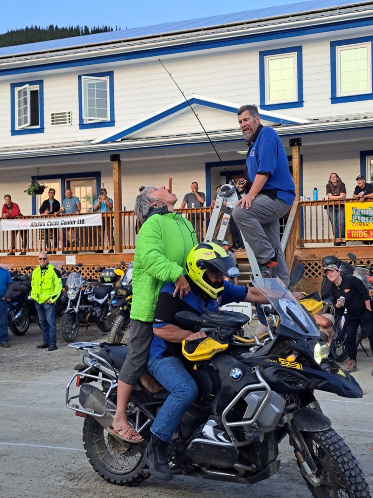
I’d read about the D2D back in February and was mystified by the constant refrain of ‘It’s Not a Rally’. So what was it?
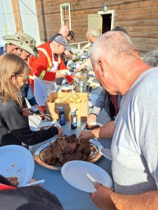
Alaskan steaks!
Clearly, seeing as it was an adventure biker event and we were ‘in the area’ we needed to find out. And, it’s definitely south of Prudhoe, and only a weeny diversion away from our route back to Anchorage. Oh, and over the border in Canada. We’d booked in On-line but were aware that they were expecting ‘larger than ever numbers’. The main events took place on the Friday but tickets for the meal, one of the main events, went on sale 12 midday on Thursday. They were sold out by 5 when Nate, a young American from Rhode Island, who shared our camping pitch, tried to buy one.
To be honest it was Fairbanks that we had come from as that was when we turned east and headed for firstly Tok, then Chicken and on to Dawson but we were expected to say Anchorage as nothing else made much sense. If the conversation with our new acquaintances developed we’d explain that we’d flown into Anchorage, bought our bikes there, already done the Dalton and headed over to Dawson when returning from that. Yes, we’d come across the Top of the World road.
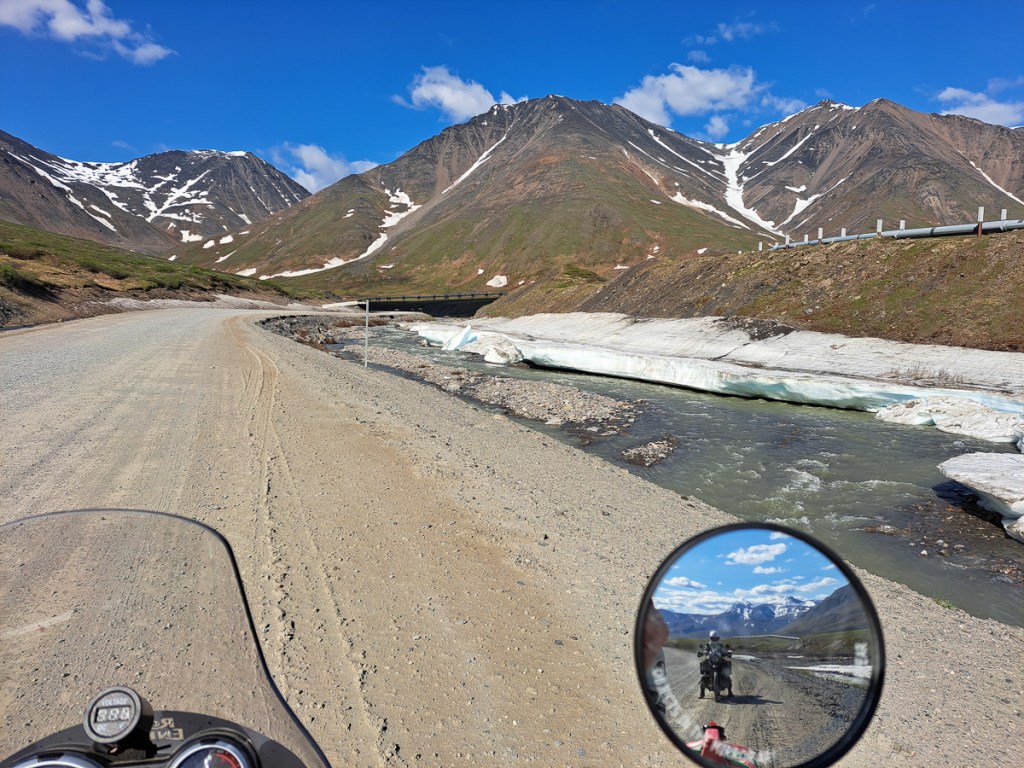
The Top of the World road (TOTWR) is precisely that. It rises up to about 1000m for over 100km. It undulates from one pass to another at times sweeping round corners to display fantastic views of the snow topped Mount Sorenson range or tree filled valleys below. It peaks at the little border post where it got to 1280m. On our way back we had been told that caribou were migrating and passing across the road up by the border post. When we arrived one guy checked our documents while the other was clearly scouting the area for caribou.
Our route across TOTWR had had it’s moments. Gid was leading along the paved road, a perfect surface as many highways start. When about 10miles in there was a black patch. A lot of the repairs are in different colours from the original surface being produced from the natural materials nearby – sand, mud, black tarmac (shipped in), grey rock compressed to gravel (if you’re lucky) . Gid’s voice came blasting through the intercom. ‘Shit, shit! That’s deep’. He’d clearly had a wobble. ‘That’s deeep!’ With barely time to stop myself I came to a stand still, in it. Not 6 inches as he’d said but definitely a good 4. Chatting to some bikers later others had clearly been there to with equal tales of surprise and dismay. All happy to laugh about it now it was history.
Other excitement on the TOTWR occurred the following day. One chap exclaimed that he’d had a heck of a time coming across in 6 inches of snow. Mark, a new friend who is part Indian, an avid rider and has lived in Alaska all his life reiterated this saying that he wouldn’t have made it if it hadn’t been for the tracks of the car in front of him. A third person in a car was also dazed by the weather up there. All agreed it was six inches deep. The latter continued that he’d seen 3 or 4 flash fires from the lightening. In our first two days in Dawson we’d got used to the oppressively hot mornings and thunderstorms in the afternoons.
1% of Alaska burns out every year. To give that some perspective, 2% of Alaska is populated. The fires are left to burn out as that is a part of natural regeneration. The old burns down, clears the leaf litter and debris all of which rejuvenates the soil. The roots of the plant Fireweed are fire resistant so it regenerates quickly. It’s also a prolific seed producer which in turn brings in the birds, squirrels etc. And off it goes again.
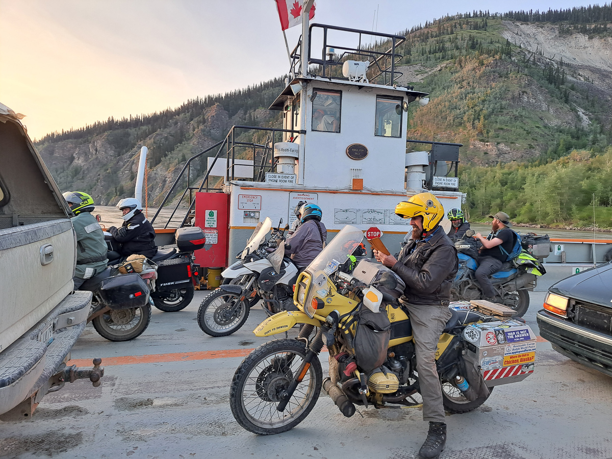
Whilst all was clear for our way back to Anchorage, where we were getting the bikes serviced, it wasn’t the case one week later when we returned to Tok, the launch point for the TOTWR. Revisiting Eagles Claw campsite, a bikers campsite at Tok, the chatter was all about the road being closed between Dawson and the more southerly town of Whitehorse, because of forest fires. It had been closed for a couple of days and we were strongly advised not to go that way. The following morning the road closure was confirmed by the Yukon news station. Several days later it was still closed with one or two trips being lead with a pilot car, as a lady hoping to make the journey was telling me.
So, the D2D. Bikes were arriving from all points. The widest possible range of old and new adventure bikes, and a few brave cruisers (Hi Behr, hope the 34-year-old Electraglide made it home to Germany!). The poker run turned out to be – in the continuing good weather – an enjoyable 60 mile or so loop along local dirt roads, stopping at places of interest to draw a card. When we looked a bit nervous on the surface in places (read – slow), Nate was good enough to stick with us as others whizzed past. In the end, only one little bit felt challenging, but we’re definitely slow. The ride looped back to Dawson for a jolly good natter with other bikers at the steak feast prepared by Dawson Fire Department (proceeds to local charities). Then outside for the biker games, which definitely planted ideas for our RoSPA SMART training team back home. Mark appeared again here, as a bit of a star (opening the slow races – on his Ducati). And, as well as the (informally) organised events, an awful lot of chinwagging, and I suspect, beer too.
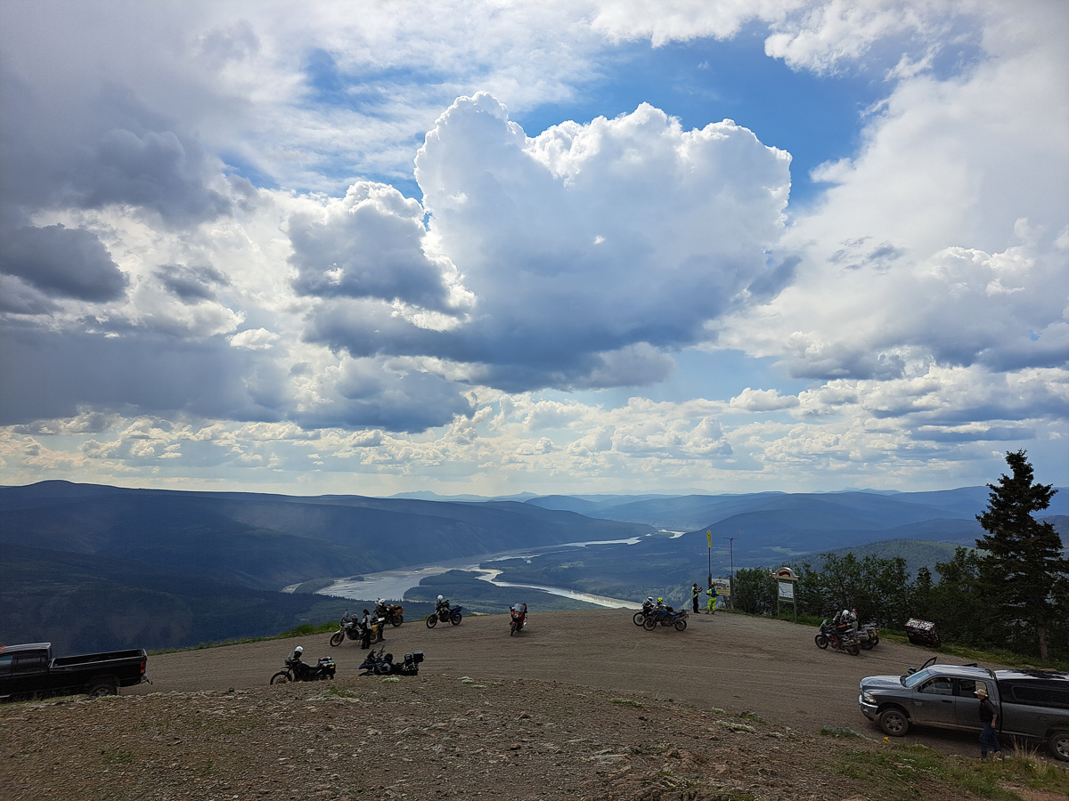
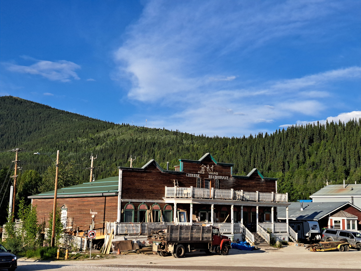
We hadn’t twigged before we got there, but Dawson City is the famous historic town at the centre of the 1898 Klondike gold rush. Well, it wasn’t historic then, just a gravel bank that the local Athabaskan Indians appreciated as a summer camp. They withdrew as swarms of smelly prospectors turned up by boat, and built a camp. Enterprising non-prospectors quickly built a town. After the gold was gone, it quieted down a lot, and now is reinvented as a living memorial to the gold rush (ahem, tourist town), with still a bit of a supply centre for the remaining local miners. Many of the buildings have stood still although some explained that many decades of the permafrost melting and re-freezing beneath the buildings had shifted the foundations severely. Now some are decidedly wonky.
That big grey thing is a gold dredger. These gigantic barges were winched through the river bed, banks, and shoals, washing gold out of the gravel. A reminder that for all the romance of “panning for gold”, the early 20th century was an industrial age.
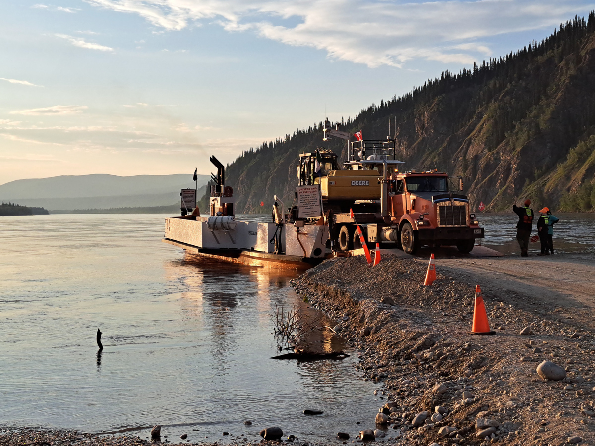
Dawson City is at the confluence of the Klondike and the bigger Yukon, and the river boats came downriver from Whitehorse. Sourced with snow melt in BC, Canada, just kilometres away from the Pacific south-west coast of Alaska it heads north and inland and has carved a route out all the way to near the Bering Strait 1,980 miles away. The fast flowing water that passed our camp site was thick with silt. It’s hard to imagine it frozen solid throughout the winter. Sufficiently so that it will take the weight of fully laden trucks as clearly the 24hr ferry can’t operate. During the months of non-drivable ice, the part of the city over the river is isolated.
Photographs recorded the harsh conditions and ill-prepared prospectors. The latter was reiterated throughout the graveyard where tomb stones displayed the names of failed young hopefuls at the tender ages of 26 / 27. The paddle boat graveyard was another vivid record of a by-gone days although the structures to lower the boats into the water still existed, as well as one hauled-out old timer to tour.
The Dalton Highway especially is billed as long distances between any services, but other, more workaday routes in these parts still strain the endurance of riders and, especially, motorcycle fuel tanks. The main road (really, it is!) from Anchorage/Wasilla/Palmer to Tok, had my bike 60 miles into reserve before the well-named Eureka Lodge around halfway provided fuel, coffee (25 cents!), food, and more bikers. The Top of the World road also involved a bit of vapour running, and those roads weren’t the only ones. Gid’s Himalayan seems to have a rather panicky fuel gauge, but also it seems to be thirstier than Clare’s. Maybe it’s just more loaded or bulky. The big bags on the front tank bars do provide a lot of weather protection, though. 60 miles into reserve (as in, the dashboard flashes, there’s no tap), gives a total range of something over 200 miles (haven’t actually conked out yet), and then there’s 2 gallons (~8 litres) in the can on the back. Clare’s front tanks total 6 litres, so we probably both have around 300 mile range.
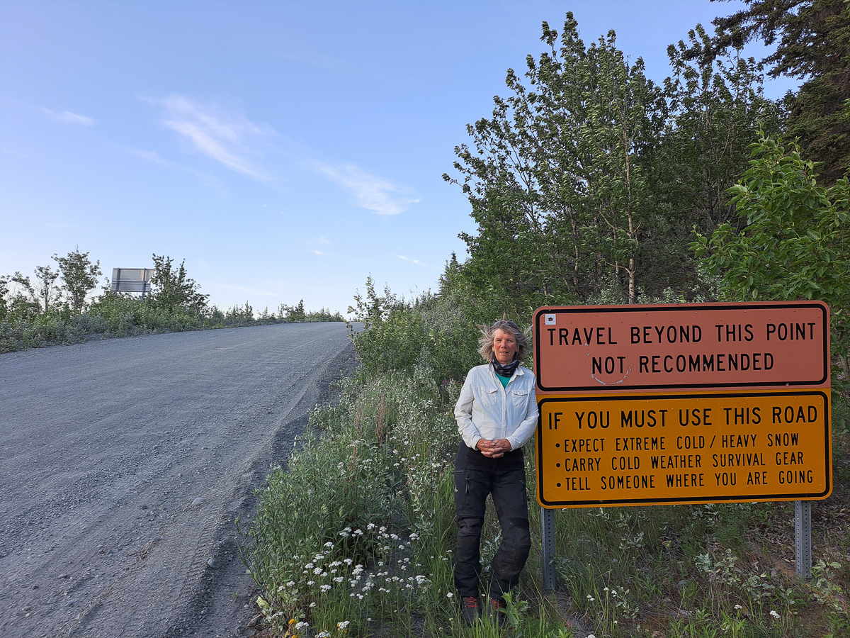
On these long connecting roads, there will be a few small communities along the way but nothing more than a few scattered dwellings that are in a full tank distance. The sheer distance between places is remarkable for a mere Brit. That’s not just Alaska – now we’ve moved into the Yukon, although the scenery and signage differs, the immense distances and rare communities continue.
From Wikipedia:
Alaska – 665,384 square miles, population ~733,000 (nearly a square mile each), the main part is roughly 1,500 miles long and wide.
Yukon – 186,272 square miles, population ~45,000 (about 4 square miles each), around 1,000 miles along the two short edges.
Great Britain – 80,823 square miles, population ~66,000,000 (about 1/743rd of a square mile each), 600 x 300 miles.
Highways are frequently numbered and often named. The longer ones, unless they really are major arteries are typically some part dirt road. Even on metalled sections, ‘repairs’ are frequently areas of gravel spread across the road sometimes for 100m or so and have been known to cover several miles. The weather isn’t friendly to roads. Spring melt floods regularly wash away anything in their path, so some parts simply aren’t worth making up nicely as they’re re-laid annually. And often there’s frost heave or problems with permafrost – many roads are basically millions of pounds of gravel laid onto the permafrost, again, it maybe isn’t worth making a nice finish. But gravel roads can’t take much traffic before they corrugate, and the dust is a major hazard which prevents high density/high speed traffic. So, dirt roads rule in the sticks. They’re a lot better than Latvian ones though, loose tomato sized rock surface and pretty tight bends were frequent there.
The Dalton or the Dempster?
Sitting in our armchairs at home we’d barely heard of the Dempster, not until it was featured in Motorcycle News just the week before we flew out. A pair of tour leaders exclaimed that it had been on their bucket list for a while and they’d just achieved it. That was our first awakening to it’s existence as a biker road. Out here it’s definitely the one to do. ‘You’ve got to do the Dempster! The Dalton just dumps you in an oil field,’ one enthusiast was trying to persuade me.
Although some of the resident bikers in Anchorage we’d spoken to have never done the Dalton and don’t intend to, because of the difficulties in riding it, it’s clearly yesterday’s challenge. As we’d continued on our travels around Alaska bikers told of their Dempster ordeals.
‘Six inches of thick mud all the way’, one grave looking soul who’d just finished it told us.
’80 kph is the only way to crack it. That way you just fly over the pea gravel.’
Wallowing around in the Canadian gravel, some pea sized, some egg sized, which, all agreed was dug up from the river bed and smooth felt like walking on marbles, as opposed to the Alaskan mountain gravel that is crushed and jams together when pressure is applied, was not a great option.
‘It took a while of wallowing to even think of trying it but it worked!’ Richard exclaimed still pumped up with riding at 80Kph across the gravel and beaming from the success. Luckily our 24hp bikes probably won ‘t get to 50mph in deep gravel (who knows?). What a relief.
So, all these dirt roads and wobbly moments – what was the damage? Luckily, we haven’t yet had a spill on these Himalayans. That compares to 3.5 drops of our UK Himalayans, in few miles. But Gid’s bike had been on the deck twice by now. Once, after dismounting in a highway rest area, on a seemingly well chosen surface, the bike decided to lie down. BANG went the airbag vest as the leash pulled out, leaving Gid standing bemused and squashed beside it. No damage apart from a £25 airbag cartridge. The other time, in Safeways’ car park, after shopping, Gid pulled a little on a loading strap, and the bike just toppled. The strap was on the left, and the bike toppled right. It’s a known defect of the Himalayan 411 that, designed partly in the UK, and otherwise Indian, it prefers to be parked on the left hand side of the road’s camber. Especially when loaded. In other words, the side-stand is too darn long! Clare’s UK 2018 bike got an adjustable, but driving on the left, Gid’s UK 2023 seemed to indicate the defect was fixed. Not so. And the forums confirmed it. A solution was needed, we can’t carry on crossing the road to park when there’s population.
We’d headed back into Anchorage for the bike’s 3,300 mile service. We figured it best to have this done at the shop because they know what noises a Himalayan should make, and it might help with any future warranty issues. We also picked up our proper Alaskan plates and title documents.
Tim at Wasilla, having helped us previously when setting up the bikes, had generously offered to shorten our side-stands. We’d had some delays in Anchorage. Getting lost on the way out didn’t help. But when we finally arrived at Tim’s another mate had turned up with an unexpected extra elderly BMW to salvage. Didn’t know BMW did orange bikes. Inexorably, our offer to treat Tim and his wife to a feed was defeated by the clock. Heather, Tim’s wife, generously fed us! A sheepskin seat cover also came our way. What a lovely generous chap! Clearly he’ll need to visit us in the UK.
A couple of people had mentioned McCarthy while we at the Eagles Claw. ‘The place is a copper mine museum and it’s about 60mi on a dirt road but that’s ok once you pass the fishing bridge,’ Stranded Strommer Steven, waiting for parts for his broken down V-Strom had told us. ‘And you can bike across the footbridge to get there. Cars can’t but bikes can’. That clinched it. I had visions of a suspended rope walk bridge that I could cross on a motorbike. It was straight out of some of the videos I’d watched of Vietnamese ladies, infants on their backs, careering up the side of mountains on heavily loaded 125s. Now I had the chance of crossing something in dare-devil fashion. Nervous anticipation was quick to set in.
The road up there was no problem. It was somewhat corrugated but corrugation, mud and gravel in moderate doses were no problem now. Then there was the fishing bridge. Smooth wide concrete across a braided gravelly river. The word was out, the salmon were coming in. There was an air of excitement. It was evening and pickups were arriving regularly, parking on the gravel banks and everywhere else. The river was shared by the rod guys, the wader guys dipping nets wielded at the end of 20ft poles and the bald eagles over head. Spectators watched along the road side. It was definitely a community event, although we didn’t see so much success. After the fishing bridge there was a worrying road sign, clearly designed to deter traffic from proceeding, but actually apart from the road being a bit narrower than before, it was nothing to worry about.
The village of McCarthy, 1km after the narrow but extremely solid metal footbridge we had ridden over, offered tourist facilities and a general store with the usual frustrating mix of things one doesn’t really want, Alaska’s slowest Wi-Fi, and cheapest ISO propane bottles. We rode on to Kennecott where we joined a Kennicot mine tour (Both spelt correctly). Fascinating: Back in the early 20th century it made a ton of money for the owners, and was abandoned in 1938 when the copper ran out. Keen to do some walking we were back the next day, plagued by mozzies at first as we walked along the dingy old wagon road, and on past the mill to visit the glacier. Our first real walk since we got here. And, Ting-a-ling, we remembered the bear bells! Knackered, we dined out that night – luxury. Actually, Alaskan groceries are so expensive that cheaper eat out options are pretty competitive.
From McCarthy (Hwy 10), we headed back to the main road, but this time turned left, heading south-east: towards Canada on the Alaskan Highway. Although Alaska is huge, it has few highways – we probably had traversed most of the metalled ones outside of cities.
It was, rather tidily, July 1st when we crossed the border. Clare’s “tiny bear spray” turned out to be, formally, “pepper spray”, ie for defence against humans not bears, not allowed in Canada, so she had to fill in a form and surrender it. While she did that, I idled round the bikes, and found another missing bolt (running total 3 lost plus 1 tie-wrap, and 2 loose). Easily fixed, but we need to watch our stock, despite commercial and Tim’s replenishments. Well, as we head into Canada, it’s only 2,000 miles until the bikes need another service (perhaps done ourselves this time), and the rear tyres, especially Clare’s, look pretty worn (after only 5,000 and 4,000 miles respectively). So we were already thinking of a service stop.
The full range: CT125 to GS, we’re in the middle.
Eureka Lounge was a vital fuel stop – and good grub. As tour guides Moto Quest know.
Our month in Alaska is done. The overwhelming impressions are: Space, sun (!), empty dirt highways, moose at any point, friendly helpful folks – and a lot of motorcycles.
Our flight to Anchorage was a great improvement over the last time we came here – thankfully. This time all our bags made it too. Based at Melissa’s AirBnb with all we need (bed, space, covered workspace for fettling motorbikes and a helpful host), we strolled over to The Motorcycle Shop (TMS) where Andrew McConnell was very helpful and there’re the bikes. A slick operation later and we’re off to the insurance place. All is good, the quote for us foreigners comes up fine. But. But the actual insurance co only takes cards … that have zip codes. Oops. Cue an afternoon of thrashing about. Unfortunately a Friday afternoon. Which isn’t enough to sort it. Paperwork is sure stressful. But, anyway, we leave with a one week’s cover.
It also turns out that getting a local SIM card isn’t entirely simple either and certainly not cheap. In the UK I pay £6/month for a good enough service. Last summer, in Latvia, my SIM for Europe was about €10/month. Here, there’s nothing below about $30/month. Wow. And the only card we’ve tried so far in my phone, wouldn’t work – we’re told none will. AAT, $40/mo 15GB, works in Clare’s, but what a price!
One gallon milk bottles are a rather daunting prospect for a motorbike tour. Customers are advised that they can only purchase two bottles. Some of the shelves in the store were also running low of stock too. Very covid-esque. Local news told of a propellor being broken on the supply ship which had failed to reach its destination. Thankfully powdered milk was still available. Sorted! But it did start to explain why goods at least are so expensive.
Fully loaded we set off for Seward as our first 300mi initial running in trip. A max of 3000 revs means our top speed is 40mph. We soon observed the signage that states ‘5 vehicles following – pull over and let them pass’, which seemed to work well enough. Gave us time to check out the locals…
Seward Highway Traffic
The Seward Highway, featured in ‘501 must take Journeys’ is indeed very picturesque. Views across sea inlets to snow topped mountains are all very dramatic but the road itself is rather dull. Although it follows the coastline and gently sweeps in and out my lasting impression is of it being on an American highway – mainly broad with long sweeping curves on the sections when it isn’t dead straight. But at 40 mph it doesn’t really matter. Running in a Himalayan is a slow process.
The Himalayan could be described, as Itchy Boots (an infamous motorcycle tourer and blogger) has said as, ‘under powered and over weight’. That’s rather harsh but probably right. I was highly amused to see that the Owners Manual states a maximum speed of 70mph. It’s low down torque and overall speed make it a perfect bike for mountain climbs with sight seeing. In second gear it pulls steadily up the steepest pass. Even when the throttle is released, because of deeper gravel or a series of pot holes etc., the speed drops off but is perfectly happy to pick back up again.
We made it down to Homer, a thriving peninsular with a mix of commercial and tourist activity. A sign displayed that short term parking was no more than seven days but the tourist scene has a board walk of all the familiar niceties- ice creams, snacks, coffees and a few attractions. Undoubtably the star of the day was a bald eagle consuming some road kill perched on a sign across the road. A close second was a moose with her newly born calf we’d seen along the way.
Homer Resident
Back from Homer, and our fleeting visit to Seward, we handed the bikes back to TMS for the first run-in 300 mile service. It has to be said shop servicing is expensive up here, especially in peak time – now! But we’re beginning to realise that everything is. Got them back, and spent the next 24 hours adding our previously prepared and brought accessories to the bikes. Gid’s appeal on the ADVRider forum, for loan tools or covered space (posted before Melissa, our host, had offered her garage), raised a few great offers, as well as alerting the locals to the presence of two ‘clueless’ Brits: Thus Mark, a frequent ADVRider contributor, accosted us with a friendly tease about our English voices as we perused the chain lube at TMS. The best offer though, was from Tim, who invited us into his spacious workshop, where we admired his various moto projects before cracking on with final jobs needing tools we didn’t find it sensible to bring. As icing on the cake, Tim treated us to a lesson in tubed tyre dismounting and mounting, for puncture repairs. We hadn’t got around to this back home – our experience is with tubeless and the “worms”.
Finally, we set off North. The wrong way! But really (or anally), one has to start at the “start”, and the northern end of the Pan American Highway is Deadhorse on the coast of Alaska’s North Slope.
Dead Horse, the end of the road, is not a town but an industrial camp that supports the Prudhoe Bay oilfields
The Dalton Hwy Guide 2024
Just thirty people live there all year round with an influx arriving for the summer season, although a lot of construction is in the winter as ice is more stable than the ground.
That step north, and back, was possibly the most challenging riding we’ll encounter for many months. It requires carrying extra supplies. Not just food and water but also gas – a new one for us (spot the 2 gallon gas can in the photos). The longest hop between gas stations or food outlets is 240 miles. Gid’s bike runs for approximately 210mi including his tank’s reserve of 50mi. That’s taking it right down to the fumes before topping up from his reserve container. Mine for some reason does an extra 30mi per tank. Obviously my smooth and economic gear changes, optimum tyre pressures, unaggressive acceleration make all the difference! The Camping is (mostly) free though which includes a drop toilet but usually no water unless filtered from a stream: So the bikes were loaded up with gas and drinking water. Once at Deadhorse basic rooms at about $220-$260/night are little better than a run down dormitory block, although with private rooms and comfortable but after a couple of days on challenging roads it had a shower and felt like a palace.
To reach Deadhorse, iconically the start of the Pan American, the Dalton Highway is the only road, built as a “haul road” for the oil industry, and it has a reputation for being challenging.
The road is narrow and has soft shoulders, high embankments and steep hills. There are lengthy stretches of gravel surfaces with sharp rocks, potholes, wash boarding and, depending on the weather, clouds of dust or slick mud, Intermittent sections of pavement can de deceptively smooth, until unexpected and sometimes very deep potholes. Watch out for dangerous curves and loose gravel.
The Dalton Highway Visitor Guide Rev 2024
Dear Reader – don’t think we’re all alone: We’ve already lost count of the number of other folks we met who are also attempting (or, rarely, finishing) the PanAm. In our “camp” at Deadhorse, two cyclists had flown in to start. We met bikers doing it. There are those military looking German-registered 4×4 trucks at regular intervals. Names, alas, have already slipped our minds. There are also many bikers on shorter adventure rides (Short? Rhode Island to Deadhorse – try asking Google for a route) and on tarmac, Harleys and the like.
On our way north, three bikers arrived in Coldfoot, one of the very few settlements and gas stations along the way. They had just come in from the north over the Atigun Pass, where the Dalton climbs over and through the Brooks Range. There, the guide book informs us, storms can dump snow at any time of the year. They looked worn out. Conversation sparked off and one chap exclaimed that they had had a really difficult time getting up the northern side of the pass to the elevation of 1422m as they had had to cope with thick mud. Their bikes were certainly extremely dirty. He paused for a moment and said that on reflection it had been worth it but we should expect a tough time.
We had a couple of hours or so to ride before reaching the pass. Our route up seemed fine but we’d been warned that the northern side was much steeper and that we could expect the temperature to drop significantly. From our own monitoring of the recent weather forecasts of the area up to Prudhoe we knew we could expect fog or freezing mist. Temperatures further north at Prudhoe had been as low a 1 degree C. Freezing mist would be a new one on us.
Both of us must have been pondering the ordeal to come and how we would fare. We had contemplated doing some off-road courses this last winter but the weather was so wet in the UK and our bikes at home were fitted with 70/30 tyres, not knobblies that are suitable for mud. Gid on his first off-road effort back in the UK covered 100m before sliding into a tree, whereas, on a different occasion I had made it a whole 10m before the front wheel slipped away from beneath me in mud. Our bikes, now fully loaded, with the same 70/30s tyres weren’t going to cope well in extreme mud.
Our trip over the Atigun Pass was awesome. The wind and strong sunshine had dried out any mud and the truckers had flattened it. We only saw the merest hint of mud. My concern was burning my brakes out on the way down the steep mountain side. In fact, we were lucky with the weather the whole trip: No mud, no snow, and the freezing fog burnt off at Deadhorse, giving a clear view of mountains 120 miles away.
I was retelling the tale to a cheerful flag man who controlled traffic at one of the road work stops. With large machinery working along the road passing traffic is guided behind pilot trucks through the road works. He proclaimed in a slow American drawl, ‘That ain’t thick mud’. He continued with a broad smile across his face, ‘But they like their story so we’ll let them run with it.”
One week earlier, he exclaimed they had had 1 1/2 foot of snow in a day. ‘It only cleared a couple of days ago,” he said. The snow and subsequent ice had been the cause of a wide-load trucker veering off the edge of the road down the embankment. We’d passed that a few miles back. Its load of pipes had already gone. The truck itself would be salvaged just as the other three up ahead had already been retrieved.
Southern ascent of the Atigun. No mud today!
Our spin chilling moment was when faced with crossing 20m of freshly tipped rubble, forming a low berm along the centre of the road. The side-dumper truck, whose load needs a vehicle with 16 axles along its 20 metre length, was blocking the lefthand carriageway. Our pilot car merrily jumped and bounced across it. Well … we made it! But not without some heart stopping moments as the bikes bucked and jerked their way across. On our way back this memory was still with me but there was no sign of where the work had been. All was smooth and flat. I shouldn’t have been surprised as the Dalton Hwy had taken a mere 159 days to construct the entire length of the road back in 1974, describe by many as a ‘momentous feat’. Of course they’d finish that bit in 24hrs!
Most of the campgrounds are provided by one or other of several apparently competing public bodies, and follow a formula of lots of space, gravel to pitch on, a sturdy restroom hut with pit toilets, picnic tables, bear proof rubbish and food bins – and that’s it. Usually no water supply other than treat it yourself from a stream. On reaching Galbraith Lakes, a fabulous spot in the lee of the Brooks mountains on the slopes down from the Atigun Pass we realised we didn’t have enough water. A previous campsite had got the water filtration kit out of the packing. Using our tiny hiking/emergency filter confirmed it as a back breaking lengthy process. Signs at Galbraith stated that the stream leading into the lake was highly contaminated with giardia. Either, boil the water rapidly for 5 mins – our biggest saucepan is 1.5 lt and how much gas have we got? Or, filter it to reduce the risk. Yep, we’ve got a filter. We decided to ration our water.
OLYMPUS DIGITAL CAMERA
Most campsites provide bear proof rubbish bins and food lockers but on one occasion the food lockers were missing even though a sign declared that there was bear and wolf activity in the area. Gid cunningly fitted his food panier with an alarm exclaiming, ‘That should be enough to scare them away’ Revisiting the panier a little later it all seemed to work ok as off went the alarm. Equally, he’d lined he entrances to our tent with throwing rocks in case of a bear or wolf attack. Relieved at our cunning we relaxed into a deepish slumber. It wasn’t ’til the morning when I went to retrieve our breakfast that we learnt that Gid had failed to reset the alarm.
On the northern side of the Brooks range the land is cold, flat, featureless Tundra. Very little can grow. The permafrost 1ft down limits the depth of roots and the resulting height that bushes etc can grow. The plants have developed strategies to deal with the harsh conditions. Some of the spruce trees although they look emaciated might well be 100yrs old. The dark buds of the Blackish Oxytrope plant absorbs the sun’s heat at the onset of spring, whilst still under the snow. Thus warming and melting the surrounding snow to get a head start.
At Galbraith lake we spotted our first caribou. It was a snow patch that moved which was pointed out to us by a Wild Life and Fisheries ranger who was there with a group of children. Caribou eat lichen which is a nutritious, high energy food but in the last few years the snow has melted during winter and frozen leaving the lichen covered in ice. With their food source inaccessible the numbers of caribou have adversely suffered.
Further north we started to see muskoxen. The art of spotting them if they weren’t near the highway was to look for semi rotting hay bales. Voila – now you’ve spotted muskoxen in moult.
We survived the Dalton Highway! And, of course, got a few stickers.
Apologies, this is published about 3 months after we got back! A certain lack of immediacy pervades it.
So, exit the wilds of Scandinavia to a different mode of touring. From here on,we have crowds of cities, book-loads of history.
We knew little of Finland before. One salient point striking us Britons, not just about Finland but everywhere until near home, was how recent so many countries are. From Finland through to Poland, for most of the last several hundred years they had been part of the Czar’s empire. Freed in the Russian Revolution, all but much of Finland were back under Russia’s thumb by 1940 or 45, until the end of the 1980s. So “independence” in the modern age lasted just 20 years or so, before restarting in 1990 or thereabouts. And in that 20 years, they’d fought amongst themselves quite a bit. In the last hundred years north eastern Europe’s national borders have been far from static, and don’t entirely match the language and cultural boundaries. So a lot of the “history” felt as if it were still lurking nearby, and might resume any moment. Well it did resume: The ongoing war in Ukraine added a very big dose of edginess to that feeling.
I should probably apologise for my historical ignorance demonstrated below, and for accidentally treading on anyone’s sensitivities.
We rented a budget apartment in Helsinki for a few days. Importantly, we were able to get one with secure parking, although access was convoluted. It was a sunny 4km hike into central Helsinki. Nice to wander and explore, as true tourists. We found a huge deli supermarket, the first time since Copenhagen there had been such a choice of yummy, or healthy, things. Though, no, there weren’t any paper maps of eastern Europe in the shops. Lots of history to visit and try to comprehend.
Russian Orthodox Architecture
Industrial era cannon on island of Suomenlinna outside Helsinki
WW11 Finnish submarine Vesikko
On 16th August, 2 months after our ferry to Holland, we boarded the comfy ferry from Helsinki, to Tallin, capital of Estonia. Aboard we chatted with pair of Latvian bikers and admired their Smartin Adventure luggage and crash protection on their bikes, a new TransAlp and a T7. Another young Lithuanian was on a CFMoto. Of course, we all had been to Nordkapp.
In Tallin we stayed at a curious camping-in-a-garden, in a sort of cubicle in a sort of gazebo. It worked well enough, and was walkable to the centre. It’s a lovely old town, although far less old than it looks, being rebuilt, after WW11 laid much of it flat. Like many Baltic ports, it is famously an “Hanseatic” city, founded by the medieval trading alliance. We started learning about the Livonians, and were surprised to learn that they and others brought (presumably, imposed) Christianity to these parts only around the time the Muslim Ottomans finally extinguished the Christian Byzantine Empire at Constantinople, in the 15th century, 800 years after the monks brought Christianity to the back-end-of-beyond island of Britain. But, of course, the Romans never controlled this territory or anywhere nearby. What did they ever do for us, eh?
We knew Clare’s bike would be due a major service while we were away, now it was due, and my rear tyre looked pretty sad. Unfortunately no outfit in Helsinki could fit the big service in over our three days planned stop, but Helsinki Honda did do me a new tyre. I’ve ended up defaulting to Bridgestone’s BT23, my earlier fitting of 80:20 road/offroad adventure tyres brought no reward on dry gravel tracks or wet grass, and they’re never in stock; the BT23s seem to always be ready, be it Oban, Worthing or Helsinki. Yamaha Tallin did Clare’s big service and a fork service too. Mechanic one of those slightly curmudgeonly sorts who will often go a bit beyond. Good value, that was. Two pillion runs as we shuttled about for a day exploring Tallin.
We explored further east in Estonia, along the northern coast, ending up in Narva, whose medieval fortress looks across a river at a contemporary Russian fortress. Nearby is a heavily secured border crossing, much less busy than it was before 2022. The mediaeval fortress was interesting to explore, but had been rebuilt. We recalled our cycling adventures in the ‘stans, also part of the Czar’s empire, later the Soviet Union, now independent. There also, the great historical castles were quite often thoroughly maintained, and kept in good repair. We saw a lot more of it as we worked our way west. A very different approach to here in the UK, dotted with scenic ruins, most of which have been left unrepaired since Cromwell blew them up.
We’re in Narva.That over there is Russia, the sea is not far to our right.
I’d always thought of the three Baltic states as “small”, but actually they are each very roughly twice the size of Wales; yet the combined population is less than twice that of Wales, so there’s plenty of forest. Somewhere in the Baltic capitals, we managed to acquire a paper road atlas of the three countries. It made planning a lot easier, and just fitted in my map case. Many of the minor roads were unsurfaced, often the atlas legend was a good guide. As remarked in our Finland posting, we’re pretty slow on dirt roads! Having escaped from the Soviet Union only 30 years ago, and being sparsely populated, the countryside in the Baltics is often a bit unimproved. As always in countries with lots of space, there are derelict buildings – it must make more sense to start again on a new plot.
It’s a small world. We stopped at a rather posh campsite, and there, again, was a German couple from the Tallin campsite-in-a-garden. Less probably then arrived 2 guys, Danes, a father on a Harley and son supporting in car, we’d met before at a curious backroad roadhouse in Finland. But, to confuse us, they’d parted from the second biking father & caged son they were then with, and, they’d exchanged facial hairstyles – the beard had moved to the son. Monthly shaves, like me! Beer was a reasonable €1.50 for a can, so I had my first since Denmark or Germany.
Speaking of beer, somewhere random in Estonia, we turned a corner on a country road, and dropped straight into a random breath test. Clear, of course, and no trouble, but a reminder that from Tallin on, there are really rather a lot of police about. In Scandinavia they are almost invisible. Poland, too, we were pulled over there for no apparent reason, and the cop’s explanation seemed rather, err, weak. Apparently there had been a lot of accidents, so he was certain he wanted to check our V5s (vehicle registration documents). Not sure how those avoid accidents, and he didn’t check our insurance, tyres, or breath. Perhaps he was just curious – seemed a nice chap.
We moved on to Latvia. And wondered in our ignorant English fashion – why are there three countries here, anyway? As so often: Language and religion. Each of the three is quite distinct: Estonia’s language is related to Finnish, and Lutheranism dominates religious life, plus a fair following of Orthodox churches. Latvia’s language is one of the last remnants of the Baltic family, and again Lutherans are the most common religious community. Lithuanian is also a Baltic language, but quite different from Latvian, and most of the population is Catholic. We were also noting, whenever we learned about recent history, that the monolithic Soviet Union, that dominated a lot of the UK’s foreign attention in our youth (the far off sixties, seventies and eighties), wasn’t quite so monolithic after all. The three Baltic states (and for that matter, the ‘stans) did a lot of stuff their own way, and were quite careful of their borders and differences. Much more like the USA than the UK, except that Russia was rather more dominant than the USA’s most populous state.
One of the most fascinating places in Latvia was a 1980s bunker, built by, and for, the government, so they could continue during and after a nuclear war (that’d be, ahem, our bombs then. Blush). The Latvian civilian politburo probably weren’t treated to the latest technology available, and, the Soviets didn’t much go on consumer electronics, and it had to work in a nuclear war, and, it was a bunker, so the technology and ambience looked pretty archaic. You could film Stalin, or Hitler, or Churchill working in this bunker and “continuity” wouldn’t baulk at almost all the equipment. It would have impressed Lloyd George or the Kaiser though. And it might still work, unlike modern electronics with a 5 year life. The generators do still work, as they use them to power the sanitorium above the bunker.
It’s ok – Clare doesn’t speak Latviski or Русский!
It might seem a bit of an odd, though pleasant and countrified, location for the, still operating, sanitorium, but apparently it was built there only to disguise the bunker. Did MI6 know about the bunker? Well, Latvia wasn’t alone – try googling “UK cold war bunker”. Indeed – Subterranea Britannica describes several, albeit smallish, cold war bunkers in our home county Sussex alone!
Bunker green by Dulux
They still run, we’re told
Not sure if way in or way out!
Tactfully, there’s no national emblem on those planes
Riga gave us a shock by having an actual, congested, rush hour. After two months of absent or free traffic, this was a shock. Rather smelly, too, as many of the vehicles date from the early days of Europe’s diesel boom. Well, we have one at home, too. Riga’s old town was attractive, but mostly a late 20th century facsimile as it was flattened in WW2. We listened to a church organ concert and visited the city market. Perhaps Latvia has more liberal trade practices than it’s neighbours as I was able to buy medicines that needed a prescription in some countries (not in the UK), and a SIM card for Europe because my roaming had ended after 2 months (thanks Boris). We stayed in a cheap hotel, and were entertained by the top floor guests who were migrant workers – all men – from Uzbekistan, Kyrgyzstan and more. We had language-hampered reminiscences of our time in those lands. The communal kitchen was very well used, but fortunately I didn’t have to take Clare any plov.
Riga, new and old
Babushkas!
Riga, old and new
Out of town, sometimes in town, our time in the Baltics probably produced around one castle a day. There’s loads. Many are in good repair, some are ruins. Trakei was particularly striking.
Trakei, Lithuania
Trakei, Lithuania. What’s she done to deserve that?
Lithuania’s Hill of Crosses grabbed our attention shortly after crossing into Lithuania. Pretty much all summer, if we’d seen a religious site, it was Lutheran, or latterly, sometimes Orthodox. Hill of Crosses is all beads and Popes (three, IIRC). It was sort of charming, attractively scruffy, but also a little creepy. Its actual religious purpose is, well, it just is. No miracles or martyrdoms. It does
to mark an element of national consciousness for Lithuanians. Perhaps in repressive times crosses were tolerated and national symbols not.
We travelled east to Vilnius, capital of Lithuania. Vilnius is scarily close to the Belarussian border. Unusually for us, we didn’t think of going and peering over the fence, to add Belarus to our little list of countries we have seen close over a border, but not visited (for the record: Iran, China, Afghanistan, Russia). This is a tense part of the world: NATO countries’ territory squeezes nervously through a narrow gap between Russia and Belarus; and that exclave of Russia, Kaliningrad, is surrounded by NATO countries except for its Baltic coast.
Vilnius is a nice old town, mostly original as it wasn’t flattened in WW2. It’s also less medieval, less Hanseatic than the coastal capitals (the Hanseatic League was nautical), it’s more 18th or 19th century. But our enduring memory of it is the horrible museum of the worst period of the 20th century when they endured two Soviet occupations and one Nazi one. The small museum is actually in the old KGB premises and mostly details the Soviets’ appalling oppression and methods. It was also eye opening how long resistance against the Soviets endured, nearly till Stalin’s death.
Vilnius Cathedral, outside
Vilnius Cathedral, inside
So it’s no wonder that Vilnius was enthusiastically hosting its second Military Tattoo with bands and parades by many NATO allies. Just the second, in 2023: They started in 2022, odd that. It was free to attend, and we waited on a bench for it to open. We were joined by a military officer off duty with an injury. He had relatives studying in UK, and we chatted about, well, stuff. Alas, that was it for the entertainment, the VIPs were all in situ, the parade descended the boulevard towards our temporary auditorium, prepared for the ceremonial entry, and – the heavens opened. And how. Totally torrential, and it didn’t stop. Military intelligence had warned of it, and they’d been handing out free ponchos for a while, as even the VIPs had no roof. But this was mega rain. Even the submariners gave up*. Also, the wind started blowing parts of the auditorium over. The outside audience, including us, broke and ran, hiding under the great portico of Vilnius Cathedral. Which unfortunately was also very tall, and facing into the wind, so only kept some of the rain off. I think the event was abandoned.
*Fiction on my part, Lithuania does not operate submarines.
Off from Vilnius, by the afternoon we were in Poland …. what? I haven’t written about motorcycling in the Baltics? Oh? Well it’s fine. Pretty good, not too busy, main roads – where there are motorways we avoided them. Pleasant minor roads. A lot of forest, but it’s normally cut way way back from the road. A lot of the minor roads are unsurfaced, and many then have very loose surfaces, but aren’t much corrugated. Most of the countryside is flat, and the population is modest (and doubtless easily displaced in Czarist or Soviet times), so the roads are usually pretty straight. So unless you actively want to ride dirt roads, it’s not especially interesting riding. There were some pleasantly winding bits though. There are campsites, and cheap hotels, and apartments for short rents. Food is cheapish but you won’t find low fat yoghurt and muesli.
Oh yes, Poland. Ah Zlotys. Didn’t have any. But cards accepted, so we’re good. This border area of Poland is quietly pleasant, a sort of Kotzvolds perhaps. Everyone has been friendly all along, this is no different. I can’t remember if there was really a border; it’s all very European and easy. The day after, we arrived in Gdansk, as following our Baltic theme, we’d take the coast, rather than head for Warsaw and other cities. We rented a little apartment. With secure-ish parking, but rubbish instructions to get in. Including, we didn’t know that non-resident motor vehicles aren’t allowed in the day. So the apparent baffling one-way system is, actually, and really, a no-way system. Good job we didn’t know, because we got in, eventually. And, unusually for a flat advertised as in the city centre, it actually was.
Gdansk is a fair sized city, yet the central old town area is compact and very walkable. Again, “old” town means rebuilt after WW11 to look like the old town. A clue is probably that walls and roofs tend to be straight. Attractive though. We spent a day sightseeing (and getting a haircut) and another day seeing most, though not all, of the WW11 museum. Like the museum in Vilnius, it could, maybe should, give one nightmares. Learned a lot. WW11 was large in Britain’s historical background during my 70s childhood, and I vaguely remembered the 37m+ death toll from WW11 – now we were in areas where the bloodbath was at its worst. In comparison, history I’ve read since suggests that the UK government was quite careful to limit its casualties to under 0.5m, as the memory of losing 4m in WW1 was fresh.
Now, following the Baltic coast west from Gdansk on motorcycles, for us, was a mediocre plan. This is Poland’s riviera, and like England’s, it has an air of having seen better days. But it was still crowded, and even at the fag end of the season, plenty of Poles and maybe others, were ambling about, idling outside tat shops or licking ice-creams. It’s not as pedestrian and bicycle friendly as Germany or Holland, but there’s a lot of crossings! Chug, chug went the bikes, 50kph almost all the way. Still we saw some beautiful beaches, the Baltic was warm and not very salty, and camping was cheapish.
We crossed into Germany, still in a holiday zone. Even though this was our first time ever in the ex-DDR, everything looked smarter, and bigger, and shinier, especially the prices. More cycle lanes. The Ruge campsites were organised to a painful level of do-this, don’t do that. It’s rather the same in our UK Camping and Caravan Club; could it be camping brings it on? Of course, if you actually got past the notices and systems and spoke to the Fraulein of the campsite, she couldn’t be more helpful. I can’t remember whether Poland or Germany, away from the coast, we stayed at a huge, old, much underused, disorganised campsite with creepy dark pathways to giant, echoing, slightly decrepit shower blocks. No notices there.
Although there were still lots of (other) tourists, the roads became much freer. The speed limit went back up to 100kph (for the first time on ordinary main roads since leaving Germany in June). More to the point, we welcomed the end of the ex-eastern bloc habit of posting micro limits covering a few metres, with ambiguous endings. 1 ferry, to island of Ruge, very scenic and perfect, very expensive.
At home we have a Simon Weir guidebook, and before we’d left home, we’d grabbed a few GPS files from it. They were nice roads, strung together with little bits of Autobahn. Little used autobahn at that, so the answers are: Just about 140kph true flat out in 6th, and gets-wobbly-at-the-front at about 170kph. But our IT was frustrating at times, and reversing GPS routes doesn’t work well when there are slip roads onto dual carriageways, especially if you don’t know the local town names. Oops. A cheerful old codger in the welcome caravan at a huge campsite relieved the frustration with a bit of comedy. He was a right joker he was, directed us to a wriggly pitch full of odd noises. Woke up in the morning to a tent full of molehills. I had a minor scare, thinking my bike was leaking oil, but it was just the very thin Norwegian “Racing” chain lube reacting to warm continental temperatures.
Celle, and SilberSee camping. Celle’s a charming old town, with enough to see. We stayed two days. The campsite was lovely, loads of space, freeform pitching, few punters, and a big, warm, lake with a beach. And a simple restaurant. We dived in and caved in. My diary says: “Decided to walk into Celle but bus arrived. Driver chatty, used to play darts with BAOTR at Bergen Belsen (!). Wandered town, old and neat and pretty, homogenous tho. Castle, more palace, outside impressive. Walked back via supermarket, but 500m from home the same bus driver insisted on giving us a freebie. Swam again”. We fixed a minor electrical issue on Clare’s bike and cleaned a leaking fork seal on mine, both satisfactorily.
The next campsite, the distinguished looking owner saw the bikes and became chatty. The more so as we each explored our previous travels. Stunning photos arrayed on his wall. Herr Wolf had had some epic journeys especially in Africa, way back when. On, natürlich, a BMW flat twin. With a sidecar, which, in retrospect, he wasn’t convinced about. The bike was still in his barn, worn and dusty and sans sidecar, but looking sound.
7th Sept. Having decided to skip a flog across the Ruhr and then Essex we entered France. The frontier signage was even less than usual. Clare didn’t notice until we sat down for lunch when I mentioned it. Immediately, a lady passed and said Bonjour, then Bon Appetit. Voila!
Our trip ended with some lovely French roads, charming villages, towns and cafes. A last minute booking on the Dieppe ferry, which drops us almost back home after a 4 hour crossing. Before that, a last leisurely coffee outside a harbourside cafe filled with old radios. Finally we survived the challenge of getting out of Newhaven, on the wrong, or right, side of the road, in the dark.
The Continent sees us off in style – two days before we’d have been thrown out!
We were away for just a few days short of our post-Brexit 90 day limit, and covered almost exactly 8,000 miles. What a lovely trip!
The plan had long been that, after reaching Nordkapp, we’d bum about a bit in northern Norway, travel south through Finland, then home east via the Baltic coast. Well, we’re well on our way, here’s an update.
We did indeed bum around in Norway a bit more. Rode around the the most easterly bit of Norway, peered over the border at Russia. Took a short hike to the “triple border” where Norway, Finland, and Russia meet. Only Norway guards it, and the very civil national service lads explained the rules. As you might expect, nobody was allowed to approach the Russian segment. Then, to our surprise, they said that, since Brexit, we were also not allowed on the Finnish segment. I’ve no idea why. Happy Europeans romped around it, taking pictures with the guards. But we got our first glimpse of Finland, and saw another lump of Russian forest, while we picnicked in Norway.
Border Guards get plenty of photo practice! Norway left, Russia right, Finland behind Gid.
Finland was going to offer us miles and miles of peaceful gravel roads with us wild camping where we pleased by a lovely lake for a swim (sans, obviously though mysteriously, any biting insects). It was not to be.
Firstly, the Finns have tarmaced a bigger proportion of their roads than we’d assumed. Which is just as well, because, well, of us.
Our access at home requires passing 50-500 metres of roughish track, that has to be taken slowly because it’s so uneven, and also quite crowded. I (Gid) feel quite chuffed that standing up on my 500X, I can take some of it at nearly 30mph/50kph quite comfortably, and remembering driving cars in Canada, and riding dry tracks on a slick tyred MTB, I thought biking on well graded gravel would be fine. However, our home surface is mostly quite compacted, so firm under tyre but, err … faced with a real gravel road, that’s a lot flatter, but also usually rather looser, I can go …about the same… Clare’s somewhat slower (and actually standing isn’t feasible on her MT07). Well 50kph max doesn’t really cut it if you want to ride 300 kilometres a day. Plus, it’s uncomfortable sitting, and arduous standing for long periods (my longest was about 25km, I think). It’s also possible that our firm and rather slick road tyres and Clare’s firm suspension don’t help – we both recall enjoying a led trip on CRF250s around Fuerta Ventura’s dirt tracks: Although that probably wasn’t much faster, it felt a lot more natural: tyres, pressures, soft springs and lightness probably account for that. And also, perhaps critically, neither of us has the skills to use offroad steering techniques (ie slinging the back end out to use drive to make the turn, whatever it’s called), and have to corner at speeds where the front wheel can get enough grip, which was often “dead slow”. A real eye opener, and if we aspire to do longish trips where the roads are gravel, we need to resolve.
So, we pretty much stayed on Finland’s tarmac. Mile after empty mile of it. Little traffic. Lots of trees. Occaisional reindeer, who own the road. Seriously, lots of trees. And so, mostly, formal campsites, too. They usually have pretty good facilities. Even some informal, but known, campsites had toilets, which was nice. And everything seemed a bit cheaper than Norway, though not by much.
Shop cashier told us to go back 3km and take the track to the lake. A lovely camp spot.For €20 this had showers and a huge lake.
We had some nice stops as well, especially those connected with Sami culture. Ok, and Santa’s HQ. Clare found out about a famous hiking trail, the Bear’s Ring. Of course, we got to the tourist info for it at 4pm on Sunday, just before it closed. To be told that the bus link to resolve the logistics ran on Monday at 9am. But not on Tuesdays. Cue absolutely frantic getting ready-ness. We’d been scratching our heads about carrying capacity, couldn’t resolve it. My ancient 35 litre packable sack would suffice, both it and me groaning, but Clare had only a micro bag. In the end we bought a new 50 litre rucksack, Intersport’s cheapest. I took the heavier stuff and Clare took the bulk.
The Bear’s Ring is 82km, and the terrain is middling for a hike. We took the default 4 day/3 night option, although a slight misunderstanding of the (must be used) camp locations put us a bit out of sync with other folks from the bus: But, maybe the peace was a good thing.
Apart from a cafe in the middle, good for 1 meal, there’s no resupply option, so food has to be carried. We were super lucky with weather, fine, fine, fine and fine… until, literally the last, steepest, hour. When it rained in biblical fashion. Before we could don waterproofs, we were soaked. After 30 minutes, wading up and down the torrential path, we spied a shelter hut, crowded. Where we all sat and stood the last of it out. Before leaving, we emptied our boots. I was wearing shorts, and my boots had cupfuls in. Clare’s fabric trousers had at least deflected such gross amounts. Let’s be clear: We both had decent waterproofs, but it happened too quick to don our overtrousers.
I think this was late on the last day, before the sky turned black…
We indulged in an hotel for a night to recover. The boots took a few days…
From there, it wasn’t so far to Helsinki. Where starts, really, a quite different phase. From wildness and scenery and lots of camping, we’re now faced with dense history, a border every week. A cultural and historical tour of a part of the world that our anglo-centric history gives us little knowledge of. Another post, I think.