Meandering through Mexico

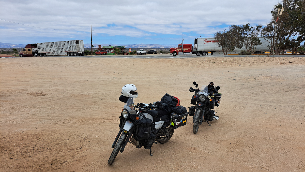
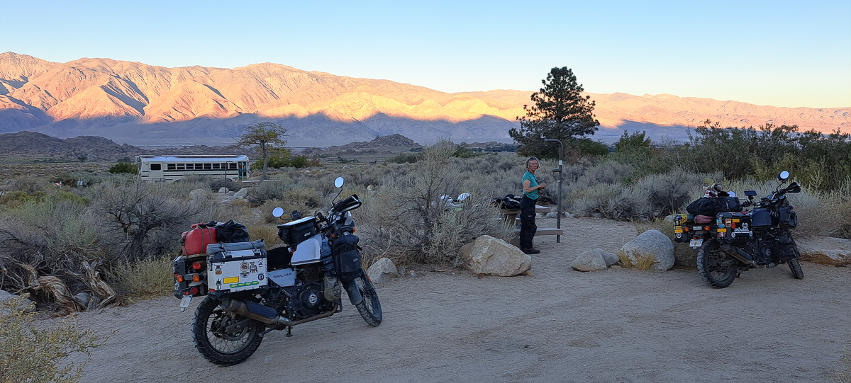
Mexico had such impressive pre-hispanic ruins that we gave them their own post. So what else did we do in Mexico? We certainly zigged and zagged. North and east of Mexico City to start with, then south to the Pacific coast, then north east again to Yucatan. Cheap, basic hotels are readily found in most small towns, but we generally pre-booked to stop in tourist hotspots.

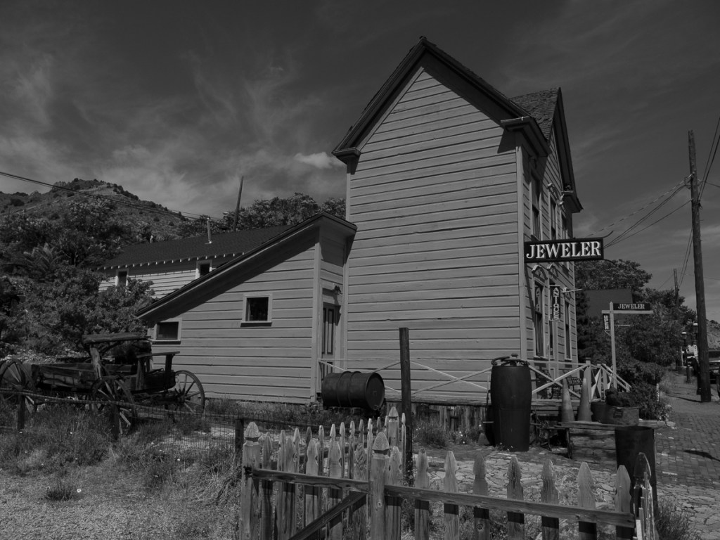
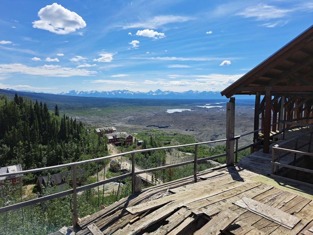
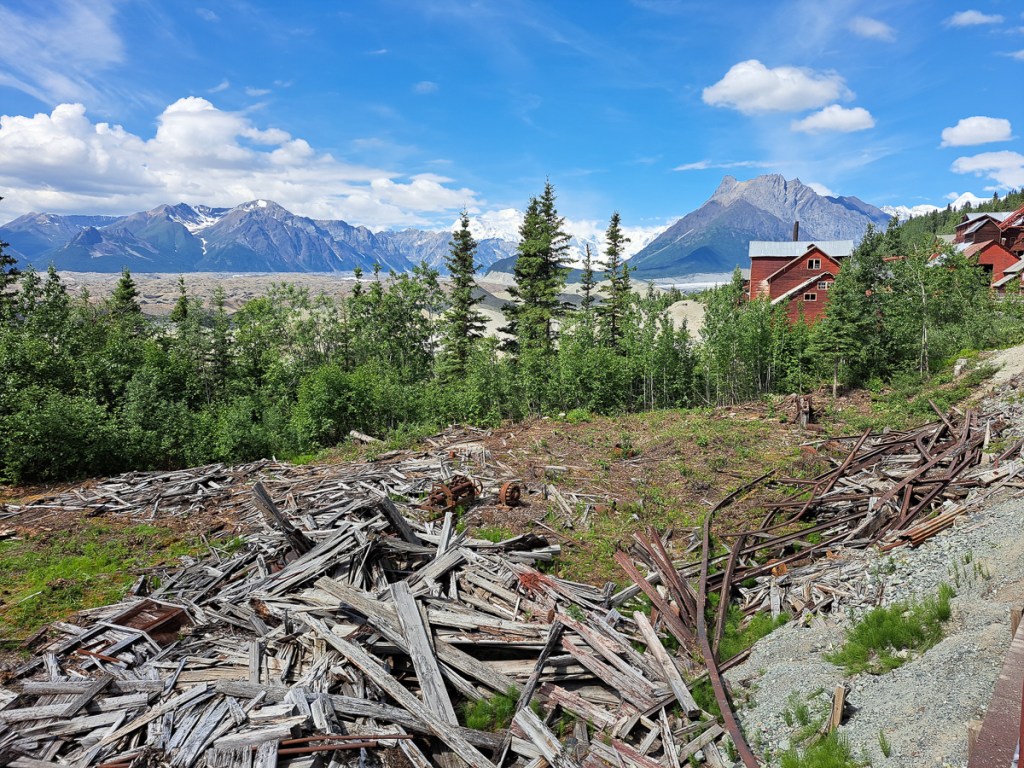
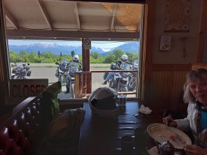
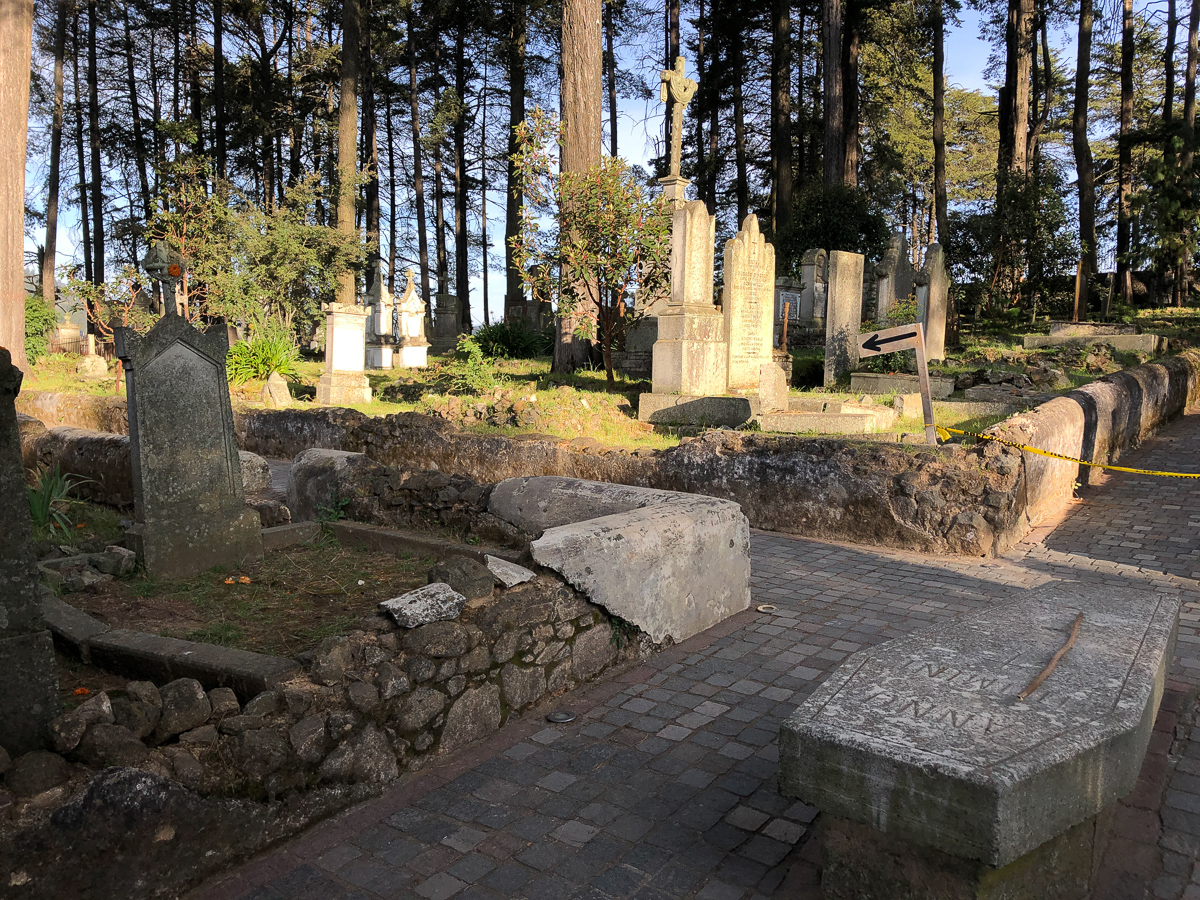
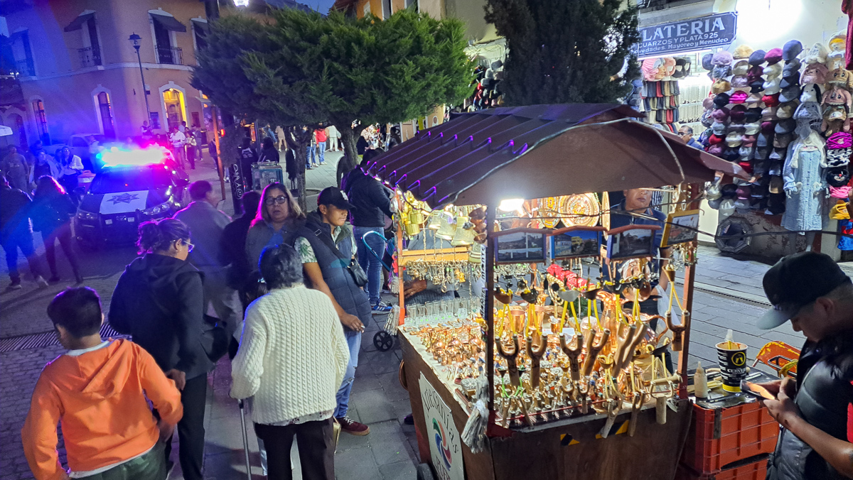
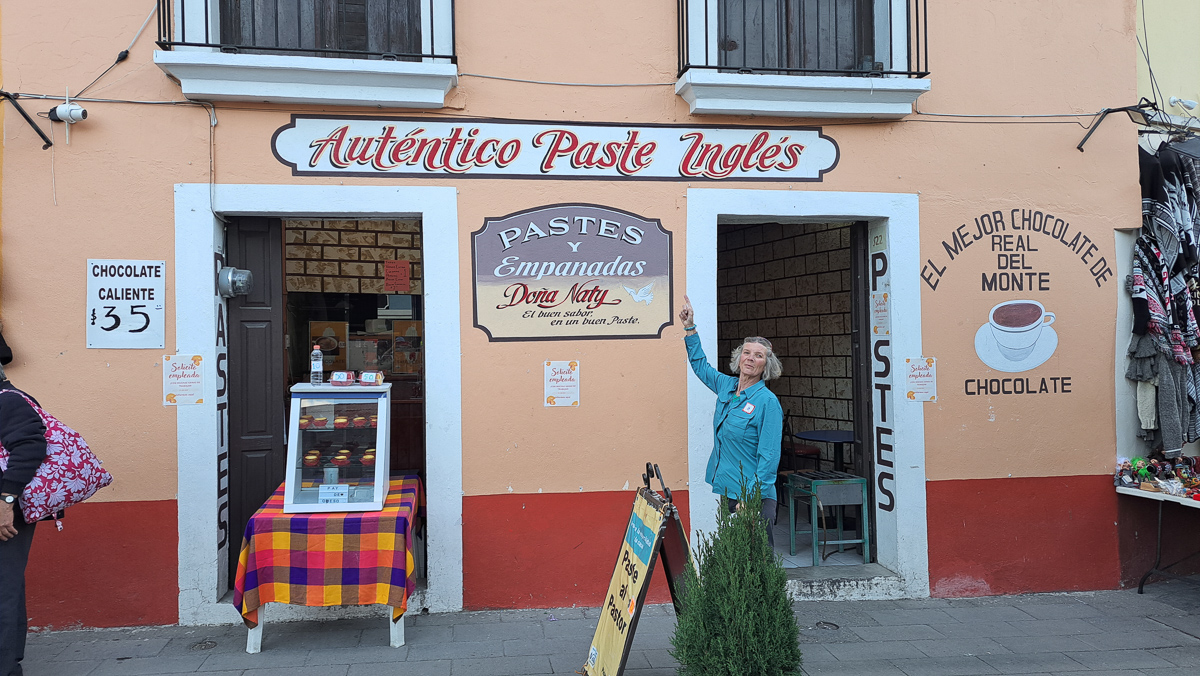
After Mexico City and Teotihuacan, we travelled a short day’s ride to Real de Monte the Mexican home of Cornish Pasties and a British style graveyard dating back to the 1880s.   Cornish miners were encouraged to travel the world to find work back in 1880s when Cornwall’s mining industry was collapsing.   One intrepid group had arrived in Real de Monte.  Families had packed up shipping everything from personal possessions to heavy mining equipment, and not forgetting the recipe for their prized pasties, to their new homes.  The streets were littered with signs for Traditional Pasties, and we’d arrived amidst some kind of fiesta.  It had to be done.  We tried a few.  My first mouthful almost reduced me to tears as the chilli, not a modest amount, scorched my mouth.  I courageously swallowed it washed down with copious amounts of cold drink.  Now my whole throat was on fire.   ‘No chilli / Sin picante!’ became a new phrase in my Spanish vocabulary.  Our Cornish friend, Tony, complained that they weren’t properly crimped.  Neither were they limited to swede, tatties and mince.  An interesting take was the rice pudding version. We tried a few others over the next few days.

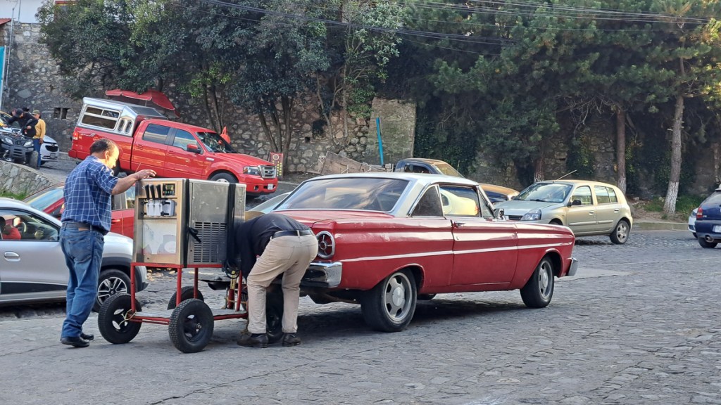
Arriving in the town had been an interesting experience.  Once off the main intertown route the streets were pretty much all cobbled.  Garmin was navigating us to hotel accommodation which Gid often sorts out on-line, but had not this time.  We would stop, he’d speak to the receptionist and a decision was made – yes or no.  On this occasion, complicated by it being a bank holiday weekend, the first nice looking accommodation was deemed too expensive.  We tried a couple of others which were full and ended up heading off out of the city centre. It was, naturally, rather warm, and compounded by the steep 45 degree cobbled lanes – a number of them being blocked by bollards necessitating a u-turn, or festivities linked to the bank holiday, I was getting rather fraught.  Across the valley we’d seen an orange hotel halfway up the hill and headed for that.

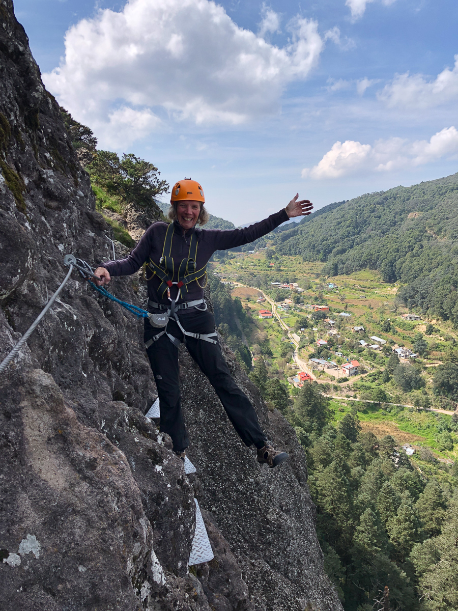
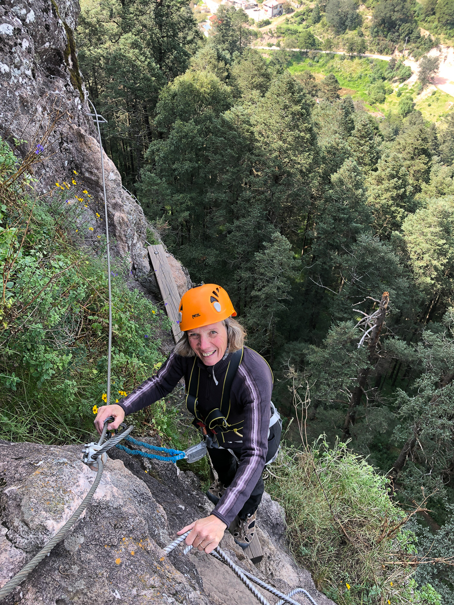
Not so simple.  The sinuous narrow roads were blocked by delivery trucks, the street names weren’t visible and who knows whether this road would actually go somewhere.  The sat nav didn’t distinguish between the tiny streets and twittens with staircases.  We ended up going far too high up the hill and clearly needed to head back down to find the orange hotel.  Gid was leading.  The road got quite narrow heading steeply downwards.  I refused to go.  Very quickly Gid realised it wasn’t such a great idea (steps, bollard) and was trying to u-turn.  Nope that wasn’t going to work either.  He accelerated at the grassy bank thinking that he might progress a little bit up it and then be able to roll back.  Wrong!  The front wheel went down not up, now he was stuck in the hole.  I had to get off and help but was on quite a slope myself.  I managed to turn my bike around by going into an entrance to my side.  “Reception”, it said on the side of a rather grand looking building.  Staff rushed out.  They were keen to check my non-existent booking. I needed to help Gid.  ‘Esposo stuck’, I repeatedly said pointing over my shoulder in a down the lane direction.  Communication established two guys rushed off to pull Gid backwards.  Minutes later he arrived by my side.  After thanking the staff he asked me if we were going to continue looking for cheap accommodation.  He must have seen the glare on my face as he conceded we were staying here, in possibly the most expensive boutique hotel in town. While there, Clare found that nearby was a rather exciting via ferrata course. She did (Clue: Photos not taken by Gid!).

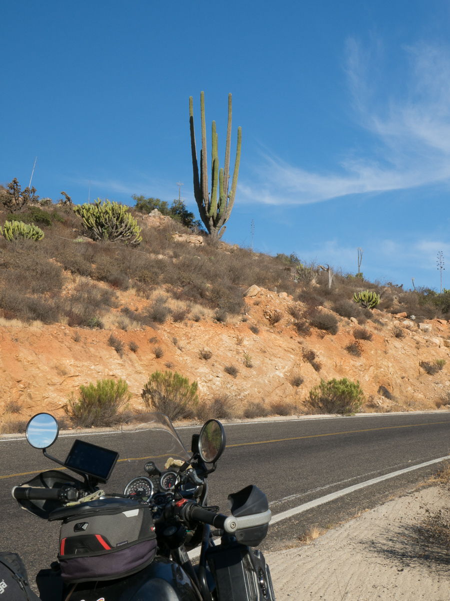
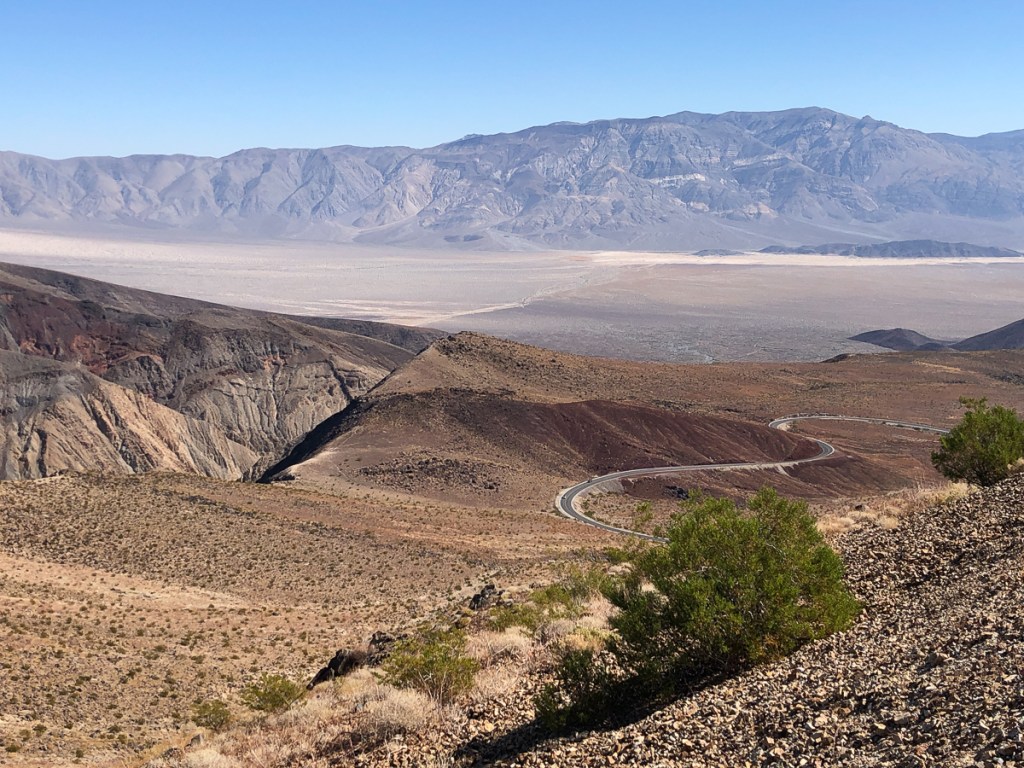
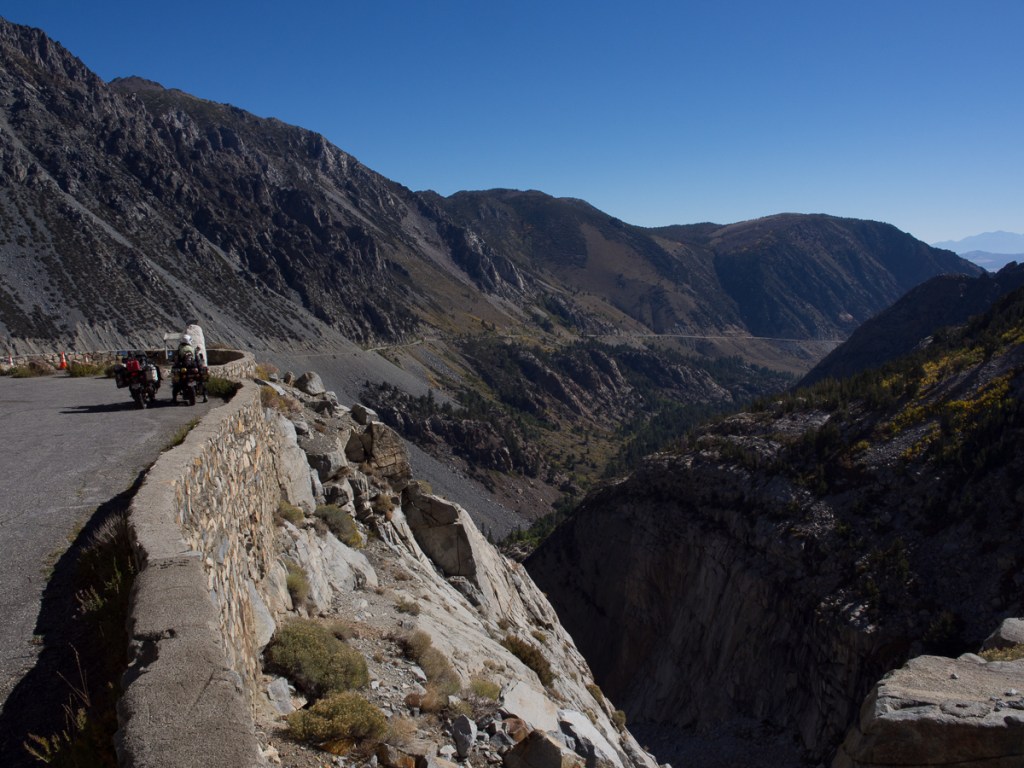
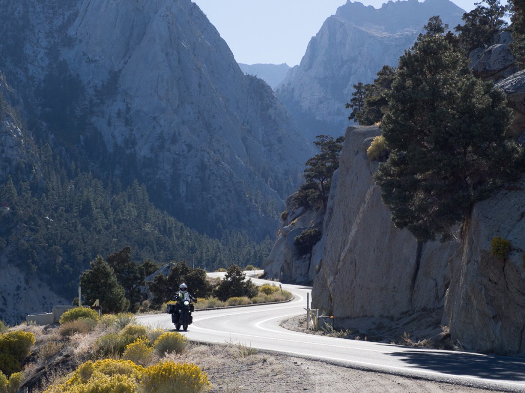
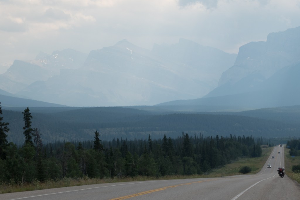
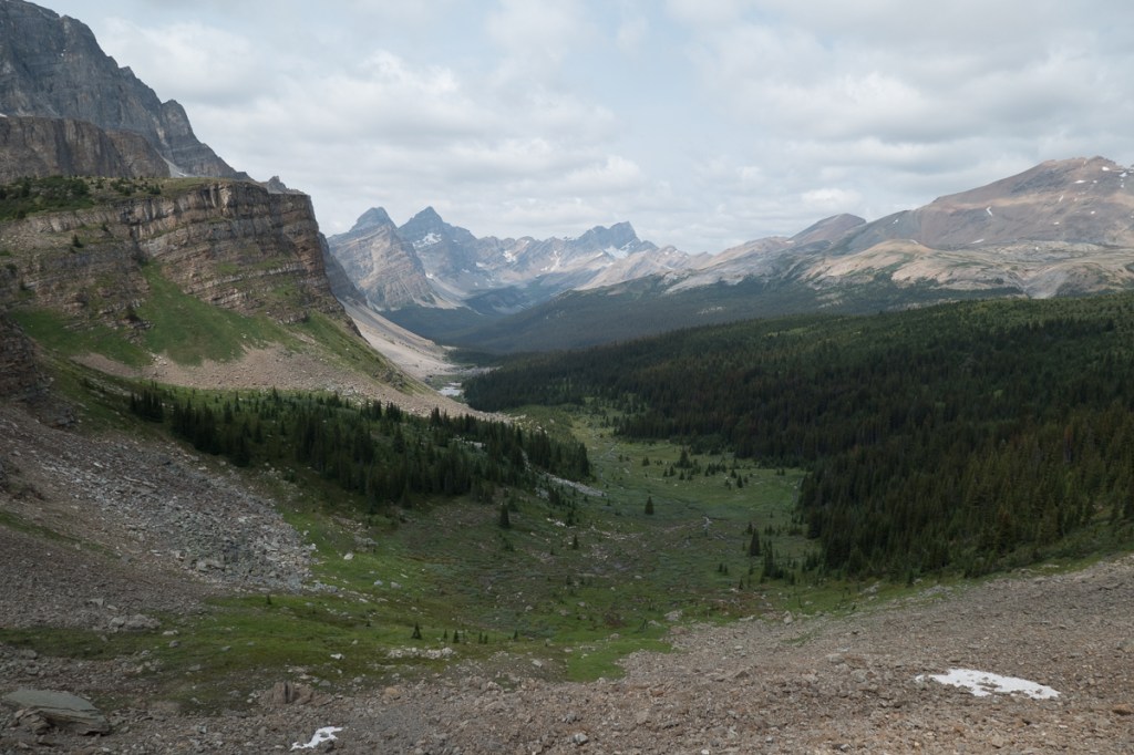
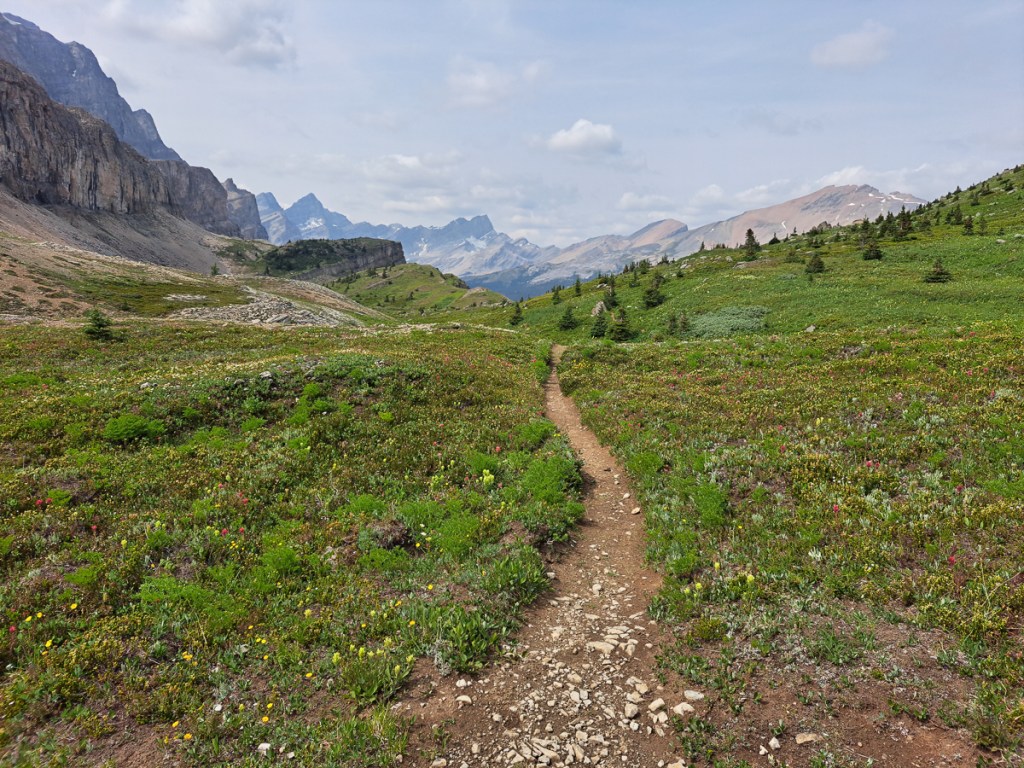
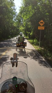
Another box to tick was ‘the best roads in Mexico’.  The Mex-175 was regularly near the top of the lists especially the section from Oaxaca down to the coast.  Gid wasn’t that fussed about going to the coast but I was keen to ride one of Mexico’s top roads.  Alex, in Mexico City, had told us it was through jungle which added to the intrigue.  The road itself was a delightful mountain road, full of twisties some of them very tight.  A little unsettling was the contrast between the bright sunlight which was at times dazzling and being plunged into darkness as we cornered round the base of another ravine especially as the road surfaces are very unpredictable with ruts & ridges, gravel & gullies, pot holes and generally broken surfaces in the mix.  Not to mention topes (speed bumps), which vary considerably from signed, smooth sloped, rising mounds to severe unmarked, abrupt, high lumps.

Later we were on the Mex-190 which I think I preferred.  The road surface was generally a lot better and the bends were more sweeping meaning we could maintain a higher speed throughout the twisties.  The, at times, frequent cow on a yellow warning sign had vanished with a slinky big cat replacing it.  Later came an explanation – you might see one of Central America’s last remaining big cats but it is illegal to purchase a jaguar the signage declared.  Sadly we didn’t see one.

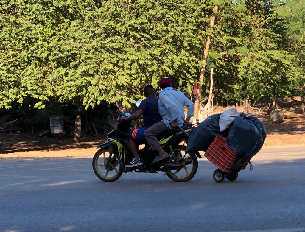
Pot holes which locals sometimes very kindly fill with anything from leaves and sticks and more usefully small rocks are everywhere. Cones are not unknown in Mexico, but absent officialdom, locals put rocks out, sometimes even painting them, usefully marking subsidence at the edge of the road.  The lack of any such notification on a section of subsidence caused Gid a flutter or two when he nearly took the nearside round one “pothole” only to discover that the road was completely missing.  The road had subsided down a small cliff.  We’d just passed subsidence on the opposite side of the road with an approaching car not far from it.  The height difference was about a foot which would have hit the undercarriage of most cars angled between the two.   I wondered how the approaching car was going to handle it and had luckily taken the higher section when we hit the same problem going round a mountain bend. In quite a few places, the villagers seem to dirt-fill potholes in the village, then stand in the middle waving a hat for change. This also happens by a tope, or, they put cones out to bring the traffic to a near halt. Unfortunately, a motorcycle doesn’t have a change pocket (HD or BMW might, electric of course), so we don’t contribute. Similarly we leave unremunerated the occasional jugglers, snack sellers and screen wash merchants at traffic lights.

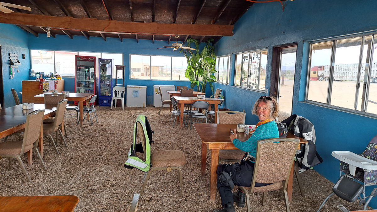
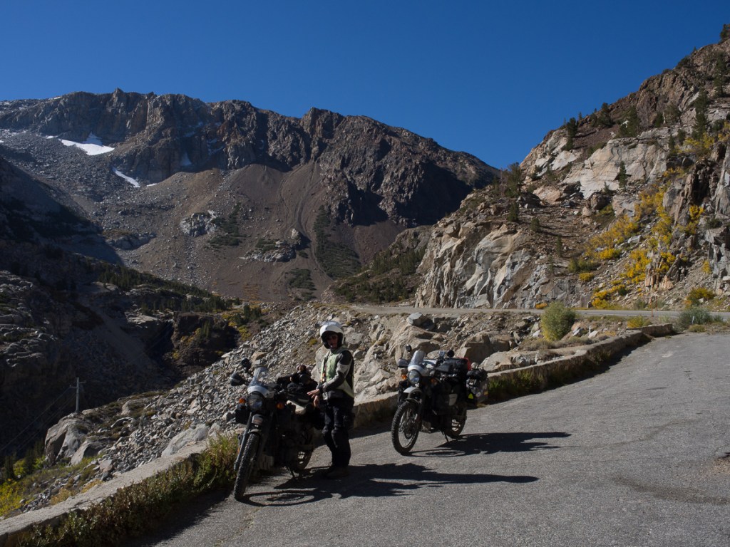
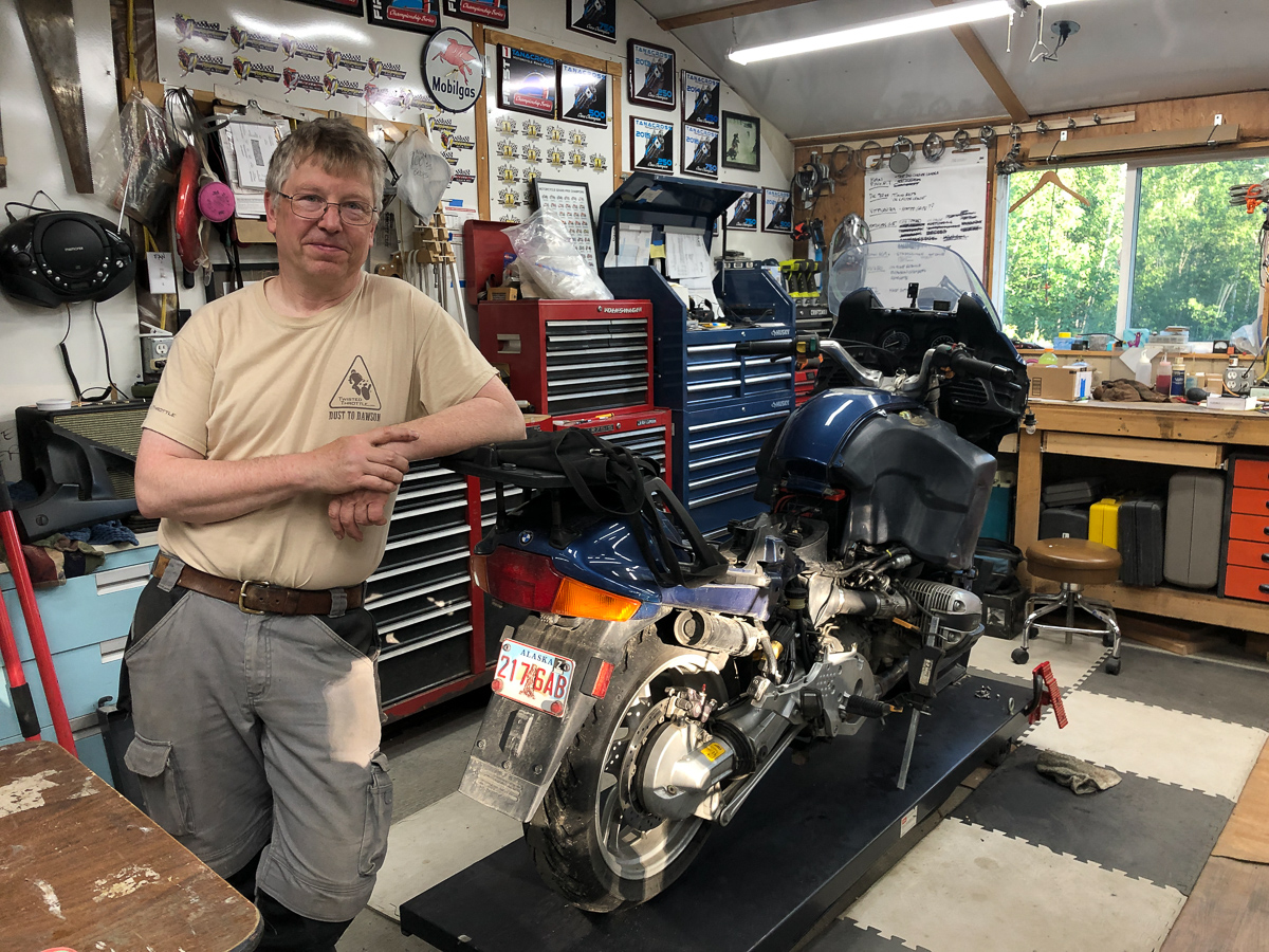
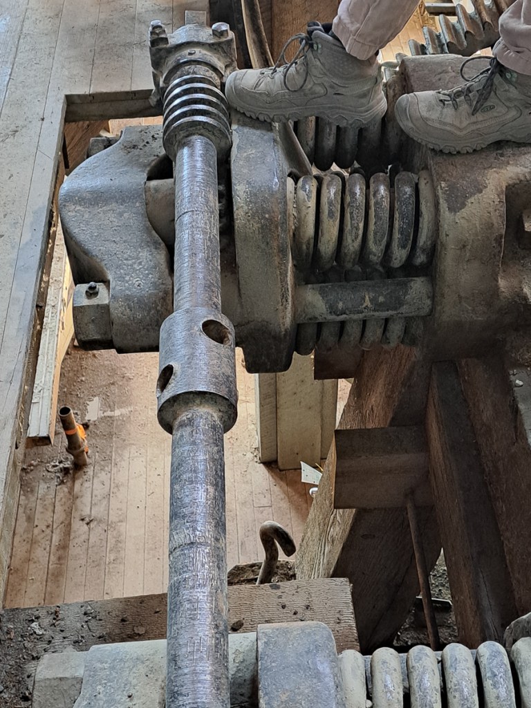
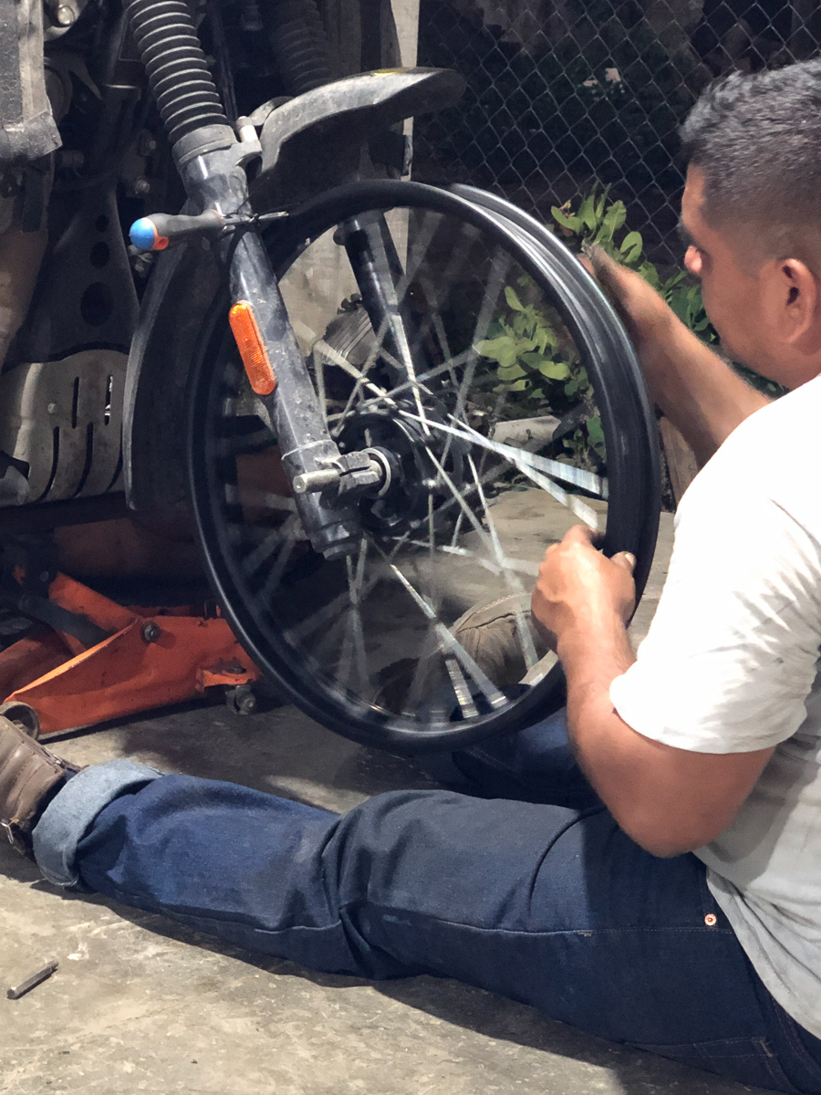
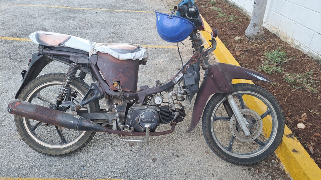
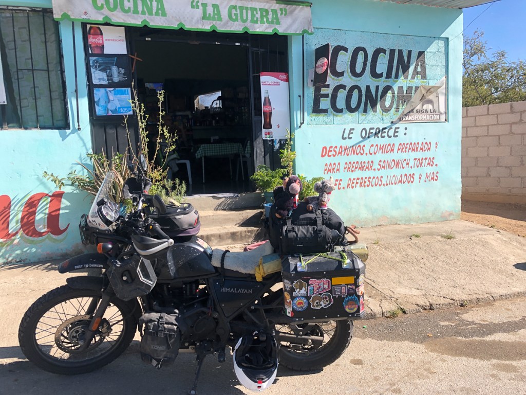
It can be tricky to get the correct balance between making progress and going slowly enough to avoid all the pot holes, especially when dappled shade makes the surface hard to see.  It’s far better to be some way behind the vehicle in front especially through towns but not always possible because, inevitably, as a gap appears someone will overtake and fill it.  Among days of biking we’re going to get it wrong somewhere.  On one such occasion Gid hit a large hole at speed, the front suspension and tyre both bottoming out.  He yelped!  The bike felt ok but he could see the fork legs vibrating from 50mph – the cruising speed for these roads & bikes.  At an approaching village we stopped for lunch and to asses the damage.  Yep, he’d flattened a section of his rim, with four loose spokes. The massive front tyre* looked unscathed, and the tube obviously hadn’t split. We decided we could limp on but Gid was obviously disappointed and concerned.  He explained that there was a problem with his bike to the waitress who cheerfully said the mecanico de motocicletas was across the road 10 metres down a dirt lane.

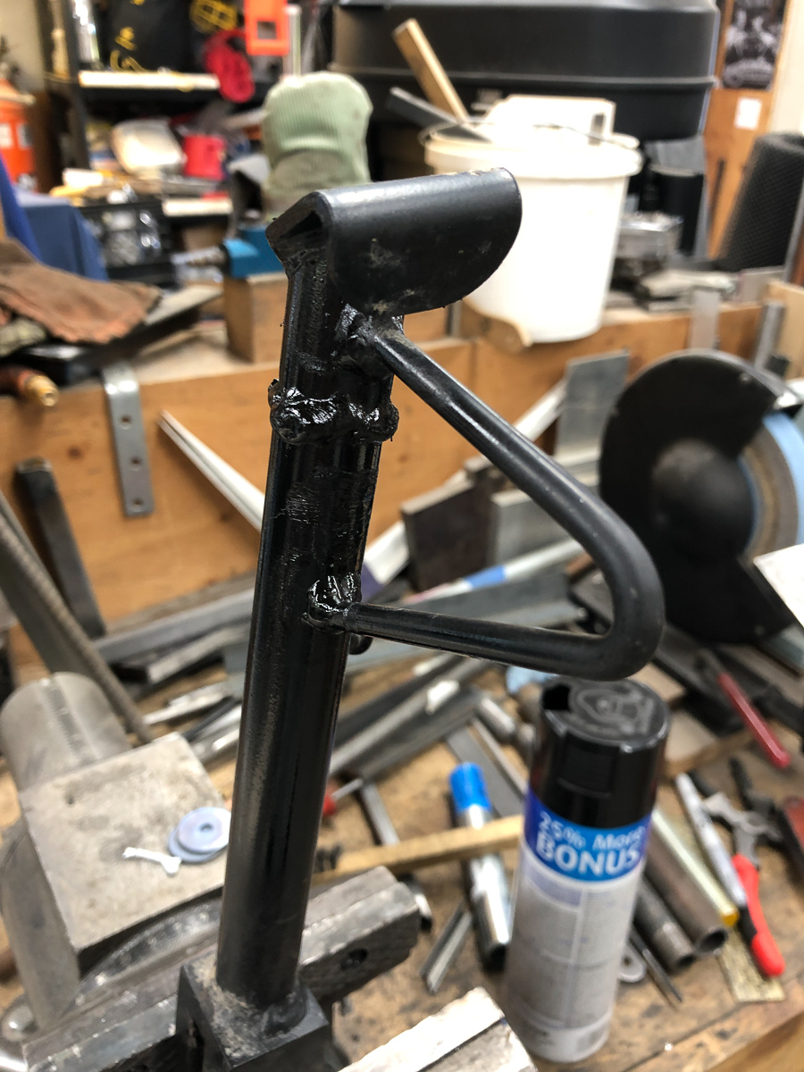
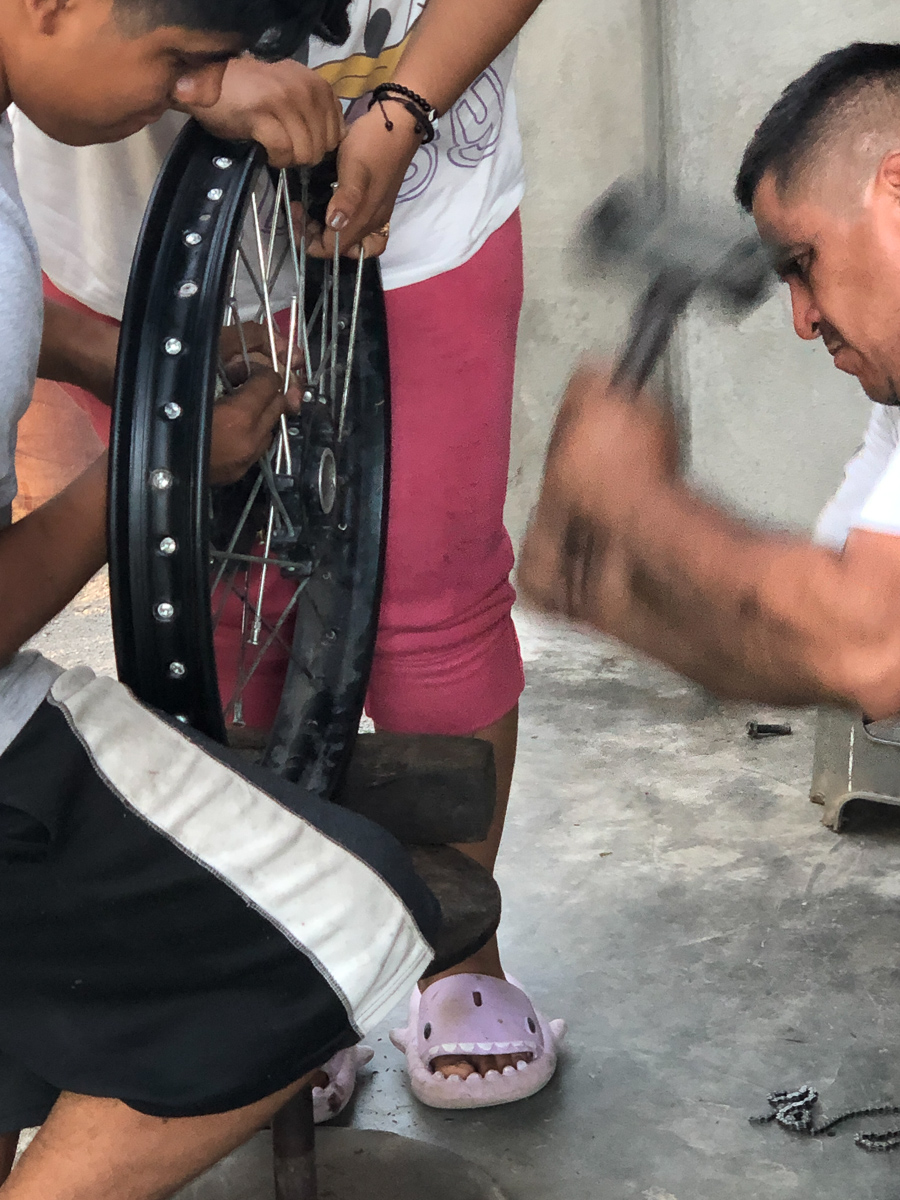
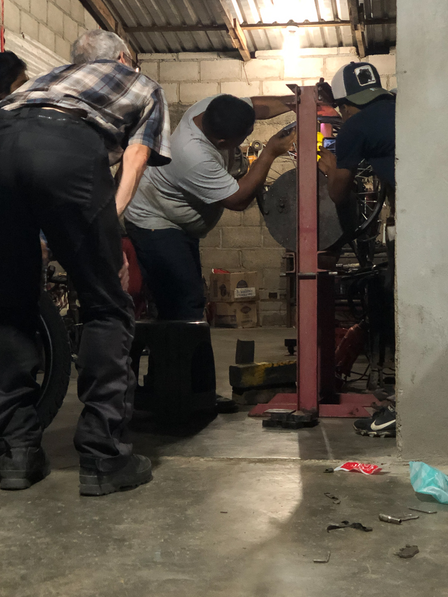
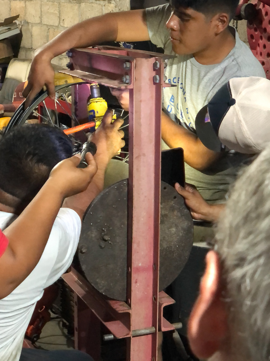
Moments later we were in his yard amongst an assortment of relics and a jumble of tools straining our Spanish to explain the problem.  “Si, ahora”. He could fix it, right now.  Verily he did.  Off came the wheel, then the tyre.  Out came the dead-blow hammer. Bing, bang, bong.  Fixed.  Well almost.  Gid tried to explain about the wheel balancing and the need to mark where the tyre was situated to be balanced on the rim. Such interference was politely resisted, but our man – Tito – was very careful to line up the bolts to show the order of reassembling.  That worked well until one of his offspring, keen to be a part of the intrepid fixing of the European’s bike picked up Gid’s disc that had been carefully placed on a seat, bolts all in place and put it upside down on the ground.  That part was reassembled but back to front.  To be fair, it was very much a family affair as one person held this or that while dad walloped it. 

This process got the rim all but circular.  Unfortunately Gid had hit close to the balance weights, which Tito couldn’t replace, so didn’t take off, so that bit wasn’t hit and was still a little flat.  Tito was sure that he could do a better job so into the workshop they went.  The wheel was placed on a big bearing press and a jack wedged in to try to press the last flattened part into shape.  The result was pretty good so the bike was reassembled.  Tito took a considerable time, with the traditional screwdriver fixed onto the forks as a guide, to tighten the spokes so that the wheel ran true.  And it did.  It must’ve taken 2 hours, albeit interrupted by other things.  We guess that straightening moto wheels must be pretty common on that road, and fortunately the Him’s are steel rims with spokes. The charge was very modest indeed, we tipped a bit, and later added him to Google maps and Open Street Map – his business was undetectable to the phone generation, which clearly included his daughter, who was inseparable from her device.

*Tyres: Dunlop Trailmax Mission, 21″. It has huge knobbles for highway and dirt, deep tread, and weighs about twice the stock tyre, or indeed most front tyres. We both commented on the bike’s loss of steering response when we put them on. But they’re versatile, tough (fingers crossed) and long-lasting.

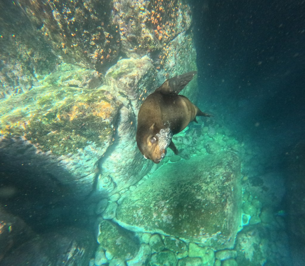
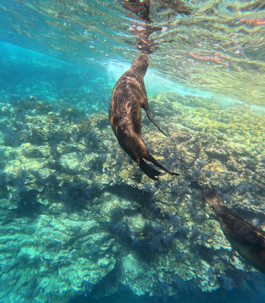
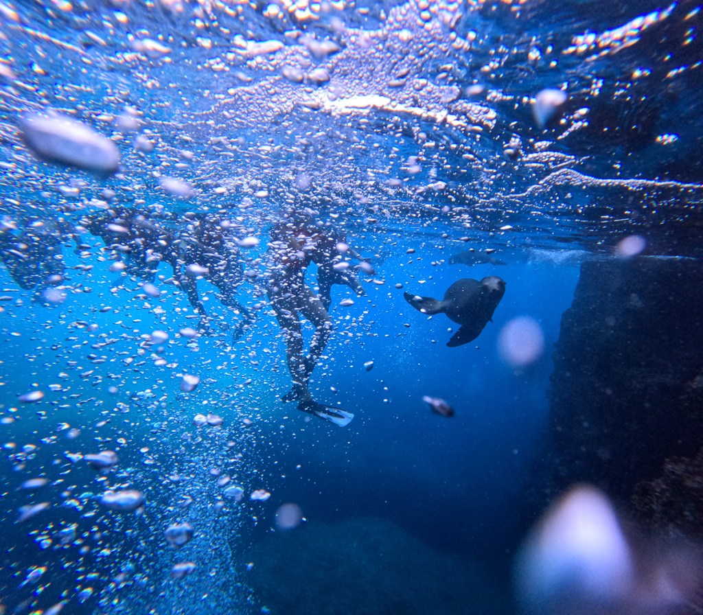
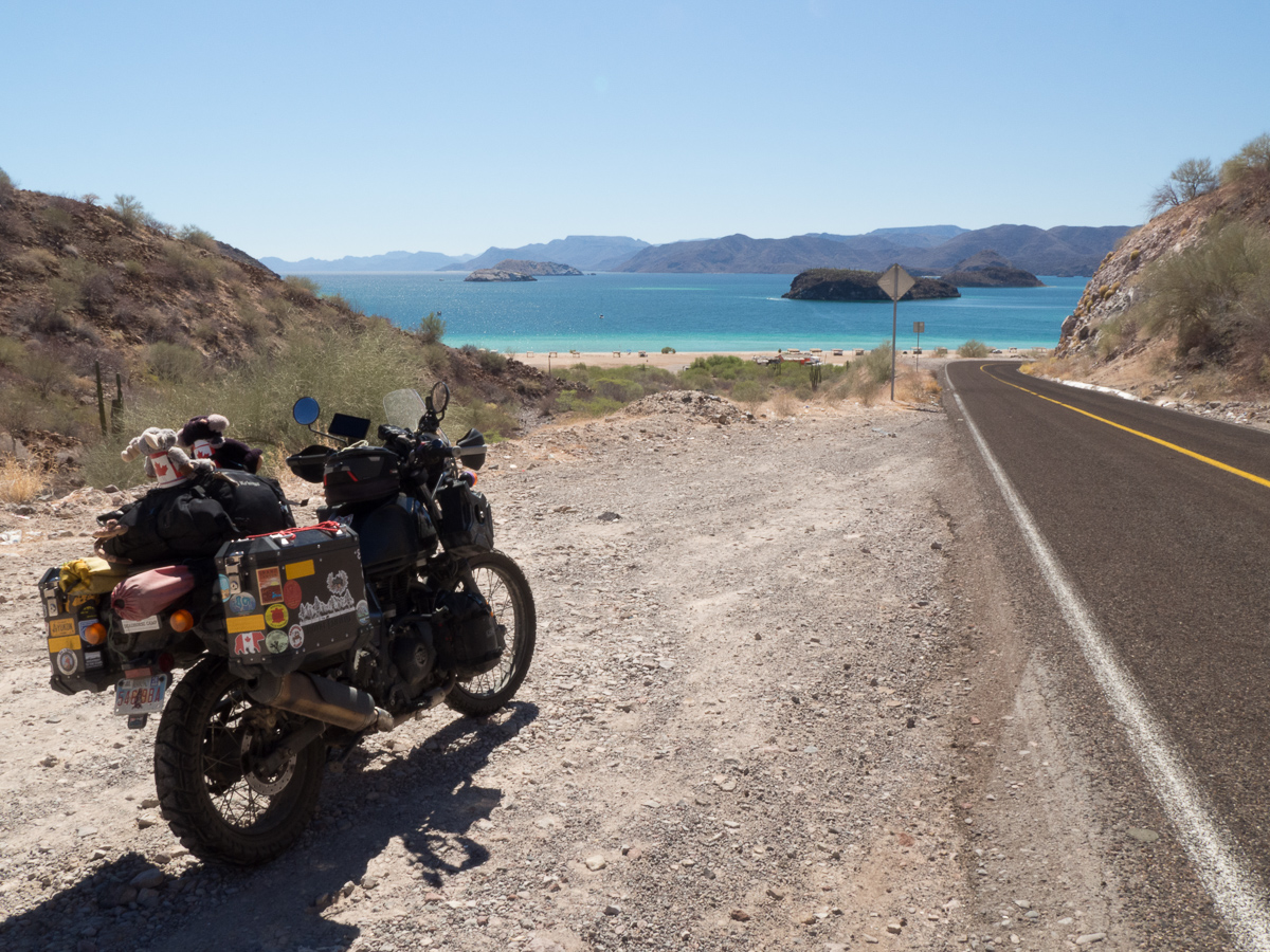
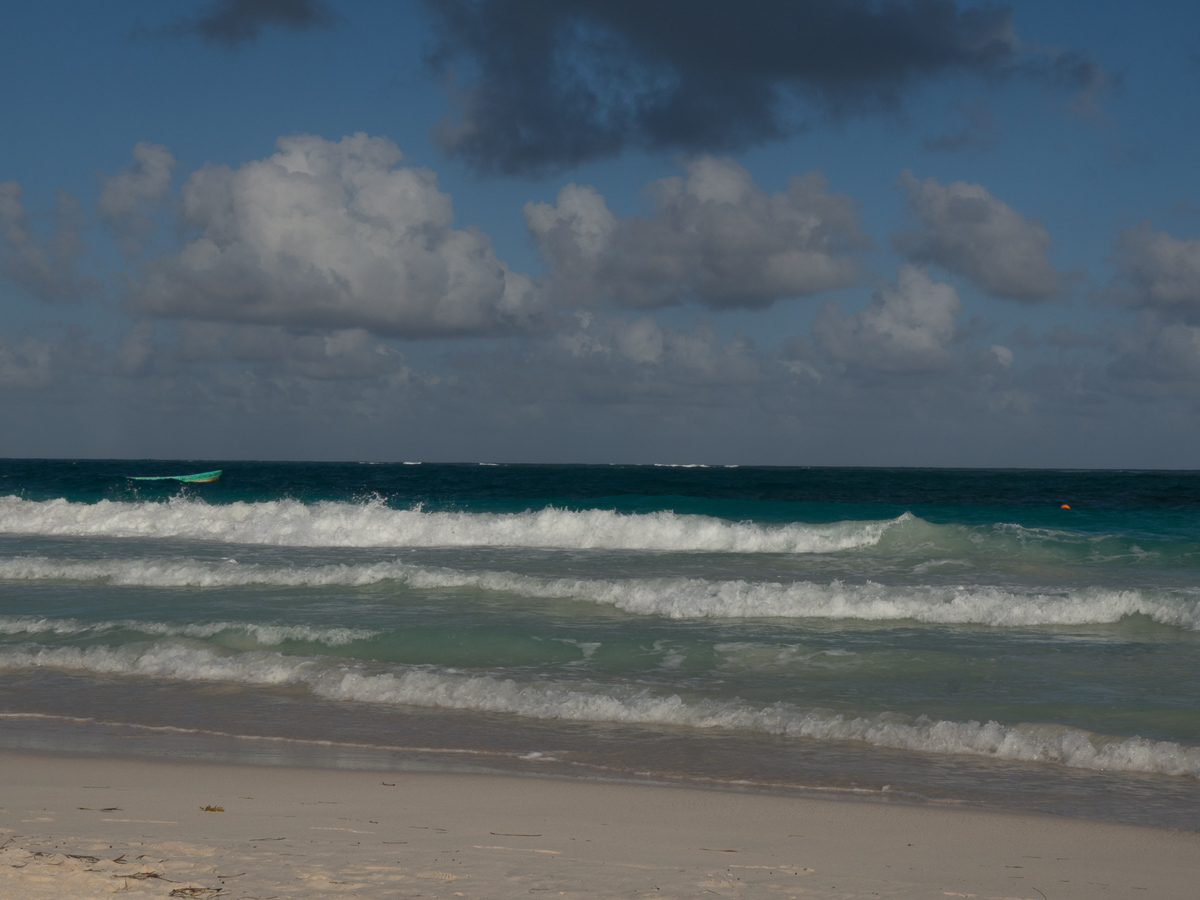
At the coast we stopped at Zippolite, a wonderful Pacific beach resort.  It’s also Mexico’s only legal nudist beach, and a dangerous one.  No, no –  it’s because of the rip currents, it’s not a place for much swimming or beach toys. The beach boys, on the other hand, were out in force (did you see that!?).  We did a tiny swim – there sure were strong rips- but it was nearly sunset. Gid’s still wondering if he should have done his morning run along the beach starkers – but none of the other runners did.

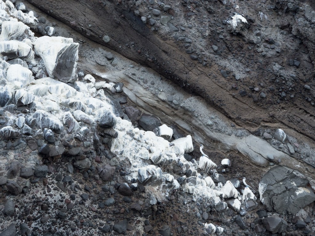
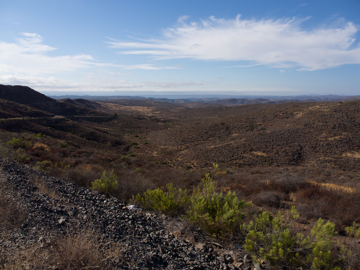
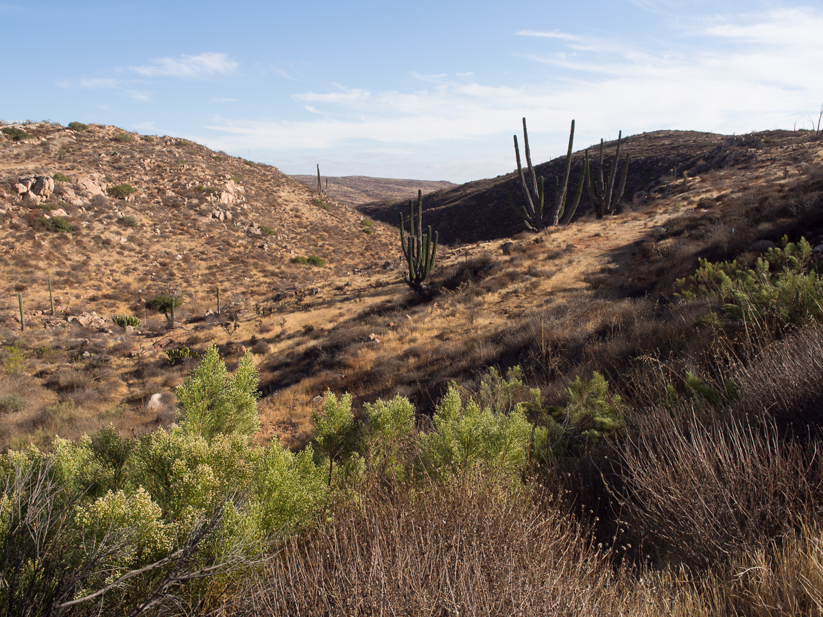
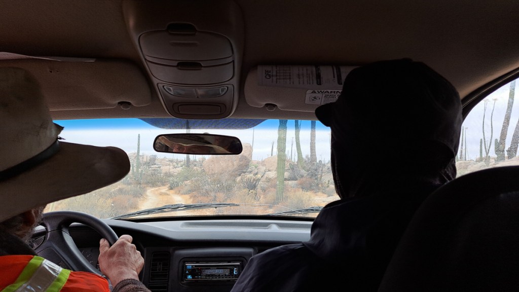
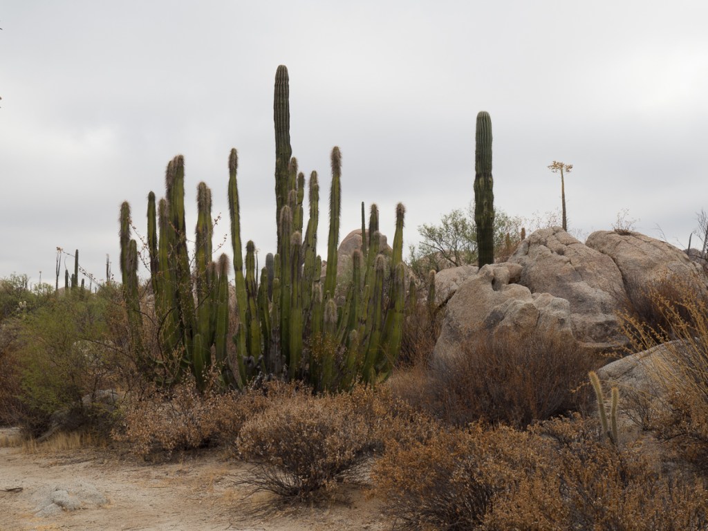
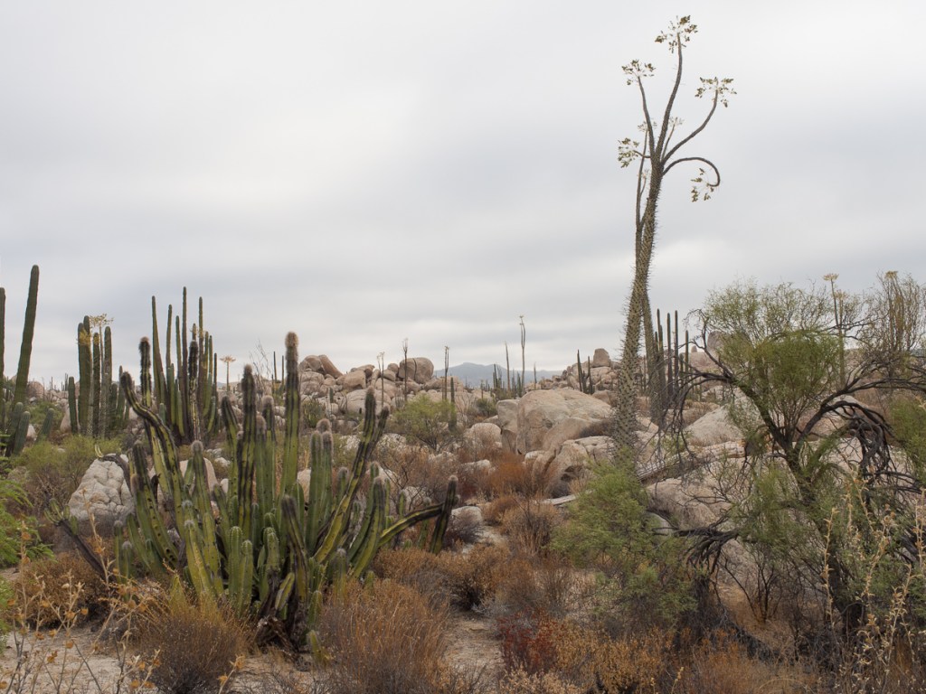
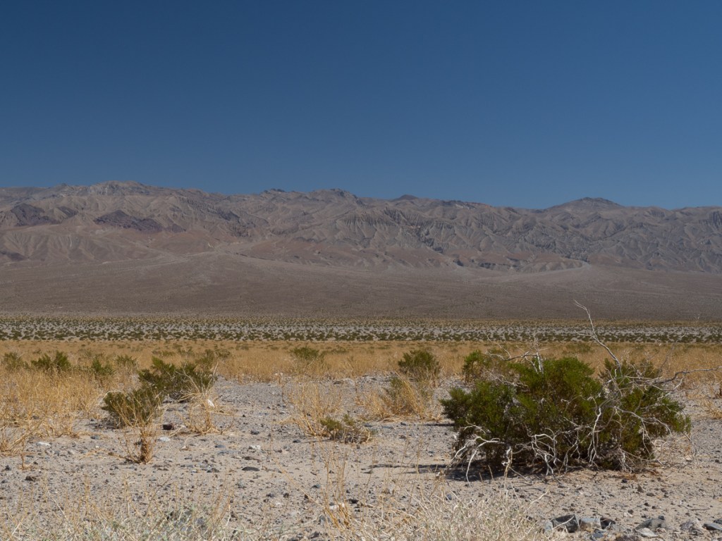
Although Mexico has around twice the UK’s population, it is much bigger – each Mexican has, nominally, over 4 times as much space as a Brit. So there’s a lot of wild country and wildlife. From the Pacific we headed north to Frontera on the opposite, Caribbean Sea, coastline, and took a river trip into the Pantanos de Centia nature reserve.  Our hotelier had a mate, that old chestnut, who appeared very promptly at our hotel door, introduced himself as Negro Chon, and outlined the deal.  It sounded fine, just exactly what we were looking for and he could pick us up from the hotel.  All of this was agreed from our hotel room. 

At 9:30am promptly Chon was there.  And so was his car!    It hadn’t passed an MOT in the last 30 years.  No self respecting scrappy would touch it!  Gid, who’s normally quite particular about working seat belts, got in the front, relieved, I think, that the door did actually shut (allowing for a certain amount of visible daylight around the edges).  I climbed in the back.  The door almost shut.  Thankfully it wasn’t likely to rain.  I needn’t worry about seat belts – the  attachment point didn’t exist nor was the seat actually attached.  In fact the whole car, inside and out, was totally rusty, wrecked or ripped.  Off we went.  It did seem to work.   Around town Chon was perfectly cautious but once on his local road he changed up a gear.  Chicane Chon would have left any grand-prix driver in his wake the way he spun the wheel weaving left and right avoiding the pots holes, using the dust along the tree lined edge and back to the other side. The boat trip with his son-in-law was tame by comparison, but we did glimpse a croc – eeek! – and a multitude of diverse herons as well as other birds.

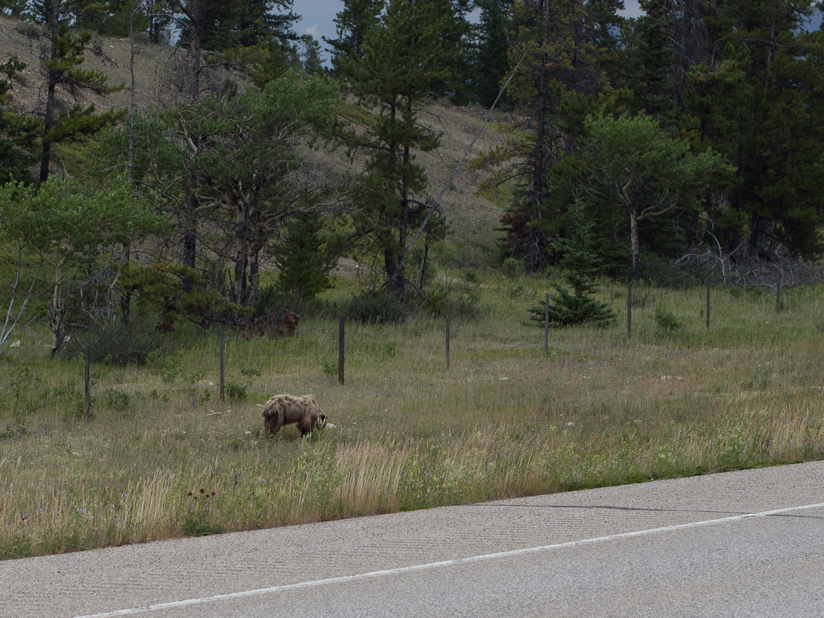
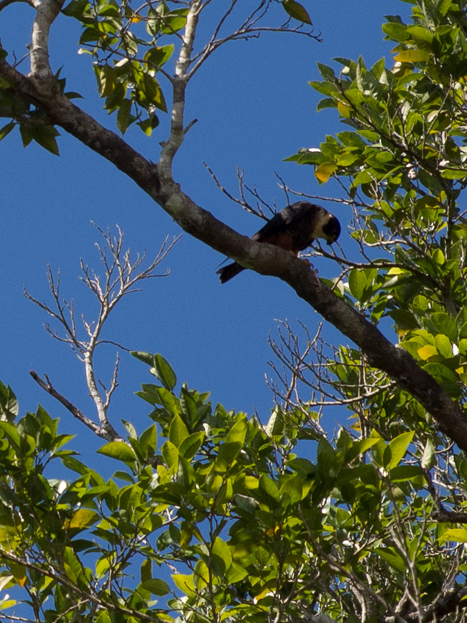
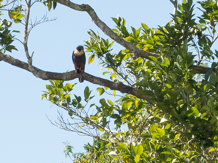
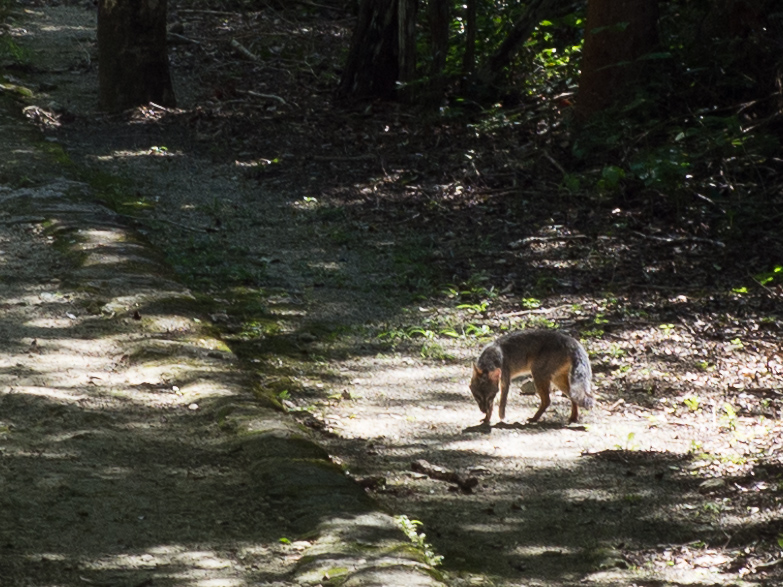
The next mission was another set of ruins, Calakmul, but this time in the jungle that covers the south eastern part of Mexico. The site is quite large, but isolated with a slow, narrow, jungle access road. Pootling along it, ocellated turkeys were little concerned about our bikes, and Gid glimpsed silhouettes streaking across the road, one probably a marmol or ocelot, and later we saw a grey fox. A day later, still based in the town of Xpujil, we visited some much smaller, quieter ruins. For 30 minutes we sat quietly on top of a small structure, at treetop height. To our right, a bat falcon polished off something more like a small chicken than a bat, and on a path ahead of us a grey fox lounged in the sun. Perfecto.

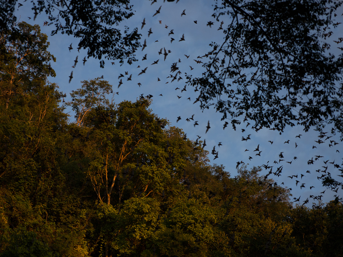
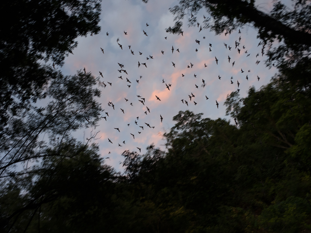
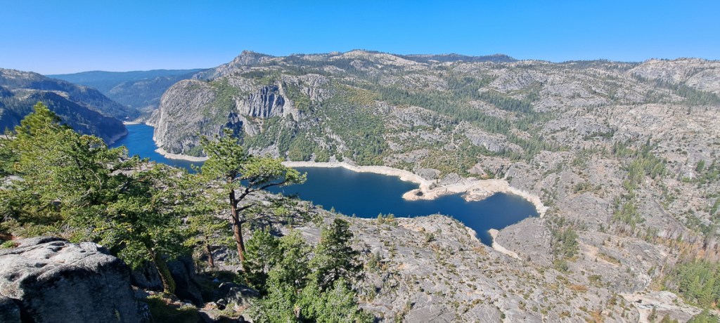
That evening we rode back down the road to the “bat volcano” and watched 3 million bats stream out of a cave at sunset.  The second largest bat cave in the world.  Talking to a Scottish couple at the event they exuded excitement about the cenotes they had been to.  It had become a theme in their holiday to explore as many as possible.  They were telling us the merits of this cenote over another.  We’d not even heard of these sinks holes / caves, many open to the public to swim in, which are abundant in this area of Mexico. Yucatan is dry on top, but made of limestone, it’s riddled with underground watercourses, many quite near the surface. Cenotes are formed when the roof collapses. Many are connected, and scuba diving them is popular.  Our new Scottish friends had said that they were often warmer than their hotel swimming pool.  Our posada (inn) in Xpujil barely had a shower.

But first, we had to return the maybe 40Km to Xpujil. In the dark. We knew there were a few big dangerous potholes on this stretch, but at least we had ample time and knew where to go. It was still terrifying at times. In daylight, we observed that Mexican vehicle lights are quite random – all sorts of flashing colours, indicators/hazards used according to all sorts of strange thought processes, none of them in the UK highway code, brake lights left broken.  At night – well, Mexicans driving at night either have very little or total trust to the gods, or fit huge LED lamps that only half of drivers dip. Even though traffic was light, it was scarey – statistics confirm that it’s a massacre. Our worst moment on this ride was when truck B decided to overtake truck A with us oncoming. The road there was actually quite wide enough to do this, but the b*st*rd didn’t dip his huge LED floods and didn’t indicate that it intended to pass (they never do).   We were completely blinded as it pulled out into our lane and couldn’t see the road 2 metres in front. It had taken us a while to realise what was going on, because most truck drivers did dip, and the relative positions weren’t clear in the dark. We pretty much came to a scrambly halt, unsure if in front of us was ditch, pothole, or road. It confirmed that riding at night in these parts was a very bad plan.

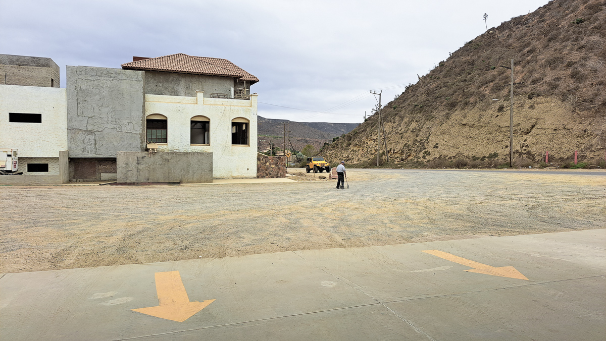
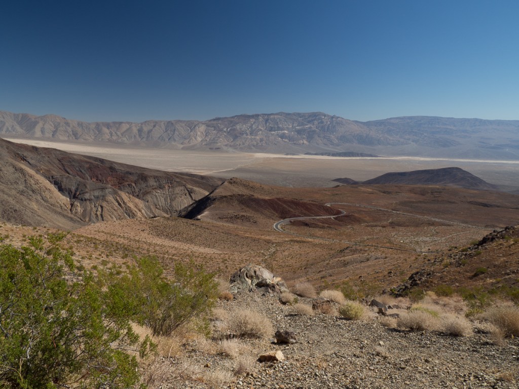
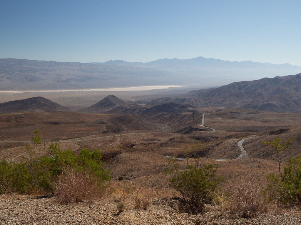
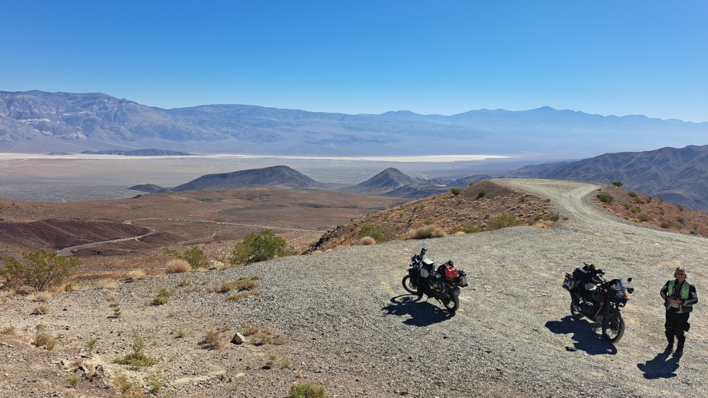
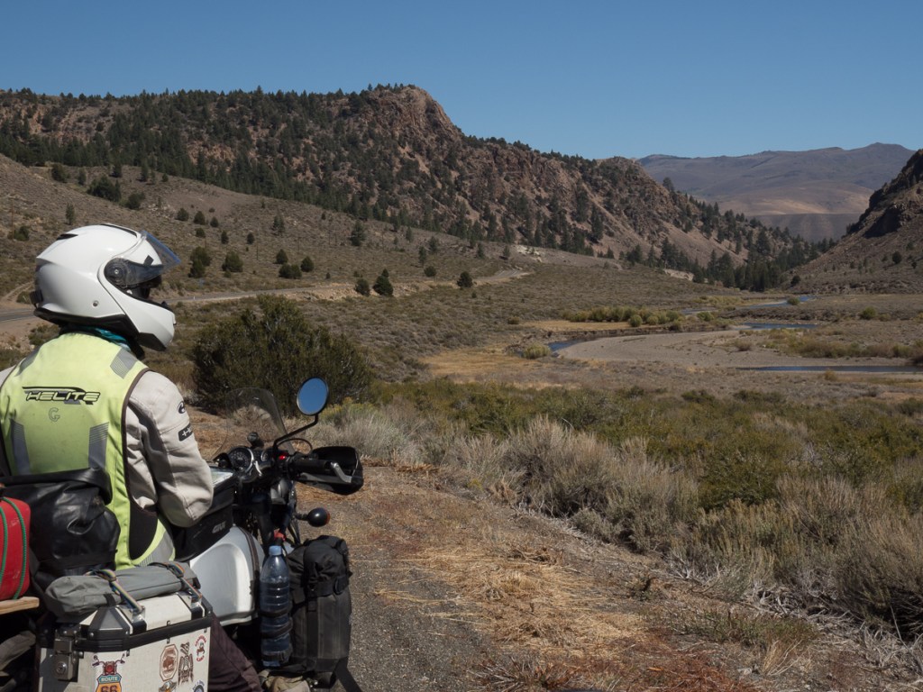
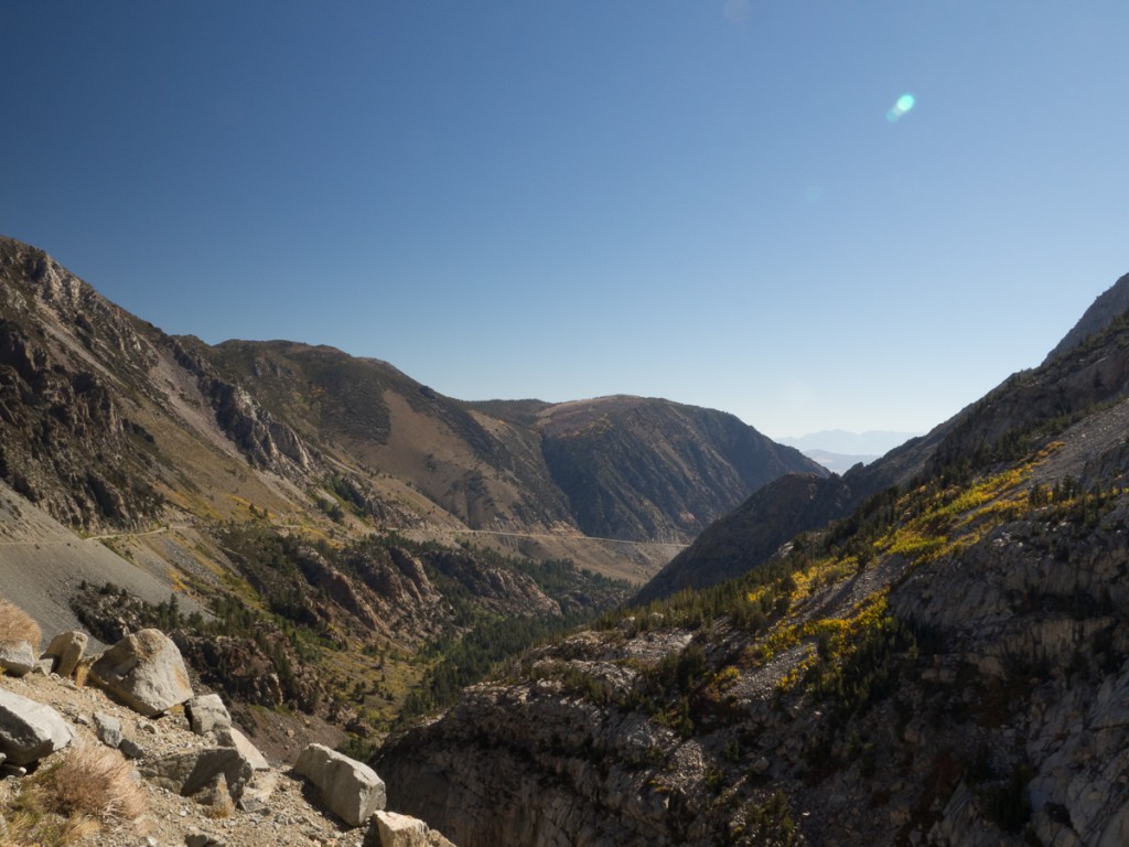
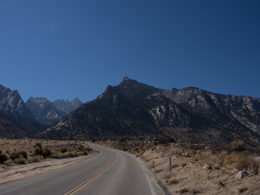
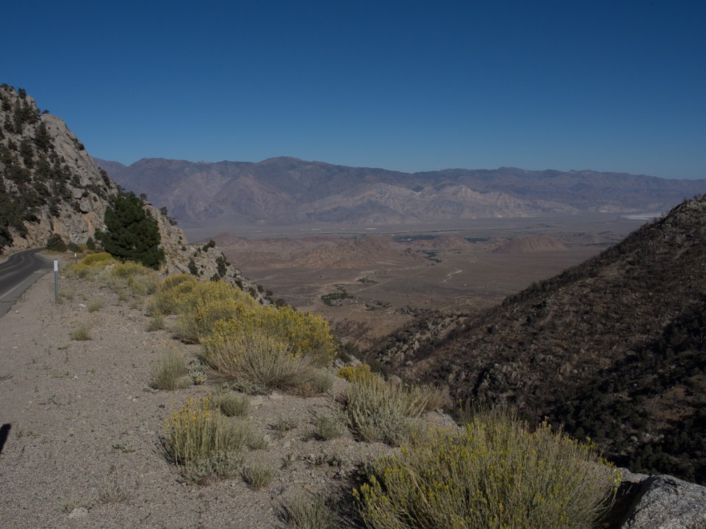
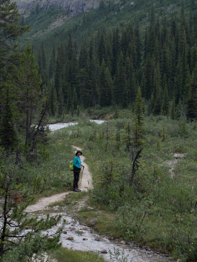
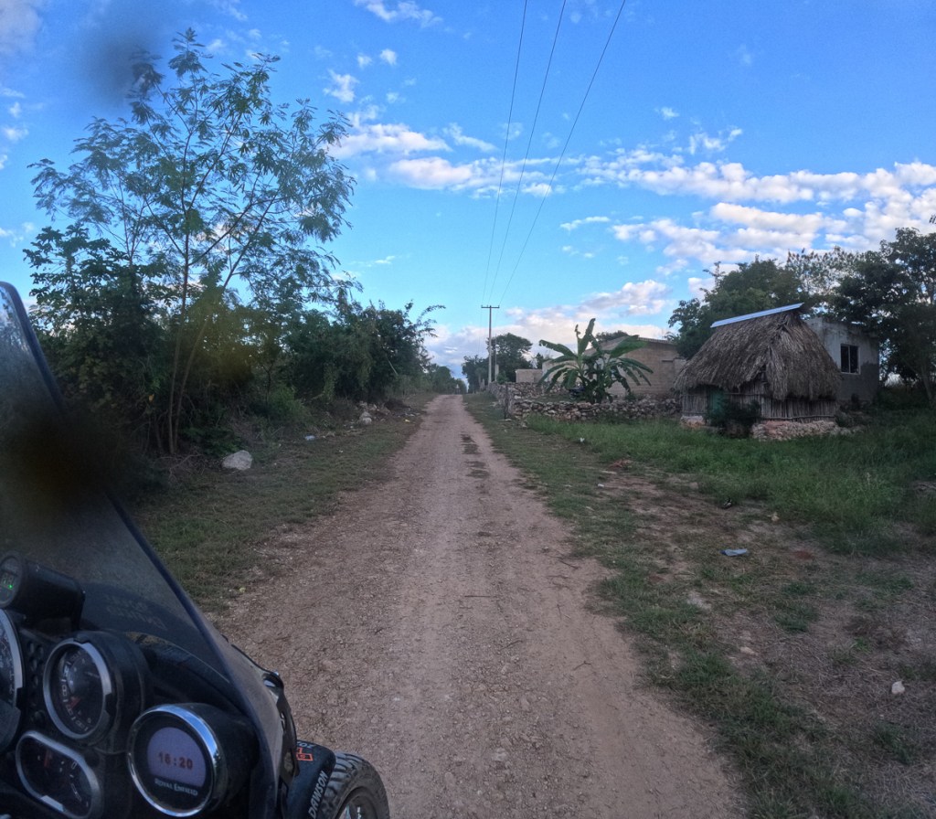
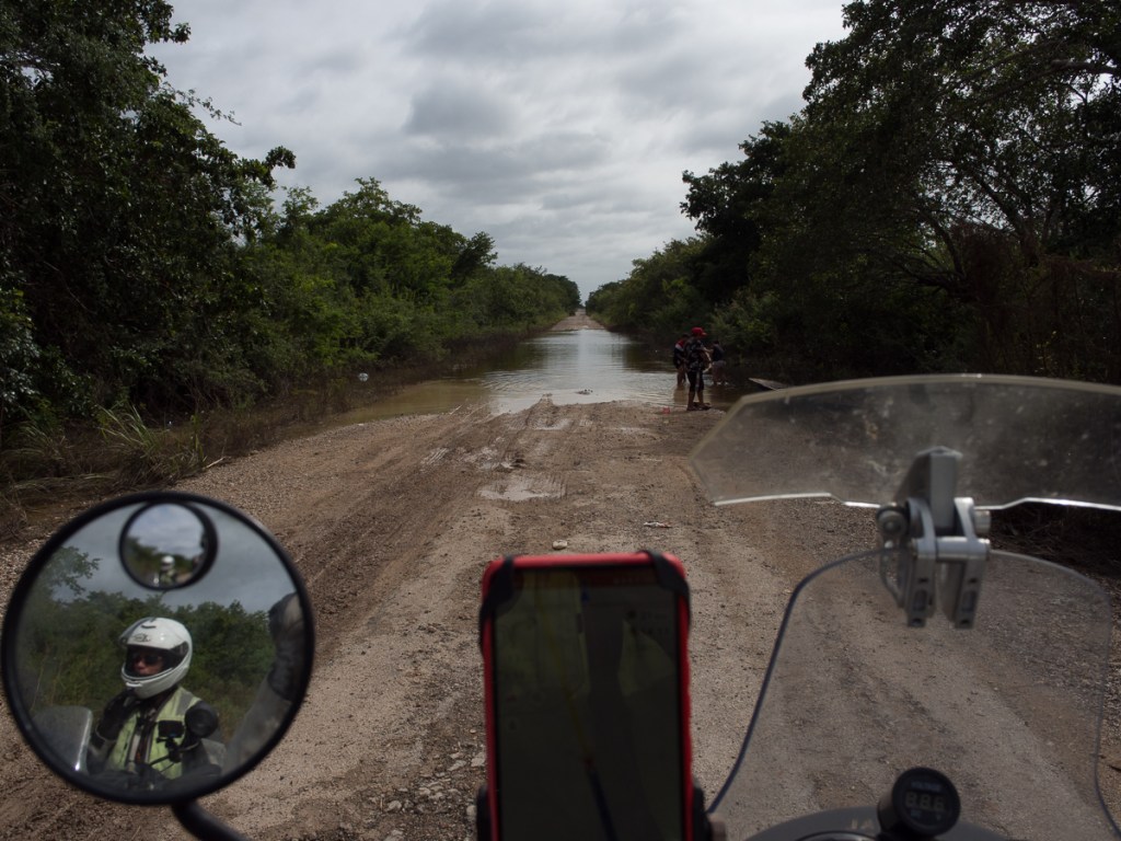
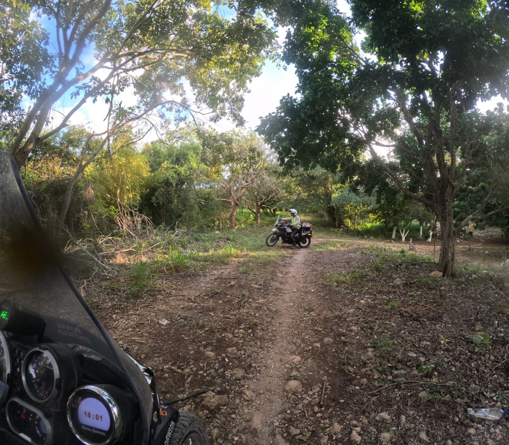
On a brighter note we spent much more time on larger single-carriageway roads, but the excursions were more interesting. Two of the pictures are points where we gave up and backtracked: One road shown clearly on the sat nav shrank and shrank until it completely ended in a logging camp. Another road was flooded out for maybe 50 metres.

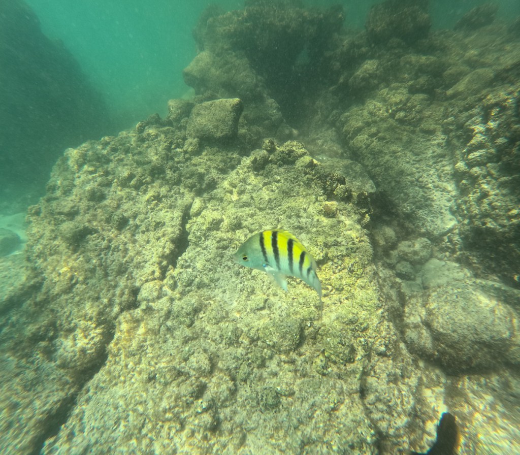
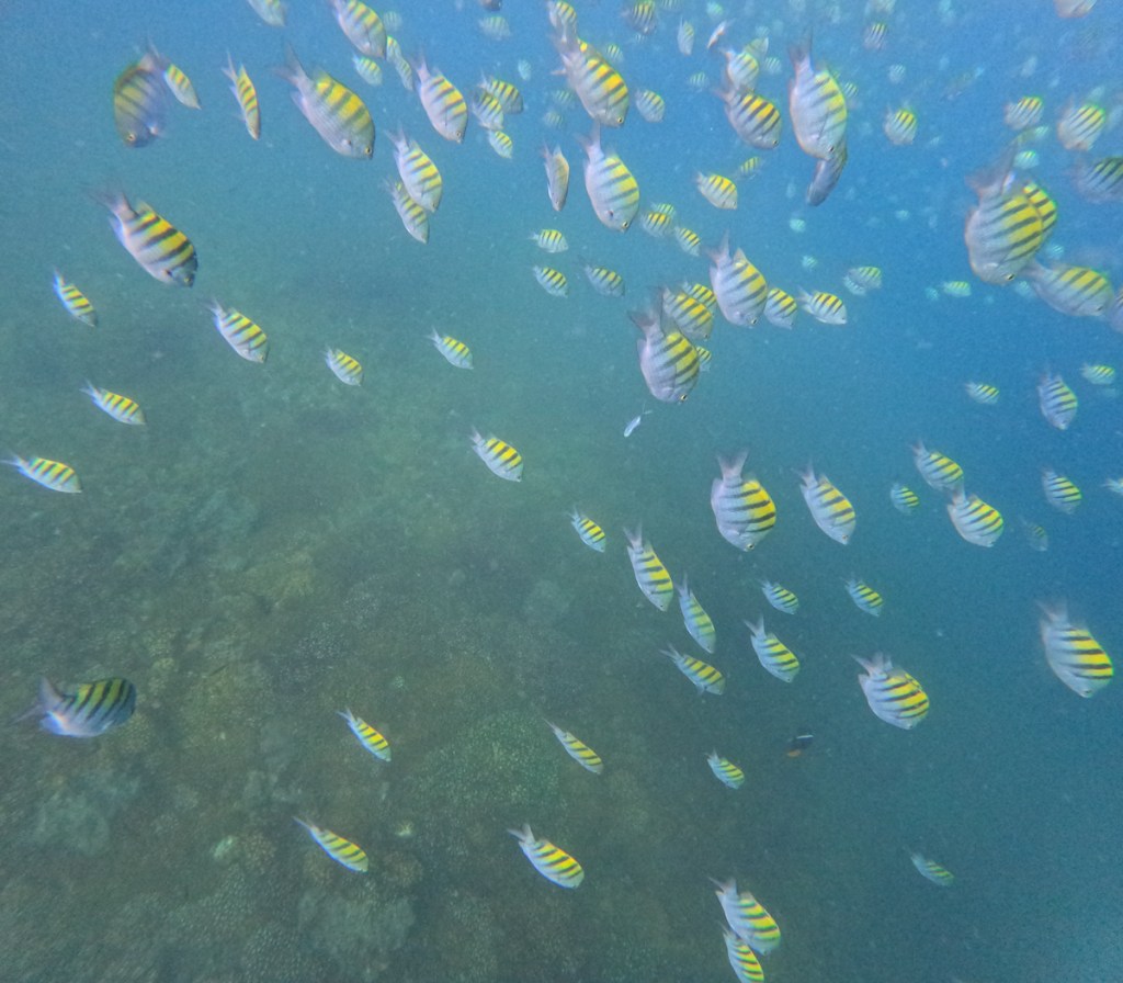
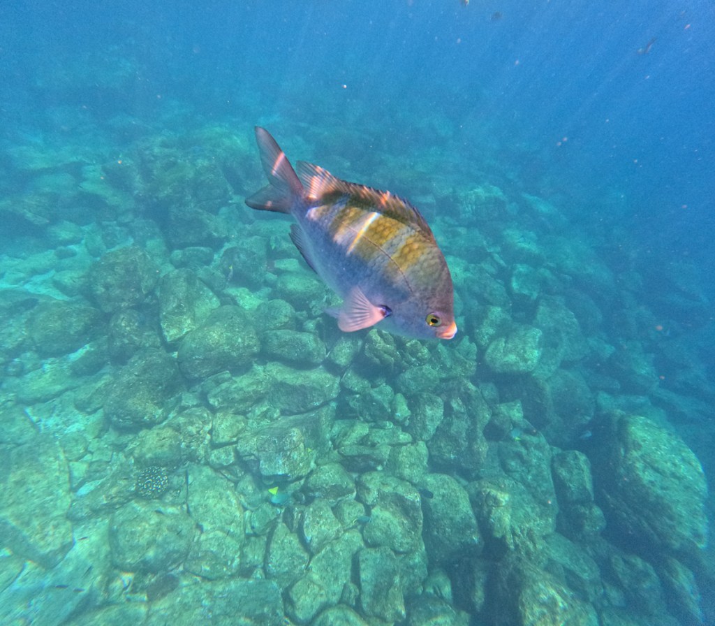
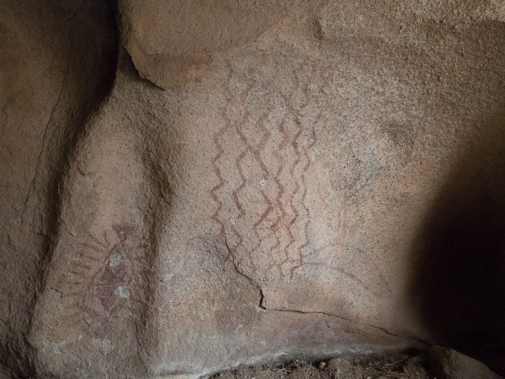
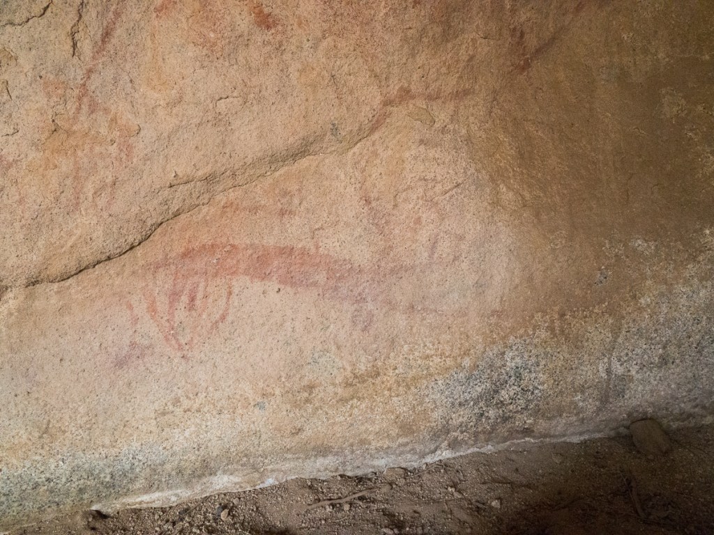
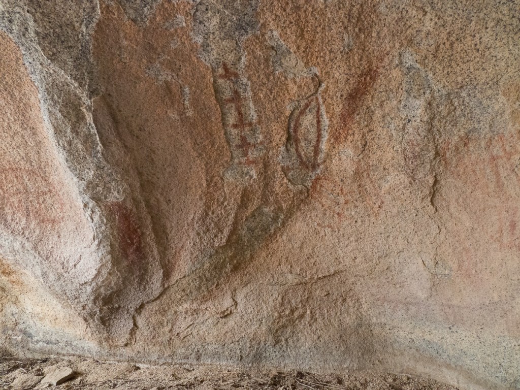
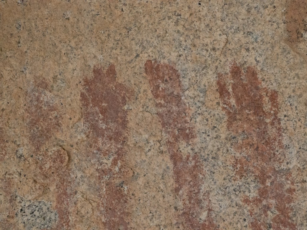
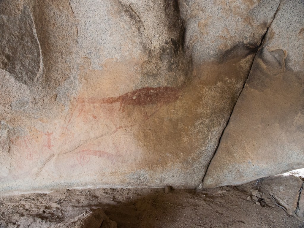
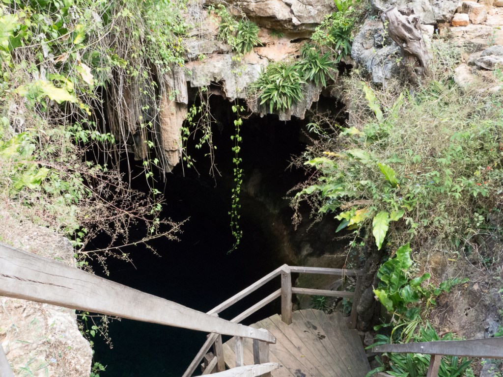
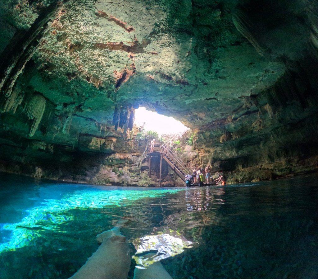
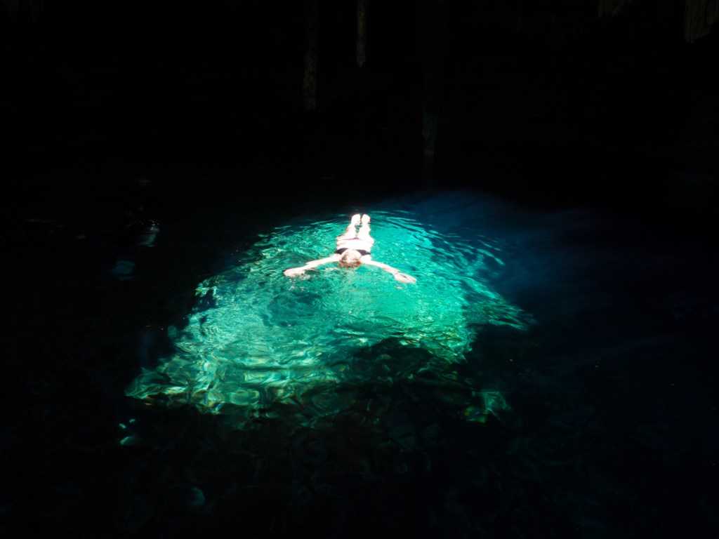
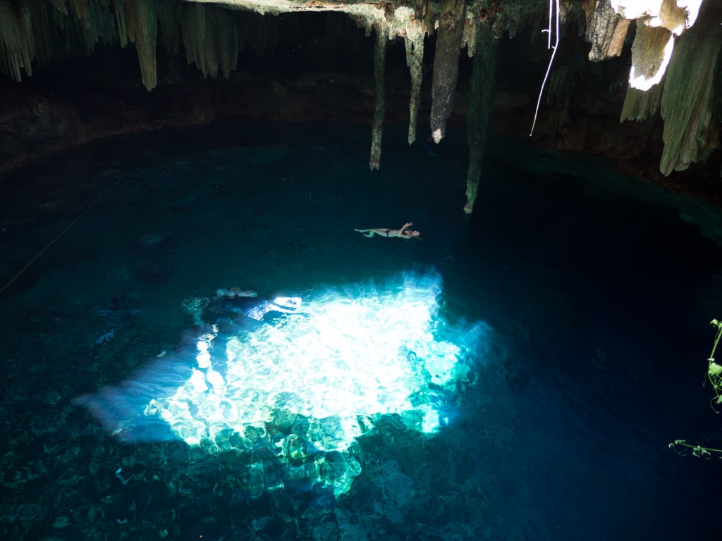
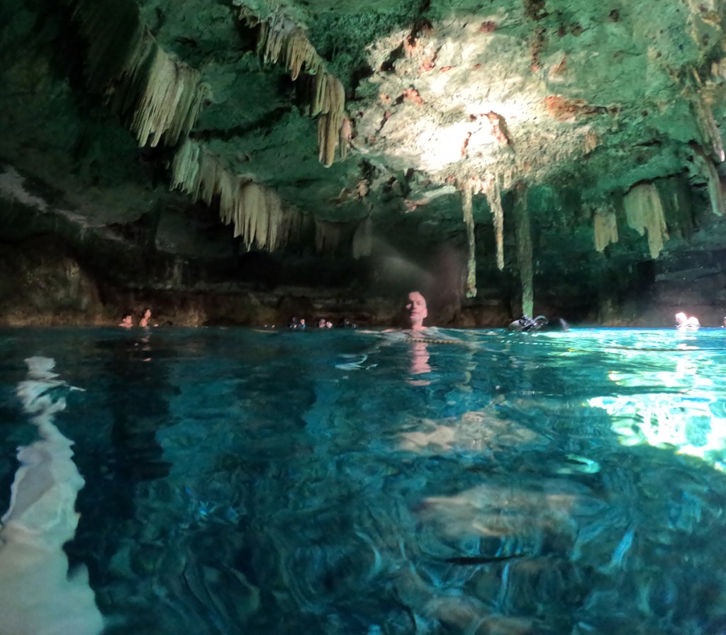
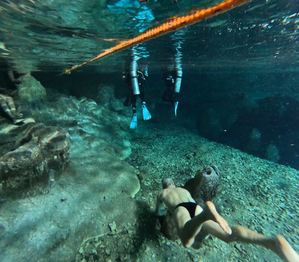
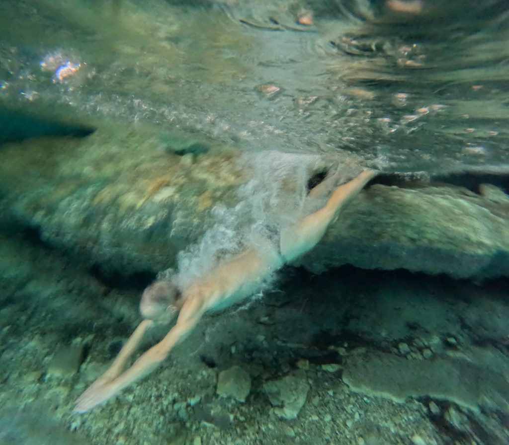
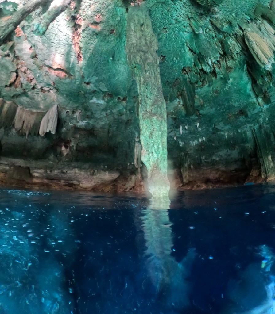
A bit of research had us concerned at the cost of entry to some of the cenotes. Undeterred Gid came up with an area close by that had a few.  He picked one that we visited enroute the following morning. It was fabulous!  We’d become a bit wary as two of our selected underground attractions in the area had been closed since Covid.  One was a cave system with paintings the other was an underground water system.  Both shut.  The chosen cenote was open, cheap and not highly populated. We descended about 5m down a wooden stair, to water level.  There were two small diving groups who disappeared downwards to explore the cave system joining it to other cenotes in the area but the surface space was pretty much clear, except for their bubbles.  The natural lighting was beautiful clearly lighting the stalactites and different colours around the cave.  A guy who seemed experienced at the qualities of different cenotes told me that this one was one of the best because it had crystal clear water and you, together with the fish, could swim about in it.  He commented that some of them are rather pokey holes with murky water.  ‘The ones nearer ground level can be cold’, he added.

Looking at our Mexican travels on the map, there’s quite a zig-zag, but now we were getting to the end of the road Mexico. We decided to stop for a couple of days to catch up the blog and plan next steps. The east coast of the Yucatan peninsular is more beach resort than history, scenery and nature. We chose Tulum.  Tulum the town had every tourist facility at a US price, but we found somewhere cheapish.  After a stroll around Tulum’s small, but very scenic ruin, one of the few in Mexico to have been walled, we wondered down to the beach.  But the sun went on strike at the sight of Gid’s bethong’d behind.  Overnight it poured down with warm rain and into the next gloomy day which didn’t clear until the following afternoon making it perfect for updating the blog.

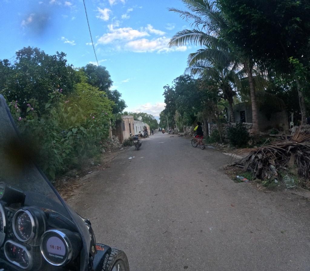
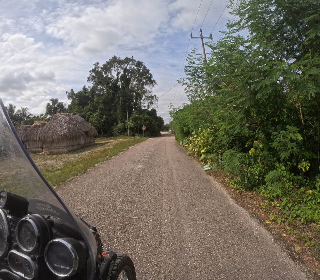
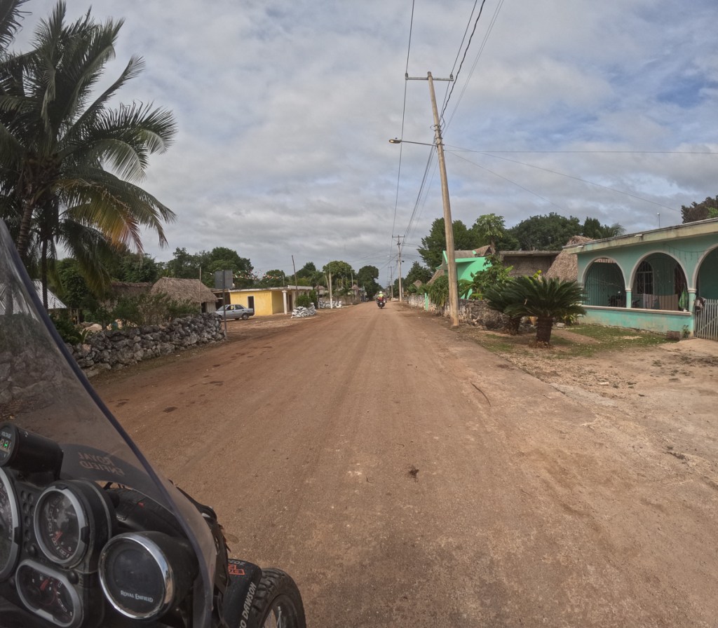
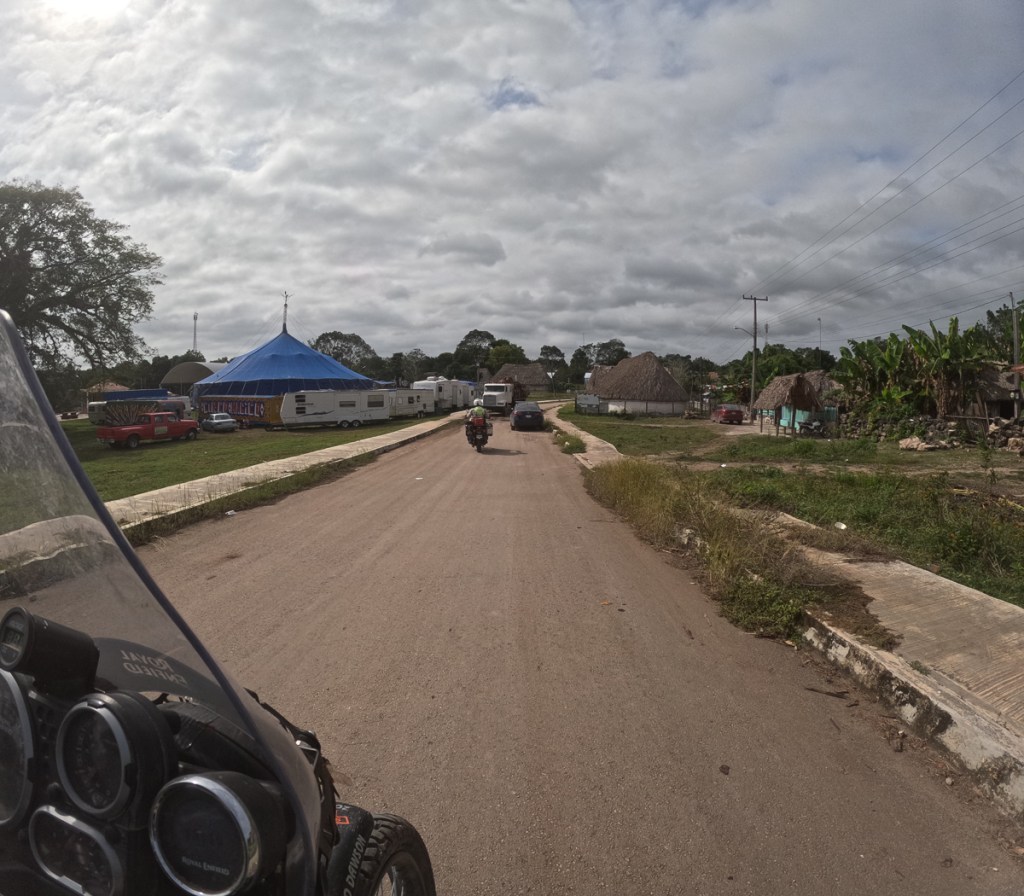
Wanting to finish this leg of our trip with something more Mexican we set off along the back roads and were rewarded with many rural villages.  We had hoped to stay in an isolated nature reserve at Noh-Bec where we might see the elusive jaguar but the rain thwarted us.

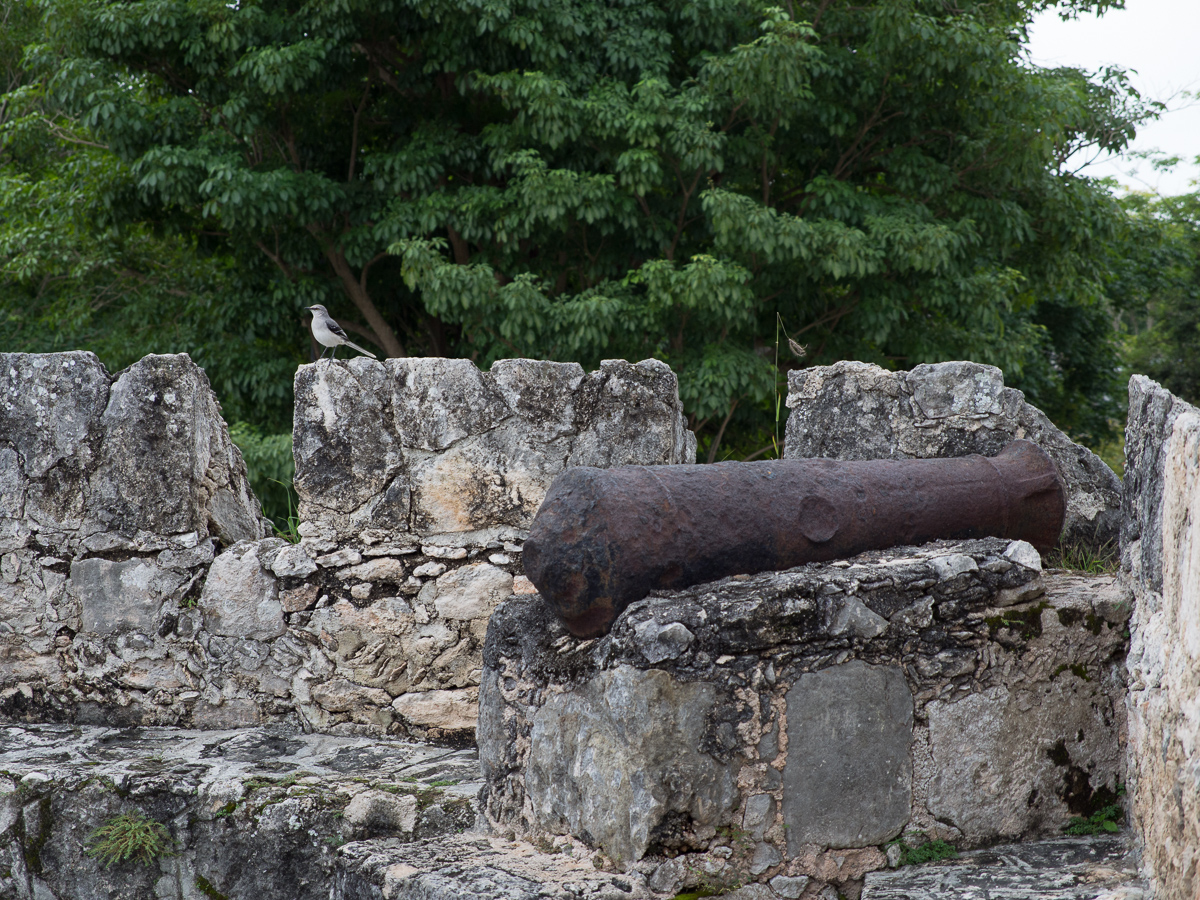
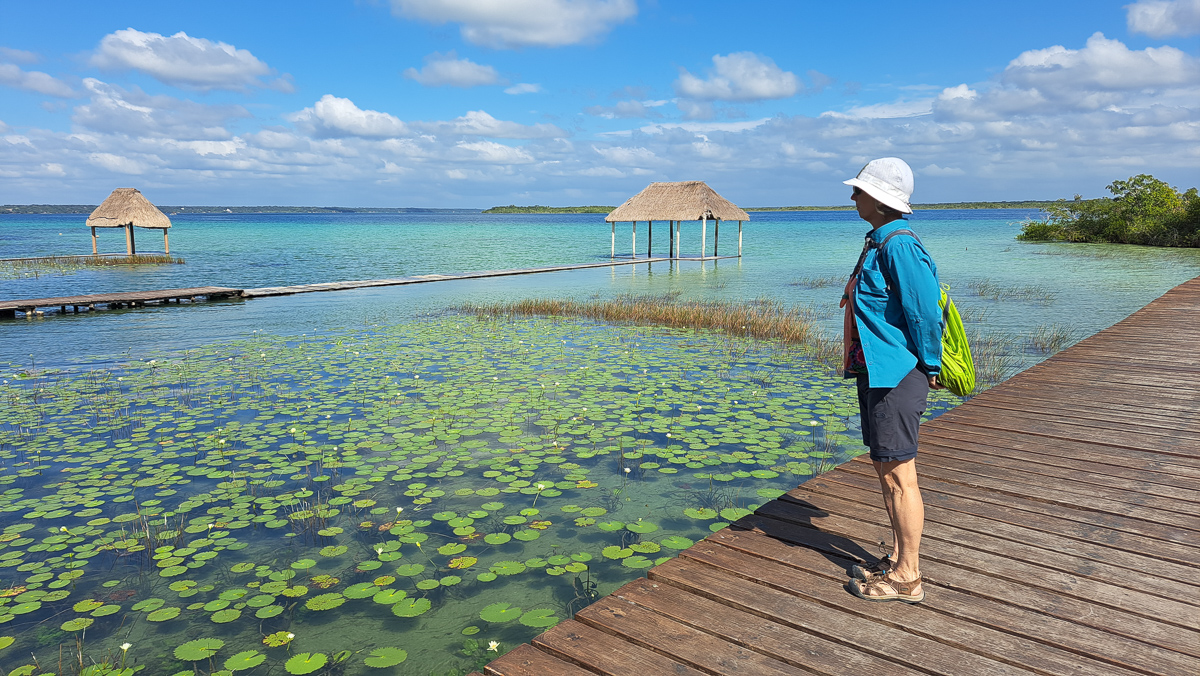
Not able to make it to Noh-Bec, Bacalar, a low budget traveller town on a big freshwater lagoon, became our final Mexican stop. The signage on the board walk notified everyone that swimming was fine but stay 3m away from crocodiles and not to feed them.  At the other end of the town the fort, Spanish built back in 1729 now a museum, was very informative.  It outlined the succession of invaders from the Spanish perspective.  In the mix was Sir Frances Drake.  Whilst the text acknowledged that Queen Elizabeth 1 had given him a knighthood, to the Spaniards he was no more than a bandit.

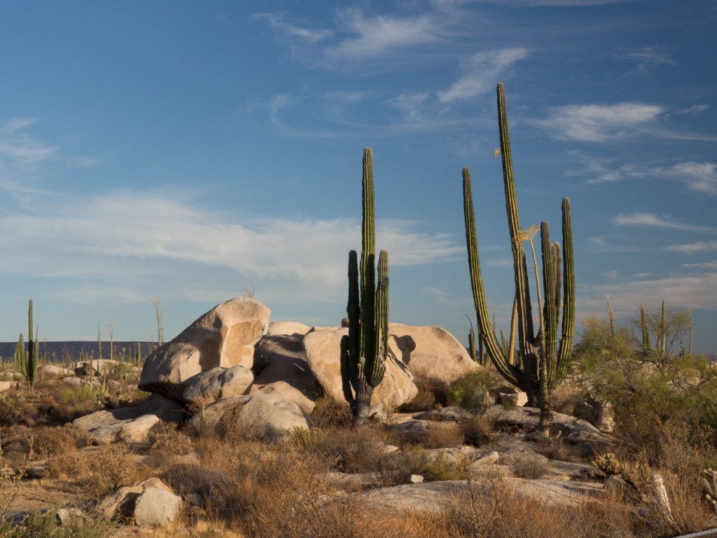
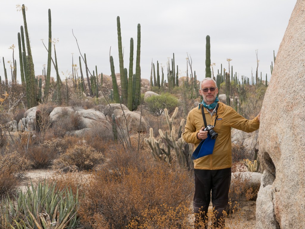
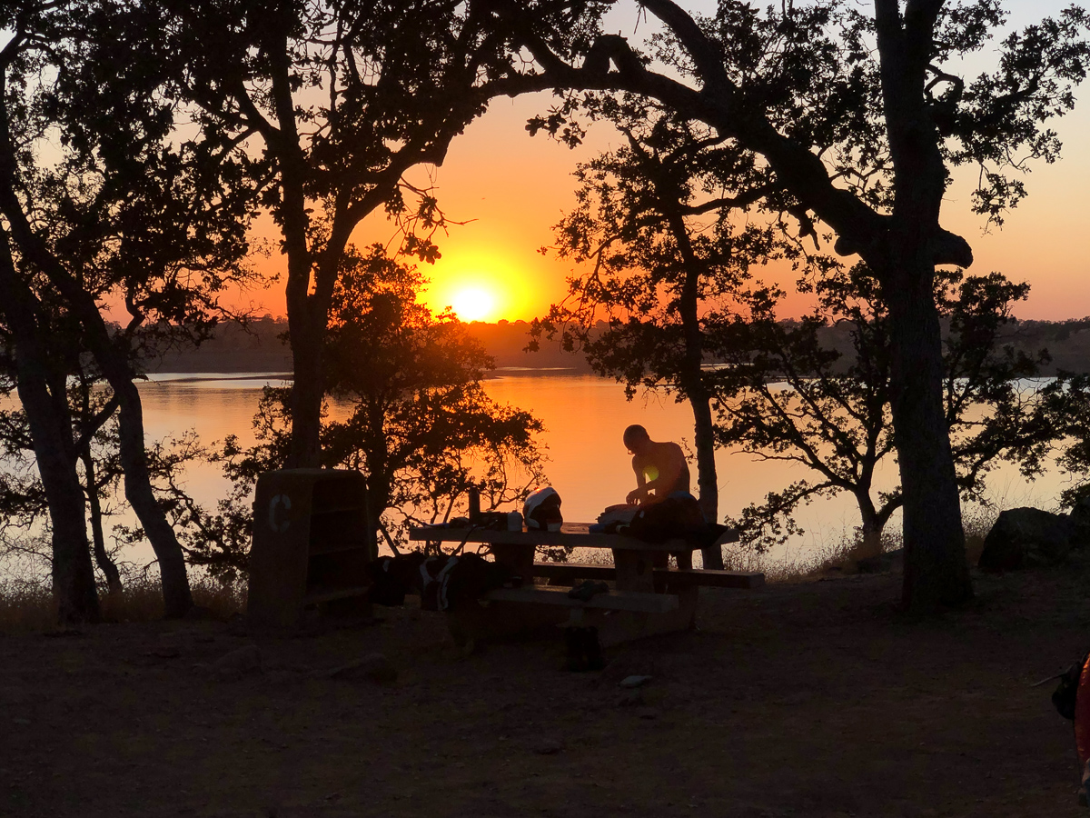
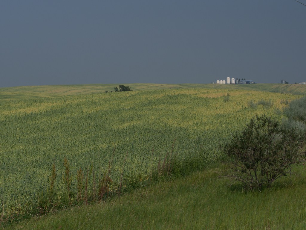
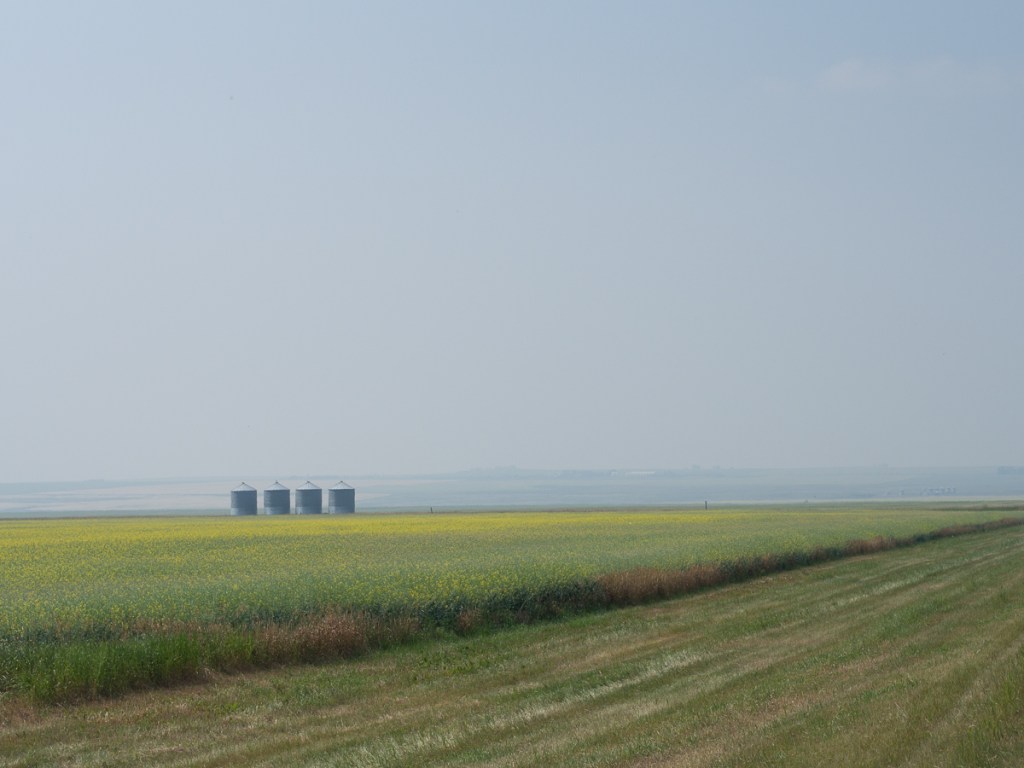
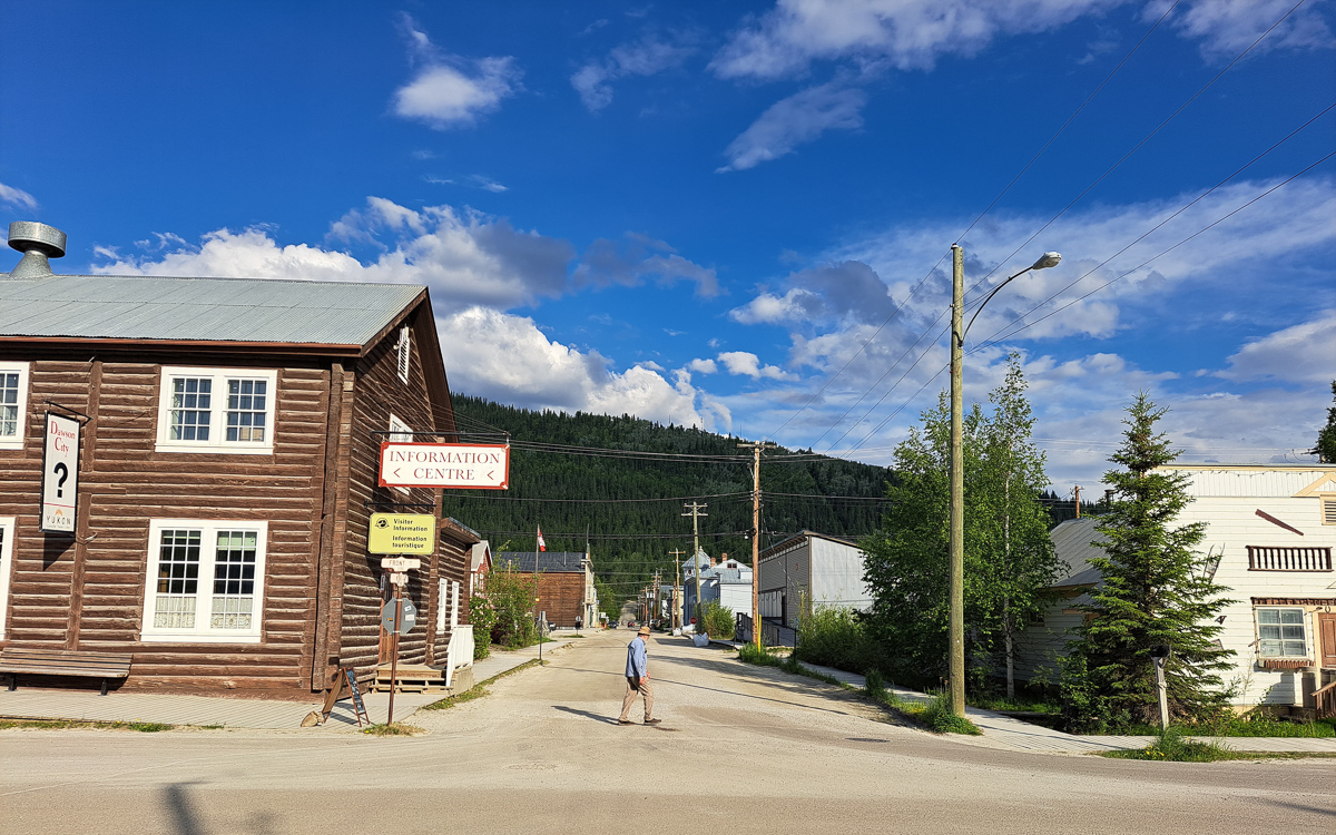
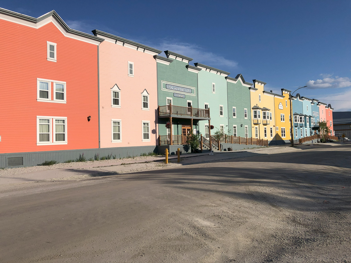
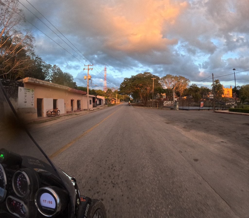
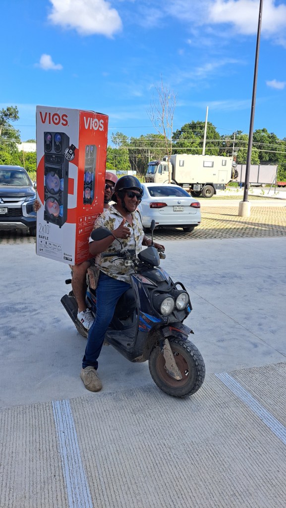
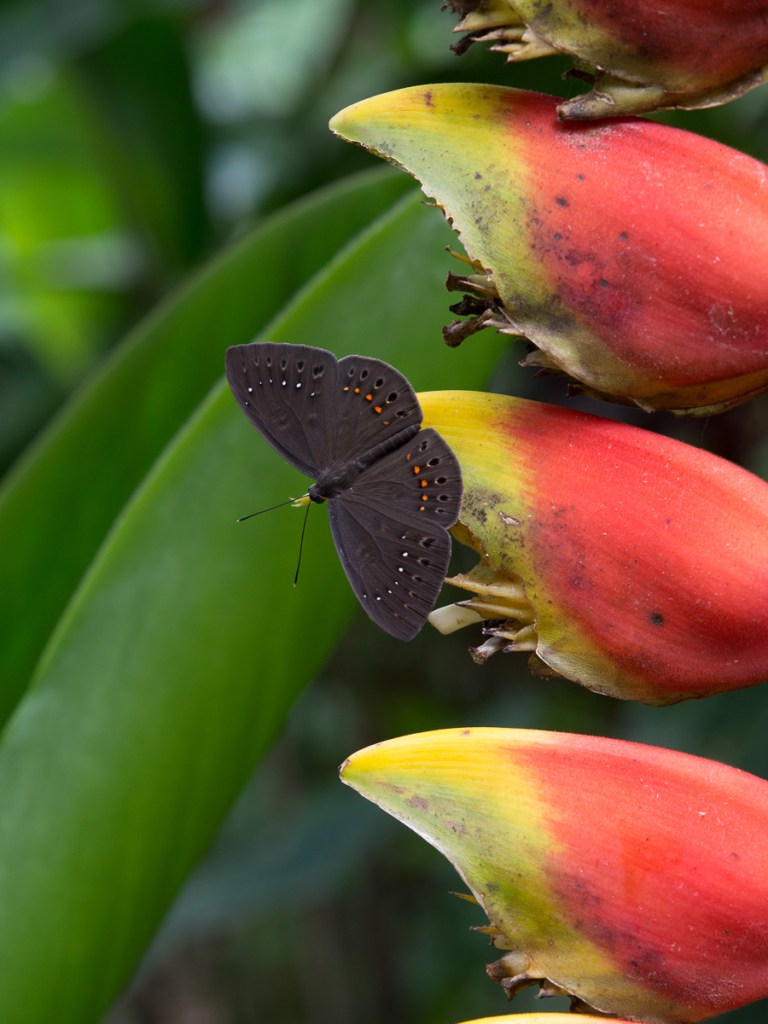
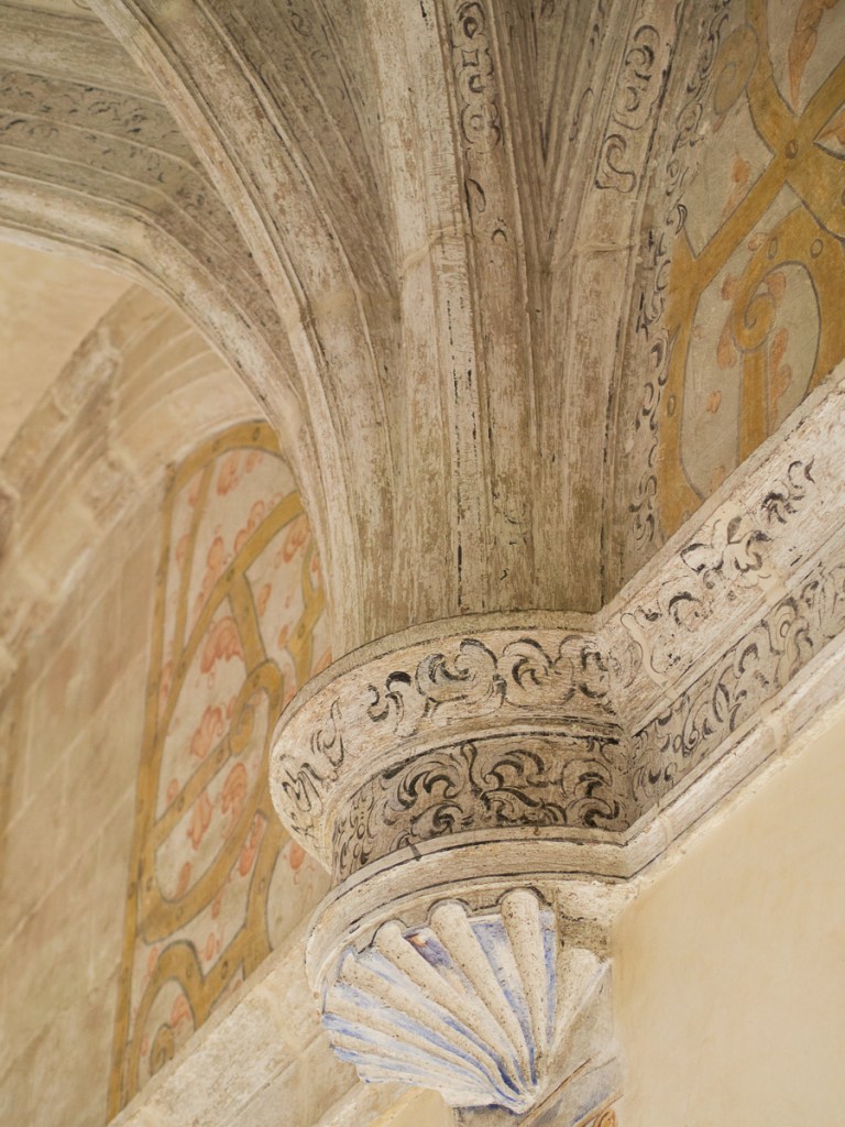
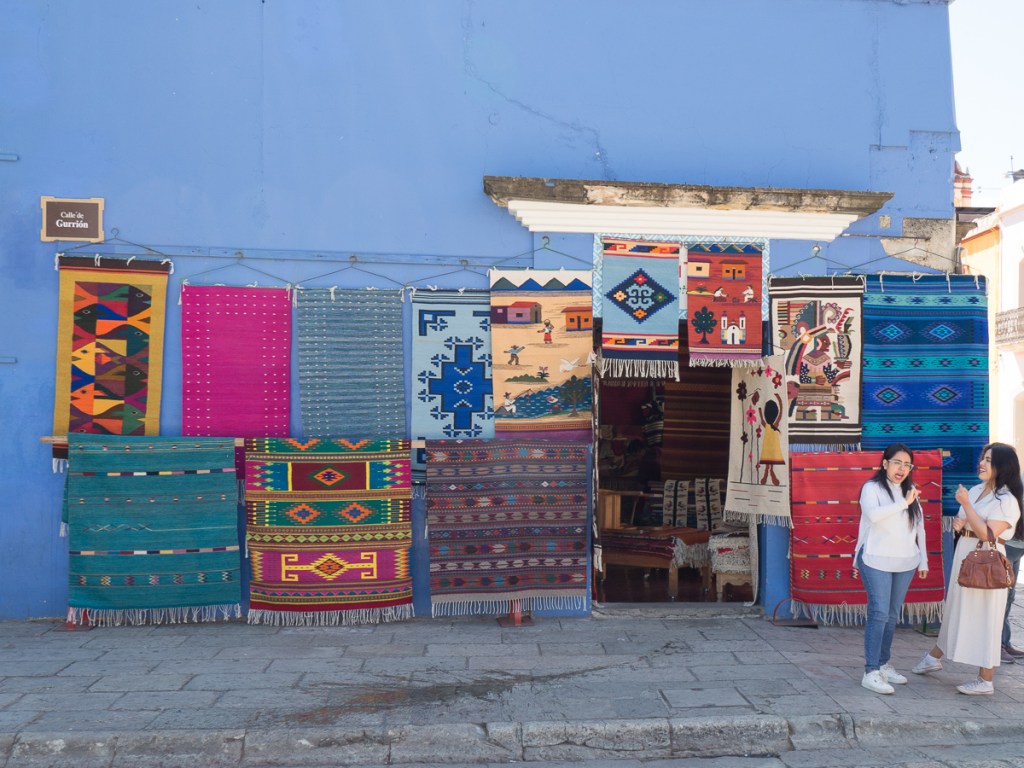
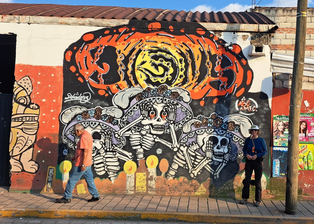
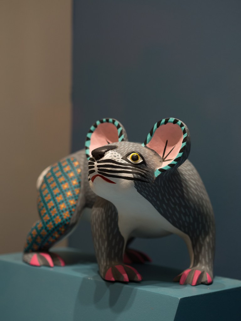
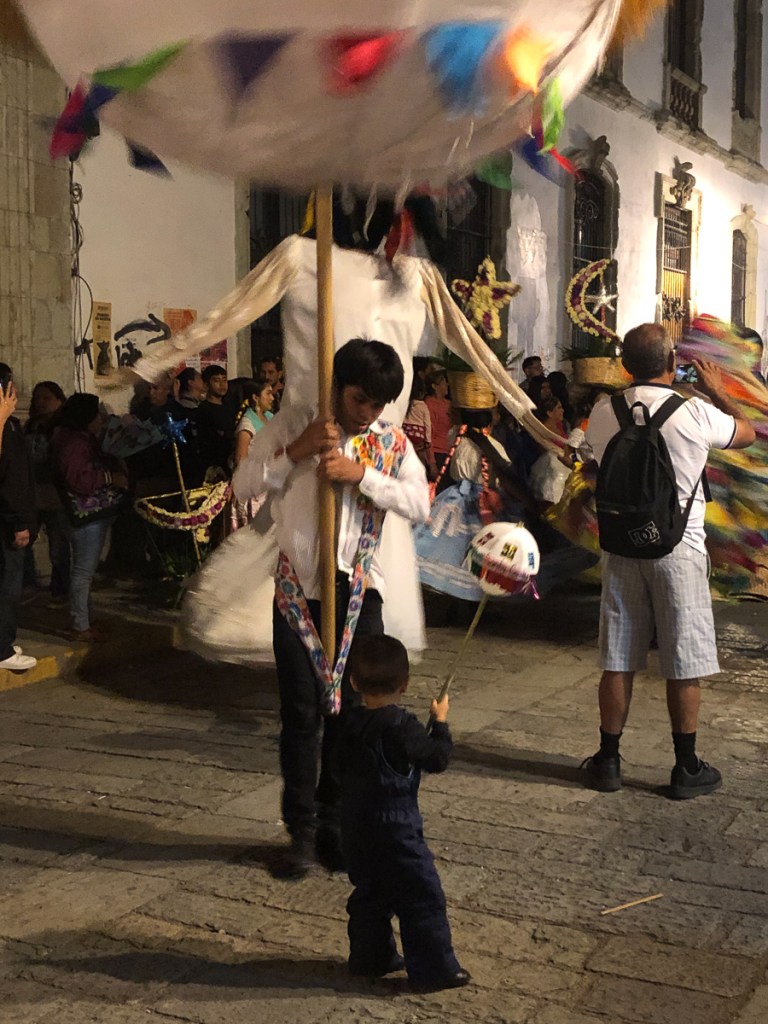
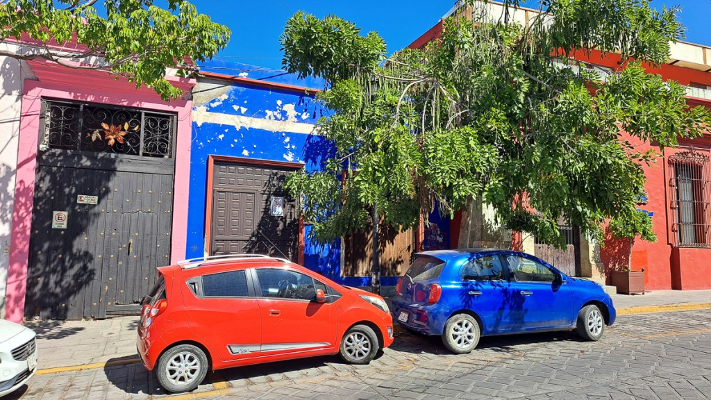
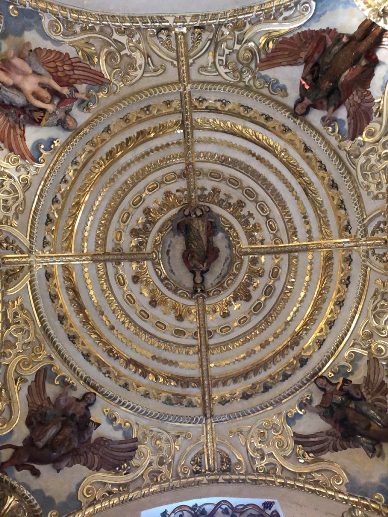
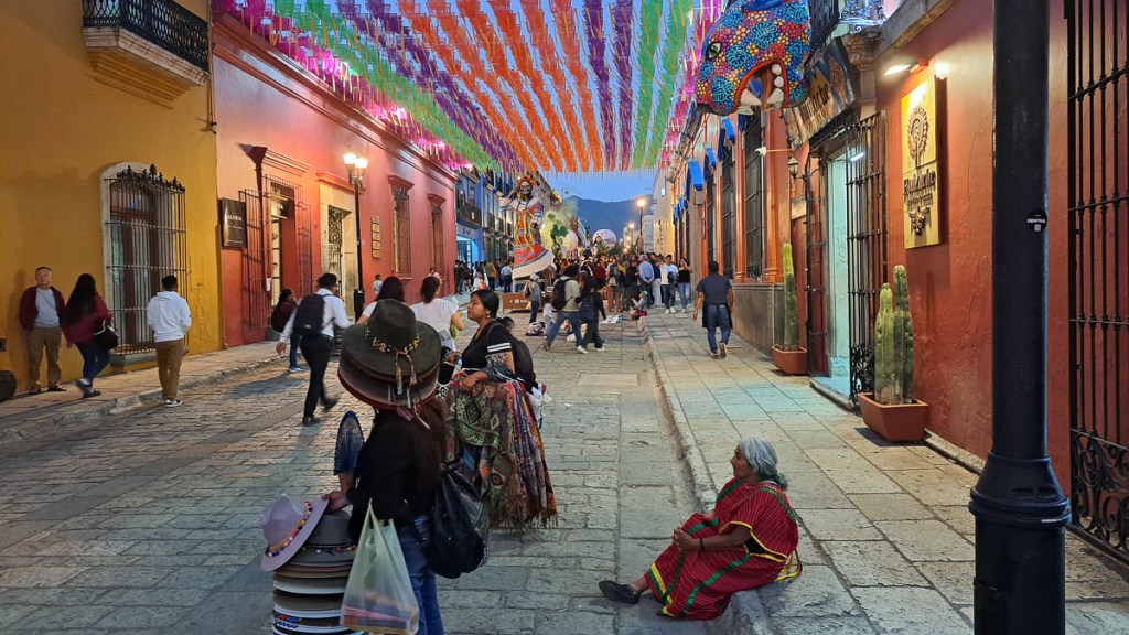
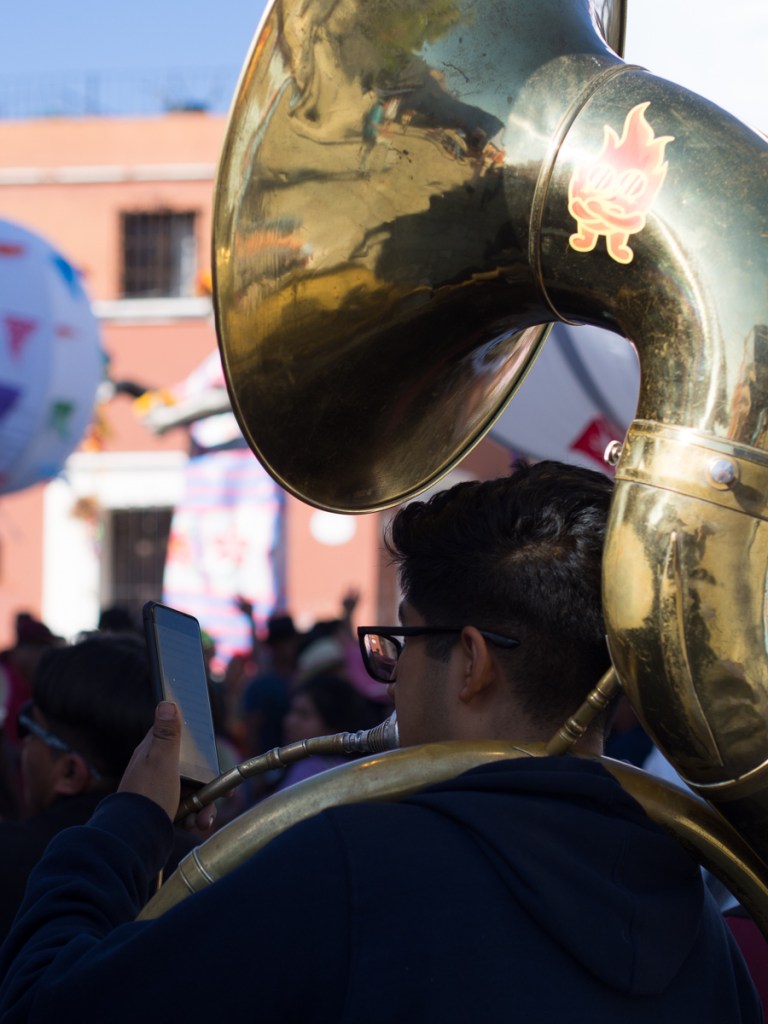
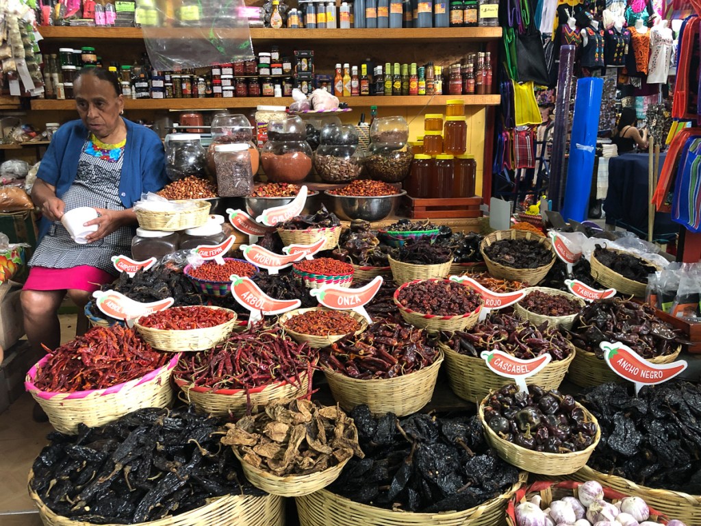
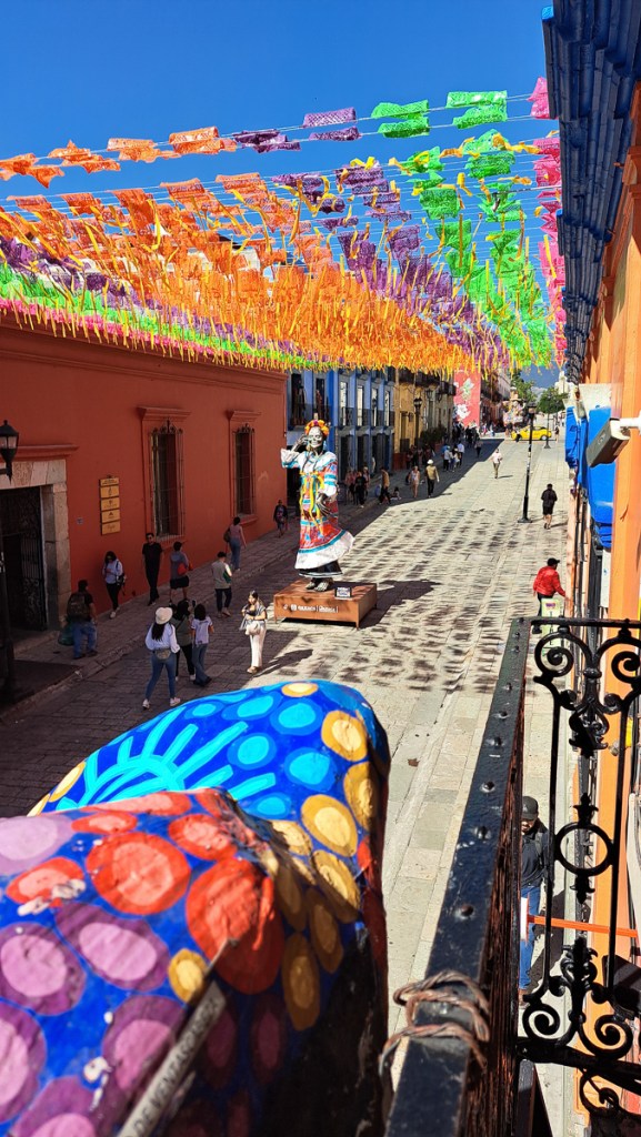
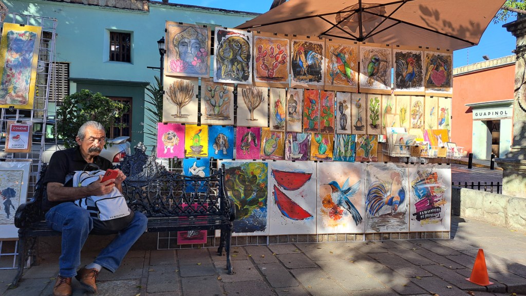
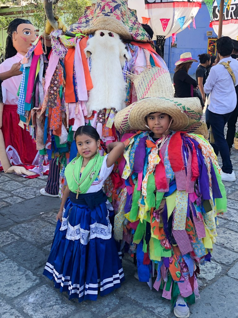
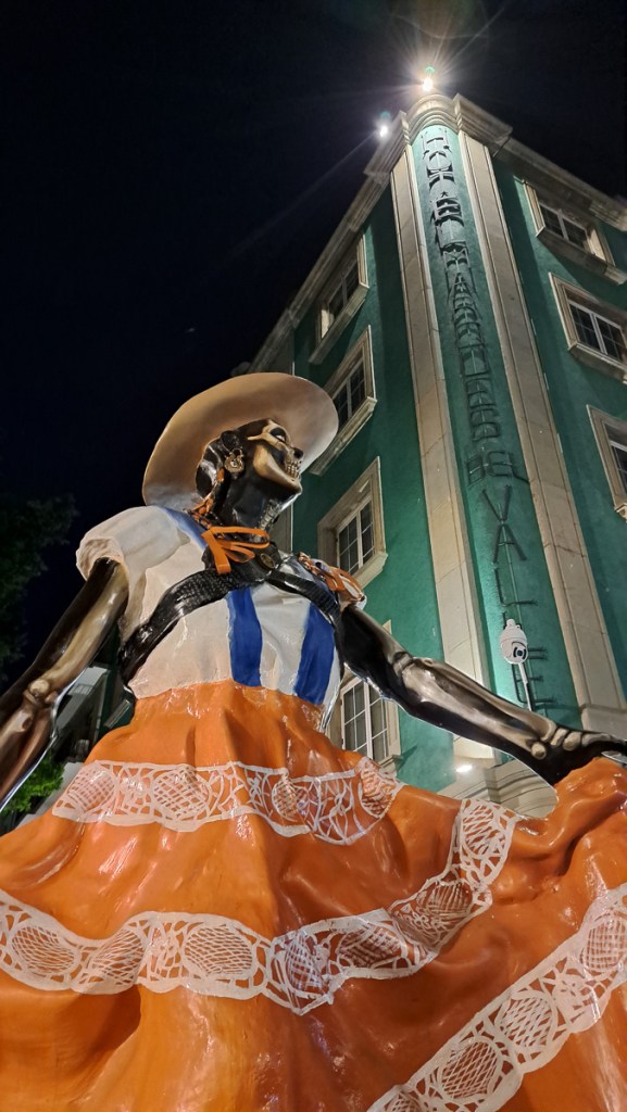
Let’s sign off the Mexico blog posts with a reminder of Mexico’s colours.

And so to Belize…

La Paz

The small city of La Paz sits near the south end of the Baja California peninsula. From there we would take the ferry to the mainland. La Paz faces into the Sea of Cortez, which divides Baja California from the mainland. The sea is warm, shallow and sheltered, attracting wildlife. It’s a beach hotspot.

We intended to spend a few days in La Paz but it was such a wonderful location it turned into a week.  I’d marked on the map that swimming with whale sharks was a possibility but knew little else – information online was confusing, so we’d check that out when we got there. 

Our Casa Buena accommodation was a real hit as it had a very comfortable room, a social area and a swimming pool that you could actually do lengths in.  15m wouldn’t qualify for a training pool but was wonderful to push off, stretch and not stub your fingers on the other end. And, apparently, Itchy Boots stayed here when she came through.

The town itself is a tourist resort which has managed to find the balance between tourist tack and a functional Mexican town.  The promenade provided access to the golden sandy beach although the advice was not to swim from the town’s waterfront.  There were plenty of cleaner beaches further along.

On our arrival in La Paz we pulled over at the posh marina (not inside, it wasn’t free!), and the gatehouse attendant dug out a jolly fellow called Oscar, who did boat trips, only to find out that the sharks are seasonal and won’t be in for another month but the boat trips to the island of Espiritu de Santa are still happening. ‘You’ll be able to swim with sea lions,’ he enthused.  Sea lions, they’ll do.  ‘Lunch on the beach and snorkelling over coral reefs during the afternoon.  Arriving back about 5,’ he continued.  Great!  But we couldn’t go for at least two days because the winds were too strong and the harbour was closed. 

The ferry from La Paz to Mazatlan goes three times a week and we had to be in Mexico City by 30th Oct. Putting our crossing back two days was still perfectly achievable. We instantly extended our stay visiting the museums and wandering around the town to fill the days.  The Baja California Sur Regional Museum was as to be expected – stairways to well organised rooms, displays annotated in Spanish, QR codes available for English translation.  The second museum was a real treat.  The Museo de la Ballena y Ciencias del Mar was a sandy grit base with three shacks housing exhibits with plenty more aquatic bone collections outside.  Pickled brains were a blast from the past and reminded me of my supper the night before which luckily Gid ate.  Hippopotamus and whales were on the same display and one of the earliest separations on the time line.  There were also a few electronic displays in Spanish but the cooling fans were the biggest attraction.

We started to understand where things were in town, and appreciate the steep price gradient as one got nearer to the Malecon (promenade). Speaking of which, Gid chose the statue of Jacques Cousteau as a running turn-around point, but couldn’t find him the first time and fell short. The run had to be completed by 8am, as by then it was getting much too hot. Locals knew that, the prom is pretty busy 7-8 but everyone soon vanishes, emerging again just before dark.

We arrived at the jetty at the appointed time ready for our boat trip.  The wind had died down but the sea was still producing some big swells.  We were one of two couples booked in for the ‘swim with sea lions’ boat trip, along with an extended family.

We set off full of expectation. It soon became evident that it was too rough for our crew.  As to be expected really, the swell was still up.  The two children were whimpering as the boat bounced along spray flying high.  Once we were heading away from the shelter of the land the chop became more intense.  Our plaining hull rose over one wave crashing onto the next covering us in spray. One wave came over the bow and ran a river down the footwell over our feet.  The children panicked. It might swamp the boat. The next wave we jumped had us all briefly zero-g above our seats. Gid and I would thrive on this excitement being seasoned sea-kayakers but the two children instantly burst into tears.  That was the end of that.  Sea lions were off!  The day turned into a snorkelling over coral in the sheltered bays exercise.  It was pleasant enough, and scratched our “beach itch”, but not what we had paid for. 

As we set off for home from our snorkelling pursuits Andrea, our guide, announced that we would visit the nearby lighthouse rock as it was reported that sea lions were there.  I assumed that they had had radio communication with the other tour boats in the area.  A smile was back on my face.. It wasn’t far to the rocks which we circled in the boat looking for sea lions.  Nothing!  Andrea asked who wanted to snorkel anyway.  Gid and I jumped at it but the rest were set for home.  We were quickly ready and in the water.  Circling the lighthouse rock the visibility was great on one side but less so on the other.  Just as we were ready to call it a day a squeal of excitement alerted us.  A single sea lion swam lazily past us.   Success!?

At breakfast the following day our German friends exuded enthusiasm for their trip where they had made it out to the island.  They were full of how wonderful the experience had been – swimming with numerous sea lions.  They talked of how close the sea lions came, the acrobatics they performed, the babies on the rocks and the unmistakeable bark of the sea lions.

It had to be done.  We extended our stay at the guest house again.  Thankfully we hadn’t booked the ferry yet – back that went another two days.  Once on the mainland we had to make Mexico City in three days now.  Perfectly do-able providing everything went well.

Our second boat trip was a totally different experience.  A more professional set up that cost twice as much but our guide, Andrea, gave a more extensive dialogue about the marine biology and geology we passed along the way, and more of a look at the local birds too.  It cost twice as much but was worth every peso. And, the sea was now flat.

Indeed, we swam with numerous sea lions.  They came really close, performed superb acrobatics, the babies were on the rocks and the unmistakeable bark of the sea lions surrounded us. 

California Sea Lions – A pup and (probably) an adolescent male. No, those aren’t the tasty fish.

More videos here!

And there was another delicious ceviche lunch – a food we’d never heard of before La Paz.

Entering Mexico – Baptism by Fire and Paper

We’d spent the previous afternoon filling in the forms at the campsite.  Gid’s android translated the info into English.  Mine didn’t.  I felt as though I was signing my life away with a blindfold over my eyes.  He was feeling challenged with his own form and didn’t need me constantly quizzing him.  We finally got there.  Paid up, two forms.  Copies of this, copies of that.  But one of them said we needed a paper copy and please arrive at the border with it.  We were crossing the border on a Sunday and suddenly we needed a paper copy.

On the way out of our Palomar campsite we’d called into the local convenience store.  The part time lady cheerfully said she’d ask the manager for a print as they did have a printer.  It all seemed quite hopeful.  The manageress arrived flushed and in a considerable flap.  ‘I do wish you hadn’t offered to do this,’ she admonished her assistant.  Despite three heads trying to solve the problems it was not going to happen – passwords, signals, connections – the list goes on.

Gid was keen to try the few random shops we passed.  I was more, ‘Of ‘cos they’ll let us in.  Are they really going to send umpteen tourists away?’  One more failed effort just before the Mexican border left us with no option.  We progressed forwards.  It all seemed very relaxed.  There were a few officers there in uniform but they just waved us through.  Gid exploded.  ‘We can’t just go through. We need our paperwork stamped and the bikes need to be registered.’  He conveyed this to one guy who casually pointed to the office at the side and told us to go through the barrier and come back to do the paper work!

The Mexican immigration office was to the right on a one-way street.  With no access to it we had to park further down the road and walk back.  The señor in the office was very patient as we tried to locate, from among the umpteen forms we’d saved, the ones that he wanted.  We emailed them to him so that he could print them out.  Stamped and dated off we went.  The vehicle importation was equally trouble free once we’d sorted out which paperwork equated to which bike and whose it was. Our recently hard-won, but very elementary Spanish hadn’t really been challenged, but it had had a little outing.

In.  Now we needed some Pesos.  Going down the main drag I spotted an ATM sign.  We pulled in behind a car.  Gid jumped off his bike and in he went.  Moments later un hombre policia appeared pen in hand opening the pages in his ticket book.  He pointed to the writing on the side of the kerb and said what must have been, ‘No Parking’.

‘Un momento, Un momento,’ I cried, calling to Gid through the intercom that he was about to get a parking ticket.

‘I’ve just put my card in, I can’t come now,’ he anxiously replied.

The policia was gesticulating that Gid’s bike needed be to moved.  I indicated that I would move it.  But of course as I swapped bikes mine was now illegally parked.  I was trying to wiggle Gid’s bike round mine when Gid reappeared.  Thankfully the policia seemed to despair of this comedy act and walked away.  Two bikes two riders, money, we were off.

As we set off down the road Gid informed me that a high proportion of the population have never taken a test.  Pay a little extra and the licence was yours is what most Mexicans did.  Somehow I was sensing that and the signage wasn’t as clear as we’d got used to either.  There were stop signs used in the same way as in the US but the accompanying stop line had been erased – some of the signs had suffered over the decades of time.  I ploughed straight through one.  Thankfully no one was coming.  Later we learnt that irrespective of red lights, Alto signs and what ever, ‘Get eye contact!’ before progressing, that’s the important thing. Things seem a little “loose” compared to the UK, Spain or USA, but it works on civility yet is not remotely in an Indian or Indonesian league.

Further down the road I was overtaken on the hard shoulder. A car just came careering past me on the inside.  Wow!  What was that?  The next half hour was a sharp learning curve.  The hard shoulder albeit much narrower than the road lane was regularly used to over take.  One vehicle straddled the solid white line that demarked the hard shoulder while the overtaking vehicle straddled the central solid yellow line.  All sorted then.  One good thing was that as the hard shoulder served as a lane, of sorts, it wasn’t full of debris. The crap was piled high in the pull outs and off the side of the road.  No $1000 fine here for littering.

Another surprise was the trucks passing along through the towns and along the highways with armed soldiers masked and in full uniform standing in the back.  Regular check points along the roads also told of the extent of the drugs problem in Mexico, a lot of it driven by the trade over the border in the USA.  The nearest we got to being searched was one bored pair of young military guys asking where we had come from and where we were going.  Other vehicles, mostly northbound, had numerous inspectors with torches pawing all over their trucks.  The bigger the vehicle the more extensive the search.  We settled into the new regime. The road to Ensenada passed through a scenic wine making area, and wasn’t heavily trafficked – a great introduction once we’d worked out the hard shoulder plan.

Ensanada was our first destination, for very prosaic reasons. But it was a joy to visit. The internet-booked motel was just fine, and after months in the western USA and Canada we could again wander around a town. While none of the pavements were consistently flat it had a centre we could amble through enjoying the atmosphere. Gid could have stayed a few more days, but after all the delays I was keen to get on. The plan was to travel the length of the Baja peninsular, then ferry across to the mainland. Interestingly, it was two weeks before the famous Baja 1000 desert race. We decided not to enter.

We’ve visited Spain a number of times and the similarities here were stark.  In some towns with buildings set back from the road, many things were broken down or in need of repair with the occasional thing half built while others had large murals and were brightly painted with bougainvillea adorning the walls. Whereas the western USA has almost everything in town concreted over, in the pueblos the road had a wide apron of dust – of course, everything was coated in it unless it moved.

We’ve travelled fairly extensively across the globe, and it was a pleasure to see again local, improvised, low key services along the road. Home made as well as printed signs are common, and as Baja California is both very sparsely populated, and not highly developed, sometimes we needed to see that “man with a can” gas stop, or the little stall selling burritos (we hadn’t even been entirely sure what a burrito was). And every café had a “wifi” sign – the wifi may well have been the most reliable service. There were many “proper” gas stations, but interspersed with can men whom we really needed at least once pricey though he seemed. Very sugary pop is also always available, more difficult is avoiding it!

Another change – to us – is an expected one. In the USA we tended to avoid the trafficked and expensive megopolises, and skip from scenic park to scenic park, camping. In the less developed parts of the world, there are fewer campsites, debatably less safe, and our pounds go a lot further. So we tend to reverse the pattern and skip between cheap hotels in towns. Cheap hotels here can be jolly nice, usually best not booked through a big website – local rates are cheaper. El Hotel Frances was a memorable 19th century historic building, in rather mid-western style (but of probably tropical hardwood), but most are pretty new, Hispanically concrete. None has yet approached in cost the San Diego campsite!

We still felt very wary of much adventure in Mexico and there’s only one main road down through the Baja peninsula which was generally ok, two lanes, little traffic, and relatively few slow bits through pueblos.  Occasionally it was a pristine new surface but at times a pitted pot-holed mess – no worse than our home town in the UK, but that’s not a 60mph road.  On our Himalayans we didn’t need to lose much speed to plough through whatever the road surface threw at us.  Along the grotty sections we even overtook some cars and trucks.  We passed a road repair team on a couple of occasions.  It was a truck loaded with tarmac and some spades.  The truck stopped. Out jumped the team.  One filled the hole, another raked it flat while a third flagged the approaching traffic.  All sorted.  Move on.  They had their work cut out!  More dangerous than the overtaking, and the potholes, was probably the occasional livestock, rare in the first place, that had gotten out of the fenced ranches and now munched at the roadside.

But plenty of the roadside was also lovely to look at, and especially in the north, quite curvy with fabulous views.

The country side we passed through changed from sparsely covered desert to a rich environment with many desert plants thriving.  Despite my resolution to not camp in Mexico on the grounds of personal safety we did camp at Cataviña.  We’d just passed a police station next to a deserted motel when we came across a small community: a campsite with two motorbikes and a tent inside a perimeter fence, opposite a taco shack and a fuel stop.  Encouraged by the gated entrance and bikers already camping we went in and were enthusiastically greeted.  We were staying then.  Alexandros spoke reasonable English and encouraged our efforts in Spanish.  He’d also done the southern half of our planned trip and gave us the book he’d written pointing out the pages that recorded his crossing of the Darien gap.  ‘Three weeks for the bikes,’ he said. ‘Three hours by plane for us.’  We spent a fabulous evening sharing tales.  A surprise bonus was the campsite’s tour of the desert by truck to see the painted caves just up the road and off in the desert.

So, we’re off! ¡Vamos! Well, now we stopped in the lovely resort of La Paz, there is the ferry terminal, but it’s so nice we’ll pause awhile.

Death Valley?

Death Valley had been on my wish list from the beginning.  Gid, however, was vehemently against it.  He is far more sensitive to the heat than I am.  Gid had bought mesh biking kit from the UK thinking that he would rather try to layer up and be slightly cold whilst I had brought full winter kit.  Recently I have purchased summer gloves and mesh trousers but I’m still in my full on winter jacket.  I just open up the zips, shrug occasionally to circulate some cooler air, boil a bit but seem to get by.  Gid has also had problems with becoming slightly faint when he didn’t realise how hot he was getting.  On one occasion when we did stop he was seriously affected.  Heat is an issue for him and Death Valley is seriously hot.

I hadn’t given Death Valley a second thought as we’d set off from San Francisco back towards southeast California, for a last bit of tourism before the real adventure resumed at the Mexican border. To begin, we were aiming for the Yosemite National Park.  Stopping for fuel on the way in I chatted to a couple of bikers swapping the normal stories.  Where have you been? Where are you going?  I spewed forth with the ‘On our way to Yosemite bit’ while they replied they were doing Death Valley tomorrow. ‘How are you going to do that?’ I asked.  Not even realising that it was ‘just down the road’ at that point.  Right off HYW 395.  They explained that they were booked into accommodation near the start of the access road and planned to be riding by sunrise. We said our goodbyes but the seed was now festering in my head.  If they could do it …

I relayed the discussion to Gid who’d not been there through the conversation and declared that I was going to do it.  He didn’t have to come I said we could meet up on the other side.  Gid was very uncertain about it but was at least not panning the idea but it was clear that if I did it he would come too.  Later in Yosemite Nat. Park we met more bikers.  They had crossed Death Valley.  ‘You’ll never see anything like it anywhere else in the world,’ one biker said and went on to describe some of the sights.  ‘It’s the right time of year’, he continued, ‘End of September and February/ March are best times to do it’.

Gid was starting to show some interest and looked at where we might find accommodation near the start as packing up the tent to be on the road by five would be tricky.  After leaving Yosemite, we agreed to visit the Lone Pine Visitor Centre situated at the end of the road leading to Death Valley to get an accurate weather forecast and find out more information.

Arriving there and off my bike first I strolled in full of confidence now that we could do this.  I asked the advisor if I could have an up-to-date weather forecast for Death Valley.

‘On the screen’ he replied without moving a muscle.  I looked at the screen which displayed a load of text.

‘No it’s not’ I replied.

‘It’s a rolling screen, it’ll be back,’ he added.

This was 4 in the afternoon and the temp was high forties.  He produced a newspaper style information brochure which I opened up to show the map.  Gid had joined me by now and asked how long it took to cross Death Valley and which bits were likely to be most challenging.  The advisor spewed out a load of statistics and information way to fast for me to comprehend.  I explained that I wasn’t familiar with a lot of the terminology he was quoting to me.  Please could he talk slowly so that I could have a chance to get my head around it.  He stated unfathomable feet rather than miles. I work in centigrade he was quoting Fahrenheit.  ‘It’s very hot out there,’ he restated.  He was aware I clearly wasn’t absorbing this.

I told our story of the biker who had said that this was a good time of year to do it and the guy who had setting off at day break to get across before the temperatures got too hot.   ‘It’s hot by mid morning,’ he said.  Still rattling out his friendly advise at a rate that I could barely take in.  ‘This isn’t fall here.  Fall hasn’t started yet!  It’ll be another month before we get fall.  End of October beginning of November the temperatures drop, that’s the time to go if you really want to do it.  That or end of March /April.’

Ok we’d got it we’re one month too early.

Gid asked how long it takes to cross Death Valley.  Using the map he broke the route down into three sections giving a time for each bit.  Two and a half hours at the national speed limit of 60mph.  We wouldn’t be achieving that.  ‘Stay on the main road,’ he said.  ‘That way if you do run into trouble you’ve got a chance that someone will pass you by.  A couple of German lads went along this other route,’ he showed us a smaller road on the map.  That’s the one that had attracted me because it passed to lowest point in the park.  ‘They got into trouble and they made it into the papers for all the wrong reasons.  They were on their own and they didn’t make it.’  Not that way then.  Gid questioned how many people travel along the main road.  ‘Oh you might expect someone to pass you every five mins,’ he said.   ‘There’s two mountain ranges.  After the second range you’re down into Death valley.  Then you’ve got to climb out of the valley.  Then what are you going to do?  You’re straight into the desert.  It’s mighty hot out there!’  He was talking to us in an exasperated fashion.

Gid pointed at a couple of towns on the map.  Our advisor’s retort was, ‘They’re just names on a map.  There’s nothing at those places.  That one’s got about five buildings, that one’s not got much more.  You won’t find accommodation down that road.’  I explained that we intended to head on down that road to Joshua National Park.  He nearly exploded. ‘You’re just not getting this are you.  This area to the east of Death Valley is all desert!  It’s all extremely hot.  I wouldn’t advise you to visit Joshua National Park.  That’s going to be extremely hot too!’

We left the visitor centre with our tails between our legs.  We would need to get up at four in the morning.  Sunrise is five, we’d been told.  It would take us 1 1/2 hrs to reach Death Valley from the nearest town.  Then 3 and a half to cross it with no photo stops.  We’d be pushing 11am by the time we got across when we can expect the temps to be getting seriously hot.  On air cooled bikes it was all looking seriously doubtful.

We agreed that crossing Death Valley wasn’t on for us but decided to visit the first viewing point inside the National Park, Father Crowley Point, and from there ride down into the first valley to take the Panamint Valley road back out.  The view was spectacular.  The road delightful.

Our route to the turn off in the valley took us past a Panamint Springs and its store.  We stopped to get a drink.  The cheerful young man in there said, ‘It’s been a hot one this year.  Up in the 50s’ – Phew he was talking centigrade.  ‘You’re in Death Valley National Park so you can get the sticker,’ he chuckled. We got the sticker.

Panamint Valley – Miles like this on either side.

Southern California

After San Francisco, we thought we’d had enough of the coast for a bit, and we’d both been a little frazzled by the extra population compared to our recent months in the mid-west. So we headed back inland, aiming south for Yosemite, the Mojave desert, and Mexico.

We set off cutting south below San Francisco across rolling hills, all golden brown with occasional trees sticking up.  The route was fine until we got snarled up in endless smallish towns.  All with endless traffic lights where we were stuck in the sun.  Stop start boil all the way.  We got out of that by cutting further east and heading along much smaller roads, ending camping at Don Pedro Lake – a huge but deserted site, shared only with numerous woodpeckers.  We both stripped off and jumped straight in.

From there is was easy enough to get onto the 108 for the Sonora Pass dropping down into the Yosemite National Park and then on down the Hwy 395.  Brian had recommended the 395 and it was coloured on the map as a scenic route. The first of the two highways was beautiful with a number of winding roads and high passes.  The Sonora Pass, the highest of them all, being quite spectacular with beautiful views spreading out before us.  From there we swept down towards Yosemite. 

We couldn’t actually stay in Yosemite, having, again, arrived in a National Park on a Friday. But it’s a fairly small park, and Saddlebag just outside (chilly at 10,000ft!), then Tuttle Creek were hospitable. The latter gave us a day trip to view Mount Whitney, the lower 48’s highest peak (it’s the distant dit-dit-DAH peak in above the cornering motorcycle below).

Death Valley was only a day’s ride away, but that turned into a bit of a saga, with its own posting.

At this point we were feeling the looming pressure of a long overdue blog update and the need to prepare for Mexico, so we hunkered down a few days in underused ski lodges in Big Bear Lake. But – would the town still be there, on the other side of the hill?

And at the time of writing, that’s where we are.

The Colossal Canyon and the Lonely Road

Apologies, we’re a little behind with our blog: It’s now October, and this relates our time in Arizona and Nevada, 25th Aug to 7th Sept. More soon! We also had a bit of an IT disaster and lost a lot of Clare’s pictures from August and September, so the imagery isn’t what it should be.

Next on the list of must see destinations was the Grand Canyon.  Having done our homework we knew that the Northern rim was thought to be the more spectacular of the two.  We set off from Flagstaff heading in totally the wrong direction – southwards.  We wanted to take in the scenic roads that were either marked on the map or had been recommended by other bikers.  But we were in luck – to get to the northern rim – we had to ride along the southern rim – bonus! Being a weekend the super route out and round to the south was rather over crowded and we were happy to get out of it but crowds were something we were going to have to get used to as we reached the more populated areas.

Along the southern rim we stopped at three vista points and learnt that the gorge was formed by opposing tectonic plates clashing and forcing each other up.  This created a raised plateau. From there the Colorado river cut through the rock.  Because there is not enough information left geologists don’t know why the river didn’t take an easier route around the outer edge.  The high levels of silt carried by the river have carved a deep gorge which continues to cut its course to this day.  The gorge was beautiful but the vultures stole the day.  Several vultures and some falcons rode the thermals swooping to and fro right in front of us.  ‘Have you got it?  Have you got it?’  we cried as another swept past.

Up at the Northern rim an elderly park guide was enthusing to us about the benefits of doing the North Rim road.  He told us that there were many viewing points and it was good use of our time.  But Gid was keen to do one of the walks.  Neither of us considered the whole day North Kaibab trail.  An 8 mi down 8 mi up marathon but we did think we could do one of the shorter ones.  Was there time for both?  ‘Of course there was,’ I exclaimed. And off we went.

On the rim road the information boards were very useful although I couldn’t see the ‘obvious’ fault lines on the southern side of the canyon.  We were excited to glimpse the Colorado river on a number of occasions as we stopped and started along the route.  We seemed to have swapped the birds for some views of the murky river.  I was pleased we’d seen both sides.

We hurried back to the start of the scenic tour road to pick up the hiking trail.  It was 5:15 when we set off on what was described as a 2-4hr hike.  We had torches and had been advised to take more water which we dutifully got.  Our walking speed is middling on most timed trails so I was predicting our return at around 8:15.  It’s dark by 8.  On a very uneven track how good was my torch?  Gid normally leads down hill and me coming back up, but I set off at a fair pace.  I wasn’t messing around we needed to speed this up.  Meeting a few people along the way was encouraging.  They were all on their way back but it was still nice to know we weren’t totally alone.  A few ‘not far now’ comments gave us encouragement but meeting a father and young daughter a few hundred metres short of our destination, Supai Tunnel, was quite a surprise.  We went through the tunnel, gazed down at the zig zagging path disappearing into the depths of the gorge and were ready to turn back.  One couple we’d met had done the whole day hike.  They’d set off at 8 in the morning and were on course to make it back completing their trek in just under 16 hours.

We made it back in good time just about catching up with the youngster and her dad.  Amazingly we did the round trip in just over two hours with just enough daylight, to pack our kit and set off back to the campsite.

We hadn’t got far the following morning before stopping for fuel.  Parked on the apron was a Royal Enfield Continental GT.  Paying for our fuel in the garage it was obvious who the Enfield belonged to.  This distinguished gent with a broad grin, a thick red beard and plaited hair readily admitted it was his bike.  We asked him about the unusual racking system he had and his tin seat.  Out we went to look at them.  He enthusiastically told us about his project to reduce the weight of the bike.  He lifted up the tin seat shaped to fit the gap between the metal rods and read from the bottom what the old seat had weighed and what his new tin seat weighed.  He proudly declared weight the saving.  He repeated this exercise with the side guards which were now leather flaps with another recorded saving.  The next project was the rear rack he declared.  That was trickly though as it had to take the cat.  At first I thought the bag of empty 5lt water bottles somehow housed the cat.  The cat, his travelling companion he informed us, was out prowling around back at camp.  The cat, he told us, could only manage three hours at a time on the bike.  With that saddle I’m sure I couldn’t manage any more.

Jamie Burns, the distinguished gent, had never been to Scotland even though he was directly related to Robert Burns the infamous Scottish poet.  ‘I  can’t go!’ he exclaimed.  ‘I’d have to set foot on English soil and I’ll never be doing that.’  A little later Gid pointed out the he must share some considerable empathy for the Native Americans with the atrocities that they suffered at the hands of the new settlers.  But he seemed to be handling American soil ok.

The Grand Canyon, Petrified Forest and our stop in Flagstaff ticked off Arizona: We were making good Pan-Am progress towards Ushuaia, on the southern tip of Argentina.  Next stop Mexico? Nope. North westwards to northern California.  We couldn’t miss the Pacific coast and the redwoods.  So we turned, heading back north up towards the northern tip of California.  We aren’t fond of megopolises, so for the second time, we avoided Salt Lake City, and this time, Las Vegas too progressing diagonally between them.  We’d soon have 12000mi under our belts so we chose Reno, Nevada, for a service stop.  It’s big enough to have everything, but not oppressively huge. Airbnb host Tyler was ok with us changing oil in the shade of his carport, and Royal Enfield dealer Eurobikes had got the service parts and our three new tyres in.

We headed westwards towards Reno along Highway 50 crossing the often empty Nevada, which passes just south of Reno. It’s dubbed ‘the loneliest Highway in America’ and served us well as it had little traffic.  The section we travelled from Ely to Silver Springs traversed great plains where there was very little to see except the next mountain range to cross.  It took ages crossing each plain, then we’d ascend up the mountains.  Most roads carve a pass through the summit with rocky cliffs towering on either side.  Pancake pass – 1988m – being the unusual one because it was flat.

The Pony Express central change over point at Old Middlegate Station on HWY50 was a wonderful choice for a stopping place, full of memorabilia with posters for ”Wanted’ criminals – Dead or Alive’, legalised prostitution advertisements and pony express riders job offers not to be missed.   Providing, that is that, you were under 18 and preferably an orphan who was prepared for high risk and possible death from their chosen employment.  The place was stacked with relics from the past both inside and out.  A quaint mix of old and modern as the petrol pump boldly claimed ‘no lead’.  Not now perhaps but there’s been no shortage of lead flying around this place I’m sure.  To add to the authenticity signage pointed out that Ned Kelly’s house was a stone’s throw away.

Our arrival in Reno was a little bit complicated, as we’d booked the Airbnb for Sunday onwards, not realising Monday was Labor Day.  Eurobikes and almost everywhere would be shut.  We needed to be close by Friday night, ready to hit the store Saturday morning to collect the service kits.  Experience told us that even ordinary summer weekends could crowd out the campsites leaving us struggling.  Lake Lahontan State Park was 30 miles out, a big reservoir with sandy shores, it seemed like a great retreat. We arrived with some trepidation about availability, but paid our fee at the unattended gate. We’d hoped for a pitch we could swim at, but there was a Red Warning stating that the lake was unfit for recreational purposes because the algae levels were unacceptably high. Oh no!  But we trundled round the shore, surveying the ad-hoc camping.  We found a beach spot facing the sunset: firm sand to park, soft sand and shady trees to camp. One RV right down on the shore was 50 metres away. The next units maybe 200m one way in a thicket, and 1000m the other.  On this side of the lake, people were swimming.  Definitely one of our nicest sites!  We stayed two nights, enjoying a starlit evening chat with the neighbours.

It was a short freeway ride to Reno on Saturday, but to return, we saw a wiggly back route going through Virginia City and tried it.  It turned out to be a local bikers’ favourite. Virginia City – City it says. Obviously swayed by the city part of it’s name I was expecting something big.  Bigger that is than a half mile main street, and not a lot else.  Rather than the boom and bust of many towns where a natural resource is found, Virginia City, once the mountain of silver under the city was depleted, has managed to maintain prominence albeit now as a tourist attraction.  Its high street is frozen in the style of 100 years ago with original buildings and facades, as are the rickety board walks beneath the overhangs.  There are tourist attractions like: the Silver Queen Hotel where the lady’s silver dress is a floor to ceiling art work modelled in silver dollars mined beneath the city.  There are many saloons, some with swing doors, eateries and tat shops, and events like camel races for the more competitive amongst us.

Mark Twain, at least his wax model, peers out of one window where he used to work as a newspaper reporter.  Words such as ‘never let the truth get in the way of a good story’, accredited to him, live on.  His famous novels, Huckleberry Finn and The Adventures of Tom Sawyer still make it onto many a reading list.  The local museum claiming ‘Of great interest to adults and children’ displays many relics from past life in the area. Virginia City became our regular route between Reno and Lahontan.

The servicing went to plan.  Having done it all before it was quicker this time. Now Gid is becoming familiar with the process he’ll let me play too – next service I hope to do the oil changes.

We’d noted the bike chains had needed occasional adjustment, but annoyingly, as we approached Reno, Gid was having to tighten them every couple of days.  Knackered. We ordered replacement chains and sprockets at the Reno dealer but RE gave no delivery date. Were they coming from Wisconsin or Chennai? We decided to wait into next week before requesting that they might be posted forwards.  The dealership had a branch at the coast and was happy for us to collect them en-route but we couldn’t continue to stay with Tyler.  With time to kill we needed a new home.

To get away from the bustle of city while we waited we went off to explore Lake Tahoe.  Our Lonely Planet guide book describes it as a very popular location for winter skiing with slightly fewer visitors in summer.  Wrong!  It, or rather its shoreline, was teeming with people.  Adding to the frustration most campsites were closed because the trails were being repaired and supplies were dumped in campgrounds.  We u-turned and got out of there as fast as possible, riding right back up the 9,000ft pass we’d come in on, returning to Mt Rose campsite near the top.  It was beautiful.  Pine trees spread around large boulders –  the sort of things that are called erratics in Norway having been randomly dropped by the receding glaciers but here they were at 10000 ft high!  It was beautifully peaceful, until the generators started.  The site host agreed that it was a beautiful area informing us, with a wry smile, that the noisy school group had left 2hrs ago. It was nice for one night, but we couldn’t think of a better option than returning to Lahontan. The exact same spot, and now the nearest neighbours were maybe 2km away. No cossies needed.

Having missed petroglyphs at the Petrified Trees NP I was keen to see the ones in this area.  Grimes Point, the site of the petroglyphs and the Hidden Cave, wasn’t far away and reportedly had the best examples so it had to be done.  We would have liked to have seen the Hidden Caves, also at the site, but on contacting the area office to arrange a guided trip we were informed that due to sickness that was off.  Thousands of years ago the Hidden Cave appears to have been a site of storage: furs, tools and remains of clothing were found there.  It’s under lock and key now to preserve the site for future generations but our wished for visit wasn’t going to happen.  On the self guided walk around the petroglyphs, the boards told us that human habitation in the area dates back to 8000 years ago.  Lahontan Lake, now some 20-30 miles away where our tent was, would once have been lapping the edge of this area.  The boulders, plenty big enough to hide behind, would have been the perfect site to hunt the animals who came to drink.  Shaman, responsible to communicating with the gods to ensure a successful hunt, may have been responsible for the pecked or carved rock art.

Finally – good news – the chains and sprockets were in. We’d already been on Bunk-a-Biker and made contact with a friendly soul who offered us a bed, a workshop, and a breaker bar, just over the border in California. We were off again, albeit only for 60 miles.

Missed Opportunities?

After the stunning views of Monument Valley, and the rocky heat of Utah, we decided to stop in the small city of Flagstaff, for a few days of motel civilisation over Clare’s birthday. It might also offer some wifi and shops, for practical things. Ok, it was the cheapest motel in Flagstaff, but it was comfy enough, especially after a small tent.

A relaxing few days, that was what it was supposed to be. I’d discovered the Petrified Forest National Park when idly looking through some advertising info.  We’d planned our next day – setting off from Flagstaff and doing a relaxing loop along scenic roads.  The Petrified National Park was only an hour and a half away.  Of course we could do that in a day.

In a day maybe but we set off at 1.30.  Gid was totally occupied with trying to pull together the resources for our next bike service, at 12,000 miles.  The bike specific service parts, and a location where we’d be permitted to do our oil change (think about it!), the latter needing to have a cover as now we seemed to be subjected to extreme sun and monsoon weather with massive amounts of rain most afternoons.  And tyres this time too.  Both front tyres are wearing smooth in places and Gid’s rear tyre has worn rather quicker than one would expect, and we had been very lucky in Whitehorse, where we’d previously got tyres, to find shops actually holding stock – normally an order has to be arranged. On top of that our chains were now showing considerable signs of wear.  After thousands of miles where they appeared not to wear at all, suddenly Gid was tightening them every 500 miles.  End of life was near. Whilst the chains themselves are sort of standard, the sprockets are not – again an order has to be placed… somewhere. Where? When?

Gid’s been quite concerned about his bike pulling slightly to one side, which may explain the fast rear tyre wear.  On a number of occasions he has been doing the ‘no hands’ bit to check how true the bike would run.  Initially his conclusion was that it was pulling to the right   ‘How does yours track?’ he’d ask me.  So once again I’d be going down the road with my hands in the air.  Mine seemed to run quite true but I wasn’t that keen on going hands free with a fully loaded bike.  We’d done this sort of thing on the i2i course back in our early days of learning to motorbike. It was about improving our balance and skills but I will never forget when I very nearly ran into the back of a car when going hands free and reading my comic returning from my newspaper round early in the morning, many decades ago!  Gid had tried to correct the error by relieving the fork clamps and next, tweaking the rear wheel alignment to pull the wheel slightly to the left but that had made it worse.  A couple of tweaks to the right had improved it but he wanted it professionally checked. The Royal Enfield dealer in Reno, our place of choice, was fully booked for the next two weeks and we’d be there in a few days.  Our preferred Reno accommodation, Air B&B host Tyler, with a car port, couldn’t extend our stay to take account of the delays with some of our service parts arriving later than hoped and we definitely needed the shelter to work on the bikes in this weather.

Before leaving America we are going to do one final loop back up and round to take in the coastal road – HWY1  as it’s supposed to be another of the  ‘can’t miss’ roads.  Another two thousand miles perhaps but that will be our final lap in the US.  From there we’ll be down in Mexico.  How easy will the servicing be down there?  It might be affordable not to do it ourselves (a DIY oil change and check over costs $200 for both bikes, a DIY valve check is $0, USA dealer shop prices are about $1400, this for a 6,000 mile service about every 7 weeks). But everything might well have to be arranged in Spanish.

From Flagstaff, starting after lunch, it took us a couple of hours to reach the Petrified Forest National Park. We went into the museum and Visitor centre.  Gid had read that in minutes it seemed – I took more than an hour.  I knew how petrification took place – vaguely, but found the information fascinating.  200,000,000 years ago back with the early dinosaurs all this had taken place.  It explained on a time-line that if a year was the wakening of the journey of life on earth the early life was about the summer, dinosaurs the autumn and man was the last 15mins – 11:45 on the 31st December!  Back with the dinosaurs these trees had fallen down into the river/stream been covered in silt and gradually turned to crystal, absorbing colour from the minerals around them.

We wandered off through the exhibits .  But again Gid hadn’t been totally ‘in the moment’ as the pressure of the servicing was all consuming.  I’d offered on a number of occasions to pull my weight with the mechanics but my approach is far more laid back.  ‘I wasn’t even doing my POWDDERSS checks every day,’ he’d chastised me.  No, barely once a week to be truthful (Gid says: Not even sure that’s true!).  I’d need a lot of support the do my own servicing and clearly it was far easier for Gid to do the lot.  Then he’d know it was done properly, was clearly in his mind!

As we wondered round the exhibits I read some of the information but Gid was pressing forwards.  I think he did relax into the event but only briefly as ominous clouds were brewing with lightning flashes signalling the storm to come.  Once back at our bikes, whilst looking at the weather Gid asked what route were we talking home?  ‘Through the park and the Painted Desert‘, I’d replied.  He queried if I knew how long it was and suggested that I came back to the Visitor Centre to look at the map.  Yep, I knew how long it was and that it would probable take us another hour or so.  This was my trip – through the park we went but I had agreed that we wouldn’t stop at any of the other sites along the way. It was rather a dramatic ride, with lightning flashes on both sides of the road and strong winds.

Arriving ‘home’ at eight o’clock Gid was straight into service mode urging me to focus on our campsites for the next week leading up the our arrival in Reno.  I’m not sure he’d thought of anything else all day. We’d booked the Air B&B for Sunday night but of course that meant we couldn’t pick up the service parts during the day.  I was still in Petrified Park mode.  I sat and read the booklet I’d picked up and was rather sad about the things we’d missed – petroglyphs, we’ve seen some before and very much enjoyed their creative form and direct link to so much history, and we’d missed the longest petrified log in the site together with some wonderful views and walks around the Painted Desert – an area of layered rock showing different periods in history as different sediments had left their colours of rock behind – one building on top of the other.

It seems there are more opportunities to see petroglyphs and many areas we have ridden through have got vivid rock colours displaying the high mineral content in this area.

Meandering Around in a Meaningful Way

Our route is currently weaving around ticking the boxes of you must see this and must see that.  Skagway was the first of these.  The route down was through more awesome scenery but equally the town itself was of special interest.  We camped at Dyea a small hop round the peninsula from Skagway.  Back at the turn of the 20th century Dyea was a thriving town building up from ‘nothing’ to accommodate the gold rush influx of hopeful prospectors.  There, was the start of the infamous Chilcott Pass route over the mountains en route to Dawson City.  The alternative route, the White Way, was from Skagway through lower land but with thick mud and rivers.  Both routes were extremely hard.

The Canadian government, concerned about the influx of people resulting from the gold rush, and the impact this would have on local services (which were, err….what exactly?), insisted that each person crossing the border from the USA had to bring two years worth of supplies so that they could maintain themselves for the duration of their stay.  This led to enormous packs that took many, many trips up the frozen stairway of the Chilkoot Pass.  Entrepreneurs  made light of the ordeal by selling potential prospectors sacks that could help transport their belongings up the 1500 steps cut in ice and be used as a ‘sled’ to speedily descend back down the snowy slopes to retrieve the next load.  Unfortunately the sacks had to be durable which led to increase in the weight to be transported.  Other ingenious ideas also blossomed but many people and horses died failing to survive the extreme conditions.  One such place on the White Way is named Dead Horse to mark where hundreds if not thousands of horses died on the trail. But today, road and rail run easily over White Way, Dyea is simply vanished, and Skagway is a cruise ship destination with a main street where one can indeed buy a ton of souvenirs.

The second, 3,000 mile, service at Anchorage had unleashed the full potential of our Royal Enfield Himalayans, well, 5,000 rpm of it.  We’re now cruising at a staggering 55mph.  Andrew, at The Motorbike Shop, had chuckled that we’d barely notice the difference from the running in speeds. Later on when loosened up more, we find the engine will cruise at 60-65mph with a bit of chatter but no real distress. However, the in-helmet wind noise at that speed, with only a small screen, gets a bit painful. Not to worry!  One advantage of being so slow is we have plenty of time to take in the views and observe the wildlife.

The views have been staggering.  Riding east into the Yukon on the Alaskan Highway led to spectacular panoramic views as wide valleys opened up.  Flowers edged the road side, rivers meander across the valley floors.  The only thing missing was the sheep alluded to on the signpost.  We went from the snow topped mountains of Alaska into the more rolling, greener, countryside of the Yukon and the change was refreshing. A short leg in BC was even greener, and now we were seeing small scale agriculture, too. Continuing on from BC into Alberta the mountains had gone replaced by expanses of arable land.  Hay bales in one field a tractor ploughing the next. Initially they were quite small but soon spread to a considerable expanse. Nearing Edmonton, prairie farms started to appear, miles upon mile of crops, mostly mown hay, rape (canola) and barley, but also oats, wheat, linseed as we turned south. And every second field had a nodding donkey extracting oil.

The wildlife has been fabulous.  On this last stretch we’ve only seen one grizzly bear but plenty of black bears.  The black bears are smaller but we’re told, that just means they take longer to maul you to death.  One person is usually mauled every year, Dave in Edmonton tells us.  Erron, a local guy we met at Mosquito Creek campsite added that a doctor and his wife where killed walking out from Banff this spring.  Bears he was telling us, ‘can go from zero to 30 mph just like that.  They are soooo fast.’  Safety around bear strategies include bear bells to ring out ‘dinner time’ and playing dead.  ‘It’s great to practise,’ Larry, at Toad River campsite, laughed, ‘because you soon will be’.  Studies have suggested that the machos who carry a gun will be too slow to draw and aim it.  So it’s bear spray, the counter attack, or nothing.  The bison along the Alaskan highway were beautiful too, all recorded on GoPro video. A few deer have also skipped across the road ahead of us. Two bounds and they’re gone.  But the one that got away was probably the most spectacular.  It started as a small dot.  Our first thoughts were could it be a bear.  ‘No!  It’s flapping and it seems to be two small dots’, I exclaimed.  It could be something blowing in the wind but road tyre debris doesn’t flap and is too heavy to blow in the wind.  Slowly it revealed itself as two birds.  Ravens probably, there’s quite a few of them around.  Nooo!  One of them has a white head.  All too late to start the GoPro it flew up from it’s road kill meal swooping right across our path – a beautiful full wing spread of a bald eagle a few metres in front of us.

We have great respect for the wild life we are passing and pay heed to the warning signs around, one of which states, ‘Don’t stroke the hairy cows’. When riding down through Elk Island Provincial Park, Gid was calmly and slowly easing past a lone male bison which was on the other side of the road when it turned and gave chase.  From my vantage point some 15 – 20 metres behind it looked as though it got pretty close!!!  Seems like the lone males might be a bit less relaxed about traffic than the breeding herds we’d often passed earlier. Perhaps this guy had the hump ‘cos he’d missed out on the lady bison this year.

The Alaskan Highway, our initial route across Canada, was hastily started back in 1941, initiated by the American government .  The Americans were concerned about a possible Japanese invasion into Alaska following on from the Pearl Harbour bombing.  In conjunction with the Canadians the road was built in 15 months but the invasion never came.  It did however prove useful as a supply line to the Soviets. Having got to Summit Lake and admired the wildlife and views along the way we turned back because the route ahead to Fort Nelson was described as flat and boring with the town itself not up to much.  We headed back to Watson Lake to take the Cassiar – Stewart Hwy south.  Many people we’d spoken to considered this the better of the two routes.

Turning left along the Hwy 16, heading east again, small towns again getting bigger sprawled ahead of us. Some abandoned ramshackle properties, the odd one still inhabited.  Mine Road, Pit Lane giving clues to former communities.  Prince George Town, in recent terms was quite big.  It spread out ahead of us barely making a mark on the sky line with it’s one or rarely two story buildings.  Heading north from there took us back into mountains, lakes and the spindly, wizened black spruce oozing resin.  The black spruce’s high flammability the reason many wild fires take hold and spread so quickly.

The temperatures of at least 10 degrees higher than normal have caused havoc with forest fires in the north of Canada.  In the Yukon the fire between Dawson City and Whitehorse was still an issue three weeks after we initially heard about it.  Canoeing races down the River Yukon had been stopped because of fire sweeping across the river.  Riding across BC we’ve seen evidence of fires with mountain views being obscured and that distinctive bonfire smell in the air.  At Johnsons Crossing the campsite owner dismissed our inquiry about safety saying, ‘Yer, there’s a fire. It’s down the valley and across the river so won’t affect us here.’   It’s great to have something other than bears to worry about at night.  As we rode further on again the tell-tale smell was still in the air, smoke was wafting across the sky line to our left but on the right smoke was billowing up into the sky.  Getting closer we could see one helicopter with a water bomb and two small aircraft circling in the area.

Riding south down the Cassiar – Stewart Highway, a part of our backtracking, took us straight into the scene of a big forest fire from back in 2010.  The skeletons of black spruce trees still stood with new growth at their feet but clearly it’s going to take some time to be anything other than the scene of a forest fire.  The following year a second fire hit the area but it’s spread was restricted because of the previous burn out.  Evidence of past fires is very clear throughout our travels in all but the prairies which we entered near Edmonton.

While in the Edmonton area Jasper had made headline news as there was a severe forest fire raging to the north.  A northerly wind was blowing it down onto the town.  The news updates were looking grim.  Two days later it was stated with impending gloom that the town was likely to burnt down that night.  It did. Our route down the famously scenic Hwy 93 through Jasper was not going to happen.  Sadly a large part of the town was demolished by fire.  The rain came the following day but was probably too insubstantial to have much impact on the well established forest fire. Current opinion in the news is that it may take three months to be truly extinguished.

Having ridden down Hwy 21 where we enjoyed the delightful lush rolling pastures of the prairies and visited the tourist attraction Dry Island Provincial Park where the buffalo/bison were herded over the top of the cliff, we yet again, cut back westwards.   We did however manage to ride over the Saskatchewan Pass on Hwy 11 linking Hwy 22 with the midpoint of Hwy 93.  It was initially very unclear as to whether the junction would be open to traffic.  Thankfully, closed down Jasper was some way north on and we were able to turn south, after being royally shafted by the gouging prices at Saskatchewan Crossing.  (A micro can of gas cost us £15).  Along the linking pass towards the Jasper end was another interesting study of forest fires.  The ground in one area of thinned out burnt spruce had a magenta hue – fireweed was doing its rejuvenation job, while in the next 10 to 20 km there were areas with green 1m high trees, 2 m trees etc. clearly demarking the zones of previous fires and the progress of regeneration.

In  Alberta a second less publicised fire line is currently across the top of the province. Yet again residents have been evacuated.  This fire has had a more widely felt impact as fuel prices have been affected due to the risk to the oil fields.  400km south, in Edmonton, the air is tainted with a mild smoky mist.

On our meandering we spent a few days in Edmonton, our first ever Bunk-a-Biker stay.  Dave and Ardis were fabulous hosts.  A biking couple themselves we had lots in common and great stories to share.  Gid was very fortunate to be able to complete a service on both bikes and we were treated to many of the cities points of interest.  Edmonton being a target town because of the Royal Enfield dealer for service parts and just in case there were any warranty issues with the bikes.  Our stay was so good it was a bit of a wrench to say good bye but I was starting to get twitchy about making progress again and Gid had even had a rest day.  Our fabulous hosts had made a few suggestions as to the great routes they had taken and would recommend.  Tips like this have informed a lot of our route. So wonderful was our experience together that Dave and Ardis gave us each a parting gift.  Like many Americans and Canadians their bikes of choice are Harleys.  To our surprise they presented us with parting gifts.   We are now the proud owners of some Harley magic as our bells reach down to keep the evil road demons at bay.

Another visit that was hard to leave was to my cousin, Debbie, just down the road from Edmonton in Ryley.  Debbie and her Mom, Barbie, the latter whom we’ll visit in Calgary, had visited us in England forty years ago so it’s clearly time that we popped by.  Debbie and her husband Robin also talked of areas of interest that we might pass on our travels and made suggestions of places that are too good to miss.   I was quite surprised by how many interests we shared and how well we got on.  Thank you, Debbie, for my Labradorite bracelet.  Another charm to protect me on my way.  We clearly need these lucky charms if Gid’s bison experience, above, is anything to go by!

Starting our route across the Saskatchewan pass into the Rockies we went into the second area to display the ‘No Cellular signal for 230km’ sign.  The first had been along the Alaskan Hwy where we ran into problems around Muncho Lake.  We had wanted to camp in that area but were always too late, arriving at any time after five.  A number of the sites could be prebooked but not if you were on the road with no signal.  It was the same thing on the Saskatchewan Pass.  We were prepared to pay a little extra to get a campsite with more facilities.  A flush toilet – luxury, potable water – great.  As it happened Crimson Lake campsite, at the start of the pass, talked the talk but couldn’t deliver.  The initial site they offered us was unsuitable because it was on a slope and had a puddle where it would seem that recent flood water had collected.  When I pointed this out they were happy enough to move us but the hoped for shower was off!  Along Hwy 93 and 1A the scenic route through the Rockies from Jasper to Banff we had the same problem.  It was in the 230Km no cellular phone signal area.  We’ve been to Alaska before in 2012 and had hired a satellite phone.  It was expensive, bulky and certainly didn’t do internet.  We didn’t consider we needed one on this trip but hadn’t anticipated large areas where we couldn’t use our cell phones.  Along the highway through the national parks we could turn up at about a quarter of the campsites the rest had to be pre-booked which we were unable to do.

Most campsites are pretty basic, so we often went for a dip in the local stream or lake  That’s typically where the campsites are – next to lakes or rivers but up in the Rocky mountains where the temperatures had dropped from the highs of 33 degrees back to 9 the mountain streams weren’t so appealing.  Even the wilderness hostel a couple of hundred metres away from our campsite had no showers.

We reached our Air BnB in Calgary several days after this plight.  Gid was very business like suggesting we make a plan and maybe shopping was the first priority.  I was already half stripped and on my way to the shower.  He was quick to follow.

Our time in the Rockies has been fabulous.  We’ve done the classic tourist stuff, Lake Louise and Banff.  Jasper is off limits for reasons explained above but the event that will put it in our anals of special occasions is the trail we took up to Mosquito Pass.  Three of us set off.  Simon, a young man visiting the area on his own and wisely not brave enough to head off solo in bear country had joined us.  I was jingling away.  Well aware of the jokes – ‘How do you tell Black bear skat?  By the berries.’  ‘How do you tell Grizzly bear skat?  By the peppery smell and the bells.’  Gid and Simon nattered away.  Hopefully that was noise enough!

We climbed up, frequently crossing the creek. We were surrounded by mountains, towering up above us.  And spruce trees.  We were expecting meadows, which were referred to on the information boards at the start of the trail, but every new view seemed to meet and exceed our expectations.  Simon armed with binoculars stopped regularly to spy for wildlife.  Once we broke free of the tree line and cut across the stony track at the head of the valley again the views were breath taking.  On we went imagining that we’d seen the best.  How wrong could we be.  Eager to go just a bit further we continued on.  The top flattened out to the most amazing meadows.  Trumping that was the golden eagle that flew just a few metres above the meadows in search of ground squirrels 30m or so to one side.  I had only just said, ‘With so many ground squirrels where are the birds of prey?  You can’t have one without the other!’  This spectacular bird soared through.   It looked rather black I thought for a golden eagle.  Golden being the key word.  The following morning Simon brought his book of North Canadian Birds.  There it was pictured, the golden eagle – black, in the mountains (seen at over 2200m it ticked that box), solitary, lives on ground squirrels etc, nests in the mountains.  It certainly was a golden eagle!

We will be rather sad to leave Alaska and the Western area of Canada behind so special are they from this and previous trips.  We certainly haven’t been disappointed to visit them again.  At  Anchorage on flying in the American border guard told us that to restart our three month American travel visa we needed to spend a meaningful trip in Canada.  Visiting my relatives was on the agenda right from the start.  One month and visiting family was certainly a meaningful trip!

And we’re still having a big dither about our route through the USA. In the USA Highway 89 is scenic, we’re told, will keep us away from most big cities and in some beautiful places. But it’ll be August, and these are some of the hottest parts of the United States. Maybe the Pacific coast would be a more sensible, cooler route, especially if we can avoid the megacities and megacosts of California?

Alaska, after the Dalton

So, having found our way to the top, or at least, a top, of the Pan-American Highway, how do we go south? The Pan American isn’t a road as such, or a route, it’s more of a concept. So, we might go this way, or that way. South, somehow. It also kept the option of diversions open – if we didn’t actually have a route.

I’d read about the D2D back in February and was mystified by the constant refrain of ‘It’s Not a Rally’.  So what was it?

Alaskan steaks!

Clearly, seeing as it was an adventure biker event and we were ‘in the area’ we needed to find out.  And, it’s definitely south of Prudhoe, and only a weeny diversion away from our route back to Anchorage. Oh, and over the border in Canada. We’d booked in On-line but were aware that they were expecting ‘larger than ever numbers’.  The main events took place on the Friday but tickets for the meal, one of the main events, went on sale 12 midday on Thursday.  They were sold out by 5 when Nate, a young American from Rhode Island, who shared our camping pitch, tried to buy one.

To be honest it was Fairbanks that we had come from as that was when we turned east and headed for firstly Tok, then Chicken and on to Dawson but we were expected to say Anchorage as nothing else made much sense.  If the conversation with our new acquaintances developed we’d explain that we’d flown into Anchorage, bought our bikes there, already done the Dalton and headed over to Dawson when returning from that.  Yes, we’d come across the Top of the World road. 

The Top of the World road (TOTWR) is precisely that.  It rises up to about 1000m for over 100km.  It undulates from one pass to another at times sweeping round corners to display fantastic views of the snow topped Mount Sorenson range or tree filled valleys below. It peaks at the little border post where it got to 1280m.  On our way back we had been told that caribou were migrating and passing across the road up by the border post.  When we arrived one guy checked our documents while the other was clearly scouting the area for caribou.

Our route across TOTWR had had it’s moments.  Gid was leading along the paved road, a perfect surface as many highways start.  When about 10miles in there was a black patch.  A lot of the repairs are in different colours from the original surface being produced from the natural materials nearby – sand, mud, black tarmac (shipped in),  grey rock compressed to gravel (if you’re lucky) .  Gid’s voice came blasting through the intercom.  ‘Shit, shit! That’s deep’. He’d clearly had a wobble.  ‘That’s deeep!’  With barely time to stop myself I came to a stand still, in it.  Not 6 inches as he’d said but definitely a good 4.  Chatting to some bikers later others had clearly been there to with equal tales of surprise and dismay. All happy to laugh about it now it was history.

Other excitement on the TOTWR occurred the following day.  One chap exclaimed that he’d had a heck of a time coming across in 6 inches of snow.  Mark, a new friend who is part Indian, an avid rider and has lived in Alaska all his life reiterated this saying that he wouldn’t have made it if it hadn’t been for the tracks of the car in front of him.  A third person in a car was also dazed by the weather up there.  All agreed it was six inches deep. The latter continued that he’d seen 3 or 4 flash fires from the lightening. In our first two days in Dawson we’d got used to the oppressively hot mornings and thunderstorms in the afternoons.

1% of Alaska burns out every year.  To give that some perspective, 2% of Alaska is populated.  The fires are left to burn out as that is a part of natural regeneration.  The old burns down, clears the leaf litter and debris all of which rejuvenates the soil. The roots of the plant Fireweed are fire resistant so it regenerates quickly.  It’s also a prolific seed producer which in turn brings in the birds, squirrels etc.  And off it goes again.

Whilst all was clear for our way back to Anchorage, where we were getting the bikes serviced, it wasn’t the case one week later when we returned to Tok, the launch point for the TOTWR. Revisiting Eagles Claw campsite, a bikers campsite at Tok, the chatter was all about the road being closed between Dawson and the more southerly town of Whitehorse, because of forest fires.  It had been closed for a couple of days and we were strongly advised not to go that way.   The following morning the road closure was confirmed by the Yukon news station.  Several days later it was still closed with one or two trips being lead with a pilot car, as a lady hoping to make the journey was telling me.

So, the D2D. Bikes were arriving from all points. The widest possible range of old and new adventure bikes, and a few brave cruisers (Hi Behr, hope the 34-year-old Electraglide made it home to Germany!). The poker run turned out to be – in the continuing good weather – an enjoyable 60 mile or so loop along local dirt roads, stopping at places of interest to draw a card. When we looked a bit nervous on the surface in places (read – slow), Nate was good enough to stick with us as others whizzed past. In the end, only one little bit felt challenging, but we’re definitely slow. The ride looped back to Dawson for a jolly good natter with other bikers at the steak feast prepared by Dawson Fire Department (proceeds to local charities). Then outside for the biker games, which definitely planted ideas for our RoSPA SMART training team back home. Mark appeared again here, as a bit of a star (opening the slow races – on his Ducati). And, as well as the (informally) organised events, an awful lot of chinwagging, and I suspect, beer too.

We hadn’t twigged before we got there, but Dawson City is the famous historic town at the centre of the 1898 Klondike gold rush. Well, it wasn’t historic then, just a gravel bank that the local Athabaskan Indians appreciated as a summer camp. They withdrew as swarms of smelly prospectors turned up by boat, and built a camp. Enterprising non-prospectors quickly built a town. After the gold was gone, it quieted down a lot, and now is reinvented as a living memorial to the gold rush (ahem, tourist town), with still a bit of a supply centre for the remaining local miners. Many of the buildings have stood still although some explained that many decades of the permafrost melting and re-freezing beneath the buildings had shifted the foundations severely.  Now some are decidedly wonky.

That big grey thing is a gold dredger. These gigantic barges were winched through the river bed, banks, and shoals, washing gold out of the gravel. A reminder that for all the romance of “panning for gold”, the early 20th century was an industrial age.

Dawson City is at the confluence of the Klondike and the bigger Yukon, and the river boats came downriver from Whitehorse.  Sourced with snow melt in BC, Canada, just kilometres away from the Pacific south-west coast of Alaska it heads north and inland and has carved a route out all the way to near the Bering Strait 1,980 miles away. The fast flowing water that passed our camp site was thick with silt. It’s hard to imagine it frozen solid throughout the winter.  Sufficiently so that it will take the weight of fully laden trucks as clearly the 24hr ferry can’t operate. During the months of non-drivable ice, the part of the city over the river is isolated.

Photographs recorded the harsh conditions and ill-prepared prospectors.  The latter was reiterated throughout the graveyard where tomb stones displayed the names of failed young hopefuls at the tender ages of 26 / 27.  The paddle boat graveyard was another vivid record of a by-gone days although the structures to lower the boats into the water still existed, as well as one hauled-out old timer to tour.

The Dalton Highway especially is billed as long distances between any services, but other, more workaday routes in these parts still strain the endurance of riders and, especially, motorcycle fuel tanks. The main road (really, it is!) from Anchorage/Wasilla/Palmer to Tok, had my bike 60 miles into reserve before the well-named Eureka Lodge around halfway provided fuel, coffee (25 cents!), food, and more bikers. The Top of the World road also involved a bit of vapour running, and those roads weren’t the only ones. Gid’s Himalayan seems to have a rather panicky fuel gauge, but also it seems to be thirstier than Clare’s. Maybe it’s just more loaded or bulky. The big bags on the front tank bars do provide a lot of weather protection, though. 60 miles into reserve (as in, the dashboard flashes, there’s no tap), gives a total range of something over 200 miles (haven’t actually conked out yet), and then there’s 2 gallons (~8 litres) in the can on the back. Clare’s front tanks total 6 litres, so we probably both have around 300 mile range.

On these long connecting roads, there will be a few small communities along the way but nothing more than a few scattered dwellings that are in a full tank distance.  The sheer distance between places is remarkable for a mere Brit. That’s not just Alaska – now we’ve moved into the Yukon, although the scenery and signage differs, the immense distances and rare communities continue.

From Wikipedia:

  • Alaska – 665,384 square miles, population ~733,000 (nearly a square mile each), the main part is roughly 1,500 miles long and wide.
  • Yukon – 186,272 square miles, population ~45,000 (about 4 square miles each), around 1,000 miles along the two short edges.
  • Great Britain – 80,823 square miles, population ~66,000,000 (about 1/743rd of a square mile each), 600 x 300 miles.

Highways are frequently numbered and often named. The longer ones, unless they really are major arteries are typically some part dirt road.  Even on metalled sections, ‘repairs’ are frequently areas of gravel spread across the road sometimes for 100m or so and have been known to cover several miles. The weather isn’t friendly to roads. Spring melt floods regularly wash away anything in their path, so some parts simply aren’t worth making up nicely as they’re re-laid annually. And often there’s frost heave or problems with permafrost – many roads are basically millions of pounds of gravel laid onto the permafrost, again, it maybe isn’t worth making a nice finish. But gravel roads can’t take much traffic before they corrugate, and the dust is a major hazard which prevents high density/high speed traffic. So, dirt roads rule in the sticks. They’re a lot better than Latvian ones though, loose tomato sized rock surface and pretty tight bends were frequent there.

The Dalton or the Dempster?

Sitting in our armchairs at home we’d barely heard of the Dempster, not until it was featured in Motorcycle News just the week before we flew out.  A pair of tour leaders exclaimed that it had been on their bucket list for a while and they’d just achieved it.  That was our first awakening to it’s existence as a biker road.  Out here it’s definitely the one to do.  ‘You’ve got to do the Dempster!  The Dalton just dumps you in an oil field,’  one enthusiast was trying to persuade me.

Although some of the resident bikers in Anchorage we’d spoken to have never done the Dalton and don’t intend to, because of the difficulties in riding it, it’s clearly yesterday’s challenge.  As we’d continued on our travels around Alaska bikers told of their Dempster ordeals. 

‘Six inches of thick mud all the way’, one grave looking soul who’d just finished it told us. 

’80 kph is the only way to crack it. That way you just fly over the pea gravel.’ 

Wallowing around in the Canadian gravel, some pea sized, some egg sized, which, all agreed was dug up from the river bed and smooth felt like walking on marbles, as opposed to the Alaskan mountain gravel that is crushed and jams together when pressure is applied, was not a great option.

‘It took a while of wallowing to even think of trying it but it worked!’ Richard exclaimed still pumped up with riding at 80Kph across the gravel and beaming from the success.  Luckily our 24hp bikes probably won ‘t get to 50mph in deep gravel (who knows?). What a relief.

So, all these dirt roads and wobbly moments – what was the damage? Luckily, we haven’t yet had a spill on these Himalayans. That compares to 3.5 drops of our UK Himalayans, in few miles. But Gid’s bike had been on the deck twice by now. Once, after dismounting in a highway rest area, on a seemingly well chosen surface, the bike decided to lie down. BANG went the airbag vest as the leash pulled out, leaving Gid standing bemused and squashed beside it. No damage apart from a £25 airbag cartridge. The other time, in Safeways’ car park, after shopping, Gid pulled a little on a loading strap, and the bike just toppled. The strap was on the left, and the bike toppled right. It’s a known defect of the Himalayan 411 that, designed partly in the UK, and otherwise Indian, it prefers to be parked on the left hand side of the road’s camber. Especially when loaded. In other words, the side-stand is too darn long! Clare’s UK 2018 bike got an adjustable, but driving on the left, Gid’s UK 2023 seemed to indicate the defect was fixed. Not so. And the forums confirmed it. A solution was needed, we can’t carry on crossing the road to park when there’s population.

We’d headed back into Anchorage for the bike’s 3,300 mile service. We figured it best to have this done at the shop because they know what noises a Himalayan should make, and it might help with any future warranty issues. We also picked up our proper Alaskan plates and title documents.

Tim at Wasilla, having helped us previously when setting up the bikes, had generously offered to shorten our side-stands. We’d had some delays in Anchorage. Getting lost on the way out didn’t help. But when we finally arrived at Tim’s another mate had turned up with an unexpected extra elderly BMW to salvage. Didn’t know BMW did orange bikes. Inexorably, our offer to treat Tim and his wife to a feed was defeated by the clock. Heather, Tim’s wife, generously fed us! A sheepskin seat cover also came our way. What a lovely generous chap! Clearly he’ll need to visit us in the UK.

A couple of people had mentioned McCarthy while we at the Eagles Claw. ‘The place is a copper mine museum and it’s about 60mi on a dirt road but that’s ok once you pass the fishing bridge,’ Stranded Strommer Steven, waiting for parts for his broken down V-Strom had told us.   ‘And you can bike across the footbridge to get there.  Cars can’t but bikes can’.  That clinched it.  I had visions of a suspended rope walk bridge that I could cross on a motorbike.  It was straight out of some of the videos I’d watched of Vietnamese ladies, infants on their backs, careering up the side of mountains on heavily loaded 125s.  Now I had the chance of crossing something in dare-devil fashion. Nervous anticipation was quick to set in.

The road up there was no problem. It was somewhat corrugated but corrugation, mud and gravel in moderate doses were no problem now. Then there was the fishing bridge. Smooth wide concrete across a braided gravelly river. The word was out, the salmon were coming in. There was an air of excitement. It was evening and pickups were arriving regularly, parking on the gravel banks and everywhere else. The river was shared by the rod guys, the wader guys dipping nets wielded at the end of 20ft poles and the bald eagles over head. Spectators watched along the road side. It was definitely a community event, although we didn’t see so much success. After the fishing bridge there was a worrying road sign, clearly designed to deter traffic from proceeding, but actually apart from the road being a bit narrower than before, it was nothing to worry about.

The village of McCarthy, 1km after the narrow but extremely solid metal footbridge we had ridden over, offered tourist facilities and a general store with the usual frustrating mix of things one doesn’t really want, Alaska’s slowest Wi-Fi, and cheapest ISO propane bottles. We rode on to Kennecott where we joined a Kennicot mine tour (Both spelt correctly). Fascinating: Back in the early 20th century it made a ton of money for the owners, and was abandoned in 1938 when the copper ran out. Keen to do some walking we were back the next day, plagued by mozzies at first as we walked along the dingy old wagon road, and on past the mill to visit the glacier. Our first real walk since we got here. And, Ting-a-ling, we remembered the bear bells! Knackered, we dined out that night – luxury. Actually, Alaskan groceries are so expensive that cheaper eat out options are pretty competitive.

From McCarthy (Hwy 10), we headed back to the main road, but this time turned left, heading south-east: towards Canada on the Alaskan Highway. Although Alaska is huge, it has few highways – we probably had traversed most of the metalled ones outside of cities.

It was, rather tidily, July 1st when we crossed the border. Clare’s “tiny bear spray” turned out to be, formally, “pepper spray”, ie for defence against humans not bears, not allowed in Canada, so she had to fill in a form and surrender it. While she did that, I idled round the bikes, and found another missing bolt (running total 3 lost plus 1 tie-wrap, and 2 loose). Easily fixed, but we need to watch our stock, despite commercial and Tim’s replenishments. Well, as we head into Canada, it’s only 2,000 miles until the bikes need another service (perhaps done ourselves this time), and the rear tyres, especially Clare’s, look pretty worn (after only 5,000 and 4,000 miles respectively). So we were already thinking of a service stop.

The full range: CT125 to GS, we’re in the middle.
Eureka Lounge was a vital fuel stop – and good grub. As tour guides Moto Quest know.

Our month in Alaska is done. The overwhelming impressions are: Space, sun (!), empty dirt highways, moose at any point, friendly helpful folks – and a lot of motorcycles.