Back In The USA

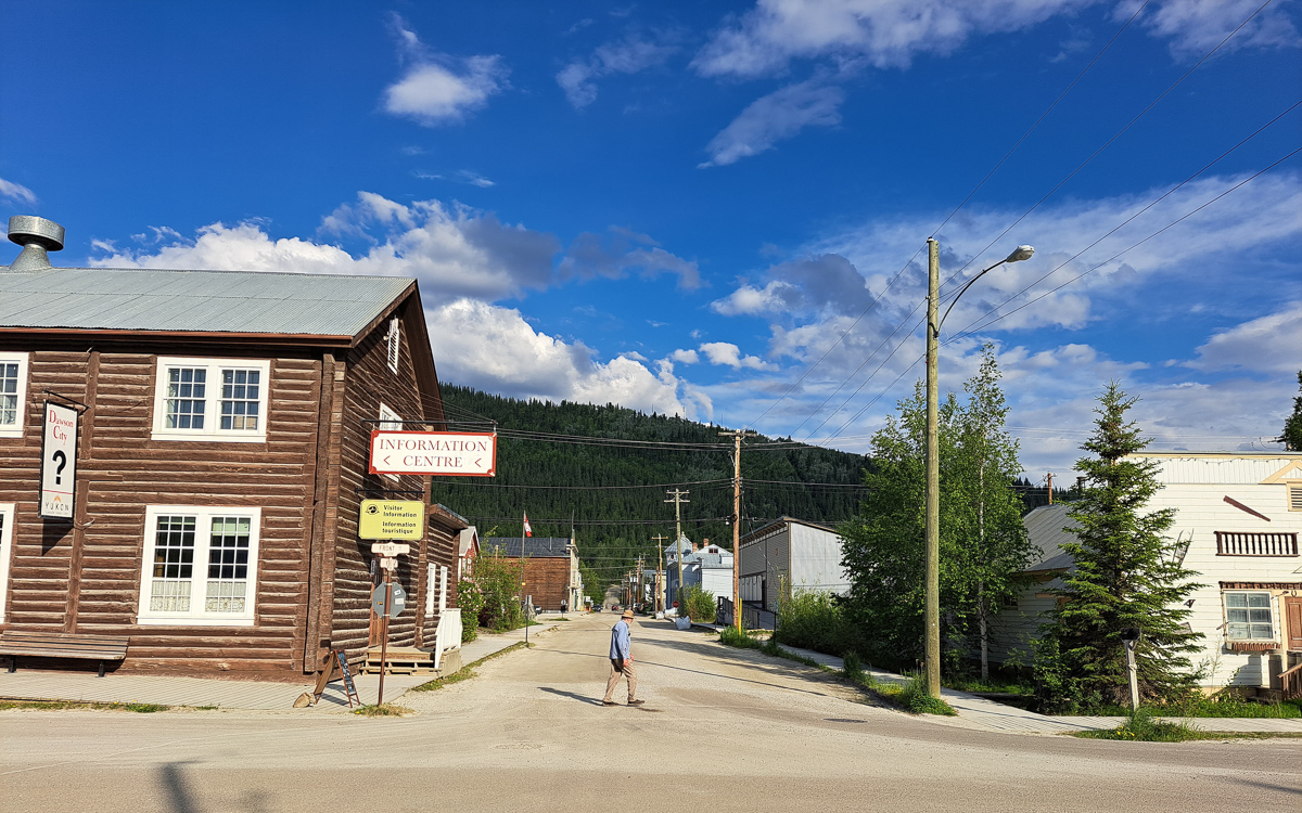
So, we’re across the 45th parallel – back in the USA.

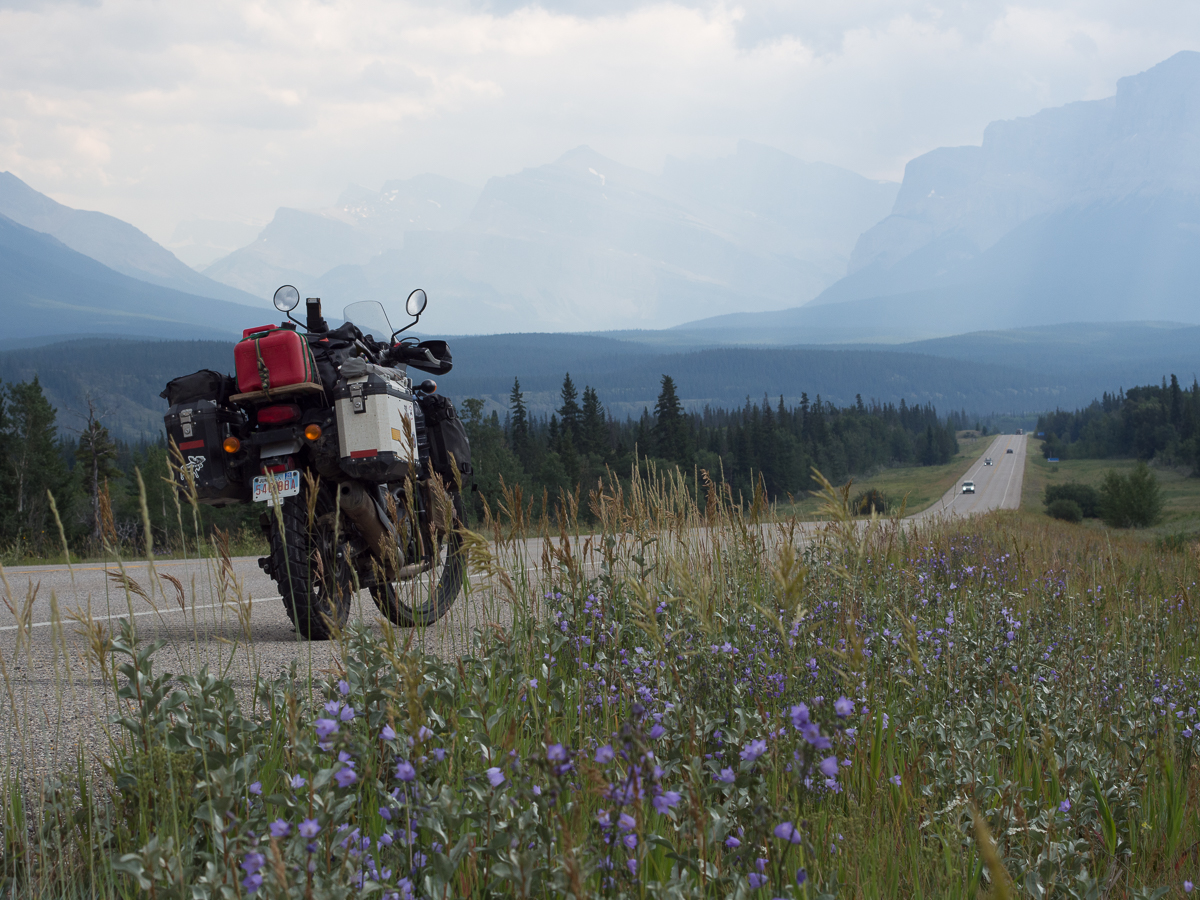
Once in the “contiguous USA” our plans were some what sketchy.  We had three months and knew we wanted to leave going into Mexico travelling down the Baja peninsula.  We had the big three National Parks earmarked, Yellowstone, Grand Canyon and Death Valley plus the HWY 89, recommended by National Geographical magazine and Dave in Edmonton, highlighted on the map.  Dave and my cousin Debbie had both suggested things to see but somehow we hadn’t digested that into a formulated plan of what to do and see enroute.

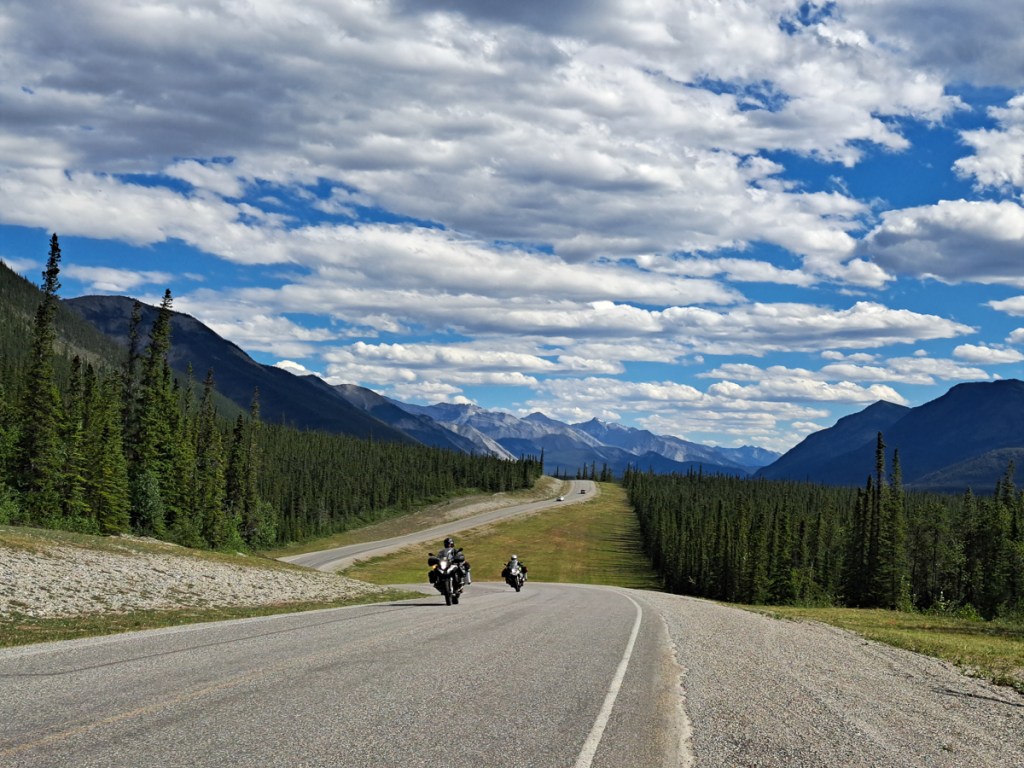
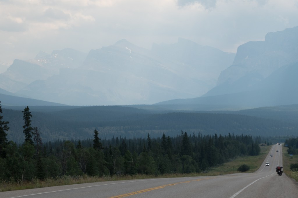
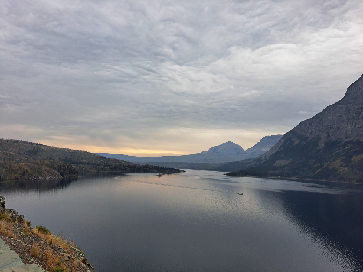
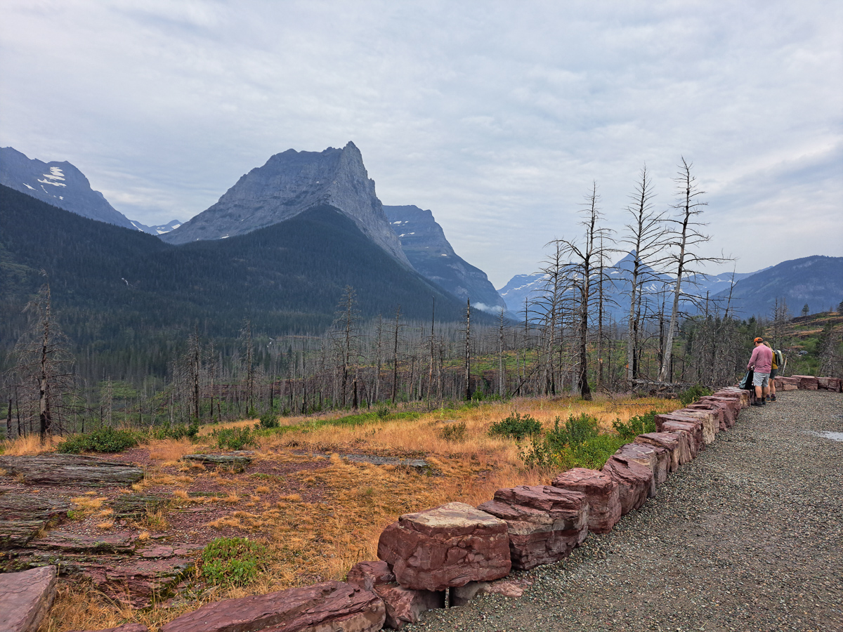
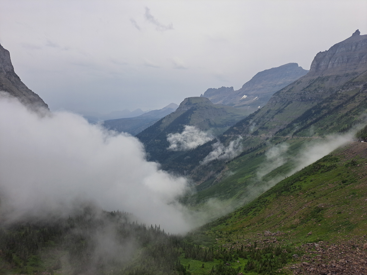
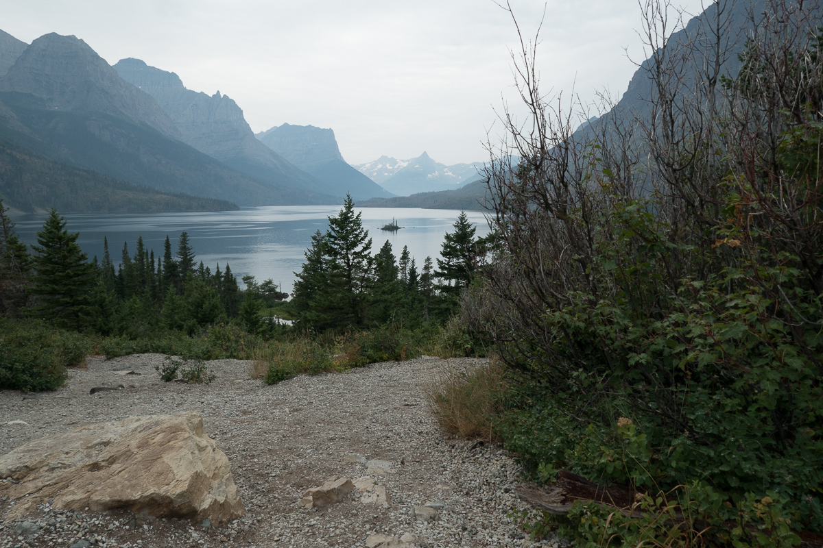
Hwy 89 took us straight into Montana’s Glacier Park.  The scenic park road, Going to the Sun, took off westwards to a height of 2026m and seriously down the other side on mountain twisty roads.  We were in a line of traffic doing the tourism trail but that didn’t seem to matter as everyone was progressing slowly admiring the fabulous views of mountains overlapping mountains – great recessions disappearing into the distance, stopping to take the must have photos at the named features.  Fortunately we did too as the return route was marred by rain.  It started out as drizzle that was supposed to stop by lunch time and indeed it did.  However as the afternoon progressed so did the returning rain.  Slight droplets to start with but slowly gaining in intensity without us seeming to notice. I hadn’t taken my normal rain precautions.  Eventually it pissed down!  By then it felt too late to fuss about the rain, we focused on finishing the trip.  Once back at the start we cowered in the lodge drinking cups of tea. Umming and erring about our options we finally caved in and booked a room.

The following day my GoPro video camera, mounted on my handlebar, with the USB lead sticking out, was sick.  It was sodden.  Apart from visible water in the battery compartment it became evident that there was condensation inside the screen.  Gutted at my stupidity we set about trying to rescue it from what seemed like its inevitable journey into the bin. A day on the bike with the battery door open revived it. Don’t know how I got away with that one!

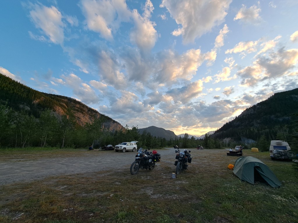
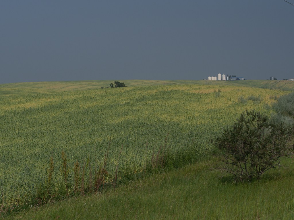
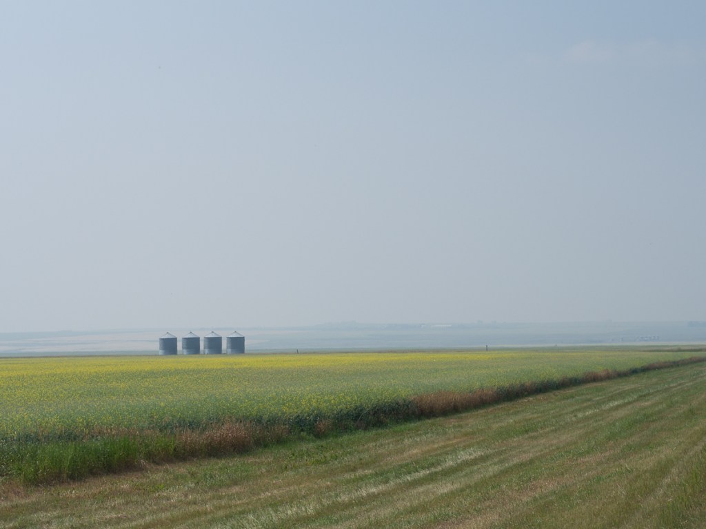
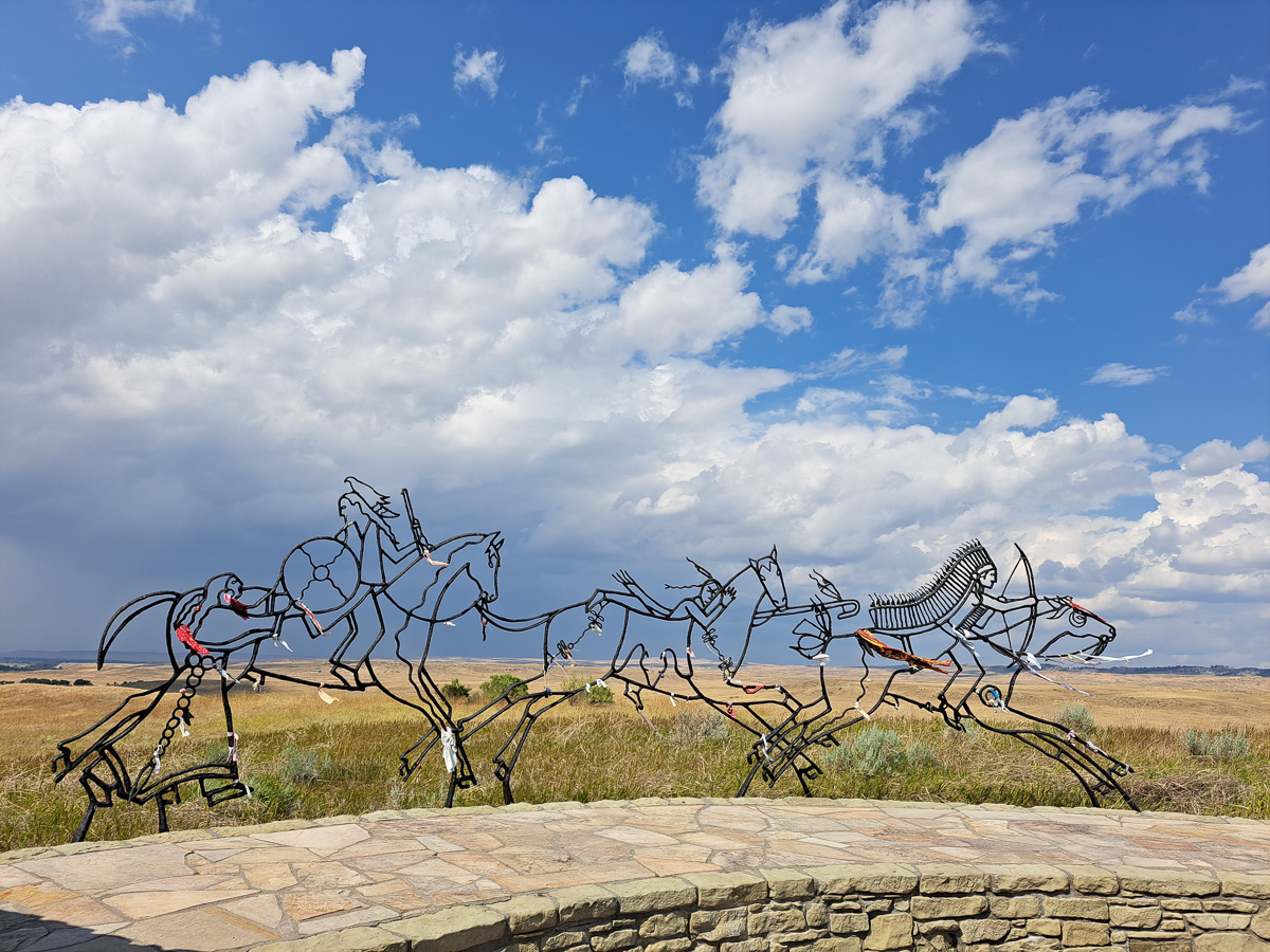
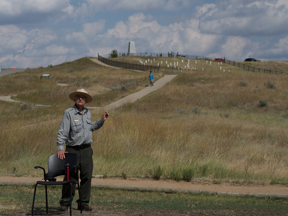
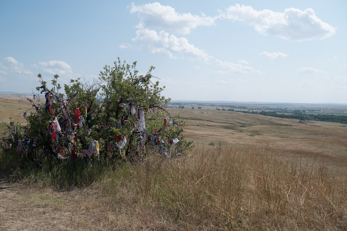
Gid decided he wanted to go and see the site of Custer’s last stand. Now it’s got a more sensitive or politically correct rename, after the location in which it took place, Little Big Horn.  We trundled along enjoying the undulating scenery and nodding donkeys, noticing also the considerable lack of campsites.  We spotted a small camping sign in the middle of nowhere some way before a lonely bar and u-turned to go back and check it out.   Thankfully there were a couple of people out the back.  One was the owner. Yes, we could camp.  Even better we could kip in the chalet that was still being fitted out. 

The Horse Thief Bar at Sunset

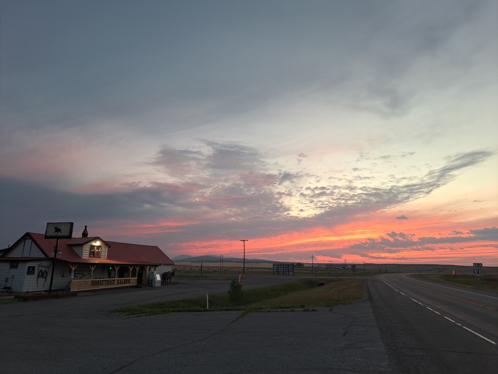
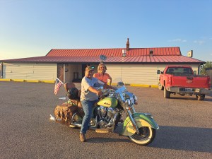
Eddie, the new owner of the Horse Thief Bar, was very pleased to put us up and spent the next hour or two telling us how he ‘d just got back from Sturgis with a new machine: a rather wonderful looking sage green & cream Indian motorbike complete with leather paniers and dangling tassels that he caressed. 

Eddie, at the Horse Thief Bar

Eddie was horrified to think that we were going to Little Big Horn and not Sturgis.  After all, Sturgis is an internationally acclaimed bike rally that was on this week – just another few hundred miles down the road!!   We would love it he was telling us.  The town comes to a standstill because of all the motorbikes!

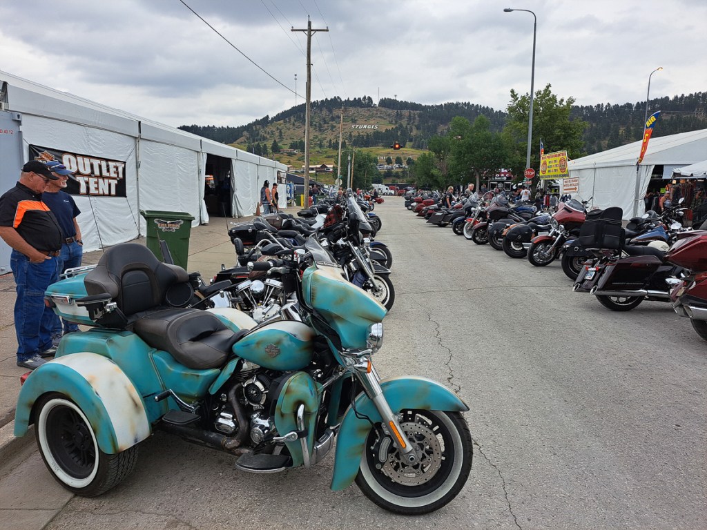
Sturgis it is then.  I’d read about it back in the UK but considered it too far east.  Another 440mi to be precise.  A twelve hour day later we arrived in the dark after a long hard flog into headwinds.  But at least we’d identified a campsite in advance and could ride straight in.

Hog Heaven, a temporary campground was one of eight that encompassed the small town of Sturgis, South Dakota. It was $80/night, but well organised, spacious, and not at all squalid as English festival campsites notoriously are.

Sturgis, the bike rally, attacks hundreds of thousands of bikers every year for the one week long event.  Now aging and many trailing their bikes to the event the numbers are starting to drop off.  Some of the roads in the town were closed for bikers use only and the town was packed with tents and displays of biker kit and paraphernalia, not to mention plenty of opportunity to test ride and buy bikes – Harleys and Indians being the key brands.  Live music was playing all day in the town and at our campsite every evening creating a real party atmosphere.  A programme of events included: best beard and moustache, Jack Daniels tasting and BBQ, show us your boobs, although many didn’t need to enter any competition to tick that box.  Scanty was the ‘clothing’ of some of the ladies about town.

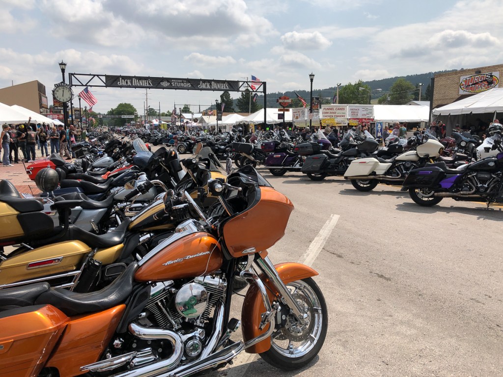
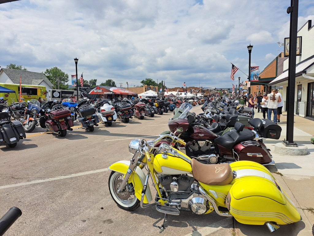
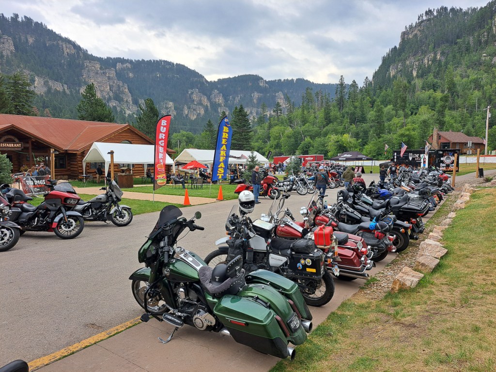
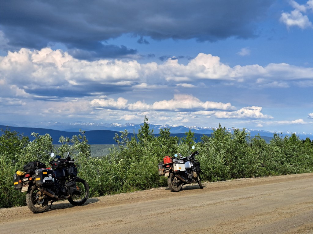
The event is popular not only for the entertainment in Sturgis but also for the fabulous roads in the SD Black Hills, which offer half a dozen of the best bikers routes we’ve experienced in the US in one relatively small area.  Roads like The Black Hills & Bad Lands, Devils tower, and Needles HWY are all comfortable day trips that attract bikers year on year for the multiple hairpins and twisties.  Iron Mountain road is another favourite with it’s multiple twisties and natural narrow tunnels.  One such tunnel had flaggers at each end because of it’s length and narrowness.  It was quite something to emerge into the path of at least fifty bikers waiting to go through.  All behind the flag man.  Mt Rushmore was another popular site to visit. 

The buzz lasted beyond the event itself but after four days we were ready to move on still discussing the amusement of this or that.  On a more sobering note we arrived back at Little Big Horn for a history lesson on the disposable nature of treaties and how the needs of Native Americans have been frequently marginalise for the benefit of the White Settlers.  It’s been easy to see where the Indian reservations are as we ride along because there is an air of greater poverty and run downness.  Plus a few stray dogs – well, maybe “stray” is the anglo-centric view, perhaps they’re communal as in many Muslim countries.

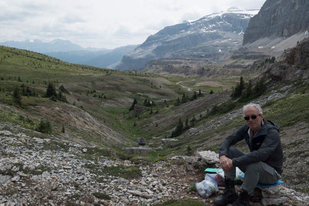
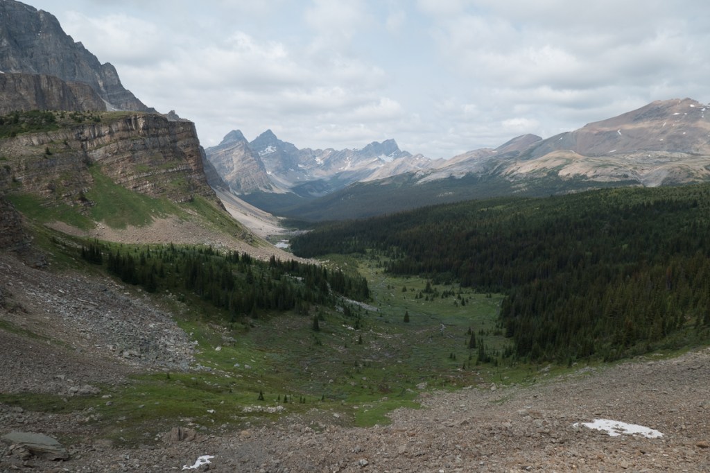
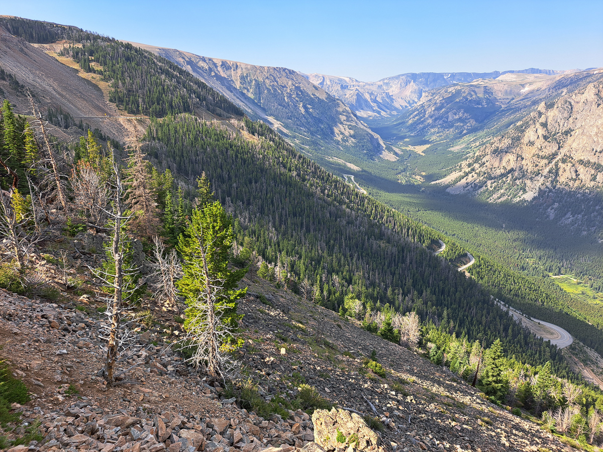
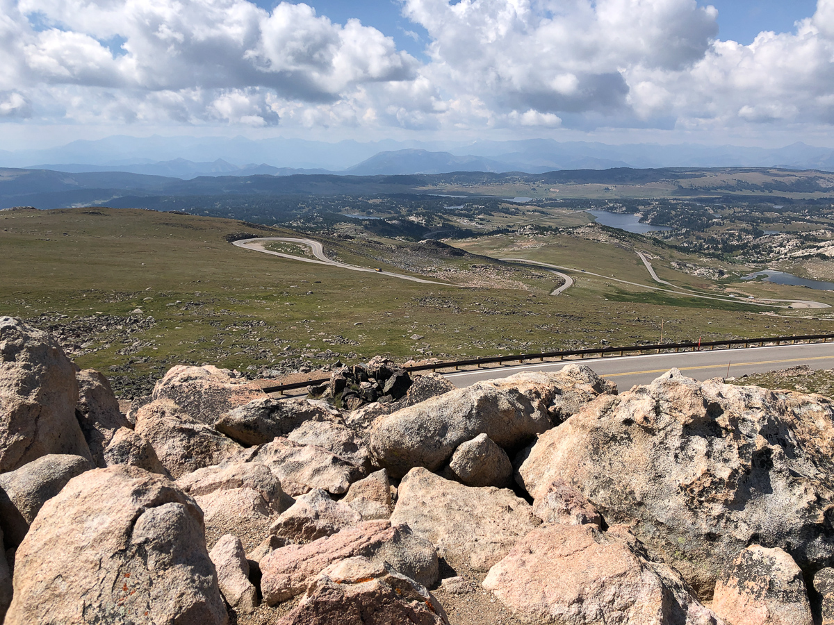
Yellowstone National Park in Wyoming was next.  A truly stunning place!  We approached from the north riding the spectacular Beartooth pass, wondering how even a National Park was going to trump this.

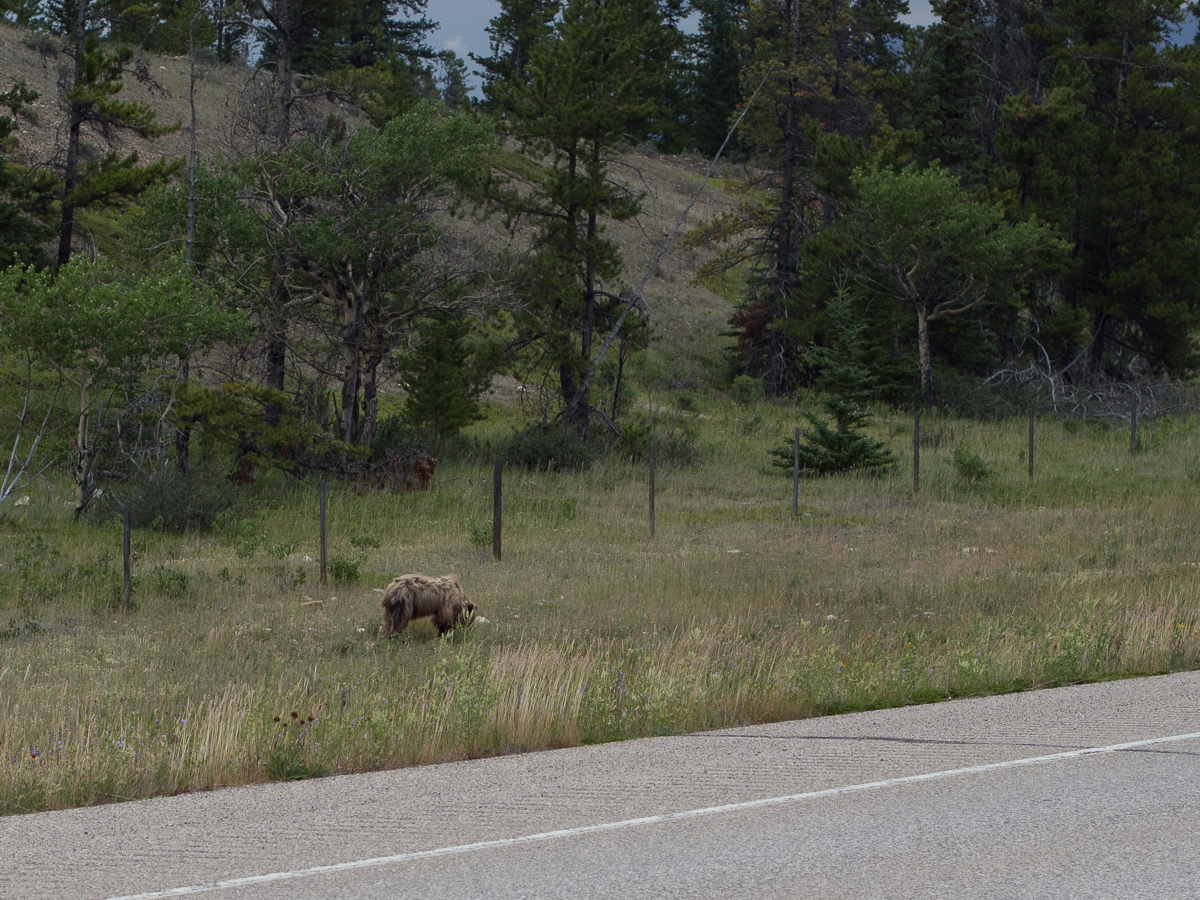
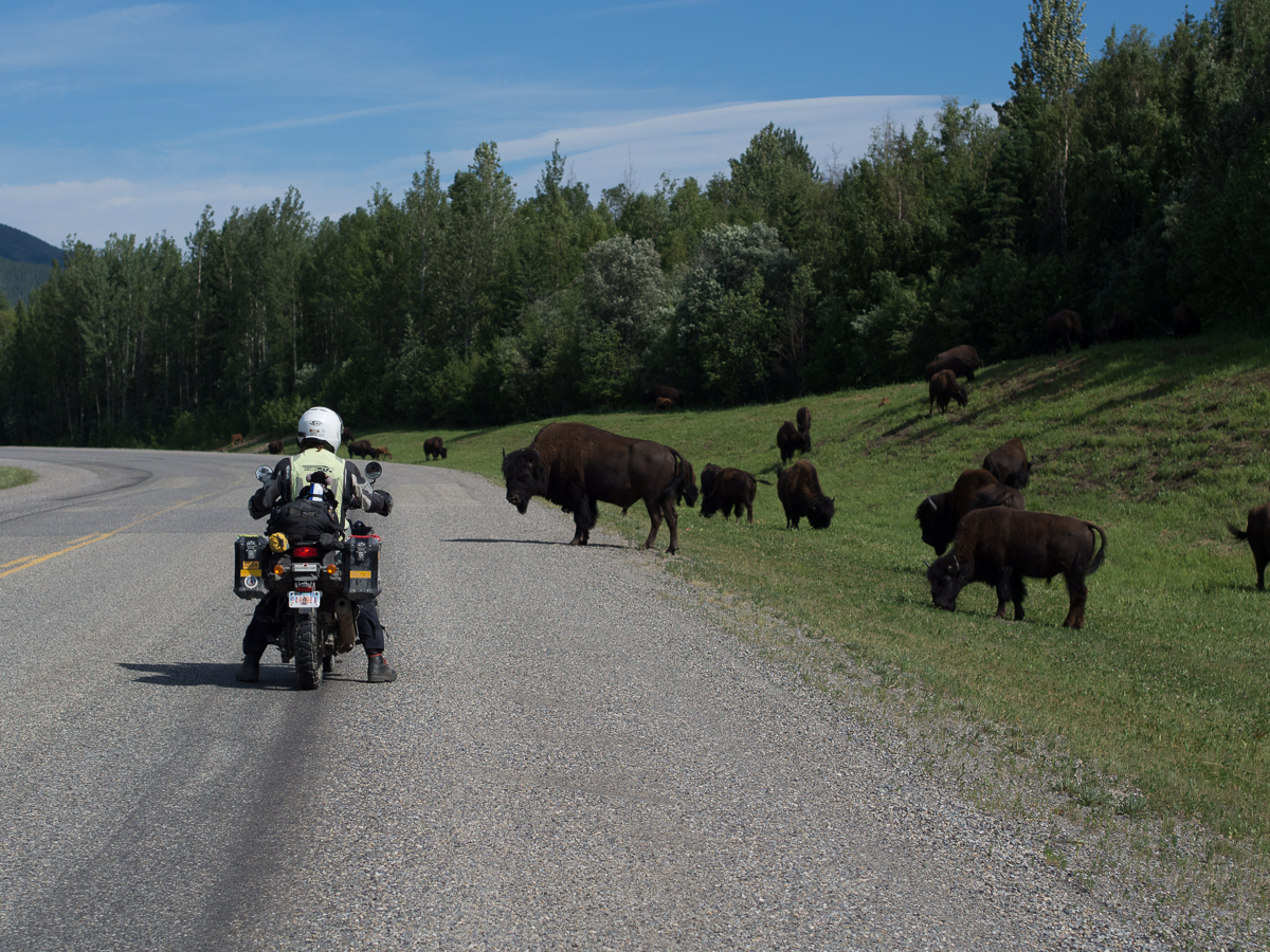
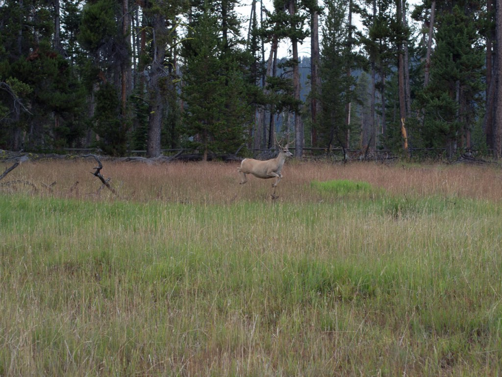
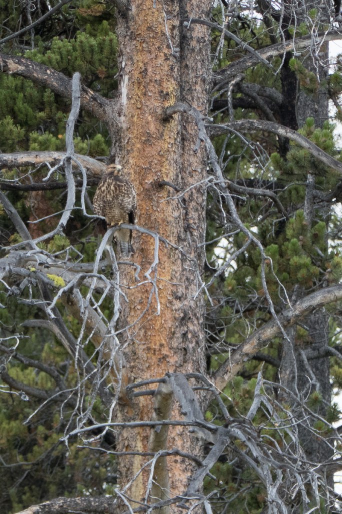
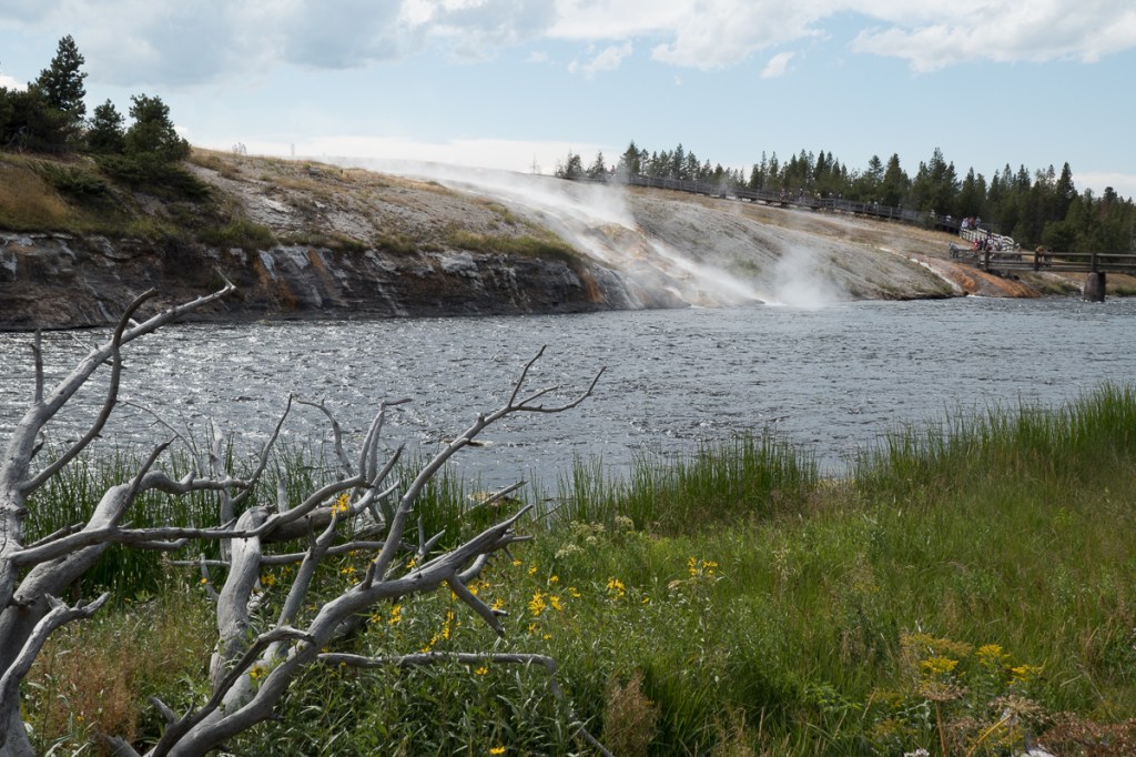
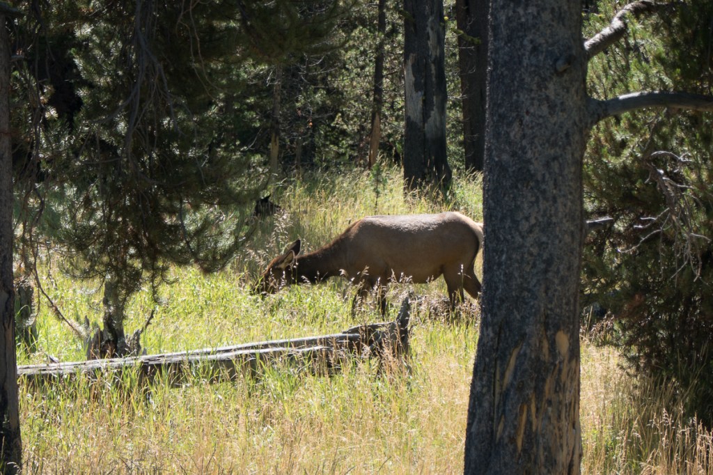
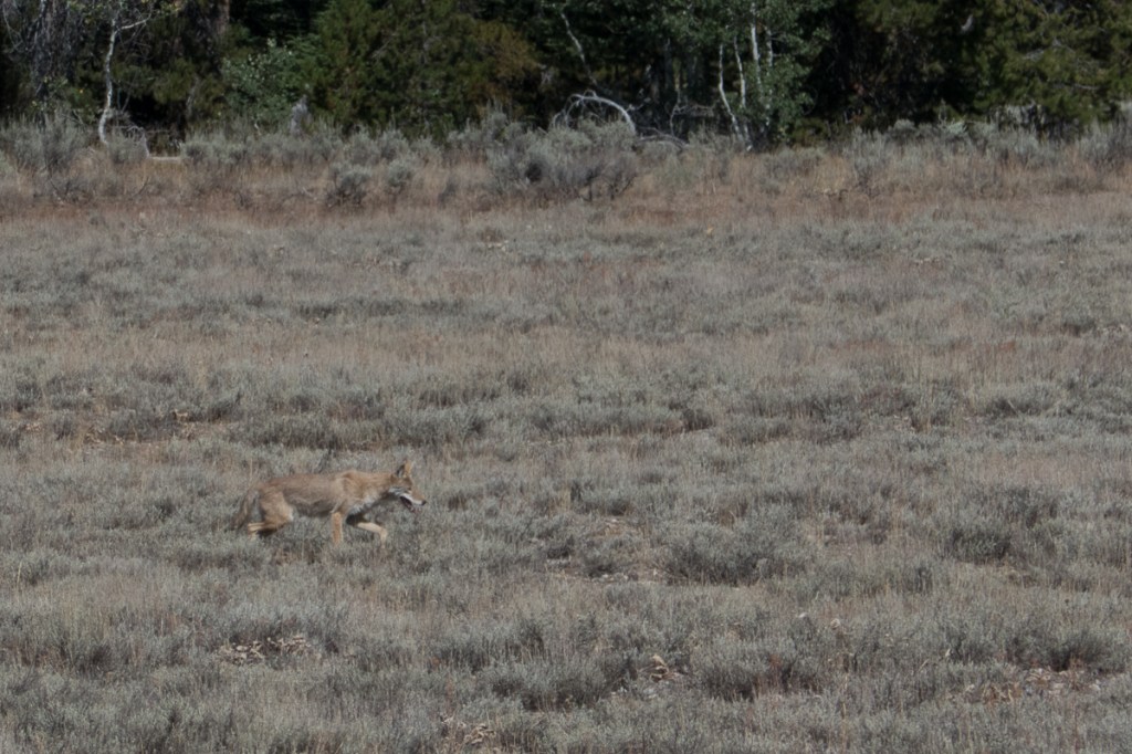
It did!  Panoramic views of pastures with bison was the first wow point.  Towering cliffs with mountain goats was a close second as was the mummy grizzly with two cubs.  The latter both in the distance but still fantastic to see.  From there the list continued to grow with birds of prey, elk, deer, coyote but the most impressive things were the geysers, blow holes and steaming sulphur pools. 

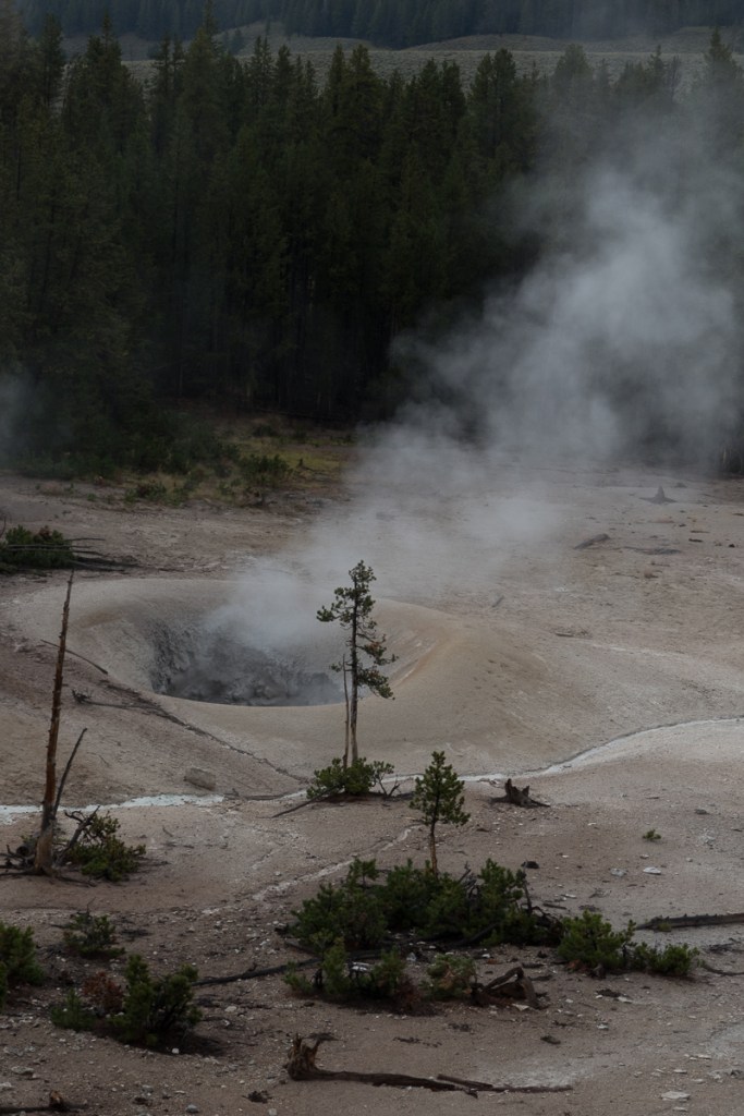
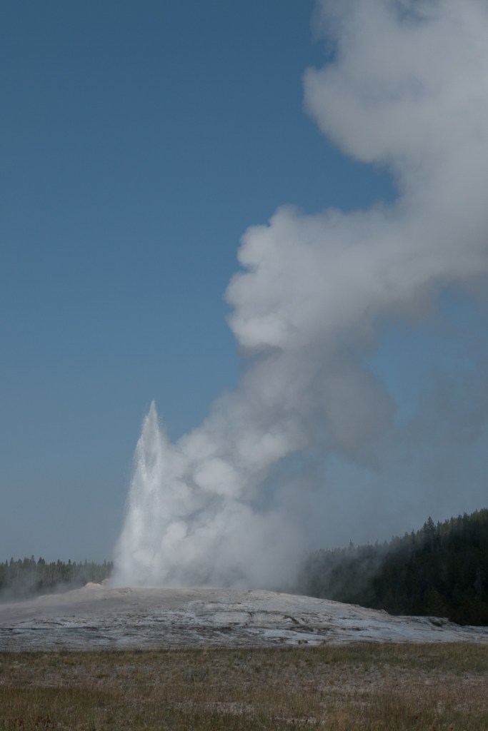
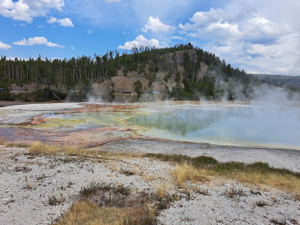
Yellowstone is one of the biggest geothermal & hydrothermal areas in the world.  It is still an active volcano!  Old Faithful is a geyser that has been closely monitored for decades to explain exactly what is taking place for it to blow every 90 mins-ish.  Because the earth’s magma is only 5-7 kilometres below the ground in this area it heats the land and precipitation significantly.  Rain water and snow-melt that seep into the land down cracks etc heats up very quickly.  In the blow hole of Old Faithful there is a constriction near the top causing a greater amount of pressure as the rising hot water gets trapped.  It finally explodes upwards with great force causing the geyser.  The temperature at ground level when the ‘explosion’ takes place can exceed that of boiling water.

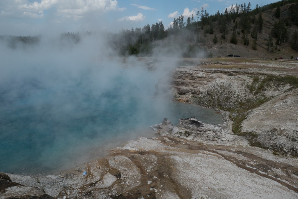
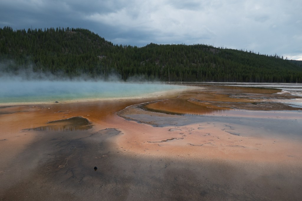
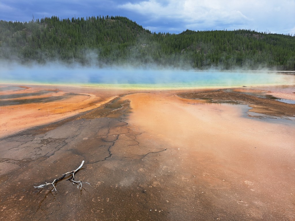
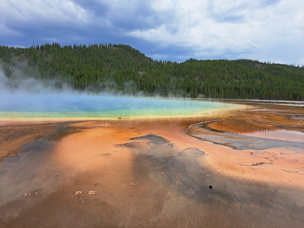
Another key feature is the Grand Prismatic Spring which has rainbow colours that look straight out of photoshop.  It is caused by bacteria and other microorganisms that can withstand the extremely high temperatures.  As the water moves away from the central point it cools and different microbes can grow and concentrate causing different colours the further away from the central point.  Another wow moment!

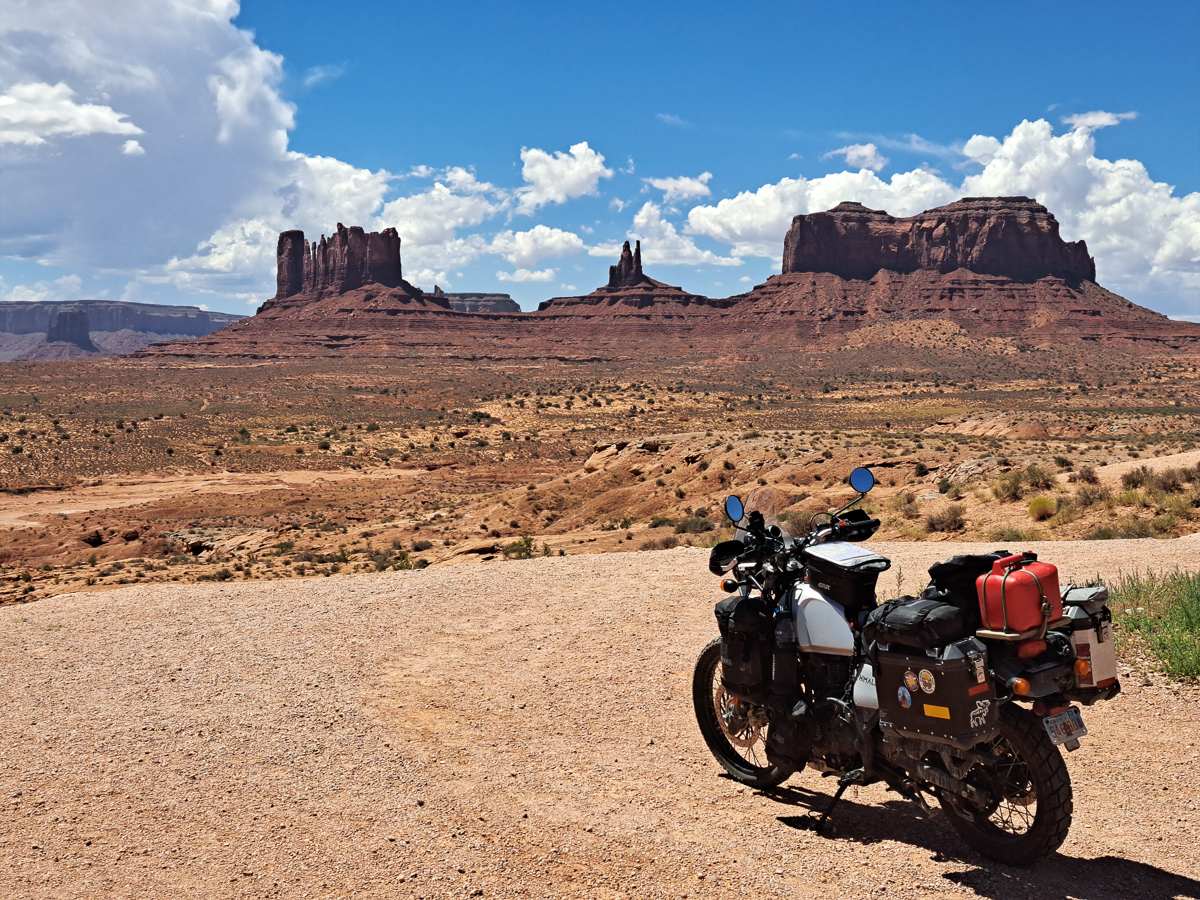
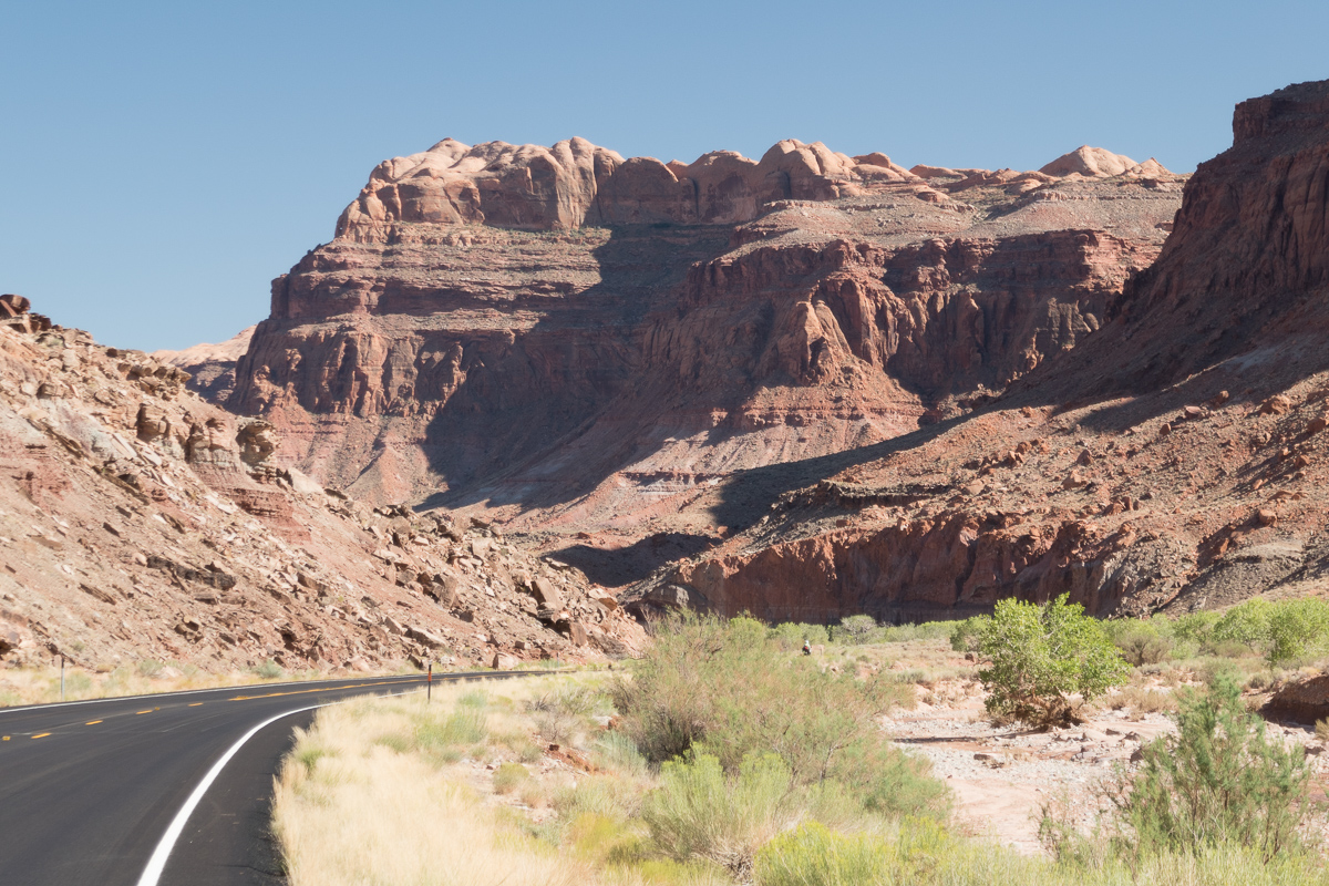
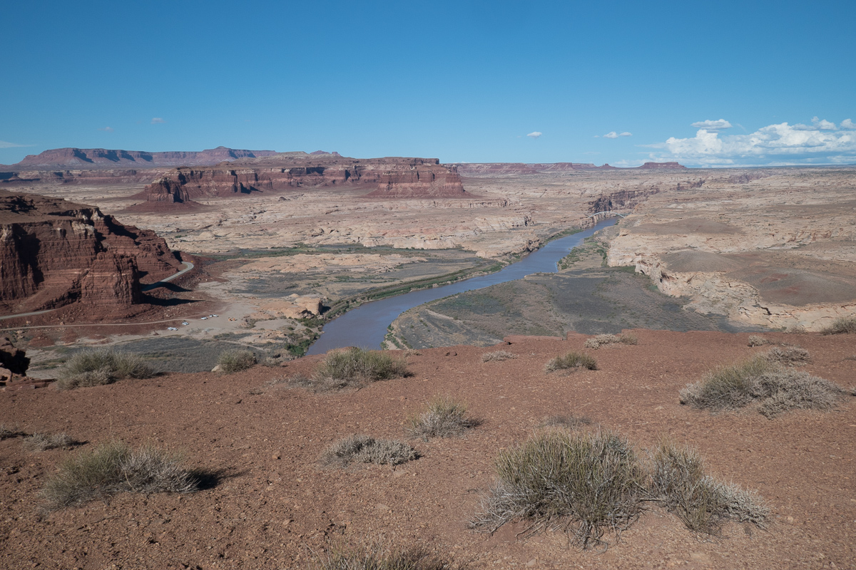
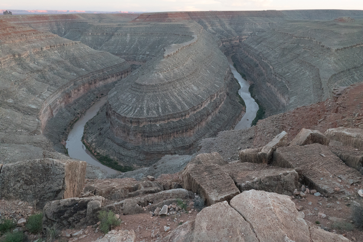
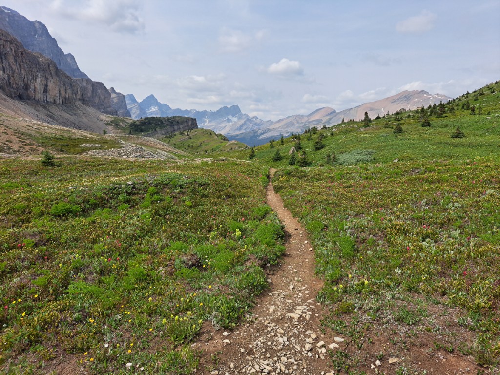
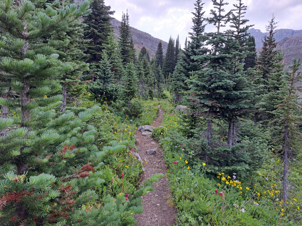
An alert reader may have spotted that our Route 89 plan was taking us through the third vertical column of states: Montana, Wyoming, Utah and finally Arizona. There were odd side trips and corners cut – Sturgis is in South Dakota, and somehow we were in Idaho for a bit. Gradually ticking off the Must See Sites, Yellowstone segued into Grand Teton National Park (nearly as interesting and much less crowded) then we passed through Utah, which was stunning rock, rock, rock, but not so prominently named until we dropped into Monument Valley, on the Utah/Arizona border.

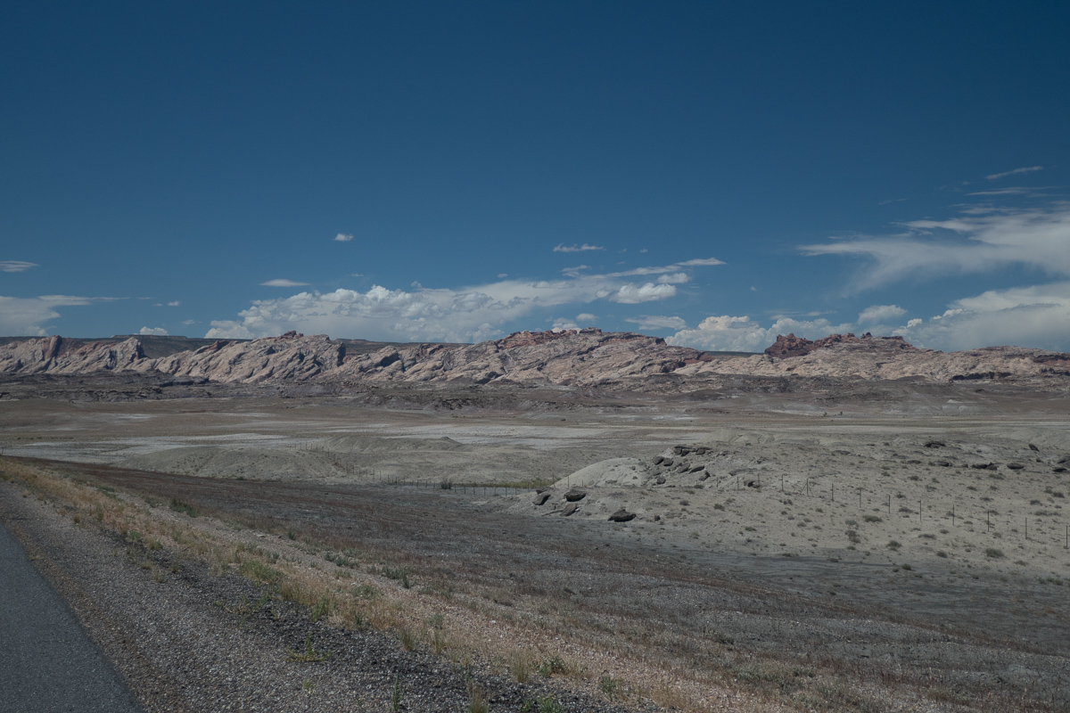
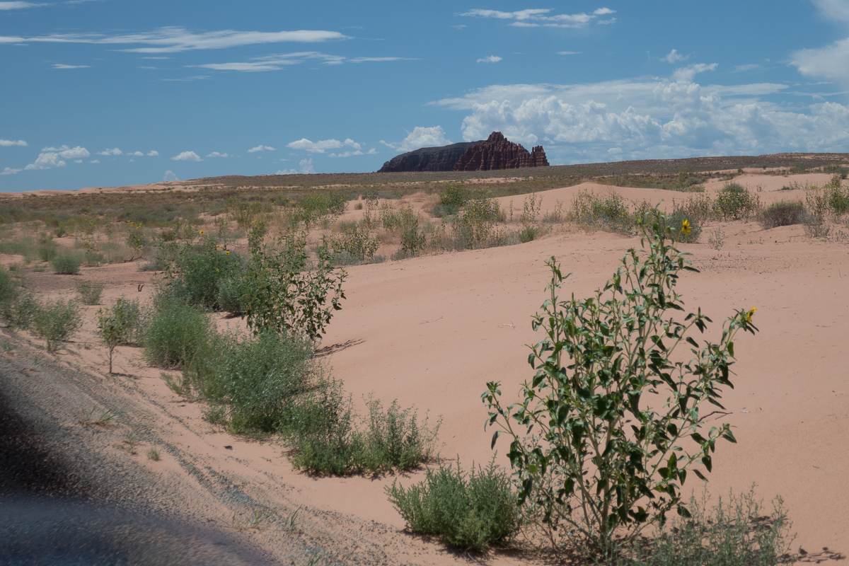
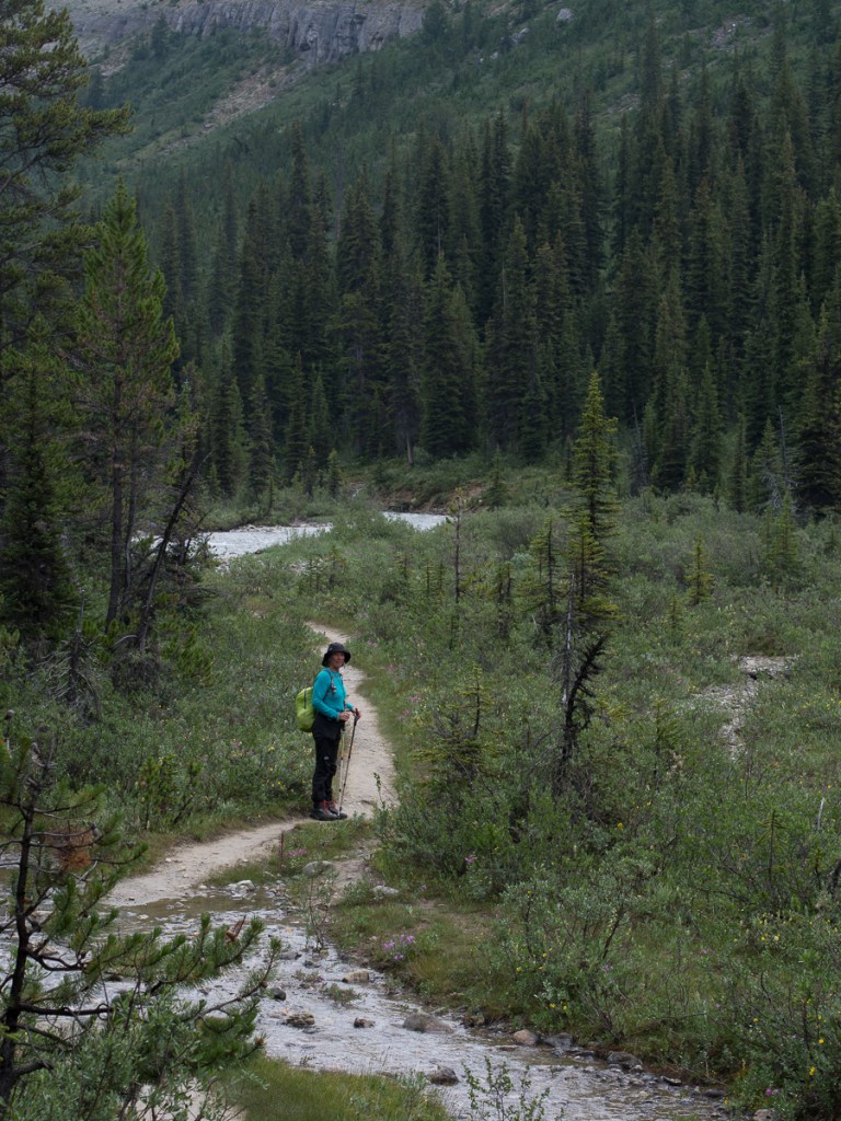
To get into Monument Valley, we were out of the almost continuous named National Forests into an area of desert.  The transition from one to the other had us riding along roads with sparsely spaced mainly fir trees through rocky canyons until the trees disappeared altogether and the vista was thinly spread scraggy shrubs and sand.  Gradually the shrubs disappeared too.  During this time the wind increased significantly until we were both squealing through the intercom about the severe cross wind and sand storm streaming across the road. We were not quite horizontal but getting there!  A large transporter overtook us causing the usual draught where we pinged away from the vehicle as the wind was blocked and true to form as it passed we got sucked into it’s wake but were very promptly spat out as the strong side wind caught us again.

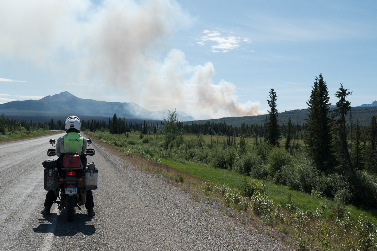
This took place against a back drop of dark ominous clouds ahead of us to the left and right.  Lightning jaggedly illuminating them sporadically.  Our focus was fixed firmly on the small spot of blue sky and white clouds directly ahead separating the two.  If only we could get there before being engulfed in the pending storms to its sides.  What do you expect, a trucker at a gas station had told us.  ‘This is the start of the monsoon season!’  Certainly our focus has moved on from mosquitoes and is now firmly on how to cope with the 38+ degree temperatures that lead into the rain storms where the temperatures drop to 14 degrees within minutes.

But these stormy conditions usually didn’t last long. Seeking shade was more common.

Meandering Around in a Meaningful Way

Our route is currently weaving around ticking the boxes of you must see this and must see that.  Skagway was the first of these.  The route down was through more awesome scenery but equally the town itself was of special interest.  We camped at Dyea a small hop round the peninsula from Skagway.  Back at the turn of the 20th century Dyea was a thriving town building up from ‘nothing’ to accommodate the gold rush influx of hopeful prospectors.  There, was the start of the infamous Chilcott Pass route over the mountains en route to Dawson City.  The alternative route, the White Way, was from Skagway through lower land but with thick mud and rivers.  Both routes were extremely hard.

The Canadian government, concerned about the influx of people resulting from the gold rush, and the impact this would have on local services (which were, err….what exactly?), insisted that each person crossing the border from the USA had to bring two years worth of supplies so that they could maintain themselves for the duration of their stay.  This led to enormous packs that took many, many trips up the frozen stairway of the Chilkoot Pass.  Entrepreneurs  made light of the ordeal by selling potential prospectors sacks that could help transport their belongings up the 1500 steps cut in ice and be used as a ‘sled’ to speedily descend back down the snowy slopes to retrieve the next load.  Unfortunately the sacks had to be durable which led to increase in the weight to be transported.  Other ingenious ideas also blossomed but many people and horses died failing to survive the extreme conditions.  One such place on the White Way is named Dead Horse to mark where hundreds if not thousands of horses died on the trail. But today, road and rail run easily over White Way, Dyea is simply vanished, and Skagway is a cruise ship destination with a main street where one can indeed buy a ton of souvenirs.

The second, 3,000 mile, service at Anchorage had unleashed the full potential of our Royal Enfield Himalayans, well, 5,000 rpm of it.  We’re now cruising at a staggering 55mph.  Andrew, at The Motorbike Shop, had chuckled that we’d barely notice the difference from the running in speeds. Later on when loosened up more, we find the engine will cruise at 60-65mph with a bit of chatter but no real distress. However, the in-helmet wind noise at that speed, with only a small screen, gets a bit painful. Not to worry!  One advantage of being so slow is we have plenty of time to take in the views and observe the wildlife.

The views have been staggering.  Riding east into the Yukon on the Alaskan Highway led to spectacular panoramic views as wide valleys opened up.  Flowers edged the road side, rivers meander across the valley floors.  The only thing missing was the sheep alluded to on the signpost.  We went from the snow topped mountains of Alaska into the more rolling, greener, countryside of the Yukon and the change was refreshing. A short leg in BC was even greener, and now we were seeing small scale agriculture, too. Continuing on from BC into Alberta the mountains had gone replaced by expanses of arable land.  Hay bales in one field a tractor ploughing the next. Initially they were quite small but soon spread to a considerable expanse. Nearing Edmonton, prairie farms started to appear, miles upon mile of crops, mostly mown hay, rape (canola) and barley, but also oats, wheat, linseed as we turned south. And every second field had a nodding donkey extracting oil.

The wildlife has been fabulous.  On this last stretch we’ve only seen one grizzly bear but plenty of black bears.  The black bears are smaller but we’re told, that just means they take longer to maul you to death.  One person is usually mauled every year, Dave in Edmonton tells us.  Erron, a local guy we met at Mosquito Creek campsite added that a doctor and his wife where killed walking out from Banff this spring.  Bears he was telling us, ‘can go from zero to 30 mph just like that.  They are soooo fast.’  Safety around bear strategies include bear bells to ring out ‘dinner time’ and playing dead.  ‘It’s great to practise,’ Larry, at Toad River campsite, laughed, ‘because you soon will be’.  Studies have suggested that the machos who carry a gun will be too slow to draw and aim it.  So it’s bear spray, the counter attack, or nothing.  The bison along the Alaskan highway were beautiful too, all recorded on GoPro video. A few deer have also skipped across the road ahead of us. Two bounds and they’re gone.  But the one that got away was probably the most spectacular.  It started as a small dot.  Our first thoughts were could it be a bear.  ‘No!  It’s flapping and it seems to be two small dots’, I exclaimed.  It could be something blowing in the wind but road tyre debris doesn’t flap and is too heavy to blow in the wind.  Slowly it revealed itself as two birds.  Ravens probably, there’s quite a few of them around.  Nooo!  One of them has a white head.  All too late to start the GoPro it flew up from it’s road kill meal swooping right across our path – a beautiful full wing spread of a bald eagle a few metres in front of us.

We have great respect for the wild life we are passing and pay heed to the warning signs around, one of which states, ‘Don’t stroke the hairy cows’. When riding down through Elk Island Provincial Park, Gid was calmly and slowly easing past a lone male bison which was on the other side of the road when it turned and gave chase.  From my vantage point some 15 – 20 metres behind it looked as though it got pretty close!!!  Seems like the lone males might be a bit less relaxed about traffic than the breeding herds we’d often passed earlier. Perhaps this guy had the hump ‘cos he’d missed out on the lady bison this year.

The Alaskan Highway, our initial route across Canada, was hastily started back in 1941, initiated by the American government .  The Americans were concerned about a possible Japanese invasion into Alaska following on from the Pearl Harbour bombing.  In conjunction with the Canadians the road was built in 15 months but the invasion never came.  It did however prove useful as a supply line to the Soviets. Having got to Summit Lake and admired the wildlife and views along the way we turned back because the route ahead to Fort Nelson was described as flat and boring with the town itself not up to much.  We headed back to Watson Lake to take the Cassiar – Stewart Hwy south.  Many people we’d spoken to considered this the better of the two routes.

Turning left along the Hwy 16, heading east again, small towns again getting bigger sprawled ahead of us. Some abandoned ramshackle properties, the odd one still inhabited.  Mine Road, Pit Lane giving clues to former communities.  Prince George Town, in recent terms was quite big.  It spread out ahead of us barely making a mark on the sky line with it’s one or rarely two story buildings.  Heading north from there took us back into mountains, lakes and the spindly, wizened black spruce oozing resin.  The black spruce’s high flammability the reason many wild fires take hold and spread so quickly.

The temperatures of at least 10 degrees higher than normal have caused havoc with forest fires in the north of Canada.  In the Yukon the fire between Dawson City and Whitehorse was still an issue three weeks after we initially heard about it.  Canoeing races down the River Yukon had been stopped because of fire sweeping across the river.  Riding across BC we’ve seen evidence of fires with mountain views being obscured and that distinctive bonfire smell in the air.  At Johnsons Crossing the campsite owner dismissed our inquiry about safety saying, ‘Yer, there’s a fire. It’s down the valley and across the river so won’t affect us here.’   It’s great to have something other than bears to worry about at night.  As we rode further on again the tell-tale smell was still in the air, smoke was wafting across the sky line to our left but on the right smoke was billowing up into the sky.  Getting closer we could see one helicopter with a water bomb and two small aircraft circling in the area.

Riding south down the Cassiar – Stewart Highway, a part of our backtracking, took us straight into the scene of a big forest fire from back in 2010.  The skeletons of black spruce trees still stood with new growth at their feet but clearly it’s going to take some time to be anything other than the scene of a forest fire.  The following year a second fire hit the area but it’s spread was restricted because of the previous burn out.  Evidence of past fires is very clear throughout our travels in all but the prairies which we entered near Edmonton.

While in the Edmonton area Jasper had made headline news as there was a severe forest fire raging to the north.  A northerly wind was blowing it down onto the town.  The news updates were looking grim.  Two days later it was stated with impending gloom that the town was likely to burnt down that night.  It did. Our route down the famously scenic Hwy 93 through Jasper was not going to happen.  Sadly a large part of the town was demolished by fire.  The rain came the following day but was probably too insubstantial to have much impact on the well established forest fire. Current opinion in the news is that it may take three months to be truly extinguished.

Having ridden down Hwy 21 where we enjoyed the delightful lush rolling pastures of the prairies and visited the tourist attraction Dry Island Provincial Park where the buffalo/bison were herded over the top of the cliff, we yet again, cut back westwards.   We did however manage to ride over the Saskatchewan Pass on Hwy 11 linking Hwy 22 with the midpoint of Hwy 93.  It was initially very unclear as to whether the junction would be open to traffic.  Thankfully, closed down Jasper was some way north on and we were able to turn south, after being royally shafted by the gouging prices at Saskatchewan Crossing.  (A micro can of gas cost us £15).  Along the linking pass towards the Jasper end was another interesting study of forest fires.  The ground in one area of thinned out burnt spruce had a magenta hue – fireweed was doing its rejuvenation job, while in the next 10 to 20 km there were areas with green 1m high trees, 2 m trees etc. clearly demarking the zones of previous fires and the progress of regeneration.

In  Alberta a second less publicised fire line is currently across the top of the province. Yet again residents have been evacuated.  This fire has had a more widely felt impact as fuel prices have been affected due to the risk to the oil fields.  400km south, in Edmonton, the air is tainted with a mild smoky mist.

On our meandering we spent a few days in Edmonton, our first ever Bunk-a-Biker stay.  Dave and Ardis were fabulous hosts.  A biking couple themselves we had lots in common and great stories to share.  Gid was very fortunate to be able to complete a service on both bikes and we were treated to many of the cities points of interest.  Edmonton being a target town because of the Royal Enfield dealer for service parts and just in case there were any warranty issues with the bikes.  Our stay was so good it was a bit of a wrench to say good bye but I was starting to get twitchy about making progress again and Gid had even had a rest day.  Our fabulous hosts had made a few suggestions as to the great routes they had taken and would recommend.  Tips like this have informed a lot of our route. So wonderful was our experience together that Dave and Ardis gave us each a parting gift.  Like many Americans and Canadians their bikes of choice are Harleys.  To our surprise they presented us with parting gifts.   We are now the proud owners of some Harley magic as our bells reach down to keep the evil road demons at bay.

Another visit that was hard to leave was to my cousin, Debbie, just down the road from Edmonton in Ryley.  Debbie and her Mom, Barbie, the latter whom we’ll visit in Calgary, had visited us in England forty years ago so it’s clearly time that we popped by.  Debbie and her husband Robin also talked of areas of interest that we might pass on our travels and made suggestions of places that are too good to miss.   I was quite surprised by how many interests we shared and how well we got on.  Thank you, Debbie, for my Labradorite bracelet.  Another charm to protect me on my way.  We clearly need these lucky charms if Gid’s bison experience, above, is anything to go by!

Starting our route across the Saskatchewan pass into the Rockies we went into the second area to display the ‘No Cellular signal for 230km’ sign.  The first had been along the Alaskan Hwy where we ran into problems around Muncho Lake.  We had wanted to camp in that area but were always too late, arriving at any time after five.  A number of the sites could be prebooked but not if you were on the road with no signal.  It was the same thing on the Saskatchewan Pass.  We were prepared to pay a little extra to get a campsite with more facilities.  A flush toilet – luxury, potable water – great.  As it happened Crimson Lake campsite, at the start of the pass, talked the talk but couldn’t deliver.  The initial site they offered us was unsuitable because it was on a slope and had a puddle where it would seem that recent flood water had collected.  When I pointed this out they were happy enough to move us but the hoped for shower was off!  Along Hwy 93 and 1A the scenic route through the Rockies from Jasper to Banff we had the same problem.  It was in the 230Km no cellular phone signal area.  We’ve been to Alaska before in 2012 and had hired a satellite phone.  It was expensive, bulky and certainly didn’t do internet.  We didn’t consider we needed one on this trip but hadn’t anticipated large areas where we couldn’t use our cell phones.  Along the highway through the national parks we could turn up at about a quarter of the campsites the rest had to be pre-booked which we were unable to do.

Most campsites are pretty basic, so we often went for a dip in the local stream or lake  That’s typically where the campsites are – next to lakes or rivers but up in the Rocky mountains where the temperatures had dropped from the highs of 33 degrees back to 9 the mountain streams weren’t so appealing.  Even the wilderness hostel a couple of hundred metres away from our campsite had no showers.

We reached our Air BnB in Calgary several days after this plight.  Gid was very business like suggesting we make a plan and maybe shopping was the first priority.  I was already half stripped and on my way to the shower.  He was quick to follow.

Our time in the Rockies has been fabulous.  We’ve done the classic tourist stuff, Lake Louise and Banff.  Jasper is off limits for reasons explained above but the event that will put it in our anals of special occasions is the trail we took up to Mosquito Pass.  Three of us set off.  Simon, a young man visiting the area on his own and wisely not brave enough to head off solo in bear country had joined us.  I was jingling away.  Well aware of the jokes – ‘How do you tell Black bear skat?  By the berries.’  ‘How do you tell Grizzly bear skat?  By the peppery smell and the bells.’  Gid and Simon nattered away.  Hopefully that was noise enough!

We climbed up, frequently crossing the creek. We were surrounded by mountains, towering up above us.  And spruce trees.  We were expecting meadows, which were referred to on the information boards at the start of the trail, but every new view seemed to meet and exceed our expectations.  Simon armed with binoculars stopped regularly to spy for wildlife.  Once we broke free of the tree line and cut across the stony track at the head of the valley again the views were breath taking.  On we went imagining that we’d seen the best.  How wrong could we be.  Eager to go just a bit further we continued on.  The top flattened out to the most amazing meadows.  Trumping that was the golden eagle that flew just a few metres above the meadows in search of ground squirrels 30m or so to one side.  I had only just said, ‘With so many ground squirrels where are the birds of prey?  You can’t have one without the other!’  This spectacular bird soared through.   It looked rather black I thought for a golden eagle.  Golden being the key word.  The following morning Simon brought his book of North Canadian Birds.  There it was pictured, the golden eagle – black, in the mountains (seen at over 2200m it ticked that box), solitary, lives on ground squirrels etc, nests in the mountains.  It certainly was a golden eagle!

We will be rather sad to leave Alaska and the Western area of Canada behind so special are they from this and previous trips.  We certainly haven’t been disappointed to visit them again.  At  Anchorage on flying in the American border guard told us that to restart our three month American travel visa we needed to spend a meaningful trip in Canada.  Visiting my relatives was on the agenda right from the start.  One month and visiting family was certainly a meaningful trip!

And we’re still having a big dither about our route through the USA. In the USA Highway 89 is scenic, we’re told, will keep us away from most big cities and in some beautiful places. But it’ll be August, and these are some of the hottest parts of the United States. Maybe the Pacific coast would be a more sensible, cooler route, especially if we can avoid the megacities and megacosts of California?

Alaska, after the Dalton

So, having found our way to the top, or at least, a top, of the Pan-American Highway, how do we go south? The Pan American isn’t a road as such, or a route, it’s more of a concept. So, we might go this way, or that way. South, somehow. It also kept the option of diversions open – if we didn’t actually have a route.

I’d read about the D2D back in February and was mystified by the constant refrain of ‘It’s Not a Rally’.  So what was it?

Alaskan steaks!

Clearly, seeing as it was an adventure biker event and we were ‘in the area’ we needed to find out.  And, it’s definitely south of Prudhoe, and only a weeny diversion away from our route back to Anchorage. Oh, and over the border in Canada. We’d booked in On-line but were aware that they were expecting ‘larger than ever numbers’.  The main events took place on the Friday but tickets for the meal, one of the main events, went on sale 12 midday on Thursday.  They were sold out by 5 when Nate, a young American from Rhode Island, who shared our camping pitch, tried to buy one.

To be honest it was Fairbanks that we had come from as that was when we turned east and headed for firstly Tok, then Chicken and on to Dawson but we were expected to say Anchorage as nothing else made much sense.  If the conversation with our new acquaintances developed we’d explain that we’d flown into Anchorage, bought our bikes there, already done the Dalton and headed over to Dawson when returning from that.  Yes, we’d come across the Top of the World road. 

The Top of the World road (TOTWR) is precisely that.  It rises up to about 1000m for over 100km.  It undulates from one pass to another at times sweeping round corners to display fantastic views of the snow topped Mount Sorenson range or tree filled valleys below. It peaks at the little border post where it got to 1280m.  On our way back we had been told that caribou were migrating and passing across the road up by the border post.  When we arrived one guy checked our documents while the other was clearly scouting the area for caribou.

Our route across TOTWR had had it’s moments.  Gid was leading along the paved road, a perfect surface as many highways start.  When about 10miles in there was a black patch.  A lot of the repairs are in different colours from the original surface being produced from the natural materials nearby – sand, mud, black tarmac (shipped in),  grey rock compressed to gravel (if you’re lucky) .  Gid’s voice came blasting through the intercom.  ‘Shit, shit! That’s deep’. He’d clearly had a wobble.  ‘That’s deeep!’  With barely time to stop myself I came to a stand still, in it.  Not 6 inches as he’d said but definitely a good 4.  Chatting to some bikers later others had clearly been there to with equal tales of surprise and dismay. All happy to laugh about it now it was history.

Other excitement on the TOTWR occurred the following day.  One chap exclaimed that he’d had a heck of a time coming across in 6 inches of snow.  Mark, a new friend who is part Indian, an avid rider and has lived in Alaska all his life reiterated this saying that he wouldn’t have made it if it hadn’t been for the tracks of the car in front of him.  A third person in a car was also dazed by the weather up there.  All agreed it was six inches deep. The latter continued that he’d seen 3 or 4 flash fires from the lightening. In our first two days in Dawson we’d got used to the oppressively hot mornings and thunderstorms in the afternoons.

1% of Alaska burns out every year.  To give that some perspective, 2% of Alaska is populated.  The fires are left to burn out as that is a part of natural regeneration.  The old burns down, clears the leaf litter and debris all of which rejuvenates the soil. The roots of the plant Fireweed are fire resistant so it regenerates quickly.  It’s also a prolific seed producer which in turn brings in the birds, squirrels etc.  And off it goes again.

Whilst all was clear for our way back to Anchorage, where we were getting the bikes serviced, it wasn’t the case one week later when we returned to Tok, the launch point for the TOTWR. Revisiting Eagles Claw campsite, a bikers campsite at Tok, the chatter was all about the road being closed between Dawson and the more southerly town of Whitehorse, because of forest fires.  It had been closed for a couple of days and we were strongly advised not to go that way.   The following morning the road closure was confirmed by the Yukon news station.  Several days later it was still closed with one or two trips being lead with a pilot car, as a lady hoping to make the journey was telling me.

So, the D2D. Bikes were arriving from all points. The widest possible range of old and new adventure bikes, and a few brave cruisers (Hi Behr, hope the 34-year-old Electraglide made it home to Germany!). The poker run turned out to be – in the continuing good weather – an enjoyable 60 mile or so loop along local dirt roads, stopping at places of interest to draw a card. When we looked a bit nervous on the surface in places (read – slow), Nate was good enough to stick with us as others whizzed past. In the end, only one little bit felt challenging, but we’re definitely slow. The ride looped back to Dawson for a jolly good natter with other bikers at the steak feast prepared by Dawson Fire Department (proceeds to local charities). Then outside for the biker games, which definitely planted ideas for our RoSPA SMART training team back home. Mark appeared again here, as a bit of a star (opening the slow races – on his Ducati). And, as well as the (informally) organised events, an awful lot of chinwagging, and I suspect, beer too.

We hadn’t twigged before we got there, but Dawson City is the famous historic town at the centre of the 1898 Klondike gold rush. Well, it wasn’t historic then, just a gravel bank that the local Athabaskan Indians appreciated as a summer camp. They withdrew as swarms of smelly prospectors turned up by boat, and built a camp. Enterprising non-prospectors quickly built a town. After the gold was gone, it quieted down a lot, and now is reinvented as a living memorial to the gold rush (ahem, tourist town), with still a bit of a supply centre for the remaining local miners. Many of the buildings have stood still although some explained that many decades of the permafrost melting and re-freezing beneath the buildings had shifted the foundations severely.  Now some are decidedly wonky.

That big grey thing is a gold dredger. These gigantic barges were winched through the river bed, banks, and shoals, washing gold out of the gravel. A reminder that for all the romance of “panning for gold”, the early 20th century was an industrial age.

Dawson City is at the confluence of the Klondike and the bigger Yukon, and the river boats came downriver from Whitehorse.  Sourced with snow melt in BC, Canada, just kilometres away from the Pacific south-west coast of Alaska it heads north and inland and has carved a route out all the way to near the Bering Strait 1,980 miles away. The fast flowing water that passed our camp site was thick with silt. It’s hard to imagine it frozen solid throughout the winter.  Sufficiently so that it will take the weight of fully laden trucks as clearly the 24hr ferry can’t operate. During the months of non-drivable ice, the part of the city over the river is isolated.

Photographs recorded the harsh conditions and ill-prepared prospectors.  The latter was reiterated throughout the graveyard where tomb stones displayed the names of failed young hopefuls at the tender ages of 26 / 27.  The paddle boat graveyard was another vivid record of a by-gone days although the structures to lower the boats into the water still existed, as well as one hauled-out old timer to tour.

The Dalton Highway especially is billed as long distances between any services, but other, more workaday routes in these parts still strain the endurance of riders and, especially, motorcycle fuel tanks. The main road (really, it is!) from Anchorage/Wasilla/Palmer to Tok, had my bike 60 miles into reserve before the well-named Eureka Lodge around halfway provided fuel, coffee (25 cents!), food, and more bikers. The Top of the World road also involved a bit of vapour running, and those roads weren’t the only ones. Gid’s Himalayan seems to have a rather panicky fuel gauge, but also it seems to be thirstier than Clare’s. Maybe it’s just more loaded or bulky. The big bags on the front tank bars do provide a lot of weather protection, though. 60 miles into reserve (as in, the dashboard flashes, there’s no tap), gives a total range of something over 200 miles (haven’t actually conked out yet), and then there’s 2 gallons (~8 litres) in the can on the back. Clare’s front tanks total 6 litres, so we probably both have around 300 mile range.

On these long connecting roads, there will be a few small communities along the way but nothing more than a few scattered dwellings that are in a full tank distance.  The sheer distance between places is remarkable for a mere Brit. That’s not just Alaska – now we’ve moved into the Yukon, although the scenery and signage differs, the immense distances and rare communities continue.

From Wikipedia:

  • Alaska – 665,384 square miles, population ~733,000 (nearly a square mile each), the main part is roughly 1,500 miles long and wide.
  • Yukon – 186,272 square miles, population ~45,000 (about 4 square miles each), around 1,000 miles along the two short edges.
  • Great Britain – 80,823 square miles, population ~66,000,000 (about 1/743rd of a square mile each), 600 x 300 miles.

Highways are frequently numbered and often named. The longer ones, unless they really are major arteries are typically some part dirt road.  Even on metalled sections, ‘repairs’ are frequently areas of gravel spread across the road sometimes for 100m or so and have been known to cover several miles. The weather isn’t friendly to roads. Spring melt floods regularly wash away anything in their path, so some parts simply aren’t worth making up nicely as they’re re-laid annually. And often there’s frost heave or problems with permafrost – many roads are basically millions of pounds of gravel laid onto the permafrost, again, it maybe isn’t worth making a nice finish. But gravel roads can’t take much traffic before they corrugate, and the dust is a major hazard which prevents high density/high speed traffic. So, dirt roads rule in the sticks. They’re a lot better than Latvian ones though, loose tomato sized rock surface and pretty tight bends were frequent there.

The Dalton or the Dempster?

Sitting in our armchairs at home we’d barely heard of the Dempster, not until it was featured in Motorcycle News just the week before we flew out.  A pair of tour leaders exclaimed that it had been on their bucket list for a while and they’d just achieved it.  That was our first awakening to it’s existence as a biker road.  Out here it’s definitely the one to do.  ‘You’ve got to do the Dempster!  The Dalton just dumps you in an oil field,’  one enthusiast was trying to persuade me.

Although some of the resident bikers in Anchorage we’d spoken to have never done the Dalton and don’t intend to, because of the difficulties in riding it, it’s clearly yesterday’s challenge.  As we’d continued on our travels around Alaska bikers told of their Dempster ordeals. 

‘Six inches of thick mud all the way’, one grave looking soul who’d just finished it told us. 

’80 kph is the only way to crack it. That way you just fly over the pea gravel.’ 

Wallowing around in the Canadian gravel, some pea sized, some egg sized, which, all agreed was dug up from the river bed and smooth felt like walking on marbles, as opposed to the Alaskan mountain gravel that is crushed and jams together when pressure is applied, was not a great option.

‘It took a while of wallowing to even think of trying it but it worked!’ Richard exclaimed still pumped up with riding at 80Kph across the gravel and beaming from the success.  Luckily our 24hp bikes probably won ‘t get to 50mph in deep gravel (who knows?). What a relief.

So, all these dirt roads and wobbly moments – what was the damage? Luckily, we haven’t yet had a spill on these Himalayans. That compares to 3.5 drops of our UK Himalayans, in few miles. But Gid’s bike had been on the deck twice by now. Once, after dismounting in a highway rest area, on a seemingly well chosen surface, the bike decided to lie down. BANG went the airbag vest as the leash pulled out, leaving Gid standing bemused and squashed beside it. No damage apart from a £25 airbag cartridge. The other time, in Safeways’ car park, after shopping, Gid pulled a little on a loading strap, and the bike just toppled. The strap was on the left, and the bike toppled right. It’s a known defect of the Himalayan 411 that, designed partly in the UK, and otherwise Indian, it prefers to be parked on the left hand side of the road’s camber. Especially when loaded. In other words, the side-stand is too darn long! Clare’s UK 2018 bike got an adjustable, but driving on the left, Gid’s UK 2023 seemed to indicate the defect was fixed. Not so. And the forums confirmed it. A solution was needed, we can’t carry on crossing the road to park when there’s population.

We’d headed back into Anchorage for the bike’s 3,300 mile service. We figured it best to have this done at the shop because they know what noises a Himalayan should make, and it might help with any future warranty issues. We also picked up our proper Alaskan plates and title documents.

Tim at Wasilla, having helped us previously when setting up the bikes, had generously offered to shorten our side-stands. We’d had some delays in Anchorage. Getting lost on the way out didn’t help. But when we finally arrived at Tim’s another mate had turned up with an unexpected extra elderly BMW to salvage. Didn’t know BMW did orange bikes. Inexorably, our offer to treat Tim and his wife to a feed was defeated by the clock. Heather, Tim’s wife, generously fed us! A sheepskin seat cover also came our way. What a lovely generous chap! Clearly he’ll need to visit us in the UK.

A couple of people had mentioned McCarthy while we at the Eagles Claw. ‘The place is a copper mine museum and it’s about 60mi on a dirt road but that’s ok once you pass the fishing bridge,’ Stranded Strommer Steven, waiting for parts for his broken down V-Strom had told us.   ‘And you can bike across the footbridge to get there.  Cars can’t but bikes can’.  That clinched it.  I had visions of a suspended rope walk bridge that I could cross on a motorbike.  It was straight out of some of the videos I’d watched of Vietnamese ladies, infants on their backs, careering up the side of mountains on heavily loaded 125s.  Now I had the chance of crossing something in dare-devil fashion. Nervous anticipation was quick to set in.

The road up there was no problem. It was somewhat corrugated but corrugation, mud and gravel in moderate doses were no problem now. Then there was the fishing bridge. Smooth wide concrete across a braided gravelly river. The word was out, the salmon were coming in. There was an air of excitement. It was evening and pickups were arriving regularly, parking on the gravel banks and everywhere else. The river was shared by the rod guys, the wader guys dipping nets wielded at the end of 20ft poles and the bald eagles over head. Spectators watched along the road side. It was definitely a community event, although we didn’t see so much success. After the fishing bridge there was a worrying road sign, clearly designed to deter traffic from proceeding, but actually apart from the road being a bit narrower than before, it was nothing to worry about.

The village of McCarthy, 1km after the narrow but extremely solid metal footbridge we had ridden over, offered tourist facilities and a general store with the usual frustrating mix of things one doesn’t really want, Alaska’s slowest Wi-Fi, and cheapest ISO propane bottles. We rode on to Kennecott where we joined a Kennicot mine tour (Both spelt correctly). Fascinating: Back in the early 20th century it made a ton of money for the owners, and was abandoned in 1938 when the copper ran out. Keen to do some walking we were back the next day, plagued by mozzies at first as we walked along the dingy old wagon road, and on past the mill to visit the glacier. Our first real walk since we got here. And, Ting-a-ling, we remembered the bear bells! Knackered, we dined out that night – luxury. Actually, Alaskan groceries are so expensive that cheaper eat out options are pretty competitive.

From McCarthy (Hwy 10), we headed back to the main road, but this time turned left, heading south-east: towards Canada on the Alaskan Highway. Although Alaska is huge, it has few highways – we probably had traversed most of the metalled ones outside of cities.

It was, rather tidily, July 1st when we crossed the border. Clare’s “tiny bear spray” turned out to be, formally, “pepper spray”, ie for defence against humans not bears, not allowed in Canada, so she had to fill in a form and surrender it. While she did that, I idled round the bikes, and found another missing bolt (running total 3 lost plus 1 tie-wrap, and 2 loose). Easily fixed, but we need to watch our stock, despite commercial and Tim’s replenishments. Well, as we head into Canada, it’s only 2,000 miles until the bikes need another service (perhaps done ourselves this time), and the rear tyres, especially Clare’s, look pretty worn (after only 5,000 and 4,000 miles respectively). So we were already thinking of a service stop.

The full range: CT125 to GS, we’re in the middle.
Eureka Lounge was a vital fuel stop – and good grub. As tour guides Moto Quest know.

Our month in Alaska is done. The overwhelming impressions are: Space, sun (!), empty dirt highways, moose at any point, friendly helpful folks – and a lot of motorcycles.

Getting Up To Speed – Starting on the Pan American

Our flight to Anchorage was a great improvement over the last time we came here – thankfully. This time all our bags made it too. Based at Melissa’s AirBnb with all we need (bed, space, covered workspace for fettling motorbikes and a helpful host), we strolled over to The Motorcycle Shop (TMS) where Andrew McConnell was very helpful and there’re the bikes. A slick operation later and we’re off to the insurance place. All is good, the quote for us foreigners comes up fine. But. But the actual insurance co only takes cards … that have zip codes. Oops. Cue an afternoon of thrashing about. Unfortunately a Friday afternoon. Which isn’t enough to sort it. Paperwork is sure stressful. But, anyway, we leave with a one week’s cover.

It also turns out that getting a local SIM card isn’t entirely simple either and certainly not cheap. In the UK I pay £6/month for a good enough service. Last summer, in Latvia, my SIM for Europe was about €10/month. Here, there’s nothing below about $30/month. Wow. And the only card we’ve tried so far in my phone, wouldn’t work – we’re told none will. AAT, $40/mo 15GB, works in Clare’s, but what a price!

One gallon milk bottles are a rather daunting prospect for a motorbike tour. Customers are advised that they can only purchase two bottles. Some of the shelves in the store were also running low of stock too. Very covid-esque. Local news told of a propellor being broken on the supply ship which had failed to reach its destination. Thankfully powdered milk was still available. Sorted! But it did start to explain why goods at least are so expensive.

Fully loaded we set off for Seward as our first 300mi initial running in trip. A max of 3000 revs means our top speed is 40mph. We soon observed the signage that states ‘5 vehicles following – pull over and let them pass’, which seemed to work well enough. Gave us time to check out the locals…

Seward Highway Traffic

The Seward Highway, featured in ‘501 must take Journeys’ is indeed very picturesque. Views across sea inlets to snow topped mountains are all very dramatic but the road itself is rather dull. Although it follows the coastline and gently sweeps in and out my lasting impression is of it being on an American highway – mainly broad with long sweeping curves on the sections when it isn’t dead straight. But at 40 mph it doesn’t really matter. Running in a Himalayan is a slow process.

The Himalayan could be described, as Itchy Boots (an infamous motorcycle tourer and blogger) has said as, ‘under powered and over weight’. That’s rather harsh but probably right. I was highly amused to see that the Owners Manual states a maximum speed of 70mph. It’s low down torque and overall speed make it a perfect bike for mountain climbs with sight seeing. In second gear it pulls steadily up the steepest pass. Even when the throttle is released, because of deeper gravel or a series of pot holes etc., the speed drops off but is perfectly happy to pick back up again.

We made it down to Homer, a thriving peninsular with a mix of commercial and tourist activity. A sign displayed that short term parking was no more than seven days but the tourist scene has a board walk of all the familiar niceties- ice creams, snacks, coffees and a few attractions. Undoubtably the star of the day was a bald eagle consuming some road kill perched on a sign across the road. A close second was a moose with her newly born calf we’d seen along the way.

Homer Resident

Back from Homer, and our fleeting visit to Seward, we handed the bikes back to TMS for the first run-in 300 mile service. It has to be said shop servicing is expensive up here, especially in peak time – now! But we’re beginning to realise that everything is. Got them back, and spent the next 24 hours adding our previously prepared and brought accessories to the bikes. Gid’s appeal on the ADVRider forum, for loan tools or covered space (posted before Melissa, our host, had offered her garage), raised a few great offers, as well as alerting the locals to the presence of two ‘clueless’ Brits: Thus Mark, a frequent ADVRider contributor, accosted us with a friendly tease about our English voices as we perused the chain lube at TMS. The best offer though, was from Tim, who invited us into his spacious workshop, where we admired his various moto projects before cracking on with final jobs needing tools we didn’t find it sensible to bring. As icing on the cake, Tim treated us to a lesson in tubed tyre dismounting and mounting, for puncture repairs. We hadn’t got around to this back home – our experience is with tubeless and the “worms”.

Finally, we set off North. The wrong way! But really (or anally), one has to start at the “start”, and the northern end of the Pan American Highway is Deadhorse on the coast of Alaska’s North Slope.

Dead Horse, the end of the road, is not a town but an industrial camp that supports the Prudhoe Bay oilfields

The Dalton Hwy Guide 2024

Just thirty people live there all year round with an influx arriving for the summer season, although a lot of construction is in the winter as ice is more stable than the ground.

That step north, and back, was possibly the most challenging riding we’ll encounter for many months. It requires carrying extra supplies. Not just food and water but also gas – a new one for us (spot the 2 gallon gas can in the photos). The longest hop between gas stations or food outlets is 240 miles. Gid’s bike runs for approximately 210mi including his tank’s reserve of 50mi. That’s taking it right down to the fumes before topping up from his reserve container. Mine for some reason does an extra 30mi per tank. Obviously my smooth and economic gear changes, optimum tyre pressures, unaggressive acceleration make all the difference! The Camping is (mostly) free though which includes a drop toilet but usually no water unless filtered from a stream: So the bikes were loaded up with gas and drinking water. Once at Deadhorse basic rooms at about $220-$260/night are little better than a run down dormitory block, although with private rooms and comfortable but after a couple of days on challenging roads it had a shower and felt like a palace.

To reach Deadhorse, iconically the start of the Pan American, the Dalton Highway is the only road, built as a “haul road” for the oil industry, and it has a reputation for being challenging.

The road is narrow and has soft shoulders, high embankments and steep hills. There are lengthy stretches of gravel surfaces with sharp rocks, potholes, wash boarding and, depending on the weather, clouds of dust or slick mud, Intermittent sections of pavement can de deceptively smooth, until unexpected and sometimes very deep potholes. Watch out for dangerous curves and loose gravel.

The Dalton Highway Visitor Guide Rev 2024

Dear Reader – don’t think we’re all alone: We’ve already lost count of the number of other folks we met who are also attempting (or, rarely, finishing) the PanAm. In our “camp” at Deadhorse, two cyclists had flown in to start. We met bikers doing it. There are those military looking German-registered 4×4 trucks at regular intervals. Names, alas, have already slipped our minds. There are also many bikers on shorter adventure rides (Short? Rhode Island to Deadhorse – try asking Google for a route) and on tarmac, Harleys and the like.

On our way north, three bikers arrived in Coldfoot, one of the very few settlements and gas stations along the way. They had just come in from the north over the Atigun Pass, where the Dalton climbs over and through the Brooks Range. There, the guide book informs us, storms can dump snow at any time of the year. They looked worn out. Conversation sparked off and one chap exclaimed that they had had a really difficult time getting up the northern side of the pass to the elevation of 1422m as they had had to cope with thick mud. Their bikes were certainly extremely dirty. He paused for a moment and said that on reflection it had been worth it but we should expect a tough time.

We had a couple of hours or so to ride before reaching the pass. Our route up seemed fine but we’d been warned that the northern side was much steeper and that we could expect the temperature to drop significantly. From our own monitoring of the recent weather forecasts of the area up to Prudhoe we knew we could expect fog or freezing mist. Temperatures further north at Prudhoe had been as low a 1 degree C. Freezing mist would be a new one on us.

Both of us must have been pondering the ordeal to come and how we would fare. We had contemplated doing some off-road courses this last winter but the weather was so wet in the UK and our bikes at home were fitted with 70/30 tyres, not knobblies that are suitable for mud. Gid on his first off-road effort back in the UK covered 100m before sliding into a tree, whereas, on a different occasion I had made it a whole 10m before the front wheel slipped away from beneath me in mud. Our bikes, now fully loaded, with the same 70/30s tyres weren’t going to cope well in extreme mud.

Our trip over the Atigun Pass was awesome. The wind and strong sunshine had dried out any mud and the truckers had flattened it. We only saw the merest hint of mud. My concern was burning my brakes out on the way down the steep mountain side. In fact, we were lucky with the weather the whole trip: No mud, no snow, and the freezing fog burnt off at Deadhorse, giving a clear view of mountains 120 miles away.

I was retelling the tale to a cheerful flag man who controlled traffic at one of the road work stops. With large machinery working along the road passing traffic is guided behind pilot trucks through the road works. He proclaimed in a slow American drawl, ‘That ain’t thick mud’. He continued with a broad smile across his face, ‘But they like their story so we’ll let them run with it.”

One week earlier, he exclaimed they had had 1 1/2 foot of snow in a day. ‘It only cleared a couple of days ago,” he said. The snow and subsequent ice had been the cause of a wide-load trucker veering off the edge of the road down the embankment. We’d passed that a few miles back. Its load of pipes had already gone. The truck itself would be salvaged just as the other three up ahead had already been retrieved.

Southern ascent of the Atigun. No mud today!

Our spin chilling moment was when faced with crossing 20m of freshly tipped rubble, forming a low berm along the centre of the road. The side-dumper truck, whose load needs a vehicle with 16 axles along its 20 metre length, was blocking the lefthand carriageway. Our pilot car merrily jumped and bounced across it. Well … we made it! But not without some heart stopping moments as the bikes bucked and jerked their way across. On our way back this memory was still with me but there was no sign of where the work had been. All was smooth and flat. I shouldn’t have been surprised as the Dalton Hwy had taken a mere 159 days to construct the entire length of the road back in 1974, describe by many as a ‘momentous feat’. Of course they’d finish that bit in 24hrs!

Most of the campgrounds are provided by one or other of several apparently competing public bodies, and follow a formula of lots of space, gravel to pitch on, a sturdy restroom hut with pit toilets, picnic tables, bear proof rubbish and food bins – and that’s it. Usually no water supply other than treat it yourself from a stream. On reaching Galbraith Lakes, a fabulous spot in the lee of the Brooks mountains on the slopes down from the Atigun Pass we realised we didn’t have enough water. A previous campsite had got the water filtration kit out of the packing. Using our tiny hiking/emergency filter confirmed it as a back breaking lengthy process. Signs at Galbraith stated that the stream leading into the lake was highly contaminated with giardia. Either, boil the water rapidly for 5 mins – our biggest saucepan is 1.5 lt and how much gas have we got? Or, filter it to reduce the risk. Yep, we’ve got a filter. We decided to ration our water.

Most campsites provide bear proof rubbish bins and food lockers but on one occasion the food lockers were missing even though a sign declared that there was bear and wolf activity in the area. Gid cunningly fitted his food panier with an alarm exclaiming, ‘That should be enough to scare them away’ Revisiting the panier a little later it all seemed to work ok as off went the alarm. Equally, he’d lined he entrances to our tent with throwing rocks in case of a bear or wolf attack. Relieved at our cunning we relaxed into a deepish slumber. It wasn’t ’til the morning when I went to retrieve our breakfast that we learnt that Gid had failed to reset the alarm.

On the northern side of the Brooks range the land is cold, flat, featureless Tundra. Very little can grow. The permafrost 1ft down limits the depth of roots and the resulting height that bushes etc can grow. The plants have developed strategies to deal with the harsh conditions. Some of the spruce trees although they look emaciated might well be 100yrs old. The dark buds of the Blackish Oxytrope plant absorbs the sun’s heat at the onset of spring, whilst still under the snow. Thus warming and melting the surrounding snow to get a head start.

At Galbraith lake we spotted our first caribou. It was a snow patch that moved which was pointed out to us by a Wild Life and Fisheries ranger who was there with a group of children. Caribou eat lichen which is a nutritious, high energy food but in the last few years the snow has melted during winter and frozen leaving the lichen covered in ice. With their food source inaccessible the numbers of caribou have adversely suffered.

Further north we started to see muskoxen. The art of spotting them if they weren’t near the highway was to look for semi rotting hay bales. Voila – now you’ve spotted muskoxen in moult.

We survived the Dalton Highway! And, of course, got a few stickers.

The Penny Drops

Looking back now, I realise what was missing from our route across the ‘States and come to think of it, since Southeast Asia – it was the ancient history.
From our outset we traveled across Europe progressing through, for us, more alien countries reaching a climax in India or perhaps Sumatra. Once in Australia much of the awe and wonder was lost. Having spent nearly 8 months in New World countries it has been quite an awakening to return to ancient history again. Even though we both spent part of the trip reading Guns, Germs & Steel , and other interesting works, the impact is greatest when the past is physically present.
Cycling down through Australia we weren’t wowed by Victoriana. Frequently there was just a plaque notifying us that some Victorian house had once been there. It’s simply far too plentiful in our own home town. There was a rare nod to the Aborigines ancient cultural history – an occasional sign informed the reader of the importance of a site or even once or twice a museum, but there was little evidence left by these societies. Neither of us can even recall any rock or cave paintings in Oz, although we’d seen them in India and the USA.
The celebrated – by some – Captain James Cook made several appearances on plaques and information boards. The town Seventeen Seventy is even named to commemorate his historic landing date, but that brings us into New World history. It’s interesting for sure, but not as awesome as Romans, Mughals or King Midas.
Equally in the USA, the Wild West was thrillingly different with, vast space, saguaro cacti, cowboy hats, boots, belts, team roping and the occasional fort or Spanish Mission. The 19th C forts in the west defended settlers from Indians while as we reached the southern coast it was the 18th C French and Brits who were the problem for the Spaniards.  But as we cycled further east, in Gid’s words, ‘It’s the same dish with a few different spices.’ The fabric and cultural background was similar to our normal home lives. A few cliff dwellings in the desert hills hinted at more ancient cultures, but weren’t actually, so old.
Lots of places were delightful, NASA in Houston, New Orleans with its hip culture and wrought ironwork balconies a la Francais, the Keys with the island hopping despite large areas of hurricane damage around the Marathon area , the Everglades with its wonderful wildlife, Miami Beach with its 1920-30s Art Deco and bronzed beauties, to name a few.
But now in Lisbon we are back to ancient history in every direction you look – starting with bronze age,  stone walls and mosaics from the Roman times, 400 year old tiles still adorning some houses, ancient narrow cobbled lanes winding up and down hills, a city center rebuilt after the great earthquake in 1755 . A Moorish castle, with breath taking views in every direction, built over ancient remains which were then rediscovered in 1938, providing yet another turn in history.  Our cameras are drawn, cocked and firing every which way.

To be fair we did visit one monastery and chapel in Goliad, Southern Texas, dating from around 1700, and in the deep south there are wooden shacks which housed the cotton pickers and workers for other local industries but wooden shacks aren’t going to last centuries. It had never really dawned on me how rich Europe’s history, and Asia’s is, in comparison with the New World.
Yet for all the fascination and wonder of these ancient cities and palaces, I – this time Gid – think back also to the wide open plains and wide open country towns of Australia and the USA – and find these Iberian cities claustrophobic. It’s wonderful everything is close together and walkable via tiny lanes and steps. But one can’t take two steps without swerving around an old buffer or a fashionista or wandering tourists, there’s people everywhere, never mind the tiny, uneven sidewalks. Where do they build anything new? Why are all the rooms so small? I think home is going to feel exactly the same. Oh dear. Should I emigrate, or at least, move to Northumberland, the least densely populated county in England, with only 62 people per square kilometre, and Roman remains?
.

Places to Go, Things to See – Tourists in Florida

Turning down into southern Florida we had the wind ahead of us yet again but our spirits were high as we started to realise we had made time to spare. Shedding the extra layers as temperatures rose up into the eighties was also delightful.
Camping in comfort for three nights with Warm Showers host Jim, put us back in tourist mode as we visited Tallahassee in neighbour Jethro’s car. Despite being the capital of Florida, Lonely Planet is fairly dismissive of the city saying a couple of days is plenty. We found one did the trick – In the Museum of Florida History I was fascinated to learn that ‘dug out’ canoes were in fact burnt out and the trees initially burnt down – coaxing the shape out of the wood with mini fires and scrapping out the charcoal. None of this sawing and chopping malarkey for these Indians. The museum also laid out some of the ebb and flow of peoples across what became Florida. Our second stop was the Florida State Capitol.  The one building houses all the political part of Florida’s government, but, wisely, they only meet for politics for about 1/4 of the year. The panoramic view from the 22nd floor was unusual due to the nearby abruptness of the city limits whereafter the tree line went as far as the eye could see.
Wakulla Springs, as the name suggests, has a fresh water spring, that’s notably warmer than the winter sea. Many creatures are tempted to enjoy this, indeed it extends the northern limits of manatees and probably other species too. It’s been a peaceful spot for many years, the beasties have lost their fear of man, and don’t run away. Viewing the manatees from a tower and a boat tour,  which also gave us our first full on experience of wild alligators, introduced what became very special in Florida – the wildlife. Manatees, turtles, wading birds, iguanas, armadillos and, did I mention alligators?  were all exceptional. A few days later, at Crystal River, we paid our tourist dollars for a chance to swim with manatees.

This slideshow requires JavaScript.

 There were so many herons they can have their own panel!

And that’s leaving out the pelicans, ibis, spoonbills and storks, the other leggy, beaky, wady things. To be fair, bird watching opportunities had been superb pretty much since Galveston, south of Houston. The flat country was often wetlands, which always attracts birds. But in Florida the birds were tamer. Alas though, we never spotted the rare American Crocodile, only alligators.
Turning down south, accommodation prices rocketed and that was when you could find any. RV parks greeted us with, ‘There used to be tents here, but I haven’t seen any for … years‘.  Pitch late, strike early and the ever present dog walkers are none the wiser of our camping if you’re prepared to take the risk.
We stumbled through to an emergency stop in Fort Myers with Warm Showers hosts Dennis & Divina. After a day of reassurance there, they were encouragingly suggesting something would turn up and we’d find places to camp as we cycled along the Keys, we decided to hop across to Key West, on the assumption that it would all work out.. The Florida Keys are one of the region’s big attractions, so we boarded the ferry from Fort Myers, full of anticipation, with the intention of sneaking up on Miami from the south.

In Key West we got the T- shirts before yet another search for somewhere to camp. As luck would have it we got a space for two nights at our second try for a mere $69/night. Later at Key Largo the warden at John P State Park stated they tried to help get bikers and hikers off the road at night. We couldn’t have a regular site there, they’d been all booked up months ago, but they could let us on the group camp site as it wasn’t being used that night. Although there were no immediate  facilities, except a tap with, to our surprise, a three foot long iguana staking it out, the full amenities weren’t far.  Actually, it was so nice that we begged to stay for another night – allowing us to hire their kayaks for a potter. Another time, a very friendly Chinese man offered us some scrubland, we bought supper at the grill next door – who agreed to leave the back loo unlocked – and that was another night sorted.
Finally, WarmShowers saved the day near Miami with the spacious grounds of Steve’s church. After a good nights sleep, having been disturbed only by his resident peacocks, Steve grinned when we said we were going on to Miami Beach. Bit of a party town he chortled. And verily, our hostel was a bit unhappy about our bikes while selling  pub crawls to topless nightclubs to the rest of the guests. After a day there, one suspects it should be called Miami Breach as frequently areas of flesh broke free from their defenses. In some items of clothing elastic triumphed over gravity in its effort to hold back the wobbling flesh. Tho I do believe there is a beach.
But before heading into Miami and boxing up the bikes, we were keen to see the Everglades proper and so with the prospect of more alligators we headed inland again – especially as we’d managed to book a campsite! The wind on our backs made the excursion, together with the 15 mile lap round the Shark Valley gator trail, delightful.
The trail, along with the frequent sightings in the stream by the roadside, took our gator count well up to the one hundred mark in a day. A kaleidoscope of birds: storks, cranes, ibis’, a wide variety of herons, and the egret family, all flying up in alarm as we cycled past. Trucks and cars they don’t mind, but bicycles must be unfamiliar on Hwy 41.
On the next day, our last cycling day in the USA, we’re back into the headwind. On this occasion it also rained for a while, although more like Thailand’s warm monsoon than Texas’ freezing rain.  Bank holiday, roadworks, big city, with added Cuban machismo – Gid recorded three near misses on the Miami approach. We found a crack in Clare’s worn rear rim – outlasting the other rear rim by a mere 3000km or so. And Hailey told us our dear old cat had died. Quite a day!
Besides the beach at Miami Beach, there’s a little bit of culture too. They’re very proud of their art deco hotels and buildings, and make a bit of a them of it. Like El Paso’s unexpectedly Victorian mansions, it reminded us of home, a mix of Brighton’s hedonism, Shoreham Beach’s geography, and Worthing’s architecture: But writ large, spacious, and so much sunnier!

We’ve had a great time in the USA, it’s another country where the permitted visit length (90 days) isn’t really enough. We’ve seen so much, and been aware of so much more we’ve skipped. Plus, we were crouched down as far south as possible, to avoid the cold. But now, after the wide open spaces and newness of Australia, New Zealand and the USA, we’re back off to Europe, perhaps appropriately to one of the cities that first sent forth European adventurers to claim the New World, Lisbon.

Although we used Warm Showers a little in Indonesia, Australia and New Zealand, it was in the USA where we used it most. Here’s our complete USA thank you list, there were a few others we had offers from but missed (starting with the nice Californian  lady we met back in Pushkar). Thanks to all, and we’d love to accommodate you back in Sussex.
  • Oscar – LA
  • Dan & Pat – Phoenix
  • Hal, Jay – Safford, and the history tour
  • Deborah & Clayton – Duncan
  • Nick –  Silver City
  • Bonnie, Lake Roberts, not actually WS, but so kind she must be an honourary!
  • John & Donetta – Las Cruces
  • Greg & Cindy, Matt – Victoria – and good luck with round-the-USA later this year!
  • Ryan – Houston
  • Mike & Peggy – Crystal Beach, and again in Port Neches
  • Melissa & Elvin – Grand Chenier
  • Will & Kathy – New Iberia
  • Martin – Inlet Beach
  • David – Blountstown, who remembered a friend from Worthing, Tim Lezard, who cycled round the world a few years ago.
  • James (and Jeffro) – Medart
  • Divina & Dennis – Fort Myers
  • Steve- Kendall near Miami
  • Max – for advice in Miami Beach

Knuckling Down

With the mountains and chill behind us, combined with dodgy tummy and tourism stops, we needed to turn around our pitiful weekly average of under 400km or our American dream would be over. At our current rate we’d never manage the coast to coast across the Southern Tier let alone reach Miami with a couple of days spare to visit the crocs and ‘gators in the Everglades.
We pored over the map, calculated where the time had gone and the progress we needed to make each week to achieve our goal. The hills, and headwinds cutting our speed in half, together with the bitterly cold sunrises where we delayed going out in the -5C temperatures, had all taken their toll. True enough it’s the journey not the destination that’s the key thing but we had always assumed we’d actually reach the destination.
The new plan was good. I’d divided the distance to go into weekly achievable chunks. Just hit our targets and we’d get there. We’d already managed over 600km across southern Texas in the first replanned week.

Houston was our first stumbling point when our fabulous Warmshowers host, Ryan, suggested a whole heap of things and places to see, plus the NASA museum that we had penciled in. That’ll be one extra day then. Ryan pointed out where, a while back ,his neighbourhood was flooded a yard deep. This time, Houston had a different trick up it’s sleeve – freezing rain. A new one on us – the rain freezes as it reaches the ice cold ground. Roads were closed due to the ice, others looked like a guaranteed tumble with fully loaded bikes as sections of ice stretched across the carriage way.  What, no gritting machines? Apparently not. Houston rarely gets weather like this we’re told. There goes another day enjoying Ryan’s hospitality again.


Our whistle stop tour of Houston’s eccentricities was only capped by our sitting in the auditorium and gazing in on Mission Control at NASA. Six photos, we were told, was the computer power with which men were sent to the moon as we gazed in at the control panels, electronic screens and large computer room downstairs.

Gid clearly remembered staying up late in 1969 to watch the moon landing at whatever o’clock in the morning. Not so Gid’s Dad says – he was asleep in bet, as a six-year-old should be.
On week two of our knuckling down program we were already two days behind schedule and then the headwinds kicked in. Our weekly mileage was back to being pitifully low.
I’d already declared that 80% of the time we were up against headwinds but Gid thought this was an exaggeration. Checking the wind direction over the next ten day forecast it was clear that I was wrong. It was 90% headwinds! Where were those favourable winter westerlies?
Having spent thirty odd minutes tapping away on his phone, Gid announced in a melancholy tone that we couldn’t easily catch a bus out of here either. The Greyhounds had always been our fall back plan but they were about as awkward as shipping bikes on airlines, it seems! And where were we going to get bike boxes from in the tiny towns we were passing through? Yet, we’d have to reach the Atlantic Ocean before trains would help us out. We were stuck with endless days of headwind. Plan A – knuckle down and grind out the miles.
We found camping in this area difficult. Wild camping isn’t very accepted, and there’s little unfenced, never mind unclaimed land. Wild camping in such areas, besides being a little nerve-wracking, also requires the hunt for a stop to being maybe two hours before sundown, which isn’t helpful when trying to churn out good mileages. RV sites would increasingly refuse us as we approached Florida. Cheap motels became scarce, then vanished altogether in southern Florida. And – alas – we also find that at our advanced years, too many days crawling on the floor does our backs no good. Yet some of the campsites were lovely, especially Florida’s State Parks, rich in wildlife, though an alligator bellowing 30 metres away from the tent is a little unnerving.


Fortunately, WarmShowers gave us a string of prearranged cosy overnight stops providing us with some respite from camping, and more hours to pedal in.  It’s been the kind people who put us up who have made the highpoints of the trip from Texas into Louisiana, Mississippi, Alabama and into Florida.

And finally the headwinds eased.

What a difference a day makes.

I’d been lulled into a false sense of security. With temperatures in the low thirties both of us had been cycling along in T-shirt and shorts all day – of  course we could camp tonight.

I’d declared a week or so ago that I wasn’t camping in sub zero temperatures. I really didn’t feel we had the kit to cope with it and yet, here I was again. We woke up to the tent bulging in on top of us. Despite the guy lines pegging it out the bottom was lifting up two or three inches as the wind tunneled underneath.

Another morning of -5.6. Today, the added factor of wind chill made it feel much colder. And where was the golden orb with warming rays?

We ate breakfast huddled up inside the tent but sooner or later we’d have to brave the bitingly cold outside. I soon decided that full rain proofs, as a wind proof layer, on top of all my other layers, was the only way to go. Even so trying to pack and undo the bag clasps was proving nigh on impossible with frozen unbending fingers. Gid wasn’t managing much better. He’d borrowed my spare buff and was wrapped up with nose and eyes peeking out. He came to help but we had to agree that neither of us could undo my knot of the previous night on the plastic bag covering my handlebars, so ripped it off.

We tried to huddle, whenever possible, in a teepee standing vacant some metres away. Gid had told me hot drinks were available at the site office but getting them was proving difficult. It was too cold to sit outside and tend to our stove.

By 9:15, with not a ray of sunshine in sight, we were in the nearest cafe with a hot Mexican breakfast and tea/coffee ordered. Sitting in the warmth we decided to press on but we hadn’t got far, pedalling into the biting cold and headwind, before reassessing that decision. I suggested cancelling the day on the grounds of it being too cold. Hide in the nearest motel was my idea but Gid was keen to press on. ‘We’re managing,’ he said.

Well, yes, managing, in a manner of speaking. 10kph – Ugh. And our circulation was still moving.

3 hours later feebly, the sun came out but it got no warmer. The services ahead were a welcome sight – shop, drinks machine, restaurant, the lot. Well, no motel, but no objection if we put up the tent out back, then cower in the restaurant for the rest of the day. And, they say, the next service centre, at our turn off the interstate, closed down five years back.

We huddle in the cafe, slurping hot drinks. The News declared 63 inches of snow fell in a storm in Erie, USA. New record. After careful consideration, we buy a Texan hat and a saddle. Key rings.  And another hot drink.

It’s only lunchtime, if we stop now, the next comfy accommodation is much more than a day further on, so that’s two more nights rough camping.

“Where ya goin? Did you come through the fog?” A customer asks us. Fog? Turns out it’s ahead of us. Another joy as we set off.  Headwind still holding us to 10kph.

IMAG0044-1

Ahead the highway pulls alongside a low beige hill, and vanishes. It’s a wall of low cloud. Fortunately it’s not that dense, road visibility is fine but it’s freezing, We start passing bushes loaded with hoar frost. Really loaded. Fog, doesn’t cohabit with wind, and sure enough, the headwind’s gone. So for that matter has the incline. We whizz, toes, noses and fingers still numb.  At 3:45pm the temperature was  -2.5 degrees and dropping by then. I doubt that it got above freezing.

Kent: The cycle route information says “no services”, so did the garage staff. Map shows a few streets. The services are bricked up, the other four buildings are deserted, boarded and/or on their way to ruin. But hey, behind a wooden wreck is a patch of clear land, out of sight, sheltered from the easterly if it kicks up again, even old carpet to sit on.

And wood. Gid, sitting outside to cook, made a camp fire. The first on this trip and definitely a first time ever when it’s needed purely to keep warm.


DSC_0190-1

Our night in a ghost village is not too bad really. Clare slept like a log. Gid was a bit disturbed by all the extra noises a decrepit building makes. And the interstate. And – the trains – HOOOOOOOHH! HOOOOOOOHH! HOOOOOOHH! – followed by about an hour of rumbling and ground shaking as the mile long brute crawls past, shipping containers stacked double on massive wagons.

Next morning – fog’s gone, hoar frost is gone, sun’s shining. Still cold, but the rays warm the day up. By 2pm, climbing into the Davis Mountains, Gid’s shirtless. What a difference!

Yeeh-Ha ! More Western Adventures

Cycling through Arizona and New Mexico has been a bundle of surprises.
The Wild West seeps out of every corner with frequent sightings of Stetson hats shading a rough hewn face, cowboy boots, and decorated belts holding up the faded denims. Straight out of the Western movies holsters and leather chapps are readily available too. Out on the street, the soundtrack is in Español and V8 rumbles..

We had to make a short visit back to the UK, for which we booked flights from Phoenix. This gave us a little spare time before Phoenix. So just before Thanksgiving, we pitched up in Wickenburg, treating ourselves to a motel. On wandering into town, after spending  hours in the fine museum, we discovered we were in the world capital of Team Roping. And, oh dear, rather a lot of souvenir or western gear shops. All closed of course, so we extended our stay. After a curious camping stove cooked Thanksgiving dinner, and a comfy night’s rest, we hit both the town’s attractions. As we’d read online, “heeling” proved a lot harder than “heading”. Well, a steers horns are a fine hook to lasso, whereas it’s hind feet definitely point the wrong way. Maybe half the teams managed both.  Saguaro cactuses adding to the Wild West feel.

This slideshow requires JavaScript.

Dotted between Fort this and Fort that are Indian reservations. The Navajo reservation was followed by Hopi reservation and then came the Apache reservation. The latter is probably the biggest reservation we’ve been through. They are quite notable for their lack of development. But unlike the Australian aborigines the Native North American Indians have held on to some of their sacred sites and banned mining on their land. They do run a few casinos though. If you want to see the historical life of these original Americans, you have to visit a museum.
Cycling down through the Tonto Basin we came across the Tonto National Monument Cave Dwellings. Abandoned in about 1450 AD the Apache Indians were the original suspects for driving the occupants out but current opinion is that the Apaches didn’t arrive in the area until 1500 AD.  A little later we cycled over a double peak to reach the Gila Cliff Dwellings set in the Upper Gila River valley.  Claimed to be 80% original it gave a fascinating insight into Indian life back in period around1270 where again, for a relatively short time – approximately 30 years – the cliff dwellings were home to a community. In both cases it’s nothing like “cavemen”: The inhabitants built their usual adobe (mud brick) buildings inside the caves – shady and defensible places –  it seems a sensible thing to do.

Our distances are, as always, influenced by where the next shower is. Here, we are finding that progress is slow with small distances between accommodation or camp grounds followed by unmanageable distances to the next one. Neither of us are that keen on wild camping. We’ve done it a number of times and are always fretful about the prospect of being disturbed; on one occasion receiving advice that we shouldn’t contemplate wild camping in this area as the local reservation residents are prone to excessive drinking and unruly behaviour.  But sometimes we have to stick the tent where we’ve got to. It is, at least, often common and legal, until we reach Texas.
Warmshowers has been a fabulous organization providing a means by which to contact local people who will offer a free bed to touring cyclists. Often, they’re touring cyclists themselves, or were. Making arrangements is naturally a bit hit and miss, but it’s great to have a shower, share a meal or two, natter or go out, and retire to a comfy bed.

Our Safford Warm Showers hosts Hal and Jay filled us in on a lot of local history, and took us on a jeep tour of mountain back roads south of Pima. In an area steeped with history we saw where the Apaches ambushed a wagon train, and where the local Mormon settlers robbed the pay wagon crossing the pass from the south.

The landscapes have been delightful. Sweeping views held in with mountain peaks, at times volcanoes. Blue skies dappled or streaked with white cloud formations provide contrast to the expansive desert and savanna. The desert and mountain plants can be lovely red, whites and purples, beside the expected yellow and green. It looks especially dramatic in low afternoon sun. The short days of winter do make it easier to grab dramatic photos, but they also limit available cycling time, clamping down with dark and cold.

This slideshow requires JavaScript.

The temperature has fluctuated radically. Whizzing down the California coast we were frequently nudging into the 30s. We were repeatedly told the temperature was high for this time of year. Further tales suggesting this winter was to be a mild one were warmly accepted. Then, wallop; up a few mountains and the temperature dropped radically. By the time we reached New Mexico’s Gila Cave Dwellings, we’d been over 2267m or 7440 feet. So it was chilly as well as dramatic. One morning, crawling out of the tent greeted us with -5C degrees. On another it was -3C but each time it rose to 20C/70F odd by lunchtime. Then came the big freeze -13 degrees Celsius (9F). My water bottle, filled with fresh water indoors, rattled a couple of hours later when I rather rashly tried to have a drink. I’d already had problems with condensation freezing on the inside of my glasses forcing me to scrape it off in order to see the road ahead. The forecast threatened 2 inches of snow in the first few hours leading to decisions to be made – sit tight, despite our dwindling food supplies, or try to bum a ride out.

Well, the snow came and we sat tight for a couple of days helped out on the food front by our cabin hostess Bonnie who kindly cleared out the depths of her freezer for us, coming up with unwanted meat items as she’s vegetarian. The weather warmed up as forecast, and our escape was to divert down south, off the official route, to avoid the highest mountainous passes and the prospect of more snow.  We end with a rare huge-progress day. From Faywood to Las Cruces was a 143km blast, dropping 365m, pretty evenly, with a tailwind. For a day we believed we were fast! The next day, we crossed the New Mexico/Texas border, marking the one-third point of our USA journey, and a big culture change.

The Land of John Wayne

The United States has never been on my ‘must visit’ list. The awe and wonder has long since gone with the US continually in the limelight; splashed across the media for this reason or that. The States felt some how over familiar, un-exotic, and ‘the easy way’. Gid had occasionally posed the idea of going east across South America, denying that it would be his first choice for our way home; just waiting for me to bite, I felt.

But an hour or so after we arrived in LA, I was hooked. It didn’t have one or two beach volleyball courts, there were twelve of them lined up waiting for players. Roller blades, bikes, skateboards all zoomed past; the place was alive. As we cycled toward our host’s place in Korea Town, Gid pointed out the Hollywood sign on the hill in the distance. What a perfect start! Hollywood boulevard, Sunset boulevard, Route 66 here we come.

This slideshow requires JavaScript.


We were lucky to be staying with an enthusiastic local, Oscar, who was generous enough to take us on a guided tour for a day. Whizzing about on our bikes we visited the Griffiths Observatory, downtown, rode the metro with our bikes (yah boo LT) … and had the best tacos in town.

This slideshow requires JavaScript.

Under our own steam we wandered along Hollywood Boulevard, spotting the stars names in the pavement sidewalk. Besides a spattering of tourists like us, there were scores of movie wannabes, in costume, hustling for paid photo shoots. Instead, more economically, Clare opted to lie down with Rod Stewart and Burt Lancaster, and fire off selfies. She passed on Donald Trump though: he used to host a talk show, apparently. What have we missed?


  • Wide, long, hot, dusty streets – check
  • Grids, intersections, traffic lights – check
  • Glitzy mall – check
  • Elaborate Christmas decorations – check
  • Spanish spoken maybe more than English – check
  • Stretch limos, Ferraris; and Porsche runabouts – check
  • Movie cameras in use on the street – check
  • Black & white squad cars – check
  • Big red fire engines blasting through intersections – check
  • Palms and bougainvillea – check
  • Huge pickups with nothing in and rumbly engines – check
  • Empty lots and abandoned shops – check
  • Body beautiful workouts on the beach – check
  • Joggers left, right, and centre – check

Gid was struck by the poverty evident amongst the splendour. Street walkers riffled through the bins, make-shift shelters filled hidey holes, and tents appeared along the concrete floodways. Shanty towns, where structures were covered with random sheets of plastic, that could have been straight out of India, filled areas of wasteland. Such ad-hoc homes were especially evident when we followed the cycleway along the enormous culverted drain – and each tent seemed to have a bicycle or several.

OLYMPUS DIGITAL CAMERA

We’d chosen Cycle Route 90 – the USA Southern Tier coast to coast crossing, because during the fall it’s run as a commercial trip. Local ‘guided trips’ we’ve done before are picked for their scenery, points of interest and traffic free roads so we hoped this would be too. We would be cycling November to February, so we hoped staying well south would avoid frozen toes (and many mountains too).

This slideshow requires JavaScript.

To reach Route 90 we rode down the California coast, with eye watering camping costs but beautiful coastal views, to the starting point in San Diego, then turned eastwards and set out through California towards the desert. To our relief, camping costs plummeted, often being free and the occasional motel became affordable.

This slideshow requires JavaScript.

This was a different USA entirely. Small towns, widely spaced in the hills and sands. The days are short, so we often cycled through sunset, and occasionally met the dawn when we crawled out of the tent in the morning. Most days we meet at least one other cycle tourist, although most of them seem to be heading for South America rather than California. It’s a playground for the local big cities too. Motor bikes, quad bikes, buggies: big, medium and small career around sending out plumes of sand up behind them. Endlessly, we’re passed by towed buggies and all-terrain vehicles behind monster pickups and huge RVs. Unfortunately, while American freight drivers (“semis” mostly) seem responsible enough in passing or waiting, the RV boys seem unconscious of their width, bow-wave and tail suck; it’s a good job the roads are mostly wide and lightly trafficked.

This slideshow requires JavaScript.

With lots of space to leave things where they are, and a climate that’s kind to buildings, metalwork and even mummified roadkill, there’s lots of photogenic old stuff to take pictures of.

This slideshow requires JavaScript.

One disappointment so far, is that wildlife seems very timid.  We’ve not seen much although, the humming birds were rather special and much too fast for our cameras . On the highway, there’s not even roadkill, until just recently a couple of flat & desiccated coyotes. Maybe morelive beasties will turn up further east.

Writing this, here we are in Wickenburg, AZ, a town of cowboys and rodeos – team roping capital of the world, it claims. But frustratingly, it’s Thanksgiving Day, so no rodeo today. Worse still, the local shops have run out of turkey, except for whole frozen ones. Chicken will have to do, cooked on the camping stove on the veranda of this comfy motel.