Thailand

Thailand was initially, following on from our route across the ‘Stan’s’, India and Myanmar, extraordinarily ordinary.

_CTF2092-1
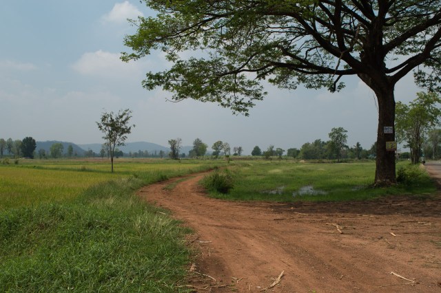
Much of the scenery could have been back in Sussex; fields dotted with trees, some ploughed others left to scrub land. A few oxen, occasional sugar cane fields and the odd palm tree marked it as different. The homes and shops were frequently brick built. The shacks, when they existed, were now a more up market version of log cabins rather than the flimsy woven bamboo affairs frequently seen in Myanmar. Actually, we haven’t seen much bamboo growing, perhaps that’s why?
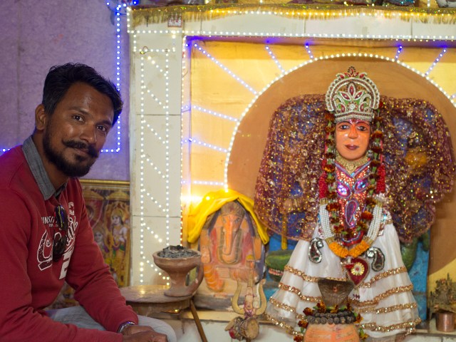
There is also no evidence of a national or historical costume. Way back we have seen traditions that have marked the different nations: the occasionally worn Lederhosen in Germany, shoes with curled up toes right back in Vienna, scull caps – square, Uzbekistan, scull caps round, Kazakhstan,  tall felt hats – Kyrgyzstan or buzzbeee style hats –  Karakalpakstan, and saris in India of course.
Having just crossed the border from Myanmar, where more men than women wore long wrap around skirts called longees, it was a surprise to see in Thailand we’re back to western clothes and hair styles. If there’s a national costume, it seems to be the mini-skirt, at least for the ladies.
And the road traffic features fewer local oddities as seen in the ‘stans, India and Myanmar. On the wide main roads mostly modern vehicles travel at developed world speeds, unlike their western neighbours.
We knew that Thailand is more Westernised than its western neighbours but it felt rather disappointing. Although it is nice to dive into the frequent 7-11 or Tesco Lotus for chocolate milk shake and other goodies.
Gradually, like opening a Pandora’s box, we’ve uncovered Thailand’s unique delights.
Keen to keep off the main roads, we’ve, as often, relied upon the Garmin to weave us a route along the minor roads. At times this has lead to the occasional dirt track which has so far been well compacted and manageable. We drew the line at the ‘path’ where a narrow trail led off across the grass next to a field and luckily found an alternative track. (After all these month’s I’ve finally learnt how to scroll between visual maps on the Garmin and step by step written directions so we can now check out what delights our route has in store and reject  ‘bad track’ options.)
_CTF2661-1
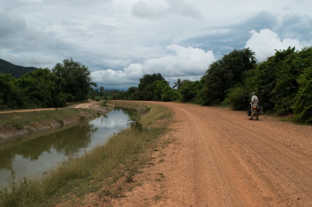
It’s been along these minor roads that we’ve discovered Thailand’s delights. After crossing the border we were, as in India, in the midst of the sugar cane harvest. Then pineapple farms were a nice surprise followed by waterways where wooden longtail boats power past less sophisticated shacks bringing home the reality that economic development hasn’t reached every corner of Thailand.
Oh yes – another reason it’s a bit familiar – as you can see in a lot of these pictures, around week #3 in Thailand,  April got rather cloudy and rainy. In a way, that was a relief, as it wasn’t so hot and we could go further and faster. Air-con rooms meant we dried out overnight. But after a few days the heavy rain showers got tedious, and certainly the bikes’ gears and brakes didn’t appreciate them. 
Coconut palm plantations were another delight where we wove our way through small lanes between furrowed waterways densely planted with palm trees. The tall palms cut out the light giving it a real jungle feel with lots of birds calling from the under growth.  Homes are dotted amongst them where people busily welded machetes chopping off the husks and splitting the coconuts – milk one way , flesh another.
Markets, many floating in this maze of water ways, also have a few treasures. Frogs, half gutted of course, chickens feet, fresh or on the café menu, pig’s trotters or whole face if you’re feeling hungry, together with a large assortment of fish and shell fish, are now all available.
As well as the above we now have salt farms and fish farms. The latter in an array of inland lakes or with fishing huts out in the estuary, which add a different take on farming. Some we think may be shellfish or crayfish as the dug out pits whilst aeriated are quite shallow.
As we have cycled further south the dominant crop is coconut.  Unlike Myanmar where bamboo ladders were used to climb the tall trunks, here our primate cousins are exploited as it’s monkeys who agilely bound up the lofty heights. A bit of chewing, a bit of twisting and down thumps another husk while the owner, looking on, makes a few encouraging noises from the ground.
These harvesting teams travel about in style; monkeys are pillion passengers, in the shopping baskets or on the side-cars of motorbikes. It’s not the dog peering out of the utility trucks, monkeys are keen to see where they are going. On these rural roads the traffic is less like home – everyone seems to ride a small motorbike, almost all commercial traffic is in pickups, and there are the distinctive Thai open sidecars with a fringe on top.
The wildlife has also taken off. In Myanmar even the trekking guides carry catapults, so the wildlife needs to keep its head down. Thailand doesn’t seem to have that problem – and has many national parks – so we’ve seen a lot more. Also, now in southern Thailand, we’re definitely in a different ecosystem – tropical rainforest – even if a lot of it is replaced with monoculture palm or pineapple plantations and hotels. More about wildlife in the birds and beasties log (update coming soon).


Out of Myanmar

After the strenuous riding to get to Inle Lake, before moving on south we studied the map, and profiles, carefully! Thus we decided to turn initially west, to get out of the hills. We had to start by climbing them, but they got even bigger further south. It added about 70km to the route to Kyaikto, our next planned stop, but avoided a lot of climbing. It did, alas, expose us to the apparently regional, afternoon south to north wind, reducing our daily range.

Some of this route was on highway #1, which was a bit busy, but bearable. Main road traffic in Myanmar is mostly largish trucks, with all sorts of cargo. Very few buses, but lots of smallish trucks and pickups crammed with folk and allsorts. A fair bit of agricultural machinery, mostly looking rather improvised. Loads of motorbikes, and a very few cars and bicycles. But even on highway #1, there were enough gaps that drivers usually waited before overtaking, and birdsong could be heard. Other parts were on very quiet country roads, wide or narrow, sometimes dirt but in good condition.

Transports

Country Life By The Road

Urban Life

Temples

Look Who We Met!

Golden Rock

Kyaikto was our rest stop, the nearest town on the highway to the famous Golden Rock. From there it’s 28km to the famous rock and the pagoda atop it. After seeing it we’d then have to backtrack to the main road. An ideal scenario for a rest day and a bus trip. Even more so when the profile showed that the last bit of that 28km ascends nearly a kilometre into the sky. In fact, it seems private vehicles aren’t even allowed on that bit; There are dedicated buses for the pilgrims (and tourists). Actually they’re modified trucks with benches six wide, a roof, and open sides. And pretty powerful engines and brakes, as that road is mighty steep and full of hairpin bends and narrow bits. The truck drivers clearly enjoy the challenge, there was a fair bit of oohing and aaaahhing as the driver hurled the truck round the hairpins, rubber squealing a protest at times.

The rock site was home to many stalls, sub-temples, and hotels. Sitting up on its narrow ridge, it reminded me (Gid) of England’s Lands End complex; but unlike that dour monstrosity, the bright decoration here gleamed in the sun, the colours glowed, the folks were brightly dressed and cheerful. Alas for us, although we deliberately got there approaching photography’s evening “golden hour”, this cast the sun from an unforgiving direction, and we were disappointed by our pictures. It looked like many folk just dossed down there, maybe that’s a better plan for keen photographers.

Over and Out

After Golden Rock, we headed for the Thailand border, between Myawaddy and Mae Sot.  I had read about the famous border road that corkscrewed over and through the border mountains, so tight  it was only open in one direction each day. About two years ago it was bypassed with a newer, wider, lower, straighter highway – oddly, it’s in OpenStreetMap but not yet in Google Maps. But the day before we met, coming the other way, two English cyclists, Katie and Joseph, who said “you have to go the old road, it’s fabulous..”. The rotters. We decided not to, to spare our legs. Got up early, cycled 2km out of town to where the new road started, looked at the smooth, broad, almost empty, tarmac, sighed, and turned back into town for the old road. Which was, duly, fabulous. We climbed for maybe 2-3 hours. It was indeed narrow, it was indeed very up, although actually reasonably graded (it used to be the main truck route). It had lots of bends, and in a few places was failing to gravel or encroached on by the jungle. We saw about 3 motorbikes, 5 people, and a few houses in the entire way up. There were a few more folk in a village at the top, houses outnumbered by abandoned refreshment shacks from the trucking days.

The way down was only slightly less peaceful (we saw one agri-truck, parked). The road was in good enough shape for a speedy descent.

Although it’s kind of the border road, it’s all inside Myanmar. Reunited with the new road, broad and smooth, we continued to Myawaddy, swapped the last of our Myanmar money, and into the border post. All the terrible internet warnings about Myanmar’s complicated border rules came to naught, and we wiggled through waiting trucks as the 4 lane road squeezed over the 2 lane Friendship Bridge, complicated by changing from right side driving to left side driving over the middle of the river. From there it’s a short flat cruise to the Thai town of Mae Sot, which usually gives its name to this crossing.

This is one of the main crossings between the two countries. It’s really remarkably quiet. I guess this reflects partly the tough terrain, partly Myanmar’s underdevelopment and isolation (although I’m not sure the Thais participated in the sanctions during the long junta years), and maybe also that the history of this border mostly seems to involve sending armies across it, to cause mayhem on the other side. Mostly Burmese, but some Thai, and latterly British and Japanese. And yes, now we’re reading our Indochina history lessons.

Memories of Myanmar

Lovely warm smiles. Monks. Slim, smiling, people in longhis or pencil skirts. Myanmar buffet. Stir fried vegetables without chilli. Sane drivers. Elephants. Not much wildlife (guides with catapults!). Hills. Wanting more time.

Back on our Bikes and a Rude Awakening

‘Down hill all the way’ we were told by more than one person. Gid had pointed out the minor point of the Gokteik gorge, which we’d passed over on the railway’s spectacular viaduct. But once again we were living up to our title, within outdoor pursuits circles, of ‘Southern Softies’ .
At 40km into our 80km trip my legs were knackered from grinding up hills in my lowest gears. Once up on the plateau and greeted by a significant head wind our average speed was still a meagre 10 km per hour.  I was still peddling in middle gears to get down hill! Gid proclaimed he was in his ‘granny gear’ on the flat. I didn’t take umbrage.
At 22km the horizon line looked ominous. In a canoe it would indicate a weir as the river dropped away before you but here, with a dark mountain line in the distance, we’d reached the gorge.
As we started our descent I fantasised that I could see a wide valley through the trees at the bottom as we took a long sweep back along the hillside. I was beginning to wonder if we’d got it wrong. We weren’t going down a gorge but into a valley where we could cycle out the other end over a much lower pass. Dream on!
OLYMPUS DIGITAL CAMERA(Gid adds: Clare hadn’t seen this then, from the top of the descent)
Initially it was a wide road with sweeping bends big enough for articulated lorries passing in both directions but it quickly got narrower and steeper. Soon there were queues of truckers in both directions at the cutbacks. At one especially tight turn a policeman was in charge, otherwise polite hooting indicated a driver was going to move. The rest tucked in.
We carved a route between them and stopped to quiver at the sight of the road winding up the other side. Our descent taking 40 mins. Disappointingly, we’d not yet glimpsed the famous Gorteik viaduct we’d been across on the train.
The ascent started well. The sections were well graded with long steady climbs. There was only the occasional steep hairpin that required a real effort. We thought we’d reached the top in an hour but then it went on and on, still climbing. Every time we thought we were there, another cafe, and someone hosing down their truck’s brakes (think about what that means), at yet another truckers stopping point would appear.  So the climb went on. At least heading south we got some shade while going up.
It was after 15 km that we yet again had the wind in our faces. And at around that point we finally saw the viaduct. After a further 2km we did indeed reach the top. Gid seemed OK but I was fit to drop. Fortunately a bottle of pop was enough to take me the remaining 2km to the hotel.
Only 84km, but tough ones. Or rather, 52 miles, as bizarrely, Myanmar uses miles.
Gokteik Gorge road (Myanmar road #3)
40 min. Descent
1hr 40 min. Ascent
Total distance 17 km.
Day two started with even more steady climbing. Very soon we turned left off #3, onto #43. Another 15 km passed before we reached a stretch that could be called undulating.  We were still waiting for the start of the promised ‘down hill all the way’. Gid started swearing, ‘When are we ever going to get to the top of this lot?’. My legs were reduced to jelly.
We’ve just had 5 months of flat cycling across the ‘Stans’ and India. Even the ominously named Snake Mountain, on the way to Pushkar – India, turned out to be little more than a South Downs bump. This was day two of some serious ascents.
We’d been enjoying the more peaceful smaller road, until we found out why. Gorge 2!
Forget the well graded gradients. This was serious stuff. Gid reckoned the steeper bits were 1:3, and kept stopping to let his rims cool – eventually letting his tyres down a bit to avoid explosions (and one old tyre had partially split its sidewall, we noticed a little later). I reckon it was serious shit. Down narrow gravelly hairpin bends where I could barely stop the bike at all I soon lost my bottle and walked! And, gave up all hope of cycling up the other side.


Crossing the bridge at the bottom Gid tried to convince me that beyond the first section the gradients looked better. He flogged up the first part, l pushed my bike from the start.
Trimmed down and super fit Gid did manage a gallant effort but had to admit in the end, that the gradients did not improve. Pushing 45kg of loaded touring bike, even on two wheels, isn’t an easy option but Gid was finally beaten and joined me on two feet.
Just over two hours later we reached the top. Spirits were very low. The hotelier in Hsipaw thought we’d be at Inle lake in two days. We weren’t even half way. Here’s the profile of this leg, provided by doogal. We were just at the third peak.
ProfileTsipawInle
X = Kilometres, Y = Metres. Spot the two gorges. Downhill all the way!
For anyone trying to (avoid) following in our footsteps, it’s road #3 from Tsipaw to the second peak, then road #43 and #41.
_ctf1385-1
One of many pagodas, linked to monasteries, along the route

It was a second exhausting day but every cloud has a silver lining. Deadbeat, at 6pm after the sun had set, we finally reached a village.

Camping is strictly forbidden. Apart from tribal warfare that continues, blocking certain roads and areas in Myanmar, there are still land mines in the countryside. The first port of call in a village with no tourist accommodation is the monastery. The monks will, apparently, frequently allow you to sleep over night. The locals quickly directed us to the monastery. On arriving there we were greeted by hordes of young monks. Both Gid and I were waiting for an elder to appear but a monk in his late teens directed us to follow two young lads on a motorbike. Little did they know how slow we would be.  They lead us off up the road turning off along a lane to a family home.
We had a lovely supper with the family who were kind enough to put us up for the night. Two English speaking young ladies, teachers from the local school, came to join the crowd. Charades finished, translations started, as we struck up some conversation. The two young ladies also offered a breakfast invitation which we gratefully accepted and were treated, again to traditional Myanmar fare. Just before we left they offered Clare a gift, a beautiful blue green longee. Oh dear, how to respond? Gid dived into a pannier for our tiny gifts; a bell with compass! The lady was a little nonplussed, not having a bicycle, or even, we learned, a motorbike but liked the idea that in time her children would like the bell on a bike.


Finally, the next day, the run into Nyaung Shwe on Lake Inle was unmemorable. But when it came to planning our departure, we checked the profiles in advance, and headed west initially, towards the big, flat, river valley that’s the centre of Myanmar, rather than the shorter route south, which turned out to look rather hilly!

Hiking to Meet the Hill Tribes

Our public transport northwards in Myanmar ended in the town of Tsipaw (Hsipaw), Shan State. It’s a pleasant place, but the attraction there is as a base for hiking into the hills.
Myanmar isn’t exactly a unitary state. It used to be called Burma, reflecting the dominance of the Bamar people. Indeed, they were expanding quite an empire westwards in the early 1800s, until they met the East India Company expanding the other way, attacked, and came off worst. One reason the country’s name changed in 1989, was to be more inclusive of the other people’s the Bamar had (partially) subdued: the Shan, the Palaung, the Mon, and many others. So, hiking in this part of Shan State, we’d meet Shan people, and also Palaung people. Our guide, Aikethein, is a Palaung.
We’d been told our route would be across the fields in the morning heading up into the hills during the afternoon. No such luck. Barely across one field we started on our incline. The broad track occasionally opening out into panoramic views, eventually shrank into a ‘sheep’ trail across the steep edged hills winding it’s way up and down. We didn’t see any sheep, just a few motorbikes.
Forest paths wound over tree roots and rocks as we crunched through the leaf fall, passing cleared areas used for crops, often, at this time of year, burnt to clear them for the next growing season. Towards the end of the day, small plantations of tea bushes ranged up steeper slopes.
A small boy dancing from rock to rock  across the burbling brook, swiftly crouching to take aim, catapult in hand. The bird flew off as junior sprang into action again, for another shot. Aikethein fumbled in his bag seizing his catapult for a more experienced attempt. Peeyaang .. another shot flew out but still the bird fluttered away. We now know why we hear, but don’t see, birds in the forest.
We stopped in a Shan village for lunch, although at the house of a Palaung family. Shan and Palaung have their own languages, and the Palaung generally live higher up in the hills, where they grow tea. I nabbed the only chair, a small plastic garden chair the same as a few others on the veranda that stood next to the bamboo ‘deck chair’, the fomer probably for tourists when they arrived. Our food was on a circular low table in a large sparsely furnished room. Our hostess bustled away at a bit of sweeping keeping the room spotlessly clean once we had eaten. The small pile she had swept with her traditional handmade broom quickly disappeared down a lifted floor board to the ground 8 feet below – how neat was that!
The roomy houses are lovely. There’s stuff lying around showing just how much can be made out of bamboo and twine: hats, walls, plumbing, fences, gates, chairs, bridges, it’s endless. There are now some concrete houses, but most are a traditional chunky wood frame with bamboo mat walls. Sometime in the last 100 years, corrugated iron roofs replaced thatch in most cases. The light woven walls keep out the sun but provide ventilation.
The cuisine is one of the many things that defines each culture. We were first introduced to fermented tea leaf salad on the Myanmar International Airways plane where Gid tried it but declined a second helping. Here in the village, having done a days hike and with no other option, we both tucked in.
Aikethein was telling us that whilst the main ingredients may stay the same across regions of Myanmar the method of cooking them has slight changes from village to village. He pointed out that the food we were eating was less greasy than in Hsipaw which we agreed with. Sourbanyan tree leaves, cabbage soup, a solid  wad of steamed rice were three of the things on our supper table.
Manns Tan, a Palaung village, perched on the edge of the hillside, is a cluster of 15 houses. There are numerous children all keen to smack your hand in a high 5 greeting calling bye- bye, hello, tata. Relatively recently, the trails to it have been dug out to be passable by motorbike as well as horse. A motorbike can carry two 50Kg bags of rice, plus a bit else.
18km (11miles) walked. Mostly up, as we climbed to around 1000m, amongst small tea plantations and wandering water buffalo whose bells clonked musically as they browsed. Fortuitously, the buffalo don’t eat tea bushes. We noticed the Myanmar (SE Asian) water buffalo are indeed different from Indian.
Aikethein Taw was our guide. His village is 50 km away but is not accessible to foreigners because, like many places in Myanmar, there are civil, and not so civil, disputes between tribes fighting over the natural resources in the land. He left his village to move to the ‘city’ as he didn’t want to be a farmer, and has been guiding now for quite a few years. He has big ideas for more work in the growing tourist trade.
Aikethein is one of twelve siblings. Two of his brothers died from cocaine addiction, one from measles which in the last ten years is now immunized against.  In families where there are three male children one has to join the “army” (that is, the tribal militia, not the national army, whom they may fight). In villages where there are less than thirty children there is no formal education but children will often be sent to a nunnery or monastery at the age of six or seven and are free to leave when they like.

A Plain of Ancient Pagodas, Tops Peeking Through the Mist – Bagan

Bagan is famous for its plain of ancient pagodas and a ‘must see’ on the tourist trail in Myanmar. If you’ve only seen one photo of Myanmar, it’s probably Bagan.
We arrived with a couple of days in hand to do the circuit. The electronic version of the Lonely Planet guide, now downloaded on to my Kindle for every country we’re visiting, does an excellent job of outlining the key sights, so off we pedalled along with hoards of other tourists on rented e-bikes, each clutching the same tome.
Around 1100AD, this area was the centre of a growing kingdom, that converted to Buddhism, so enthusiastically that they went and raided all the Buddhist treasures from nearby kingdoms, and over about 250 years, built thousands of temples, pagodas, and stupas. Some very grand, many small, and anything in between. Since then, many have fallen into disrepair or been demolished by earthquakes. A few are restored, many are maintained, somewhat, and still used. The people who built them are largely forgotten, historians theorise they spent so much building temples that they were economically and militarily overtaken by neighbours. A few photos are at the bottom of this posting, but first, how we got lost in the country….

Lost

DSC_0649-3Around we trudged with a trail of others to all the top sights stealing a bit of respite from the heat in Bagan’s magnificent new Archaeological museum where we saw room after yet another large room displaying dozens of Buddha images, and some interesting cultural displays.
Day two we took a different approach. I hunted out a few of the lesser pagodas with a more interesting commentary. One had passages underground, a second had a ghost and promised excellent views; with a couple of others along the way our day was sorted.
The route connecting them was cross country on adjoining tracks. That’s where the fun started.
We’d had some experience of off road the night before when following our sunset viewing spot, another tourist ‘must do’, we had taken a short cut across the tracks to the main road, in the dark. The trails often disintegrate into sand and as our front wheels carved deep and the back wheel slides sideways we frequently came to an abrupt stand still.
In daylight, ‘map’ to hand, off we set. And we had GPS too, even Google maps, thanks to spending about a fiver on a Myanmar SIM card. All were useless, the tracks unrelated to the maps. The only thing that worked was: mark 1 – eyeball, the compass on Gid’s bike, and the sun. The sand track was big enough for a bus initially, indeed, there were several on it. Then it got a bit smaller, then smaller again, but fine for motorbikes and us. Then smaller still, really just a footpath across a field until it finally petered out altogether. We walked the bikes along the field edge, heading north, towards the road. Beckoned by a farmer tending his field, we pushed through a sort of hedge to regain a track across a field. Finally, we got back to something navigable. Whose plan was that?

Temples of Bagan

And we found a yard of abandoned carriages – two wheelers are still widely used for tours, but these bigger jobs are discarded. A B&W treatment seems to work nicely for these.

Alternative transport tried and tested

On leaving Yangon airport, after our flight from India, it was like stepping back into normality albeit with a sauna full on. The taxi had four – count them – wheels, and four – listen – cylinders, real springs, and the driver’s style had only a soothing effect on our blood pressure. Other cars travelled along marked lanes with the occasional brief hoot as we listened to the purr of motor car engines. Motorbikes are banned! Buses cruised along. All very orderly and blissfully peaceful. Melodic bird song returned to our ears.
The city itself was, by comparison, clean, although as we explored further we found many similarities with India: crowds, street vendors, wires draped along the buildings and criss-crossing the streets, surface drainage channels and food stalls filling the pavement. But no cows, no hasslers, and the wares now carried on shoulder poles. And did we mention, no hooting? We visited quietly busy pagodas and restocked on memory cards and a few bike bits.
Our plan for Myanmar was designed to show us some of the country, bearing in mind that we’d flown into almost the “end” of it, near the Thai border. So, we used alternative transports to backtrack about halfway up the country, back towards the border with India. Not that riverboats or Myanmar trains go much faster than a bicycle, but they do keep going for longer and don’t collapse from exhaustion.
Decidedly top heavy, perched on a one metre wide gauge, the sleeper train from Yangon to Bagan lurched and jolted along, frequently caterpillar style whilst wobbling from side to side. Sharing the carriage with Anton from Germany and the many bugs and mosquitoes, left us all with ample space but the mossies seemed rather greedy. Gid resorted to a bug net overnight, carefully tucking me in as well. Lurching along in the train we were submerged in village life: fields being watered or tended to, traffic waiting for us to pass, children, and those young at heart, keen to wave. Vendors tempted us with their wares peering into our gaping windowless chasms, other locals sat just biding their time or peeking from behind their doors but all were near to be seen.
The river boat from Bagan to Mandalay was not as interesting as the train trip from Yangon to Bagan. Bustling along the river that was  a good half mile wide, despite winding our way back and forth avoiding the shallows, we were rarely in touch with the people. Dancing dots on the horizon appeared to be children playing on the bank. Others were attending laundry or fishing nets, just distinguishable in the distance. Photos taken require dramatic cropping to give a feel of the people and scenery around us. River traffic trundled past but was frequently industrialized; clearly not from the villages that periodically line the banks.
On the boat itself there was an on going game of musical chairs as views versus the sun battled for the prized seats first facing one way then the other.  With about 20 tourists aboard (and one local passenger), there was a chance for some chat. Especially as Nicolas and Elise were also cycle touring. Navigating through the sand banks that were intermittently marked, was highly technical.  Two people stood on the bow of the boat elegantly welding depth gauge poles, arm actions directing the helmsman left or right.
Motorbikes are banned only in Yangon, elsewhere in Myanmar they are ubiquitous. Like India, they’re all small, if a little newer in design. Unlike India, there’s an assumption of observation, and a concept of right of way,  so hooters are used sparingly. Sometimes one can hear a motorbike approaching by the voices of the people on it! We’re still trying to take this on, after immersion in India for three months. In Mandalay, it was our voices, as we took motorbike taxis at one point. They also gave us helmets, but had they just got their motorbikes and wanted to practice? The two times we went on the back of Indian’s bikes, helmetless and three up, admittedly in the middle of nowhere, the riders were much smoother and assured, whereas our Mandalay taxis, two times two up, felt a bit wobbly and less secure. Were we paying for their learner petrol?
Our second train trip, Mandalay to Tsipaw, notable for two feats of engineering back in the early 1900s, was also marked by higher levels of sophistication seen in the farming. Although still mainly small scale stuff with every last patch of fertile land cultivated,  the watering cans on shoulders and the ox ploughs had been replaced by rotavators, hose pipes, sprinklers systems and strimmers.
Unbelievably the train jolted to a halt then went backwards. It was plenty slow enough surely it didn’t need to cover some bits twice. It gradually became obvious; as day was breaking we could see the track layers beneath us. We were gaining height up the side of a mountain onto a plateau, the train can’t do hairpin bends, so it had to switch direction for each zig or zag. A panoramic view opened up before us, lined with receding hills.
The second spectacular event was marked by people peering out of the windows and cries of, ‘There it is’. Fleeting glimpses developed into a full view until the train stopped just before we curved round to cross the Goteik Gorge viaduct. Crowds clambered down onto the track for a better view framing the ‘must take’ photographs.
Think that’s about covered it: Plane, taxi (4 wheels), train, riverboat, motorbike, train. Oh and then  in Tsipaw, tuk tuk, hiking, and in Lyaung Shwe, long tail boat.

Bye-bye, ta-ta; Farewell to India

It is with very mixed feelings that our time in India draws to a close. Different it certainly is! One minute we’re loving the chaotic bustle and vibrancy together with the curious, smiling, friendly people who crowd around us when we stop.  At the next we can’t stand the incessant head drumming noise, crushing crowds and appalling drivers. Not to mention the persistent touts, swindlers and beggars at many tourist attractions and sacred sites we’ve visited as we’ve laced our way across a strip of India.
Of course, more than any other country we’ve visited, there’s a feeling of “well we haven’t seen X”, but that’s why it’s called a subcontinent. Probably two years would be needed to explore the whole country, whereas we’ve trundled across it in three months, riding only half the time.
We’ve almost enjoy seeing the cattle, goats, dogs, less frequently pigs, ever present in the streets, or the pesky monkeys swinging overhead. All up for a vegetable stall raid if a merchant has dropped their guard. The cattle nonchalantly block the road or a passageway. Gid had a narrow escape meeting a bull who was ‘hoofing the turf’. A moment or two after he squeezed past, it hoofed again before tossing a 20kg cement bag up into the air where it got caught on overhead wires, trickling its contents in a shower back down to earth. Thus we learnt to recognise a bull in this mood, and avoid it! Most, however, are very tolerant of being moved along with a quick ‘ha!’ or simply squeezed past.
The mess and muck we’ve grown used to as well as the frequently present stench of ‘street’ toilets where well-dressed Indian men will only approach the general area before adding to the problem. No idea where the ladies go when they’re out in town!  Amusingly, in Bodhgaya there’s a street sign – Please use toilet. It was truly incongruous to see jewelled bare feet squelching through slime and muck after an unseasonal down pour. But we got used to it, although you won’t see us in flipflops!
It’s hard not to be disturbed by the visible poverty. It’s far more evident than in, say, Kyrgyzstan, despite the countries having similar per capita incomes. It probably testifies to India’s immense inequalities. However, Indians generally seem in very good spirits. It seems in England, everyone’s miserable because they are feel short of money and time. Can’t see why India should follow that model, and it doesn’t.
We encountered begging in tourist areas, with a peak at the Buddhist pilgrimage sites. The Hindu holy men are supposed to be a cultural fixture, and sustained only by those around them, but they seem to make a beeline for tourists. Having seen one old guy score basically a day’s wages in one hit, from four Thai pilgrims, it’s not hard to see why. Urchins often put their hands out, and in Bodhgaya and Varanasi there was real medieval stump-waving, but it’s impossible to work out what’s real – locals usually advise not to give. I passed a lady walking by the roadside in the country, and she lifted a hand to me: “Rupee, rupee”; yet she had about $400 worth of silver bangles on that arm.
In many ways India has seemed to be in a time warp. It’s been quite stunning to see so many ancient machines and techniques still in use where ox carts and man power still dominate. In the country, there are lots of new tractors, but apart from that everything looks pretty archaic. We passed the sugar cane harvest in Madhya Pradesh, a prosperous state. The factories filled the skyline, chimneys billowing out thick black smoke, but it was scythes and ox carts out in the fields that fed the mills. In towns, half the market’s spread out on the floor, and cobblers, tailors and puncture repairers have plenty of work, while roadside corn grinders and milk boilers are busy too. Aside from the animal hauled transport, some of the stuff on the roads seems crazily archaic. The tuk tuk is a fine piece of 1940s minimal engineering (sez Gid), but there are still motor tricycles running, that appear barely any advance on Carl Benz’s original 1886 tricycle, with the machinery (belts, chains) taking up nearly a cubic metre. But it’s juxtaposed with sleek new Suzukis, mobile phones and satellite dishes together with, adverts for ECGs and medical labs, and in the papers, India’s just tested a new, longer range, nuclear missile.
‘We’re not like your country, we’re relaxed.‘Without it it wouldn’t be India’, are a couple the claims I’ve overheard. And no one follows any of the laws that are passed for the safety of your citizens, I could add. ‘No, we don’t follow any rules,’ one lad chuckled as he agreed. Road traffic regulations are blatantly ignored resulting in the worst driving we’ve experienced and leading to one of the highest death tolls on roads in the world, as well as being a topic of frequent debate in the newspapers. We’ll make a separate posting for Indian drivers!
India is widely known as the world’s biggest democracy. But curiously, it feels more like a police state than anywhere else we’ve been. Not only are there heavily armed police all over the place, but there are rules, rules, rules prohibiting all sorts of things. No wonder Indians generally don’t attend to them. Passports are needed more than anywhere else, and numerous forms to be filled. Unlike everywhere else though, we can read the newspapers, and see the very public, and venal, politics (oddly, it reminds Gid of Irish newspapers and politics, dominated by the crookedness of the politicians). There are hugely snarled up checkpoints and taxation at the borders between states. We only realised while here, how separate the states are, and of course, with their own politics, perhaps like the USA. Maybe that’s one reason there’s an impression that the Delhi government says “jump”, and …it doesn’t work out the way the “Centre” intended (planned would be too strong a word, perhaps). It does feel as if the country is tied in a bureaucratic Gordian knot of its own devising, although some might comment that the British helped devise some of it!
The British often claim to be an exceptionally tolerant nation. But Indians seem much more so. They put up with – smile through – what seem to us the most appalling behaviour and difficulties.
Cricket, India’s unofficial national game, has filled the tiniest of crevices in passage ways and the busiest of road sides – fielders posed on the other side of the streaming traffic – to spare fields, parks and the ‘promenade’ of the Ganges, where yet again fielding was an issue. With the high levels of enthusiasm and skill displayed, it’s no wonder they’ve just thrashed England here, in the latest Test series… And One Day… And T20. Probably a good job we never managed to get to any of the matches.
Just before we flew in, the Indian government abruptly invalidated the two larger main banknotes, and prohibited cash withdrawals larger than roughly £23: “demonetisation”. Result, utter chaos in this cash economy. Enormous queues at the few ATMs that got stocked with new notes. Like other tourists we spent days hunting hotels that take (foreign) cards, working ATMs, and queueing for endless 2000 Rupee  withdrawals. And the banks simply lapped up the flat rate charges they levy when people make small transactions abroad, like a 10% tax. So it caused a lot of hassle and wasted time, we saw others in real distress, and a lot of Indians really fell foul of it as it killed the casual labour economy dead in some places. That plus the impact of the Brexit vote on the pound’s value, made a real difference to our budget here. Unfortunately we only worked that out after we’d stripped Rajasthan of souvenirs and posted them home on Concorde.
The other money issue is the swindling. Led by the India government, which charges foreigners typically ten times what Indians pay to see sites, there’s a culture of gouging in some sectors. It’s also common to quote one price at the start of a transaction, then try to charge a lot more with unexpected add-ons. There seems to be complete tolerance of swindlers who claim to be collecting for charitable purposes, but are not. There are different amounts of swindling in different sectors: 100% of boatmen, 50% of auto rickshaw drivers, whereas most shopkeepers seem pretty honest.
There’s generosity too. Free tea stops, the odd free meal…. Nice people about, especially away from the tourist trail.
We’ve seen spectacular sights in India, and found the present and past both fascinating. Much of the culture, to us has seemed, unique and other worldly. There were frustrations and dropouts with all the electrics, but most days we had WiFi or phone data, and rather wobbly electricity was available every night. The winter weather is nice, guesthouses plentiful and cheap, our tums have managed ok so far, and the roads are mostly flat and smooth. And yet….. It’s felt a struggle being here. Has India beaten us, or does surviving count as a win?

Madhya Pradesh Travelogue

At the start of 2017, we left the desert and dry hills of Rajasthan for the state of Madhya Pradesh. The country gradually became a lot lusher. Not so flat, either, although mostly it’s gently rolling terrain interspersed with occasional ranges of small hills. Of course, the wildlife changed as well, so the Beastie and Bird Log has a set of new pictures.

Mandu

Not such a famous place outside India, considering its merits. Huge abandoned city, of which semi-ruined palaces, temples, mosques, tombs, and city walls (37km around!) remain. Extensive waterworks add to the fascination.

Maheshwar

Like Mandu, not so many western tourists, and many more visiting Indians. A famous pilgrimage site on a holy river. Temples, walls, a (small) palace, and river boats (with middlemen gouging the tourists and giving the boatmen as little as possible). While ambling around town, we saw a yoga school, and while discussing it, up popped the head of the yoga teacher – from Brighton! She invited us in for a chat, which was lovely, ranging over ‘how-to-spend-our-lives’ philosophy to (sigh), the hassles of property in England. Unfortunately we couldn’t make any of the yoga sessions before we left, so we got ripped off by a boat tout instead. We reckon he ripped off the boatman, too.

OLYMPUS DIGITAL CAMERA

Hoshangabad and Bhimbetka

Following the Narmada from Maheshwar, we stopped a few days in the unfamous town of Hoshangabad. Hoshangabad was on our route as an overnight stop between Maheshwar and Bandhavgarh, a seven or eight day run, with a rest day in Jabalpur. But it didn’t pan out like that. We got to Hoshangabad relatively early in the afternoon and, as usual, stopped on the outskirts to look on our phones for places to stay. Also as usual, we became the centre of a small crowd. One guy, astride his Honda, acted as translator.


An old chap came up and very straight faced was jabbering away. It transpired he was a sculpturer, and wanted us to come and look. We did, and very interesting too. There were remarkably lifelike, life size, lions, in various states of preparation, including one finished, complete with realistic, but vegetable, fur. And gods, who might ride them. All made in clay on a straw frame.

The young biker suggested popping round to his place for a chai. His family were builders, so they had their own, grandfather-built, temple. In the cool and quiet front room of their house, we met all three generations living there. And he told us about some of the town’s sights. Then he led us, on his bike, to the area of the hotels, where we were unusually fussy and chose the third one that offered us a room. Balaji-Inn turned out to be a good choice, we had long chats & good information from owner Deepesh about places to see, and our later route. And it had both hot water and WiFi. We started to think about staying an extra night.

So, we got up and going really late, that being ideal for a rest day, taking a tuk tuk to see the ancient rock shelters and paintings at the Adamgadh Hills. And bought some more souvenirs in this very untouristy town. That evening we met a lovely local couple, the Bhagats, in the restaurant, dining together. Ajay especially was a super-keen traveller, and gave us lots of good tips for along our remaining Indian route. We realised with a jolt that we were halfway across India already. And they insisted on buying us dinner, too. Come to think of it, our elevenses stop at a roadside diner had been complementary, too. Still, we’d attracted a huge crowd into the diner 🙂

OLYMPUS DIGITAL CAMERA

Can’t remember if Ajay Bhagat or Deepesh at the hotel told us about Bhimbetka, 35km north. Cue more replanning. It was certainly Deepesh who told us of the Silk factory, and reminded us the town had extensive ghats down to the sacred Narmada.  We’d originally thought to divert our cycle via Bhimbetka, but 35km is an annoying sort of distance, and it’s likely not cheap to stay there, so we booked another night at Balaji-Inn and did a morning trip using the frequent buses to Bhopal. 1 hour bus trip – 40 r each. It was about 2km from bus route to the rocks, but transport was available on the back of a motorbike,  three up.
Bhimbetka was indeed impressive and intriguing. And we learnt some new words, mostly containing the syllable “lith”. Then back again on the bus from Bhopal. It was, err, interesting to see the maniac bus driving from the other side. To be fair, only one of the two drivers adopted the horn blaring maniac stereotype, the other was a peaceable, careful fellow. Both stopped to make an offering to the gods.
After this palaeolithic experience (the buses as much as the paintings, one had its roof held up by a metal post, the other’s windscreen parted company with the frame over every bump) we rushed back to Hoshangabad for a tuk tuk to the Silk factory,  which showed some aspects of silk we’d not seen before, indeed different types of silkworm chrysalis. There was no weaving, but it turned out some of their yarn went to the silk hand weaving works of Maheshwar, which we’d seen there. And of course there’s a shop… Oh dear, more souvenirs, making up for buying nothing in Maheshwar. Then the early evening wandering the ghats. And our third night in Hoshangabad. Very restful. To be fair to ourselves, we also did a lot of blog work, booked our days in Bandhavgarh National Park, and mostly sorted ourselves out for the increasing risk of malaria over coming weeks: The many labours of the long distance tourist. Sometimes we overlook the time we need to find for planning, preparation and blogging.
With all these people keen to chat extensively with us, Hoshangabad rates as the very friendliest town we’ve been to in India, where everywhere has been friendly. And on our last evening, one of the hotel lads knocked on the door, and waved the local paper at us: Our moment of fame, in Hindu. We’d been flagged down a couple of times by local press on motorbikes – this was the outcome. The headline most ungallantly highlighted Clare’s age.

Bheda Ghat

Still on the Narmada, more famous religious sites to see. And a waterfall. Not sure if it was Grade IV or Grade V.

Bandhavgahr – Tigers – No, no Tigers today.

Indian National Parks seem not to be accessible unless one forks out for a jeep (or elephant) and a guide. Pretty pricey, so we limited ourselves to two jeep safaris. Here’s what we saw. Mostly birdies, plus deer and boar.

And on to Uttar Pradesh… A few roadside snaps from along the way…

And more wildlife too, see the Beastie and Bird Log.

Another gem from the Garmin

Despite being on National Highways we spent two days on bone shaking, bike wrecking roads, since arriving in Uttar Pradesh, on a par with the worst we’ve experienced so far.
Lorries weaved across the roads at pitifully slow speeds to avoid being the next victim at the already over crowded tyre and suspension repair shops that line these villages. On the good stretches, that were far outweighed by the bucking bronco sections,  my optimism about our ETA rose, only to plummet as the next morass of potholes emerged out of the dust cloud. On arriving at Mirzapur we asked the hotel manager what the road to Varanasi was like. With dismay we listened to, ‘Another 15 km of broken tarmac and pot holes but after that it’s alright.’
Varanasi, our next destination, was only 52km the Garmin displayed. We could manage that even on lousy roads but as we came to set off the locals stepped in to direct us. With a few arm waves, head wobbles and the words ’65km’, it was job done, our route was sorted, except it was in the opposite direction to the Garmin’s.
Keen to please our hosts, we set off as directed; I tried to combine electronic and ‘verbal’ instructions. Gid, a few road turns later, pointed out that we were heading south despite our efforts to travel north. At that point I gave up trying to merge the two and stated, ‘OK, are you up for a Garmin route?  I can’t see where it meets up with the main road.’ Truth be known, it didn’t!
Our route trundled along some single lane dirt roads, cobbled roads, tarmac roads but nothing as bad as the National Highway. We were right ‘in the middle’ of rural India passing through tiny villages with lots of people excited or curious to see us. Many communities were engaged in activities long since mechanised in England turning the clock back as we watched man power at work.
We were both excited by the route and appreciated that we could never have navigated it from our maps but Gid was most concerned. ‘Can we cross the river? Are you sure we can cross the river?’ he kept probing. Both Google and Garmin showed a route across the river. But was it true? On this road? A bridge, or a ford maybe? Thankfully, as we got nearer to the river we turned onto a bigger road allaying Gid’s fears. At least this looked big enough to have a bridge and, suddenly, sweeping round one last bend, there it was.
From our high vantage point we looked down across the half mile, pontoon and beams, covered with sheets of metal, bridge. On approaching the toll ticket barrier we were beckoned on with beaming smiles; cars and tuctucs have to pay and struggle across as best they can but we were free to go.
The approach from both sides was through sand with two lanes of 10 x 3 metal sheets providing a firm surface. This was fine until cars needed to pass or …. oh no – a three wheeled tuctuc where lots of people were frequently out pushing or digging out the front wheel.
We made our way across, stopping to take photos as we went, absorbing another terrific  sight and spectacular event in India.

May your God be with you

‘Safe journey, may your God be with you’ were the parting words of one Indian gentleman we have spoken to.

We got used to the high profile of religion in Turkey. Our first experience was in Kirklareli, where an Imam very kindly welcomed us into the mosque, explaining the symbolism on the walls and the practise of Muslims. The frequent calls to prayer and tidal rush of men accompanied us across the country.
In Indian, the birth place of four now global religions (Sikhism, Buddhism, Hinduism and Jainism) where, by law, Indians have a freedom of choice,  religious practice is all around us. Red ribbons mark a sacred tree and shrines, erected in the smallest of stone hearths, are placed at seemingly random places along the road, desert and countryside. On a bigger scale there are frequently larger shrines and full sized temples in and around villages and towns. These are usually brightly decorated with incense and flowers around the deity being worshipped with plenty of places to buy these things nearby.
On the way to Ranakpur, to see the famous Jain temple, a man passing us on his motorbike guessed where we were heading but was very insistent that we should see his village’s temple. 5 km down the road he was waiting for us to arrive, eager to point out ‘his’ temple which turned out to be a couple of flags placed on a hill sized rock.
Later, another proud villager sped after us on a motorbike imploring us to rethink our hasty transit as ‘his’ temple was not to be missed. It had been quite impressive to have such a grand building in such a small village but it appeared to be of a similar structure to many we have already seen on our route across India and time was running short. We very guiltily continued on our way.
It’s not uncommon to start the waking process at 6 am with an hour of chanting which can give way to a lengthy session of ‘random’ bell ringing or drum thumping which can be followed by the call to prayer enabling many Indians to start their day with worship.
At numerous other times along our way we have been accompanied by banging and crashing as a religious service takes place. Occasionally a procession escorts a highly decorated truck that emits, from its loud speakers, volumes of thumping music. It all seems to add to the general melee of high noise level the Indians don’t appear to notice.
At the other end of the scale there are many silent almost fleeting gestures. Another moment to be noted was when our bus, on the way to Bimbetka, stopped for the conductor to leap out and purchase a garland of flowers. On passing the sacred river Narmada the bus stopped while the man placed the garland on a roadside shrine. On our return trip the bus slowed while a coconut and garland of flowers were thrown into the river demonstrating a religious side to the maniac bus drivers who invariably scream along the roads with horns blaring.
At Maheshwar, on the sacred river, we stayed for a couple of days to again visit temples. Late one afternoon we took a boat trip out towards Baneshwar temple.  The oarsman wasn’t fussed about us actually landing on the tiny island but set off up river to a religious ceremony taking place at the water’s edge. Singing and playing, accompanied by setting afloat candles in tiny dishes to create a light trail as they drifted off down river, made a magical moment in the fading light.
Washing in sacred water, to cleanse both body and soul, are very much are part of the Hindu tradition. Many Hindus make at least one pilgrimage to a sacred water site in their life time. On foot, with a knap sack, often wearing something orange and sometimes with no shoes, they are a frequent and unmistakable sight, especially as we approached the sacred places. One, we came across in the middle of nowhere, having just explained that he was on foot, to our amusement, jumped on the back of a passing motorbike and sped off ahead of us.
We’ve followed the course of the Narmada crossing it several times observing shrines, religious practice and places of pilgrimage. The marble rocks on the Narmada at Bheraghat, and Pushkar’s sacred lake, that originated from a lotus petal, are two such places but none are more important than Varanasi. Situated on the Ganges Varanasi is one of India’s seven sacred cities and of major importance in the passage of life and death in Hinduism. It is here, in a ceremony on the river bank, that the cycle of rebirth can be broken releasing the person from the caste system and setting their soul free. The ‘burning ghat’, as it is known, is ablaze 24 hrs. as the public cremations take place.

Varanasi is one of three sacred cities in India where aarti takes place. Aarti is a ceremony performed by priests, where fire is sacrificed to the Goddess Ganga, and a number of other deities.